
A trip report by user JnsV
Introduction
This trip report is about my four-day long trip around California that took place between March 2 and 5. I have only flown an intro flight in the US before, which was in Hawaii and well before my PPL. In fact, I had got less than 60 hours and have never flown a significant cross-country flight before, LHNY-LHBC being the longest pre-PPL and LHNY-LHDC post-PPL. I still thought that with enough preparation I could safely and successfully carry this trip out.
Preparations
First of all, I arranged the paperwork for my FAA piggyback licence right after I got my PPL and ELP6 in Hungary. Using e-fax it took less than two weeks to get the verification document in hand. Therefore, I had ample time to schedule an appointment with the Los Angeles FSDO, where they have been very helpful throughout the whole process. I had somewhat limited success finding a place to rent a plane from, as you can see from my other thread, but eventually got to choose between two C172s and a Piper Arrow. Even though the latter was more expensive per hour, I decided to go for it due to the relative familiarity with the type and the somewhat higher performance. So, N70EF became my plane for this trip.
I have been reading about GA in US since the age of 12 on the internet, and have also played with many computer flight simulator games that rather realistically depict the American airspace and ATC procedures, I re-read most of the AIM before the trip to refresh as much of the information as possible. I also listened for LiveATC feeds around California to familiarize myself with the environment. Even though I speak and understand English well, I still felt that I might have trouble understanding everything and keeping up with the pace there.
Shortly before the trip I posted my proposed itinerary on an American board, to get some input from locals. That input helped to finalize some aspects of the trip.
For navigation I used the trial version of ForeFlight running on my iPhone 6 Plus with Consumer Ceullular (AT&T network) data connection, but I had the printed sectional and terminal area charts with me as well.
Pictures
Please find below some photos that I (or my passenger) took on the trip. Most are not the best, but I was trying to concentrate on flying of course and only take photos when it was safe. Interestingly, I found that it was much easier for me to handle my Canon EOS 40D camera with one hand (and therefore keeping the other on the yoke) than the iPhone. Also, on the photos taken by the phone, deformed propeller blades are visible, as always.
February 29 and March 1: Rental checkout and BFR
On the morning of February 29 I picked up my Temporary Airman Certificate from the Los Angeles FSDO. I arrived a few minutes before my scheduled appointment and was welcomed immediately once the preceding airman was dealt with. I filled out a form with the help of the officer and had my certificate in hand in about 40 minutes from arriving.
Originally all the rental checkout and BFR was to be done on the afternoon of that day, but unfortunately weather closing in on KSMO prevented us from doing everything that the CFI wanted to. We were still able to do a landing at Catalina (KAVX), two different transitions of the LAX class B airspace. The special VFR landing back at Santa Monica showed me an important tool in practice.
On Tuesday we finished the checkout, completing a few mock-up approaches and a stop and go at Van Nuys (KVNY). I was therefore good to go solo the day after.
The overall process, and its cost of course were still rather unpleasant (imagine having to do a driving test when you rent a car) and I think that I will rarely want to do it again in the future. I may try OpenAirplane for my next US rental, but they are still not ideal for the infrequent (1-2/year in the US) renter.
En route to Catalina 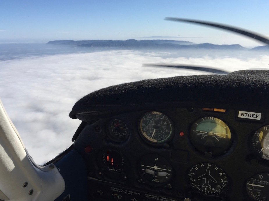
March 2: Santa Monica (KSMO) – San Louis Obispo (KSBP) – Davis University (KEDU) – Sacramento McClellan (KMCC) (1st leg chart, 2nd leg chart, 3rd leg chart)
On this day the goal was to fly a colleague of mine from LA to another conference taking place in Davis, near Sacramento. We decided to fly up along the Pacific Coast to the Golden Gate, then fly along the shore of the San Francisco Bay to its southern tip before going direct to KEDU. Originally we planned to stop to get fuel and have some rest in Monterey (KMRY), but worsening weather there and not full tanks on departure made me decide for a stop in San Louis Obispo (KSBP). I could easily refuel there at the self-service pump and also the setting of the airport was very nice. After refuelling, however, the engine of the Arrow did not want to start again, so we could not taxi away from the pump when a resident C152 arrived for refuelling. With my passenger we pulled the plane away enough to give room for the Cessna and after multiple tries the engine came to life. (To the guy in the C152: sorry for the wait and the propwash, my bad.)
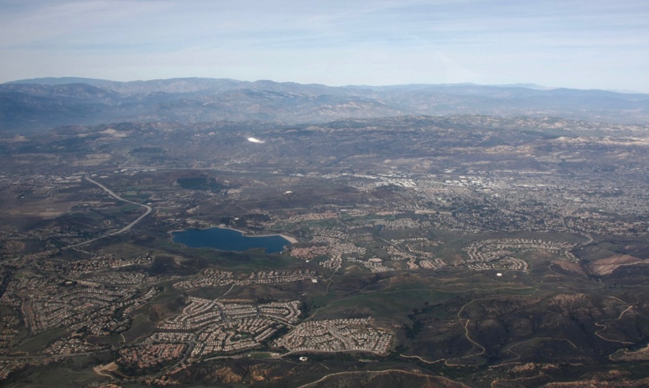
Mountains north of Los Angeles
Approaching San Louis Obispo from the south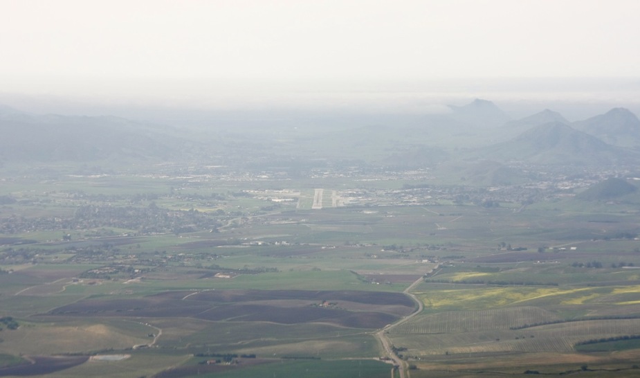
After departure I picked up flight following again and flew all the way up the coast to San Francisco. Due to low and thick clouds I had to fly at 4500 until the Half Moon Bay, where I descended to first 2000 feet, then 1200 feet to get a better view and stay clear of the San Francisco class B. Due to the lack of sufficient radar coverage flight following was cancelled by the controller at this point. Unfortunately the western side of San Francisco was covered in clouds and the Golden Gate Bridge was barely visible. After turning towards the bay I contacted NorCal approach to approve my transition through the B along the bayshore. There was some confusion about my intentions at first (even though I used VFR points defined on the terminal area chart), but after clarification I was let through more or less as requested. When giving instructions, the controller referred to a highway (I-280) that I could not find on any of the charts, so she offered vectors instead, which I happily accepted. After playing with the declutter function on the GNS-430, I could get the I-280 on that map as well, making it even easier to follow. When above the Dumbarton Bridge I requested a turn direct my destination. I had to continue flying south for a few minutes, than I was cleared direct KEDU while maintaining visual separation from a Delta medium jet and a FedEx MD-10 heavy. I remained on flight following with NorCal and Travis Approach until having KEDU in sight, where I have landed uneventfully. I did the standard pattern entry and position announcements. There were two other aircraft in the vicinity, one also communicating while the other not. Nevertheless, there was no close call with either of them. My pax got out here and I set out for the short hop over to KMCC.
Hearst Castle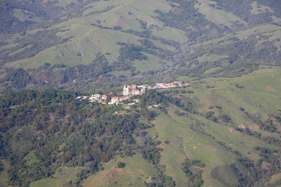
Half Moon Bay
Downtown San Francisco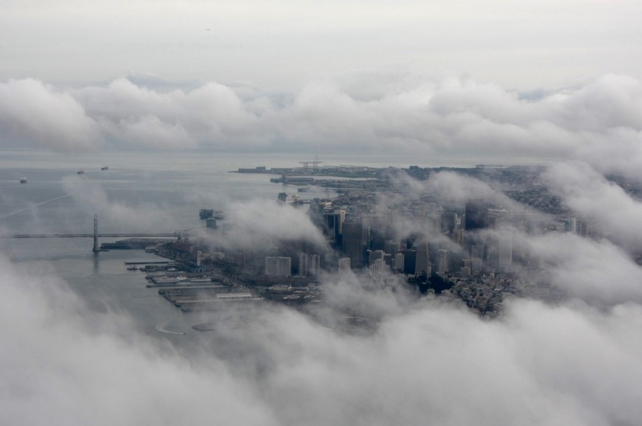
Over San Francisco International Airport (KSFO)
At KMCC, based upon the suggestions received at the other forum, I prearranged overnight parking with McClellan Jet Services and also reserved a rental car. They very helpfully directed me to a parking spot on the Unicom and one of their employees kindly drove my rental car out to the aircraft and did the tiedown for me. I only had to stop at the office on my way out from the airport to arrange for refuelling of the plane. All this for a whooping 0 USD handling/ramp/overnight fee. I really felt if I was a VIP.
Sunset over Sacramento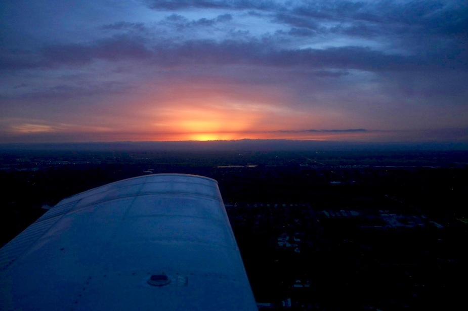
March 3: Sacramento McClellan (KMCC) – Bishop (KBIH) (chart)
After a leisurely breakfast and some shopping in Sacramento I headed out to the airport and prepared for crossing the Sierra Nevada at Lake Tahoe to fly into Bishop. On the live weather radar images it was obvious that there was a front with light-medium rain on the direct route between Sacramento and Lake Tahoe. The rain decreased visibility to a level low enough that I was not comfortable with and the cloud tops were too high for me to outclimb. I, therefore, decided to turn south, hoping that I the weather got better that way. In the worst case, I knew that most of the Central Valley was cloud-free, so I could have landed there and not cross the Sierra Nevada that way. Fortunately, after flying south for ca. 10 minutes the visibility vastly improved and I could see my way to and across Lake Tahoe. In that direction there also was a 30 kt tailwind, so I had to do 2 circles while I reached my planned altitude (10500 ft) for the crossing. There was some turbulence, but nothing bad until I reached the ridge on the western shore of the lake. There the tailwind component went up to something like 40 kt and for 1-2 minutes there was moderate turbulence with some downdrafts. I was high enough the lake to land at South Lake Tahoe (KTVL) had it become necessary, but fortunately I soon encountered smoother air and climbed back to 10500 ft while above the lake. I then crossed over the pass south of Carson City and flew to the east (with the help of the great tailwind) until I reached the line of the Owens Valley, in which Bishop is located. There I turned to the south and proceeded to Bishop uneventfully. I stayed on the western side of the valley to get updrafts rather than downdrafts, but there were no major winds and conditions were never worse than light chop. The only minor issue with this leg was that I did not pick up flight following immediately after departure from McClellan and after that I was unable to contact the proper control unit. It may have been true that even if I was on flight following I would have lost radar or radio contact en route, but this was a lesson for me to get flight following as soon as practical.
In Bishop the airport is rather far from the town, but there is a dial-a-ride service that takes you in for 4.20 USD. It is also possible to rent a car, but both options have limited working hours. If they are not operating, the phone number of a local willing to provide rides for stranded pilots is posted at the airport.
The front…
…and end of a long Union Pacific train in Sacramento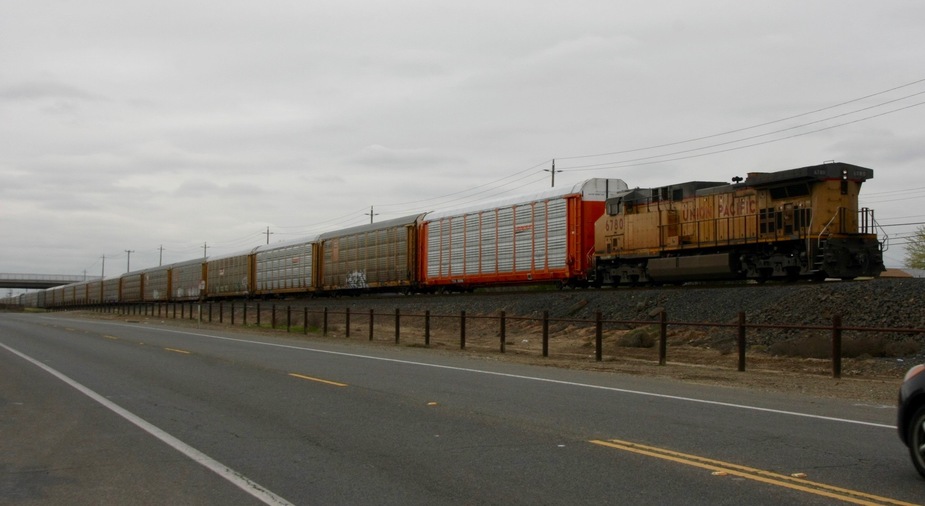
VIP treatment at McClellan
Folsom Lake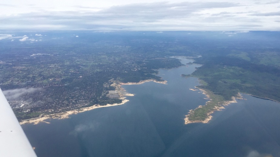
En route to Lake Tahoe, over the Eldorado National Forest
Over Lake Tahoe, looking towards the NE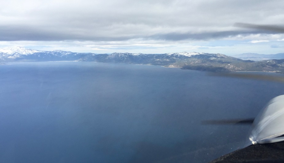
Carson City, Nevada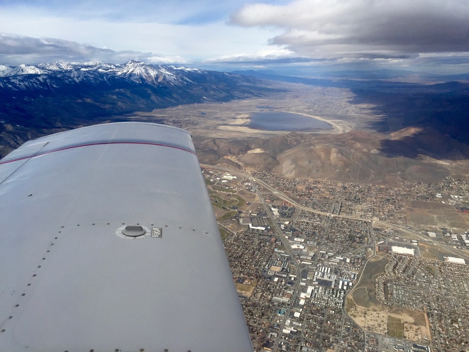
The Wassuk Range and the Sierra Nevada, over Schurz, Nevada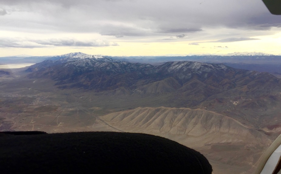
Mt. Grant and Walker Lake, over Hawthorne
Boundary Peak, the high point of Nevada (13147 ft / 4,007 m) and Montgomery Peak, California (13,447 ft / 4,099 m)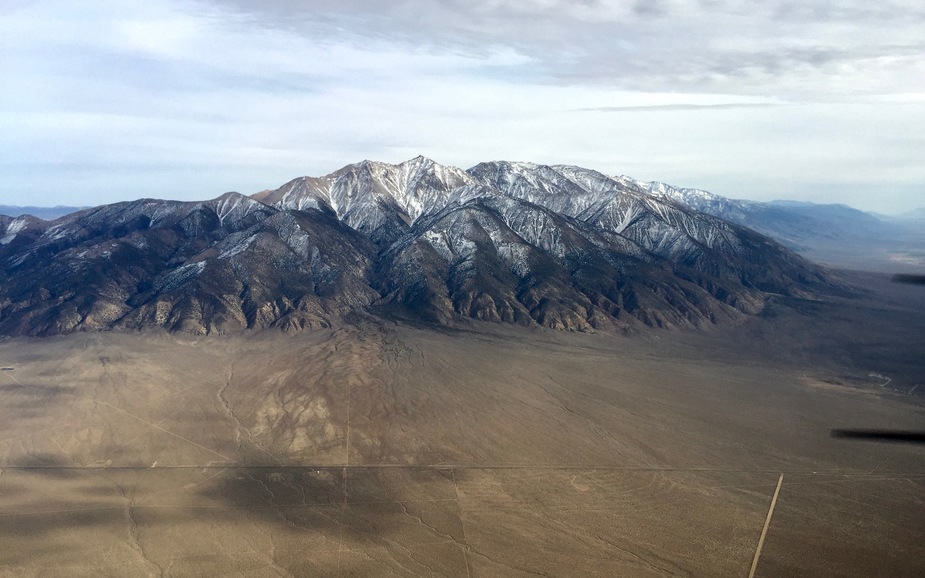
The White Mountain Range near Bishop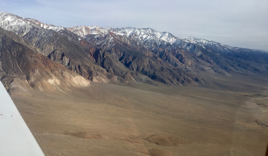
My Arrow with White Mountain Peak (14252 ft / 4344 m) in the background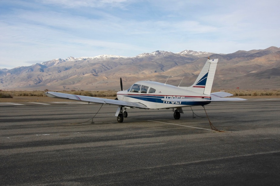
A beautiful Bombardier Challenger on the apron in Bishop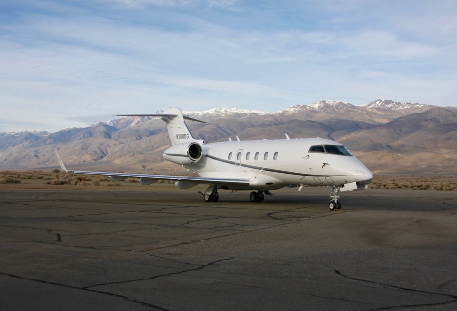
March 4: Bishop (KBIH) – Furnace Creek (L06) – Tehachapi (KTSP) (1st leg chart, 2nd leg chart)
Originally when I planned this trip I was thinking about overnighting in the Death Valley, but both hotels were too pricy for me as a single traveller. Also, I was thinking about doing a detour to Las Vegas, but I picked up more hours on the Hobbs than what I initially thought so I decided to skip that as well.
I found out that at Furnace Creek it was possible to have a lunch for a reasonable price and they would come out and pick me up at the airstrip. And for overnighting, I decided that Tehachapi should be a good destination due to the high-traffic Union Pacific railway line there. (I ftm sort of a public transport enthusiast as well.)
With this in mind I set out from Bishop to Furnace Creek at around noon. Weather was seriously CAVOK, as we would say in Europe and the whole flight was as smooth as it gets. When trimmed properly, I could easily release the yoke for a long enough time to get some nice shots taken. I contacted Joshua Approach for flight following, which I received for most of the flight. The only minor issue was that at some point in cruise at 10500 ft the “Gear in transit” light came on. I double-checked that all gear-related controls were in the up position and confirmed that the plane flew as if the gear was retracted. Not being within easy reach of any better place than my destination, I decided to proceed normally, just be careful not to exceed the gear extension speed on descent. The light went away at around 3000 ft and I could extend the gear normally in the pattern and get three greens. Around 2000 ft AGL I encountered some turbulence, but it subsided by the time I got down to pattern altitude. I could therefore easily land at Furnace Creek airport, 200 ft below MSL. I called the ranch for the pickup, had some delicious chicken wings for lunch and than was driven back to the airfield.
A delicious sandwich from Erick Schat’s Bakery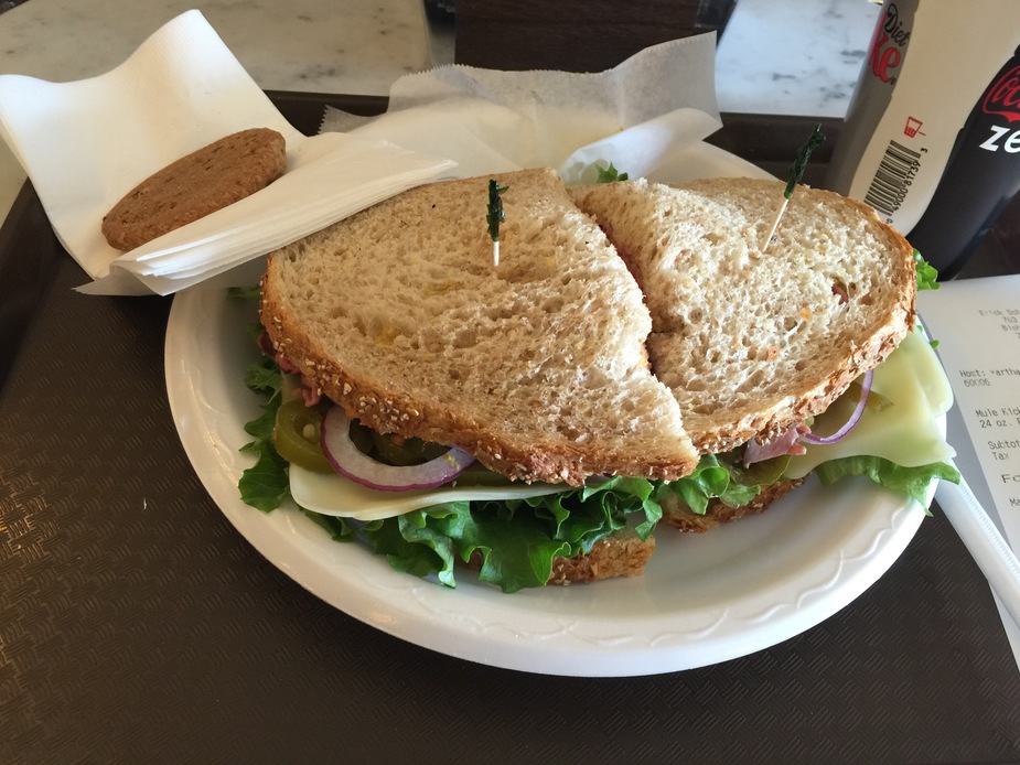
Again the Arrow, this time with the Sierra Nevada in the background (note the self service fuel station)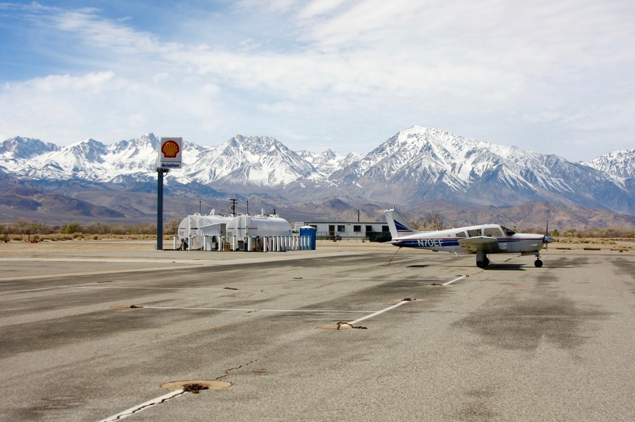
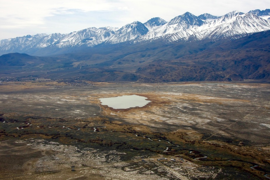
Klondike Lake and the Owens River, near Zurich 
Crater Mountain (foreground) and Mt. Bolton Brown, near Big Pine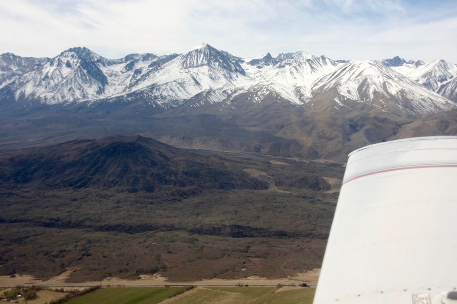
Looking down the Owens Valley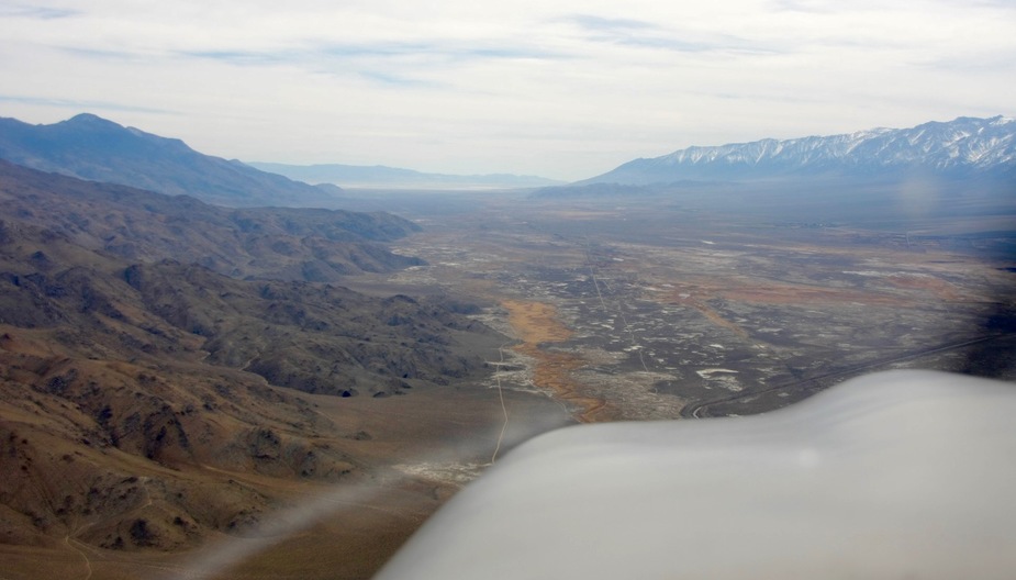
Lone Pine with the airport (O26) and Mt. Whitney (14505 ft / 4421 m, on the far right, next to the “needles”, highest peak in the lower 48 states) in the background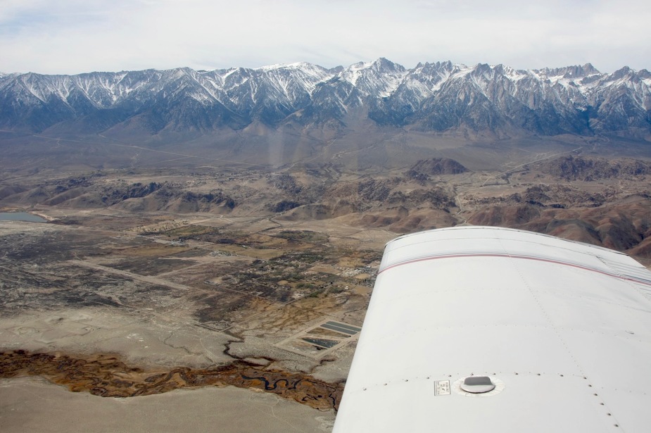
Colourful rocks in the Inyo Mountains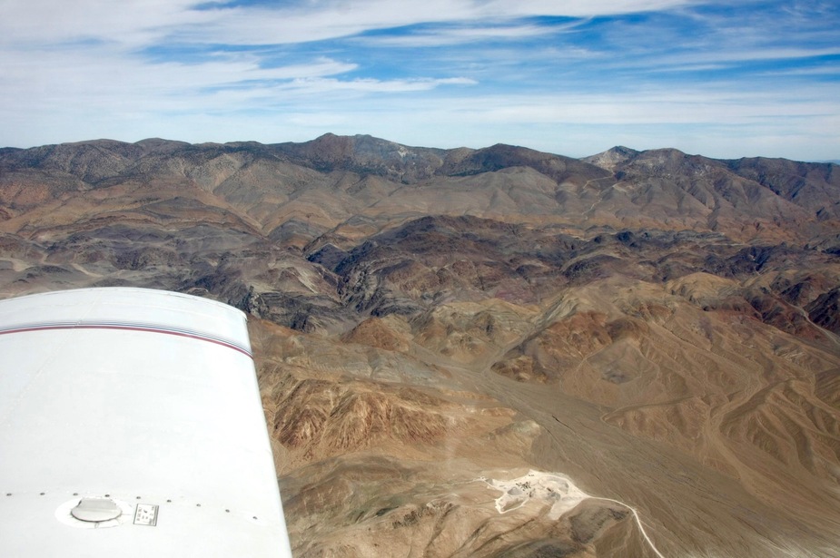
Owens Lake with the Sierra Nevada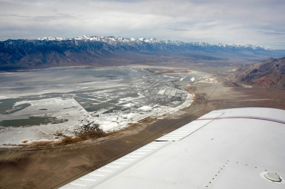
Panamint Valley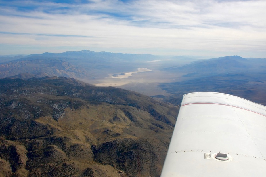
Approaching the Death Valley from the north
Furnace Creek, Death Valley, from the west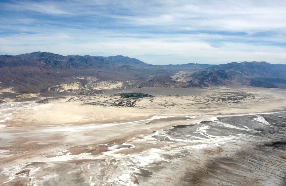
Final approach Furnace Creek (L06) runway 15, -200 ft MSL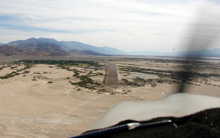
Furnace Creek airport apron (note: bring your own tiedowns)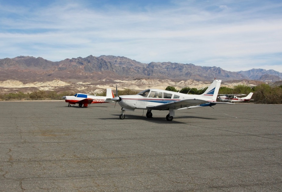
From there the flight to Tehachapi was very similar to the first one of the day, with almost zero turbulence, but the “Gear in transit” light also came in similarly. I was in contact with Joshua Approach continuously and they were very helpful by giving me a shortcut through the Edwards AFB and China Lake NAWS restricted areas. I landed in Tehachapi around 4 p.m. and could take some nice shots of UP and BNSF trains at the level crossing in the downtown. I saw some nearby valleys filled with clouds, but at this point I did not really gave much thought to it.
Near Badwater Basin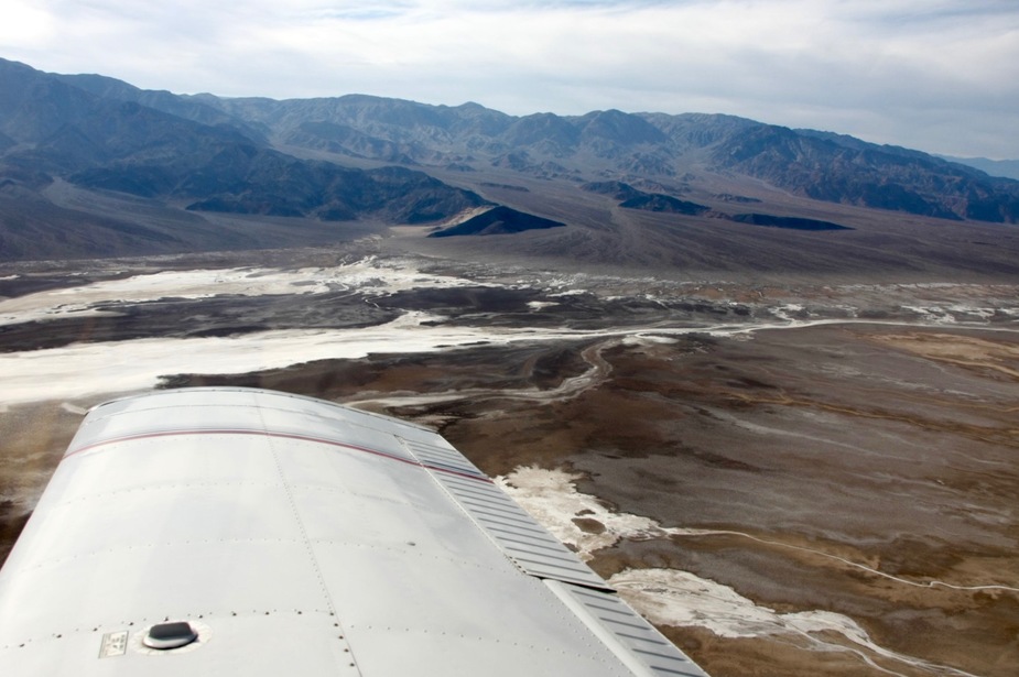
Black Mountains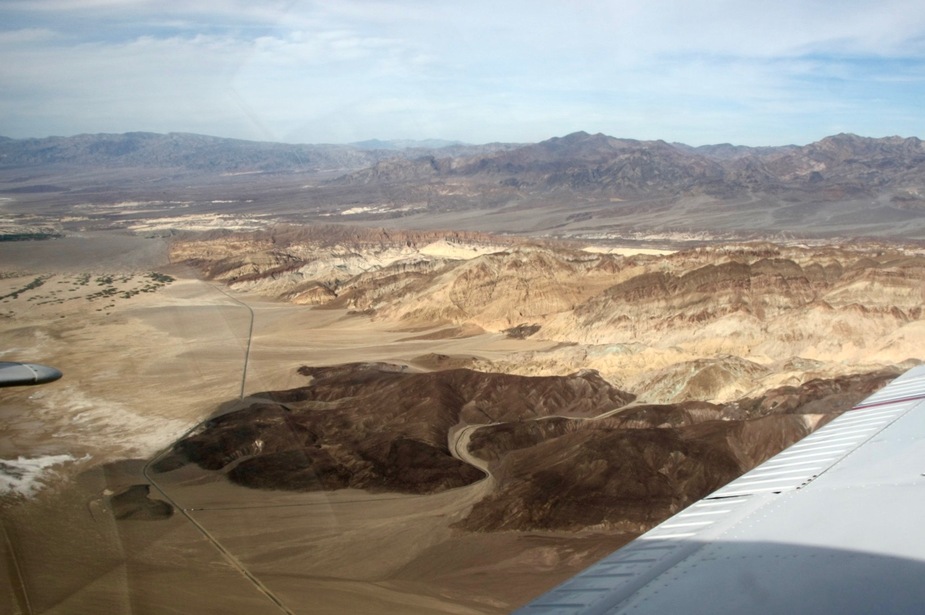
Owlshead Mountains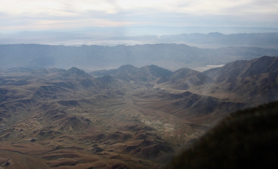
Trona and the Searles Lake
China Lake NAWS with the Indian Wells Valley
Wind farms near Mojave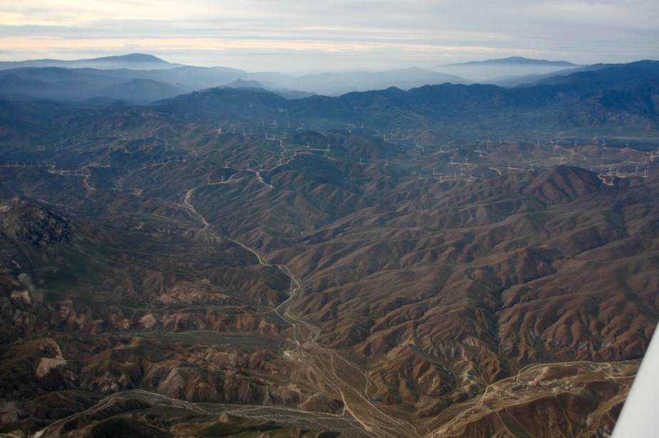
Mojave Air And Space Port with Edwards AFB in the background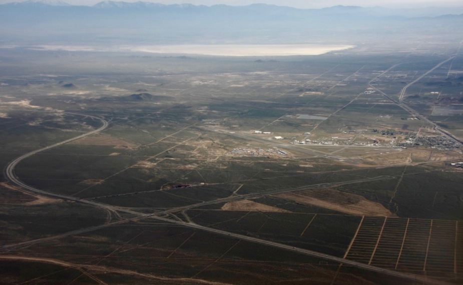
Union Pacific maintenance train, downtown Tehachapi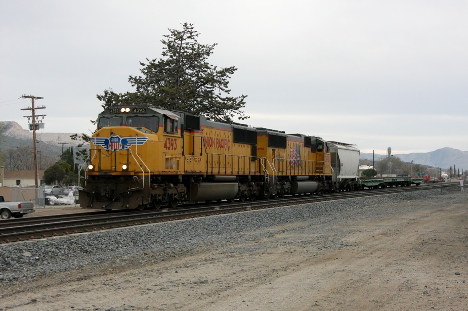
BNSF container train, downtown Tehachapi
March 5: Tehachapi (KTSP) – Santa Monica (KSMO) (chart)
After crossing all so many mountains and deserts I thought that this day would be an easy day as far as flying goes, since I only had to go above a single range with peaks between 5 – 7000 ft and fly ca. 70 nm. I scheduled a 4 p.m. return for the plane at KSMO so that I would have ample time taking photos of trains in Tehachapi and getting to LAX for my evening British Airways flight home.
In the morning, however, I realised that Tehachapi was completely in clouds, most of the mountains around not being visible. It was supposed to improve later that day, so I went out to take some more train photos a bit outside of the town. By around 10 a.m. the local weather improved very much and became clearly VMC. I still decided to leave around 11.30, so that I would have more options if needed. It turned out to be a wise decision since some major showers were heading towards Tehachapi which would have made it impossible to depart in the following 1-2 hours. I could see that the nearby airports of Mojave (KMHV) and Fox (KWJF) were in the clear and forecasts said that they would continue to be so for the rest of the day, so I thought that in the worst case I could land there and wait for a better time to cross the mountains north of Los Angeles. I still tried my luck (with enough fuel to safely return to the above mentioned airports) to outclimb the weather and see if I could find a hole to descend below the overcast layer. Fortunately, I was able to find a hole over Santa Clarita where the terrain below was clearly visible so that I knew that I was not descending into the hillside. I quickly informed SoCal Approach about my intentions, who handed me off first to the next sector than to Van Nuy tower for transitioning their airspace en route to Santa Monica. They made me do a low approach over runway 16L to be clear of the path of other traffic and then handed me over to Santa Monica Tower, who quickly cleared me to land on their runway 21.
While I had a safe VFR option B for landing, that option would not have been a real option for my flight home. If I were unable to get into KSMO that day, I would have had to pay for the collection of the plane and would have probably either missed my flight home or would have had to pay an enormous taxi cost to LAX. I will therefore never again make such a close schedule until I can get my IR ticket, possibly not even after.
BNSF train, near Rt 202 overpass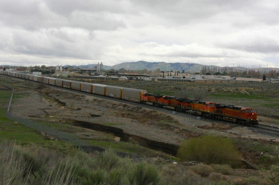
Mojave and Edwards, after take off from Tehachapi
Palmdale and the San Gabriel Mountains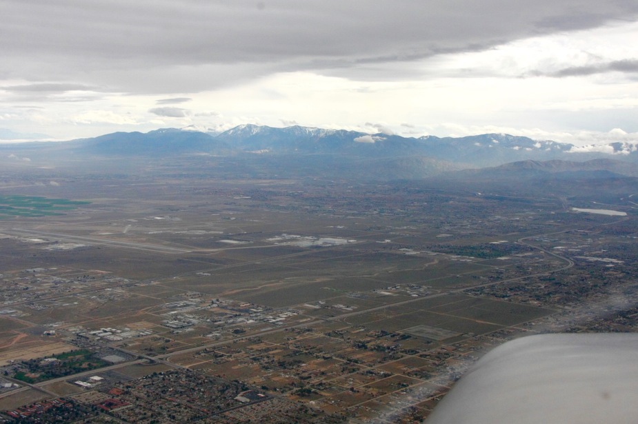
Approaching the Transverse Ranges (note the clouds close to the peaks, I did not want to try scud running here)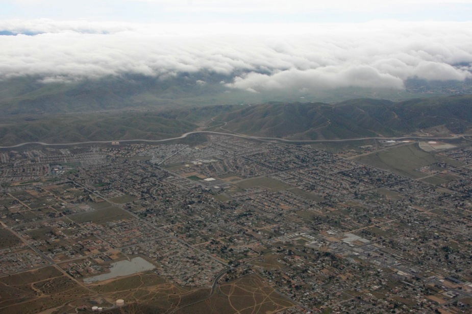
Finally under the clouds (Dowtown LA in the backround)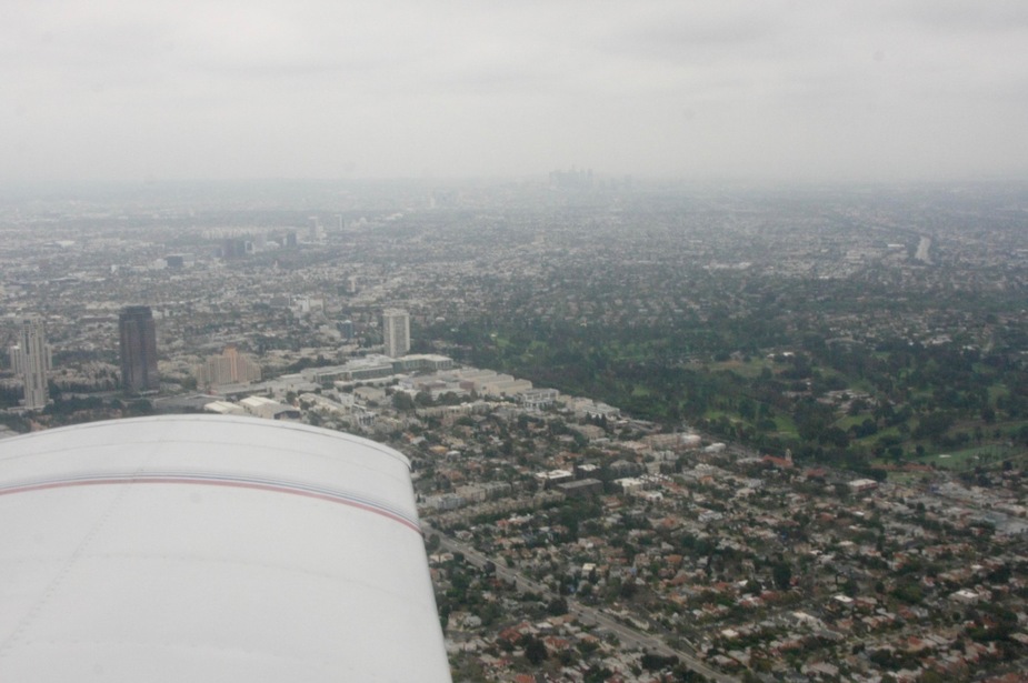
Approaching Santa Monica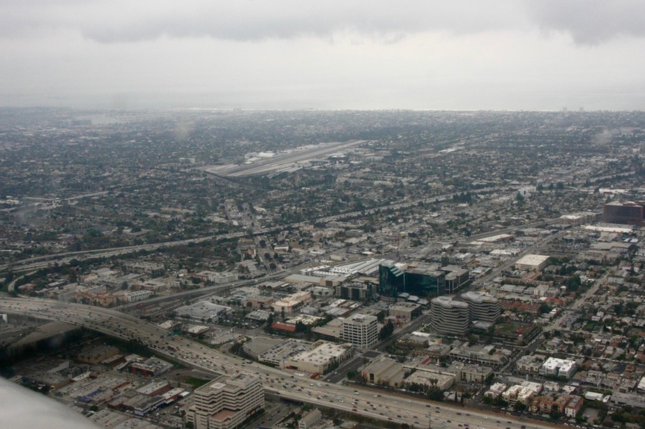
Final approach, Santa Monica Airport (KSMO) runway 21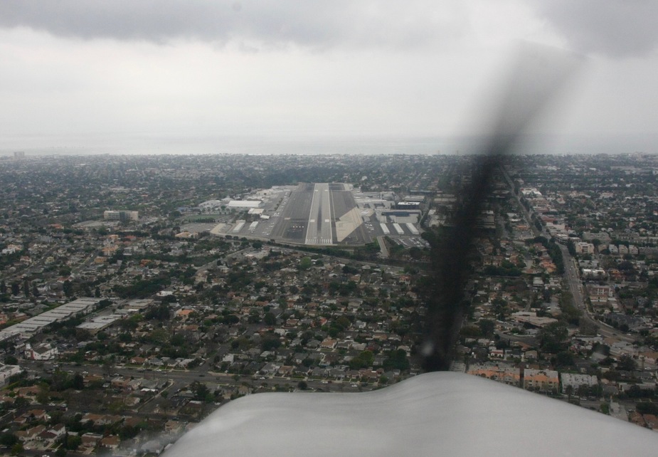
Conclusion
All in all I found the trip very enjoyable and with all the preparations and resources available, it was rather easy. There were no major problems with radio communication, apart from a few “say again”-s I understood everything and I was also understood. I found the ATC system wonderful, where everybody really tried to help me get safely on my way.
Having ForeFlight with a working mobile data connection was essential. Of course this is not as reliable as having a subscription and using Stratus for ADS-B weather, but I was never out of cell phone coverage for more than 20 minutes, so I had a live picture of weather in front of my eyes.
All in all, I am very happy that I had the courage to take this trip and was able to complete it. It is a huge confidence booster for me and while I know that I still have much to learn, I now see that I can safely fly to interesting places on my own. The events of the last leg make me think about getting my IR sooner than originally planned.
I also find it disappointing that the training I got in my PPL did not at all prepare me for taking such trips. They of course taught me how to fly a plane, especially how to land one, but the amount of real-world knowledge passed on was minimal. Without forums like EuroGA and other resources on the internet I would not have been able to undertake the trip.