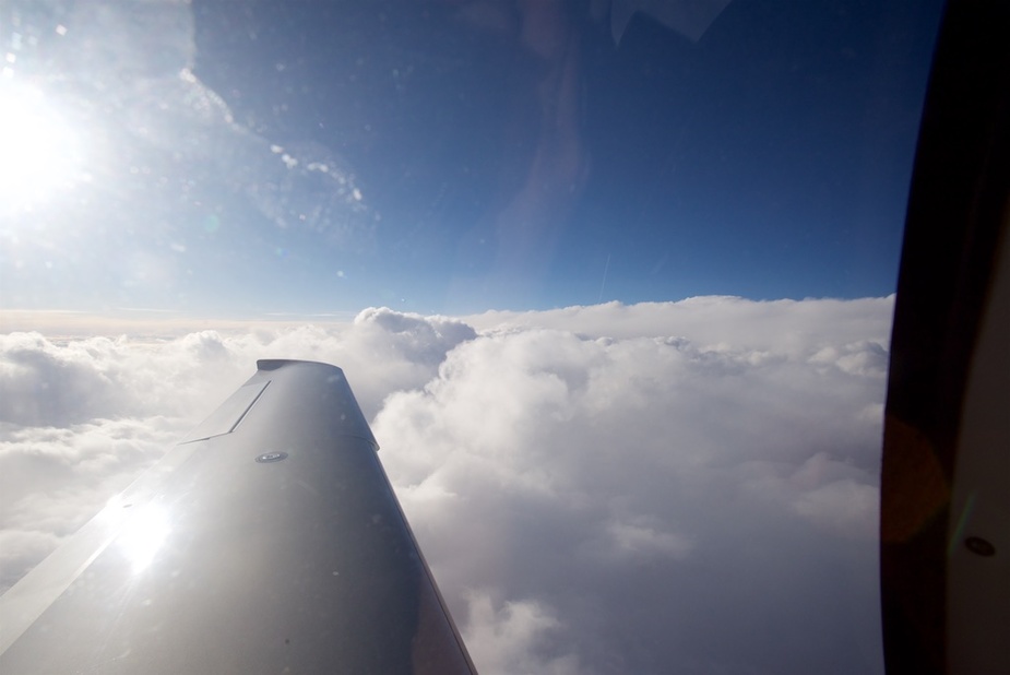
On a flight earlier this week I was flying at FL190 when the ADL radar image was showing some lightning ahead. I expected the bad clouds to be higher and was thinking about avoiding the whole area completely by going through Switzerland instead of MOU EPL through France. The wind was blowing from the NW strongly and obviously the stuff was moving SE but not that fast to be impossible for flying by before it gets there. However, ATC was reluctant to change my route completely. Instead I got a huge shortcut of ~250 NM to ALURA and upon reaching was sent to EPL. That is when I took this first picture:
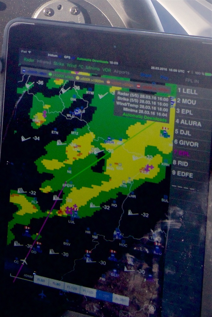
As you can see the magenta line takes me through and probably over a narrower stretch of bad cloud but still close to lightning on the right. I’ve still not updated my ADL to show the infrared derived cloud tops and therefore those are not shown. You can tell from the remaining pictures that I was in blue sky with great visibility over long distances. So that wasn’t an issue.
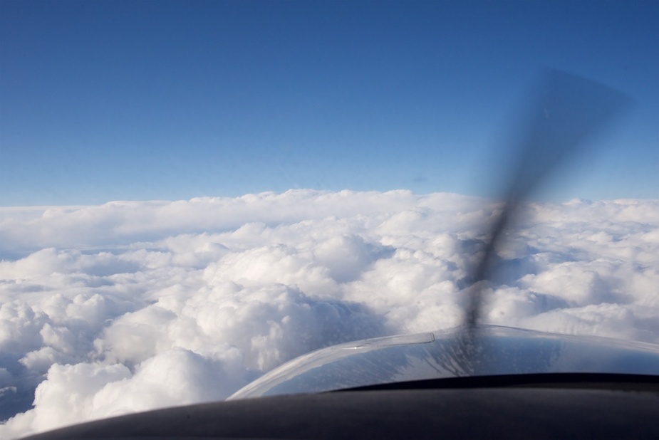
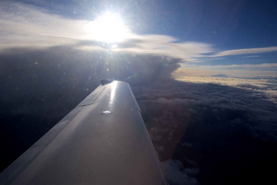
As I was getting closer the cloud looked like shown here:
I was almost above it and as it didn’t look very scare I decided to scratch it a bit on the top. It didn’t seem to be very wide either and indeed after less than a minute I was on the other side in blue sky again.
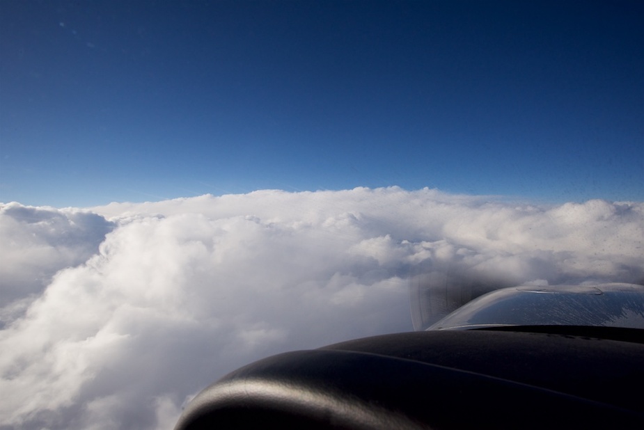
From the other side it did look a bit scarier though. But it might just be the light and the resulting shadows.
To my right the other stuff, where the lightning has showing on the ADL, looked similar. That is the reason why I’m asking you to help me interpret these images.
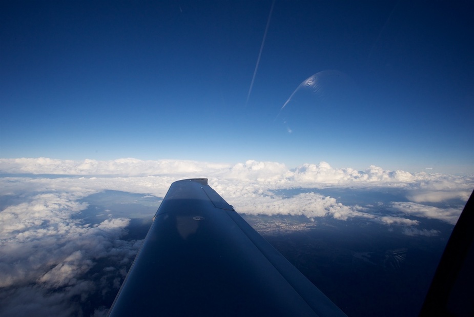
When I scratched the top of this cloud I got a tiny bit of ice but there was no need to do anything about it. The OAT as shown by the aircraft probe was -18C.
As I side note I can tell that I “jumped” over another one of those by climbing from FL190 to FL220 and then had to perform a steep descend at 1600 fpm down to 1500’ so that I was able to switch to VFR of the RID for my landing at Egelsbach EDFE where the class C base is at 1500. Langen Radar was happy and helpful and the descend worked out beautifully.
Help me interpret this a bit better
You flew over the weather. That is the joy of being able to fly high. The higher you go the more you can fly over weather that, were you lower, would lead to a horribly unpleasant ride at best. Going from high teens pistons to the Mirage at FL250 made a huge difference. Then to 280 also made a surprisingly big difference to topping weather. Obviously in Europe 410 is pretty well assured of being over the top of almost all weather other than some really big CBs around the med.
The best thing about flying high is you can also almost always visually avoid a lot of this stuff.
You were in the clear. It got bad ahead you could have just turned.
Stephen thanks for posting, and great weather awareness kit on your aircraft. Skimming the top of TCU/CB might lead to a potential lightning strike from below which can always get your attention and in the worst case may require some repairs and de magnetisation. Am not sure how much separation, but 2,000’ vertical seems a good guess.
What I have found, Stephen, is that radar images tend to depict “weather” which is low down, say below FL100-150.
The exception to this would be CBs and such, obviously.
Often, the IR image shows almost nothing but the radar image is very nasty.
BTW don’t assume that -18C is safe for icing in an SR22. Sure it should be safe for airframe icing (though I posted a pic of ice picked up at -15C) but as Aeroplus reported you can get an engine stoppage due to (presumed) air duct icing. That event was never reported on openly because the plane was sold really fast, but IMHO it was similar to what I reported here. The alternate air door freezes too.
I agree that the ADL image looks much nastier than how it turned out to be. I wouldn’t have expected to see what you saw at FL200. Shows again that there are no absolutes in weather.
Regarding the routing: major deviations are a big problem always when these take you in a completely different country which was orginally not affected by the fligtplanned route, because there is no information about that flight in their computers and they have to enter it somehow.
When that “other” country happens to Switzerland, then it gets even more difficult…
I would not skimming the top of TCU clouds. The icing risk is very high and I do not want to attract a lightning strike. The SR22 is more plastic than my commander, but it sure can disturb the field and trigger a lighting.
In the US, there is a radar tops (and horizontal movement) product . I haven’t seen anything similar for Europe, although for example in Germany you can get an idea of the reflectivity tops for each individual radar site here https://www.flugwetter.de/fw/bilder/rad_lokal/index.htm
Of course, for the low-performance plane I fly, the 2D radar image tells me all I need to know — that (1) there’s an excellent chance of finding supercooled liquid in that cloud and (2) unless there is some other evidence to the contrary (like a really shallow drizzling stratiform cloud in a high-pressure situation), I shouldn’t assume I will be able to get above the tops.