
This report describes a VFR flight from Panshanger, UK (EGLG) to La Rochelle, France (LFBH).
My
inspiration for this trip was fuelled by some of the trip reports and
photographs from other pilots on EuroGA, and to test my capabilities
with regard to a longer trip. Most trips I have done to France, or in
the UK, even day trips, have generally been short trips of about 1.5
hours, and I was keen to embrace different charts and learn more about
‘touring’.
The return leg was largely planned in the same way, so this article focusses just on the outbound leg, which I was PIC.
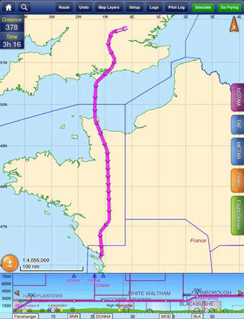
The Route
DCT BNN DCT DONNA DCT WOD DCT BLK DCT MID DCT GWC DCT KATHY DCT GARMI DCT MP DCT VIREX DCT ANG DCT LP DCT BOBRI DCT
In
expanded terms this means Panshanger to the Bovingdon VOR, to the DONNA
intersection, Woodley NDB, Blackbushe NDB, Midhurst VOR, Goodwood VOR,
KATHY intersection (near Isle of Wight), GARMI (intersection on the
UK/France boundary), MP NDB (near Cherbourg), VIREX intersection, ANG
VOR, LP NDB, BOBRI intersection and then finally La Rochelle airport.
Image taken from SkyDemon:
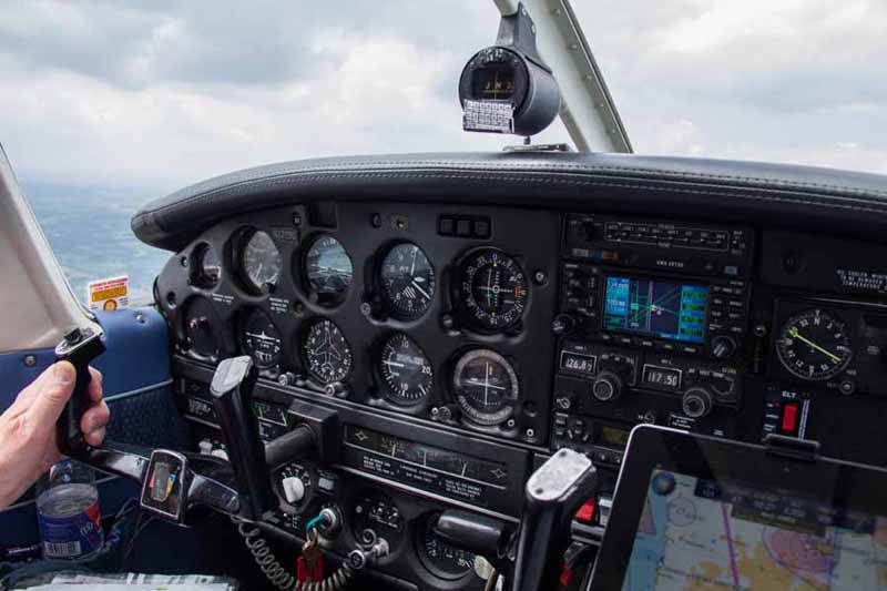
Aircraft / Pilots
The aircraft is an N
registered Piper Archer II (PA28-181), which belongs to a small private
group, of which I am a member. The aircraft is IFR equipped and carries
a panel mounted Garmin GNS430W, and I carry a yoke mounted iPad2
running SkyDemon. There is a basic autopilot which when coupled to the
Garmin GPS, will keep the aircraft on a set track, but without altitude
control. Both pilots on the trip have UK CAA issued PPLs with am IMC
rating, as well as piggy-back FAA PPL licenses
Although the aircraft is IFR equipped, our PPL licenses prohibit IMC
flying outside of the UK, therefore the routing was designed to allow as
much flexibility as possible with regard to flight altitudes or levels
outside controlled airspace (OCAS), allowing visual meteorological
conditions (VMC) flight below cloud or VMC on top. Beyond the Goodwood
VOR we had the chance to begin a climb up to flight level (FL) 65
(around 6,500 ft) and then continue a climb pretty much up to the limits
of the aircraft, which is around 12,000 ft in practical terms. The
aircraft has no de-icing or oxygen systems, so altitudes chosen during
the flight were based on the semi-circular rule, avoiding possible
icing, but also on the ability to get some nice photos, which was part
of the mission for this flight anyhow. Due to our license restrictions,
the cloud coverage before the descent into La Rochelle had to be broken
at a minimum, allowing a visual descent into the La Rochelle terminal
manoeuvring area.
Planning
The
flight was originally going to be performed during the week a few days
earlier, but to the West of our track (so Rennes and beyond), there was a
published NOTAM indicating an Air defence week exercise with something
like a 200 mile radius. Therefore our route was more inland. As we later
changed the plan anyhow to fly on Sunday, numerous NOTAMs highlighted
gliding activities in the UK, some aerobatics and numerous PJE
(Parachute Jumping Exercise) in France, so I chose a flight plan
friendly route (so based on NAVAIDS like VORs and NDBs and IFR
intersections, but excluding aerodrome ICAO codes), avoiding most NOTAMd
areas, and the large areas of controlled airspace to the west of our
track (e.g. Dinard Pleurtut, Rennes, Nantes) which we may or may not
have got clearance to cross. A scenic route along the west coast would
have been more picturesque, and although I have done around 10 flights
to France, all have been within the confines of the UK CAA chart, and
being restricted to VMC flying I wanted to avoid placing too many
challenges and workload into this flight. Maybe next time though ;-)
The
flight time (not corrected for wind) was 3hr 16 minutes and a distance
of 378NM. The Archer II at 65% power (about 2350 RPM) has a fuel
endurance of about 5.5 hours. Therefore we had a reserve of around 2
hours.
The planning was initially performed using SkyDemon, and
later copied to paper charts to double check and ensure compliance with
airspace boundaries and so on. My choice of charts was the IGN 1:1000000
and the SIA 1:500000, aided by this discussion thread. Aero WeatherPlus was a great help on this trip as well, and the Ogimet site showing cloud bases and tops for the entire route.
The
main cockpit items we carried were the 4 charts (UK, 1 x France
1:100000, 2 x France 1:500000), an iPad 2 running SkyDemon, a printed
PLOG and enroute charts from SkyDemon, a weight and balance chart, a
copy of all NOTAMs and paper copies of all enroute aerodrome charts.
Personally I am not comfortable with a completely electronic flight bag,
and nor do I find it practical to solely use the iPad for storing
everything, especially as I found out due to my own clumsiness, you can
delete an entire application and all of its contents in a matter of
seconds! Therefore all essential items and other backup material is also
paper based. The flight plan was filed via SkyDemon, though in the past
I have used RocketRoute, and in the future I may use Eurofpl.
I
would estimate my total practical time planning this flight was in
excess of 10 hours more than the total flight time. Some of the time was
spent using EuroGA looking for advice, and the rest was trying
different routing options, and then transferring it to paper, and
preparing all printed copies. No doubt this could have been done much
quicker I could have done it all on SkyDemon or some other package, and
hardly used any paper items, or I could have chosen simpler routes, but I
quite enjoy the planning aspect of flying and believe in doing as much
preparation as I see fit, and not putting all my eggs in one basket. As
one gets more experience, the lessons learned much reduce the time spent
planning anyhow.
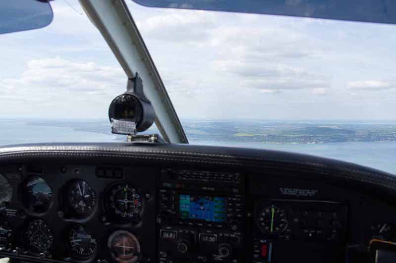
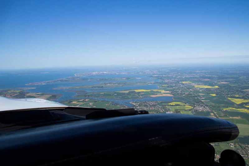
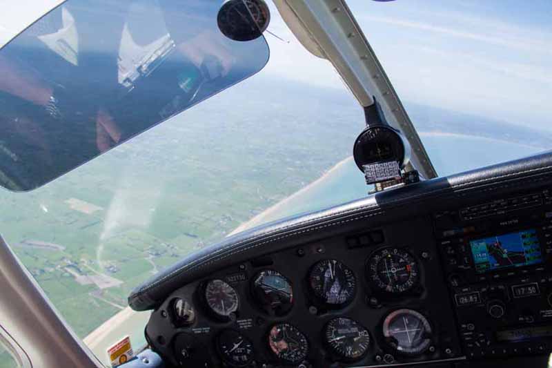
The Flight
The flight went according to plan. The weather was fine for a VFR flight in France
Just past Cherbourg we saw cloud formations approaching in the
distance, and we increased our flight from FL060 to FL070 stay in VMC
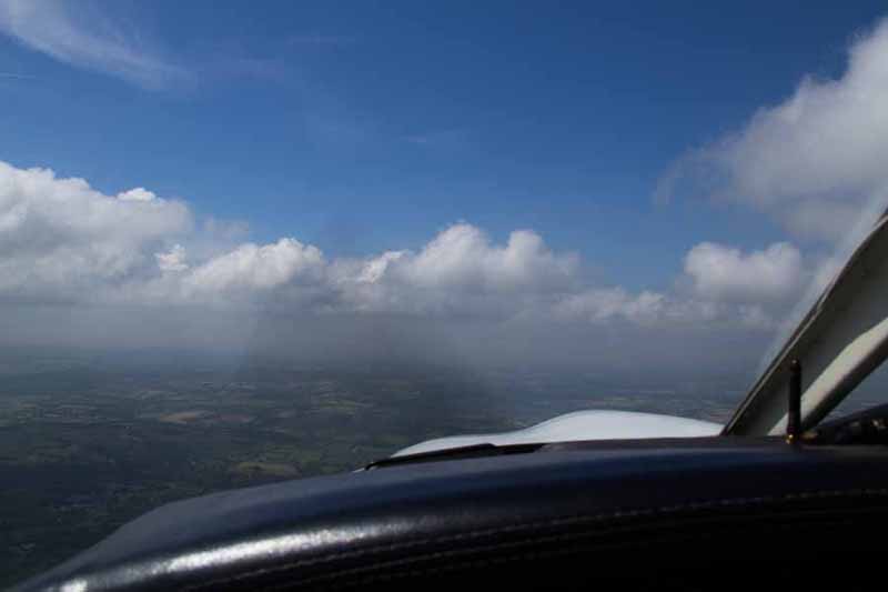
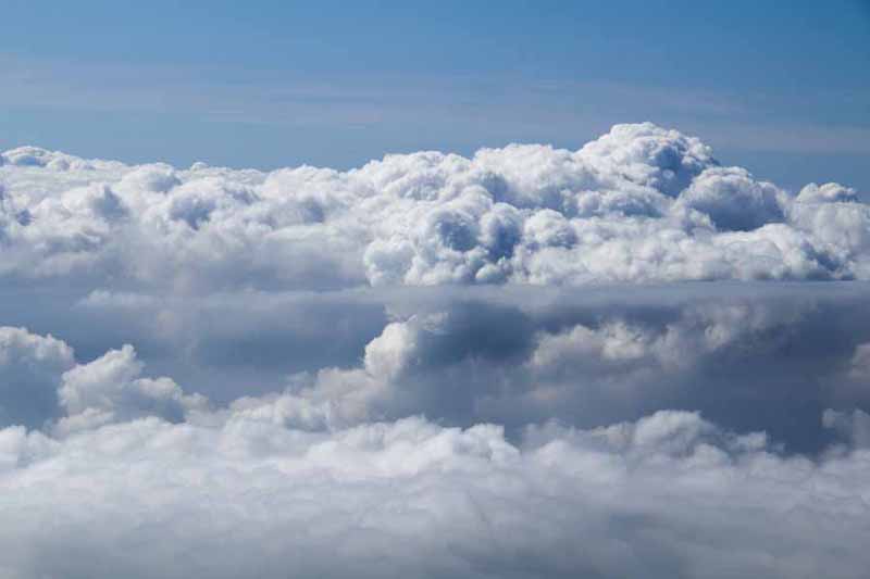
We stayed at this altitude until near the BOBRI intersection, where
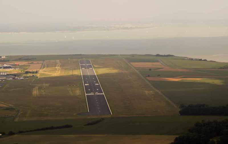
we descended to altitude 2000, to just stay under the cloud base. La
Rochelle were reporting scattered clouds at 1900 ft (and their aerodrome
is about 74 above sea level). The French ATC smoothly handed us over to
the next controller one en-route and generally gave us a traffic
service. At La Rochelle we were given a right base join for runway 27,
which was straight forward
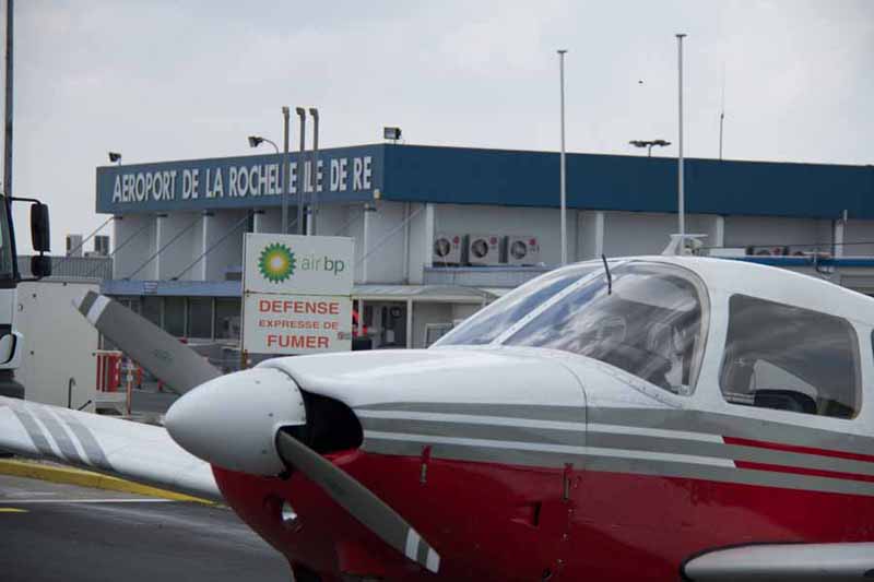
After landing we parked at the Avgas pump, and even though it was
shut for an extended lunch period, someone kindly came along and filled
us up. The flight time was about3 hours 20 minutes.
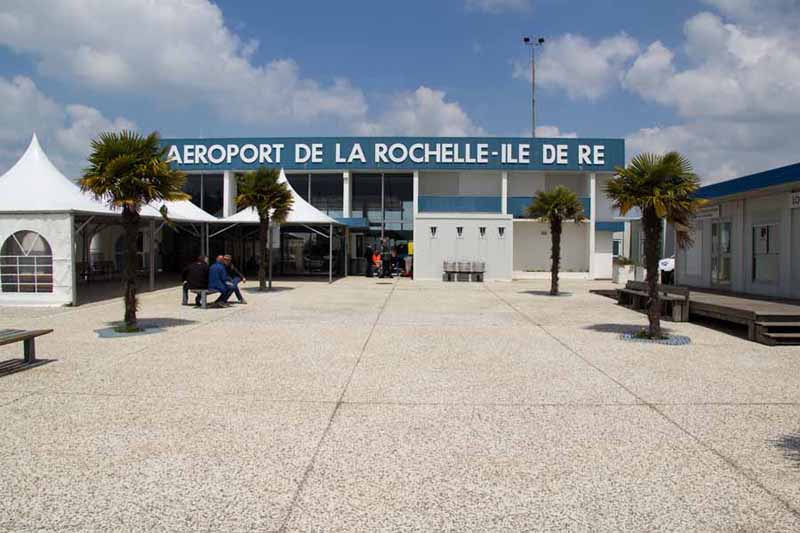
La Rochelle airport doesnt really offer much in terms of food, drink
or other interesting amenities for pilots. On this tip we didnt have
time to go into the city which was a shame.
The flight back was pretty much the same
except we flew back at lower altitudes to see some of the scenery
though this part of France is fairly flat and it all invariably looks
the same. Arriving back near UK mainland we descended to 1500 ft to
circle around the Isle of Wight
and then proceeded back to EGLG. The flight time coming back was 4 hours.
Lessons Learnt
With
enough planning and research, long distance trips are not all that
complicated. I found SkyDemon to be very helpful in checking airspace
boundaries and depicting active Notams. We were fortunate that we had no
technical or weather challenges, and having having minimal quantities
of drink before the flight, and eating neutral food like bananas saved
having to use some of the not so attractive GA toilet ‘facilities’ in
flight :-) Next time I will allow more time to go into a town like La
Rochelle, rather than just stay at the airport. Also, next time I would
like to explore a more Eastern part of France, ideally a mountainous
region.
Simon, June 2013