
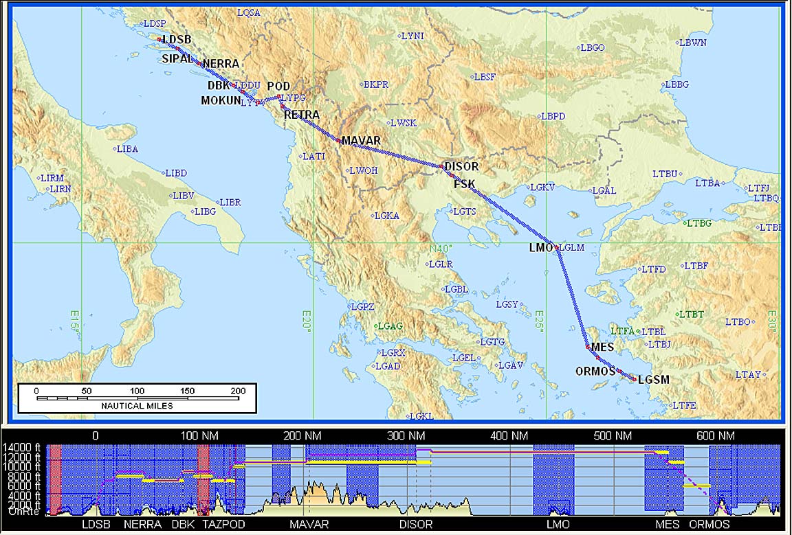
This article describes an IFR trip from Shoreham (EGKA) to the island of Samothraki in Greece (near Alexandroupoli LGAL), via Brac (LDSB) in Croatia, Samos (LGSM) in Greece, with a stop to a GA fly-in (URL) at Balikasir (LTFD) in Turkey, and back to Shoreham via Zagreb (LDZA) in Croatia, over a 2-week period.
I flew over Samothraki in 2009 and decided back then that we must visit it someday…
Due to uncertain weather, the stop in Turkey was cancelled.
The summer of 2012 has delivered the worst weather for Europe that I have ever seen, and this trip was affected accordingly. We managed to get around it but only by being flexible on flight dates and on how long we stayed in different places.
General Planning
Greece is always a bit of a planning challenge because while most of the airports have Customs (due to the many holiday flights) most do not have Avgas, and many have very limited opening hours. Also some, notably those with military usage, have long PPR or PNR-Customs requirements, particularly for aircraft on non-SX (non-Greek) or non-EU registrations. In most cases, there is no evidence that it was done deliberately to exclude GA as has been the way at so many European airports. It seems to be the result of planning for only the commuter or holiday airline flights, without much regard for GA activities.
The Aegean has the biggest problem, with Avgas available only at Samos LGSM, Rhodos/Diagoras LGRP and Sitia (Crete) LGST.
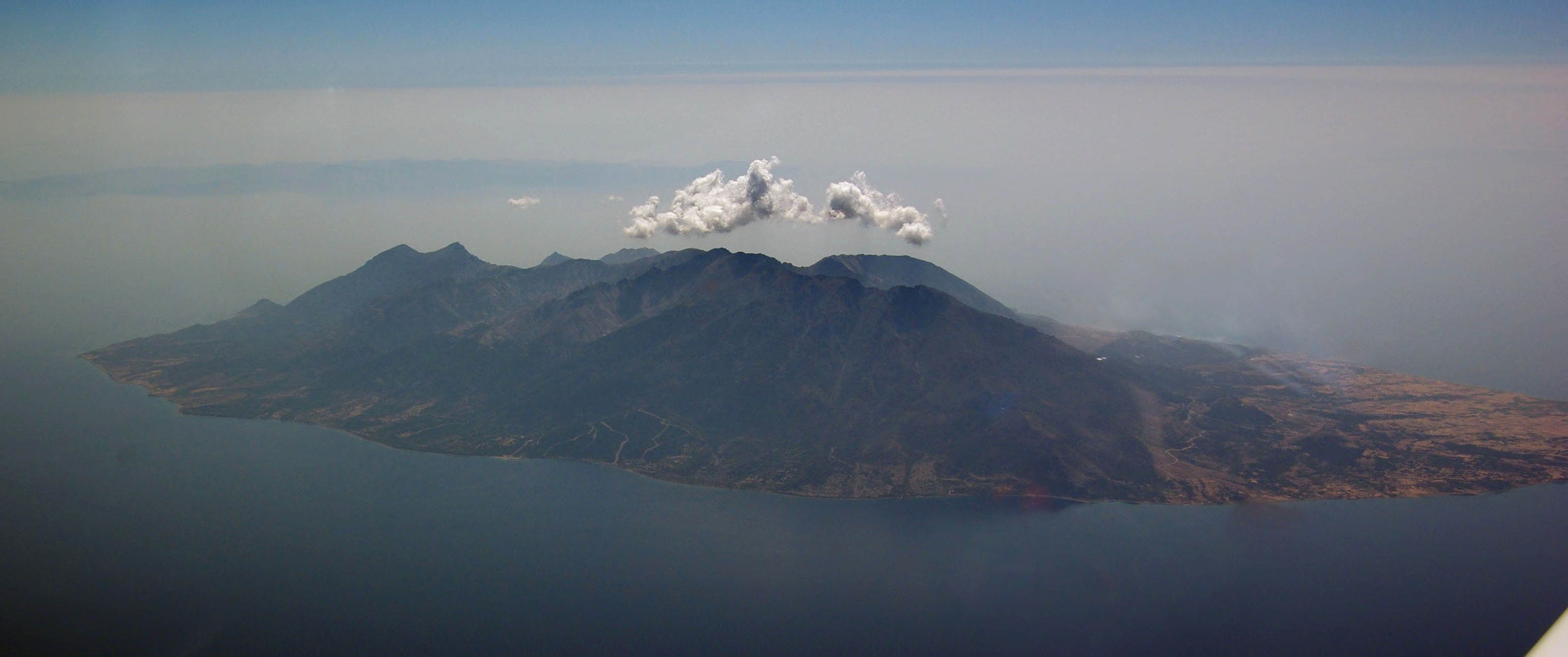
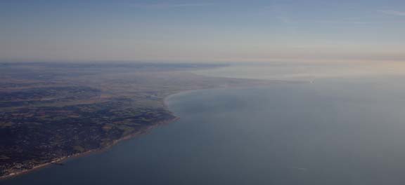
This pic of Greece (click for a better version) shows the airports referred to

On the plus side, Greek airports communicate well in English, respond to faxes and emails (where the email addresses work) and their opening hours are accurately shown in airport Notams. For the past few years, Greece has offered free landing and parking to GA, though not free handling where handling is mandatory. The ubiquitous Olympic Handling firm is particularly friendly, efficient and responsive, and is not unreasonably expensive. SwissPort Handling is similar and offers a discount to AOPA members. No Greek airport is ludicrously pricey (along the lines of ~€600 Gatwick, Frankfurt, etc, where mandatory-handling cartels have inflated GA prices to bizjet levels) and even the H24 Athens LGAV, which has Customs and Avgas, is around €200. For an English-only speaking pilot with a bit of flexibility in his schedule, this makes flying around Greece easier than flying around some other southern European countries where non-response is the default position, particularly to an enquiry in English which is rarely spoken on the airport and is poorly spoken even in the tower
Until only a few months ago, the Greek AIP has existed only in printed form which meant that virtually nobody used it and it was way out of date anyway, so important information such as opening hours is permanently Notamed. Contacting the airport directly is however very advisable. I did not use the Greek AIP at all on this or any previous trip to Greece. It is accessible online here.
I have some general notes on the frequently difficult business of locating airport contact details here and this site is a good start for airport phone, fax and email details but with Greecethis site (local copy) is a good start if you just want to try a phone call.
The planning on this trip was complicated by the often not overlapping airport opening times. Many of the airports open relatively early in the morning but close in mid-day. This means long flights need to be carefully planned to avoid arriving during the closed period. Some examples of opening hours for the destinations and alternates are: Brac LDSB: SEP 01-22: MON-FRI AND SUN 0600-1400, SAT 0600-1700 Alexandroupoli LGAL: MON 0330-0830 1300-1600 TUE,WED,THU,FRI 0500-0930 1300-1600 SAT 0500-1030 1300-1430 SUN 0600-0830 1300-1600 Balikesir LTFD: 14 JUN-17 SEP MON:0600-1930 TUE WED THU FRI:0600-1930 SAT:0500-0800 1630-1930 SUN:1045-2245 17 SEP-27 OCT MON TUE WED THU FRI:0600-1930 SAT SUN:1630-1930 Samos LGSM: MON,TUE,WED,THU,FRI,SUN 0330-1630 SAT 0330-1845 Sitia LGST: MON,WED 0330-0900 1100-1300 TUE 0400-0800 THU 0400-0530 1500-1700 FRI 0330-0900 1100-1530 SAT 0330-0530 1500-1700 SUN 0700-0830 1530-1730 NOTES: 1.FROM 13/09 TILL 25/10 THU 0400-0530 1400-1600 2.FROM 09/09 TILL 21/10 SUN 0400-0530 1400-1600. Try planning a trip with that lot
The immediate issue with the airport opening times was on the first leg: Brac is only just reachable from Shoreham before it closes, and a 1hr extension at Brac (available for approx. €60) may be needed. This assumes a 0700Z departure from Shoreham, which is possible only on weekdays! At weekends, the earliest departure is 0800Z. A Saturday departure is still possible, however, because Brac is then open till 1700Z…
The ferry between Alexandroupoli and Samothraki is run by SAOS Ferries whose timetable for September 2012 is here. On most days it is not possible to arrive at LGAL and catch the ferry to Samothraki on the same day, or vice versa.
There is no avgas in north-east Greece and Alexandroupoli (LGAL) is the only place from which one can get a ferry to Samothraki. Flying to LGAL from Brac LDSB is nearly 600nm which burns about 50% of the fuel carried. This was OK provided that the Turkish (LTFD) fly-in was not cancelled or didn’t have a problem with the avgas bowser. It would leave enough to even go to Sitia LGST on Crete (which does have avgas but has very limited opening hours) and more easily Samos LGSM (which has avgas, and reasonable opening hours) but to maximise our options in case of a problem with Turkey I planned a stop at Skopje LWSK in Macedonia which has everything including avgas.
Fortunately, the three elements of this trip could be altered in their order to suit the weather:
Plan A: Croatia/Brac LDSB – Samothraki (boat from LGAL) – Turkey LTFD – Croatia/Zagreb LDZA
Plan B: Croatia/Brac LDSB – Turkey LTFD – Samothraki (boat from LGAL) – Croatia/Zagreb LDZA
Only the Turkey stop was time-critical, being fixed for 14-16 September. This also meant that it would be discarded if the weather did not play ball, or if there were any permission issues. Turkey is notorious for being absolutely strictly PPR for N-reg aircraft and a special authorisation code has to be put on the flight plan, or read out to ATC on the way there. The code changes if there is a change in the airport one is flying there from or the one which one is returning to. Obviously one could get around the latter one using a diversion. The Istanbul Aeroclub which organised the fly-in very efficiently sorted out the permissions but it was still not possible to do a last-minute change of plan.
Plan B was the most attractive because the interaction between the Samothraki ferry times and the LGAL opening times would be “suffered” after the time-critical part of the trip in Turkey.
Plan B involved a flight directly from Brac to Turkey. With Samos as the alternate, the Skopje fuel stop could be avoided. This in turn would require a large fill-up in Turkey and thus a greater exposure to possible avgas issues there. Sitia’s opening times on that day (Friday) also make it acceptable as a 2nd alternate but – depending on enroute winds – probably only if the diversion is done while enroute. The worst case would be landing in Turkey and finding the avgas bowser is empty or broken; then Samos might be the only reachable option.
There are some Greek airports where the aeroclub has avgas in drums. Officially they don’t sell it to visiting aircraft but it may be possible to get some. The price to outsiders is high – around €3.50/litre. I did not plan to rely on this option, except in the case of one of the alternates.
Very importantly, all stops on this trip were chosen to be in places which we wanted to visit anyway i.e. no stops purely for fuel. Being able to do that is one of the luxuries of the TB20, with its ~1300nm range, and greatly reduces the pressure of having to get somewhere.
Procedurally, the flight was very similar to other airways flights I have done. Other VFR and IFR trip reports can be found here.
Here is a glossary for non-aviation readers.
Pilot
FAA CPL/IR
JAA PPL/IR
1500hrs (approx).
Aircraft
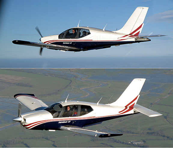
The aircraft is a 2002 Socata TB20GT which has a zero-fuel “book” range of approximately 1100nm and an economical cruise speed of 155kt TAS at 10,000ft. Extra economical cruise power settings can extend the zero-fuel range to 1300nm which, according to FAA rules, translates to approximately 1100nm with IFR reserves. It has a ceiling of about 20,000ft and is equipped with oxygen. It is not certified for flight into icing conditions but has a TKS de-iced propeller. This is the actual aircraft
 :
:
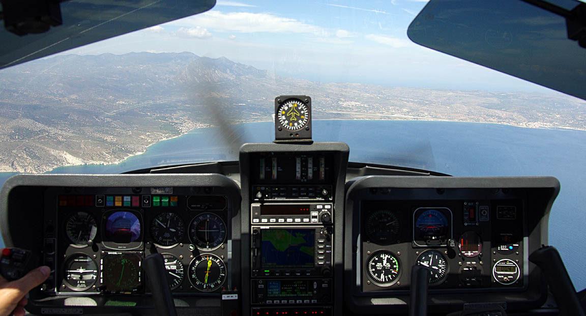
Navigation equipment includes a KLN94 IFR GPS and a KMD550 MFD and these are used for primary navigation. IFR flight in Europe at any meaningfully high altitude requires BRNAV certification which in the GA context is met only with a BRNAV approved IFR GPS installation. My KLN94 is also now certified for full-IFR which includes GPRS/RNAV approaches. The only thing it can’t do (officially or otherwise) is GPS/LPV approaches but currently none of these exist in Europe.
The aircraft has a KFC225 autopilot which can track VOR/GPS/LOC/ILS and fly a preset altitude or a preset VS. There is an additional battery powered Garmin 496 GPS which also provides an audio terrain warning (TAWS) function with a European terrain and obstacle database. The TAWS function projects the current trajectory for 2 minutes and if there is a terrain conflict, one gets a “pull up” type audio warning whose tone gradually becomes more urgent. A WX500 stormscope is also installed. One of the radios has 8.33kHz channel spacing to legalise flight at 20,000ft although I have never been assigned such a frequency

A Sandel SN3500 EHSI was recently installed which provides automatic waypoint sequencing to the autopilot so a whole route can be flown without HSI course pointer adjustment. In effect this delivers what is called “roll steering”.
Weather Planning
I try to use “technical” methods to make the go/no-go decision as objective as possible. In the context of flying a non-deiced aircraft (I have propeller-only TKS de-ice, which really does work very well but is no good for spending hours in icing conditions) this means establishing whether the enroute section of the flight can be done substantially in VMC, which given the subzero temperatures at typical European airway levels most of the year means VMC on top if there is any cloud about.
One therefore needs to establish where the cloud tops are likely to be. Cloud tops are almost impossible to forecast with any useful accuracy, but things have improved in recent years with satellite IR images which show actual cloud top temperatures and thus altitudes. Some notes are here and here.
Since about 2009 I have been heavily relying on satellite IR images to get a “cloud tops METAR” just before a flight and this simple technique has been completely successful on every flight where I have used it. No flight I have done has been what some pilots call “eventful”, and I have never had to turn back. The cost of this strategy, with the TB20, and with long legs of e.g. 700nm+, is that the despatch rate on a particular day in UK weather is only about 80%. But this is a whole lot better than it would be under VFR… especially legal VFR
IFR Route Planning
The routes (which included various options) were planned using Flight Plan Pro (FPP) which was used to generate a Eurocontrol-accepted airways route which was then pasted into Jeppesen FliteStar from which I printed out enroute chart sections, plogs, etc. The workflow I use is illustrated in this article. The flight plans were filed using EuroFPL.
However, there are numerous other ways one can do this job, and there is enough capability in FPP alone, or EuroFPL alone, to generate adequate data to do an IFR flight with. Taking the simplest case, one can fly IFR in Europe’s enroute airspace system with just a list of waypoints like this which EuroFPL emails you some hours before the flight planned EOBT. If you pick up this email on a phone, you can enter it into the IFR GPS and just fly it. Electronic or printed enroute (airway) charts are very unlikely to be required. However, my view is that this is somewhat risky, and I have been asked to fly named airways on a few occassions.
There is also RocketRoute (which runs FPP code) and, being a straight website, is the only current facility for generating optimised airway routings for pilots with non-Windows / OSX platforms (Iphone, Ipad, Android phones, etc). EuroFPL offers the Eurocontrol “route suggest” feature which is continually improving but is still less optimised than FPP’s routes, not least because the entire Eurocontrol-suggested route is prepared for a single flight level.
With European IFR flight itself being a wholly point to point RNAV DCT-button-pushing exercise, a flight done fully under IFR needs a lot less traditional flight planning than under VFR which requires current VFR charts. However, IFR flights which involve VFR sections, and this includes Z and Y flight plans, or departures at airports with nobody in the tower capable of getting you an IFR clearance, still do require VFR charts and an awareness of controlled airspace, etc.
The route illustrations in this article are screenshots from Jeppesen FliteStar. Note that the terrain profiles shown at the bottom are illustrative only and are not usable for safety altitude planning; in fact the Jeppesen data contains systematic errors. The vertical profile of an IFR flight is at a minimum level which is decided by what is acceptable to the Eurocontrol computer. The minimum levels which can be filed and flown tend to be around FL070 but acceptable routings usually need higher levels. Sensible routings start to appear around FL100 and the best ones (below FL200) are obtained at FL120 plus.
Oxygen is therefore highly desirable for European IFR and that is assuming the weather is perfect! In reality, for me, for any significant flight, no oxygen = no fly. Over the years I have got through various equipment and the best is what I use now: all from Mountain High in the USA:

This kit works really well and the cannulas are comfortable and are forgotten about almost right away.
In some airspaces, one can file IFR at lower levels without the Eurocontrol computer chucking it out, but it’s likely to cause problems with ATC services if e.g. the flight is outside controlled airspace. Some notes are here.
Equipment and Communications
Emergency Equipment
I always fly with a liferaft, an emergency bag containing a 406MHz EPIRB, a handheld radio and a lot of other stuff, a second 406MHz+GPS EPIRB, and together with the large 48 cu. ft. carbon/kevlar oxygen cylinder these take up the RH back seat. on long trips I carry a spare identical oxygen cylinder (and a spare 1st stage regulator) in case the main cylinder leaked out through a faulty valve, or because I forgot to shut off the gas after landing. With the O2D2 electronic regulator the leakage (in the absence of breathing via the cannula) is very low but if any constant flow cannula is connected the gas will be all gone by the next day… There is also a large toolbox with enough tools to do the 50-hr service plus potential emergency jobs like changing the vacuum pump. I carry a spare vacuum pump too, with the vacuum line filters which must be changed if the pump fails. On longer trips I also carry a complete set of spare servos for the notoriously unreliable KFC225 autopilot, 1 refill for the 2-litre TKS propeller de-ice system, and several 1-litre bottles of isopropyl alcohol (IPA) for use as fuel anti-icing additive (there is no known case of a TB20 suffering fuel icing but this is a very cheap precaution, although on this trip the temperatures were so high – lowest seen was -3C at FL150), and four 1qt bottles of engine oil. Plus a lightweight reflective aircraft cover (from Bruce’s Custom Covers) which keeps the cockpit cool when parked in hot climates and is a huge help in keeping the interior in good condition. It is difficult to imagine doing such a trip in one of the many 2-seater “homebuilt/sports” types (although many people have done exactly that… travelling with a toothbrush ). This leaves the LH back seat free and Justine sometimes likes to sit there; that seat is a lot thicker and softer than the front ones. In that case I run down the LH fuel tank substantially, to keep the aircraft balanced.
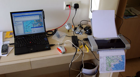
Laptop
It is of course possible to pre-plan everything back home and – for trips with a duration of under 5 days – even file all flight plans in advance. I usually do that on overnight trips and then I travel with just an Ipad and a phone. This enables me to delay a flight plan (using the EuroFPL SMS facility) or even file a new one, and get the weather and notams. However, on any significantly longer trip, the chance of needing to replan in detail, using flight planning software, is very high and then I carry a lightweight laptop (an old 12" Thinkpad X60S-1704 with a 4 hour battery) which does everything needed for VFR and IFR route planning, weather, notams, flight plans, and communication via fax and email. The laptop has several different ways to get internet access; in descending order of preference: normal WIFI, a WIFI connection to an E585 GPRS/3G-WIFI modem which normally has a UK Vodafone SIM but is used with a locally purchased SIM on longer stays in one place, a WIFI connection to my Nokia 700 GPRS/3G phone running JoikuSpot, a USB cable connection to the same phone, a built-in GPRS/3G radio (with a UK T-Mobile SIM). Fax (which remains very handy for some airport communications, where a phone call is difficult due to language issues, and published email addresses often don’t work) is done via email2fax and fax2email accounts; these are not free but are very cheap.
Mobile Data / Roaming
Free unsecured WIFI is very unusual in Europe nowadays. WIFI is also rarely available outside hotels and cafes and in nearly all cases it is secured with a password issued to customers only. This means that mobile data – GPRS/3G – is the best way.
Unfortunately the cost of roaming data can be very high, especially outside the EU (Croatia for example) and the best solution for a stay of a few days’ or more is to purchase a local “data” SIM. This way you get say 1GB for around £10 which is unbeatable and covers any plausible flight planning or personal communication requirement. The SIM has to be inserted into some suitable device; I use the E585 GPRS/3G-WIFI modem which provides a straight WIFI connection which can be used by multiple users concurrently and this has proved to be a superb solution for travelling, which “just works” and rarely gives hassle. Some notes on this topic are here.
Unfortunately the mobile companies make billions out of carelessly used roaming data, which people are happy to pay for out of ignorance or because simply using their existing phone when abroad means they don’t have to do anything and they retain their existing phone number. Accordingly, the companies go to huge lengths to complicate the process of sorting out a local “data” SIM card, and in some countries only someone with good IT knowledge and who is obscessive enough to be a private pilot is sure to get it to work.
I went through the process in Greece on one of our regular previous trips; it involved spending an hour in a phone shop, with a passport (to curb tax evasion involving “invisible” businesses running on mobile phone numbers, Greece requires ID proof to buy a PAYG SIM), a load of form filling, purchasing a Cosmote “Pay as You Go Me Karta” SIM and a topup voucher (total cost around €20) and going on an obscure Cosmote website (which is accessible only via a device connecting to the internet via Cosmote 3G) on which the topup voucher is added to the account and the desired data package is selected. Nowadays the Greek phone shops are capable of adding the topup to the SIM electronically but you still have to go to that website to “spend the credit” by selecting the desired package. That website is supposed to appear when you go to any URL in a browser if you have no data package selected but this doesn’t always work. The website is also insufficiently functional on an Iphone/Ipad (I did eventually find a work-around). Now, on a new visit to Greece, I need only to buy the topup voucher (9/2012: €15 for 1GB; valid for 30 days) and go to that website, add the voucher code, and select the 1GB option. The SIM itself is good for 1 year. The E585 modem needs no configuration for the Cosmote SIM, which is suprising given how flakey the auto-APN protocol often is.
Croatia has elevated the process to new heights which are designed only for a Croatian-speaking person and only the most determined foreigner will be able to work it out. T-Mobile is probably the network of choice down there (I tried the other one – VIP – and the SIM card didn’t work at all when tested in the shop) and the full gripping details are here. I got it working only after a protracted email exchange with their support people (who were responsive but like so much of today’s “Iphone generation” rarely read past the first line of an email) and only after we had left Brac so the functionality was verified on the later stop in Croatia – Zagreb. It’s a pity, since Croatia is normally really well organised in all the other ways involving tourism.
For brief visits to the EU one can usually make do with a UK-purchased “EU data pack” which most UK networks offer. These do not give you the vast amounts of very cheap data of a locally purchased data SIM but you can get e.g. 50MB for £10 from T-Mobile (2012) or Vodafone’s “Euro Traveller” (your UK free allowances transferred abroad for £3/day (2012) which is usually OK, and you just use your existing phone, or Ipad/3G. One general tip when buying a SIM card is to not buy it with a USB GPRS/3G radio adapter because such SIMs are often set up on special ripoff tariffs. If possible, just buy a normal phone SIM.
Supplementing Panel Mounted Avionics
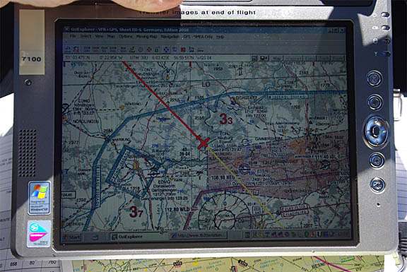
One needs a backup for a total electrical failure, and it is useful to have mapdata which is not available on any panel mounted GPS. On all long flights I run European VFR charts as a GPS moving map under Oziexplorer, mainly for emergency use but also for identifying interesting places on the ground
For crossing mountains above a solid cloud layer, there are better topographic maps for emergency use e.g. the synthetic one derived from the Space Shuttle (SRTM) radar imagery which is shown further below.
The Alps offer suprisingly favourable engine failure options if one is flying say 8000ft+ above the terrain. I would say that 90% of the time there is an easy, flat, and obvious landing site within glide range. The Pyrenees are a different story, however…
Oziexplorer was originally developed for offroad driving in the Australian outback but it is really just a GPS moving map application which can run almost any graphical image (that can be georeferenced) as a GPS moving map. The LS800 tablet computer used here is an outdated product but remains one of the few tablets which is truly sunlight readable.
Oziexplorer is not yet available in an IOS (Ipad) version but one is expected, and it will make the above types of mapping much more accessible. Despite copyright restrictions, many current aviation charts are “out there” for Oziexplorer
I also use the LS800 to display weather data using an internet connection with a satellite phone
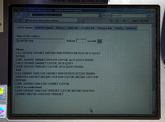
Each weather check like the one above costs about $1, using a Thuraya 7100 PAYG phone, connecting on a 1722 dial-up call at 9600 baud. The system is not 100% reliable but usually works fine in the context of a flight lasting several hours. One can supposedly get destination weather from ATC but many ATCOs are too busy, many in southern Europe cannot speak English well, and some evidently don’t like doing it anyway. It also appears unprofessional when the vast majority of the players in the IFR airspace (airlines) can get weather via their own comms systems (ACARS). I did some tests on using satelline phones for aviation weather - here.
Paperless Cockpit?
It always pays to do as much as possible back home, before departure, where internet is free, printing is cheap and quick, and one would not depart in any case if the weather is not suitable. For this trip, all routes were preplanned and the ones actually intended to be flown, and all main and alternate approach plates, were printed on a colour laser printer. The pile of paper was about 20mm thick
Some pilots have gone “paperless” in the cockpit and use e.g. an Ipad as the display device for both enroute charts and approach plates. I have worked in electronics and IT for many years and I know that this is going to bite you one day – unless you have backups and then you end up with yet more gear, with the associated chargers, etc.
This is why I try to fly with “paper” – no backups are needed. However, one change I did for this trip was not carrying the little Canon IP90 printer which I carried on all previous long trips
The printer is about the only portable printing option for the A5 size most desired in the cockpit (it’s actually A4) and while it is lightweight it is not exactly small. Printing the route data to a PDF and transferring the PDF to an Ipad (or a similar tablet) is a better way forward and provides an adequate backup for a change of plan. The Ipad is built to a good standard and is generally reliable.
On this trip a lot of IT technology simply didn’t work. I had to re-plan some of the routes and needed to generate PDFs on the laptop, to transfer to the Ipad. However all three PDF writers on the laptop stopped working. I was able to print to Jpegs and transfer those… I fixed it by reinstalling the Adobe writer; possible only because I had the original install package on the laptop. And until I got the Croatian SIM card sorted, endless irritations with mobile data.
The Ipad
It can be difficult to transfer data to/from an Ipad, due to the way in which Apple have locked it down for marketing reasons. The only official way is via email, or Itunes. Email is highly undesirable because the cost of roaming data can be very high and it may be unavailable altogether. Itunes is a badly-behaved piece of software, designed for idiot users and counter-intuitive to people who organise their PC data locations carefully, which usually performs a “sync” operation (a bidirectional file transfer with file deletion) rather than a simple one-way file transfer, and thus has the potential to delete data from the device if the Itunes installation has previously seen another Ipad with a different configuration.
Fortunately there are ways to simply drag/drop files into the data area of an Ipad app.
One way is to “jailbreak” the device; this gets you total access to its file system (which is basically Unix) but – to a non dedicated hacker – the value of this is limited because much of the file system is non-obvious and many apps maintain separate lists of their files so just dropping in a new one doesn’t necessarily make it visible. Also the jailbreak is lost when the operating system is updated, which is a regular occurence on an Ipad, unless you ignore the persistent reminders to update.
A simpler way is to use a 3rd party file transfer utility such as Iphone Explorer. This works well with some non-Apple apps, where the developer has left open access to the directory (folder) where the app keeps its data files. The best example is the best PDF display app currently out: Goodreader. Its “Documents” directory is directly accessible with Iphone Explorer and dropping a load of PDFs in there, from a computer running Windows, is trivial.
For acceptable sunlight readability, the Ipad needs a matt screen filter and the one I have used is this one (local copy) which is not cheap but is very good.
The Samsung 10" Galaxy tablet, running Android, would do the same job as the Ipad but without the many limitations. Ultimately, as with all things in computing, one needs to choose the hardware which runs the software that’s needed to do the job, and not the other way round.
A loss or failure of the laptop would be very inconvenient, so on long trips I carry a spare laptop which has almost the same software configuration as the main laptop. This backup laptop stays in the back of the aircraft for the duration of the entire trip. The Ipad cannot be used for this since it cannot do some of the required functions, and anyway I need the laptop for doing comms related to my business.
Flight Shoreham-Brac
On our long foreign trips, we normally set aside three consecutive days for getting out of the UK, but this time it didn’t work. Most of the summer of 2012 was plagued by bad weather. Commencing the first departure slot, fronts at the UK end and widespread instability in the Adriatic with all-day thunderstorms lasted about 1 week. The forecasts for the Adriatic were essentially meaningless for any local weather. This example shows the change for a particular day between the 84-hour and the 96-hour MSLP. This type of weather can be safely flyable in the TB20 (example) but the ability to outclimb the buildups and thus icing conditions can be marginal, especially at MTOW and the ISA+10/ISA+15 conditions often seen in mid-2012. This resulted in a decisive loss of Plan A. But we were still flying to Brac as the first leg.
When the weather finally cleared, the 1200 MSLPs were clean, as were the satellite IR and TAFs/METARs. For good measure, the 0600 and 1800 SigWx were also clean. The weather for the two following days 1 2 was also good but one should always pick the first technically flyable opportunity. On the 3rd day the UK end was not so good…
The winds aloft were expected to be light, with a 5-10kt tailwind component.
EGKA
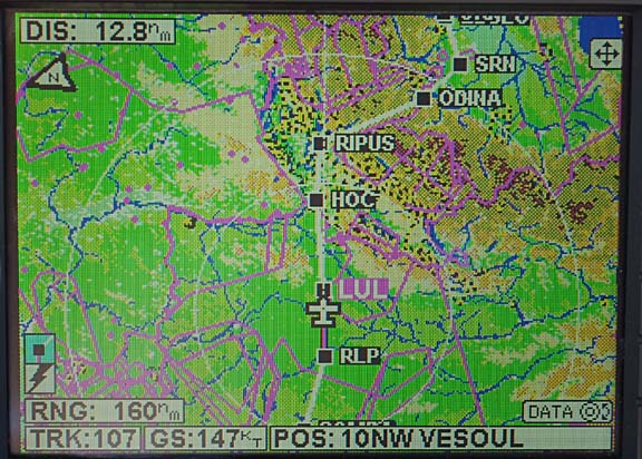
WIZAD M140 DVR/N0150F110 L10 RINTI B3 CMB/N0150F140 B3 RLP G4 HOC L613 RIPUS N850 ODINA M727 SRN L615 ADOSA L612 CHI L614 PUL N606 ZDA L607 SPL
LDSB
FL140 Alternates: LDSP, LDLO
Distance 825nm (GC) 932nm (airways)
There are several routes which can be worked through the Eurocontrol system which are all of a similar distance. The route chosen involves an exceptionally short Alps crossing with an airway MEA of FL140, so flying at e.g. FL160+ offers additional protection from turbulence, as well as better options for an engine failure
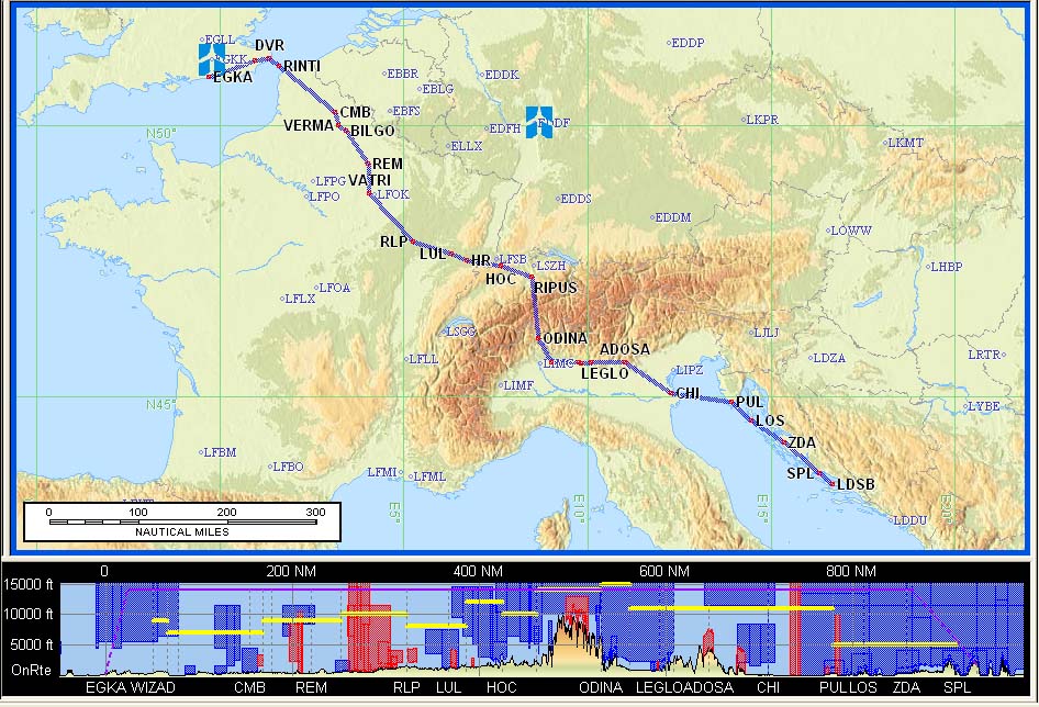
The flight plan was filed the evening before, using EuroFPL. With IFR flights – particularly ones to the east – there is a risk of a departure slot being issued by Eurocontrol. For GA flights in the FL100-190 band, these slots are apparently meaningless artefacts of their software and in any case the resulting delay tends to shrink near the time due to the slot time being modified, so one must still be ready for a departure at the originally filed time (EOBT). The paid EuroFPL subscription delivers slot notifications etc by email and SMS. On this occassion there was no slot, which was a relief due to the tight LDSB closing time. We had booked the extra hour’s extension at LDSB just in case.
The provisional clearance from Shoreham Tower was “remain OCAS, DCT SFD, squawk 0345, contact London Control on 133.175”.
There was thick fog in the vicinity of the airport but it had cleared shortly before departure
The conditions were good, though very warm (+18C at 3000ft) which really impacts aircraft performance
London Control gave us a heading of 090, a climb to FL080, then some more headings and then a DCT to TRAKA FL120 and that was it. Due to the clear weather and to conserve oxygen, I asked for a stop climb at FL120. At this level, the oxygen usage is so low that the gauge on the 48 cu. ft. cylinder barely moves over a 5hr flight with 2 people, but it keeps one wide awake. Next was a handover to Paris Control…
Except for the higher altitude parts, the whole flight was flown at the very best economy setting of 2200RPM, full throttle of course due to the altitudes, and leaned for peak EGT. At FL120, this yields a TAS of about 145kt (+4C) at 9.5USG/hr. This is an endurance of around 9 hrs and a range of about 1300nm to zero fuel. One doesn’t quite achieve that, due to the climb fuel burn, and I normally allow 30 mins’ climb (to FL160) which at 120kt IAS means around 60nm travelled during the climb and about 7 USG burnt.
Early on in the flight the fuel totaliser system showed a Landing Fuel on Board (LFOB) value of 26 USG
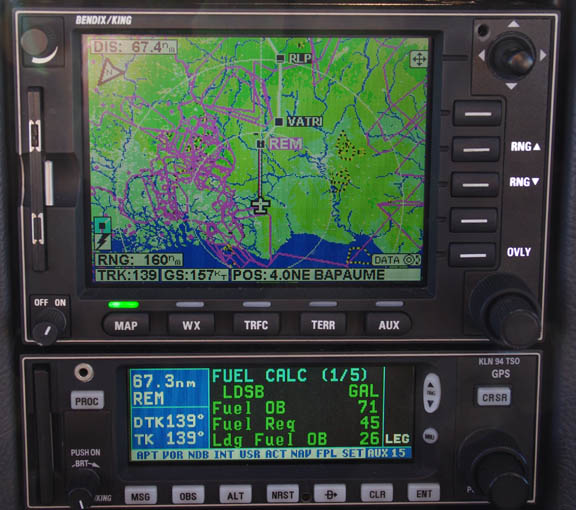
That figure later dropped to around 23 USG. This is reasonable; in an “alternate-rich” area I regard 20 USG as a reasonable minimum.
France is mostly very tedious to fly over, with very little to see until one gets about halfway down
As the Alps appeared in the distance
with a lot of low lying haze in front of them

we climbed to FL160.
The wind on the flight varied between 0 and 20kt of tailwind. Early on in the flight, the computed landing fuel on board (LFOB) figure stabilised around 24USG and later subsequently dropped to 22-23USG as the tailwind dropped off.
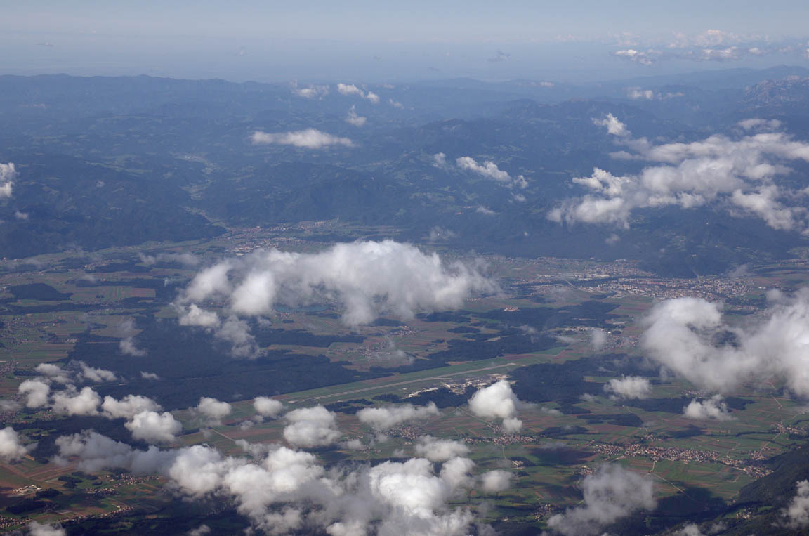
Over the Alps, the wind was generally under 10kt. A very rough rule is that for every 10kt of wind flowing across mountain ridges, one should be at least 1000ft above the terrain in order to limit the up/downdraughts to 500fpm. In this case, we were about 6000ft above most of the terrain, and there was no turbulence.
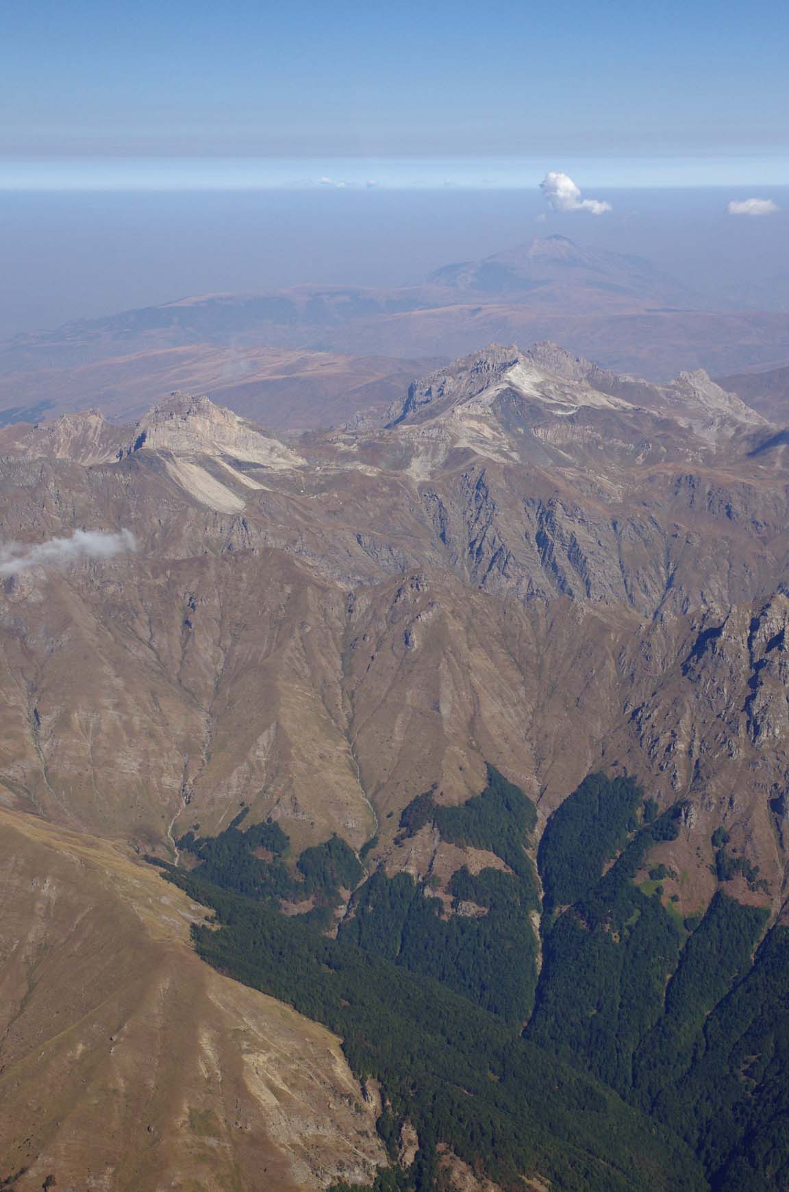
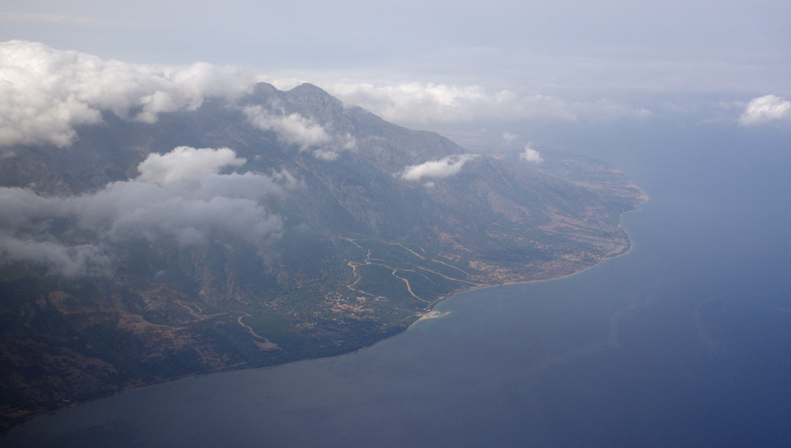
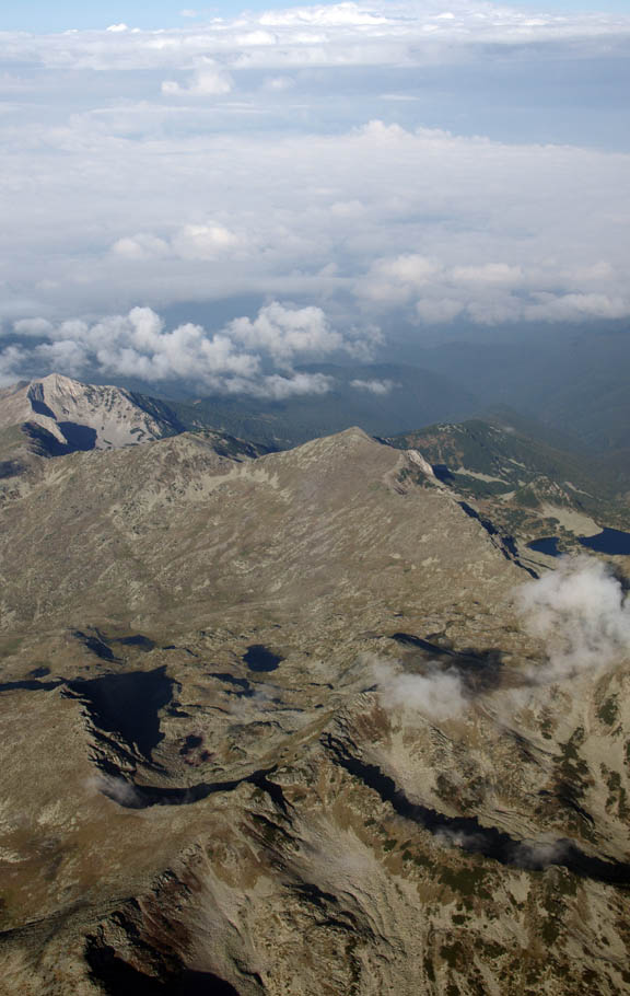
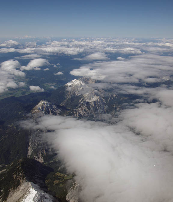
On clear days, the terrain is always spectacular
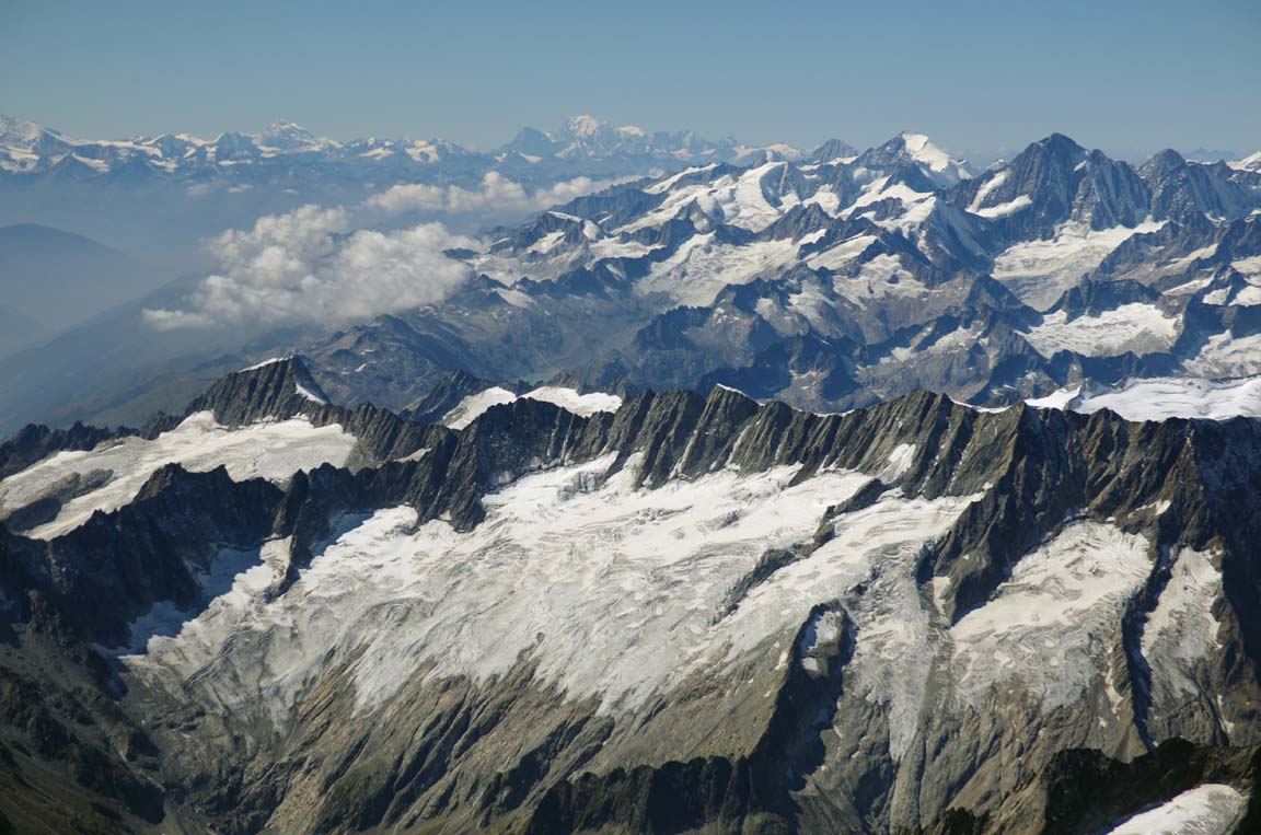

and this is not even near the “real” Alps which are further to the west. I have done a number of crossings of the Alps above a solid overcast and I do not mind because I have a “plausible” plan in the form of the GPS moving-map topographical map

It is not an ideal way to fly over hazardous terrain. But then what is acceptable to everyone, as a minimum? A King Air, with a direct operating cost of over £500/hr? One has to draw the line somewhere. My aircraft is maintained on a “money no object” regime, with the engine having been built by the most reputable US engine builder. I would not do this kind of flying in a rented aircraft…
This is Ambri LSPM; a VFR-only airport with probably more than its fair share of wreckage Maybe even as much as Samedan…
This particular route over the Alps was shorter than any we had done previously, and didn’t need any great altitudes either; FL150 was enough.
Immediately after the Alps comes the flat portion of northern Italy
Venice was passed to our left but was hidden the heavy haze. This was the last large water crossing; the first was the English Channel
The crossing of Italian airspace does carry a small risk. Italy has recently introduced a law where any private aircraft landing there and remaining for more than 45 days is hit by a massive lump-sum tax, starting at about €3000. There is an exception for aircraft “undergoing maintenance” which presumably means having to book it for maintenance by an Italian company which is perhaps the last thing one may want to do I no longer land in Italy and won’t until this crazy tax is removed.
The unmistakable islands of Croatia…
My Pentax K5 DSLR camera packed up around that point, with an intermittent fault which appeared to be temperature related, so all subsequent photos on this flight leg are taken with a Canon S95 compact camera and are of much lower quality. This is the second time the K5 is going back to Pentax. The first time was to replace the contaminated sensor (most K5s were affected by this) but this time it is out of warranty… It turns out to be a common fault related to a high ambient temperature together with a fully charged battery.
As soon as I was talking to Croatian ATC (Zagreb) I asked them to telephone Brac and tell them our ETA would be 1325 UTC. This would ensure that we would not need the extra hour’s extension.
There was some mention by ATC of a NATO exercise in the northern Adriatic, which delayed one shortcut I asked for, but a minute later this was granted so whatever the issue was had gone away.
We flew directly over Losinj airport – one of several very efficient and friendly GA airports on the long Croatian coast. I asked ATC for a 10 degrees right so we could get a picture
This is Split LDSP which was one of our alternates and which is just around the corner from Brac
Back in 2009 I had to abandon the aircraft at Split and get an Easyjet flight back to the UK, due to persistent bad weather over a large area. With easy access to the UK on a 2-hr airline flight from Gatwick, and with the TB20 capable of flying back to the UK nonstop (in light winds) Split is a good place to end up in that kind of situation Split also has excellent ferry connections. Rent a car there and go island-hopping…
Talking to Split Radar, I requested a visual approach. This is a procedure carried out under IFR (so one is not cancelling IFR) but is basically a left or right base approach to land. It saves a number of minutes of flying, which was a decent thing to do given the airport would be closing half an hour later and everybody would be trying to get home.
Splir Radar cleared us for a visual approach for runway 04, so I lined up for that. Then, talking to Brac tower, we were offered either runway 04 or 22, with slightly different winds at each end. I carried on with 04 even though there was a 3kt tailwind component.
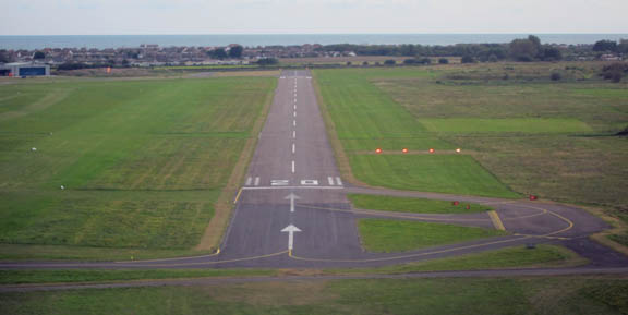
The approach was flown with a very steep descent because Brac airport (04 approach) is at the top of a big cliff and there is often some turbulence and wind shear (the light winds at the runway notwithstanding), and a steep descent angle provides much better options for a go-around. This pic shows the town of Bol at the bottom. and the famous pointed beach which is permanently packed with tourists
The runway is about 1400m (30m wide) but it looks a lot shorter from such a steep approach
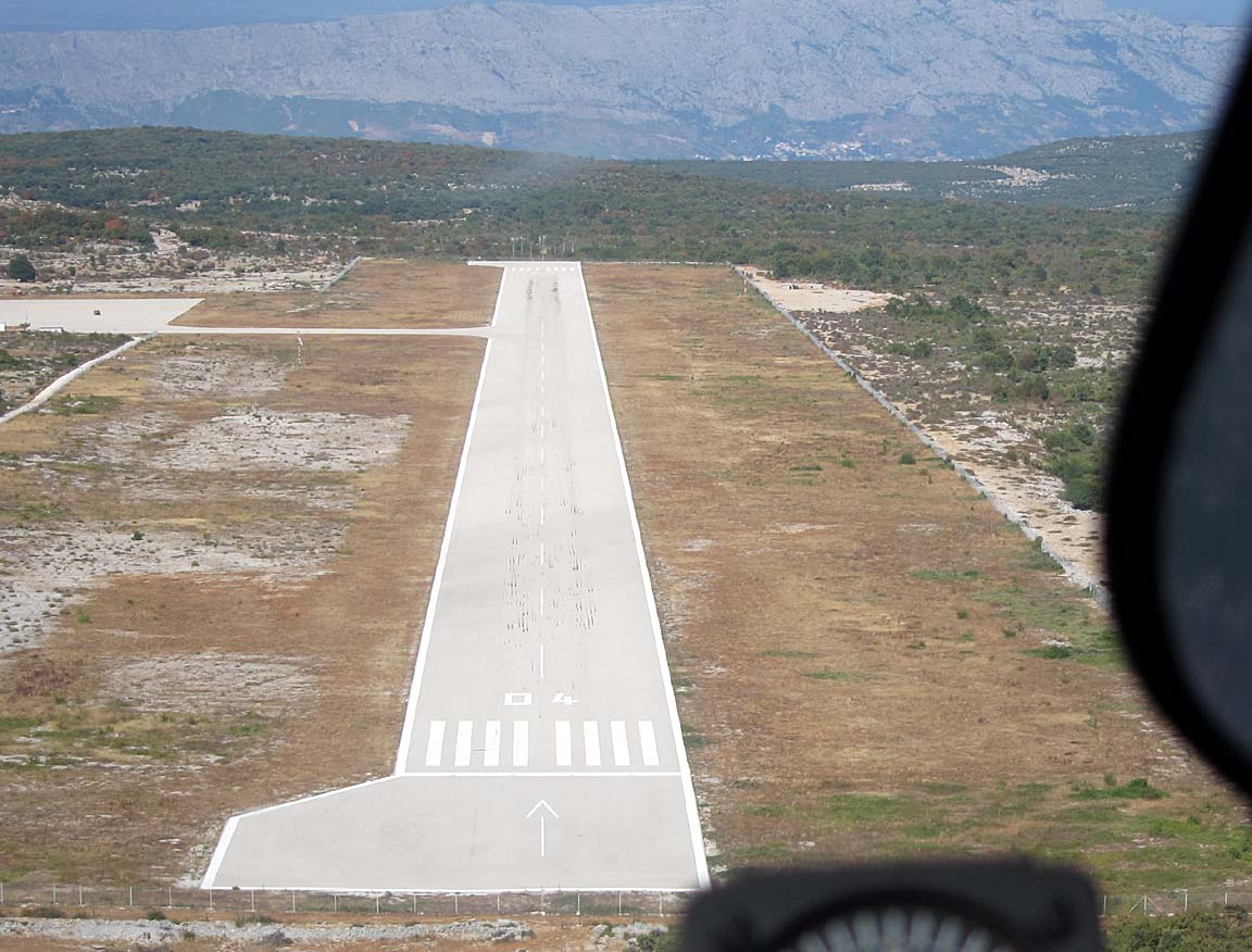
Good weather and careful flying means happy passengers
In line with all our previous experiences in Slovenia and Croatia, Brac Airport is a model of efficiency, with friendly and helpful staff and no hassle. A single policeman makes it an “international airport” with a Customs presence. There is no sign of the UK yellow jacket brigade. The total cost of landing and 5 nights’ parking was 612 KN (approx £60). The fuel cost was 16.8 KN (approx £1.70) per litre which is slightly below the current UK price.
In line with the standard practice of always refilling immediately after arrival (to avoid departure delays) we refuelled right away. In a warm place, this has the drawback that one is likely to lose anything up to a gallon of fuel (approx 1% of the fuel tank content) to evaporation and fuel loss through the expansion vents as the tanks warm up, but is still worth doing.
We had been to Brac before, briefly, but this time we hired a car and had a good look around. We also stayed in a superb self-catering apartment in Supetar (contact details: Maja Žuvi, mobile phone is +385 91 586 3489). Self catering offers much better value than hotels; you get several times more space for half the cost, and usually much easier parking. Supetar has a lot more going on than Bol. It even has a phone shop
One thing we noticed on this trip is the price of fish! The Med (on this trip, both Croatia and Greece) is now really suffering from over-fishing so fish of reasonable size are scarce and accordingly extremely expensive – around €30/kg to €50/kg which, given that the fish is weighed whole before it is prepared, means that you can easily pay €70 for a meal with one fish in it. Frozen seafood e.g. calamari (squid) is still OK and in an apparently plentiful supply.
It is much easier for travellers to find healthy light food in south eastern Europe than in northern Europe where anyone travelling ends up eating a rubbish diet unless he/she goes to a lot of effort to do shopping and self-catering.
Justine’s Highlights
Pijane lignje (drowned squid) at Konoba Lukin on the Supetar waterfront – a rich dark stew of vegetables and calamari cooked in its own ink.
Swimming at Sutivan, a tiny fishing village with a shady main square and surprisingly elegant municipal offices housing a tourist information point. Konoba Porat does memorable seafood spaghetti and grilled calamari.
Watching the sunset from Tri Mosta, the blue flag beach on the west side of Supetar (near the Hotel Amor resort).
Day trip to Split by ferry (45 mins, £3.40). Diocletian’s palace is a must once in your life and the shopping is impressive, but avoid Sundays, when lots of things are closed.
Beer – universally excellent and cheap.
Local products are equally great as gifts or as treats for yourself. Look for lavender, honey, olive oil, salted anchovies, dried figs and items made from the famous white stone of Brac which built most of Split.
As is normal these days in Europe, unsecured WIFI was nonexistent. Croatia however has a superb 3G coverage, completely outclassing the coverage in the UK which is mostly around big cities and motorways and with slow GPRS elsewhere. But the cost of roaming data is very high, not least because Croatia is not in the EU so the “EU data packs” available from most UK networks cannot be used. As described in the notes further back on internet connectivity, we used a mixture of an unusual UK roaming package (Vodafone’s “Euro Traveller” – £3/day to take your UK free allowances abroad; whether this is good value depends on your usage) on my main phone, and a locally bought SIM card in a 3G-WIFI modem.
At Brac, we stayed for 5 nights while watching the weather situation in the Aegean. It soon became apparent that the Turkey fly-in might not be possible, either to get in there or to get back out again. Getting stuck at Balikasir would be thoroughly unattractive and abandoning the aircraft there would result in huge hassles. So we decided to fly to Samos LGSM which has avgas, and this would open up the option to fly to Alexandroupoli LGAL (which has no avgas) from which we would get the ferry to Samothraki, or to Turkey if the weather picture improved.
Flight Brac-Samos
We got out of Brac just in time, before bad weather moved in. The 0600 and 1200 MSLPs, the satellite IR, the sferics, the 0600 SigWx, and the TAFs/METARs were all clear for the immediate flight. The weather which was coming was this: 1 2 3 4 which would be expected to be a lot of rain, low IMC, and thunderstorms.
LDSB
SIPAL L607 DBK R45 TAZ W47 POD L604 RETRA Y400 DISOR G18 FSK N128 LMO L618 MES G18 PIPEN H59 ORMOS
LGSM
FL140 Alternates: LGST, LGTS
574nm (GC), 610nm (airways)
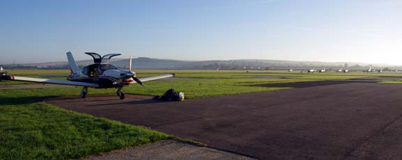
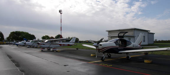
There was just one other aircraft at Brac when we departed
On IFR flights I normally fly the full arrival/departure/approach routes for practice; procedural or radar vectored. Brac is non-radar and is thus procedural. The departure clearance from Brac was a simple "cleared to LGSM, FL140, SIPAL4S". Next station was Dubrovnik…
The weather was nice but very hazy and thus no photos could be taken which would be acceptable without a lot of enhancement. We flew at FL120 all the way. The fuel situation on this flight was a non-issue, with 43 USG showing for the LFOB and with the destination having avgas
There were some small buildups over the mountains of Macedonia (properly called FYROM, to avoid the Greek/Macedonian naming dispute )
FL120 kept us just above some buildups over the terrain
The available VFR charts stop at the bottom end of Croatia but Greece now has “unofficial” VFR chart coverage in the form of the 1998 U.S. ONC charts which have been updated (example) by a group of Greek pilots and which I have running under Oziexplorer.
The island of Thassos was just visible in the haze; this is an enhanced photo

We stayed there in 2011. One gets a short ferry from Kavala LGKV, which is very accessible via UK airline flights from Gatwick. It’s a really nice place.
This is Limnos airport (LGLM)
The following is quite amusing… In the southern UK one is often flying via the SAM (Southampton) VOR, and the GPS offers the choice of a VOR in the UK or a VOR in Greece. It’s nice to visit the other one:
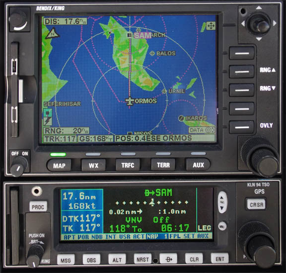
The only other similar case I recall, which I have been to, is BIG which is in the UK and in Turkey.
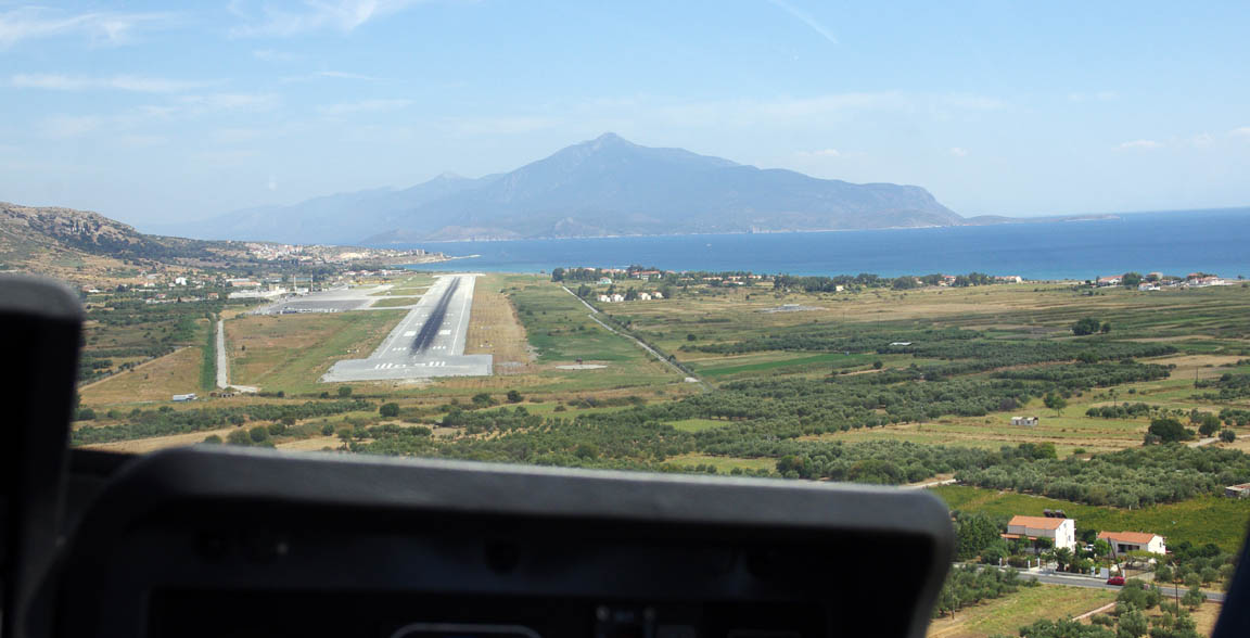
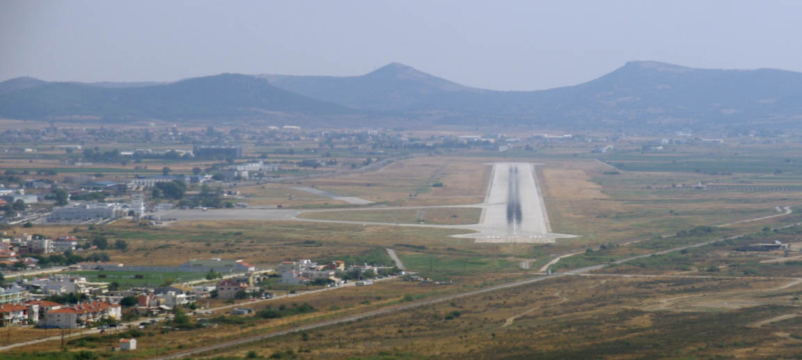
Samos airport initially became visible over some hills
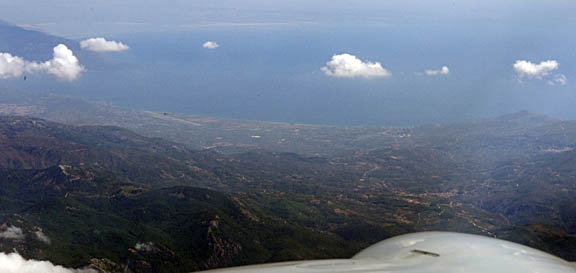
The approach was the circling VOR/DME approach which takes you 9D out over the sea and then you come back almost at a right angle to the runway, which is visible here just to the right of the compass
and here we are turning final
We landed in 350/11 330V030 conditions. LGSM is known for turbulence when the wind is blowing and here is one recent unfortunate arrival which was filmed on <a href=“
target=”_blank">Youtube
Apparently the fire service was called out while he was still on the runway.
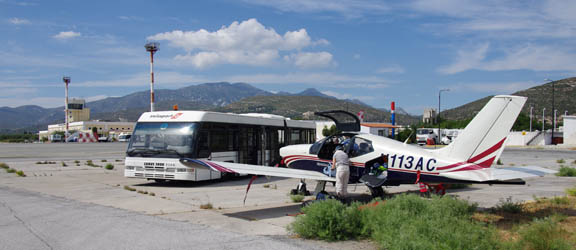
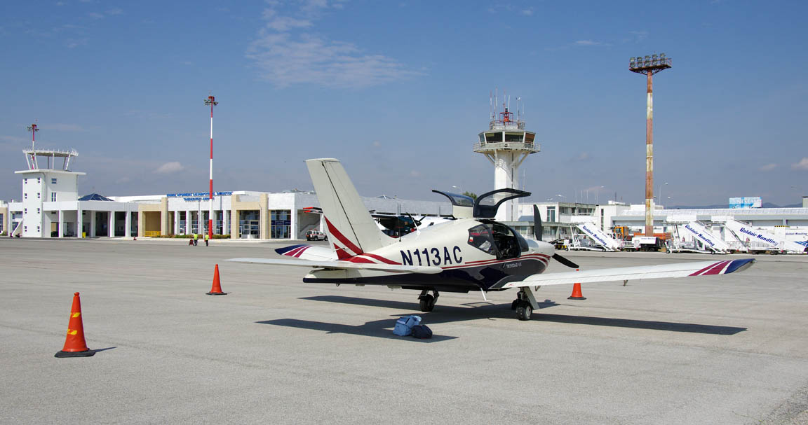
The airport is very friendly and efficient. We were refuelled immediately (€2.90/litre) and the unavoidable huge bus took us to the terminal
Inside, SwissPort Handling gave us their contact details (+30 6986764143 mobile, +30 2273062890 office) to assist with getting Customs clearance for the planned flight to Turkey, which at that time was still a possibility.
Greek airports currently have free landings and parking for GA, but you have to pay for handling. SwissPort offer a discount for AOPA members.
Having seen some budget flight advertisements in the UK for Samos, I expected it to be an “18-30 Club / fish & chips” type of destination, over-run with cheap bulk tourism, but it was nothing like that. It was very laid back and really nice. We did not do self catering because we found a reasonable hotel right on the beach, hired a car and saw a fair bit of the island.
Samos is a real gem for aviation. It has Customs, Avgas, reasonable opening hours, is friendly and very well organised, and apart from Sitia LGST (which is great but has difficult opening hours) and Rhodos LGRP it is the only place in the Aegean which has Avgas. It is also a super place to hang out for as long as needed. You just need to watch the winds there There appears to be a ban on “local flights”; maybe due to the proximity of Turkey.
Justine’s Highlights
Pythagorio is a great place to stay, close to the airport and with lots of accommodation, tavernas, shops and even ancient ruins right on site, plus good bus connections to the rest of the island.
Vathy or Samos, the main town, is bigger but less picturesque. You can happily kill a hot afternoon under the vines of The Garden restaurant two streets behind the main waterfront road.
Chora has a natural history museum with all sorts of unexpected treasures including a fabulous mineral display and a rather motheaten Anatolian leopard. The poor creature swam over from Turkey in the 18th century and decimated local livestock until it was finally killed by two brothers one of whom it fatally wounded in the process. Its story was told in the children’s book Wildcat Under Glass by the Greek author Alki Zei.
Samos wines are justly famous. Sample all the different types till you find the one you like best. But leave space for ouzo too – every bit as good as the Lesbos varieties.
You can’t really eat badly on Samos (well, we didn’t find a way) but if you want something a bit different try Thanasis’ Sister, a Pythagorio ouzeri that does traditional food with a modern twist accompanied by outstanding live bazouki music.
Turkey or not?
At this point we had to decide whether to attend the fly-in at Balikesir. Arrival was 14th September and the return 16th September. The weather was 14 15 16 17 18 which didn’t look too good for getting back out of there (to Alexandroupoli LGAL) on the 16th. The troughs tend to translate into TSRA-type weather which can be fairly widespread and with few gaps. The Turkish airport permission was good for an extra 48 hours so it covered 16th, 17th and 18th, and the weather on those days looked OK, but it was obvious that these longer range forecasts were not worth much when it comes to the general instability.
Our view was that Balikesir was not worth taking any risk of getting stuck there. The general area is unattractive, the weather was unstable and, taking the worst-case scenario, the options for an airline flight back to the UK and a subsequent return to retrieve the aircraft would be highly inconvenient.
So we decided to give it a miss and instead fly to Alexandroupoli (LGAL) and get the ferry to Samothraki as originally planned. We were going to spend a few days on Samothraki anyway and any bad weather would not be an issue while out there.
Subsequently it turned out that all above concerns were correct and the weather east of Turkey was not good on the 16th. The fly-in was however very well attended, with over 30 aircraft, of which around 20 were from Turkey which has an enthusiastic and well organised GA scene despite tight (military) restrictions on flying anything bigger than a kite, and very expensive fuel (around €3.50/litre in 2009).
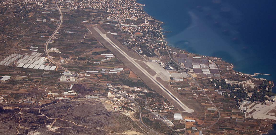
Flight Samos-Alexandroupoli
The weather was good. The 0600 and 1200 MSLPs, the satellite IR, sferics, and the TAFs/METARs were all OK.
LGSM
ORMOS H59 PIPEN G18 MES L618 LMO
LGAL
FL130 Alternates: LGTS, LGSM
195nm (GC), 228nm (airways)

Samos was one of the alternates, which was sensible because it has reasonable opening hours and avgas, and one can fly from it to anywhere in Greece or indeed direct to any of a number of places from which one can do just one more leg to the UK. Thessaloniki LGTS was a semi-plausible alternate because the aeroclub there has its own avgas which – at a stretch – might be “negotiable”.
There were no Customs issues because we were flying Greece-Greece. The staff, including the CAA office, were again very efficient, getting us quickly through security, and the journey to the aircraft was under 30 minutes. This is all a big improvement over our experiences from early trips to Greece in 2004/05. The cost at Samos was €57, made up of €24 handling and €33 for Customs. The Customs charge was due to the arrival from Croatia (non-EU) and one would pay another €33 if one was departing to a non-EU airport.
The departure clearance was “Cleared to LGAL, FL130, visual departure with a left turn to ORMOS, squawk 7025” and off we went…
This is the airport, seen after the left turn

Very obviously, the visual departure requires good VMC conditions, due to the terrain
Also, since that “hill” is Turkey, a fairly tight left turn is required to remain within Greek airspace.
The views are superb

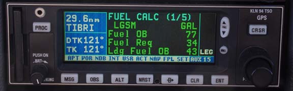
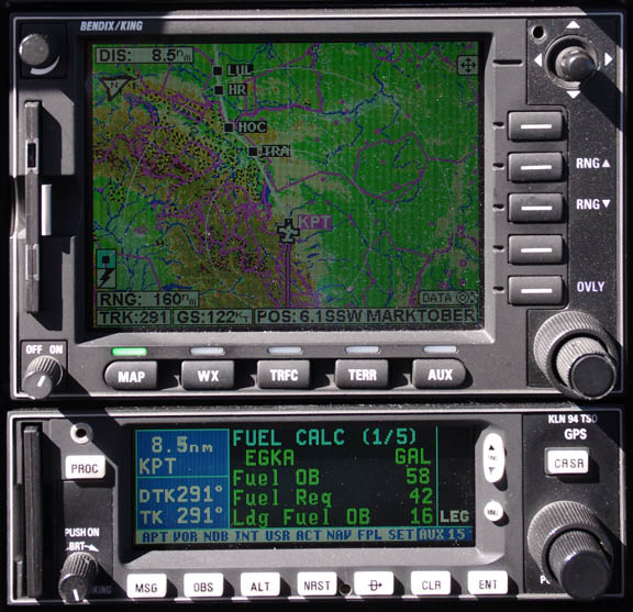
On this leg I was very careful to conserve fuel because Alexandroupoli has no avgas and – if going as originally planned – the next stop would be Zagreb, and that would push the aircraft endurance about as far as I like. The following shows us about to fly over Samothraki, with 66 USG showing as the LFOB
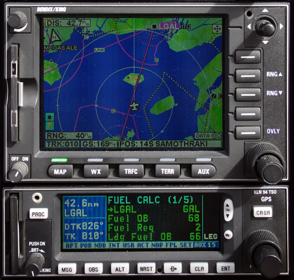
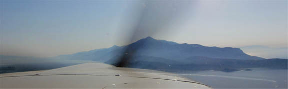
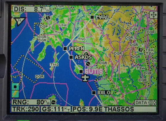
Samothraki is one factor in the minimum altitude of that airway. Another one is the Greek/Turkish F16 “encounters” which take place in the area. I was busy talking to ATC so didn’t realise till too late we were overflying it, so this pic was all I got
The flight was straightforward but with poor visibility at FL130.
We got the LIMNOS1A arrival and were asked to report at 25D for a descent. There was some confusion over the descent instructions which at one point were referred to “as per the arrival” which shows an MEA of 8000ft, reducing to 4000ft after 20D (after Samothraki) and then reducing to 3500ft on the DME arc. I therefore checked with ATC on what exactly thay wanted. In N Europe, it is extremely rare for ATC to issue a descent as per a STAR; normally one is given explicit descent instructions. ATC at LGAL evidently did not have radar.
We landed with 65.0 USG in the tanks, which was good enough for Zagreb but not with wild headwinds…
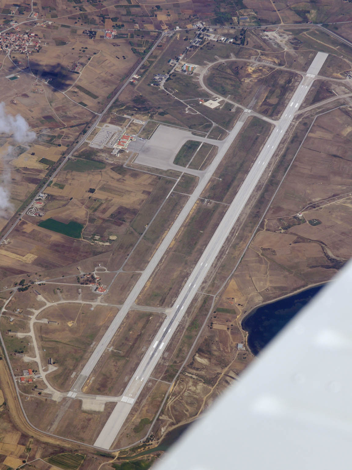
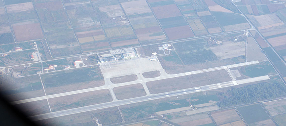
The airport is well organised and has plenty of room
There are flight to Athens, and some charter flights to Germany. The staff very really helpful and friendly.
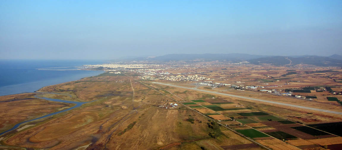
The city of Alexandroupoli is a very “normal” place, with very little non-Greek tourism
There are plenty of places to eat. It’s probably not a place one would choose for a visit, but it is the only option for a ferry to Samothraki. Unusually for Greece, however, there is a train service to Thessaloniki LGTS, via Kavala LGKV, so those would be other options for Samothraki, but neither has avgas (officially…). In fact there is avgas at both LGTS and LGKV (Egnatia Aviation at LGKV operates some avgas-engined DA40s) but it is not accessible in a way which one could rely on.
For the first time in Greece, we found sporadic issues with credit cards. In one case a major shop refused to accept a non-Greek credit card, and in another they wanted to see a passport. It looks like Greece is “going for cash” while it can.
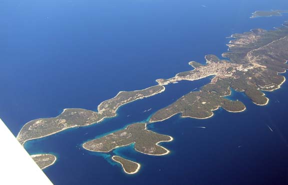
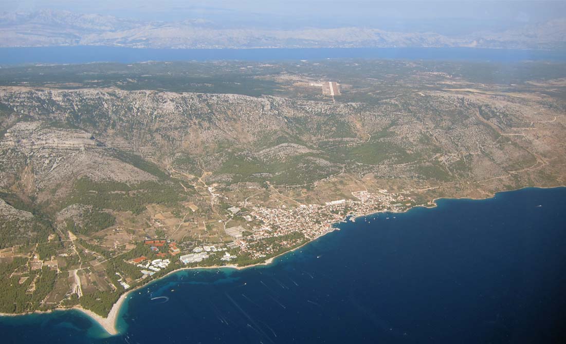
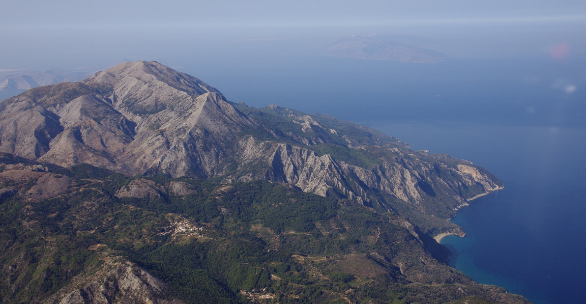
On that particular day we were able to get the ferry on the same day so did not have to stay anywhere. The ferry takes about 2 hours. This is Samothraki appearing out of the haze
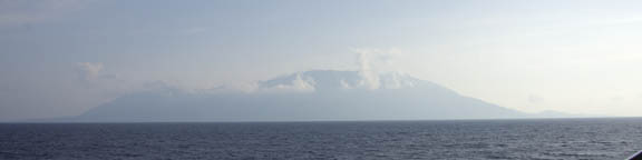
The port is in the town of Kamariotissa
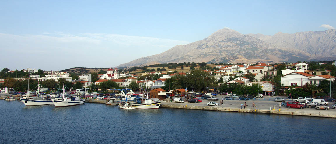
It also has the only car hire business, whose proprietor is most keen to get you to hire an apartment as a part of the package. We successfully resisted that amazing deal and got a little Suzuki car for €50/day for 3 days.
Samothraki is a lovely island which was absolutely worth the visit. The views are superb, there is a great archeological site and there was virtually no tourism (mid September). The roads (all 3 of them ) were mostly deserted. This was possibly partly due to it being off-season but also it is relatively hard to reach, due to the limited flights to LGAL and the poor overlap between flights and ferries. There were some Germans, and a visible hippie population.
We stayed at the Nikki Beach hotel which was very good.
The Sanctuary of the Gods is an impressive site
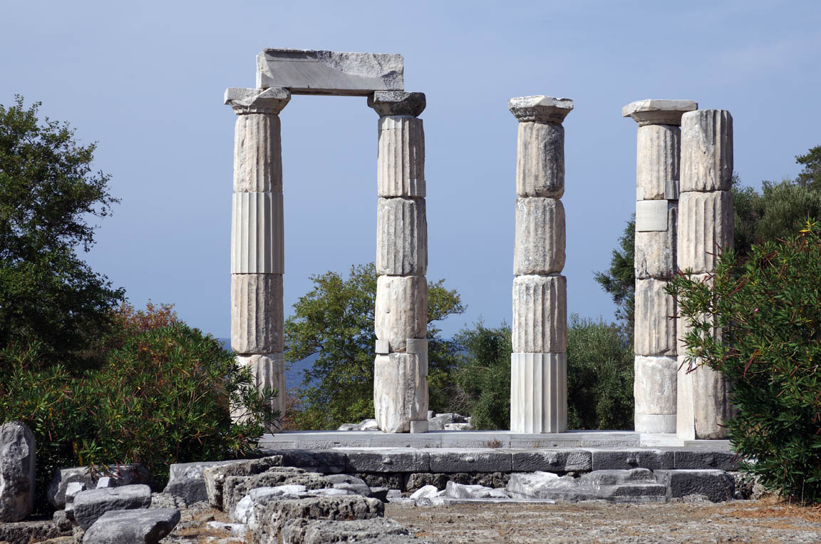
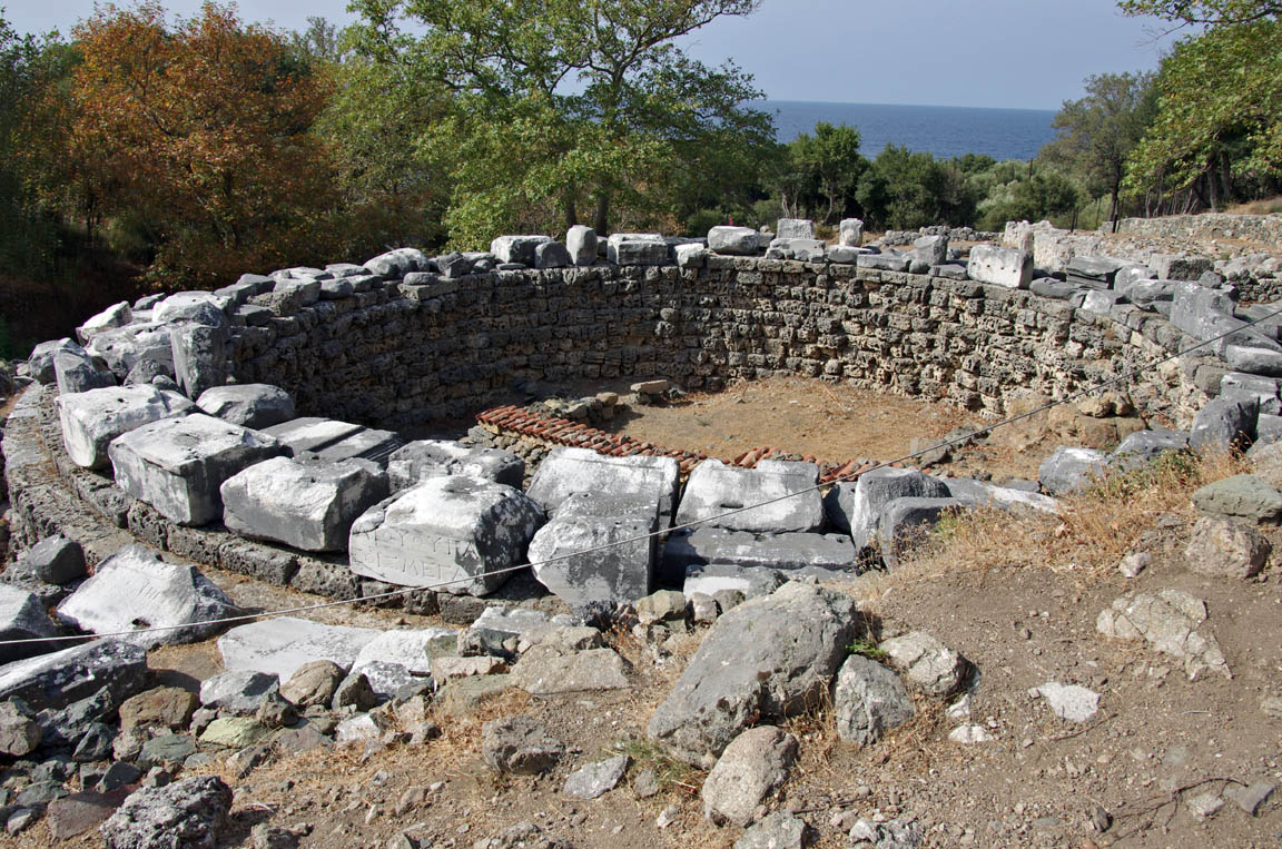
which appears to have been only partly reassembled from a huge pile of rubble still lying on the ground. It was assisted by American archeologists who are favoured there after the Europeans plundered most items of value, starting with this one.
One curious find on Samothraki was at least a couple of old rusting tanks. This one we could reach so we had a good look…

Presumably these were supplied to Greece by ThyssenKrupp last year for €10M each
One particularly pleasant thing about our stay in Greece was a total absence of mosquitoes. There were plenty on Brac… but not as many as in the UK where one gets bitten all over on any warm day.
Justine’s Highlights
Number one for any visit is the Temple of the Great Gods at Paleopolis. A huge site in a magical location between the mountain and the sea, this was the centre of a cult predating the Olympian gods. Very little is known about the mysteries that took place but many famous figures of antiquity were initiated here. There’s a excellent museum on the site with a cast of the Winged Victory.
Therma is named after hot springs that look quite inviting if you like that kind of thing. They are supposed to be good for arthritis, gout etc, and some people drink the water.
In good weather the Fonias River walk is well worth doing. Less than an hour’s hike takes you to a pool with a waterfall; after that it becomes a climbing trail which can be treacherous in wet weather, accounting for the river name which means ‘killer’.
Chora, the main town, has few amenities but is totally authentic and perches part way up the mountain for pirate avoidance. Find a taverna with an eyrie view for a reflective sunset ouzo.
Pahia Ammos on the southern side of the island is about the only sandy beach. It’s the best part of an hour’s drive from the port but well worth it. Bring your own food – there’s only one taverna and it had already more
or less shut up shop.
We had plenty of flexibility on how long to stay on Samothraki, which was just as well since the weather was starting to look iffy again. The ferry timetable is such that on Wednesdays or Thursdays one can leave Samothraki on the ferry and get to the airport and do a significant-length daylight flight on the same day. The advantage is that one can stay in a nice place (Samothraki) until actually ready to fly to the next place, which is always the best way to play these long trips. But on the Monday it became apparent that we might need to fly on Tuesday, but there was no ferry at all on Tuesday. We therefore checked out on Monday, after just 3 nights, and stayed at a fairly reasonable hotel in Alexandroupoli for what turned out to be 2 nights.
Flight Alexandroupoli-Zagreb
The weather was OK but expected to worsen later in the day, so an early start was even more advisable than it normally is. The 0600 and 1200 MSLPs, the satellite IR, the 0600 and1200 SigWx, and the TAFs/METARs were clear. The TAFs for LDZA show the expected worsening from 1400Z.
LGAL
IDILO G12 PEREN N133 EVIVI L863 RAVAK L617 OKLOP M19 VBA
LDZA
FL130 Alternates: LDOS LYBE
521 nm (GC), 584nm (airways)
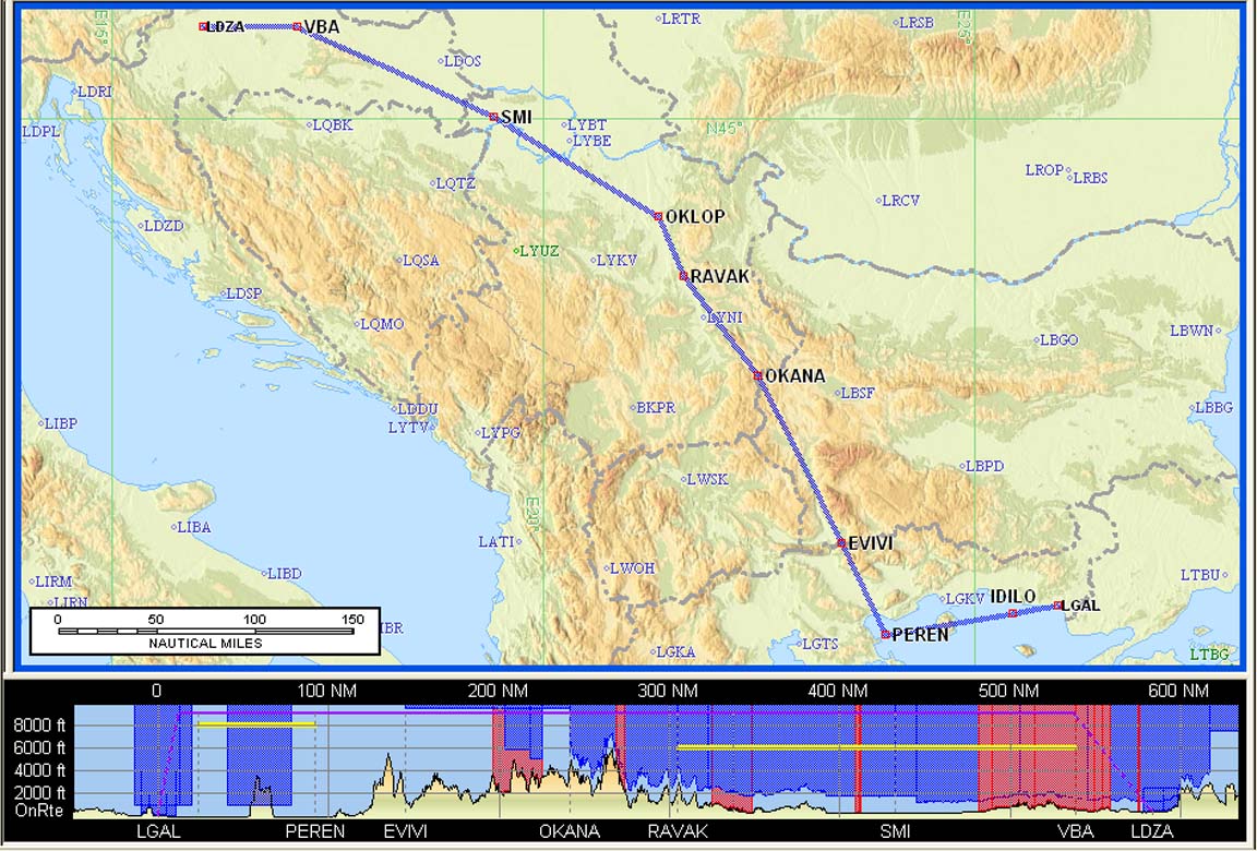
With 65 USG in the tanks, this flight was fine given the forecast winds which were generally below 10kt of headwind component.
Alternates: There were several alternates on this route which all have Customs and Avgas, and an ILS. One of the enroute ones would have been chosen had the computed LFOB fallen below about 20USG. First along the route is Skopje LWSK in Macedonia, which was laboriously contacted and which needs their CAA permission to land (which I got but for a different range of dates) so it would have to be declared as a “fuel emergency” mayday . The next is Belgrade LYBE in Serbia which was also laboriously contacted and in one reply spoke about complicated CAA permissions and in another email (from their business development manager) didn’t, so would also have to done as a mayday. The next is Klisa LDOS in Croatia which I didn’t contact but dropped them an email and a fax before the flight, and anyway being in Croatia I would not expect it to cause problems. If Zagreb was found to be closed (due to a crash, for example) after we got all the way there the alternates would be Ljubljana LJLJ, Rijeka LDRI or Pula LDPL which are all a similar distance from Zagreb. On top of that there are several VFR-only airfields in that part of Croatia.
Getting out through Alexandroupoli airport was quick – under 30 mins. However, a person from Customs had to drive to the airport to meet us and this delayed things a little. She was concerned about something which appeared connected with some earlier communications I had with the airport during the planning of this trip, when I spoke about flying there from Skopje, and Skopje (FYROM) seems to be a “hot potato” in Greece. Once she realised we were not going anywhere near Skopje, all was fine.
The total cost, all “handling”, was €86.
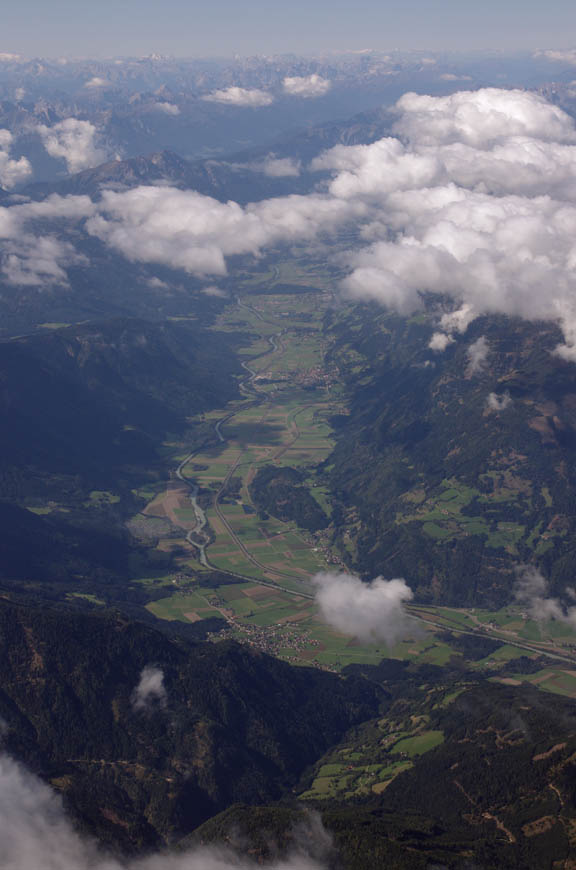
The departure clearance was simply "Cleared to LDZA via filed route, FL130, IDILO1B departure". This pic is after the right turn, when heading to IDILO, and showing the city of Alexandroupoli ahead
Obviously I tried to get a shortcut from IDILO to EVIVI… Initially ATC did not play ball but persistence paid off and together with some buildups which were conveniently looming ahead (I asked for a 40 degree right turn “to avoid”) we got it
We flew nearly overhead Kavala LGKV, where one can just about make out the Diamond DA40/42 fleet of Egnatia Aviation, the flying school, in the top left corner of the apron
The rugged terrain of Macedonia appears to offer poor forced landing options
but actually there are many flat areas with cultivated fields. The level of FL130 was just right for the buildups

Early on, the LFOB figure settled around 24 USG
but this was expected to get slightly worse due to stronger headwinds near Zagreb.
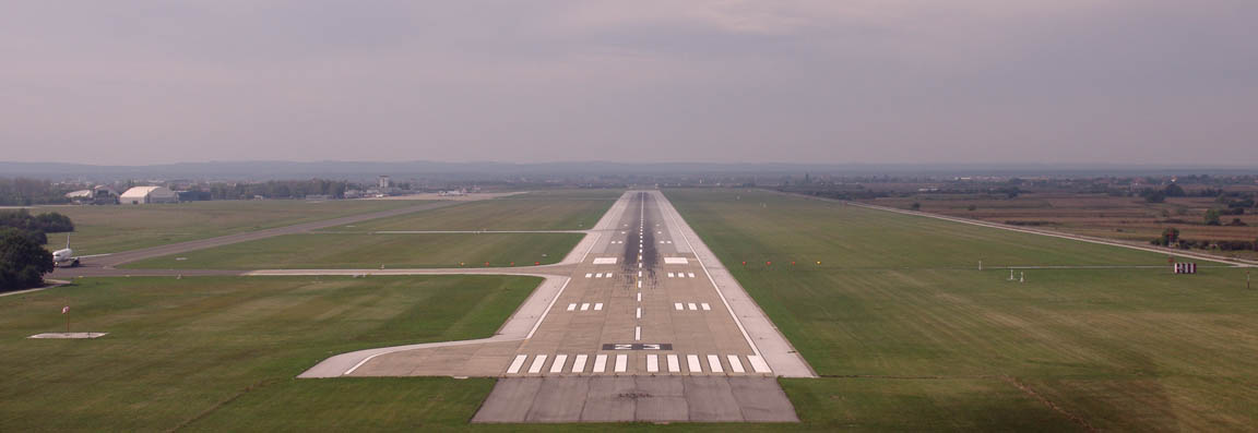
We got the ILS for runway 23. There is no such thing as a too-long a runway but with 3252m total I could have easily stopped before the first turnoff – which would not have been a good idea given the airliner about to taxi there
You get a follow-me vehicle to the sizeable GA apron
Avgas arrived immediately and we were processed fast and got a 200 KN (£20) taxi to the city centre. Fuel was the same price as at Brac: 16.8 KN (approx £1.70) per litre, from the same company INA.
The bad weather was expected to clear the following morning so we stayed just one night, at this very nice hotel for about €90.
Zagreb is a very modern city, with plenty of money evident in the “central” parts. It is somewhat similar to Prague in the old architecture.
Everyone we met in Zagreb, and everyone we met on this whole trip, was friendly. We find this consistently the case in Slovenia, Croatia and Greece – which is probably why we keep coming back to those places
Flight Zagreb-Shoreham
The front passed through during the night as expected so the weather was good. The 0600 1200 1800 MSLPs and the TAFs/METARs were all clear.
LDZA
PODET L25 NEVAG L25 VATAL L608 KPT L856 HOC G4 RLP B3 BILGO H20 XORBI H40 ABB T27 KUNAV Y8 WAFFU
EGKA
FL140 Alternates: EGHH, EGMD
719 nm (GC), 790nm (airways)

The alternates have poor utility for Shoreham. Bournemouth and Southend are 2 trains away and Lydd is a £200 taxi.
I filed the flight plan on the morning of the flight, using EuroFPL as normal. The website showed the flight plan as “filed” but I did not receive the SMS and email confirmations which normally arrive within seconds of the ACK. So I started up my backup tool – AFPEX – and did a flight plan retrieval on the callsign… and got nothing. I am not sure this means anything since that feature appears to be barely functional on the “private user” AFPEX accounts. So I re-filed the flight plan using AFPEX and telephoned Zagreb ATC to check they got it. The fact that the flight plan was accepted, for a time mostly overlapping the one I tried to file with EuroFPL, confirmed that the previous one was never seen by Eurocontrol.
At Zagreb airport, the general aviation section is separate, with its own Customs and x-ray facilities. The entrance is at one end of the main hall. This is excellent because you never have to queue up for “security” with airline passengers, which can take ages. The contact details are here.
We paid up the charges and were done in under 30 mins. The total cost was €101, which is not cheap but equally not outrageous for a one-off visit.
The departure clearance was "Cleared to destination, PODET2F". There was no vertical clearance so I enquired and got 6000ft.
However we also got a Eurocontrol slot, delaying the EOBT from 0800Z to 0834Z. The earliest airborne time the airport would allow was 0829Z.
We were cleared to taxi to the holding point for Runway 23; as per normal practice I chose the furthest one but after taxiing half the length of Croatia perhaps 2900m was a little excessive
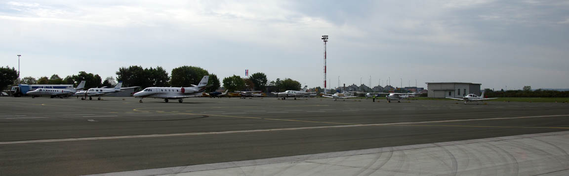
The entire GA apron…
As is quite normal, the SID was never actually flown, because we got a heading of 360 right away, and then a DCT PODET.
This is Ljubljana LJLJ
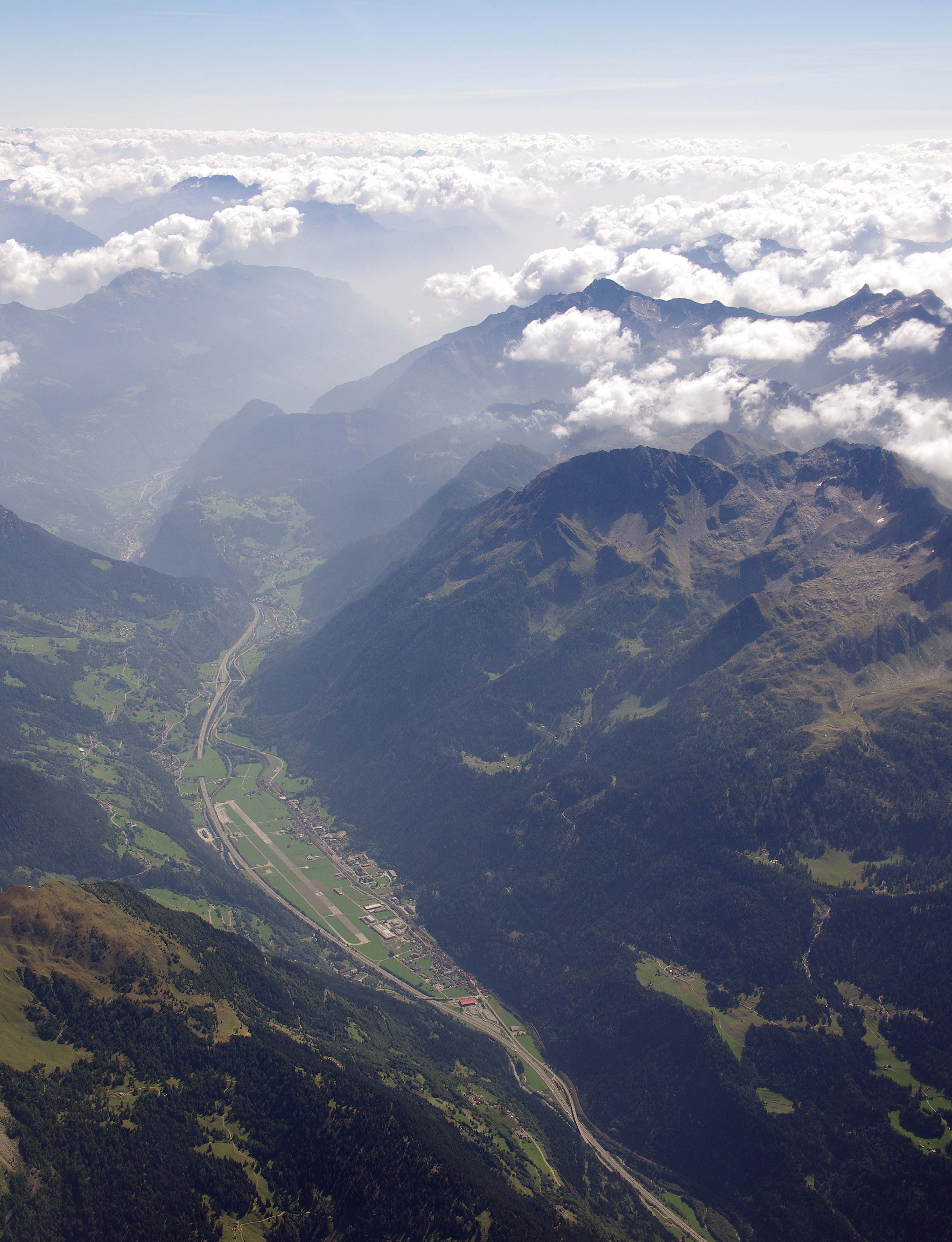
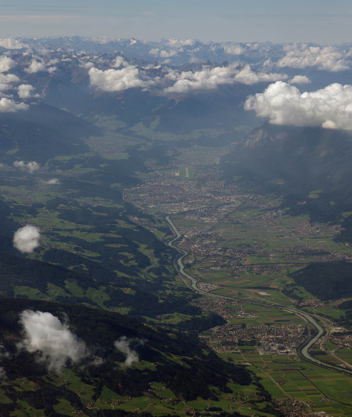
The route passes over the “lower” Alps but unfortunately one does spend quite a lot of distance over them. There was scattered cloud cover and great photo opportunities as usual
Here is Innsbruck, which we seem to fly over every time we go into that part of Europe…
The enroute winds were rather stronger than I had inferred from the forecasts, and while there was practically no turbulence, the 30-40kt headwind produced strong up/downdraughts. Initially the LFOB was showing about 20 USG but at one point, at FL160, it was rather less… unsuprising given the very low GS of 74kt
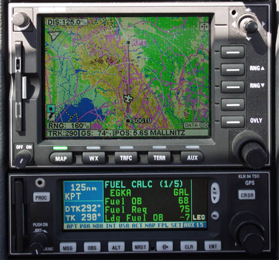
After the Alps it improved to 16 USG
and then continued to gradually improve to the landing figure of 19 USG. This is Lake Constance
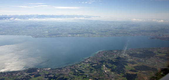
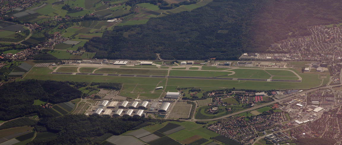
and here is Friedrishafen EDNY
Around the Swiss/French border, the KFC225 pitch servo again went up in smoke, this time with a repeat performance of a failure in 2007 where one could smell the burning 0.3 ohm resistor in the cockpit. The TB20 cockpit airflow is back to front so one can smell the servo which is located in the rear hull section. Obiously, this could be quite worrying had I not had this before (c. 2007 and since), seen the loss of pitch control at the same time and pulled the autopilot circuit breakers. So it was time to do several hours of hand flying… Honeywell don’t give a flying ***k and are not interested in fixing this product.
Paris Control cleared us “direct Shoreham” from before the French coast (a DCT of over 120nm) but on handover to London Control we were asked to route via WAFFU as filed. I reminded them that the French had already cleared us to Shoreham so London gave us a heading of 300 (which happened to be exactly direct to Shoreham). To stretch the fuel out I asked for a continuous descent to Shoreham at -300fpm; they came back approving a “non standard descent rate”, and we got a direct to Shoreham around mid-Channel.
Finally, after a couple more hours over virtually featureless France, home!
We landed with 19.1 USG, and the pump fillup disagreed by 0.82% with the fuel computer.
Spot the odd one out…
Consistently, on any GA airfield movement data, the US registered aircraft are flying the longest routes. I don’t suppose anybody in EASA gives a damn, however, with these job-creating gravy train riders in the expenses-fuelled “European Union” having recently shafted most of the European population of IFR capable private pilots, by passing a purely politically motivated decree (which is now EU law, even though nobody knows quite what to do with it) requiring them to obtain European duplicates of their ICAO compliant licenses and ratings, by 2014.
As an insurance policy against the various plausible and implausible enforcement scenarios on this mad requirement, during 2011 I did the ICAO IR to JAA IR conversion on top of my American CPL/IR. I have always had a UK PPL and medical. It was a fair bit of work, especially with the 7 exams.
We got back to the UK just in time. Over a week of horrid weather followed…
General Notes, and Lessons Learnt
GA Access to Greece: Greece remains a relatively predictable destination for GA, helped by airport personnel being friendly and communicating well in English. If an airport tells you they have avgas, they have it and you can buy it. On the ground, Olympic Handling and SwissPort are super organised and efficient – a far cry from our early visits in 2004/05. On the minus side: no new Avgas facilities have appeared, a couple of airports (Mikonos and Thessaloniki) have lost Avgas, and airport opening hours can be restrictive to the point where getting to some places is complicated.
Fly later in the year: Looking back on previous trips to Greece, it appears clear that going in September is the best time, because there is much less convective (stormy) weather than in mid-summer, and the sea is warmest.
Cloud Tops: this trip has again proven the use of IR satellite imagery as a 100% reliable go/no-go decider. One could achieve safe IFR flight using just this data, with TAFs and METARs for the terminal areas to check against approach minima in the usual way. MSLP charts still play a part in more general forward planning because they can be obtained 5 days ahead and show obvious suspect weather. SigWx charts have recently been dumbed-down by ICAO and no longer show fronts, or any weather in areas where CBs are forecast, and are now almost useless for this kind of non-deiced non-radar-equipped flying. Normally I use this UKMO site for cloud tops, and it is updated every hour, but recently I have come acrossthis Turkish site which delivers a temperature-calibrated cloud tops image, but is updated every 3 hours.
Flight Plan Filing: Clearly one needs two ways of doing this. I use EuroFPL, and the AFPEX facility (available only to pilots with a UK address). In fact one needs two ways of doing just about anything
IFR route development: FlightPlanPro worked out every route on this trip, though the current version does occasionally crash. It is great to report that for the past 3 years I have been able to file and fly IFR without all the Eurocontrol routing garbage which we had to deal with. However, it is apparent that two route development methods are required, just in case, and for me these are 1) FPP and 2) EuroFPL’s Route Suggest feature.
Hard Copy: To sidestep the need for backups of flight data, in the past I have taken care to print out everything, and carried a lighweight printer for this. On this trip I didn’t bother and relied on an Ipad into which the data, in PDF form, would be loaded for in-flight display. This worked OK but I was happy with it only because I had the waypoint list emailed to me (by EuroFPL) and I had that email in my phone (obviously I had to remember to grab my emails with the phone before getting airborne). With the failure of EuroFPL on the last leg of the trip, I did not have this, but since that flight was done as originally planned back home, I had the printed stuff for it. But if the EuroFPL failure coincided with a non-preplanned flight, I would have had to hand-write the waypoints on a piece of paper. Not a big deal but it shows how quickly things can degrade.
Airport Costs: None of the airports visited were outrageously pricey, along the lines of the £500+ charged at the likes of Gatwick, Luton, Frankfurt, Munich, etc. All were easily affordable in the context of a long trip, on which the fuel costs dominate. Even Athens LGAV (ILS, Customs, Avgas, H24) remains accessible to GA at a less than totally outrageous cost of about €200. However, all of these are too expensive to operate as a base for healthy light GA activity. If the landing fee is say €30 or more, a flying school/club cannot operate there unless the airport gives it a big discount.
Photos: The pictures in this writeup were taken with a Pentax K5 and a Canon S90/S95. The images within the text were cropped and adjusted in Photoshop to remove, as far as possible, the blue haze which features in most high altitude photos, but the images in the galleries are mostly original due to the amount of time it takes to do the Photoshop stuff. To get acceptable pictures from an aircraft, the windows need to be clean and scratch-free and care needs to be taken to minimise reflections from bright objects inside the cockpit; these may need to be temporarily moved or re-orientated. A piece of matt black cloth, laid over shiny items, also helps a lot. I have some photo tips here.
Practicality: This kind of trip is about the longest or most complex which can be “easily” done in Europe. We planned for 14 days, thinking there would be plenty of slack, but eventually took 14. One-leg trips are much easier in every respect, and the TB20 can reach anywhere in France, Germany, Austria, Switzerland, Slovenia, and much of Croatia or Spain.
Flight Times (airborne):
EGKA-LDSB 6:15
LDSB-LGSM 4:15
LGSM-LGAL 1:40
LGAL-LDZA 4:15
LDZA-EGKA 6:35
Aircraft Performance
The aircraft performed perfectly – apart from the KFC225 pitch servo. Some notes on Socata TB20 ownership and operation are here. As on every IFR flight I have done, the late-1990s avionics were 100% capable of everything required. It would be such a shame to have to rip them out to comply with PRNAV which is another European jobsworth boat which left the harbour about 15 years ago… I also do not want a “glass cockpit” because if something goes wrong in e.g. Greece, one would be stuffed.
The TB20 is ideal for this type of mission, though a turbocharged engine would be nice for the high altitude (FL160+) portions. Even though I keep half an eye out for a nice TB21GT (the turbo version) I have not taken it further because a) along with most of the turbo scene, none of the engines seem to reach TBO without at least some cylinder work; b) the ~50kg payload loss is significant when our 2-up holiday flights are already at MTOW with full tanks; c) to make real sense one needs the full TKS system and then the payload loss is ~100kg; d) for reasons which are not entirely clear the fuel burn per mile of the TB21 is about 10% greater despite the higher potential TAS gain.
Total oil used was 3 litres. Total fuel burnt… don’t ask The general enroute fuel flow rate was 8.5 to 9.5 USG/hr.
VFR?
All flights on this trip but the last could have been done under VFR on the day, albeit with the usual airspace access issues meaning the routes and altitudes would have been very different.
Moreover, had VFR flights been attempted at the levels we flew at, one might have been forced down (by ATC) into lower levels at which there was cloud.
This is the standard problem with VFR in Europe, where many ATC units run their own policies in breach of ICAO airspace classification (VFR should be permitted in all airspace except Class A, though an ATC clearance is required in Classes B through D) and do not allow access to some CAS.
Therefore, paradoxically, the capability to do IFR legally and overtly gives one access to doing the flight in VMC, which is what VFR is supposed to be about
This page last edited 4th October 2012
Any feedback, reports of dead links, corrections or suggestions much appreciated: