Ibra wrote:
Not sure, but probably an advice that applies even to “VFR only pilot/aircraft” even those who had just 30 min under the hood or not instrument equipped, the other alternative is to pull a “forced landing” but on the above picture not sure there is a suitable field?
Every now and then someone gets caught by “surprise” by terrain and clouds. In most cases when the pilot decides to go ahead it ends bad. Turn around or land at first opportunity seems to be the only viable solution because:
There are only two ways this can be done. Flying below the clouds if terrain allows, and with the correct type of aircraft. Flying IFR/on top. In both cases this requires planning and training. IMO it’s one of the cases that ends bad if you have not planned for it, and have chosen one of the two solutions well up front. But if you get caught, I would also believe flying up is better than staying low.
As a VFR only pilot, would I ever willingly fly up into IMC to avoid terrain? I’m not sure I ever would do it. I know VFR, and I would most probably try to find a solution with what I know. The solution would either be to fly back, or find a place to land. The threshold of flying up into IMC (into the unknown) is very high. How to get back down again? I think I would solve the problem before I would be forced to do that.
Jujupilote wrote:
It’s a picture taken in this area
That doesn’t look bad. But, the terrain looks very tight and compact with low hills (judging by the picture). If the cloud base covers the tops of those hills, I think only a helicopter could do VFR safely due to the small range in altitude.
The problem with climbing up into IMC is that you don’t know there is an even bigger hill coming up. So you do need a good terrain map. The tablet apps are poor at showing elevations; we had some previous threads on this here.
What do we know about the qualifications of the accident pilots?
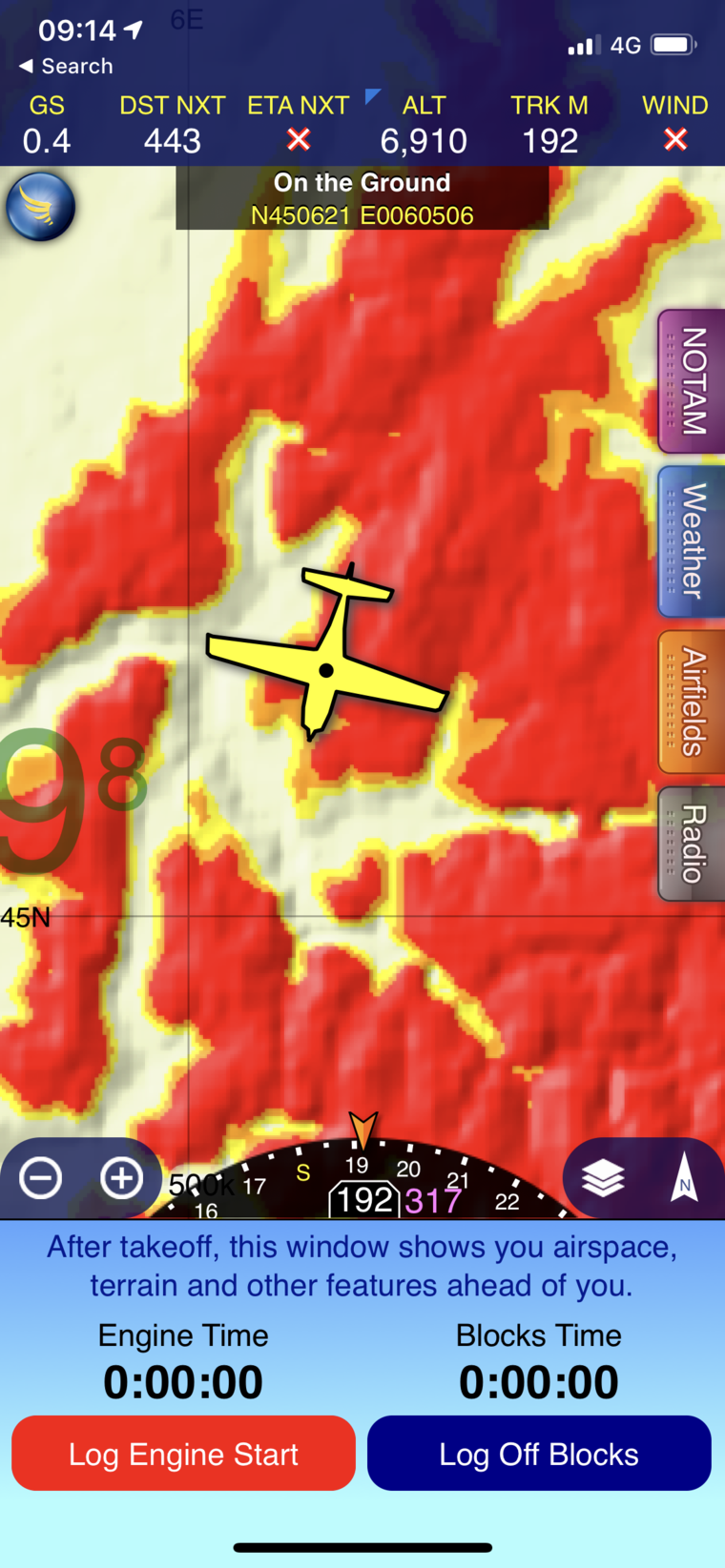
You can get the same type of display as in certified GPS. Essentially don’t go towards Red / orange / yellow.
I think that is really enough to find and escape way (if there is one). The problem mostly being that in a high stress area it’s reasonably likely you won’t be looking a much at the tablet because you’ll be focused on flying. Or the inverse.
Don’t fear on my life, im on ski lift
Ibra wrote:
If icing exhibit so much sensitivity to 1000ft/500ft change in height (compared to terrain clearance), then you should not be flying that day: one does not disintegrate in pieces by flying into ice just above MSA, however hitting a hill is a different matter
Indeed. If you have to go into IMC while on a VFR flight as an emergency, you have to climb above the MSA. Anything else is just hope.
Airborne_Again wrote:
No it is not obvious! Believe me, people did XC flights in mountainous terrain before we had GPS and they didn’t have CFIT all the time. No doubt that GPS makes it safer — and allows you to launch in less perfect weather than you would otherwise have done.
dejwu wrote:
I somehow doubt there is a big impact by using GPS
The main problem when flying in rough terrain and poor visibility and/or low clod base, is getting lost, disoriented. Valleys and fjords all look the same in poor vis. This will in turn probably increase the chances of CFIT or VFR into IMC. With GPS/moving map the era of getting lost is long gone. It’s been ages since I have heard of anyone getting lost, but this was common before.
Noe wrote:
The problem mostly being that in a high stress area it’s reasonably likely you won’t be looking a much at the tablet because you’ll be focused on flying
IMO all those warnings are nuisances. I keep them all off. Flying IFR they probably has a merit.
JasonC wrote:
If you have to go into IMC while on a VFR flight as an emergency, you have to climb above the MSA. Anything else is just hope.
Absolutely. I’ll go a step further – I speculate that almost every single CFIT in IMC event had a get out of jail moment; the pilot went beyond a decision point having made the wrong decision. GPS terrain displays should assist in making that decision but should not offer the opportunity to delay the decision.
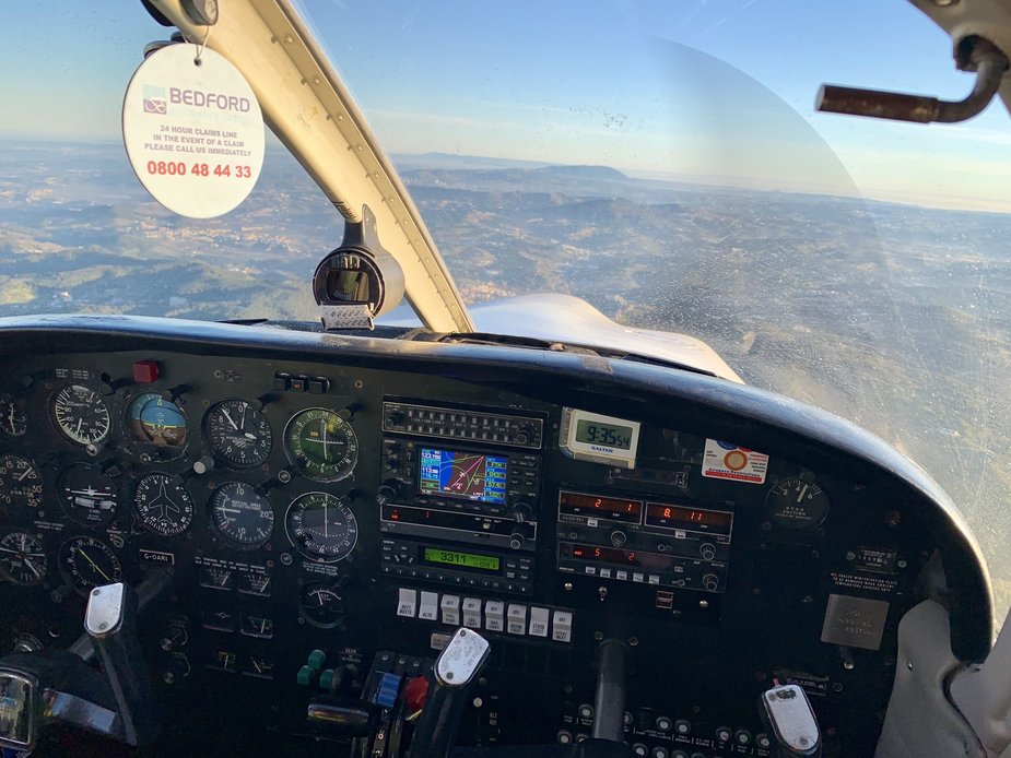
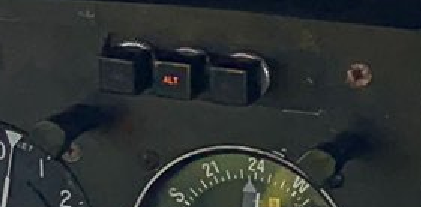
This is a photo from a tweet apparently made during the flight. It shows an alternator failure.
The ALT warning light is on and the ammeter shows zero. (On PA28s the ammeter shows alternator current.)