This trip was flown under IFR, but with VFR beginnings on both legs.
The outbound leg was filed as Z (VFR to IFR) because all Biggin departures are to the east, so one flies quite a detour first. The alternative is to depart VFR in Class G (and in the UK you can enter solid IMC almost right away, changing to IFR purely in your mind) and then climb up with an IFR clearance collected enroute.
The return leg was filed as I (fully IFR) but I was offered a VFR departure as an option over waiting for a while for some air display over Dublin to end.
The outbound weather was reasonable but with the MSLP charts showing some dubious stuff. In the end none of this was real, but the high pressure generated a lot of low cloud and a bit of drizzle in places.
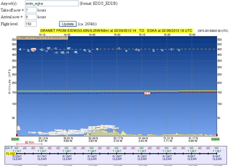
The IR image showed quite high cloud
but this could have been just harmless high altitude stuff, and indeed the GRAMET thought as much
The departure from Biggin's Runway 21 was straight off to the west, via OCK and CPT, at the customary 2300ft under the 2500ft Class A base. With the cloudbase about 1500ft, it was solid IMC. Later, with the Class A base rising to 3500ft I was able to climb to 3300ft
and 4300ft
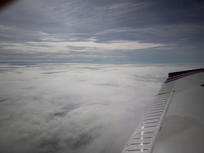
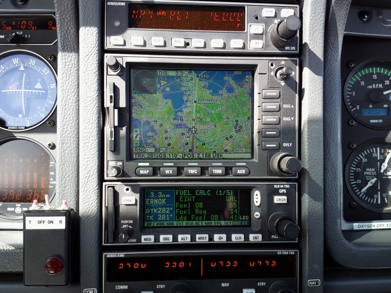
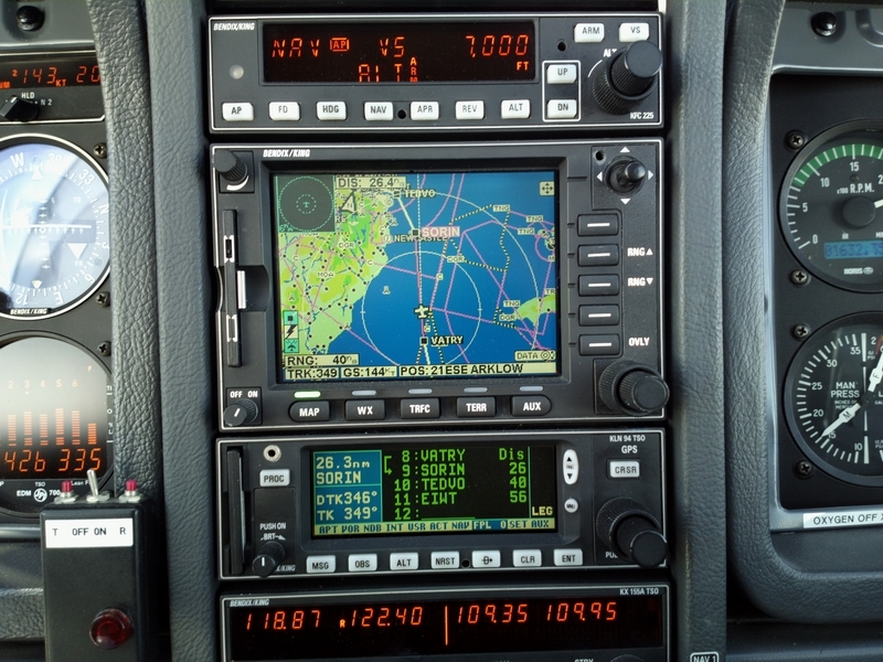
Farnborough apparently spent about 10-20 mins getting the enroute IFR clearance from London Control, and it arrived shortly before CPT. Here we are at FL160, with about 30kt of headwind which was present all the way. The fuel totaliser was showing 41 USG Landing Fuel on Board, which was fine
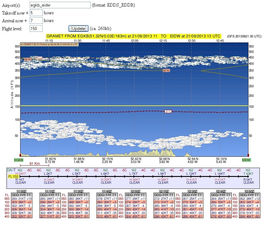
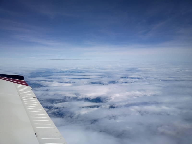
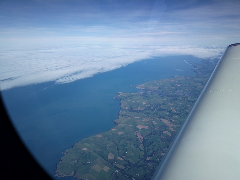
I suppose this cloud cover over Wales corresponded somewhat to that forecast by GRAMET
FL160 was reached 25 miles before BCN. At 2400rpm, 8.5 USG/hr fuel flow, the TAS was 142kt, at -4C.
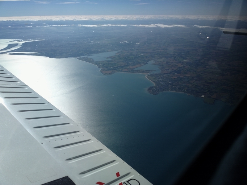
By the time the UK coast was reached, it thinned out
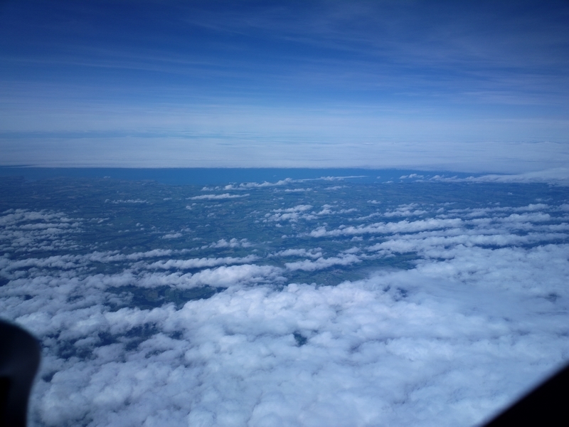
FL160 is the lowest level at which the flight remains in CAS and thus preserving the enroute IFR clearance. However, after VATRI one is out of UK airspace where this problem doesn't exist so a descent is possible immediately, consistent with staying fairly high above the water.
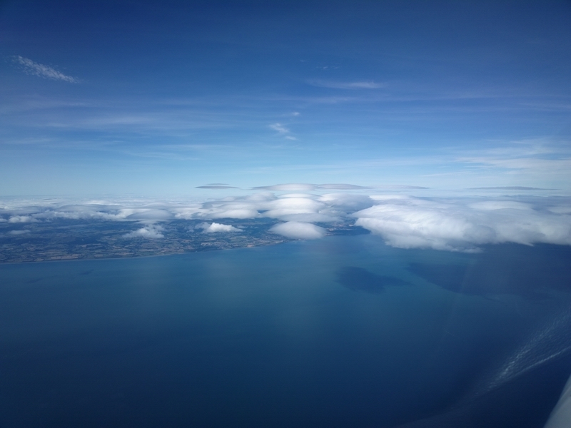
We now have 56nm to run and we are descending continuously from VATRI onwards
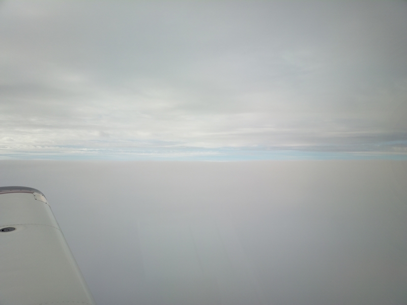
These look like lenticular clouds over Ireland, but they could not have been - there was no turbulence whatsoever
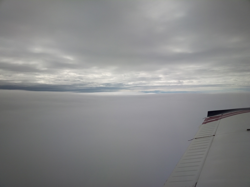
Descending below the layer

Some traffic showing on TCAS
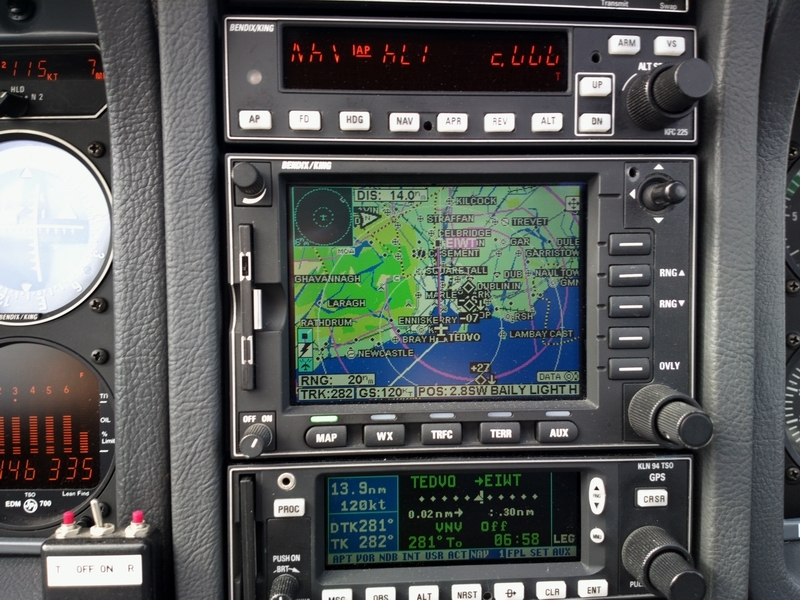
The arrival was via the VOR D approach which is a straight-in onto runway 25 (with a bit of a left turn, which makes it technically a "circling" approach). Obviously the approach was flown using GPS in the OBS mode, with the GPS sensitivity set manually to 0.3nm full scale for the most accurate tracking...
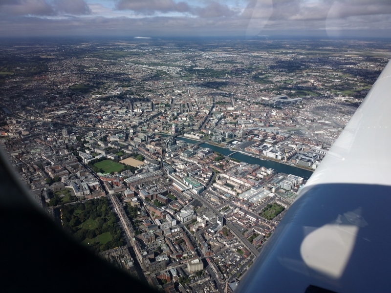
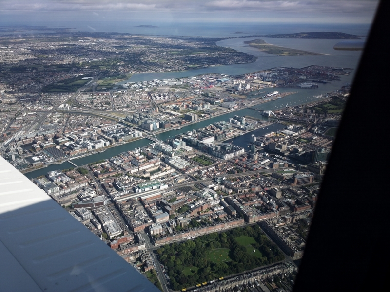
Dublin:
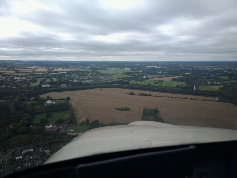
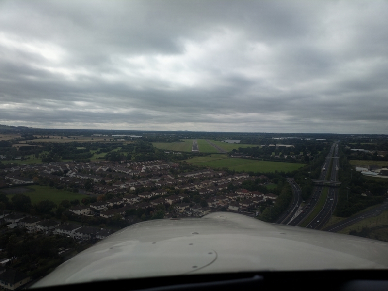
Final approach:
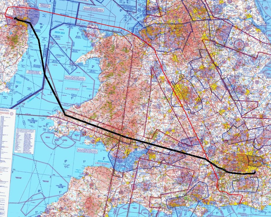
Actual outbound track is here (plotted over an old UK CAA chart background)
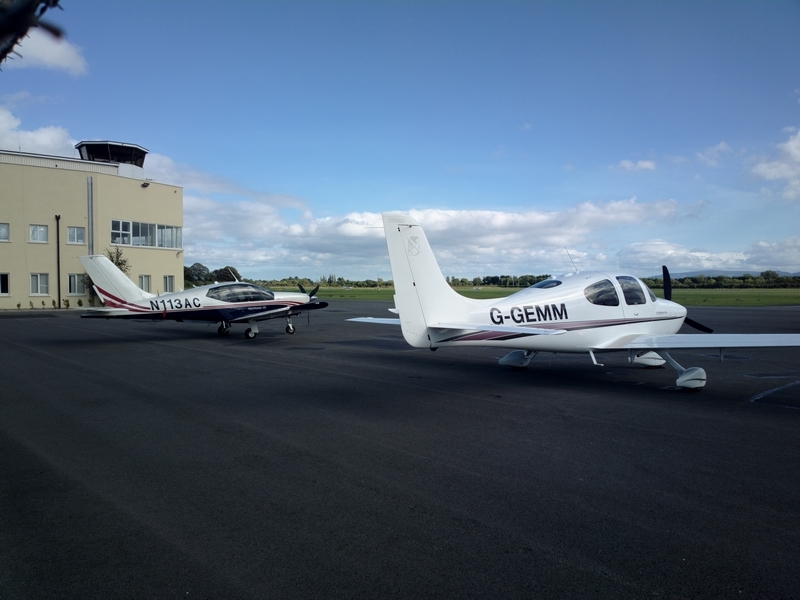
Some classy hardware was parked there

along with the hardware flown by low income pilots
The return weather was a lot better. There is the IR image showing some low level cloud whose tops I estimated (from the shade of grey) at 5000ft
The GRAMET was also clean. The bit of cloud it showed was plausibly matching reality
The departure went all the way round Dublin due to some activity over the city centre, and accidentally enabled a climb out away from any cloud
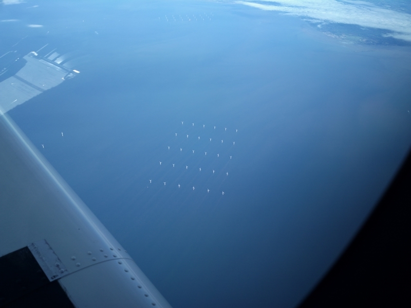
A load of wind turbines, with many under construction
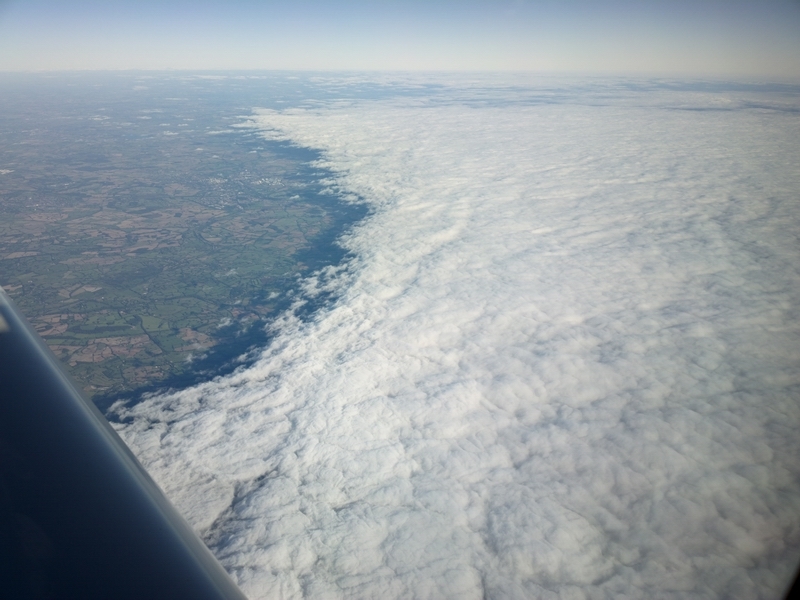
Typical high pressure conditions - a solid cloud cover with quite low bases; around 1000-1500ft

I did a little experiment to see how fast the TB20 will go at FL160, regardless of fuel flow. At 2575 rpm, 12 USG/hr (130F ROP i.e. best power) it did 150kt at 0C i.e. ISA+15.
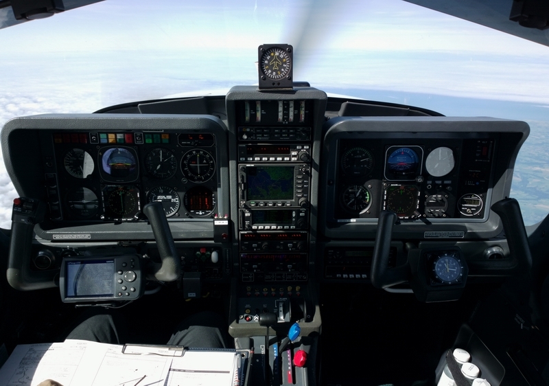
FL160 on autopilot... Not a "glass cockpit" but a twin EHSI installation with most of a proper "pilot panel" on the right hand side
The air was very warm, with 0C at FL150 i.e. ISA+15.
Arrival at Shoreham was via the GPS RNAV 20 approach, with a cloudbase around 1400ft. The MDA is 800ft.
London Control kept me high (FL110) until about 30 miles out, which is normally good, but eventually I had to go down at -1000fpm to get down to 2200ft for the IAF.
Actual track flown is here

Lessons learnt:
The VFR departure from Biggin to the west is a workable solution. One ends up flying (in this case) in IMC but one can get a radar service and anyway there is evidently very litle traffic in IMC. I saw plenty of returns on TCAS but all were below the cloudbase. Also very little time and fuel is wasted because one is flying in the desired direction anyway.
The GRAMET plots again failed totally to depict low level cloud i.e. anything below a few thousand feet. For this one needs to use TAFs/METARs.
All pics were done with the Nokia 808 phone.
That's a very nice panel with a lot of redundancy! Are both attitude indicators vacuum or electric?
Nice report Peter but you missed out on the "down the River @ 1200' " stuff that we humble VFR creatures regard as the highlight of going to Weston.
Speaking of highlights, did you meet the lovely Vanessa?
Thank you, particularly for that very interesting example & reference to Gramet. Never heard of it before, but Googled to find it. Booked it into my wx favourites for flight planning.
Seems it's a free & quick to use facility which as you displayed shows route cloud versus time. Looks very useful for low level VFR too - but you mentioned a discrepancy between actuals and forecast for low cloud.
Therefore tried to get an aftercast for this afternoon about 3 pm when I'd hoped with the mild and windless air (thus few bumps) to give the microlight single seat Rans a gallop from base strip nr. Horsham. At that time the South Downs were invisible, but I wasn't surprised as Leith hill was too when previewed from home, which at 8km range and its top 1000 ft is a good indicator for vis. and cloud base. I also expected to find a few mushrooms in the field, but that too was NBG.
Had to settle for the m/c ride out & back !
mike hallam.
Are both attitude indicators vacuum or electric?
LH is vac, RH is electric. Otherwise both are exactly identical functionally.
did you meet the lovely Vanessa?
Maybe I did but in that case my girl (Justine) is lovely enough for me to not remember another one  (is that the right answer?)
I don't think GRAMET (or any other site) forecasts today's very difficult conditions. On a return trip from France I diverted from EGKA to EGKB and altogether will end up spending some £200+ extra as a result...