Readers might remember last June when I had planned to fly to Sardinia. Well, at the time, the weather was a bit unstable over there, so instead, I ended up doing a fantastic trip to France and Spain.
The last week of August, a trip to the Southwest of England (Cornwall and Devon) was planned, but as you all know, summer said goodbye to northern Europe much too soon this year. The weather in England would have been rather cold and miserable, so I had to re-plan once again and this time, it looked perfect down in Sardinia. Well, that’s sometimes the way it goes in light GA touring. Some flexibility is called for, but sooner or later, one somehow manages to reach all those eyeballed destinations…
As a short summary, from Luebeck (Northern Germany), we flew to Calvi (for fuel, lunch and a swim) and then on to Olbia in Sardinia. After two and a half days on the Costa Smeralda, we flew up towards Tuscany, where we ended up visiting several small airstrips. One day later we flew back to Germany, with a stop at Portoroz (again for fuel, lunch and a swim).
This trip’s flights were all done VFR, the only exception being the first flight from Luebeck to Calvi, which was done under IFR for better airspace access in the Frankfurt and Milan areas. Weatherwise, even that flight could have been done VFR.
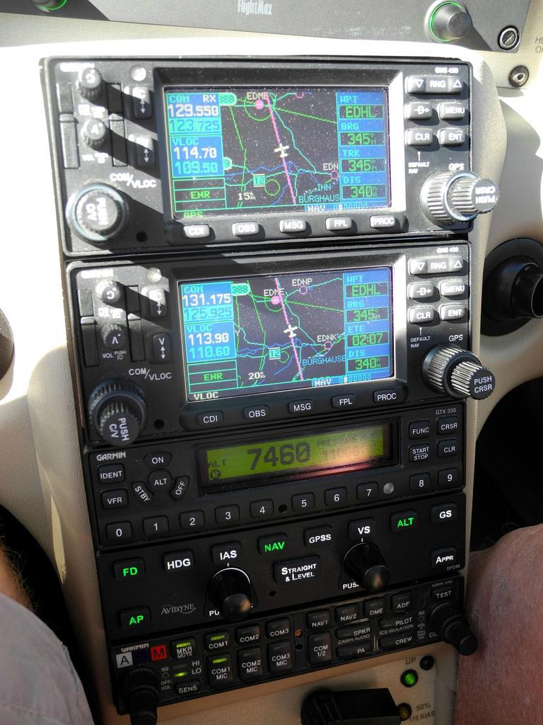
On this trip, I had a demo unit of Sebastian Golze’s ADL unit on board:
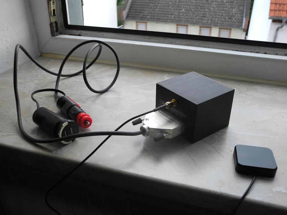
The ADL box chucks away nicely in the centre console of the SR22, leaving you with just the satellite antenna, which has to sit on the glareshield, under the windscreen (I tried to put it into the centre console, but it wouldn’t pick up any satellites from there).
Unfortunately – this only to a certain degree obviously  – I couldn’t really put it to test, since there just wasn’t any weather around at all.
On the day of our departure (Sunday 24th), the weather was very good all across Germany and also south of the Alps.
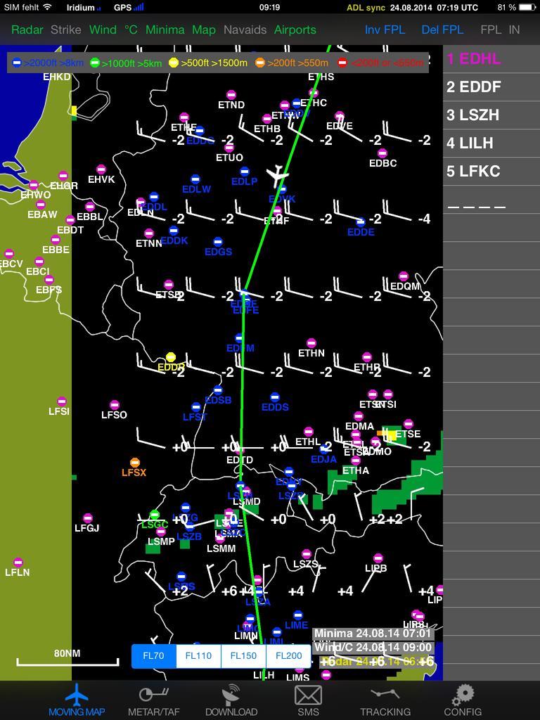
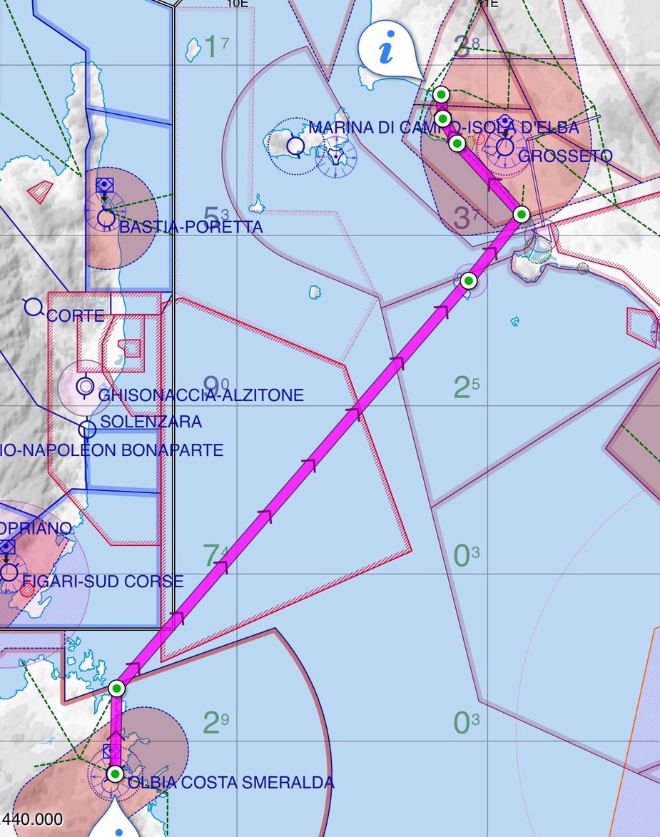
Our “final” destination of the day was Olbia (LIEO) in the northeast of Sardinia. Options for our fuel stop were the Northwest of Italy (for example Voghera LILH, or even Albenga LIMG) or if we could stretch it, Calvi LFKC, on Corsica. This latter option had a lot of charm… first of all, it would leave us with only a short one hour flight in the afternoon. Also, it would be a really “nice” place to be, even if just for a few hours. Last but not least, fuel is much cheaper in France (~2.1€) than in Italy (~3 Euros on average).
Here’s the routing to Calvi:
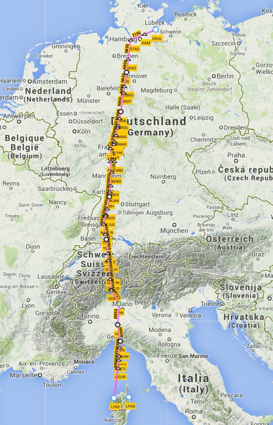
Very much a straight line. However, even the 700NM GC distance from Luebeck to Calvi is about as far as I like to stretch it, on an IFR flight plan, with the last piece of flight over water. Sure, the “book range” (with reserves) of the SR22 is over 1000 NM, but on a flight like this, I just like to arrive at my destination with absolutely no less than 1.5 hours of fuel. Also, anything above 4 hours of flying tends to get a bit long, even in the superbly comfortable SR22. Flying longer than four hours also tends to make having lunch somwehere, at normal hours, impossible.
It would thus be a question of winds aloft. Even just ten knots of headwind would scrap the Calvi plan. According to the forecast the day before, the general wind direction (between say FL70 and 170) would be from the west, with possibly a tiny northwest (read: tailwind) component, especially above FL120 or so.
So, that was the plan. The (IFR) flightplan was filed as above. The flightplanned alternate was Genoa, with my “real” planned alternates being Voghera and Albenga.
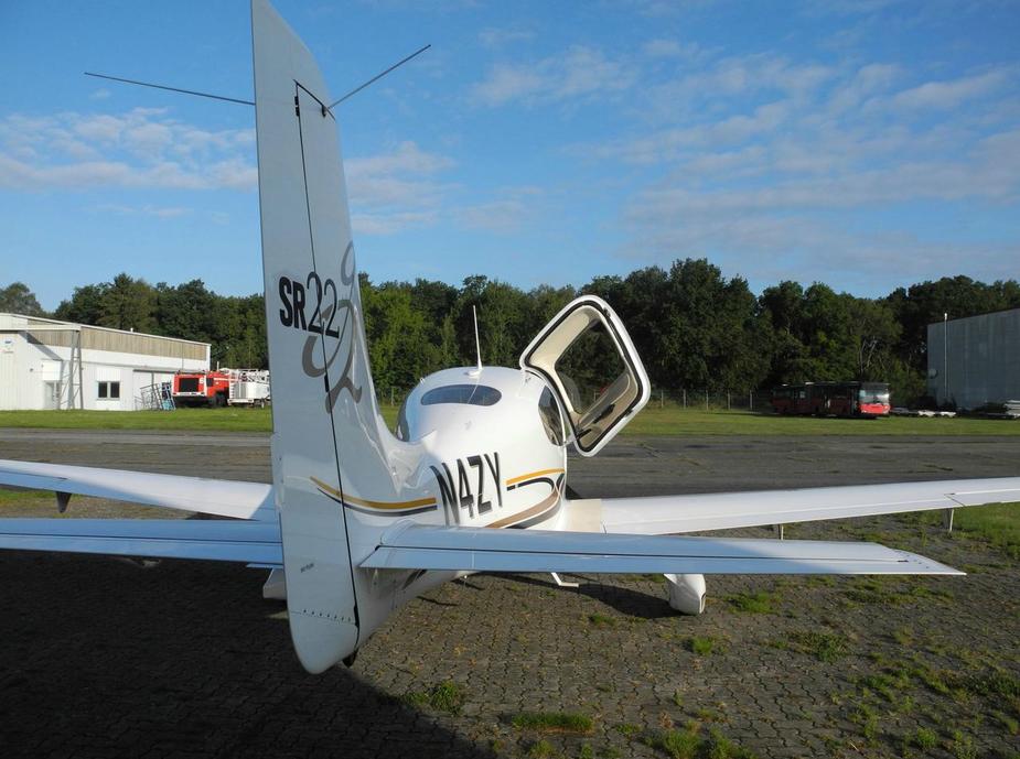
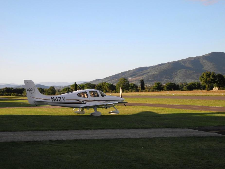
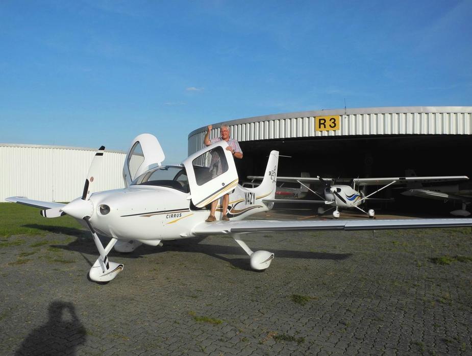
N4ZY, ready to go in front of the hangar, for our early morning departure.
After passing 3000 feet on the HAM5H departure, we asked for, and received, clearance direct to Warburg (WRB). That was good. Winds were out of the west, with a slight headwind component during the climb. After a short while at FL100, we climbed to FL120 to clear some stratus clouds, and hook up the O2. There was now a tiny tailwind component, and thinks were looking rather good, with a calculated landing FOB of 24 gallons (i.e., just short of two hours).
At the time, we also downloaded a set of weather data via the ADL, which worked flawlessly. But again, there just wasn’t much to worry about. It did however help us to determine that the winds aloft should become slightly more favourable higher up.
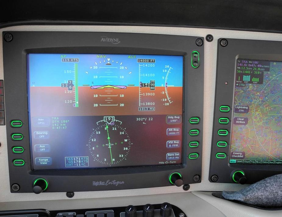
Eventually, we had to climb to FL140, as usual, due to the Frankfurt TMA. This improved the wind direction even slightly more. Here we are, doing 171 knots on 12.5 GPH, with a 7 knot tailwind to boot.
The calculated landing FOB was now 27 gallons and Calvi was now definitely safe.
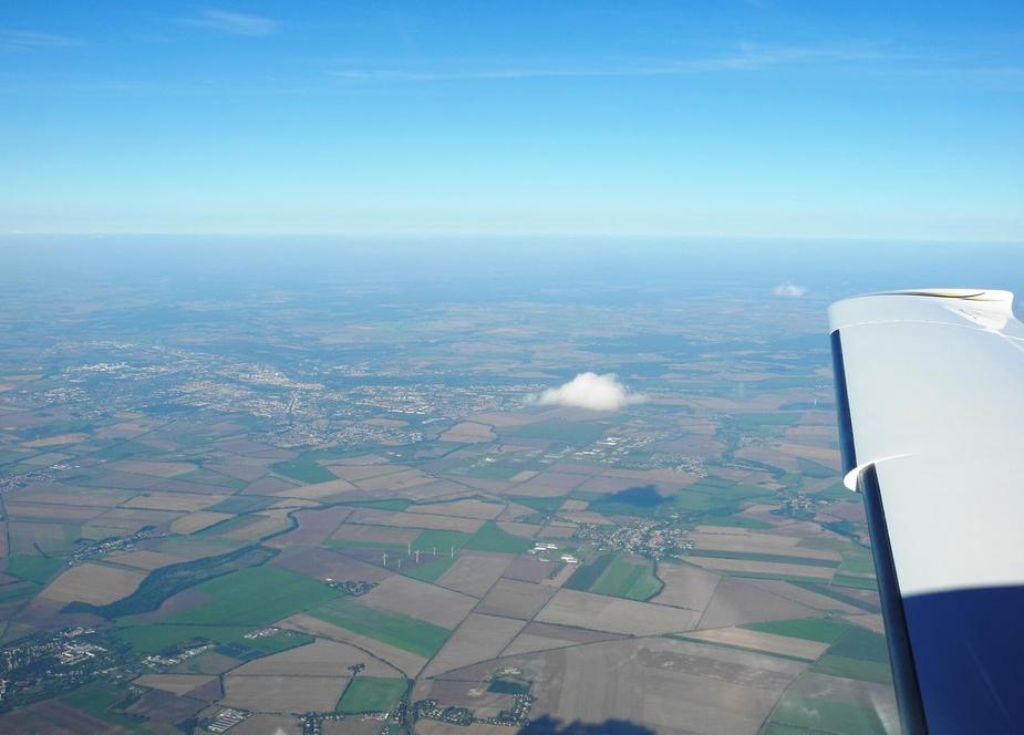
Not much to see on the first one and a half hours of the flight. The first real landmark on this routing usually is Frankfurt.
Here’s a nice shot. The arrow is where I now live.
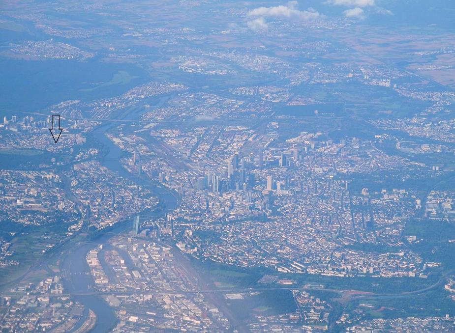
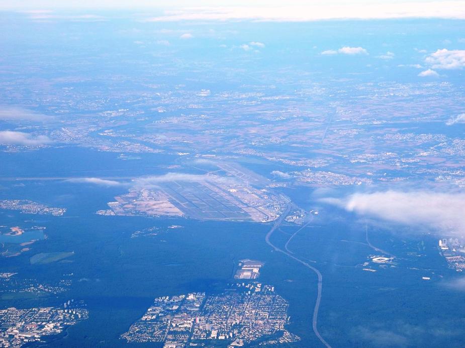
Here’s Frankfurt / Main (EDDF). By the way, the town in the foreground is Neu-Isenburg, the home of Jeppesen in Europe. Also, to be seen to the right, is Frankfurt’s Commerzbank-Arena (aka Waldstadion for locals).
By then, we were on another good shortcut, DCT Trasardingen (TRA).
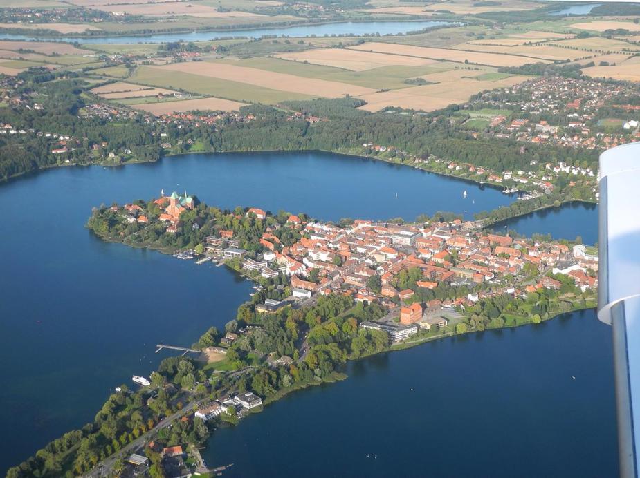
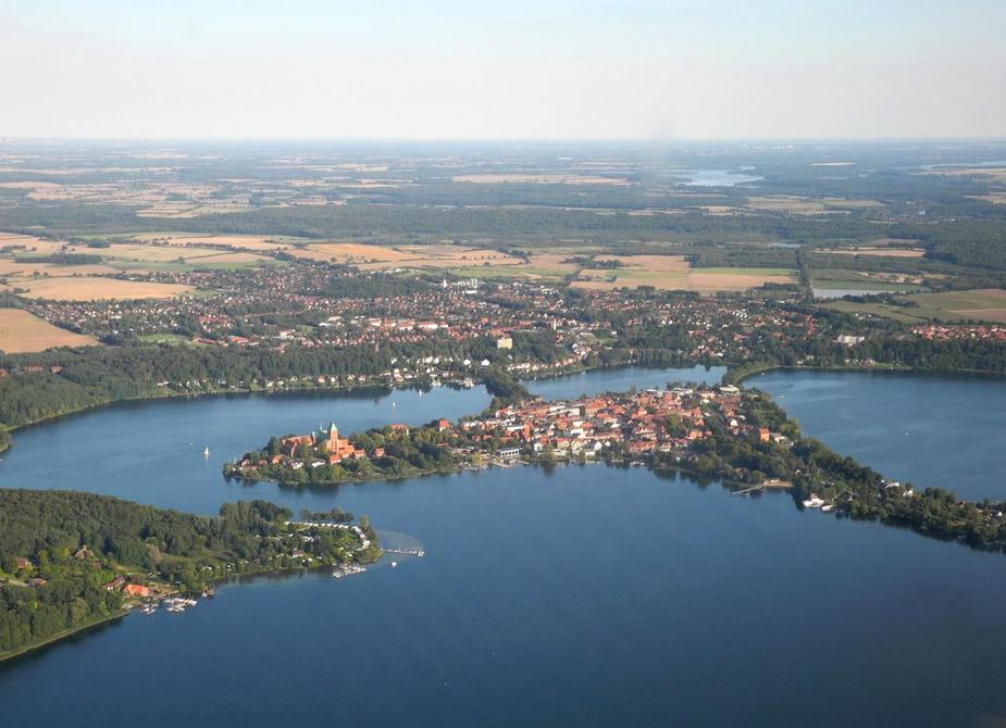
Here’s a shot of the western parts of Lake Constance. This is where the Überlingen mid-air collision took place in 2002.
By that time, we were issued an even more fantastic shortcut: direct to Saronno (Milan). Phew! So that one crossed two national frontiers, all across the Alps!
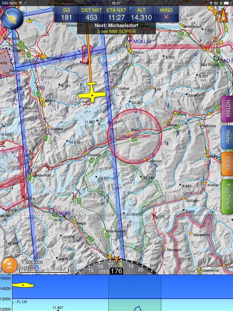
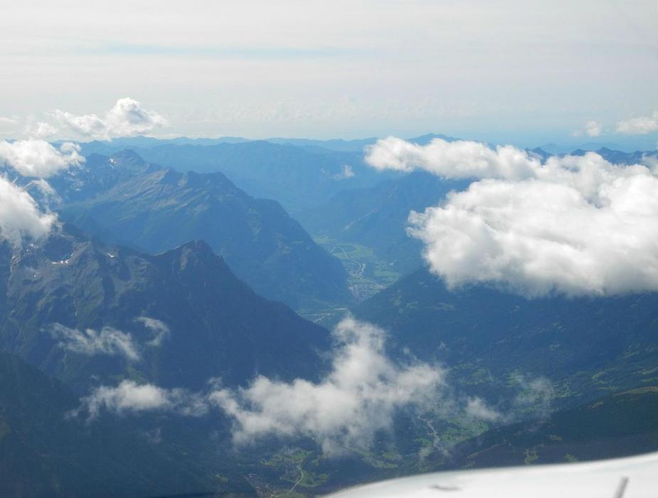
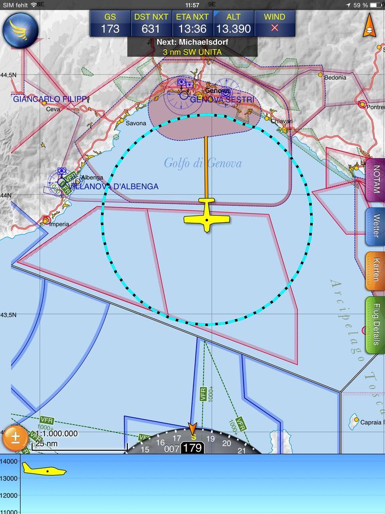
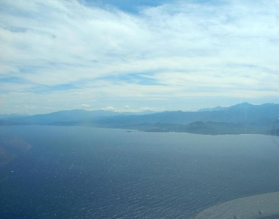
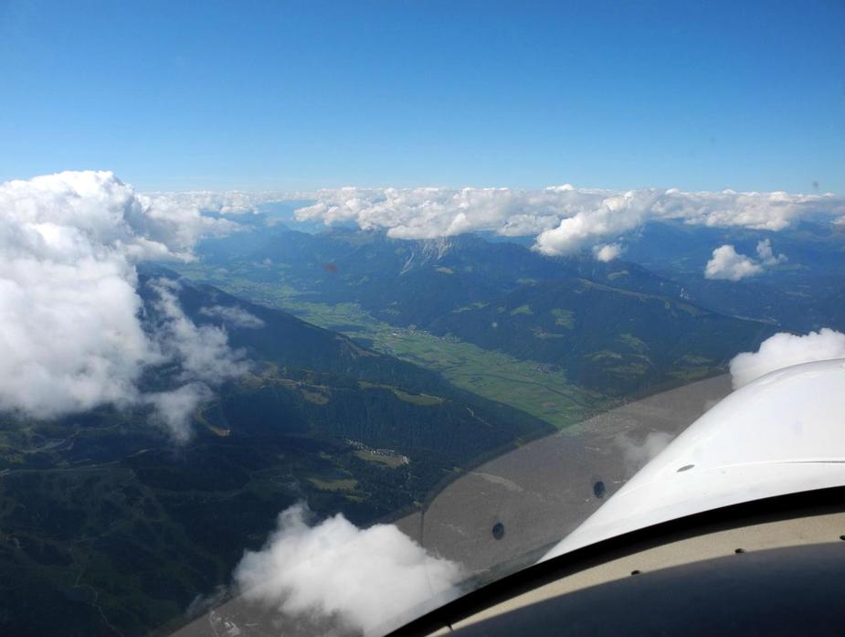
The Northern side of the Alps was mostly covered in stratus type clouds (as we predicted by the GRAMET) so there wasn’t much to see. As a result of the early direct to Saronno, this time, we were on a more westerly track than usual on the N850 routing. Here’s a screenshot I took from Skydemon:
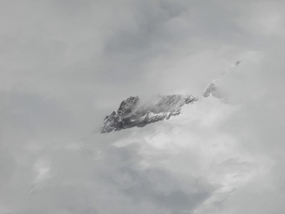
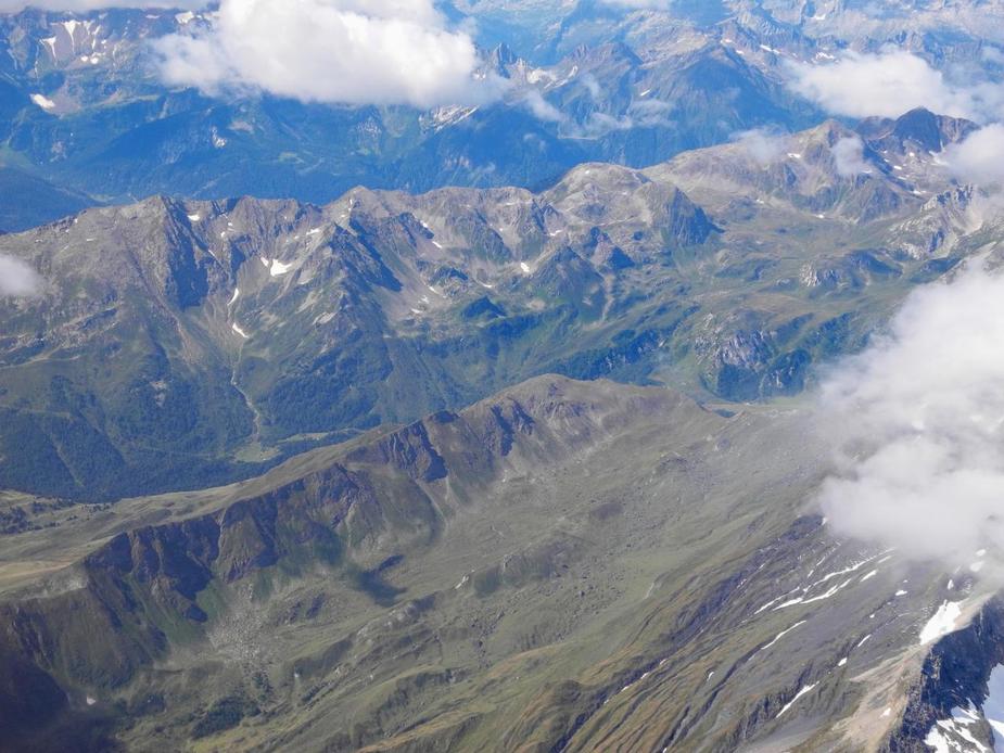
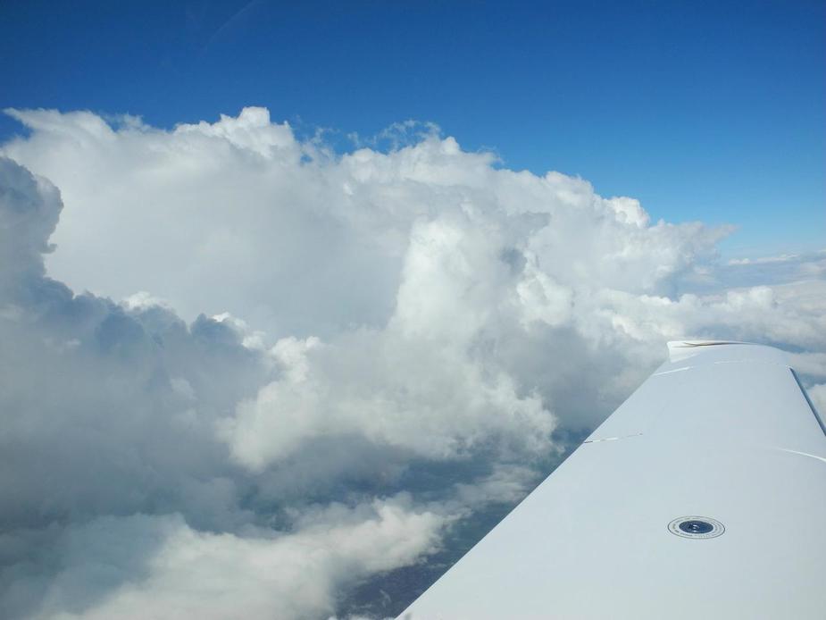
Talk about terrain clearance. Only slightly more than twothousand feet above that 11.857 foot mountain. Unfortunately, we didn’t get to see that much from the mountains, since there was still a lot of cloud below, but every now and then, we got a peak (no pun intended):
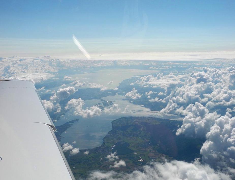
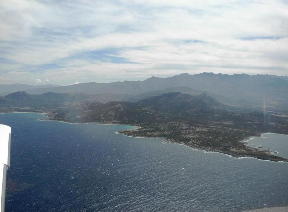
After that, the clouds started to disappear as we clearly reached the south side of the Alps. In the vicinity of Lodrino airfield (LFML).
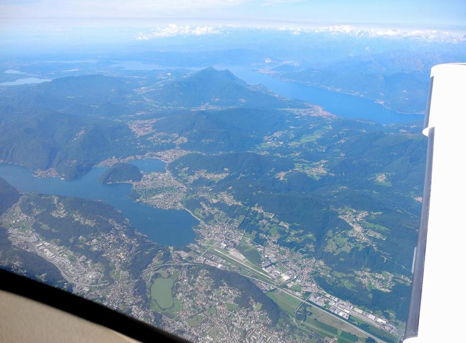
Lago Maggiore in sight.
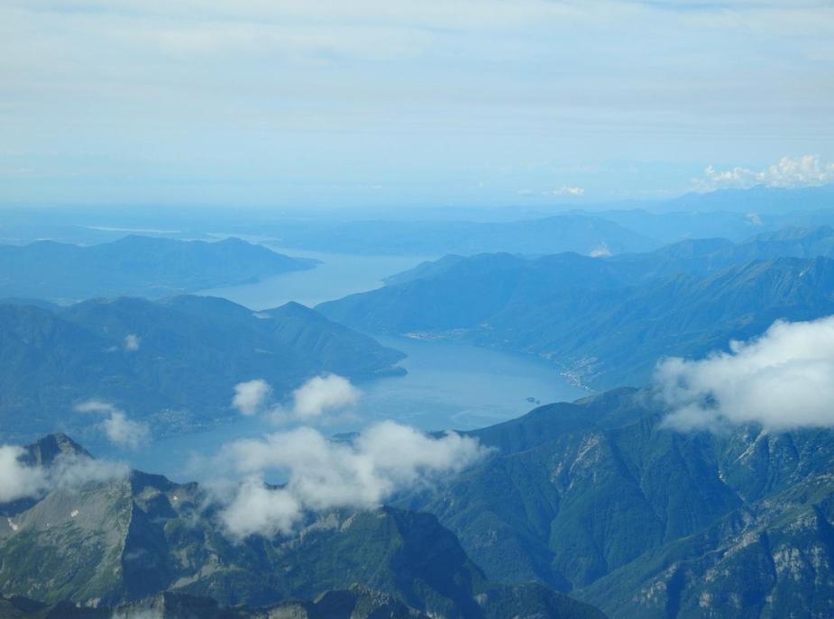
Locarno (LSZL) is down there and Ascona to the right.
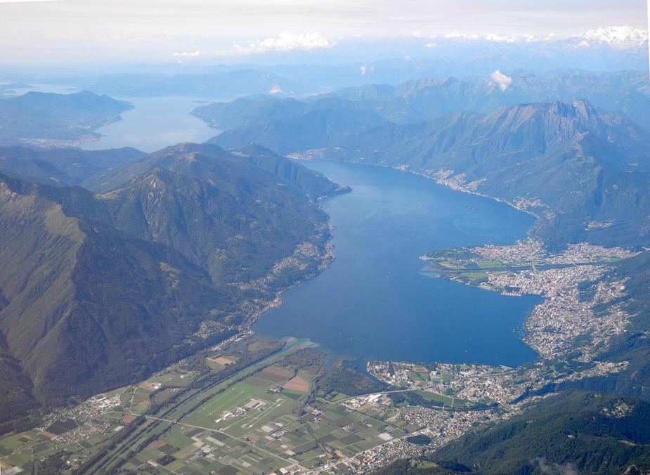
A few minutes further ahead, here’s Lugano (LSZA). Now talking to Milano Radar.
Well into Italy, here’s Varese-Venegono airport (LILN).
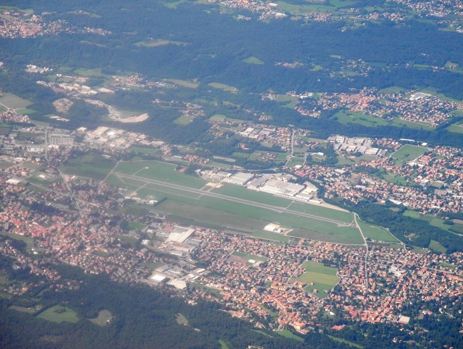
Now cleared to Voghera, we passed between Milano-Malpensa (LIMC) airport to the right and the city of Milan to the left. Shortly after Voghera, flying inbound to Genoa (GEN), we were handed of to another sector of Milano Radar, frequency, err, channel 136.025:
Some cumulus cloud over the Ligurian Apennines.

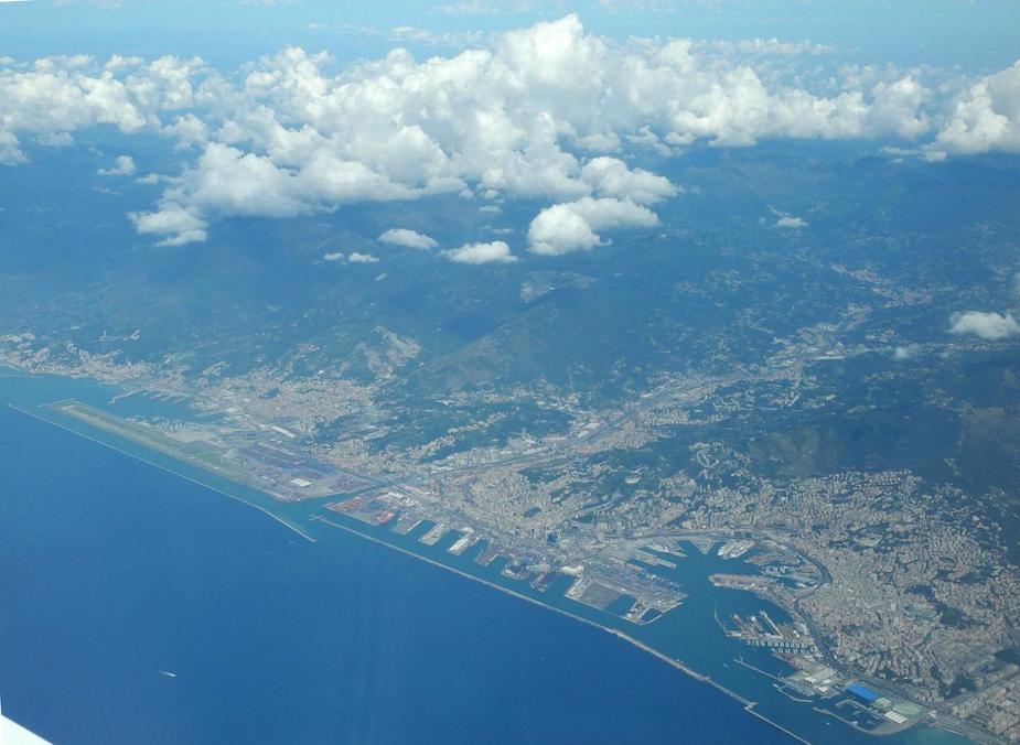
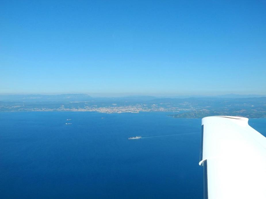
We got a good view of Genoa city and airport (LIMJ):
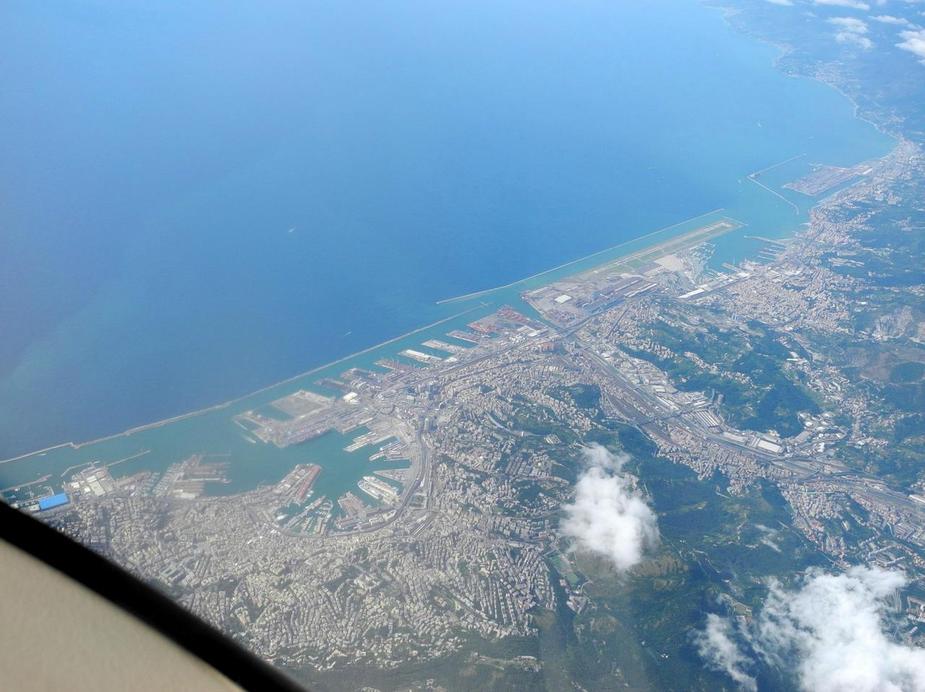
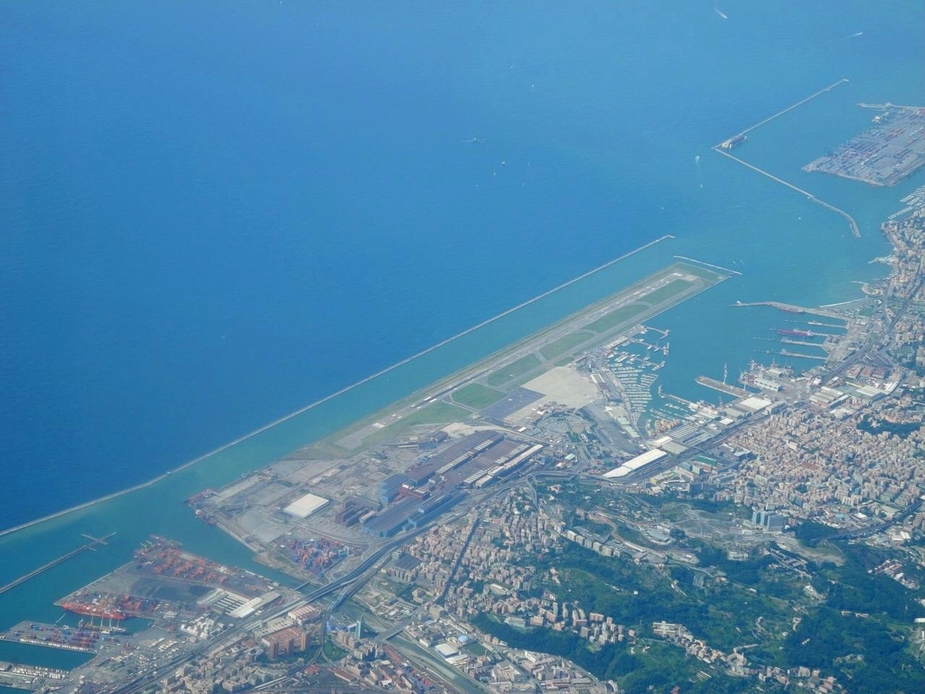
By the way, the Costa Concordia must now be somewhere done there, after having been towed there a few weeks ago. More about that one later.
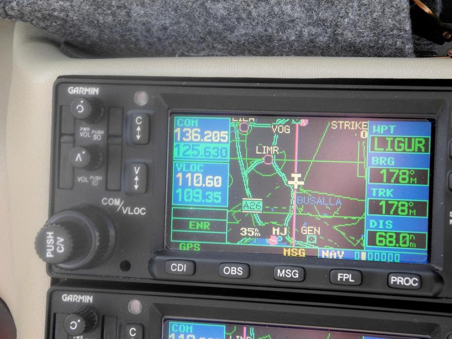
We were then cleared to LIGUR (halfway between Genoa and Corsica) and started our descent into Calvi.
Here’s a nice screenshot from Skydemon, showing the “safe glide feature”, jsut as we leave the point where land could have been reached. As you can see, this is from 13.400 feet and we’re only about 40 miles out! This shows how trying to climb ato the service ceiling of a typical non-turbo SEP to be safe in case of an engine failure is usually a useless exercise….
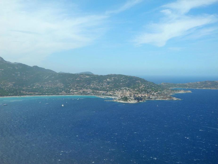
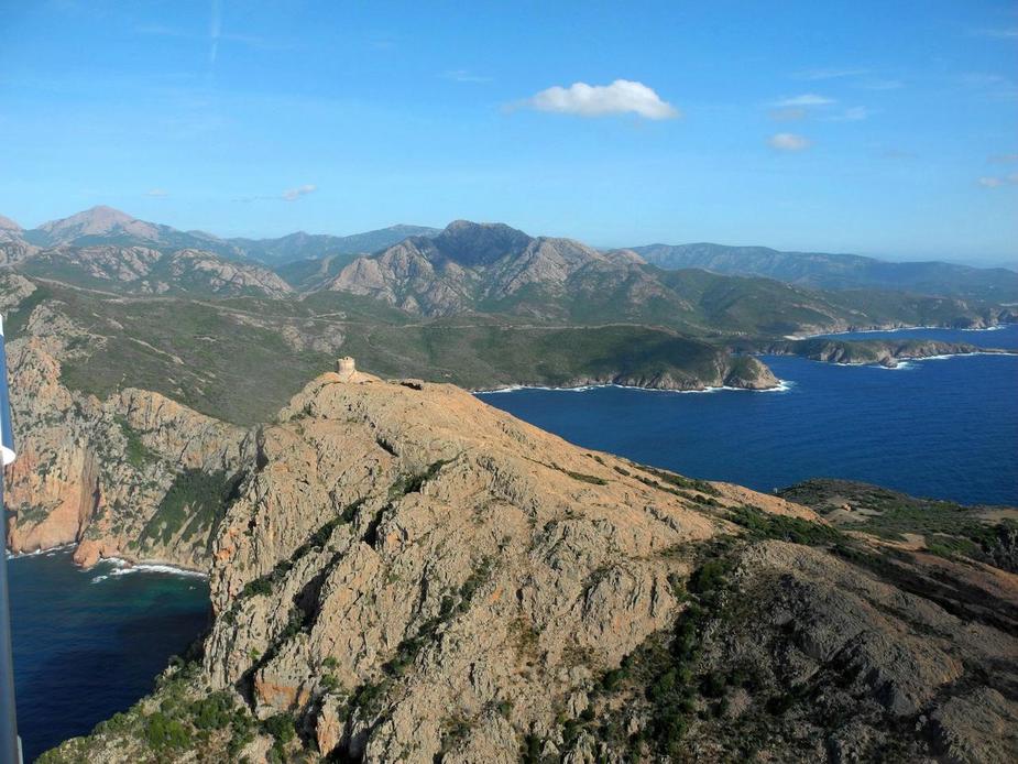
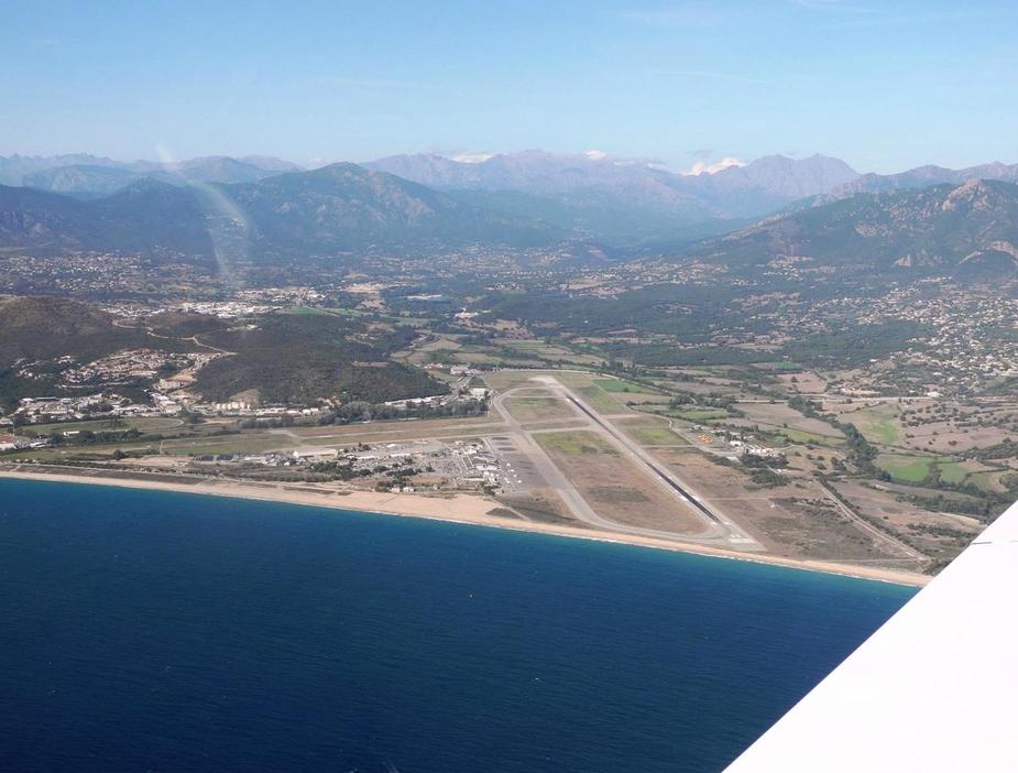
Approaching Corsica.
There’s Calvi, taken on the LOC 18 approach.

Short final 18.

4:02 hours from all the way from the very north of Germany to Corsica.
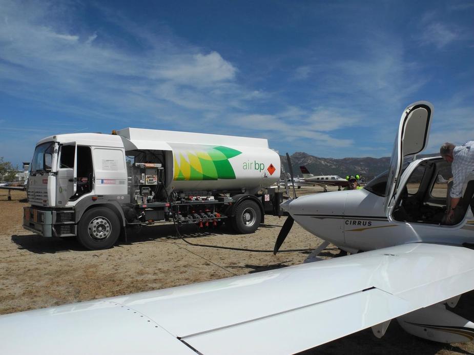
We were lucky with the fuel and get ours (198 litres) without any delay.
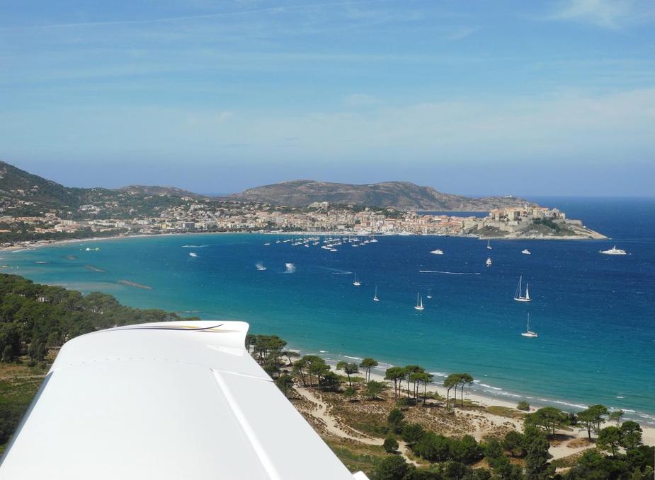
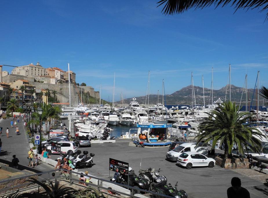
Calvi was still buzzing.
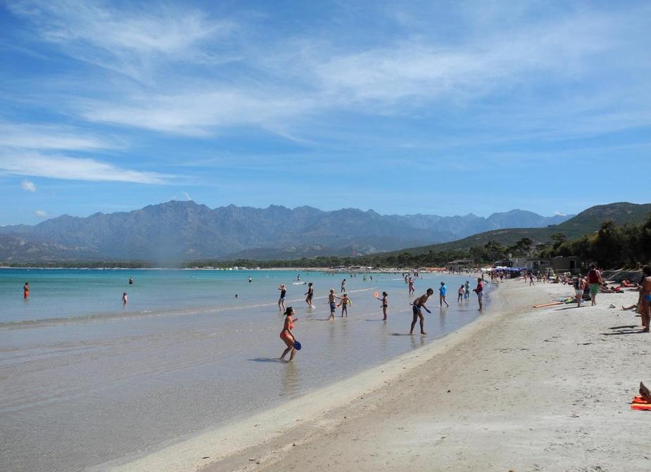
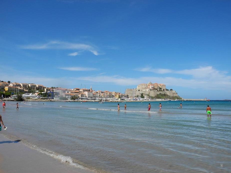
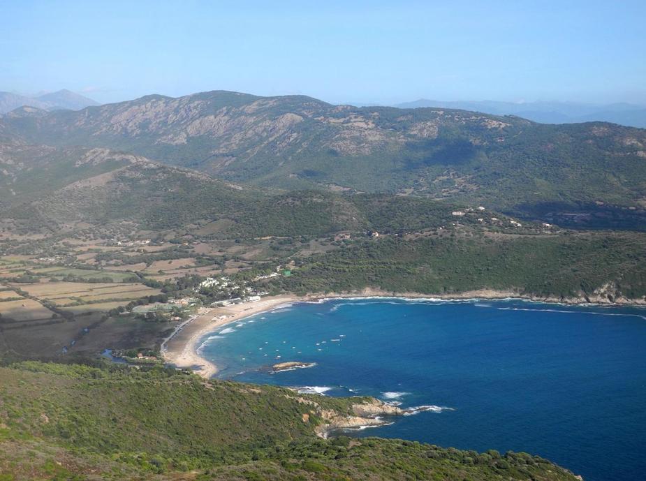
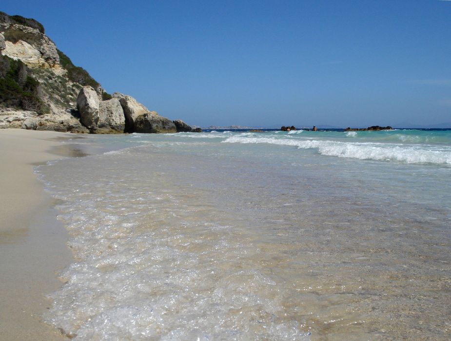
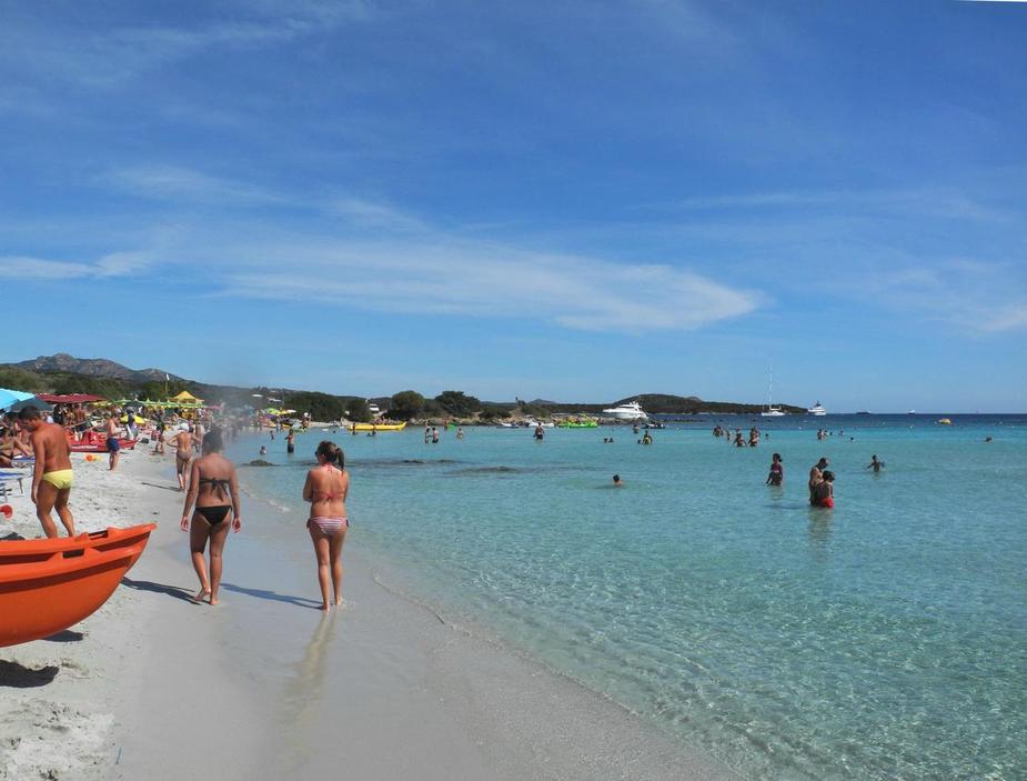
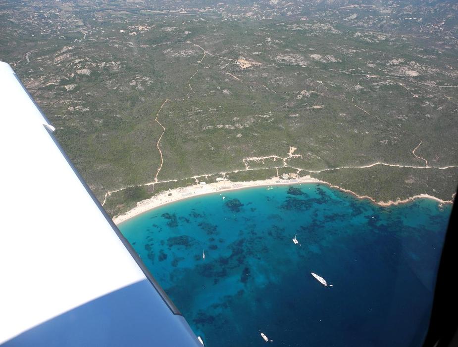
The beach was superb, as always.
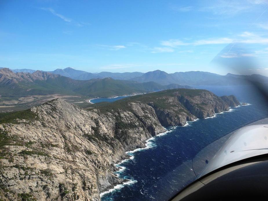
4:30 in the afternoon, time for our final leg to Olbia. This was planned and flown VFR, flying down the west side of Corsica, which is beautiful and very sparesly inhabited.
Leaving Calvi at 1300 feet, southwestbound. The airport can just about be seen in the background.

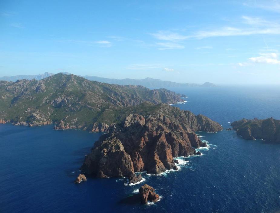
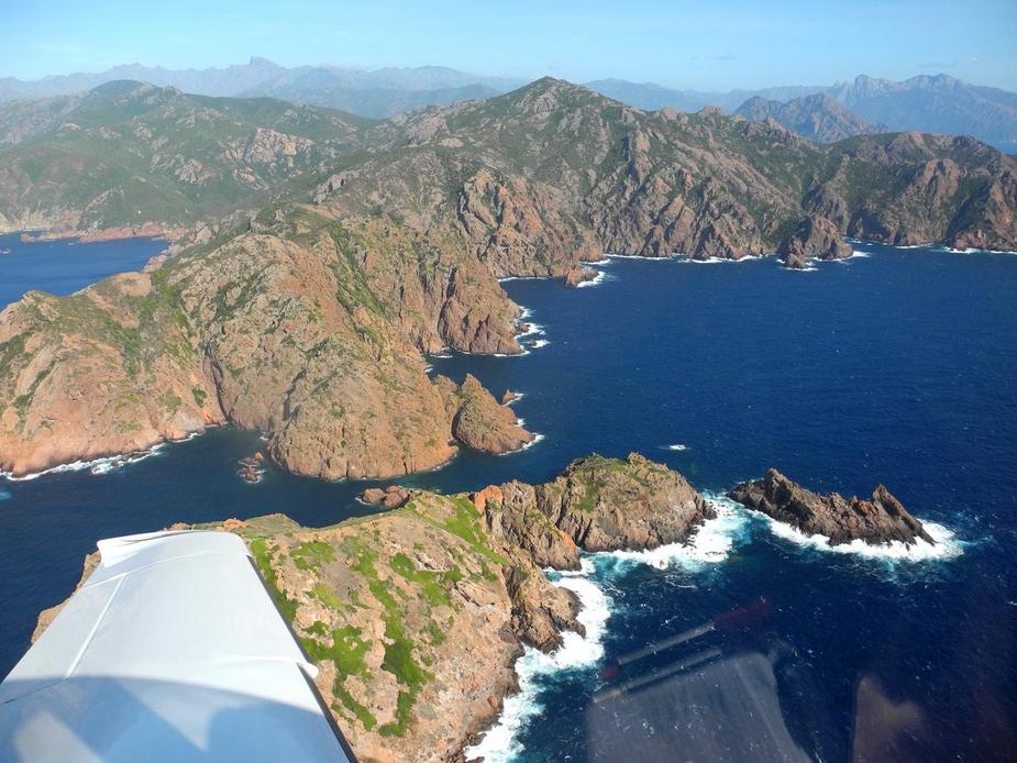
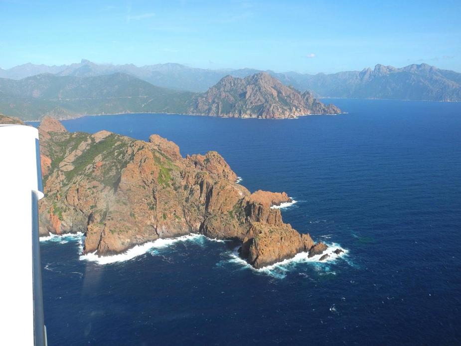
I’ll let the pictures speak a bit now.
We eventually crossed the Ajaccio CTR. The tower wasn’t really interested.
City of Ajacccio.
Ajaccio airport (LFKJ)
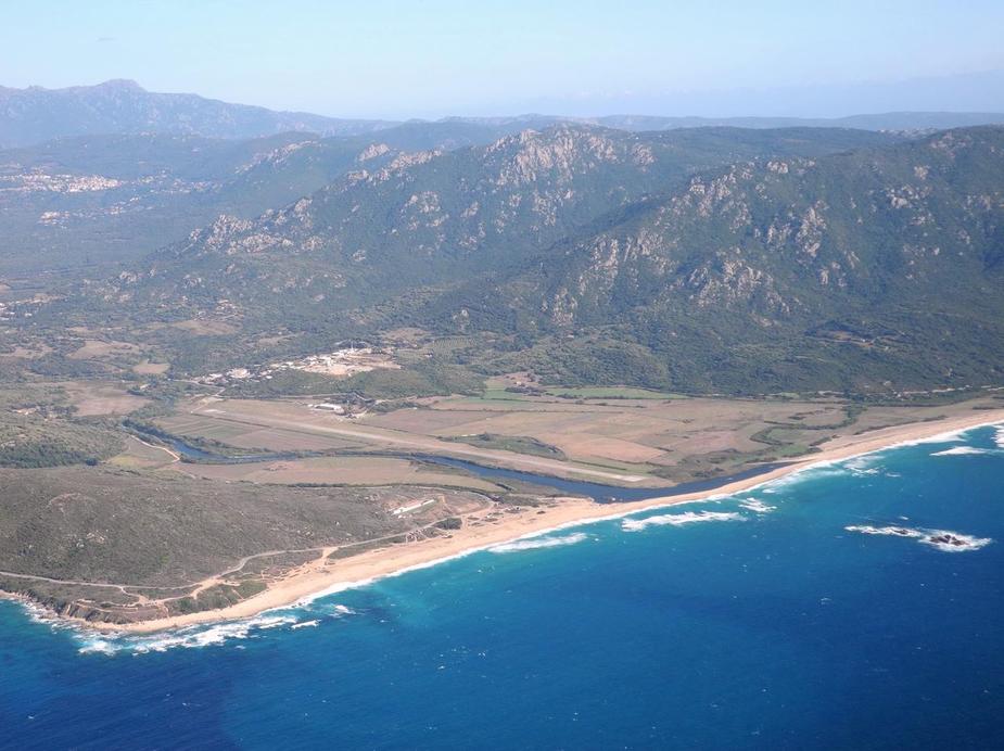
A bit further down, Propriano airfield (LFKO). Unfortunately in a steady decay over the last 15 years.
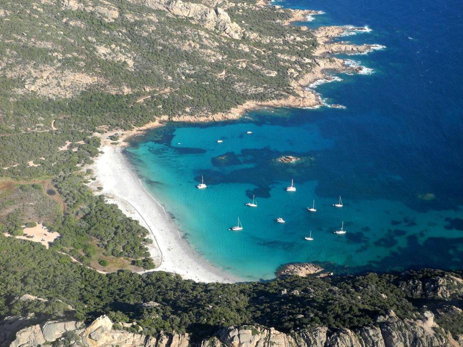
The south of Corsica has the most beautiful beaches. Here’s one, west of Figari.
Figari cleared us along the coastline. Again, they weren’t really interested in us. This surprised me a bit, since an airliner was on final for runway 23, just as were about to cross the opposite runway centreline. Doesn’t the tower need to keep this area clear, in case of a go-around? Anyway, I didn’t complain.
Here’s Bonifacio.
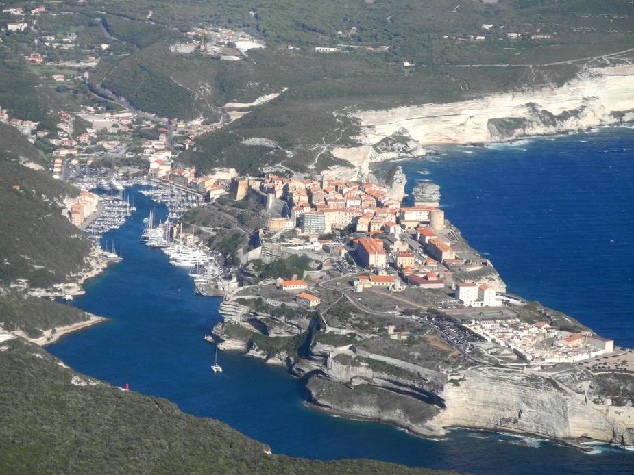
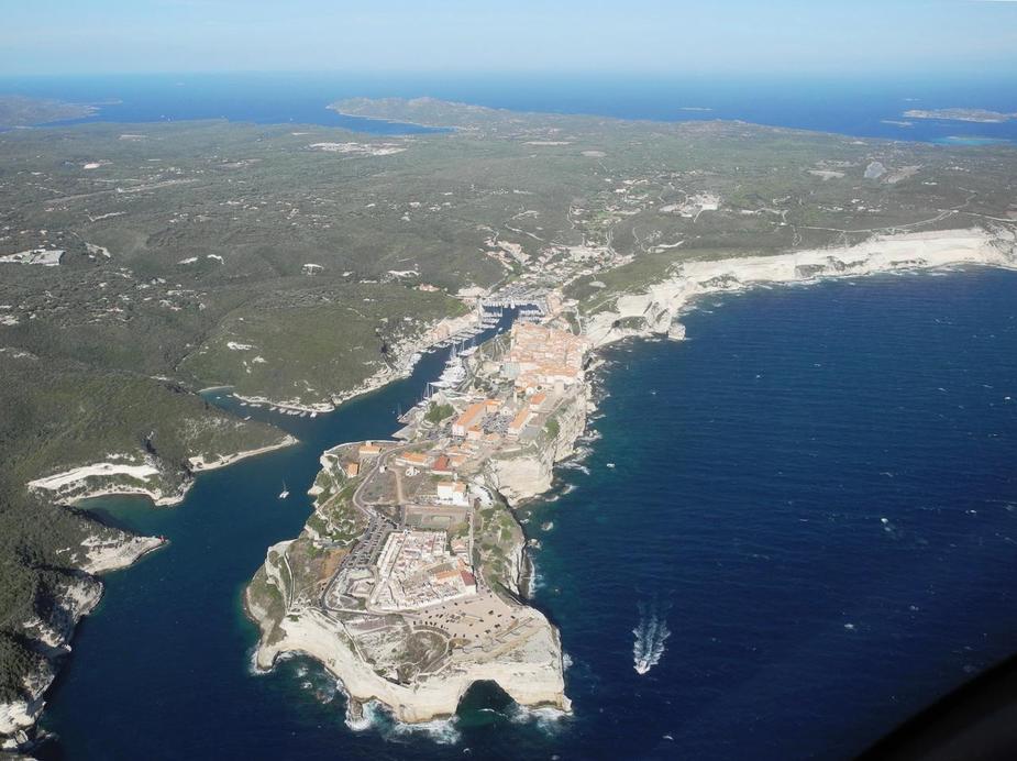
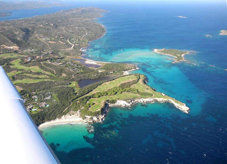
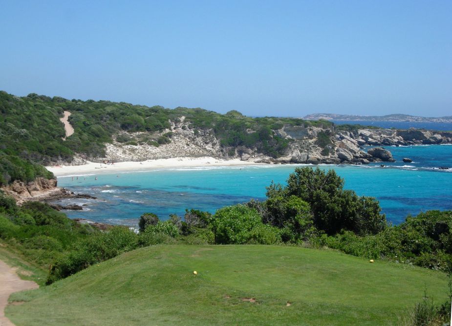
Here’s the very southerly tip of Corsica, with the Sperone Golf Club in the foreground and Ile di Cavallo in the background.
Sperone is IMHO one of the most beautiful Golf courses in Europe. I played there in 2008.
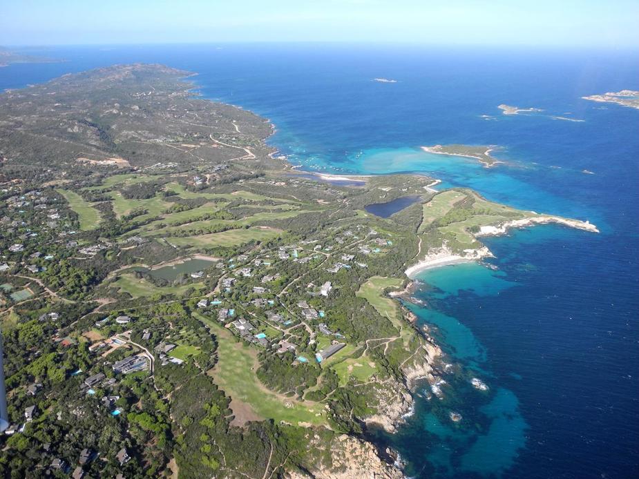
Between holes, one can have a short break and a swim at the beautiful small beach down there (La Plage de Sperone). Really recommend the place.
Here’s a brief flashback to 2008:
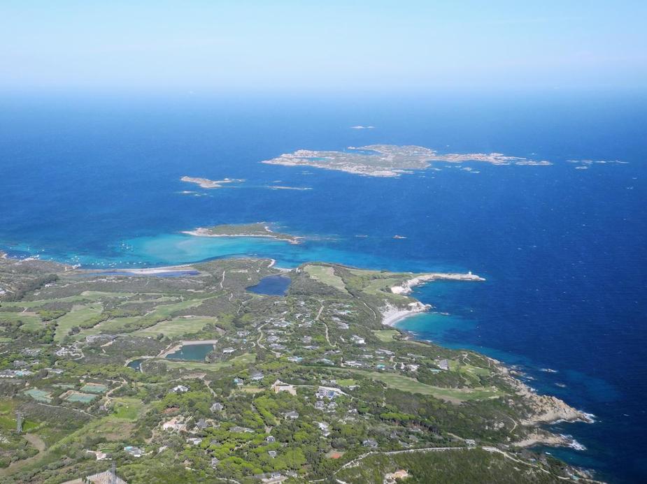
Anyway…, we then made a small detour (the joys of VFR flying…) to check out Île de Cavallo.
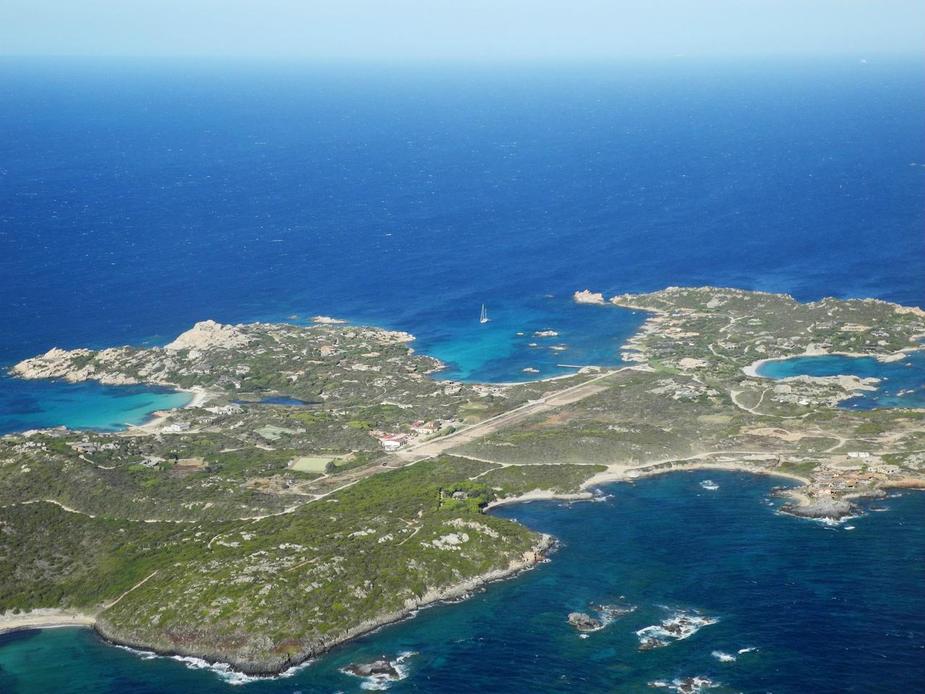
The runway looked totally unusable. It seemed like bushes have grown there. Maybe 350 metres of clear area, possibly much less. I don’t think any airplane has landed there in the last 10 years or so. There was a helicopter parked there, though.
Here’s the village, which hosts a very expensive hotel, the “Hotel des Pêcheurs”.
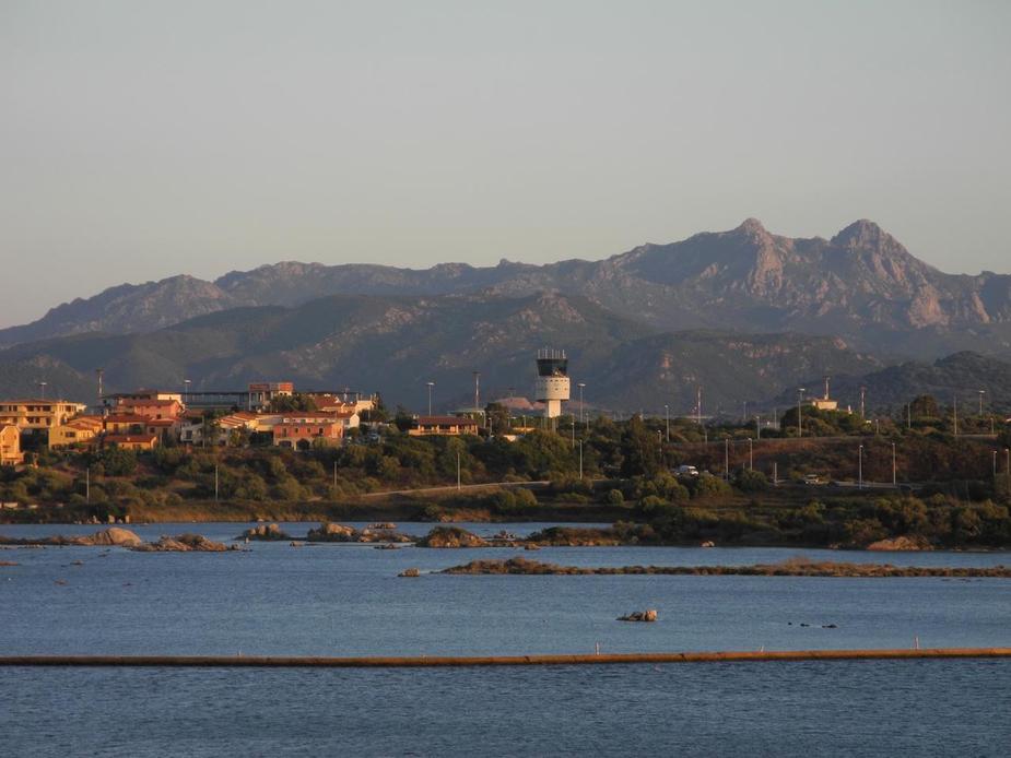
We then crossed over to Sardinia. Takes little more than five minutes. By the way, when doing these flights in the past, one always had to pay attention to the prohibited area over La Maddelena Island (US american military base). However, looking at Skydemon, I noticed that it has apparently been withdrawn. I later learned that the Americans have left the Island a few years ago, allegedly because the local prople didn’t want them to be there with their nuclear submarines any more…
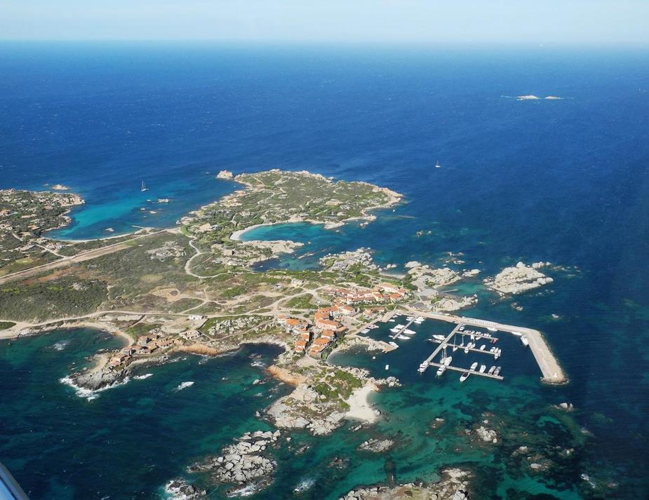
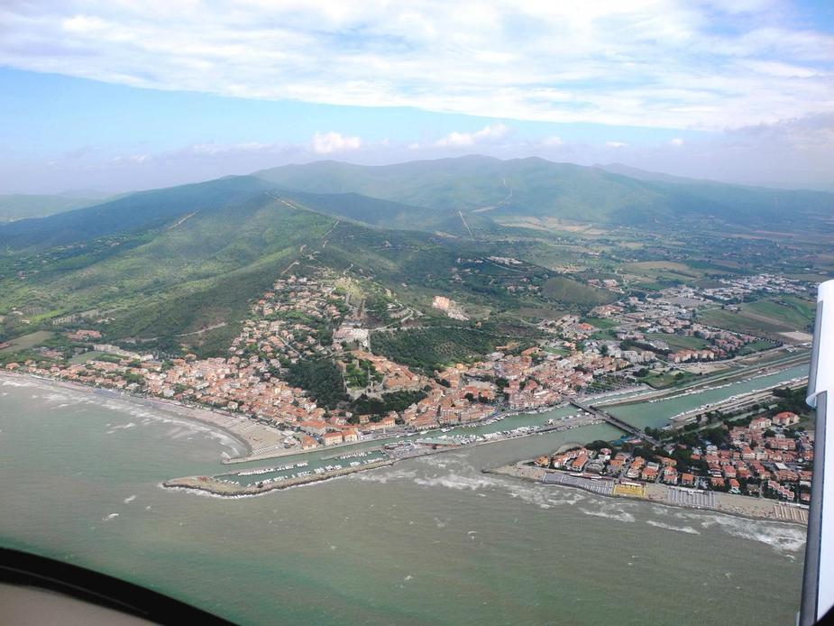
Entry point to the CTR of Olbia in the North is Capo Testa, near the town of Santa Teresa Gallura.
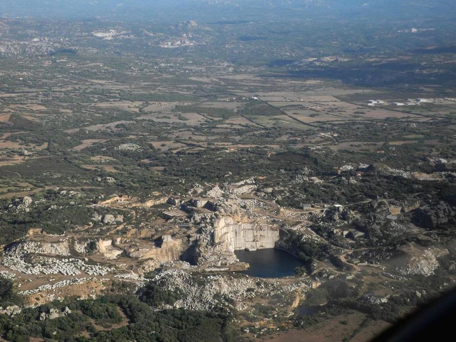
A big quarry on the way to Olbia.
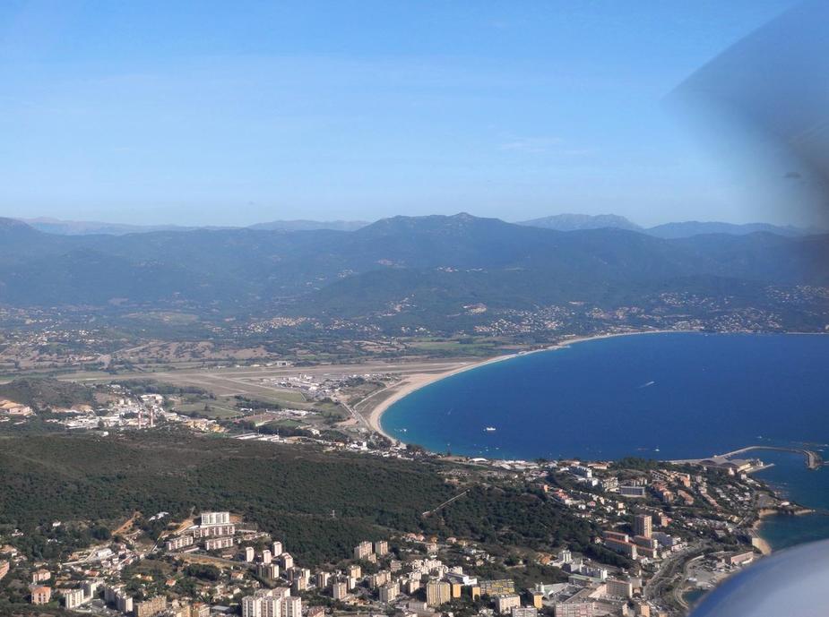
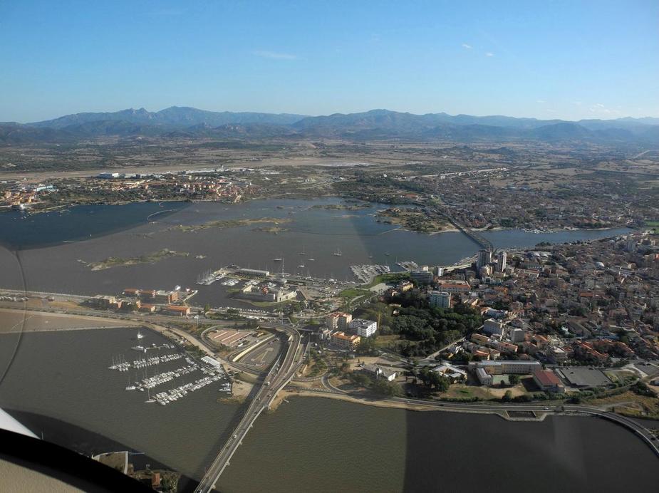
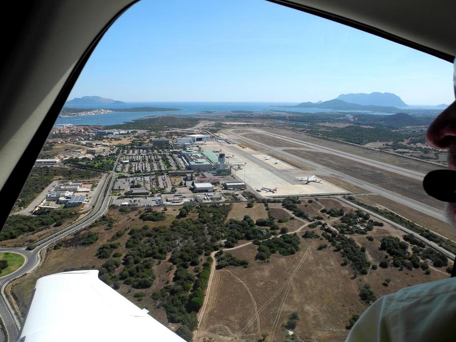
Here we are approaching the Bay of Olbia.
This was Sunday, early evening and the airport was buzzing (departures mostly). We were very pleased that Olbia Appraoch and Tower were completely reaxed though, clearing us straight to the righthand base for runway 23, with no delay at all. These people apparently know how to deal with lots of (different) aircraft, which is the exception, not the norm in Italy. Well done!
Here’s Olbia city, approaching right base. The airport is in the background.
After just under one hour, we landed on runway 23, with a moderate crosswind and taxied to Apron 3, which is where small aircraft (anything below 4 tons…  ) seem to get parked in high season.
Here’s out track.
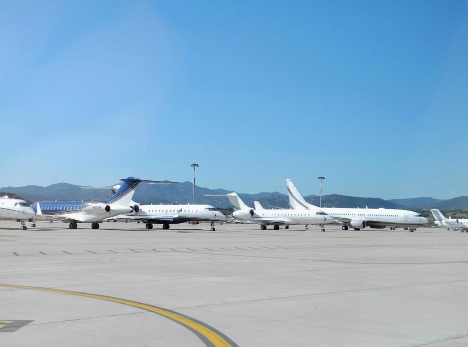
Apron 2 on the other hand is where all the heavy (GA) metal is parked. Season was coming to an end as we arrived, so it wasn’t as full it was say 3 weeks earlier, but one could still see how they park 737 BBJs, Gulfstreams, Citations, etc. “face to face” in order to maximize ramp capacity. I would love to know what ENAC (the dreaded Italian CAA) has to say about it.
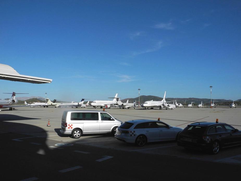
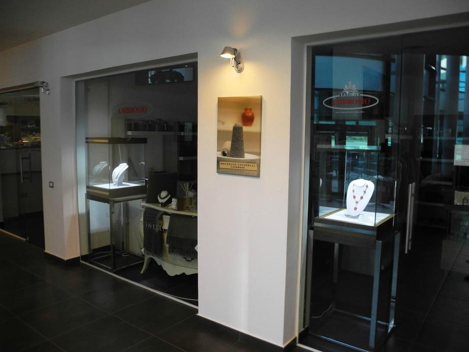
The GAT at Olbia is a sight to be seen – probably the most pretentious GAT in all of Europe.
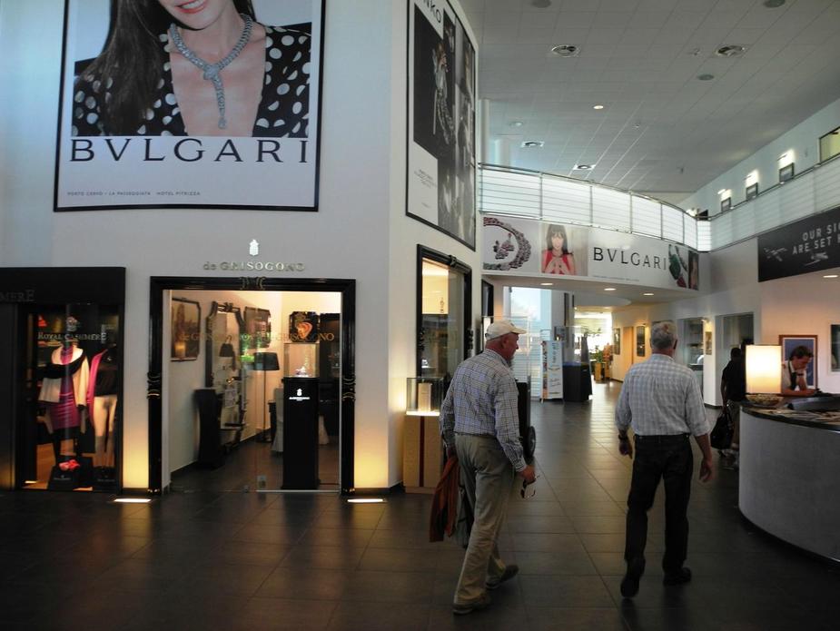
Jewelry shopping in the GAT!
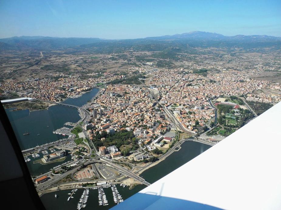
Anyway, we pickup up our rental cars and stayed in Olbia city for the first night. Nothing more than a night stop really, but the Pizza Diavola that we had for dinner was excellent.
An evening view from the hotel room over the Bay of Olbia.
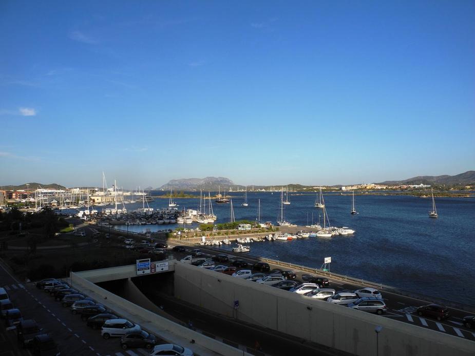
From my room, I could actually see the tower, since the airport is just to the other side of the bay.
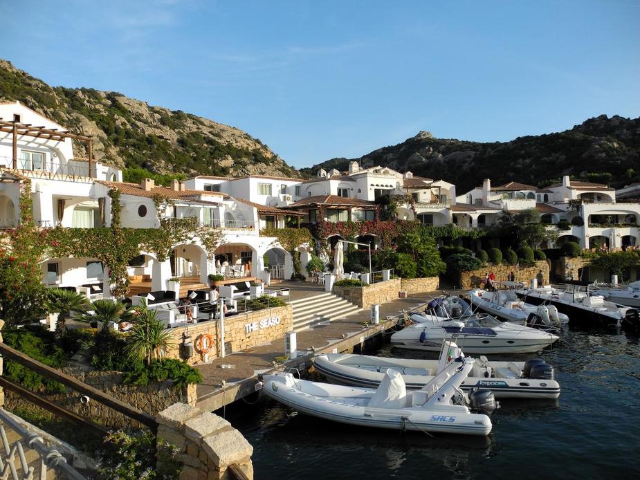
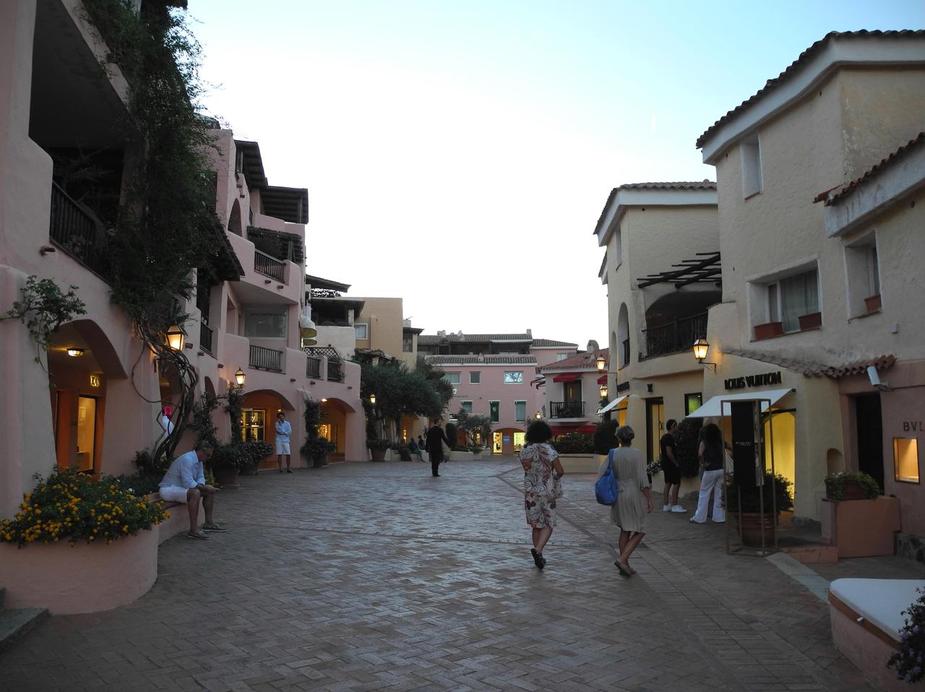
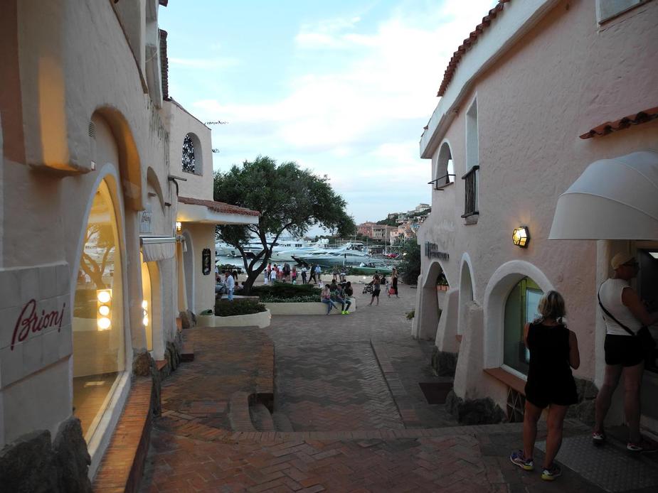
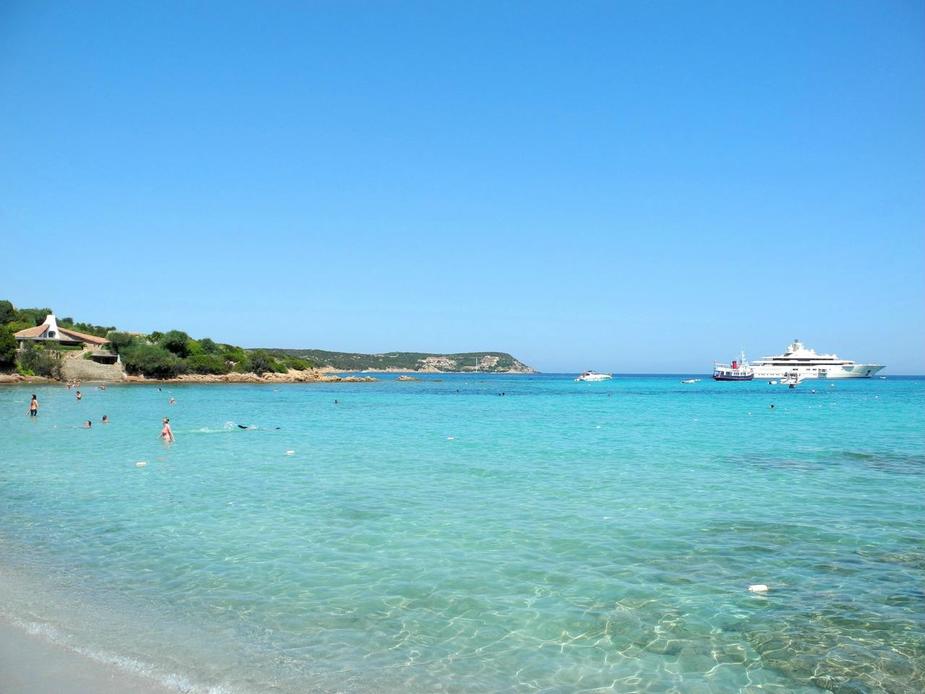
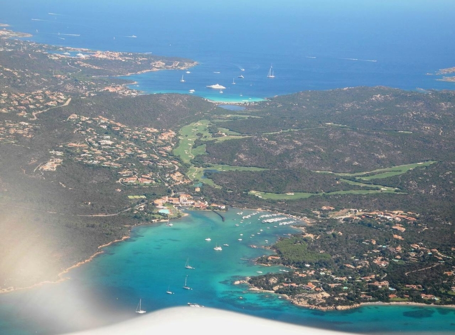
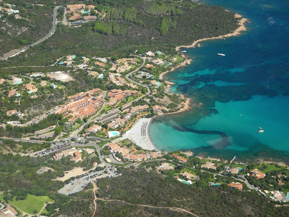
For the next days, we explored and enjoyed the Costa Smerada, which is the stretch of coast from Olbia up to Palau. In brief, we really enjoyed it. Season was just coming off-peak a little and climate was perfect. For wealthy and famous Italians, the Costa Smeralda is the place to be in July and August. We were pleased to note the prices were not as bad feared, with one exception though – Porto Cervo. This is the centre of “see and be seen” on the Costa Smeralda, and also the place we liked the least.
All the reat was really nice though. Needless to say, the beaches are among the best in Europe.
Porto Rotondo.
The beach at Liscia Ruja, near Cala di Volpe.
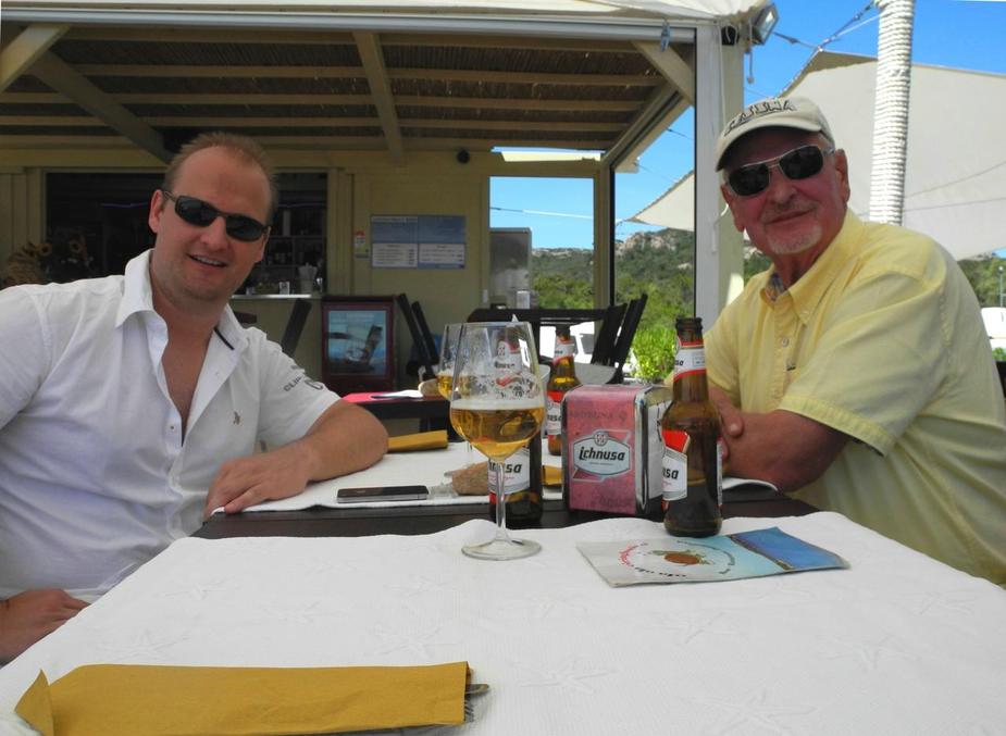
Me and my father at lunch. That bear “Ichnusa” is a local brew from Sardinia by the way, and the Sardinians seem to be very proud of it.
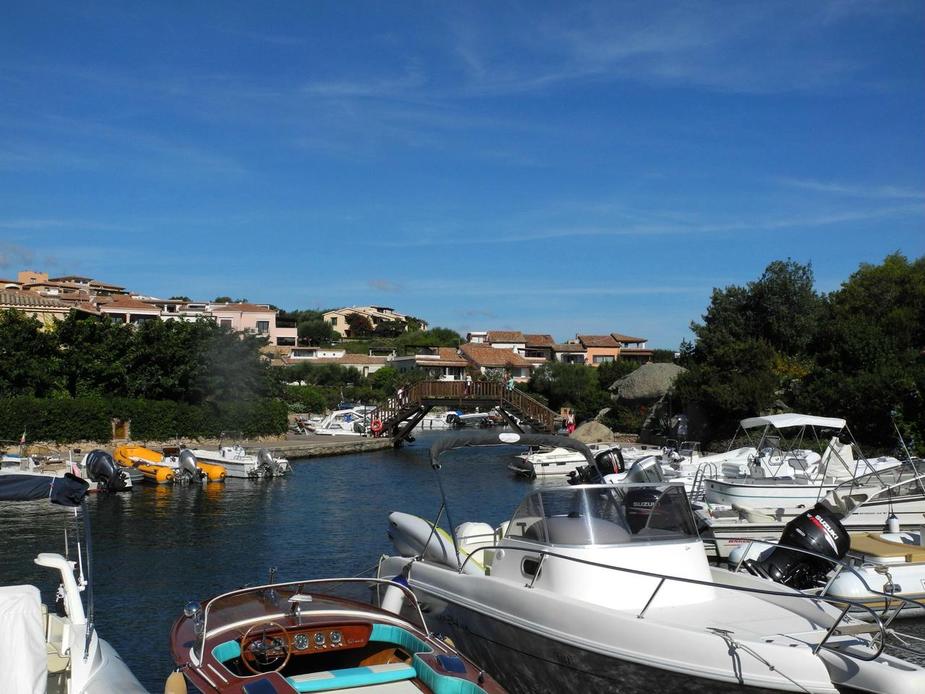
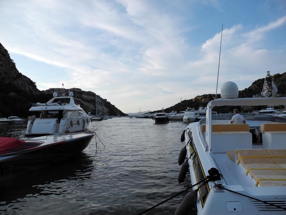
In the evening, we visited Poltu Quatu, a very beautiful natural harbour with lots of nice hardware.
Talk about power-to-weight ratio! Did anyone say the SR22 was overpowered?
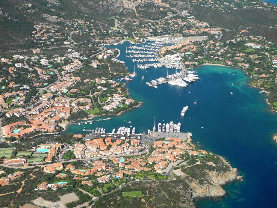
And here’s Porto Cervo. Many expensive and shops and a few expensive restaurants. Not much more.


Some more impressions from day 2 of our stay in Sardinia.
The beach at Golfo di Pevero.
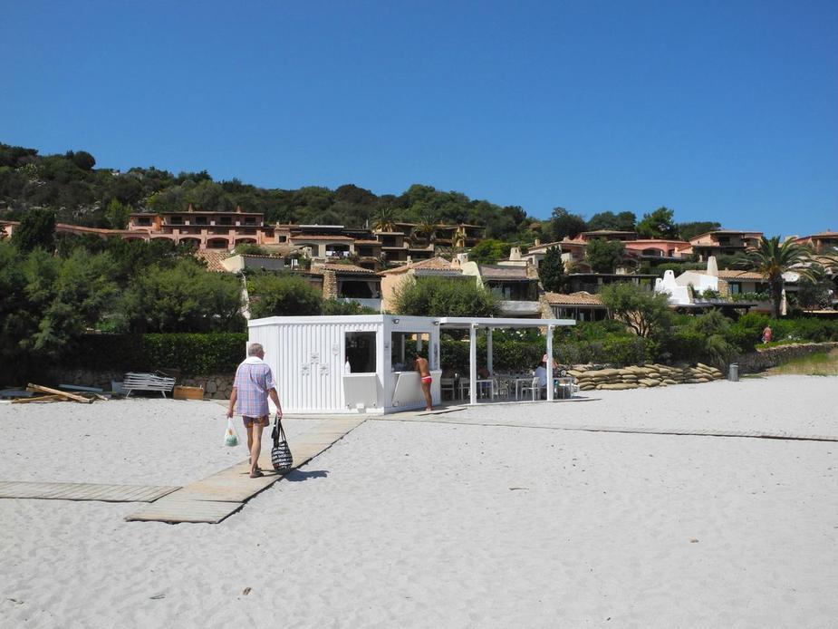
A different kind of “Beach Hut Café”.
Park at Pitrizza.

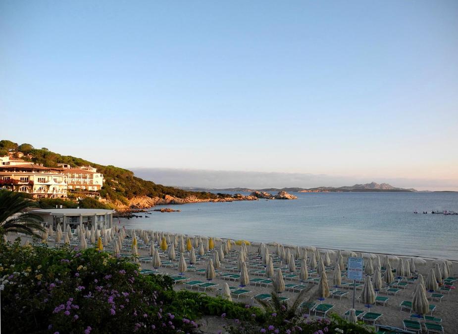
Baia Sardinia (this is where had had our hotel).
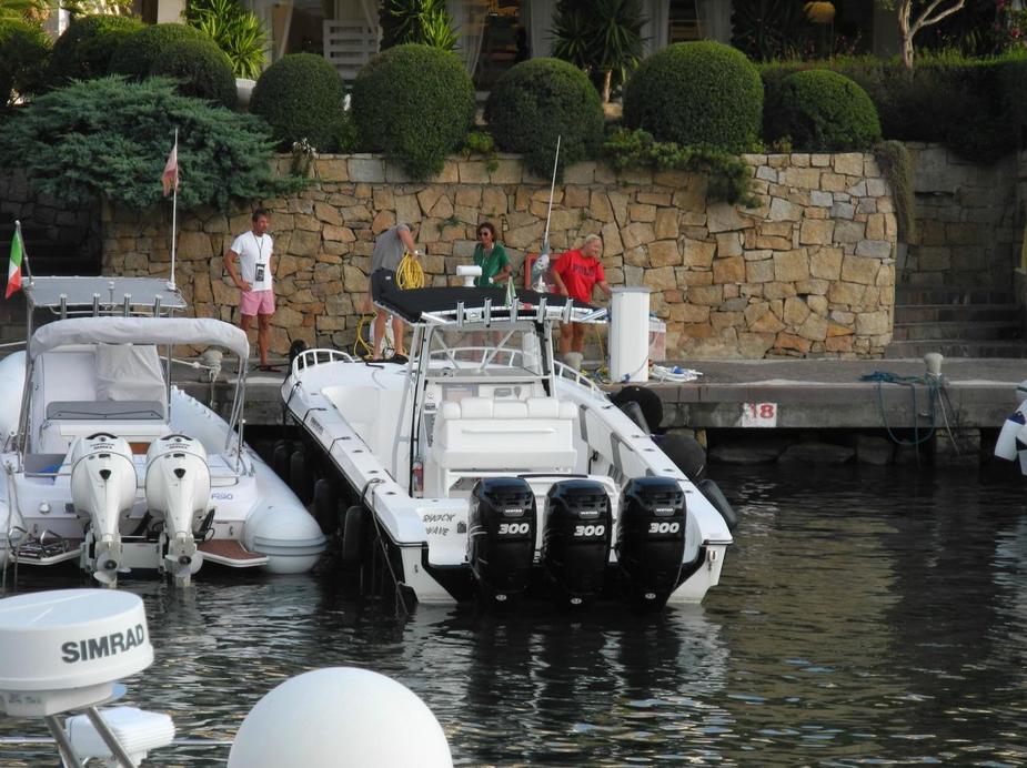
Back at the airport in Olbia the next morning, the handling was again, seamless. Really can’t fault the people at Eccelsa Aviation. The Fees for two and a half days came to 79 Euros in total. The handling people clearly have a heart for small GA.
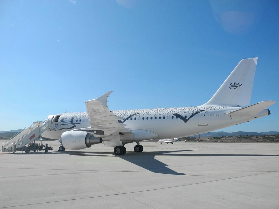
Some aircraft spotting was in order. LX-GVV, an A-319 operated by Global Jet Luxembourg.
Lots more heavy metal still there.
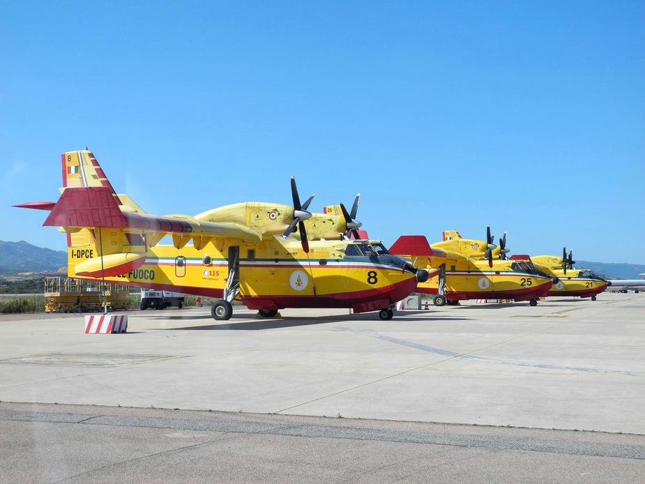
I-DPCE, one of several Bombardier CL-415 waterbombers at Olbia.
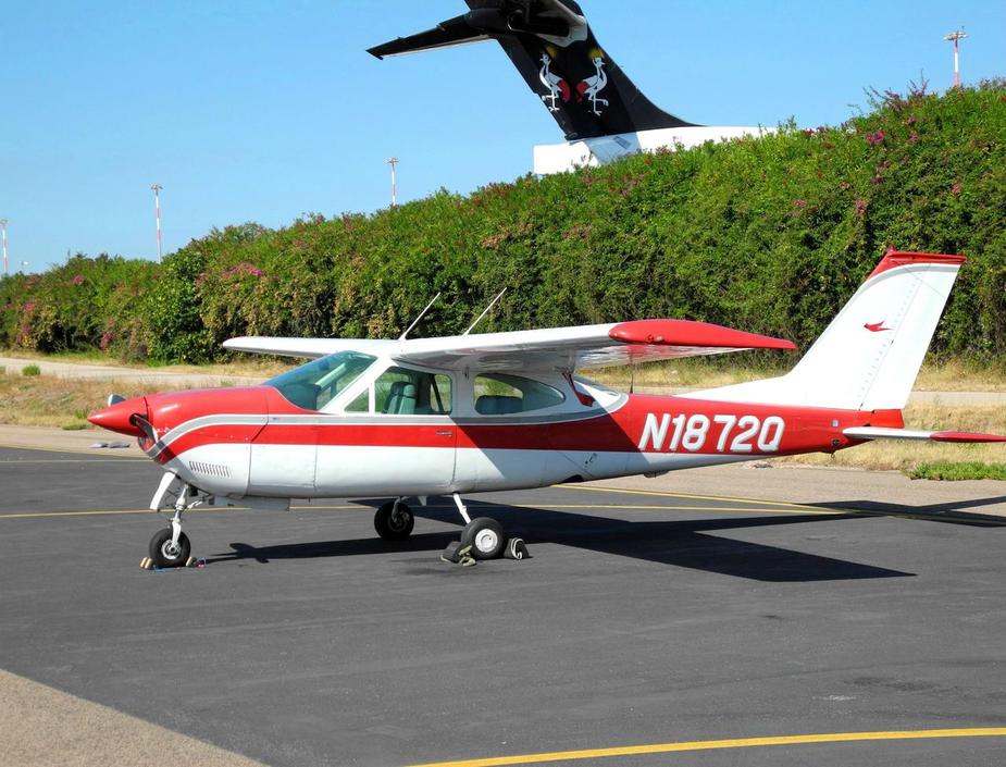
Once back at Apron 3, we saw that we had been joined by an (N-reg. – what else) Cardinal RG. I really like these.
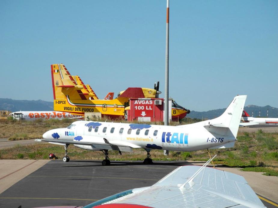
I-BSTS, an old Metro III, once operated by ItAli, parked there without engines. Slightly further back, one can see the giant sign “AVGAS 100LL”. The fact that they still display this sign feels like pure sarcasm, considering that the airport just simply stopped selling it a few years ago!
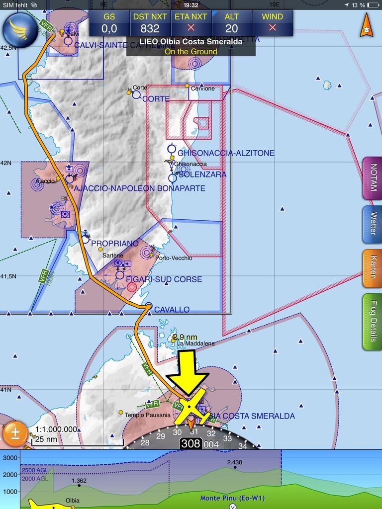
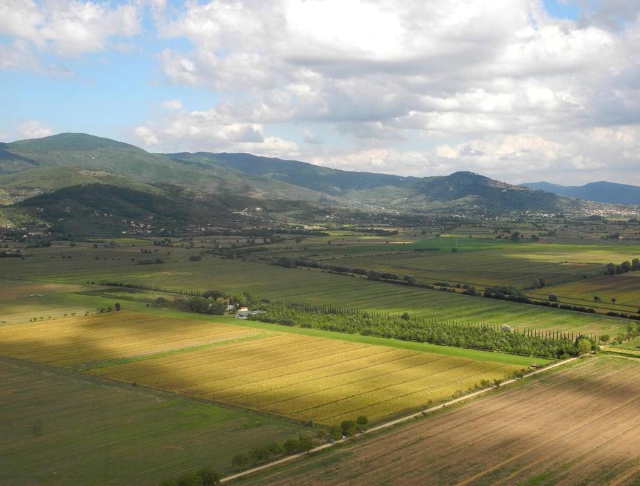
Oh, I forgot to mention what our plan was. Basically, the idea was to head for the coasts of Tuscany and check out a few airstrips there. Our planned stop for lunchtime was Aliscarlino airfield, a few miles east of Follonica. Here’s our planned route (didn’t file a flight plan):
Ligned up for departure:

Turning northbound and looking back at the airport and the airline terminal and apron. Olbia most be one of the few airports in Europe wich have both significant GA and significant airline/charter traffic, but where GA still plays the first role.
Apron 2 and the GAT.

One more look at Olbia city.
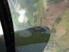
This is Golfo Rotondo from 4500 feet.

The Golf Course at Cala di Volpe.
Liscia Ruia (lunch on day 1 of our stay on Sardinia).
The beach at Golfo Pevero (lunch on day 2 of our stay on Sardinia).
And here’s Porto Cervo.
We then turned northeastbound towards our destination. VHF comunication is always a bit of a problem is flying low between Sardinia and Italy, but we managed to maintain contact with Olbia until about the midway point and then managed to tak to Roma Information (albeit only with the squelch open). Also, we eventually had to descend back to 2500 feet due to the dreaded Roma TMA.
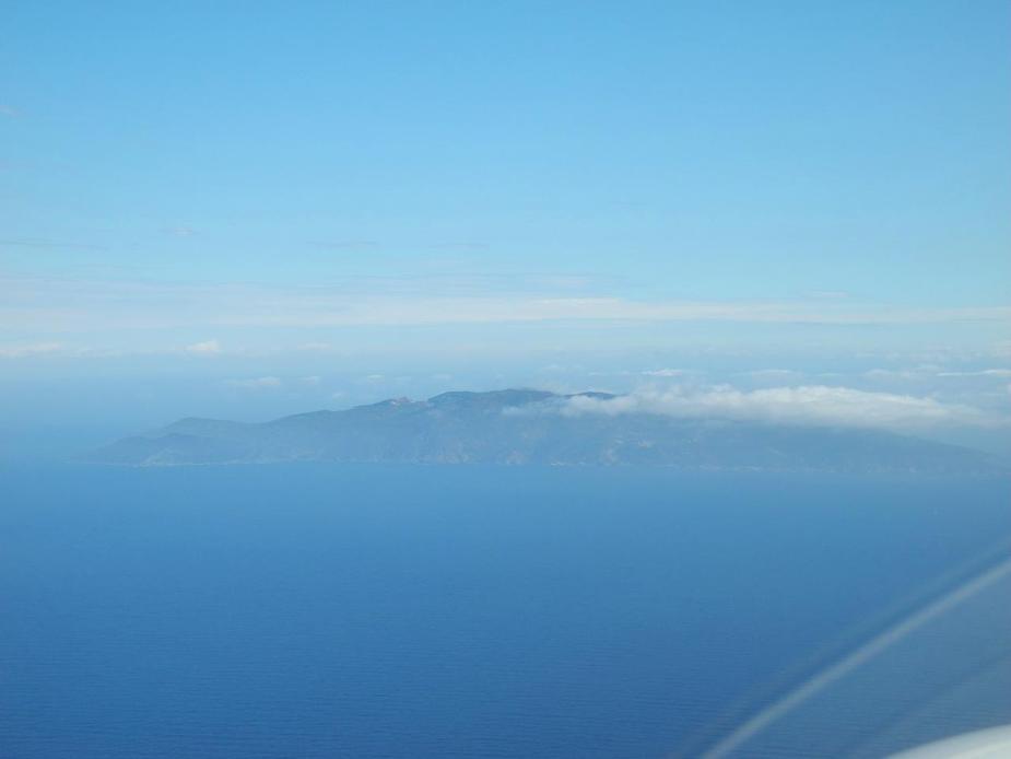
In the haze, here’s Montechristo Island, north of our track.

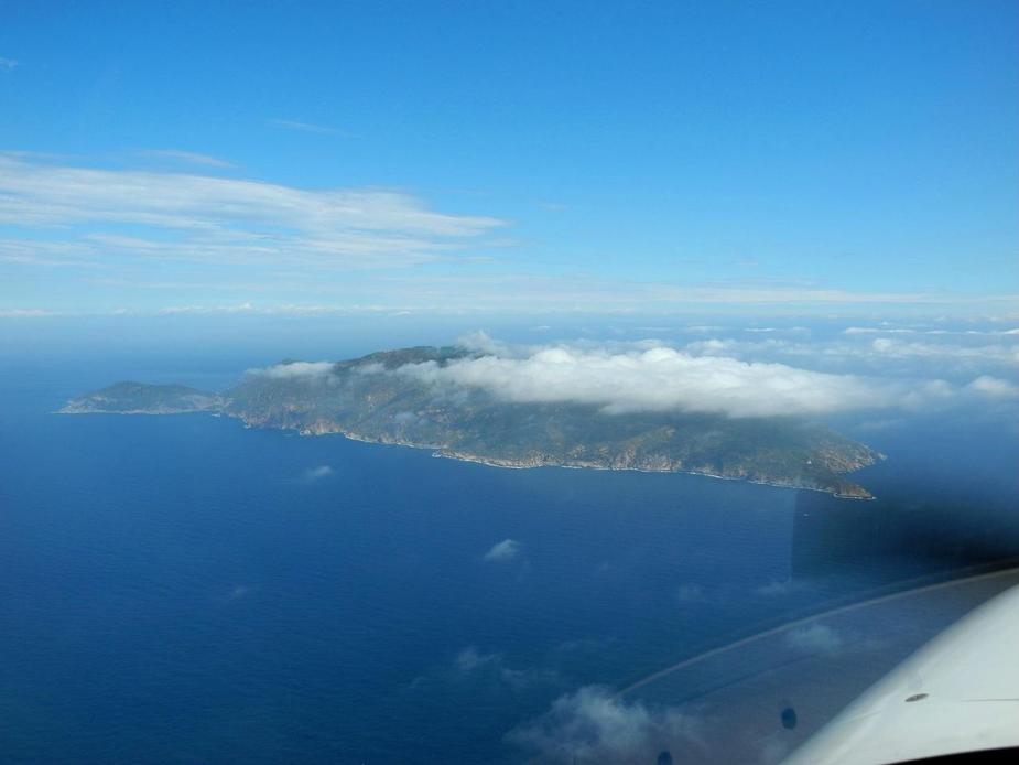
And there comes Isola del Giglio, just off the west coast of Italy.
A slightly better view. Giglio (aka “Schettino landing” ) is where Costa Concordia crashed two and a half years ago.
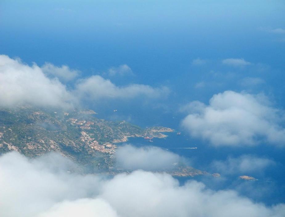
And here you can see the bay of Giglio Porto. If you look closely, one can still see the support structures that have been erected in the water during the removal project. (I couldn’t go any closer, since there was apparently still a NOTAM in force, prohibiting overflight of the place.)
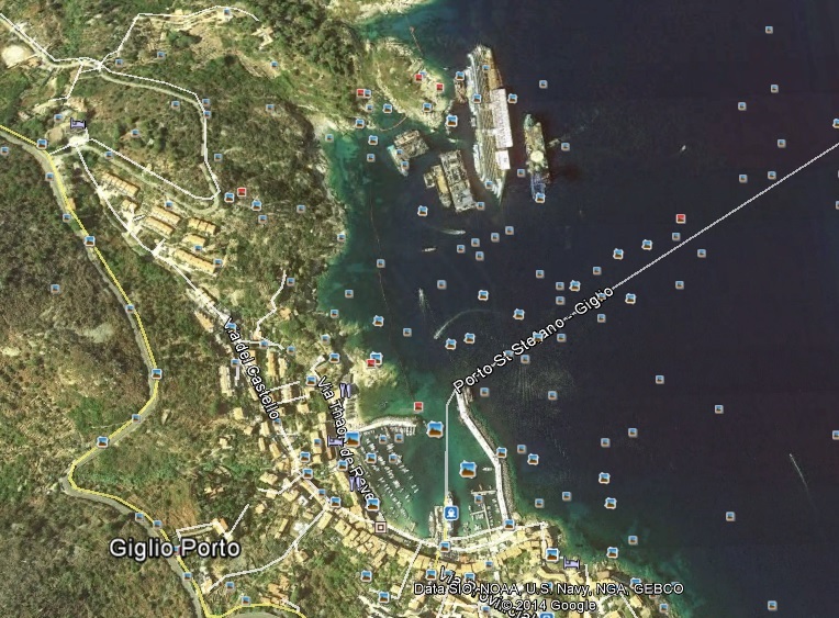
By the way, Google Maps still shows the wreck:
The Monte Argentario, slightly covered in cloud.
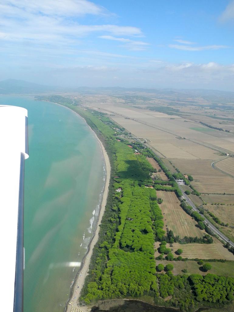
Crossing the coastline, north of Orbetello. Those stretches of pine trees are typical for the coast of Tuscany.
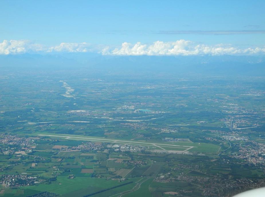
We made a short stop at Costa d’Argento airfield, just to check it out. It’s more of a paradropper’s place though and we didn’t have much time to stick around anyway. Here’s the runway:
After turning northbound again, here’s one of the three headlands reaching out towards the Monte Argentario.

The rest of the flight was along the coast, under clearance from Grosseto Approach. Here’s Castiglione della Pescaia.
Just south of there, slightly inland, is the Aviosuperfice Punta Ala, which is a beautiful, albeit tricky airfield. I landed there in 2010 already, and wanted to check it out again. The runway is 800 metres long, but has a slope. Also, it has a 100-foot high (!) power line just off the runway end (and rising terrain towards the other side), so one has to land downhill and take off uphill, towards rising terrain. Here we are on right hand base:
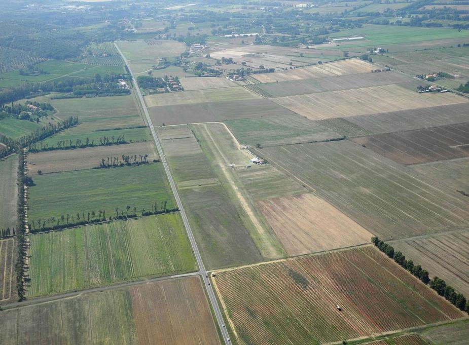
The runway was quite OK. It has been reported to be bad in spring though. We took off again without delay. Our destination, Aliscalino, was only about 5 miles south.
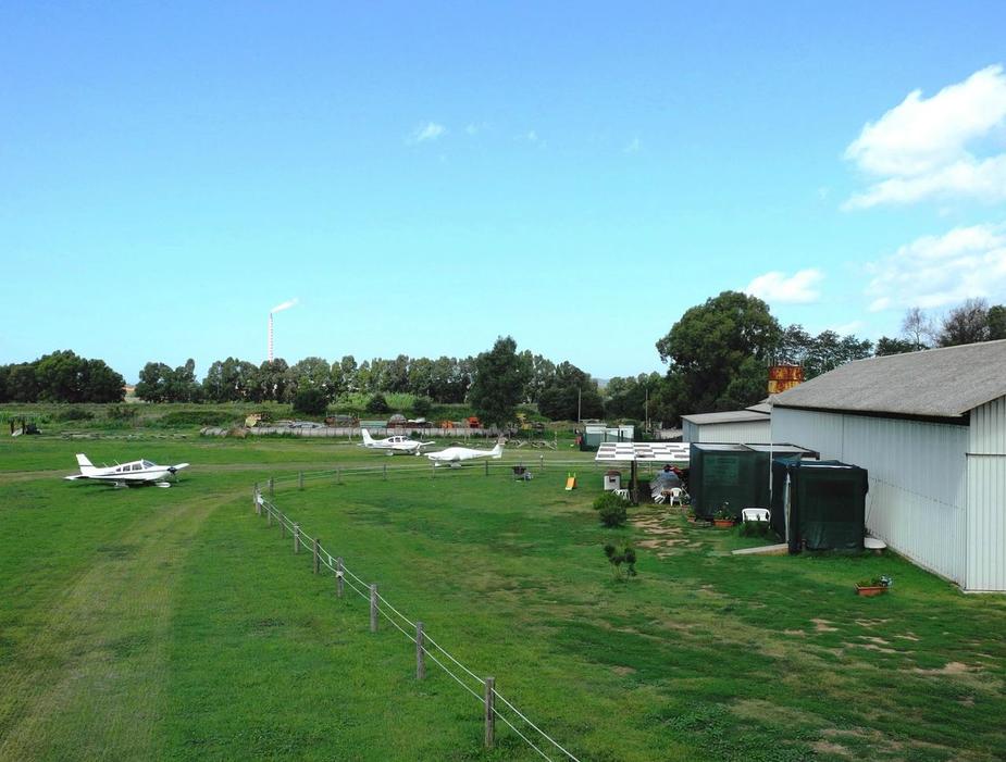
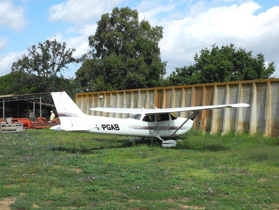
Here we are, overhead. The runway is 650 metres long with minor obstacles on both sides. No problem for the ’22.
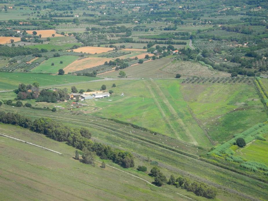
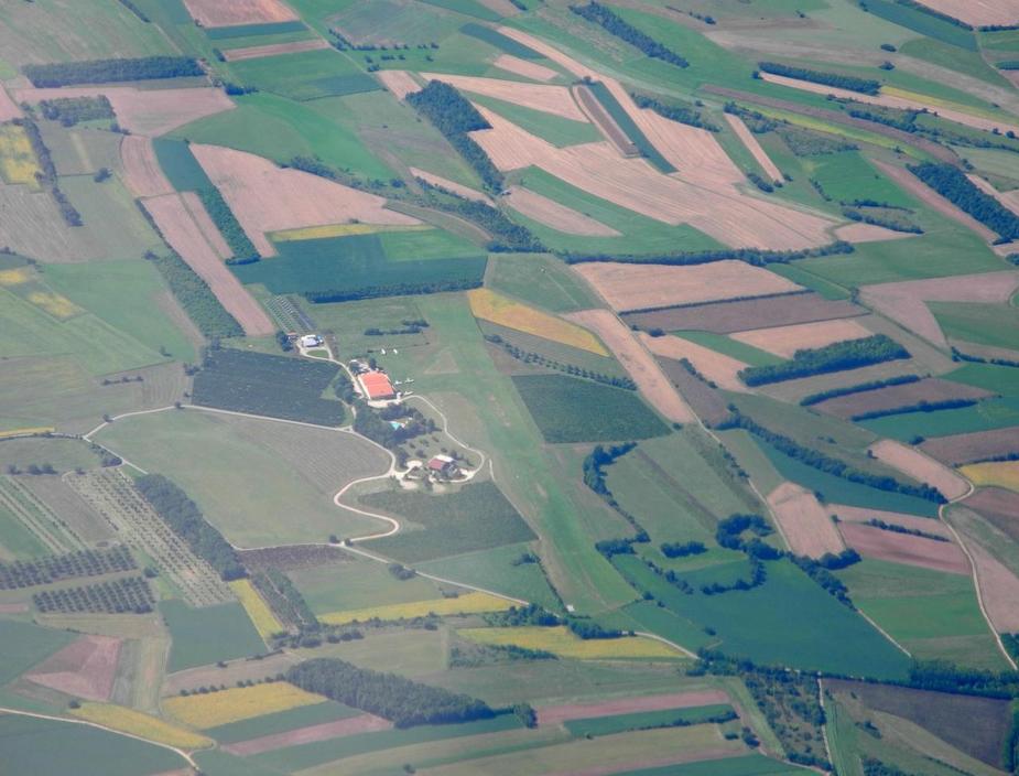
There’s an interesting bit of story behind this airfield. This place used to be nothing but corn fields until four years ago. However, farmer Claudio was struggling to produce a decent income from agriculture, and with the future looking dim, he decided, together with a few partners, to get rid of the farm, open an airfield and offer food and shelter for pilots. He’s is not actually a trained cook, but he knows ho to do stuff that just tastes good.
The airfield is in still in the middle of that transformation process and it does indeed look more like a farm than like an airfield. But that’s what makes it special, somehow. There is an old farmhouse from the 17th century on site and he is now working full-time refurbishing it to make space for a proper restaurant and guesthouse. In the meantime, the restaurant in nothing more but a caravan with a long table (for 30 persons) outside.
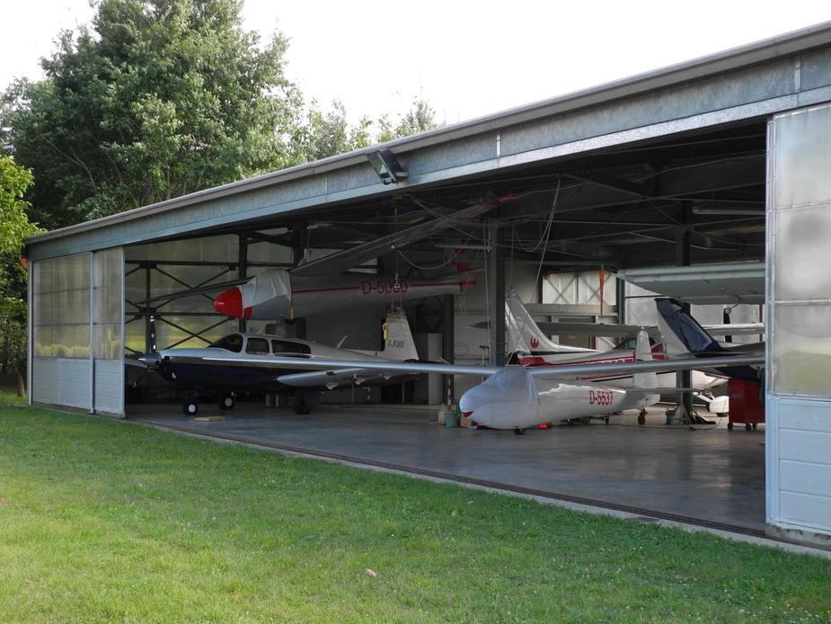
The hangar, the “restaurant” and the parking.
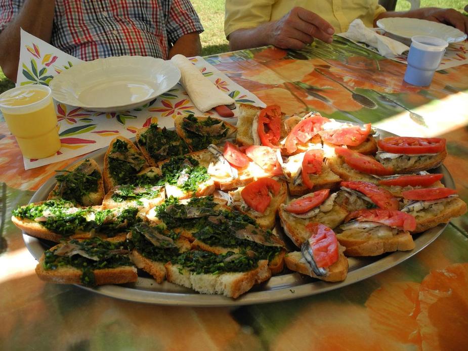
Some simple, but fantsastic bruschette.
Cake…
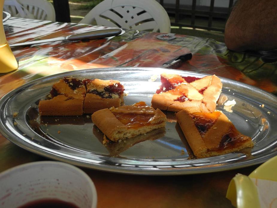
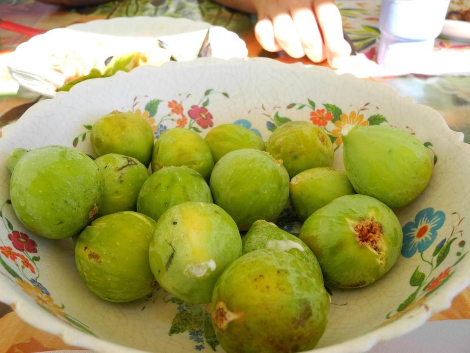
Fig (own harvest)
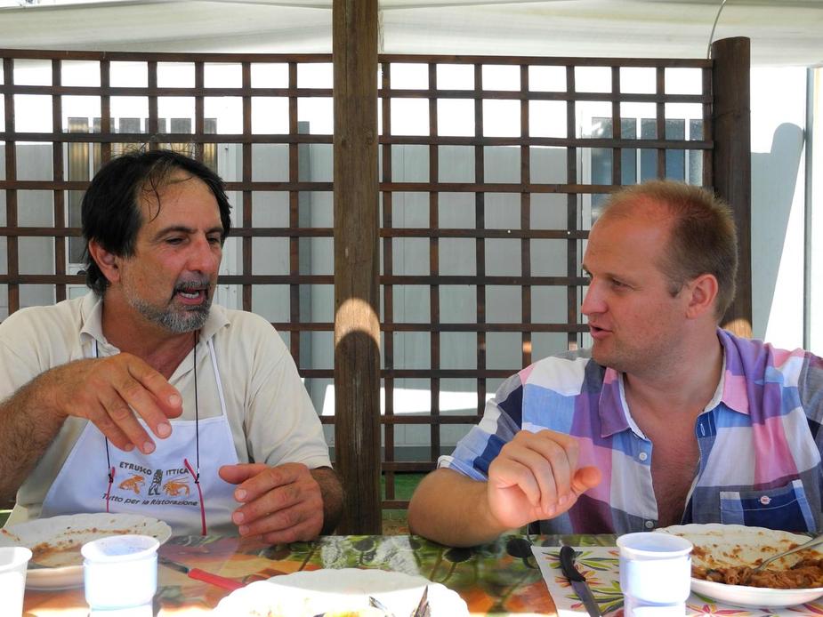
And here’s our host, Claudio, in lively discussions with Boscomantico on subjects such as Schettino, Renzi, etc. Thanks a lot again, Claudio! We had a really good time.
On a more serious note, this wonderful place (like many others) has essentially one “flaw”. None of the group of people running the place speak any English. It is therefore a world which is indeed somewhat barred for people who don’t speak a word of Italian. I pointed this out to Claudio and he said he will try to install a person as a PPR contact that can at least answer the phone and give some information / answer some first questions. In my experience, that would be sufficient; once one is there and “face to face”, it is much easier to comunicate even if the people don’t really have any language in common.
On the other hand, it does seem to work somehow, even now. The proof was in the hangar: a G-registered RV-10! Claudio said it was a Brit spending his holiday in the vicinity.
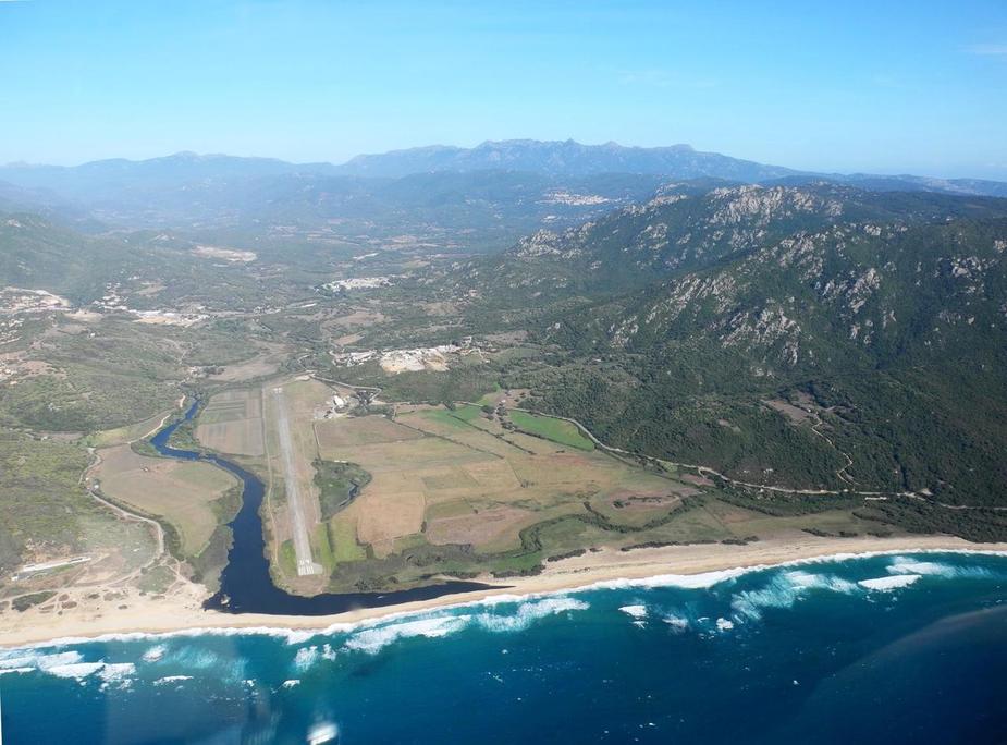
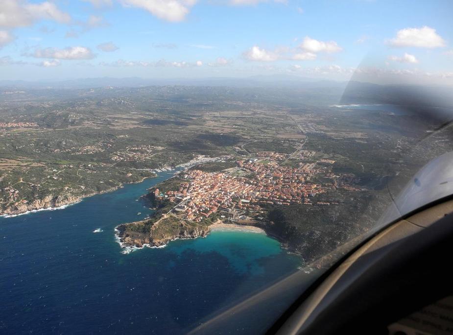
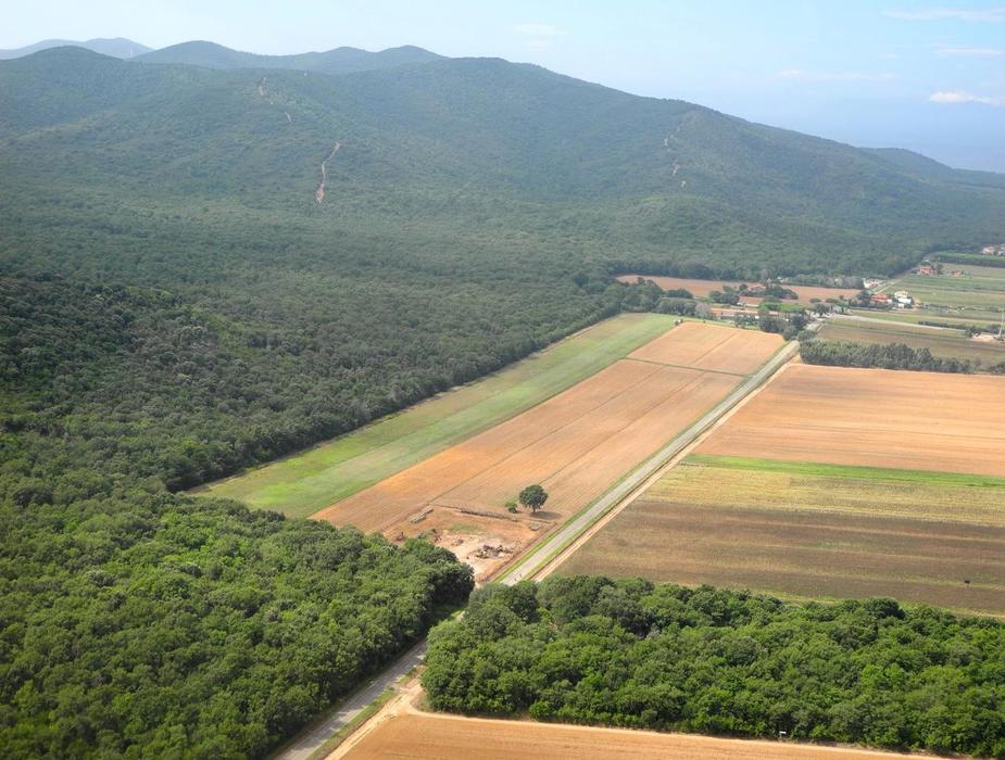
Early afternoon, we took off again for our final destination of the day, Serristori airfield (LIQQ). That is merely about 50 miles east of Scarlino.
A new motorway project well underway…
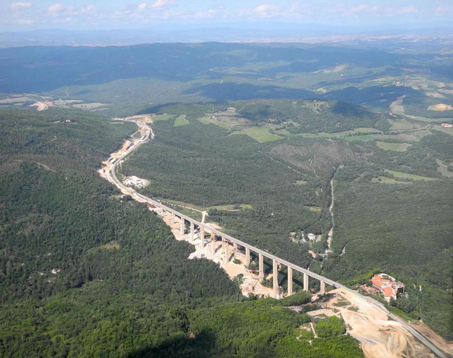
Here we are, reaching the Valdichiana in eastern Tuscany.

Before our landing at Serristori, we decided to make a stop at Montecchio airfield, just a few miles from the twon Castiglion Fiorentino. I had visited the place in 2007. At the time, it was owned and run by an elderly retired Alitalia captain who was still flying his own Falco F-8L, I-TRIP. He obviously did speak good English.
Here’s the strip:
Sure enough, he was there, just preparing a glider for another winch launch. Unfortunately, his Falco was written-off last year after a crash in a soft grass airfield. I noticed he was still very sad about it (he owned and flew the Falco for 43 years…).
Nevertheless, the airfield still hosts a variety of very interesting aircraft. Not only the Mooney and the 182 seen here, but also a PZL Wilga, a Yak-52 and even a 70% replica of a Mustang.
Time for our five-minute flight to Serristori. Here we are joining downwind for runway 34. The asphalt runway is only 500 metres long, albeit with a 100 metre grass extension.
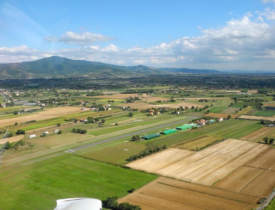
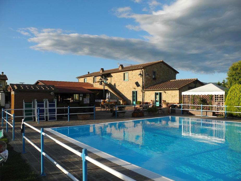
Serristori is one of those places which has the accomodation right next to the airstrip. Very convenient after a long days’ flying. See here for the website.
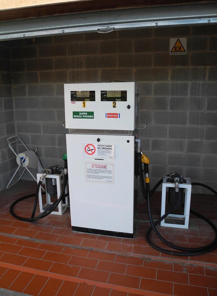
They also have a pump both for Avgas (3,10€) and mogas (2,20). However, we didn’t need any, since we still had plenty from our top-off at Calvi and planned to stop in Slovenia the next day.
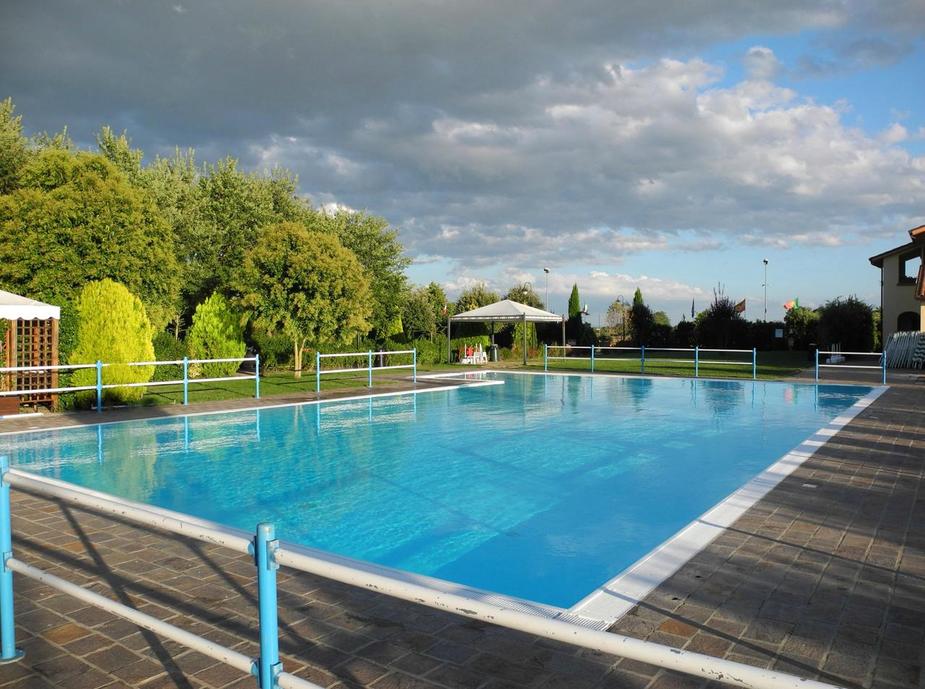
The pool of the Residence is a delight. As is the restaurant, by the way.
The weather was, too…
Day 5 was the last of this trip. The plan was to fly back to Luebeck with a fuel and lunch stop at Portoroz (LJPZ) in Slovenia. This meant we would have to cross the Adriatic Sea – roughly from overhead Rimini direct to Portoroz.
The nice thing again about these places is that one doesn’t lose any time, neither in the evening, nor in the morning. After breakfast, it’s just a matter walking up to the aircraft and leaving. One can sleep until 8 and depart at 9…
After lift-off, we turned northeastbound, direct towards Rimini and called Roma to activate our VFR flightplan to Portoroz. There was a lot of cloud around and below us as we climbed to FL65 (even levels for northeastbound VFR in Italy).
However, the nice thing about VFR in Italy is that if one is well clear of the two class-A TMAs (Milan and Rome), one can essentially fly all the way from GND to FL195, and thus have a lot of flexibility. One obviously needs clearances to cross the various CTRs, but that tends to be very straightforward. We called up Romagna Approach (Romagna “covers” the airports of Rimini, Cervia and Forlì). Here we are, just entering the CTR.
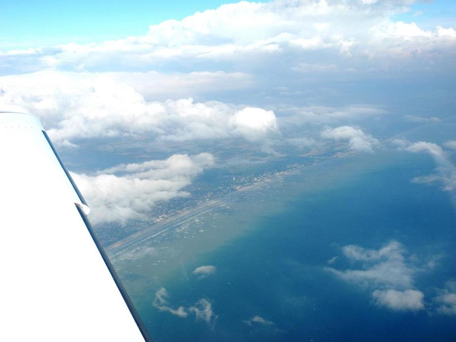
Leaving the coast, near Cesenatico.
We then entered Zagreb FIR and dealt with Pula Approach to stay clear of the “Speedy” military area. Already in the descent, approaching the Istria Peninsula.
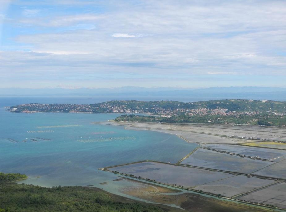
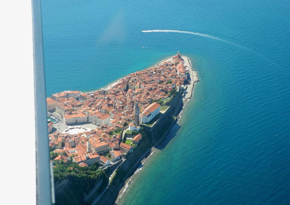
In the foreground is Umag (Croatia), in the backgound Portoroz and Piran.
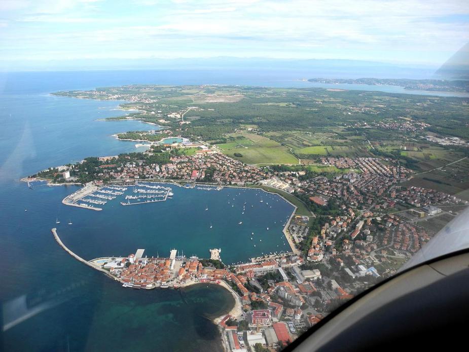
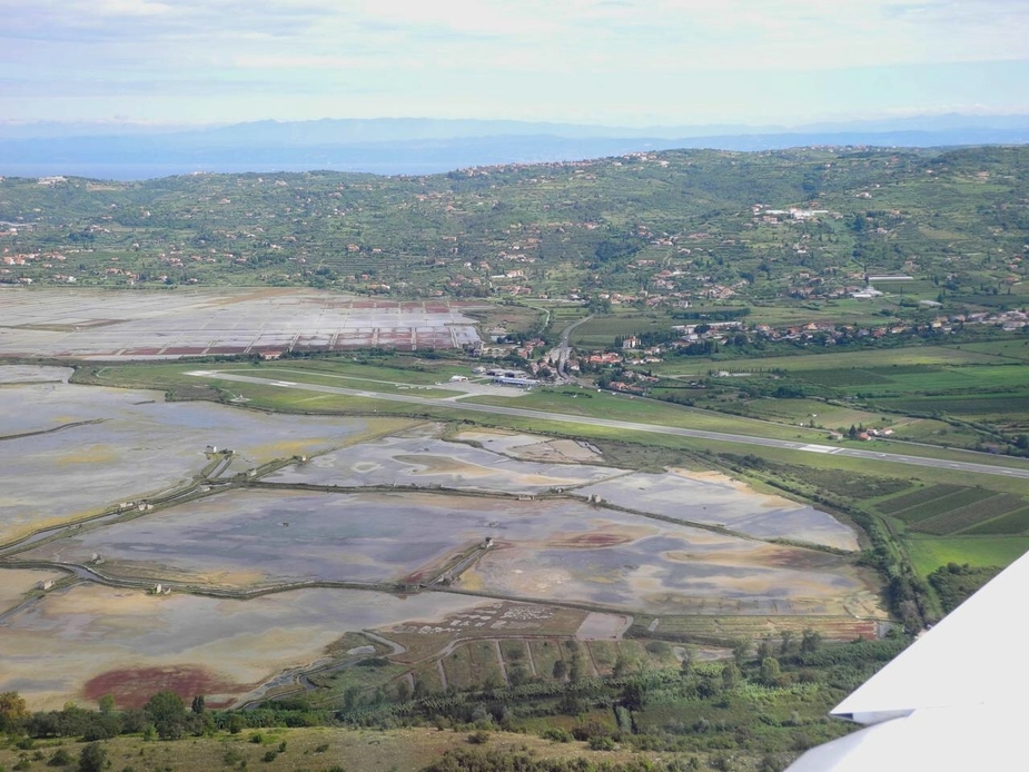
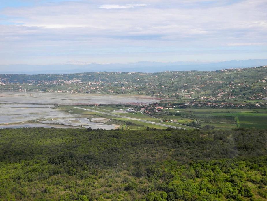
Portoroz, Piran and the characteristic salines.
This was first time I flew the lefthand pattern for runway 33 at Portoroz. It’s big fun, since the downwind is over a high ridge, so one ends up flying at about 300 feet AGL…
..and during the base leg, one briefly loses sight of the runway.
Final. 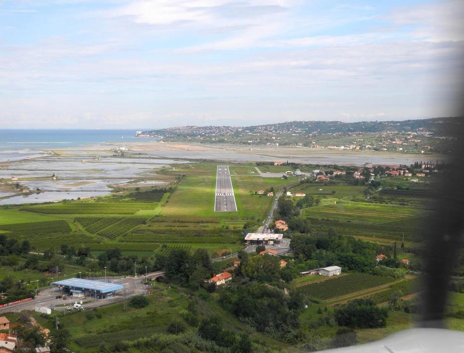
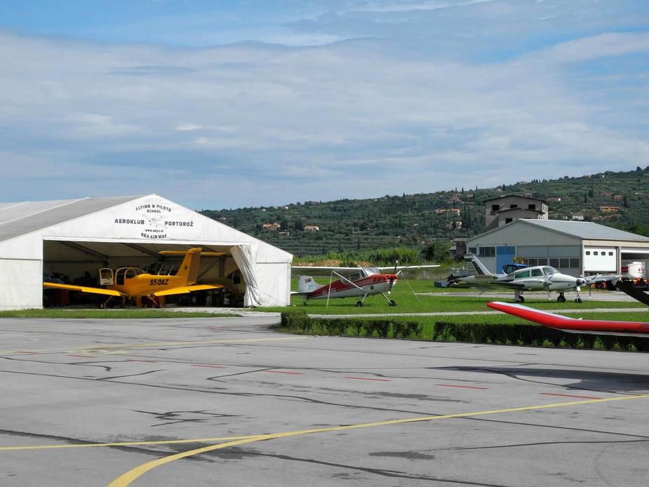
After landing, we took on 180 litres of Avgas and parked on the ramp. Always a nice mix of aircraft at Portoroz…
I consider Porotroz as the best (IFR equipped) GA-only airport in Europe. Cannes doesn’t hold a candle as far as their attitude to service, friendliness and their pragmatism are concerned.
Getting ready for another swim at Piran.

Piran. 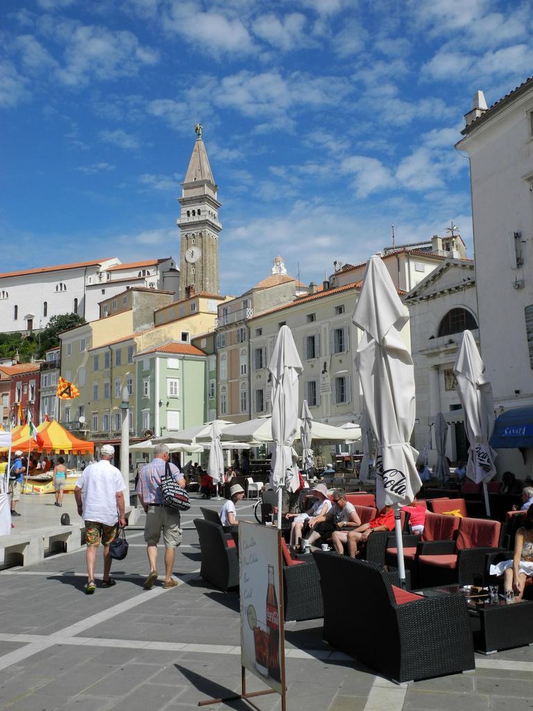

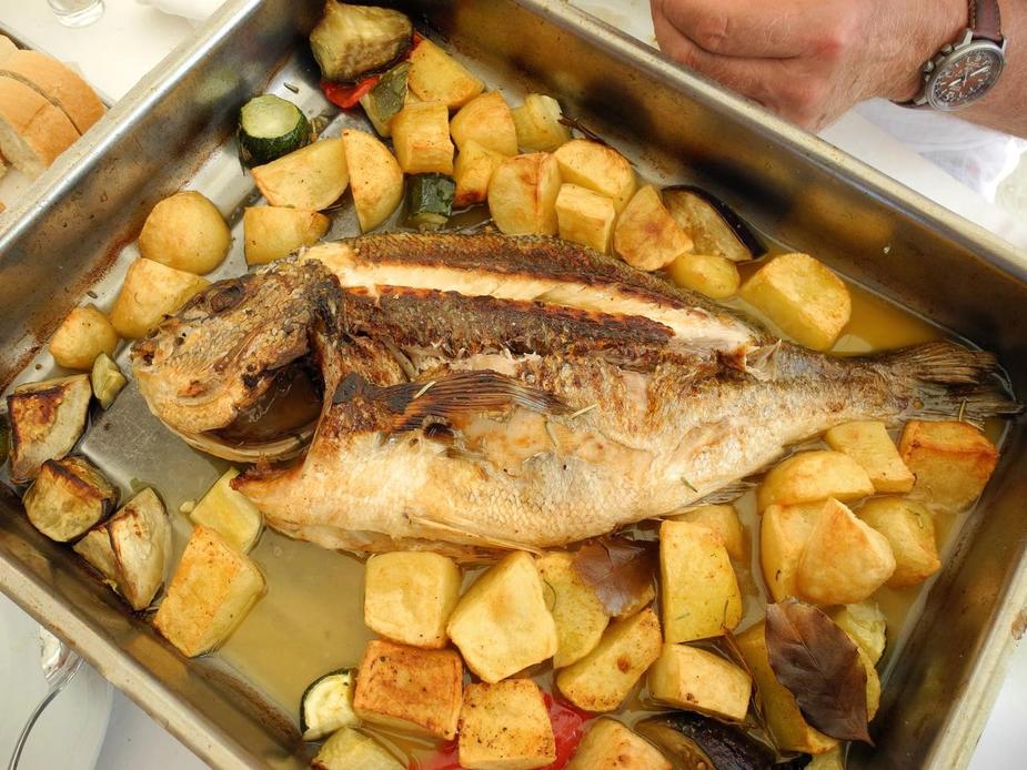
One of the highlights of every visit to that part of the Adriatic is lunch at "Ivo"’s Reataurant in Piran, and a big, fresh gilthead, prepared in the oven (not on the grill). Magic!
Well, I guess we couldn’t complain.
But another highlight was still to come, the flight back to Luebeck. The weather on that Thursday was just perfect, on the entire route. IFR flights from Portoroz to the north have one drawback: it’s either a big detour to the west (via Vicenza and Bolzano)…
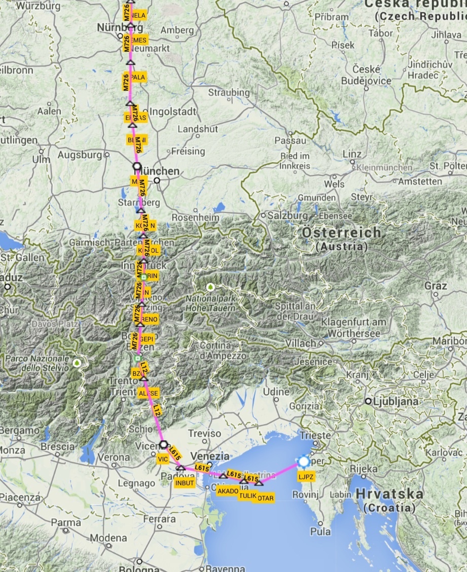
…or a big detour to the east (via Graz and Wien)…
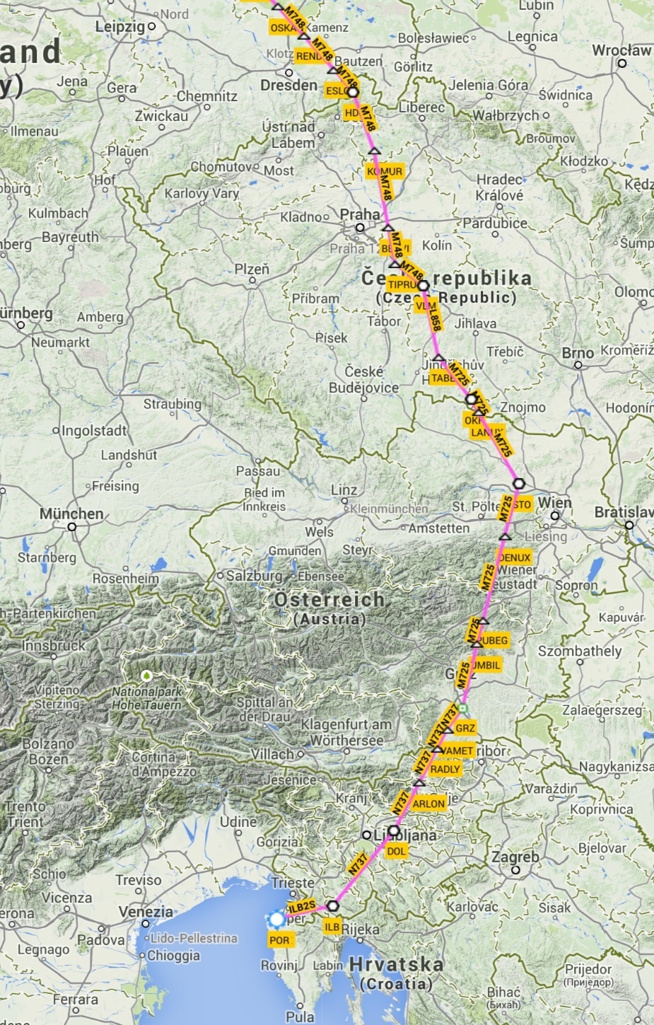
…with, in my experience, little chance to negotiate major shortcuts.
This is how I came up with this flightplan, a straight line. VFR. (The waypoints have been added just to make the routing compliant with the various countries’ rules; the plan was obviously to just fly direct).
After departure from runway 33, we flew straight out via PN1, which is where I managed to take this beautiful shot of Piran:
The city of Trieste to the right, as we climbed to FL105.
Here’s Ronchi dei Legionari airport (LIPQ).
And down there is Premarriaco – San Mauro airstrip.
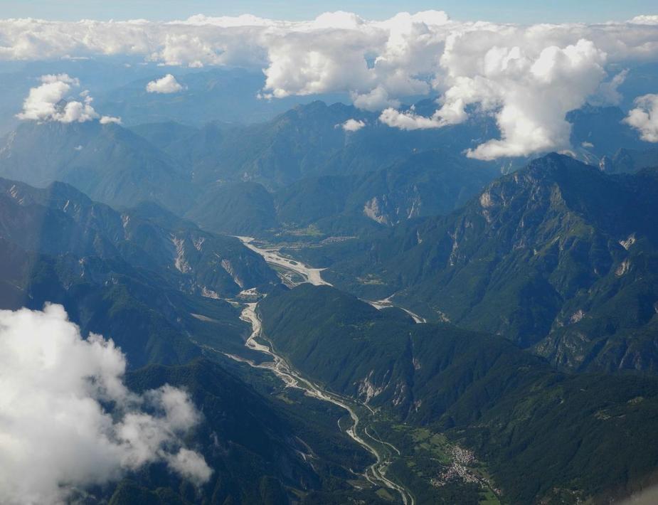
Tagliamento Valley, near Gemona.
Shortly, after we crossed in to Austria. This is the Gailtal.
We then contacted Salzburg Radar, for crossing of their CTRs/CTAs, which was approved without any rerouting at FL110.
Here’s the airport and the city, all in one nice view.

The guys from Salzburg were great. Even without me prompting, they coordinated with Munich Radar to get me clearance for the airspace Charlie (which is all over Germany above FL100), so we could continue our flight at this perfect level, just above some scatted CU clouds.
Here we are, just about to cross into Germany, just where the Rivers Inn and Salzach join.
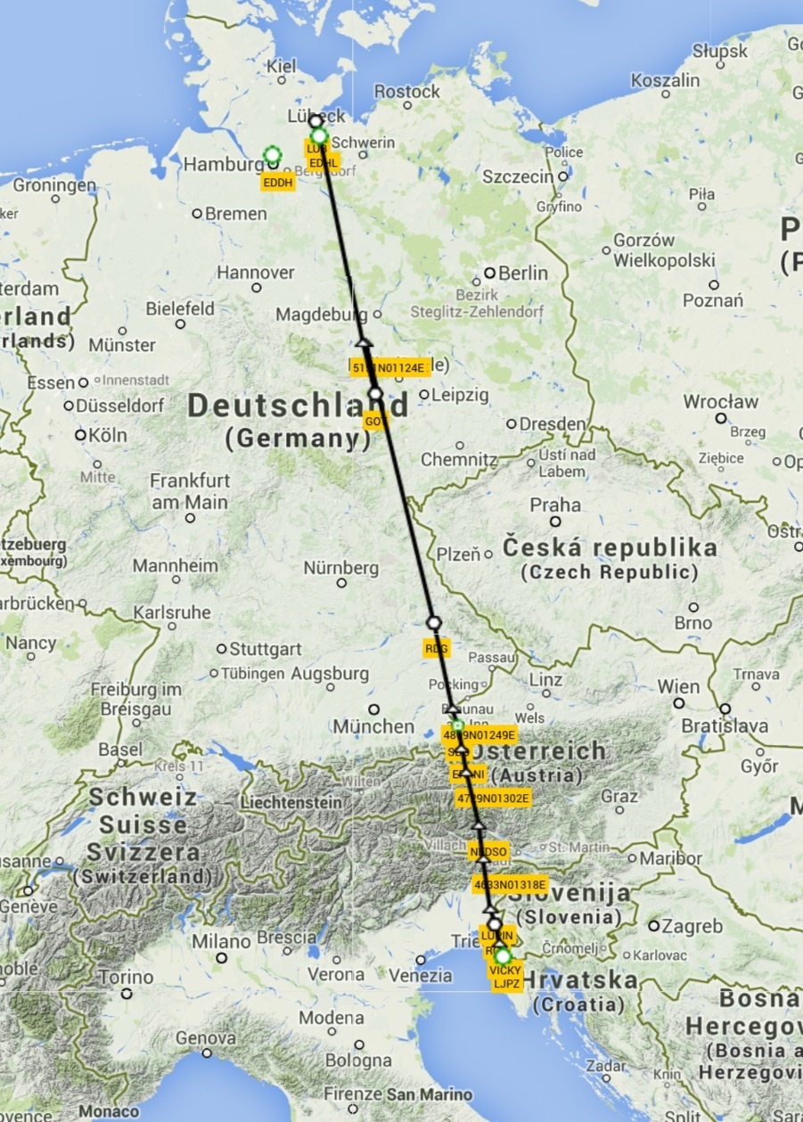
Our requested and obtained clearance from Munich was direct Roding VOR (RDG), direct Gotem VOR (GOT). This happened to be a totally straight line inbound to Luebeck, so for the fun of it, I dialed in EDHL on the GNS430 and hook up the autopilot. So there we were, just crossing the border from Austria and flying direct to our destination, some 340 NM away. All on a clearance, in controlled airspace!
We later had to comply with a very slight rerouting request by RADAR due to military airspace, but otherwise, it was a straight line. Straubing airport.

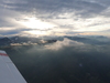
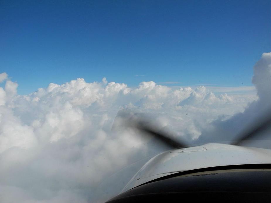
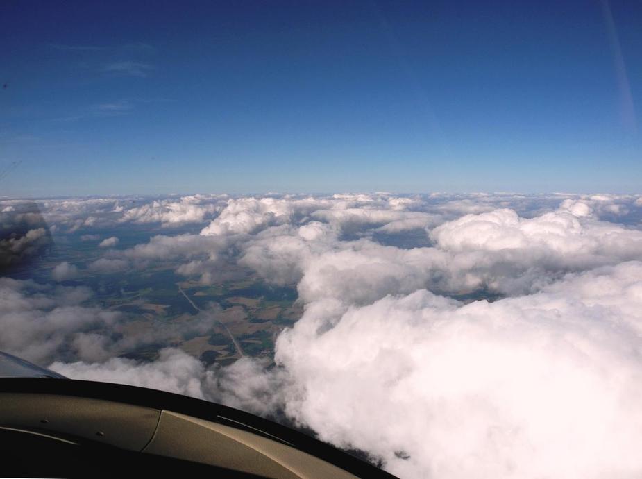
Sometimes, I just ike fotographing clouds. Mind you, there was nothing more interesting to see in that area!

For the rest, we passed our time sending text messages to friends, using the ADL.
Magdeburg passing by.
Some haze towards the west.
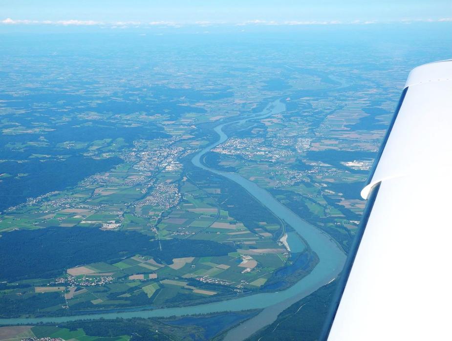
The descent was started about 75 miles out from Luebeck, with a descent rate of 400 fpm. Here we are, almost home, crossing the River Elbe.
A very beautiful natural reserve in Northern Germany, the Schalsee.
Ratzeburg (home of our passenger).
Flying along the western shore of the Ratzeburger See, towards the righthand downwind for runway 25 at Lubeck. The runway can just about be seen on the very left.

Landing was uneventful and the total flight time from Portoroz came to 3 hours and 15 minutes.
Needless to say, an excellent little trip.
Great write up and photos, thanks.
I was sad to learn that I-TRIP has been written off, it was only the second Falco built I believe.
Very good, Cirrus need to appoint you as their marketing VP.
It reminded me of the old Flying articles in the sixties when they would flight test the latest Skynight with a trip down to the Bahamas.
What some people call “a little trip” …
Thank you for the great report. You were lucky with the weather. In Austria/CSEE/the Adriatic, it was definitely the worst summer since I took up flying in 2005.
A great report of a great trip that demonstrates the fun and utility in GA. Good photo’s too.
Excellent trip report!
Must be awesome to have an aviation minded father and make trips together :-)
Interesting to read how you mix IFR and VFR to get the max out of GA flying.
Do you carry the VFR maps, or are you just using Skydemon?
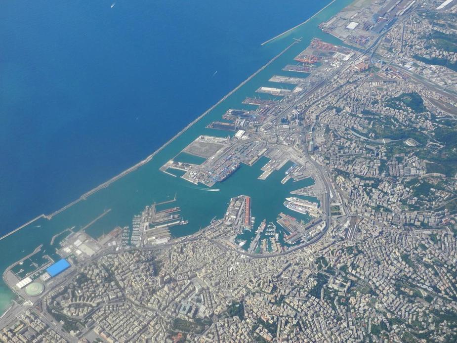
Great trip! Btw the ‘Concordia’ is right there in one of your pics of Genoa, waiting to be scrapped.
As for food in Italy – I have yet to meet an Italian (no formal training required!) – who cannot rustle up some fab dishes. And yes, I lived there for a while…
Just took a closer look at the picture of the Cardinal. It lives in the hangar directly opposite of mine in LOAN.
Very nice trip report.
I have never crossed the Alps.
The crossing of the Alps at FL140 with 2000 feet spacing to the mountain tops – any risk of down draft, mountain waves etc. at that height?
@Stick,
to be precise, I-TRIP has not yet been “officially” written off. It’s in the hangar and the owner showed it to me. The owner still has some hopes that it will fly again, but honestly, I don’t think so. The wing spars are cracked. The owner says he will require help. both in terms of parts and craftsmanship. Moreover, this requires an engineering, a project, to come up with a solution that’s acceptable to the italian CAA (it’s a certified aircraft after all). I think it won’t fly again.
yes, having flown the Cirrus for fourteen years now, I think it’s safe to say I’m convinced of it. But marketing? Nah. I’ll let other people do that. To the contrary, I know quite well which are the weak points of the aircaft (and I name them when somebody asks me).
yes, I know. My second home is Lake Garda in Northern Italy and the waether has been very poor this summer. On the other hand, it’s been fantastic in Northern Germany, Scandinavia and especially in the Baltic region (see the report of my flight to Palanga).
However, we weren’t really “lucky” with the weather here. Remember this flight was originally planned to go to southwest England. This had to be scrapped. The weather however looked very good for Central Italy and that’s when we decided to go there. So it was more about watching the weather and changing plans accordingly.
thanks!
@172,
are you sure? I can’t see it. Can you point me to where exactly it can be seen?
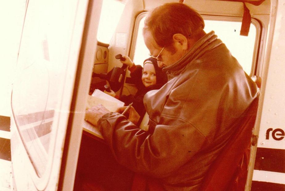
not only is my father aviation-minded. We share it all, the flying hours as PIC, the costs and the passion. It really is a great “setup” and I am very grateful.
My dad taught me the basics of flying when I was a small kid. He has lots of experience. So far, he also has more hours than me, but I’m slowly catching up.
Here’s an old photo (sorry – really poor quality) of me making my first steps in the 150: