The dangers of night VFR
A Piper Pathfinder leaving from Geneva to Normandy has crashed last Tuesday at about 22h CET, 10 minutes after departure from Geneva.
Impact site was located at Col du Sac, ca. 1300m altitude (incidentally the bottom of the TMA as well).
Instructor and pilot escaped only with broken bones – extremely lucky.
In a pure “WTF” moment Skyguide (ATC) said that it can’t comment on flight path as “it’s in France” (nevermind that it’s a couple km across the border in their coverage area…).
Oh wow, they are indeed very lucky. This one hits very close to home.
Technically the TMA only starts at 1000ASFC which they were below obviously but you have to wonder how much skyguide’s attitude towards strictly denying access to the TMA is a factor in this accident. I don’t think I’ve ever seen such a systemic refusal in this matter as Geneva FIS’ welcome line is systematically “Hello, identified. Keep out of the TMA”. Even Zurich will reasonably let you cross in certain areas.
Night VFR in this area is definitely very tricky in any circumstance. Most uninhabited mountains really do become invisible at night.
But, as always, who knows…
It does indeed start at 1000 ASFC but unless you’re a helicopter there is no way you can sneak through there – as you know, that cliff face is pretty steep. Not sure I’d ever try, not even in broad daylight.
That reminds me. After watching this video a few weeks ago, I decided it would be good to have a backup optical solution.
The only thing I could find that was cheap, portable and effective enough was a FLIR Scout Monocular.
My thought was, it might be located nearby like a flashlight, so if something did occur on a pale moonless night, I might be able to grab it, and at least get an eye on the ground before blindly trying to land somewhere…
Night VFR is not dangerous if you treat it as some kind of IFR and always remain above the MSA in an radius of say 10 NM. Assuming that you will be able to see terrain is not a good strategy when flying outside densely populated areas.
In Norway the planning minima for night VFR used to be 2000 feet base and 10 km, i.e. twice that of day VFR.
If Geneva refuse crossing the TMA which forces VFR traffic below 1000 ft, that really represents a safety hazard. I do not know whether circumnavigating is an option.
Shorrick_Mk2 wrote:
It does indeed start at 1000 ASFC but unless you’re a helicopter there is no way you can sneak through there – as you know, that cliff face is pretty steep. Not sure I’d ever try, not even in broad daylight.
Of course, you are correct. Not sure I’d try either…
Aviathor wrote:
If Geneva refuse crossing the TMA which forces VFR traffic below 1000 ft, that really represents a safety hazard. I do not know whether circumnavigating is an option.
You could always circumnavigate via Annecy and have French ATC clear you higher but it’s a pretty big detour. You could even consider via Lausanne but that seems like an even bigger detour. Taking the direct route is definitely extremely tempting in such conditions…
I don’t think it would be legal to fly in such an area without ATC clearance. You’ll need ATC clearance to get above 1000ft above surface level.
But remaining below that is in contravention of SERA, which requires a minimum altitude of 1000ft above surface or 2000ft above surface in mountanous areas, unless otherwise prescribed by the authority.
5005 (c) When so prescribed by the competent authority, VFR flights at night may be permitted under the following conditions:
[…]
(5) except when necessary for take-off or landing, or except when specifically authorised by the
competent authority,
a VFR flight at night shall be flown at a level which is not below the minimum flight altitude
established by the
State whose territory is overflown, or, where no such minimum flight altitude has been established:(i) over high terrain or in mountainous areas, at a level which is at least 600 m (2 000 ft) above
the highest obstacle located within 8 km of the estimated position of the aircraft;
(ii) elsewhere than as specified in i), at a level which is at least 300
So going below the airspace wasn’t a legal option. Looks like turning around in the event of no clearance is the only legal option.
The TMA lower limit is above surface and obviously they should have been able to fly higher. As it appears this was a night training flight and briefing altitudes should have been part of it. Also on VFR night would you not be with ATC rather than FIS?
A lot already FI should know the terrain there I imagine and also most GPS systems show terrain warnings. Quite difficult to understand.
They really were lucky to survive so let’s hope we can learn sth from them.
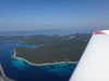
The VFR exit route from Geneva hugs the CTR and is wedged between the CTR and the mountain ridge on a 226 heading (parallel to the ridge give or take a few degrees). As you get closer to Fort l’Ecluse which is the VFR reporting point where you’re handed off from Tower to FIS you have to turn further south to avoid hitting the Jura. See the photo attached to the newspaper article – Fort l’Ecluse is the check-in / check-out point. Basically fly right around the CTR edge until you’re over the Rhone. Forget to turn left or turn too late and you fly straight into the mountain face.
The distance between the CTR and the mountain face is not enough to allow you to climb in the 1000ft TMA gap unless you’re a helicopter.