Hello,
I was planning a VFR flight this weekend from Teuge EHTE to Autun LFQF and back from Friday to Saturday or Sunday. What kind of sources do you use to get some insight in the weather for the longer term?
Happy flying,
Mark
For longer range you have either the US GFS model, or the European pressure charts of which I use the UK ones
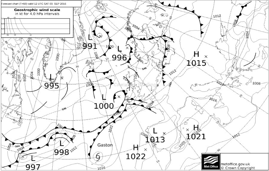
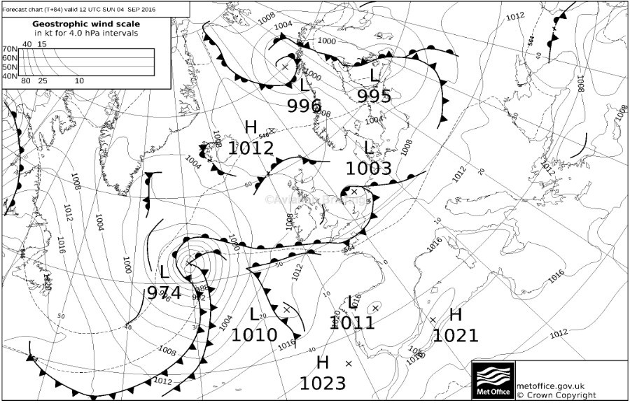
Sunday doesn’t look too great…
Thanks! I’ve been searching for those on the dutch aviation weather page of the Dutch Met Office, couldn’t find any.
It would be nice if there was a proper source for these, in the proper sequence. If you search here on
MSLP
you will find e.g. this
I use a paid site (avbrief.com) to get these charts. The basic sub doesn’t cost much.
MWIS is still there but they often offered older versions than one could get elsewhere (for a given date) which is a bit naughty.
Peter wrote:
Sunday doesn’t look too great…
Depends on where you will be 
I think a flight from Friday to Saturday is in the realm of possibilities. I’ll have a chat with the Met Office this evening and check again tomorrow.
Hi Bobo, I always use the Ogimet forecast maps for long term weather forecasts.
http://ogimet.com/tabla_pred.phtml?lang=en
Choose “Central Europe” → S(urface).
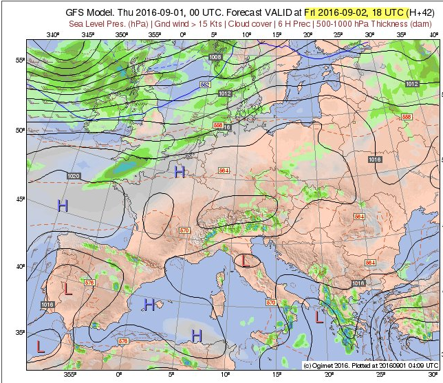
Friday and Saturday look fine. Sunday there is a low pressure system moving east that doesn’t look nice:

Thanks, looks very useful!
What does “Cloud Cover” mean in that Ogimet chart? Is a thin layer of cloud at 20,000ft shown the same as a layer from 100ft exending up to 10,000ft?
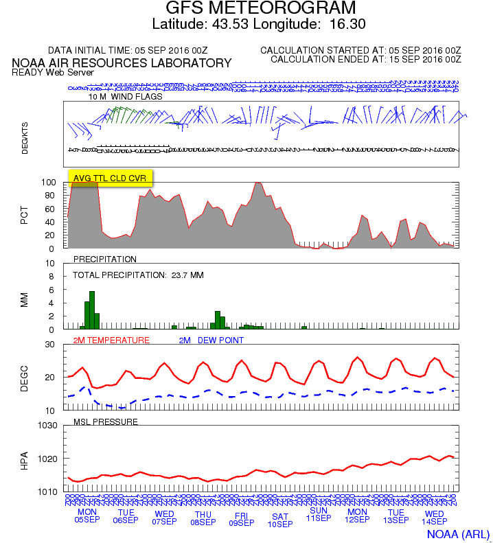
Yes; a good question! This is AFAIK how GFS works. For example this very old “GFS portal” – the READY site can produce the following, showing the “total cloud cover”
I don’t think those OGIMET pressure charts are useful because they don’t show fronts, so they require really expert interpretation.