I don't even care if my FMS switches to "APP" or not as this is an RNP5 procedure
Huh? You sure?
So more playing with that approach and the G1000 (as I was reading something unrelated which talked about DCT course mode which I always assumed was essentially OBS mode). I was trying to force an extended direct approach course from PETID on the course 087. Two ways to do it.

Jason C,
Two questions, what aircraft is the simulator for? What happens when you approach/cross the FAF? On the simulator I have, it indicates the approach is cancelled.
So, in summary, it seems like - with a "proper" GPS ;-) - on an approach like this, the VTF function will draw a line which is at an angle to the final approach course. Thus, when being vectored to final, ATC should vector you onto that leg (not onto the extension of the final approach). Right? Unfortunately, what happened in my case is that clearly I was vectored onto the extension of the final approach (something that apparently GPSes cannot display), not onto the dog-legged intermediate approach. Isn't it called vectors to final after all?
I agree there is a terminology issue. At least in the US, a controller can't clear you direct to the FAF. They may vector you to a portion of the charted approach procedure, but can't make up an imaginary leg and then vector you to it. They have no authority to change the approach procedure, as in the US, the procedure itself is a regulation under part 97.
The most recent FAA Order to controllers was effective June 3, 2013 and states in part:
4-8-1. APPROACH CLEARANCE
b. For aircraft operating on unpublished routes, issue the approach clearance only after the aircraft is:
Established on a segment of a published route or instrument approach procedure, or
Assigned an altitude to maintain until the aircraft is established on a segment of a published route or instrument approach procedure.
c. Except for visual approaches, do not clear an aircraft direct to the FAF unless it is also an IAF, wherein the aircraft is expected to execute the depicted procedure turn or hold-in-lieu of procedure turn.
d. For RNAV-equipped aircraft operating on unpublished routes, issue approach clearance for conventional or RNAV SIAP only after the aircraft is:
Established on a heading or course direct to the IAF at an intercept angle not greater than 90 degrees and is assigned an altitude in accordance with b2. Radar monitoring is required for RNAV (RNP) approaches when no procedure turn or hold-in-lieu of procedure turn will be executed.
Established on a heading or course direct to the IF at an angle not greater than 90 degrees, provided the following conditions are met:
(a) Assign an altitude in accordance with b2 that will permit a normal descent to the FAF. NOTE-Controllers should expect aircraft to descend at approximately 150-300 feet per nautical mile when applying guidance in subpara d2(a).
(b) Radar monitoring is provided to the IF.
(c)The SIAP must identify the intermediate fix with the letters “IF.”
(d) For procedures where an IAF is published, the pilot is advised to expect clearance to the IF at least 5 miles from the fix.
I would not expect anything to do with the OBS mode to give you a glideslope, because the OBS mode is just a hack to do a DIY nonprecision (LNAV only) approach.
The GPS is not even aware you are flying an approach, and I would expect it to cancel any currently selected one.
The other stuff is interesting, but seems to be amazingly system dependent.
NOTE-Controllers should expect aircraft to descend at approximately 150-300 feet per nautical mile
That's interesting too. It translates to something like -500fpm. Yet, sometimes this is nowhere near enough. Sometimes what they do can be done only with a -1000fpm descent.
NOTE-Controllers should expect aircraft to descend at approximately 150-300 feet per nautical mile
I was under the impression ATC know the type of aircraft and have a performance database which gives them typical climb and descent and flight level information. After all, I keep hearing "climb 2000fpm or greater" given to jets all the time, yet I don't get that instruction so often...
In OBS mode it cancels the approach but in the direct course mode it does not. It is the simulator for a P46T. Not advocating anyone doing it just interesting to see how tricky some of these mode changes can be. I have never thought to use DCT course to provide guidance.
I was under the impression ATC know the type of aircraft and have a performance database which gives them typical climb and descent and flight level information.
They do. As soon as we changed from Mirage to Meridian, ATC started issuing >2500 or >3000 fpm descents.
I don't even care if my FMS switches to "APP" or not as this is an RNP5 procedure
Huh? You sure?
I am sure in so far, as our equipment and our operation is officially certified for RNP 5 (= B-RNAV in Europe) only. RNP 1 (= PRNAV) certification is still fairly rare. Of course I know that RNAV final approaches are constructed based on RNP 0,3 capability (ICAO DOC 8168). Which results in a dilemma that can be resolved in two ways:
The British approach: Don't allow standalone RNAV/GPS approaches to be flown at all (for commercial operators). This covers the arse of some guy at the authority, but forces crews to fly "visual" approaches if they want to take their passengers to the intended destination.
The German/French/... approach: Don't ask too many questions and leave it with the parties involved (ATC and pilots) how to make the best of the situation. Which for ATC means to vector you to a position from where an approach can be flown somehow and for the pilots to improvise a way how to link that vector with the remainder of the procedure :-)
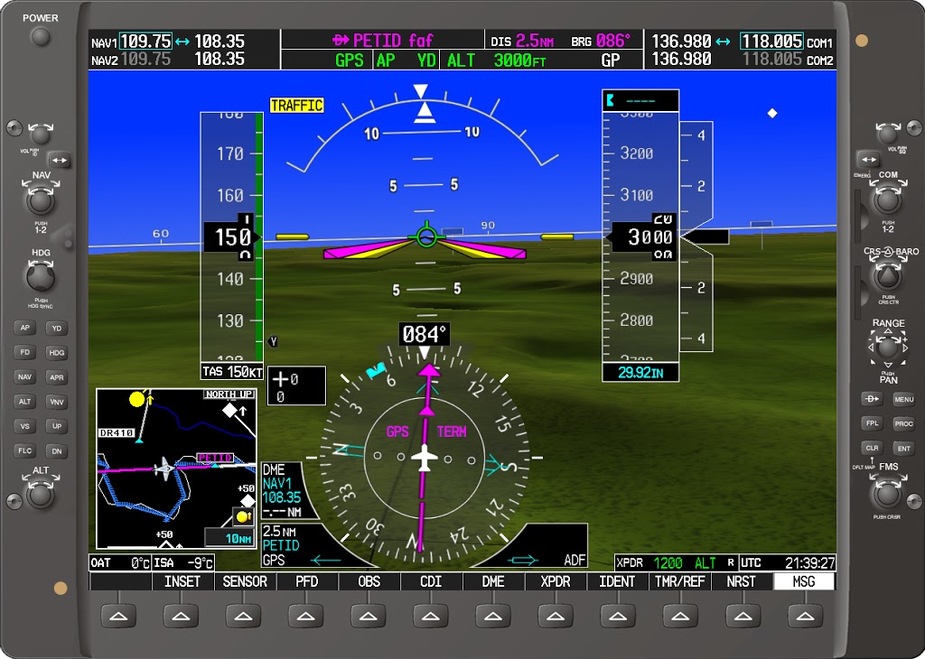
BTW: Yesterday evening I flew another vectored RNAV/GPS approach into my homebase. The controller gave us a vector from some distance out in the general direction of the FAF which could have ended a mile inside or outside the FAF as well... (I have taken a screenshot, maybe tonight at the hotel I will have a chance to add it to may post)