From here my wild guess would be 1-2m of swell, depending on the wind history beforehand.
What I don’t quite get is why he took the longer water crossing route. It is a straight line from Nantes to Cardiff
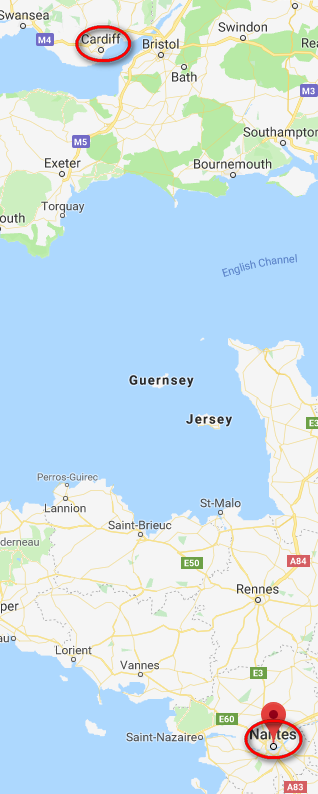
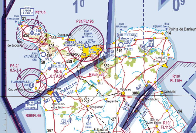
but just from the risk management perspective staying over land as far as possible, and passing over Cherbourg, would have been much better, at a negligible extra cost in track miles. Perhaps he saw the prohibited areas at Cherbourg and didn’t want to risk it. You can overfly them at 5000ft but not at 2000ft… but the big one goes up to FL195. Obviously navigation is not an issue these days but these things continue to scare people
Or perhaps he wanted to minimise spending time in French airspace…
https://geographic.org/global_weather/united_kingdom/buoy_62103_channel_lightshi_995920_99999.html
Pretty close to the Channel Lightship – but I dont have access to historic data. Its available and I would expect it to be very similiar to the location of the actual ditching. Peter 1-2 metres is probably a little conservative.
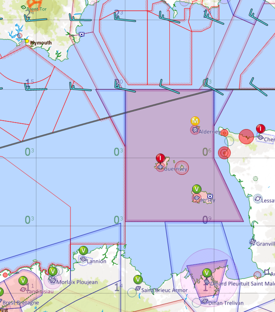
I agree on the route. I suggested earlier all the way down the beaches of the west coast, just inside the zone if you wish, coasting out just to the east of ORTAC and DCT to St Catherine’s Point. This might have kept the flight to the east of the front, and, if it didnt, plenty of options to go further East and make landfall any where along the south coast, with diversion options into any of the after hours London airports if push came to shove, or, if not pushed that far east, Southampton or Bournemouth. To the East of the airway there would also have been plenty of airspace as the danger areas would almost certainly have been closed, and sod it, climb if necessary and declare.
It is also interesting the route he actually flew as CIZ will always give you a routing (after all it is CAS), and very often via the Cap, but you can pretty much negotiate anything, especially at that time.
EDITED TO ADD – mind you having looked again at the map to be fair Guernsey to Salcombe is almost as short as the recommend VFR route I mentioned above and perhaps in the mind of the pilot that Guernsey (and even possibly Alderney), plus of course Jersey would provide bail out options along the way. (albeit Alderney would have been closed at that time, but I wonder if their lights can be remotely activated, and you would give the runway a shot even with lights out).
My (fairly uneducated) guess is that the swell size won’t matter too much when you are unable to estimate where the sea level even is (other by looking at an altimeter / GPS). Under solid IMC, I don’t see how one could even judge where the sea is. You’re likely to also not be able to do a “10 fpm descent” until you touch down, since presumably that’s not a precautionary landing: You’re being forced down anyway.
I think it is a fairly educated guess. It horrifies me the thought of a ditching at night, but I guess that is as uneducated, because fortunately almost none of us can relate from first hand experience. I can only guess that with a bright moon and relatively carm waters, you might have some idea of your landing attitude and target, but, beyond that, it surely must be all hope and prayers? I have some float hours and landing on water in good light is challenging enough. We dont know whether this was a controlled ditching, or not. We are not entirely sure of the sea state. I have been that way sailing many times, once in a F9 at night and it was genuinely scary, and that was a large racing yacht. The seas can be very treacherous and large waves build rapidly. In a yacht it can be close to hitting a brick wall when you slam into a wave at 10 knots going up wind. The G forces are also likely to be pretty large, and I am surpised the structure hasnt been significantly more compromised.
Also a routing to the west of the CI TMA would have meant that he could have went as high as he liked as there is no class A there.
I recall someone writing about a landing (possibly under emergency) after worse than expected IMC where they couldn’t see the runway (only halo of lights I think) and resorted to very slow descent + synthetic vision.
I see no reason to believe this plane did any kind of controlled ditching.
If they did, it would have been an engine failure, and then 2-3 mins to make a radio call. I think the pilot just lost it, and at night over the sea, under cloud, it doesn’t matter if you are IMC or not, there is nothing to see. No visual reference.
The pilot claimed to have 2k-3k hrs TT (according to some pub rumours which appeared in the media) but if this was mostly paradropping, it would have been day VMC.
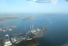
I also suspect it wasn’t a controlled ditching, when we looked at the video of that Pawnee ditching in a controlled manner the absolute worse case for deceleration G was only about 3.5G, which is generally survivable without any injury. Judging by the fuselage being pretty crumpled in the picture that’s been released, I’d guess “impact” rather than controlled arrival. Although it is possible that hitting a swell face on could still crumple the plane like that even if control hadn’t been lost.
I don’t think hitting a swell in controlled flight would be enough for that kind of damage, look at the Courchevel overrun, there’s barely a wrinkle on the cowling.
All the indications are that an iced up aircraft hit the sea very hard due to an overloaded VFR pilot who was just about keeping the wings level but without the ability to control the altitude due to weight of ice/ ice disrupted wing form / ice disrupted stabiliser degrading the pitch authority. .