Peter wrote:
However I don’t think this is the issue Timothy wrote about originally.
I agree that there are two unrelated things going on.
JasonC wrote:
But why does the HSI use GC then?
Simply a copy past of the code from Garmin GPS internal GC calculations for their emulated HSI?
For the map, I think they have a flat earth model instead of globe earth model for “visualisation” and “PLOG”?
Reason probably they have to source/collate many NAAs half mil maps, tbh who (customer) has a VFR/SEP that does 1000nm direct 
The disadvantage as Timothy mentioned is having the impression to pass through some local airspace?
For airways they should be on GC anyway, so getting it wrong twice on SD screen make it correct in reality
Ibra wrote:
who (customer) has a VFR/SEP that does 1000nm direct
The number of engines isn’t really relevant. If you cross the North Sea VFR then you definitely get into very long directs. I didn’t just make up Biggin to Stockholm, I’ve done it. There is nothing to stop that direct (though in truth it was probably Bromma, not Arlanda).
It is certainly not the biggest issue on Tim’s plate; there are plenty enough workarounds.
Timothy wrote:
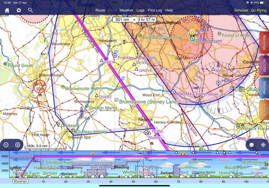
A cool 24nm!Does that answer some questions?
I’m not sure it does. That instrument is a course correction indication. You’re 300nm from your destination and only 24nm off the magenta line. It’s not surprising it’s centred?
I bet you that if you were 24nm the other side of the magenta line, that instrument would still be in the middle.
Timothy wrote:
There is nothing to stop that direct (though in truth it was probably Bromma, not Arlanda).
Appart when re-press Direct half way, that surely minimises any discrepancies between SL & GC
Like most pilots I tend to fly fixed heading for the whole leg (instead of CDI devs vs track line) and I re-press -D→ when I completely lost it for X reason, I bet most pilots like me will do that on GTN GC lines as well, very often than changing fuel tank, so those bad habit are not SD specific
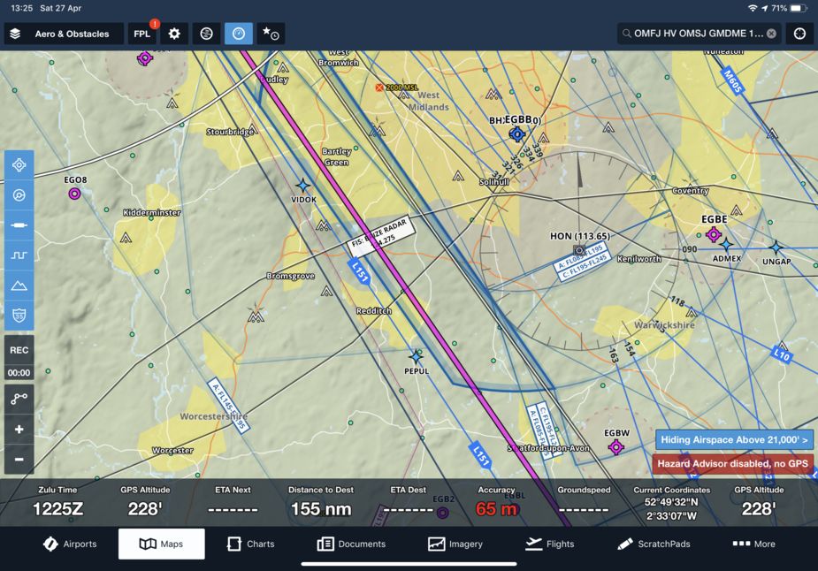
You don’t necessarily need a long DCT. Try a perfectly reasonable EGKA-WAL on SD and FF. Zoom in on the Birmingham CTR/CTA. One of them will show you that at 3000ft you’ll be in the 2500ft bit of CTA, the other will not.
Rhumb lines on a VFR planning and navigation app? Quaint.
stevelup wrote:
I’m not sure it does. That instrument is a course correction indication. You’re 300nm from your destination and only 24nm off the magenta line. It’s not surprising it’s centred?I bet you that if you were 24nm the other side of the magenta line, that instrument would still be in the middle.
How much? On the magenta line the HSI just shows the little diamond/arrow that means “way off”. It actually came in more or less the same velocity as the aircraft HSI (fed by the GTN.) If we make the bet big enough, it would be worth setting up a Skype video call so I can show you. £1000? or is that too little for you to bother? 
Ibra wrote:
Appart when re-press Direct half way
Yeah, you can do that, but it’s usually easier to rubber band the track line to an on-(GC)-track waypoint and get the GTN to go via the same point.
I have made an important decision. These issues are caused by the curvature of the earth and, to a lesser extent, because the earth isn’t a perfect sphere or even oblate spheroid.
Accordingly, I am going to sign up with these guys and the whole problem disappears.
Peter wrote:
They must be computing the correct (curved) route internally.
This has been a long and frequent discussion on their forum site.
No, they don’t and they continue to do the wrong thing. Case closed.
stevelup wrote:
I’m not sure it does. That instrument is a course correction indication. You’re 300nm from your destination and only 24nm off the magenta line. It’s not surprising it’s centred?
The SkyDemon CDI, like the CDI of any GPS (which is not in LP mode) shows linear deviation, not angular. Full deflection is 5 NM (1 NM/dot).
I bet you that if you were 24nm the other side of the magenta line, that instrument would still be in the middle.
Timothy should have accepted the bet…