I'm planning my first mini-European flying tour from the UK, having never really been further than Le Touquet before. So would appreciate any insights and advice on the route, charts required, radio etc.
Tentative route is Gloucester (EGBJ), Le Touquet(LFAT), Braunschweig(EDVE), Wilhelmshaven (EDWI), Texel (EHTX), Gloucester
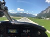
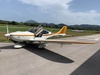
I'll be flying a TB20 VFR
Main area of doubt is the track between LFAT and EDVE through Belgium - is it better to head north up the coast first, then turn inland south of Rotterdam and squeeze through the gap via Nijmegen or should I head directly East and ask for a transit overhead Charleroi? Or just try to fly direct? What would be the best altitude to get transits (don't have oxygen but happy to climb to anything up to FL100)?
SkyDemon rattles out a long list of potential radio frequency contacts. I know its all much more joined up compared to the UK, but who should I expect to talk with after departing LFAT and Lille INFO? I understand there's a significant difference between INFO and INFORMATION (like our ATC and AFIS) so will try to use the correct terminology, e.g. ask for a Radar Information Service than a Basic one. Is there an equivalent of our LARS coverage map for the UK showing who you should be talking to?
I was planning to get the Jepp VFR charts for the areas I'd fly through. The DFS doesn't put their VFR airport charts online, so if anyone has any ideas how I could get hold of the relevant ones, please let me know.
Flight plans required for all international legs, but once inside Schengen (at LFAT), I don't believe I should need worry about customs or passport control until leaving Netherlands. Despite what I've read recently about SkyDemon flight plans going astray at LFAT, I'm aiming to use that throughout.
Thanks in advance for any insights you can share
For the Belgian part: make sure to be above 4500', this will both imply you are in controlled airspace and you are flying FL's, not altitudes. Belgian airspace below that is a busy mix of CTR's, TMA's and (especially on weekdays) active military fields. Plus a good deal of restricted areas.
The official Belgian AIP and NOTAM's can be consulted at
Registration is no longer required, though it is (for no clear reason) for the meteo pages.
There's no need to expect who to talk to. Just wait for hand over and be prepared to write down the new frequency they give you.
No LARS coverage map abroad as this is a UK concept only.
Use the FIS map instead as radar is provided over FIS.
Or call approach if you need to transit.
Sometimes FIS and approach are the same.
Braunschweig is a nice airport with friendly controllers and a good briefing room. I've been there twice and on the second occasion the controller welcomed me back!
The hotels downtown can be a bit naff so study tripadvisor. Be on your best behaviour when landing as it's the HQ of the BFU (Germany's AAIB). Look out for the extensive grid of railway sidings N of the town: this was one of the jumping off points for operation Barbarossa.
Wilhelmshavn is also very welcoming and as I recall affordable too. There's a maritime museum an easy taxi ride downtown if you are into that sort of thing. The flight along the Jade estuary past the Naval dockyard is very scenic.
One way to get the plates is to email or ring up the airfields and they will send them to you. Once in Germany the briefing offices at each airport will print out any further ones that you need. It's a good idea to include a few possible en route diversions in this exercise.
If I need a diversion somewhere where I don't have the plate, my 430 (presumably you have something similar/better in the Cirrus) has enough info to make a landing, along with the extremely helpful Information services already mentioned. I also carry an out of date Bottlang that has airport diagrams etc that are likely to be still helpful.
I've flown a few times to the UK and back, am based in Germany and unfortunately I have to disagree with Jan because I have found some - but not all - Belgian controllers to be a bit unco-operative - a case in action was I had filed a flight plan, was flying at FL65 from Germany via Eindhoven routing north of Antwerpen but they refused to allow me to cross their Charlie Airspace at ANY altitude - which was a first for me - that meant I had to drop down out of controlled airspace which, in that particular area, was a MAJOR pain in the ass - fortunately Antwerpen allowed me to cross their airspace midfield. Another time was similar where their routing was set to take me into heavy IMC so I requested 10 degrees change of track to remain VMC but was informed either I could take the approved track or drop out of controlled airspace, which I thought a tad harsh.
So, based on my personal experiences, my recommendation would ALWAYS be the following:
Route along the coast to Ostend and keep going northeast until you reach Zeeland, there head eastnortheast passing Roosendaal, Gilze-Rijen and Volkel at which point you can turn due east and fly pretty much unhindered to Braunschweig. You will pass close to Muenster and Hannover but Muenster's Class D has been changed to a TMZ and in Hannover the Charlie Airspace on direct would begin at 4500, FL 60 to 100 are Class D.
That route I've done both to a from UK a few times cruising around 4200 feet without any hassle or risk of running into controlled airspace - in fact the last one was last Monday heading to Shoreham and returning this past Friday. Obviously, if you want to fly higher, you can, just make sure you get the clearances and have an alternate route planned in case it's refused....