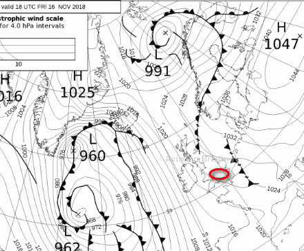
Today is a nice example of winter high pressure wx.
High pressure on the MSLP… should be nice 
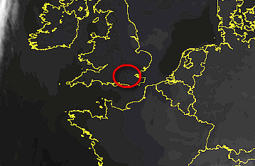
Low cloud (and some drizzle in places)
EGKK 162050Z 09006KT 1100 BR OVC002 08/08 Q1026
IR shows nothing, so the tops are really low
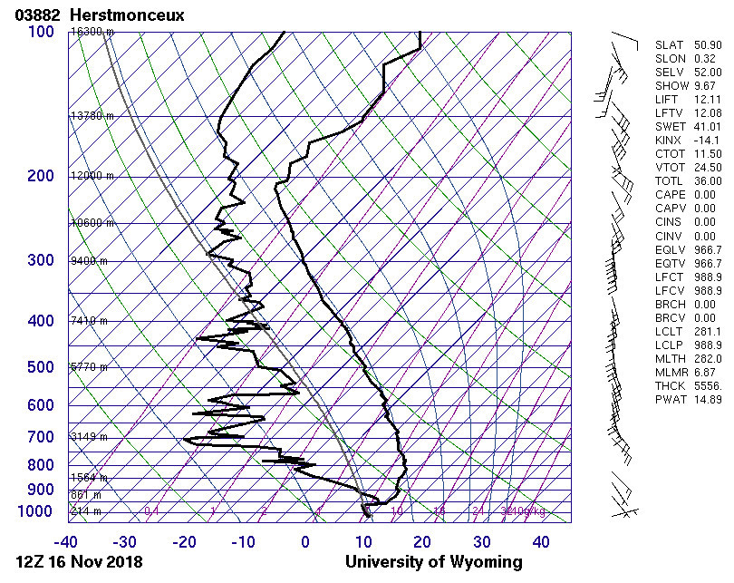
The baloon ascent (from Univ of Wyoming, since the UK Met Office don’t publish this top secret data directly)
Europe / Gif / Skew-T
Cloud tops ~950mb and ~1500ft (where the temp and dewpoint lines separate)
@Peter
Indeed, the IR image shows near to nothing. But it’s better to have pictures at hand showing more. Here is the “fog” picture (nearly the same time)
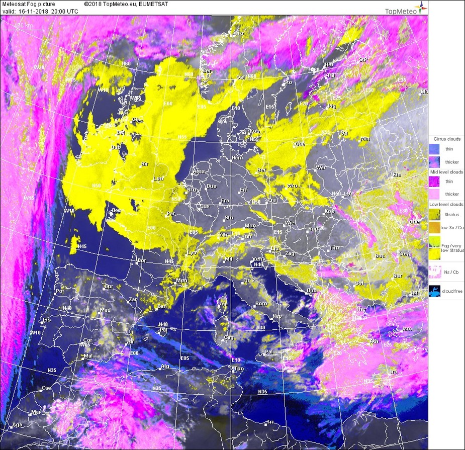
which is working best during total darkness and a false color picture having nearly similar colors during day and night
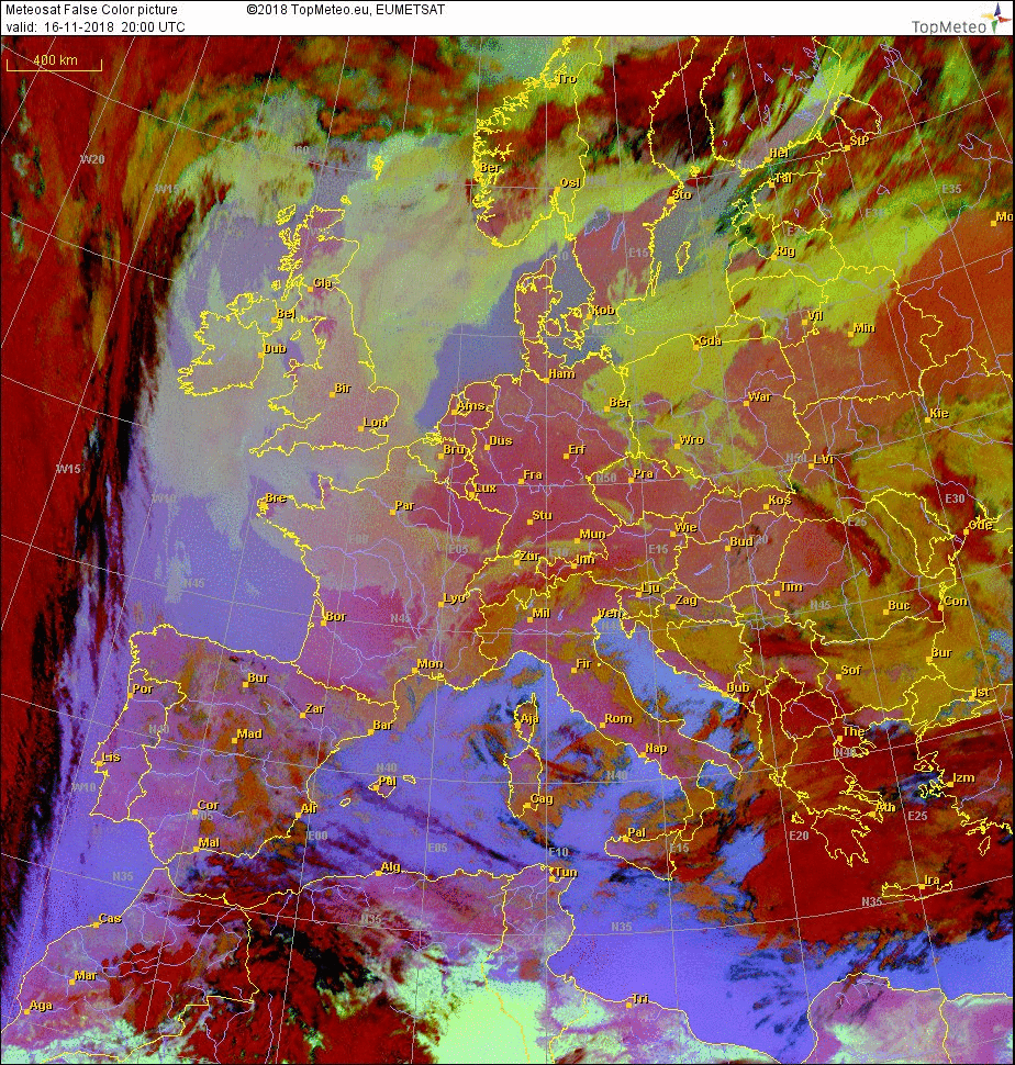
source is topmeteo
windytv.com shows cloud tops for free.
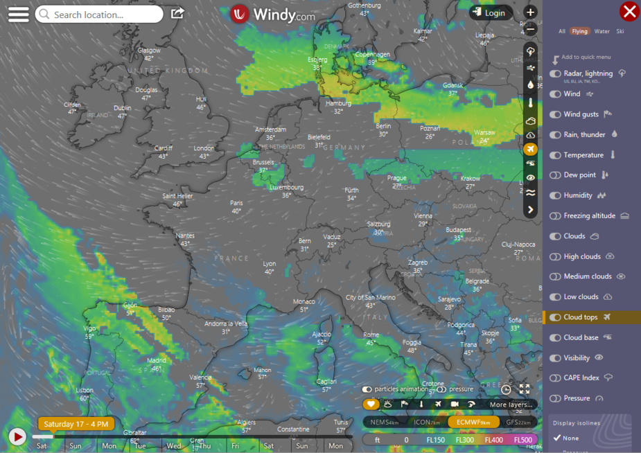
According to this the ECMWF model presented as default by windy.com doesn’t have good 3D cloud data. AFAIK the only 3D model available (without paying lots of €€€) in Europe is the US GFS one and that has many problems with nonconvective cloud depiction.
Problem of Windy is that they show tops as high as FL 150 min,nothing under .I am interesting in tops of clouds at FL060,070,etc…
Just a little Thursday morning cloud-top quiz. How high would people estimate this layer?
(Assume Skew-Ts are unavailable → I’d like views on analyzing this image specifically).

From t-Skew and windy data, two layers would be my bet: a very thin between 5000ft to 9000ft and a moderate from FL200 to FL300, the latter is not my business
Cloud tops at FL350 – F400, but estimated now at a bit later time.
It depends on the temperature and in warm conditions the tops are higher than you would expect from the IR but I would say FL250.
OTOH it could be high cloud (cirrus) of no consequence.
By the color and density of gray shades I would say anything between FL160 and FL240.