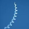
Excellent YT on aerodynamic effect of icing
Peter wrote:
I always found that icing forecasts are mostly junk, but I wonder if parts of Europe are not feeding the same quality data into the ECMWF wx model?
I don’t know. It seems that ForeFlight uses GFS because the forecasts I got in the briefings were as same as in Autorouter’s GRAMET and OGIMET. I guess that ECMWF-based forecast would be more precise in the cases above but still not aligned with real-life situation. The way SIGMET chart did the forecast is totally useless – “lets circle complete area where possible vertical development could happen and we’re on the safe side”.
I always found that icing forecasts are mostly junk, but I wonder if parts of Europe are not feeding the same quality data into the ECMWF wx model?
Last week once again I got live confirmation how hard forecast icing is.
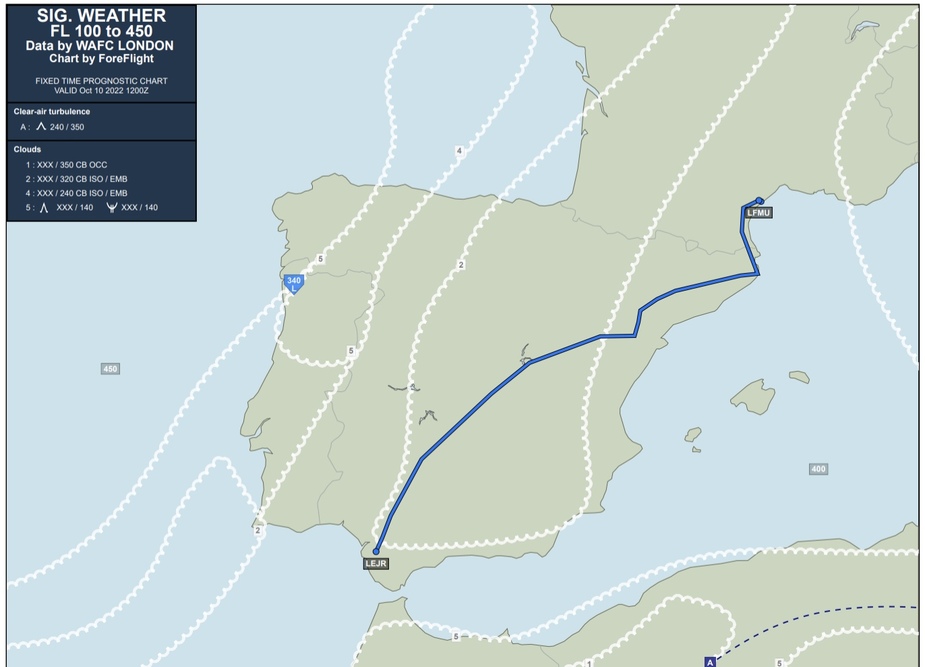
This was the forecast for LDVA→LFMU from briefing created just before the flight:
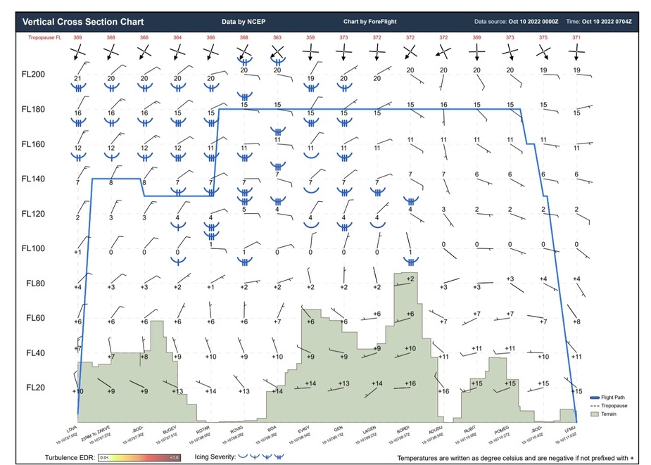
Windy was showing a bit better situation related to clouds but actual situation during the flight was clear skies and SCT030 at destination.
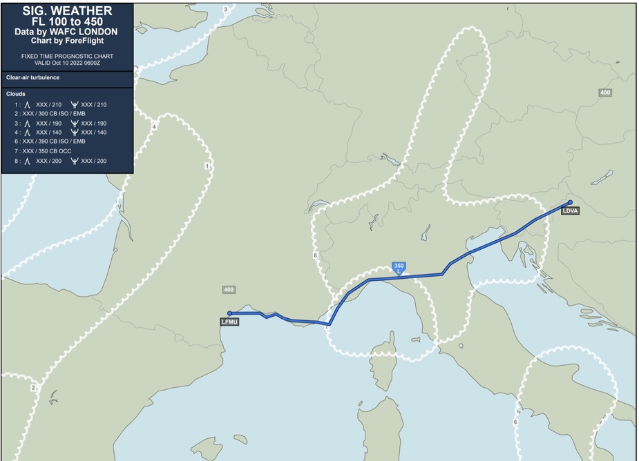
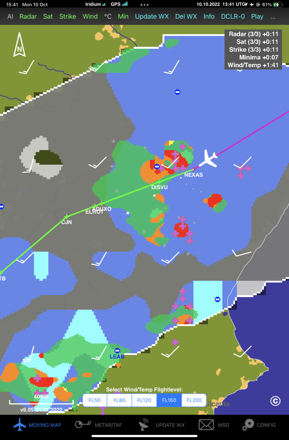
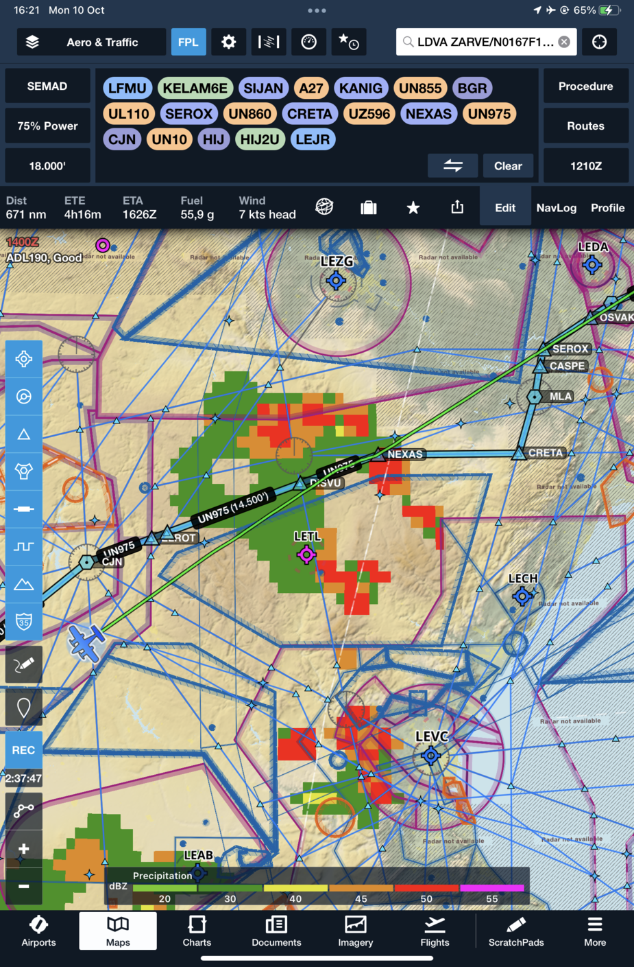
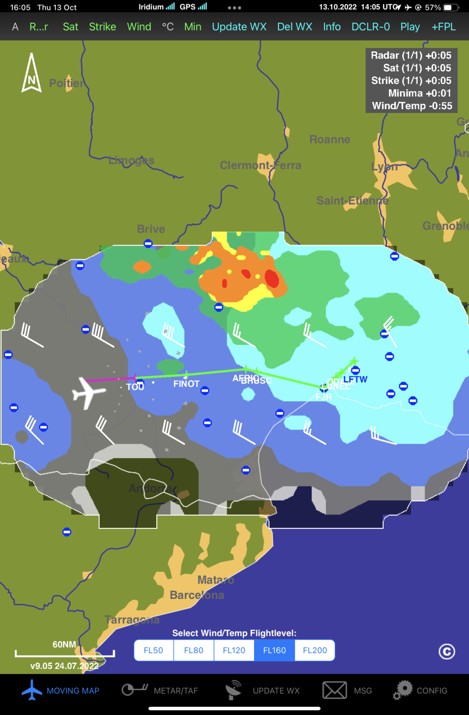
The next lag LFMU→LEJR was forecasted like this:
Prior the flight Windy was showing practically clear skies with exception of some development in Madrid area. The actual situation was moderate icing at FL170 and light at FL150 north of Valencia, well before Madrid area and clear skies after passing this isolated/embedded Cb. I flew through the visible part of the cloud which was still Cu while the part left of my path was fully formed Cb.
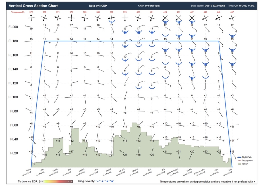
Few days later when returning home at LEJR→LFTW leg the forecast was like this:
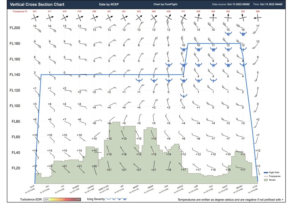
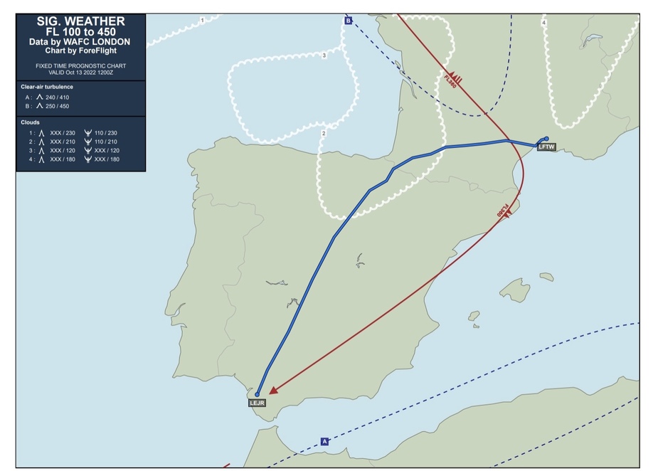
The actual weather was clear skies all the way to Toulouse area with light icing there.
This video shows what must be one of the worst (survived) GA icing cases
I saw moderate icing at FL180 to FL200 at -24C on few occasions but those were tops of cumulus clouds, somewhat expected.
In OP case it seems that it happened in altocumulus lenticularis clouds where I would definitely expect icing.
Karl_Acht wrote:
Glider pilots flew more than 1000 km that day east of Zell am See using those updrafts.
I think I was to low and driving along in the rotor :-), since I am not turbocharged..not much choice…:-(
SebastianSebastian_G wrote:
Yesterday around 14h30 local in the area of Linz, Austria we got some serious icing at FL280 and -34C
I was in that area that day on the 3rd, @ 9000Ft around the same time OAT @ +12 degrees, I experienced severe turbulence btw Vienna and Linz due to fohn wind. The IAS went to 100Kts trying to maintain altitude, a little bit later I flew for minutes on min manifold still doing 160Kts IAS in the uplift like a glider almost. Crazy weather lately….I was alone pax would have gone ballistic… I my previous life I flew once wave in mistral winds in the south of france, so the phenomena is known to me. The trick is I think to keep your IAS speeds in check by playing the throttle and assuring the AP can keep track and be ready to take over immediately manually. Around Stuttgart there was a weak cold front to cross thanks to ADL I had all the data :-)
Icing was more or less where there’s TOD on the map so rather highlands near Montes Claros. Wish I had a weather map, but it was 3 years ago.