This is amazing. I implore you guys to keep it simple as you have. Don’t “lose the plot”. A huge selling point for your website is the fact that it’s:
1) easy to navigate
2) minimal graphics (good for ipad use in a hotel with slow WiFi)
3) clean look.
I had a trial of EuroFPL and found it a bit clunky.
Keep up the great work!
-Jason
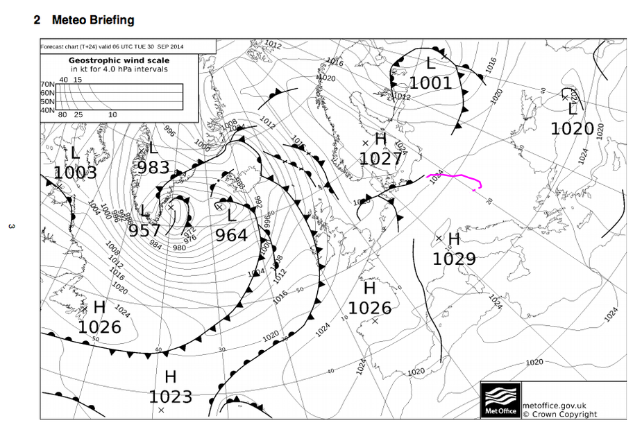
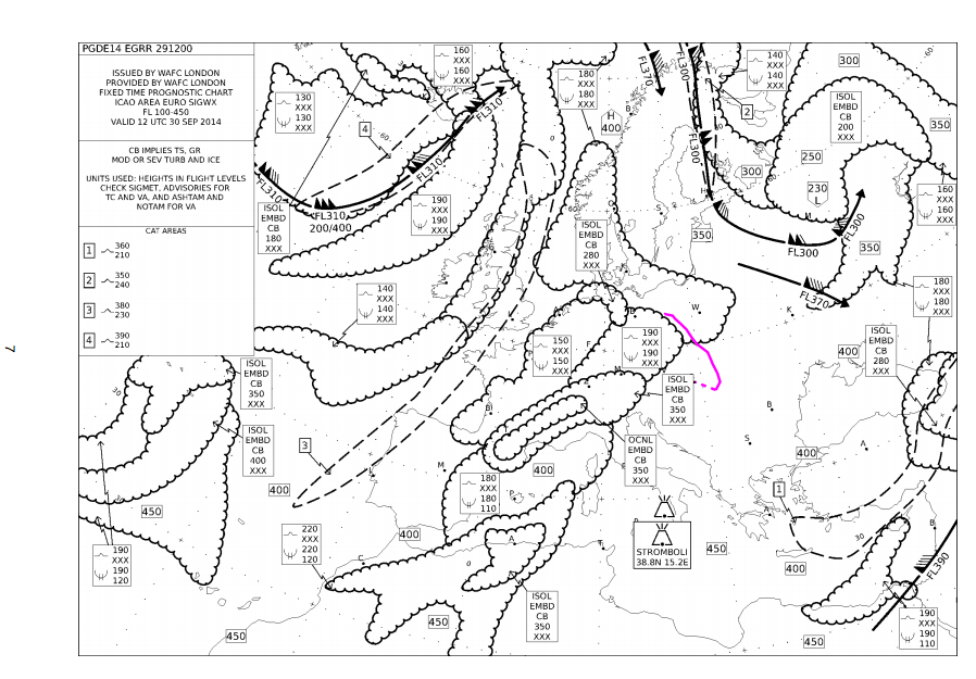
The briefing pack feature was extended with two new chart types: MSLP (mean sea level pressure chart) and SIGWX (significant weather). We automatically download the most recent charts as they become available and choose them based on the departure/enroute time of the flight. To make it a bit more useful, we also draw the route into each chart.
One major update a week.
This is the highest rate in the industry :-D
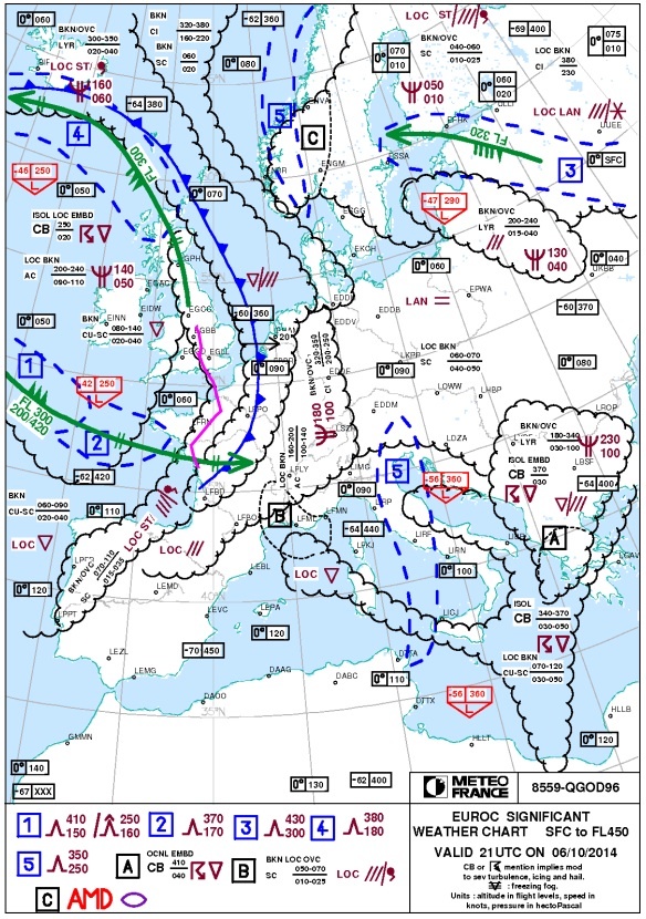
We’re happy to announce that the autorouter briefing packs now contain the TEMSI forecast if available for the time of the route. TEMSI (temps significatif = significant weather) is a product from Météo France and a GA focused and very well done SIGWX forecast, by far the best product out there in my opinion. In contrast to other SIGWX forecasts, TEMSI shows fronts with their velocity and makes use of color. As with all other maps, we draw the route into the map. There are two TEMSI maps published: one for Europe and the other for France. Depending on the flight path, we display either or both types.
TEMSI is used under license from Météo France.
Very nice! Do you think you could also use the “Nordic SWC” issued by the Swedish Meteorological and Hydrological Institute for flights in Scandinavia and the Baltic states? It is very similar to the french one.
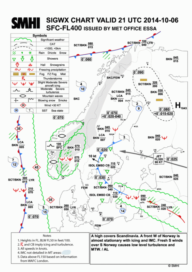
Where could we get it from and do you have licensing information? It really depends on whether we can come to an agreement with the copyright holder but it would be very nice to add this one (we’d just call it TEMSI Scandinavia). It looks like a local weather model augmented with SADIS data from WAFC London.
Link to the chart:
https://aro.lfv.se/Links/Link/LinkGroup?groupName=Kartor&type=MET&isAuth=False#
A page [in Swedish]from the Swedish meteorological institute describing the chart. It also contains contact information to the responsible persons.
http://www.smhi.se/professionella-tjanster/professionella-tjanster/flyg/nswc-1.2428
The person to contact should be Maria Lundblad, phone +46 8 517 887 73, [email protected].
Yep, thanks, request sent.
Would it be an idea to extend para 3.3 with the declared distances for alternate destination(s) ?
And, did I understand we will have all this available for VFR flying too? When, please? I can’t wait!