When it comes to weather and flying VFR, we are mainly interested in the cloud base and visibility.
Over the years, I’ve learnt to understand forecasting somewhat, but there is one area that I have no ability to forecast, and I’m interested in how others do it.
Specifically I’m interested in the periods where a high pressure system dominates and there is no frontal activity. My initial reaction to seeing such conditions would be “Great! The weather should be lovely for a trip! Get planning!”.
However experience has thought me, that at least over Ireland, when we’ve had those conditions for 2 or 3 days, then there is a high probability of a low stratus cloud base. I’ve no idea if this is due to Ireland’s maritime dominated climate, or if it is applicable in other countries too.
If it’s applicable elsewhere too, then I’m interested how you forecast this for yourselves. I have no clue how to forecast this for myself, so am left reliant on forecasts made by others (hourly forecasts in EasyVFR which come from Top Meteo, and TAFs being the ones that I usually rely on). But I’d love to be able to make some stab at a forecast of it myself, if for no other reason, then so that I can better understand what is going on when I read the professional forecasters’ opinions.
Here is a typical example.
Since the end of last week, Ireland has been enjoying a lovely high pressure system (as has much of Europe) bringing lovely weather. The lovely weather lasted from last Saturday all the way through to Wednesday.
By Wednesday morning, the high pressure system was still dominating the country, but the day started off very foggy. By the afternoon it cleared up lovely. But any VFR day trip would have been ruined because it wouldn’t be possible to leave until the afternoon. Fog and highs….always a possibility. But how to predict?
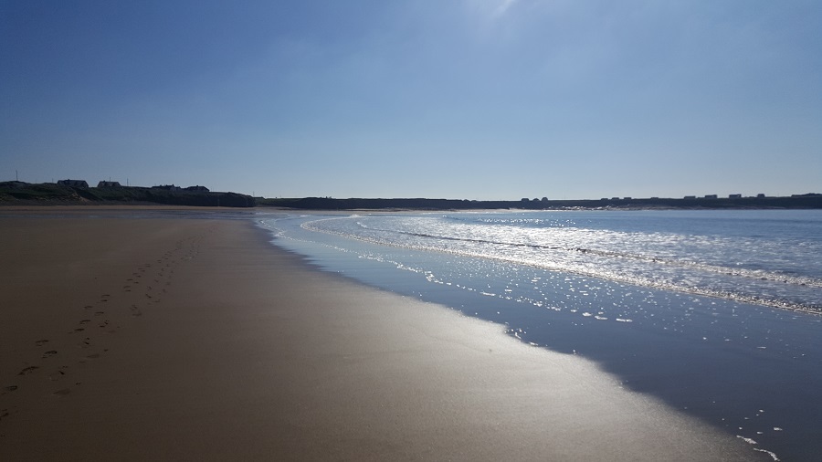
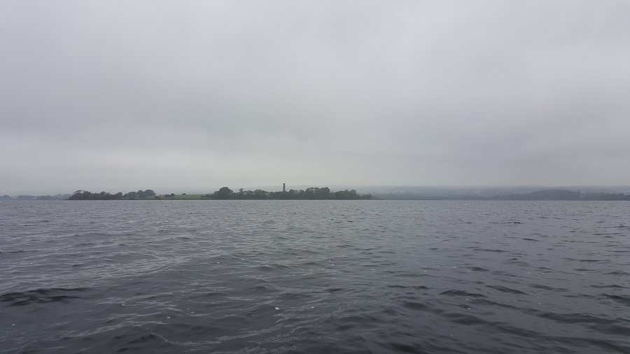
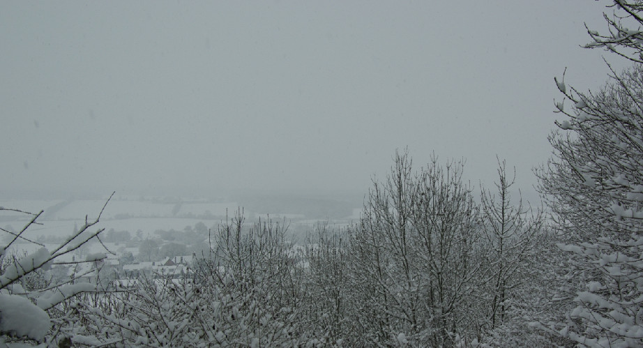
Thursday had a very similar pattern. Thick fog in the morning, and glorious, cloud free skies with wonderful visibility in the afternoon.
Here is what Thursday afternoon looked it.
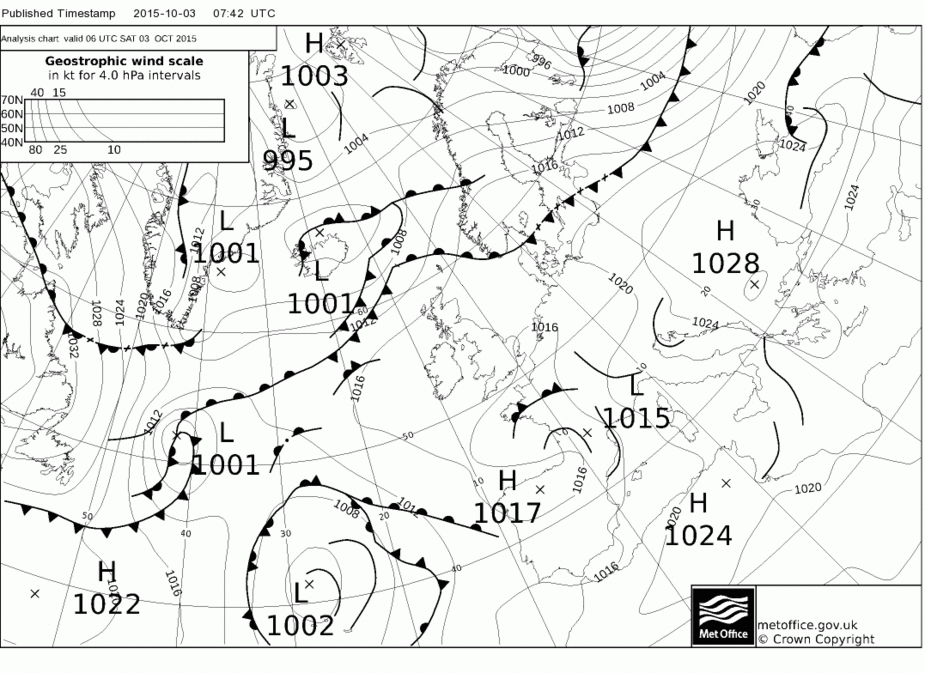
Then Friday came. Here is the pressure chart for Friday evening (sorry I didn’t capture the midday one in time).
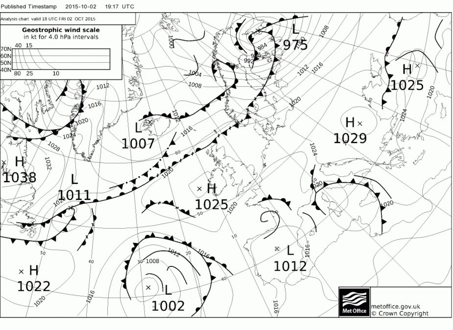
As you can see Ireland is dominated by a high pressure system and there are no fronts affecting the country. On the face of it, you’d expect lovely weather.
Here is the chart forecasting the following day
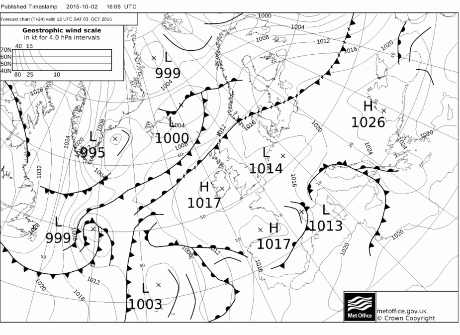
Again, lovely weather for a VFR flight. Or so I’d think.
This is what the day turned out like
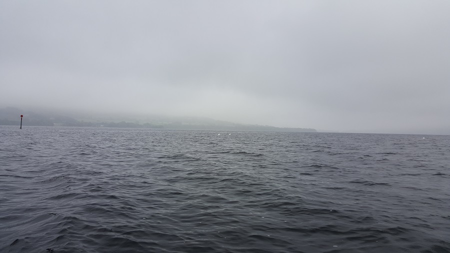
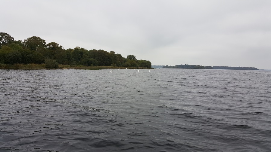
Cloud base was probably around 1,000ft-1200ft. Visibility was poor locally, but better in other places.
Not really a day for anything but a short local VFR trip, and even then, not unless you really had a reason. If I were planning a nice trip somewhere, then I’d have definitely cancelled it, as I’d not be sure about getting home again.
Today, Saturday, the pressure charts look like this
So obviously not much change from what was forecast yesterday. Again the area is dominated by a high pressure region, and there is no frontal activity.
The weather is better for flying today, which a stratus cloud base a little over 2000ft, and 10km+ visibility, but nothing as nice as I would have thought looking at the pressure charts.
Obviously this has to do with how much moisture there is in the atmosphere, and my instinct developed over the years not to trust a high that has been around for a few days without any fonts moving through, has proven to be correct. But instinct isn’t a reliable weather forecast method 
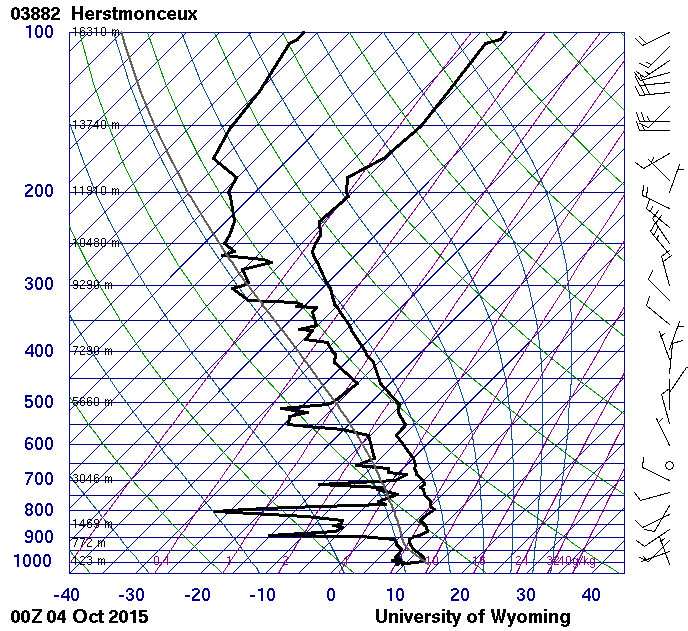
Sat images aren’t much use forecasting these low down, non-frontal clouds. Skew-T’s seem to be more about what the weather is now rather than what it will be tomorrow.
So what I’m interested in is how do you predict VFR conditions in such weather systems, and how do the professionals predict cloud base and visibility in such conditions? Do you just rely on the professionals opinions, or do you have your own developed methods that seem to work for you?
So what I’m interested in is how do you predict VFR conditions in such weather systems, and how do the professionals predict cloud base and visibility in such conditions? Do you just rely on the professionals opinions, or do you have your own developed methods that seem to work for you?
I think the answer is tafs and metars 
The European wx offices (e.g. the UK Met Office) don’t release their 3D models because they make money out of selling the data, and the US GFS model is almost useless for low level cloud.
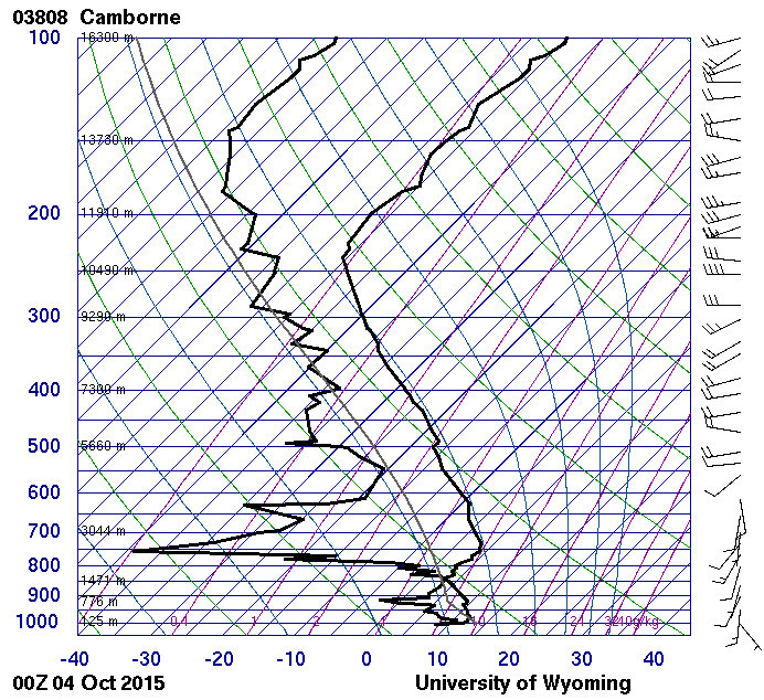
In stable conditions you can get an idea of the morning’s conditions by looking at the 0000Z baloon ascent as described here (search for “wyoming”).
For example this shows the temperature and dewpoint apart all the way up, but it looks like there was fog at the bottom
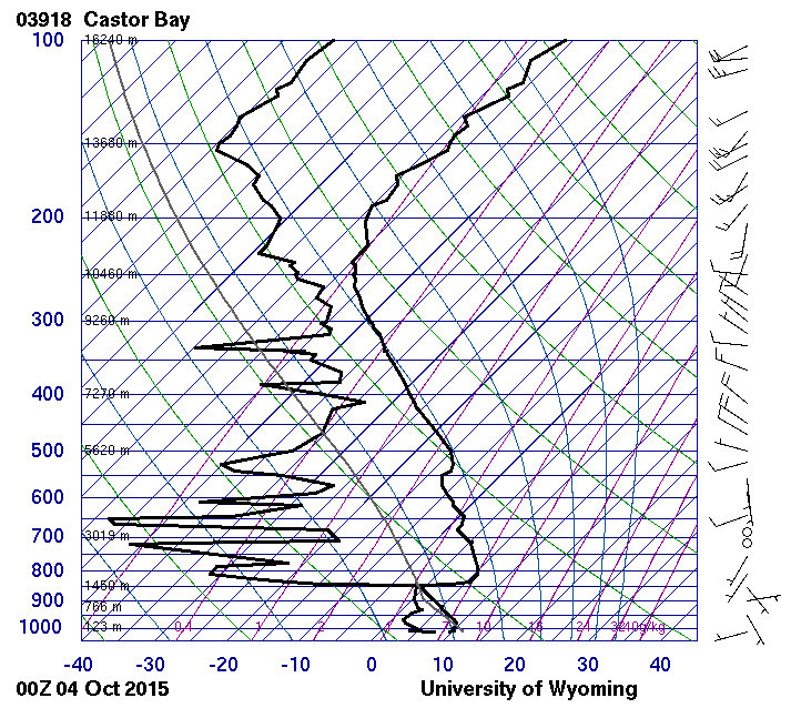
while this shows a thin layer around 4000ft
and this one is similar but with glorious blue skies (very dry air) right above that layer
“Winter” high pressure often delivers a thin layer of low cloud and forecasting it needs access to data which isn’t made public. But it should be reflected in tafs and obviously in metars. What is almost impossible to forecast is fog…
The weather pattern described in the link posted by atmilatos describes the pattern that I’m talking about very well.
But it looks like nobody has any good way of forecasting it for the amateur pilot.
The problem (for me) with the Skew T’s linked in Peter’s post, is that they are really a “what is the weather now” type of thing.
What I was hoping for was someway of getting a reasonable stab forecasting enough to be able to answer the questions “Should I invite someone along for a flight tomorrow” or “If I fly away today for an overnight, am I likely to be able to get home tomorrow”.
These highs look so tempting for those, but I’ve learnt to be wary of them
TAFs I find, at least around here, are always saying “Poor weather” during the winter. I’ve learnt to ignore them during the winter, as otherwise I’d never fly But that’s probably more to do with the attitudes of the local forecasters than anything else.
Anyway, looks like I’m not missing any tricks, and everyone is in the same boat when it comes to forecasting these patterns!
Thanks for the comments guys.
Colm
One option is to phone up a premium rate phone line (no, that that kind ).
There are people who pay the few k a year to the Met Office to get access to the 3D data. They are not allowed to resell the data (or make it available at all) but they are allowed to make forecasts for people.
I don’t have any numbers currently but the last one – a few years ago – was called something like Weatherline and was GBP 1.50 per minute. So for a few quid one could get a briefing which would be hopefully better than looking at the MSLPs which is all you have otherwise, beyond the long TAFs.
Before that I had another number which I got from somebody who worked for Avbrief. In fact I seem to recall they used to do that sort of thing too.
dublinpilot wrote:
I’ve no idea if this is due to Ireland’s maritime dominated climate, or if it is applicable in other countries too.
Not Ireland specific at all. In switzerland we can have highs in winter for many weeks which means no sun and low stratus for weeks in the lowlands (but nice and sunny weather in the mountains).
dublinpilot wrote:
But it looks like nobody has any good way of forecasting it for the amateur pilot.
Indeed, for example if you look at the LSZH TAF to find out whether the stratus is going to dissolve in the afternoon, you could as well just roll a dice.
We once called the Meteoswiss aviation weather personal briefing line (at “voice controlled value added services” charges) to ask the meteorologist what the chances were for fog the next day. He was very convinced that there was no possibility for fog the next day. In fact, we then had the thickest fog I’ve ever seen for the next three days…
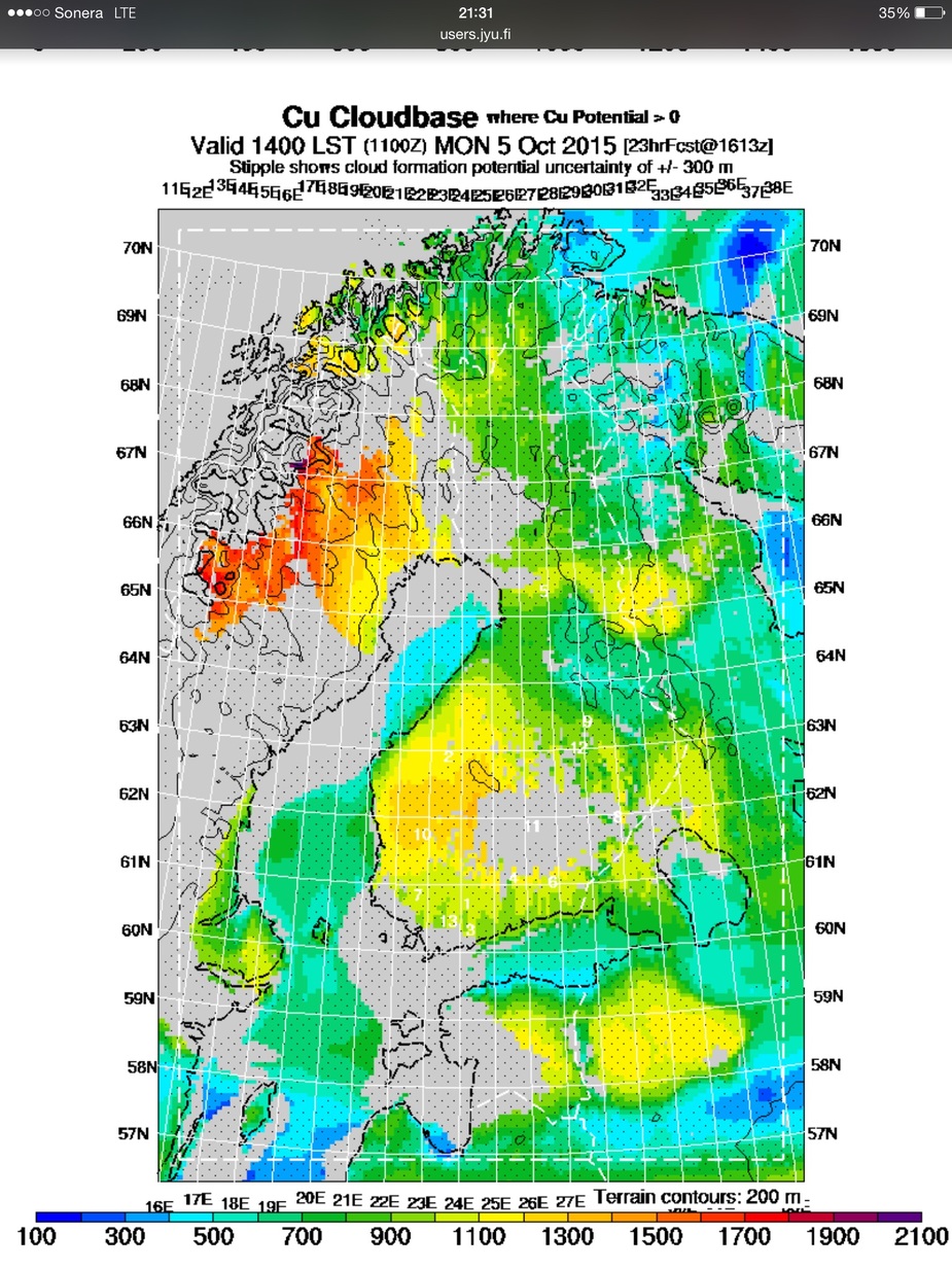
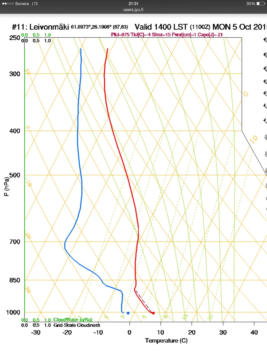
If I am right the soaring community has also elsewhere access to local balloon ascents even outside the season. Here for tomorrow in Finland.
Not Ireland specific at all. In switzerland we can have highs in winter for many weeks which means no sun and low stratus for weeks in the lowlands (but nice and sunny weather in the mountains).
Yes, but that is fog. If I understood correctly, Colm was not talking about that, but about “just” low cloud forming in certain high pressure conditions.
Yes, forecasting fog you can forget. The only solution is plenty of fuel to reach a “clean” airport, and be able to fly an ILS to zero-zero otherwise
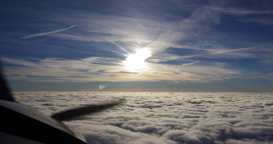
Low cloud should be forecastable. The UK often gets bases of 1000ft, vis 3000m, so below you have this
and at 2000ft you get this
Here for tomorrow in Finland.
Isn’t that just a forecast skew-t from GFS?
boscomantico wrote:
Colm was not talking about that, but about “just” low cloud forming in certain high pressure conditions.
And what is the difference to low stratus? Now I’m confused…