Yes, that’s what i would consider scud running down here in Baraia too. This would be inside my personal limits too.
Funny. Norsk Luftambulanse (The air ambulance) just started a campaign trying to get more members so they can finance PinS equipment in their helicopters (Points in Space navigation). They have some cool videos showing typical Norwegian VFR flying.
The PinS concept looks rather cool. I have never heard of it before today, but it’s essentially EIR using GPS following virtual points in space where the last point must be within visual range for landing. I can’t see why this couldn’t also work for light airplanes also.
Yes I guess. I just heard about it with this “commercial”. The way it works (I think) is IFR to a last point in space. At that point you either proceed visually (IFR) or change to VFR. If it’s outside a control zone it has to be VFR, and then it is essentially EIR.
For the ambulance helicopters it means they can fly the straightest route to any point in space where there is VFR condition as I understand it. This will be impossible using standard IFR because then that point has to fulfill both VFR and normal IFR conditions regarding alt and obstacles.
I could be wrong though, maybe it is only for landing at a designated helipad. But that wouldn’t matter if the concept was used for EIR for light aircraft, since they have to land at an airfield no matter what ( normally at least).
Back to scud running: I think it largely depends not only on the surrounding weather, but also about the pilot/crew (Together with my father in the cockpit my personal minima are lower than with my wife and with her flying they are lower than alone or with a student…), the used aircraft (if you buzz around with 140 kts you need much better weather than with a Sperling or Morane; out of the Jodel you have a much better visibility than out of a P28A, etc.) and so on.
Where do you draw the line anyway? Would you consider this scud running?
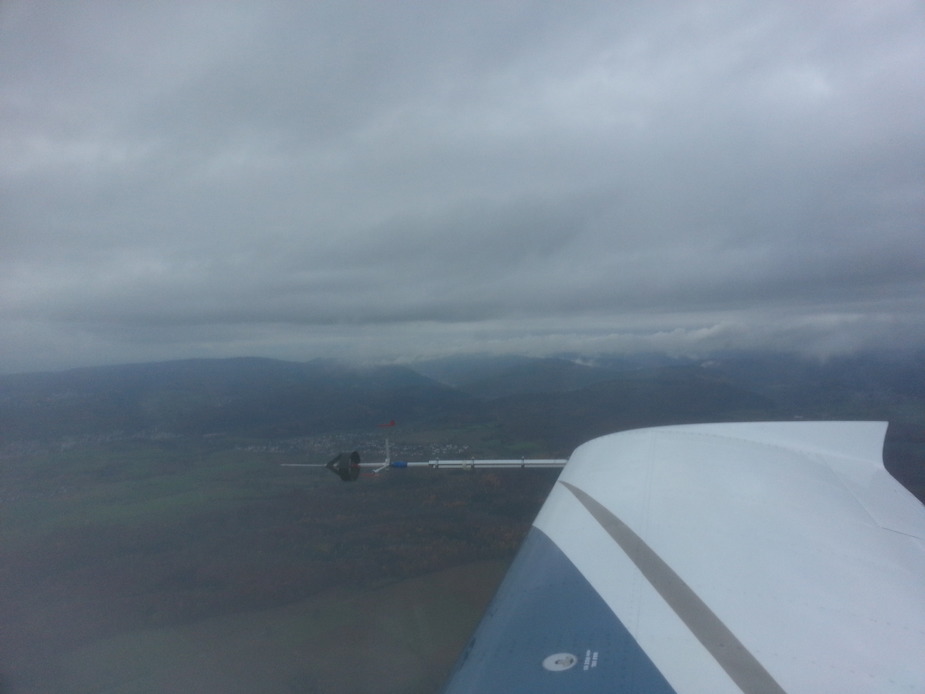
Even with this view out front?

Or this?
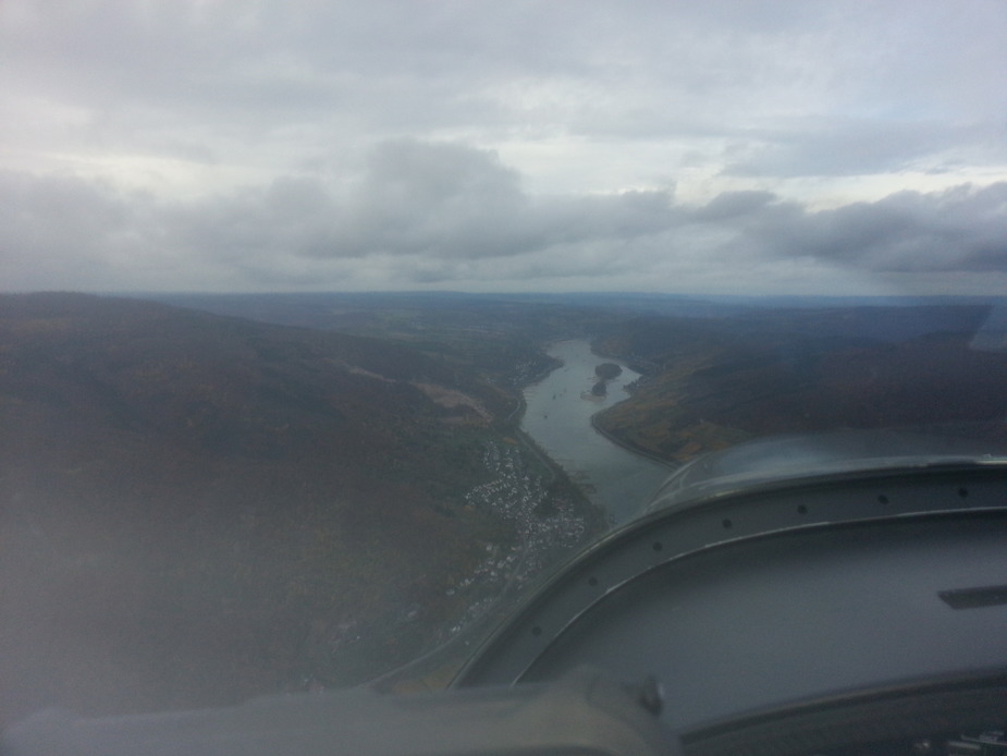
This?
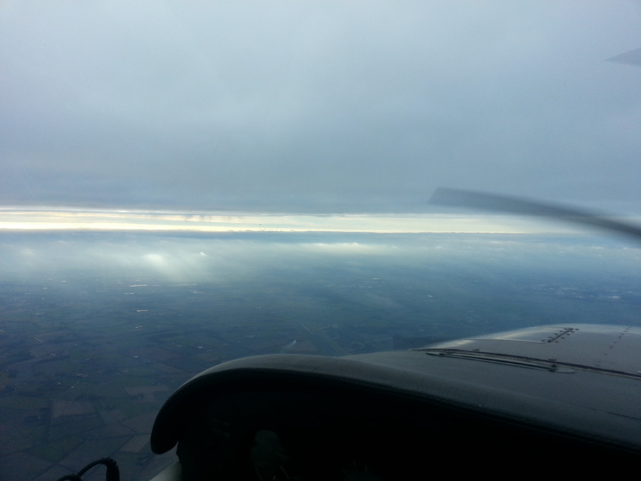
Or even this?

In the end, the answer is the same as so often in aviation: it depends. But I think it is good to teach flying in and with adverse weather during flight training. There are a couple of techniques and gotya’s that I think pilots need to know about before entering such weather. And if they do (serious) VFR cross country flying, they sooner or later will encounter scud conditions. In that case it is better to have some tools at hand to at least be able to divert to the nearest suitable airfield.
The first one, I would say, is scud running, have to be careful when the mountain tops are in clouds ….
Here’s a scud running picture that looks much worse than it actually was… just a strong rainshower and a CB a couple miles away, but a high ceiling and good visibility …

I wouldnt consider any of those scud running – but I guess it depends what you mean by scud running.
I guess flying below any base of less than 1,000 feet above the ground would be classified as scud running, but I think there is a whole emotive element to the term, because we have been told so often scud running is desperately dangerous.
As with most things in aviation it is in fact about controlling and managing the risk I think. I have flown along the coast at between 500 and 750 feet having departed from and landed at a coastal destination. I am happy wth the risk because I know the local area very well and the factors that could make this less than safe. I am also prepared to climb and accept the flight proceeding IFR.
The photos reflect only a moment in time but in that moment none suggest a desperately low base or rising terrain without an exit nor does the visibility look unreasonably so poor as to not be able to visually identify any hazards.
Agreed; none of those are proper scud running – because the forward vis is OK.
This would be, if the bottom stuff was terrain 


@LeSving It doesn’t have to be a designated helipad. PINS doesn’t require any infrastructure at a landing site (not even lighting, or marking for that matter, AFAIK). But the procedure obviously has to be prepared.
There is no guarantee of a straightest route. PINS is about approaches and departures, not en route navigation, and actually allows curved tracks (a good thing in a valley, for example).
EIR is a pilot rating. And since we are talking about an instrument approach, it’s not en route and pilot holding only EIR wouldn’t be able to fly it. It doesn’t matter there is a visual segment, it’s still an instrument procedure (when you are flying down an ILS, you also have to go missed at a decision height unless you have runway environment in sight). It’s up to regulators whether they allow an instrument procedure (and flight under IFR) in an uncontrolled airspace and how exactly would that work.
But that wouldn’t matter if the concept was used for EIR for light aircraft, since they have to land at an airfield no matter what ( normally at least).
I don’t understand you. En route navigation essentially works this way (you’re using waypoints).
As for the actual topic, when I encountered the term I tried looking it up but I couldn’t find any definition that wasn’t too vague for me. What is low? There is usually nothing about visibility while that is certainly a very important factor (it directly impacts your ability to orient yourself and avoid things). The general idea is clear. However, I have no idea where is the line. Personally, I prefer to scud run in a helicopter. It’s far less demanding on a landing site. And IFR is not an option in the smaller birds anyway. A good bush plane would be next in line.
Martin wrote:
don’t understand you. En route navigation essentially works this way (you’re using waypoints).
Yes, but you are constrained to IFR alt and obstacle clearance en route. If the world was flat as a pancake and/or the cloid base was at 8000 ft that wouldn’t matter much, but isn’t normally the case. The problem with EIR (rating or whatever it is) is that at some point you have to fulfill both IFR en route minima and VFR minima regarding alt, obstacles and cloud base. In Norway that would typically mean 20-30 nautical miles out at sea, or more many places. We just got new NVFR regulations here some weeks ago because the SERA NVFR minima has the same problem. The dudes that made SERA just hasn’t taken into account that hills and valleys are a part of the surface of the earth.
The concept of PinS would (theoretically) allow IFR right down to final, if it was VFR minima at the last point. But if PinS is an instrument approach, then this wouldn’t work in practice after all, unless.of course PinS was a part of EIR. Conceptually it seems less troublesome than full IR since the last bit is (can be) VFR, but maybe not?
I have never heard of scud running other than on this site, but it seems to be what ambulance helicopter pilots want to prevent, even if it is for a different reason (to be able to go the fastest route as the pilot say in the video, which PinS will enable)