I think most pilots have very limited terrain info.
For example when I am flying above the Alps, more than half the time it is above an overcast, and I run a topo map like this
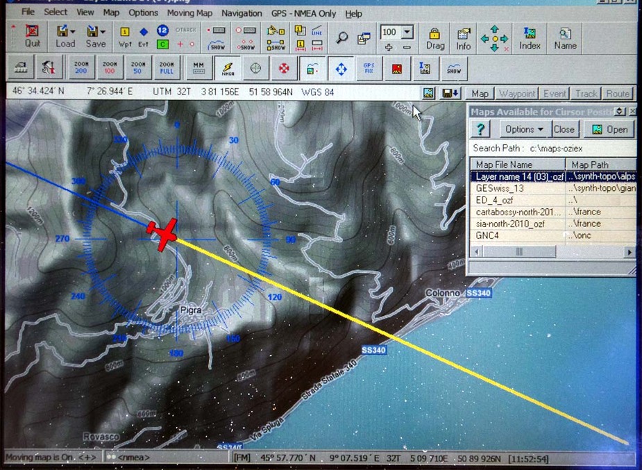
which makes it fairly obvious which canyon to glide towards. This is better than running traditional raster VFR charts, IMHO.
Products such as EVFR and SD, and others, show terrain too, but I think despite the high usage of these in some N European countries they are still not used by most people. Also this method works best if you are well above the terrain, VMC, and have time to think. This is why I won’t do IMC above the Alps nowadays. These guys didn’t have a lot of altitude to play with.
@Peter
Wouldn‘t you expect someone who experiences an engine failure to declare an emergency and advise about an imminent off airport landing in order to facilitate SAR?
Try this:
Wouldn‘t you expect someone who experiences an engine failure to declare an emergency and advise about an imminent off airport landing in order to facilitate SAR?
Yes but I think you would be surprised at how your attention span narrows to the immediate task of the engine restart once it goes quiet (or quieter) up front 
And, arguably, for the first minute or two, that’s where it should be.
While keeping the wings level of course…
Especially in IMC 
Unless you restart the engine, OR do a pretty good landing somewhere, S&R will not help you because you are going to be dead.
dublinpilot wrote:
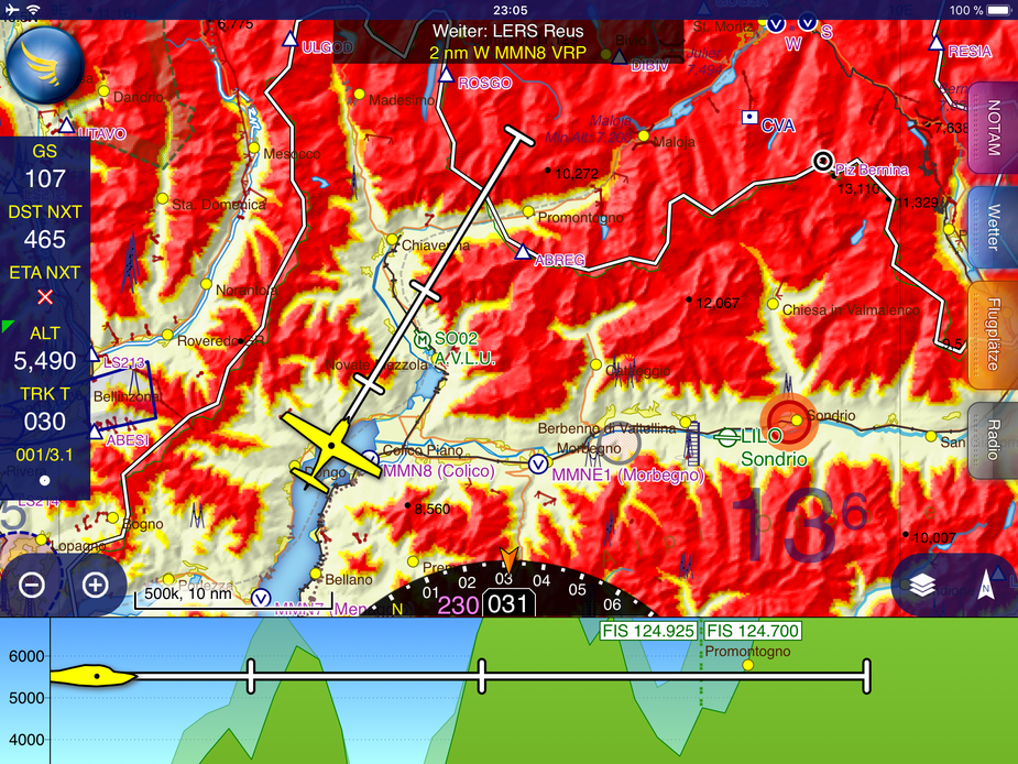
I think most of the major systems show terrain. I think what Peter was getting at is that most pilots don’t use some form of electronic navigation.I’m not sure if that’s correct or not, but if it is, it’s certainly changing.
I think among pilots who go beyond their home field circuit that is certainly changed now. I see very few pilots flying cross country from smaller fields without an ipad these days (or equivalent device).
I think you are absolutely correct, and I also think this is reinforced by being bashed in during initial training. However, I think there is an argument for a mind set of rattling out a Mayday, even if you dont get involved with much more. I think there are many occasions when survival is dependant on the services getting to you relatively quickly which would include any sort of trauma and hypothermia following a ditching, or in winter. You almost wonder if there is an argument for a one button distress on the transponder or radio which would just send your GPS position much as happens with a MOB.
With 3 POB, somebody ought to have set 7700.
Somebody with a paid-up FR24 sub can see the squawk – worth taking a look!
Squawk 7065 set 1306 UTC remains until last record.
Fuji_Abound wrote:
You almost wonder if there is an argument for a one button distress on the transponder or radio which would just send your GPS position much as happens with a MOB
Isn’t that what a PLB does? A PLB is a personal thing though.
Isn’t that what a PLB does? A PLB is a personal thing though.
It is what a fixed ELT does, but few planes have these because even they are mandatory in a lot of places, they were banned “since for ever” in Europe so not many are installed. N-regs have them as mandatory.
Squawk 7065 set 1306 UTC remains until last record.
Very interesting – many thanks.
A VFR flight for sure, too.