Nah – he’s supplementing his new job with being a French aeroclub instructor. That’s what they all believe.

I had unpleasant experience with LOI during RNP approach in IMC at LTFG, so I’m pretty sure I’d be very uncomfortable losing GPS even in VMC.
flying any distance in Europe without GPS is practically impossible, except in very rare cases like following the coast.
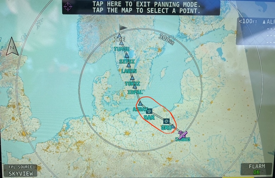
not sure if the above counts as Europe  but the red encircled part was completely “GPS free”
One has to fly with whatever is available
Spoofing put me at OLBA (while actually flying northbound in Greece).
You are pulling the guy’s leg
Nah – he’s supplementing his new job with being a French aeroclub instructor. That’s what they all believe.
you should be OK navigating visually
You are pulling the guy’s leg… flying any distance in Europe without GPS is practically impossible, except in very rare cases like following the coast.
BlueOcean wrote:
Rookie pilot here, flying VFR in a SEP, with WAAS GNSS and Skydemon
Of course it’s great to use GNSS during VFR flight but OTOH flying VFR you should be OK navigating visually.
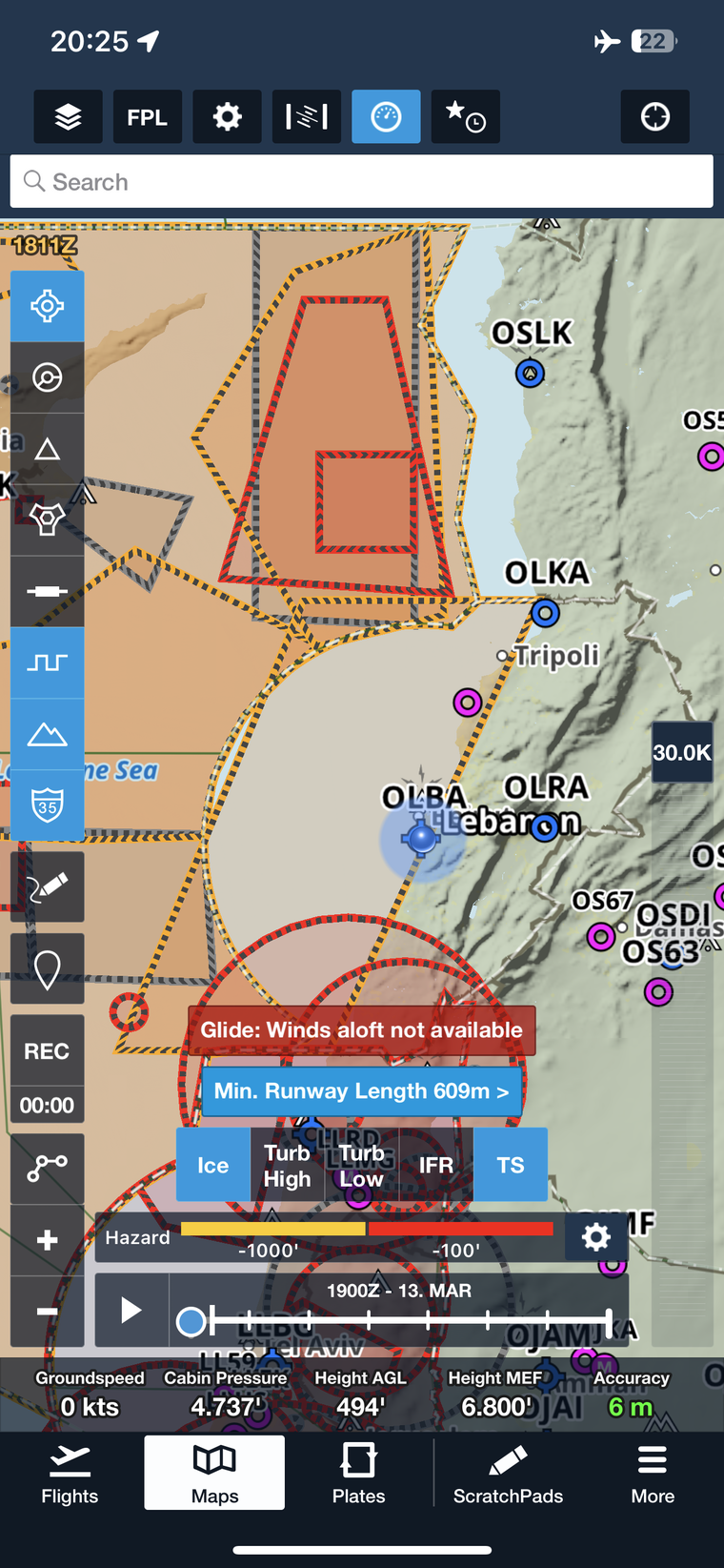
I am going to keep my ADF ;-), Just saw today a new airline route to LHPP and they were flying an NDB approach the RWY 16 due to strong winds, it allows only for LPV or NDB..guess they don’t have SBAS LPV on the dash-8 and for sure when GPS signal is spoofed you can forget RNP…
According to a Eurocontrol conference I went to years ago, the Plan is
That was for airliners. GA would use the 1st one; the 2nd one has no product on the market.
It’s also especially true over the Black Sea.
BlueOcean wrote:
and wonder what I should expect?
Definitely expect to use a backup plan, and have a backup for the backup ! (VOR, etc.)
I would also say expect to lose a lot of information you normally get via GPS (GS, time to destination, synthetic vision, etc.)
This is corroborated as I’m hearing by airline pilots who suffer hours long outages (and on modern airliners, a lot of systems rely on GPS, not just navigation).
It’s also especially true over the Black Sea.
Hi
Rookie pilot here, flying VFR in a SEP, with WAAS GNSS and Skydemon
(and, a paper map as well, of course )
I will be flying in the dark red areas tomorrow,
and wonder what I should expect?
Will my Skydemon track look like a seismograph during a Richter scale 8 earthquake?
Anyone with experience?
Cheers//jr