This afternoon at about 15h30 local, a TB20 crashed in short final to runway 35 at LFRD.
I was doing some IFR training at Rennes LFRN when it happened.
The TB20 had activated is IFR flight plan just after take off at Laval LFOV.
I heard about him until Rennes control asked him to contact Dinard tower for final approach.
Few minutes later (I had landed ans was taxiing), I heard Rennes asking a commercial flight if he could hear something on 121,5 as the TB20 was lost on radar and radio.
The controller told me later (at about 17h00 local) that the TB20 was seen in a pond at Pleslin-Trigavou and had no hope of finding survivors, he also told me that just before the crash the TB20 had deviated from the approach path as Dinard control told him.
Here is the METAR at this time : LFRD 171430Z AUTO 09007KT 060V120 2500 BR OVC002 07/06 Q1020 BECMG CAVOK
In Rennes it was quite better : ceiling at 1100 feet with alayer untill 1900 feet, 7000m visibility
Sad news.
He just posted in the diet thread, so yes he is…
Very sad to hear. It will be good to know what happened. And approach in OVC002 has very little margin for error, unless you are doing it in a vast and totally flat area.
the sat pic during the time of the tragic accident.
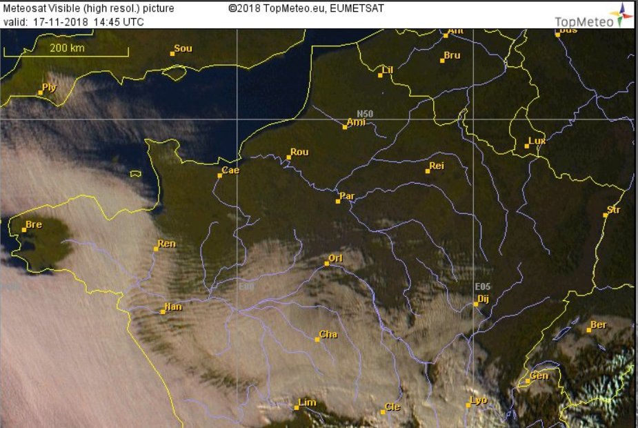
I don’t think you will see that much on sat images for higher pressure winter days
It can go from OVC002 to CAVOK then zero vis on complete mist/haze 5min later (all with “no clouds”)
From the south-west press,
https://www.ouest-france.fr/bretagne/dinan-22100/pleslin-trigavou-l-avion-se-crashe-dans-l-etang-un-mort-un-disparu-6075758
Not sure if weather related, from the press article it looks they were two experienced guys and the crash still 4nm away, they still looking for the other (probably dead) pilot…
According to the BEA it is F-GKVZ, c/n 1329 built in 1991.
Press reports show the airplane inverted and partially submerged in a lake but very near the shore, so it actually appears to have crashed into the lake. They claim the aircraft was flown by two pilots/co-owners of which one has been found deceased and the other is being searched for by divers.
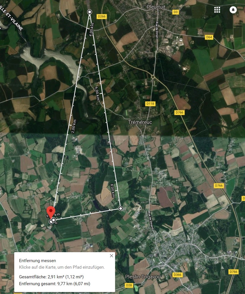
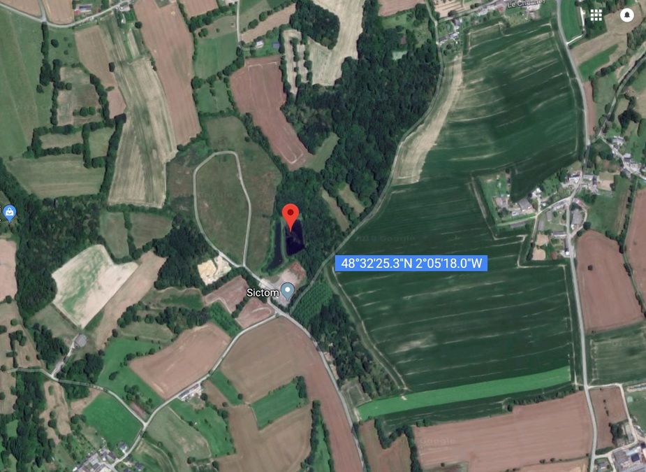
Looking at the news report and Google maps, there is one “etang” or small pond at 48°32’25.3"N 2°05’18.0"W which is about 1 km left to the centerline of runway 35 and about 4.3 km from the runway end.
It seems to be F-GKVZ
At this moment I were in Dinard (on the ground) and I can confirm the bad weather. However they were experienced, so we can imagine an instrument or engine failure, which is often fatal in IMC at low altitude.
Very sad news…