Whats the purpose of this?
Is it like an AIAA in reverse but this time to keep all the military traffic away from the commercial traffic travelling from the isles of Scilly to lands end type thing?
To me it would appear to be Class G does Lands End/Isle of Scilly ATC have radar?
also what happened to W2D route and others?
To have flown there in 2017, it is more like a non-radar CAS where Land’s End and Scillies manage GA and commercial traffic, mainly to avoid collisions I guess.
They ask for position reports and estimates, give many traffic warnings based on these, and phone to each other. Probably like Gander and Reykjavik :)
No idea what the corridor is about (it is Class G after all), but Newquay and Culdrose radars can see that area, though I don’t know whether they feed anything to the ATC at Lands End or Scilly Isles.
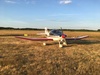
I’ve flown there many times. A very scenic bit of the UK.
Newquay radar will transfer you to Land’s End tower when you approach the corridor. They overlook the area on Sundays when Land’s End and Scillies are closed though.
It is controlled Class G :P, like a big ATZ.
Jujupilote wrote:
It is controlled Class G :P, like a big ATZ.
Isn’t it really a deconfliction service?
They didn’t give vectors and I guess they can’t having no radar. There are westbound and eastbound routes described in Land’s End AIP and website IIRC.
They ask for regular position reports and give traffic warnings repeatedly. I guess they plot aircraft on a large map with sticks like during the Battle of Britain :DIsn’t it really a deconfliction service?
Not formally.
They are just really keen for you to talk to Lands End when flying to the Scillies, and then later LE hands you over Scilly (St Mary) ATC. There is a lot of commercial traffic there, since the only other option is a boat and that takes for ever.
Looking at the dead seriousness of adherence to procedures, I estimate 40% of the world’s production of yellow jackets goes to St Mary airport, another 40% goes to Alderney airport (Alderney population: 1800)  I once left airside at Alderney via the wrong door and they detained me for half an hour while deciding on the correct procedure…
The commercial traffic is really funny to watch on TCAS. In OVC005 or less, they fly all the way at 500ft (whoops I meant 501ft ) so they do it “VFR”, so the IAP minima are not applicable. It used to be the same on the Jersey-Shoreham Islander run – sometimes 300ft all the way over the sea.
I guess they plot aircraft on a large map with sticks like during the Battle of Britain :D
Nothing as advanced as that
It’s amazing how somebody can make a huge meal out of nothing.
As things stand at the moment what is this Land’s End Transit Corridor?
Its class G that bit I understand but someone says its like a great big ATZ? Does that mean if I don’t a clearence I’ve infringed?