In the US, airways, VORs are rarely ever updated since installation, many going back to the 1960’s for the magnetic variation for radials. Airports and IFR procedures are updated more frequently, but most still use the 1990’s for variation. Pilot don’t know much about this but some do wonder why the GPS has a different track than the VOR radial or the final approach course on an IAP. 6 degrees is not uncommon in the US for the radials when compared to a GPS track using current magnetic variation.
Peter wrote:
The fluxgate would have still produced “some” value so it must intentionally do this above a certain latitude.
It is probably intentional but sufficiently close to the magnetic poles the inclination is large enough that the horizontal component of the magnetic field is very weak.
The G5 manual states following (excerpts):
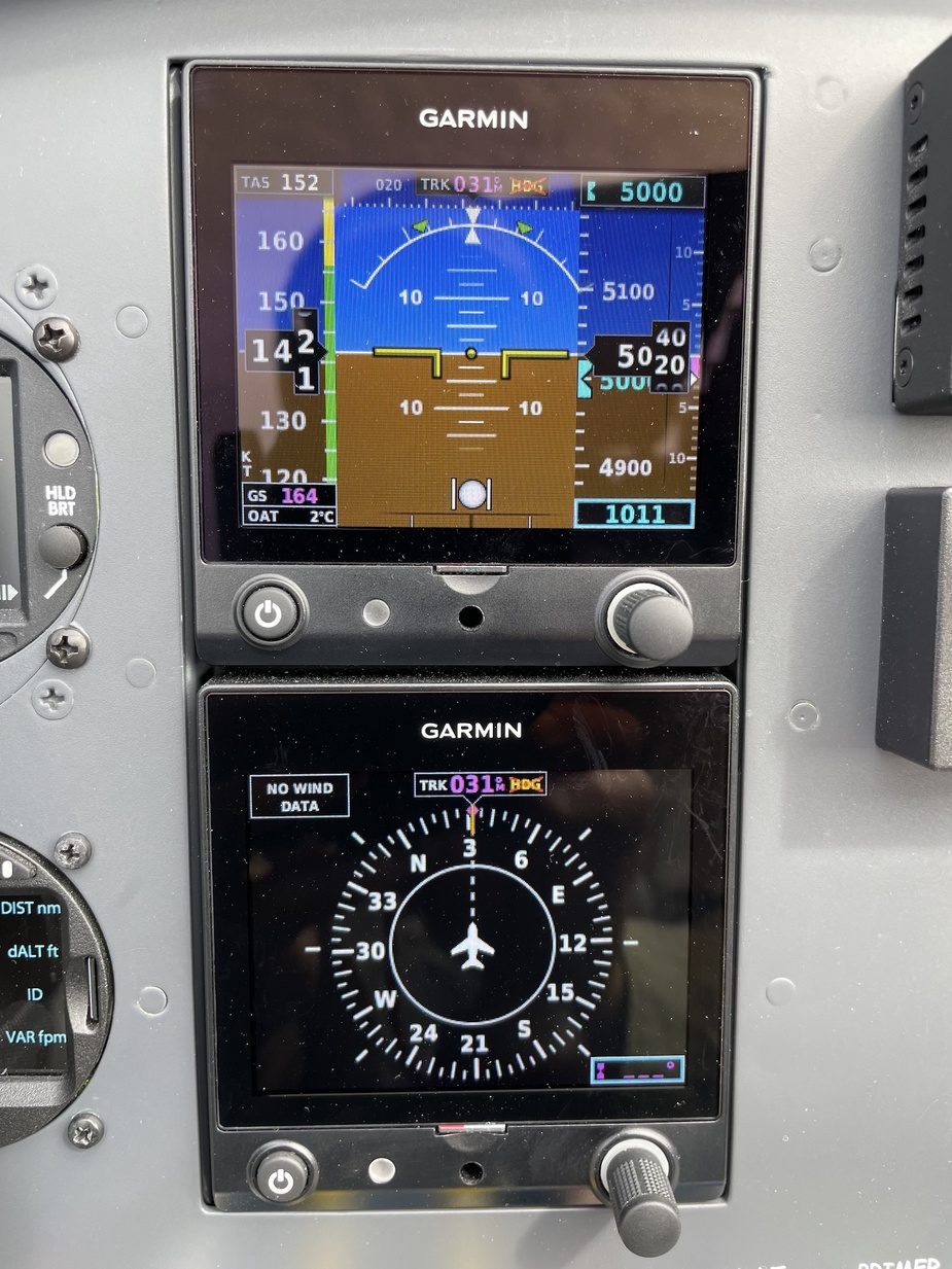
The G5 can display magnetic heading information received from the GMU 11 magnetometer. If magnetic heading input data is not available, the G5 will display GPS-derived ground track and the heading field will have a red ‘X’ displayed.
and
The G5 corrects for shifts and variations in the Earth’s magnetic field by applying the Magnetic Field Variation Database. The Magnetic Field Variation Database is derived from the International Geomagnetic Reference Field (IGRF). The IGRF is a mathematical model that describes the Earth’s main magnetic field and its annual rate of change.
and
If the G5 senses the magnetic heading measurement is valid but possibly outside of the internal accuracy limits, the numeric heading is displayed in yellow.
And this how it happened, first yellow, then a red crossed HDG as pictured above.
So the G5 abandoned the heading up there?
The fluxgate would have still produced “some” value so it must intentionally do this above a certain latitude.
as EHSI might fail to a true Track not Heading if it does not have Magnetic Heading.
An EHSI displays whatever is fed to it. It is just an indicator.
There is no way to measure true north, apart from a highly accurate INS (or esoteric GPS approaches).
So there is no “fallback to true north” possible (for us).
IMHO, this proposal is not going to fly 
And INS users already have workarounds. I wonder what @dan or @snoopy did over Canada?
Airborne_Again wrote:
I can well understand that Canadians feel that both grid navigation and the large variation figures are a problem, but their proposal basically exports a diluted version of their problem to the rest of the world – at least as long as we are relying on magnetic fields in any way.
Indeed, they will have a tough time pushing it through as the rest of the world is not impacted by variations
It may become a requirement to fly in Canadian airspace though?
‘SPACE ADSB’ + ‘TRUE HSI’
arj1 wrote:
You mean to install an INS into every a/c? Otherwise, what is the backup if the GPS fails?
You don’t need a full blown INS, any stabilized DG/HSI gyro will still work until you land 
It’s what people used to cross magnetic poles pre-GPS !
Airborne_Again wrote:
The really radical solution would be to completely abandon magnetic fields to determine direction and only use RNAV-derived tracks – even for vectoring. That could work.
You mean to install an INS into every a/c? Otherwise, what is the backup if the GPS fails?
Ibra wrote:
Most mechanical HSI allow to un-slave and manually set any value, this value can be the pilot input of true north from GPS
Meaning we’ll put the whole burden on the pilot rather than on those publishing procedures and data bases! Pilots have enough problems applying compass deviation when manually setting a DG/HSI.
I can well understand that Canadians feel that both grid navigation and the large variation figures are a problem, but their proposal basically exports a diluted version of their problem to the rest of the world – at least as long as we are relying on magnetic fields in any way.
The really radical solution would be to completely abandon magnetic fields to determine direction and only use RNAV-derived tracks – even for vectoring. That could work.