
Noe wrote:
To nitpick, at that location, the sun does set in the NW around the summer solstice (but I am also aware that this is a rendering and not a picture taken at sunset)
OK, fair enough ;-)
My point is that the way the topography is rendered has room for improvement and the resolution is also quite low, IMHO. I personally find the shadows overdone and distracting. Additonally the level of detail is not sufficient for VFR.
Supersonic wrote:
Peter wrote:The main thing Foreflight needs for European VFR is map declutter i.e. suppress airspace above a specified altitude.
I tried out FF as my SD subscription ran out this summer and found it pretty much unusable for VFR in Germany out of that reason.And, please, also include an airspace filter by type. When flying VFR there is absolutely no need to display airspace Echo and Golf boundaries. Just makes the map more cluttered.
Second: please do something about the way topograhpy is displayed and map detail in general.
Looks like the sun was standing in the NW ;-)
Otherwise, I think that FF has great potential…
Hi Supersonic,
We hear you loud and clear. I can tell you that we have received this feedback previously and we are currently working on making it easier to declutter airspace in Europe so stay tuned for that. On the depiction of the terrain, there is absolutely room for improvement and I have passed this feedback to the map team (I am also the designer for the map team) so I will make sure we take a look. On map details, we have an ongoing project to make improvements to the base map. If you had to pick 3 items that you would want to see improved on the base map, what would they be?
Out of curiosity, have you tried the colored terrain or only the shaded terrain?
Thanks again for the feedback. More to come soon.
Josh
Josh_Tahmasebi_ForeFlight wrote:
Hey Josh,
thank you for coming back to my post and request. Highly appreciate that!
On map details, we have an ongoing project to make improvements to the base map. If you had to pick 3 items that you would want to see improved on the base map, what would they be?
Out of curiosity, have you tried the colored terrain or only the shaded terrain?
I tried both. The colored is better, but missing details when zooming in.
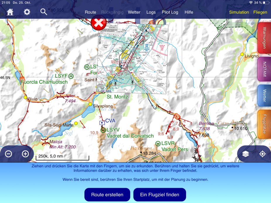
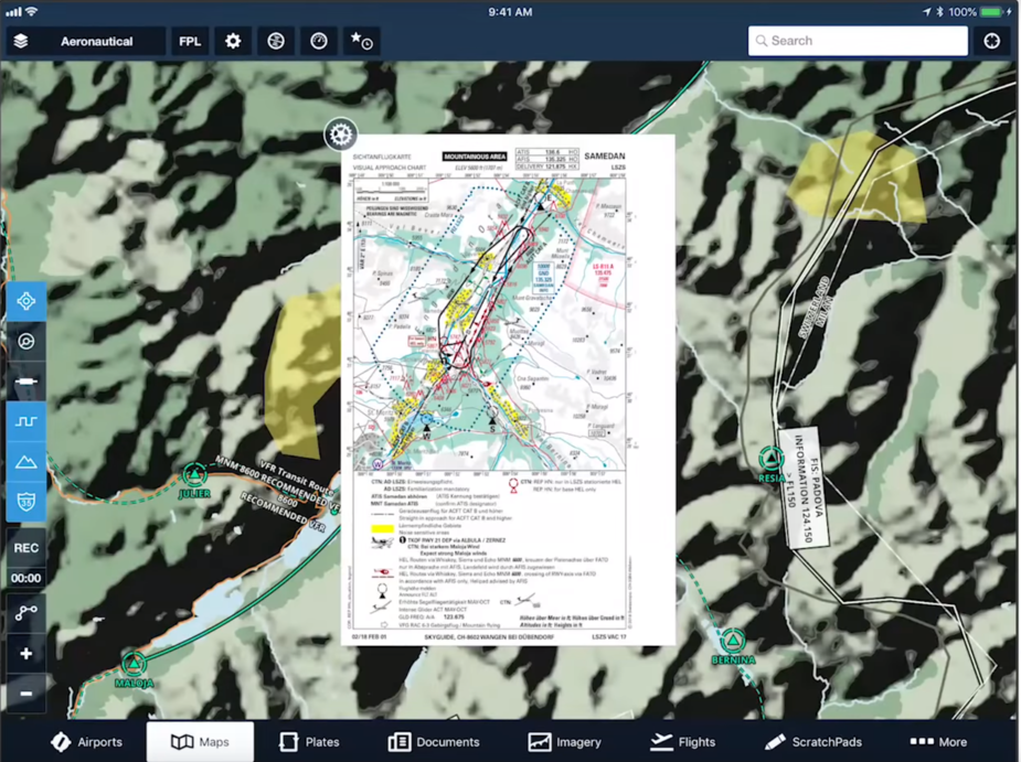
Here are two different styles out of SD – one is a hybrid between shading and colour coding for elevation, the other one is colour coded + shading for clarity. Also quite good: the obstacles shown.
FF needs to release a new version for Europe, before people start losing interest  One has to maintain the momentum.
Stuff like autorouting with fly-by waypoints, being able to properly specify the min/max levels, DCT preferences, avoiding a country, etc.
Supersonic wrote:
Josh_Tahmasebi_ForeFlight wrote:
Hey Josh,thank you for coming back to my post and request. Highly appreciate that!
On map details, we have an ongoing project to make improvements to the base map. If you had to pick 3 items that you would want to see improved on the base map, what would they be?
Terrain rendering / colour coding of elevation
I find it difficult to spot differences in elevation in mountainous areas with the shaded terrain. There is no colour coding for elevation – all mountains seem to have the same elevation.
As stated before I also find the shadows quite distracting. Plus, when zooming in, the picture gets blurry. I find that highly irritating, making me reach for my glasses (even if I wear them already).
Elevation figures in the map
Details like smaller cities, railroads, streets, highways + obstacles
Out of curiosity, have you tried the colored terrain or only the shaded terrain?
I tried both. The colored is better, but missing details when zooming in.Here are two different styles out of SD – one is a hybrid between shading and colour coding for elevation, the other one is colour coded + shading for clarity. Also quite good: the obstacles shown.
Appreciate you sending this along Supersonic. I’ll have a look and see what we can do to get these worked into our roadmap. If you have any other suggestions, let me know!
Josh
Peter wrote:
Stuff like autorouting with fly-by waypoints, being able to properly specify the min/max levels, DCT preferences, avoiding a country, etc.
Thanks Peter and Emir,
I am working with both our planning and filing services team and our planning and filing development team to see how we can best implement these items. Some items have are already on the roadmap based on feedback given i.e. fly-by waypoints, so we are listening and they will come in time. Our intention is not to let the app get stale by any means and we are working on Europe specific items to come out in upcoming releases.
Josh
Josh_Tahmasebi_ForeFlight wrote:
Appreciate you sending this along Supersonic. I’ll have a look and see what we can do to get these worked into our roadmap. If you have any other suggestions, let me know!Josh
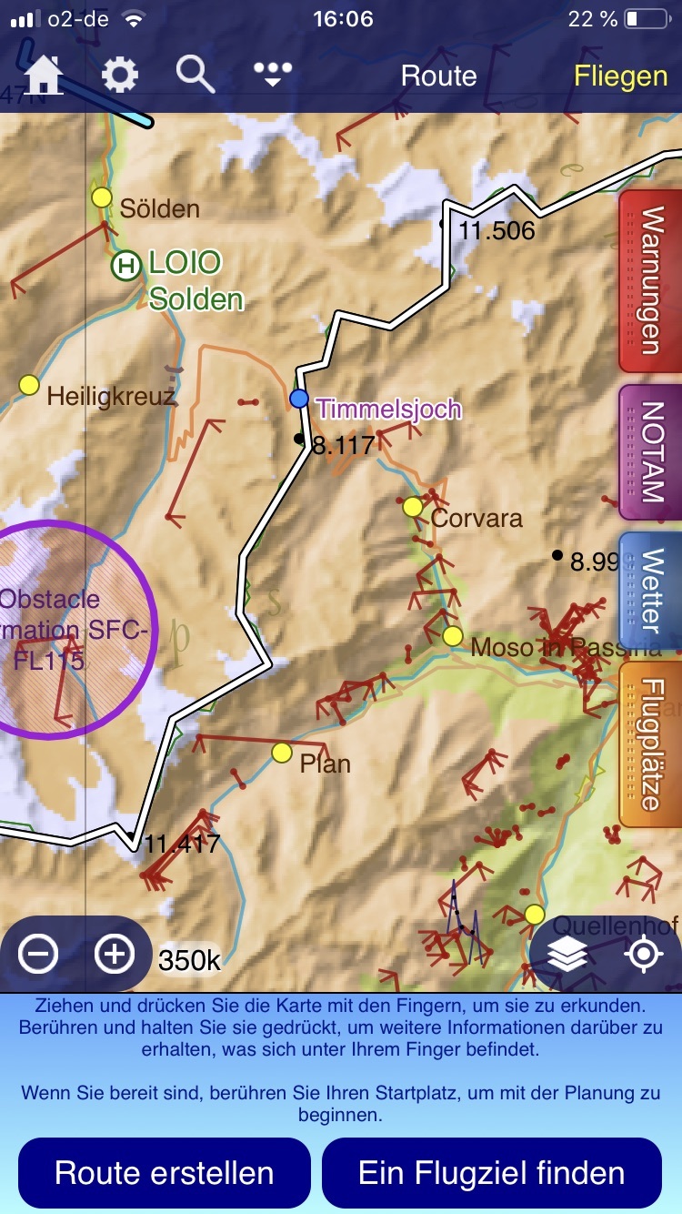
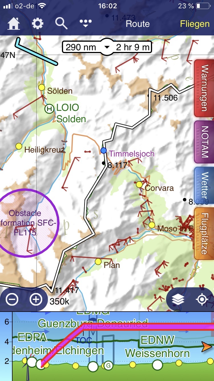
Just to emphasize what I mean I took a screenshot from the same area out of SD and FF. I guess you see, what I mean: You can read the minimum altitudes for the passes, see the elevations of obstacles like skilifts, you see the names of the towns, roads etc.
Out of my perspective, when flying in the alps, having those details is crucial for orientation and my “picture in the head”.
Does that make sense?
Thx again for listening,
Christoph
Supersonic wrote:
Just to emphasize what I mean I took a screenshot from the same area out of SD and FF. I guess you see, what I mean: You can read the minimum altitudes for the passes, see the elevations of obstacles like skilifts, you see the names of the towns, roads etc.
Out of my perspective, when flying in the alps, having those details is crucial for orientation and my “picture in the head”.Does that make sense?
Thx again for listening,
Christoph
Absolutely!
Josh
Josh_Tahmasebi_ForeFlight wrote:
Absolutely!Josh
I guess it all boils down to the question: could I use that map for navigation if I wouldn’t have my position icon on the map?


