Hi all
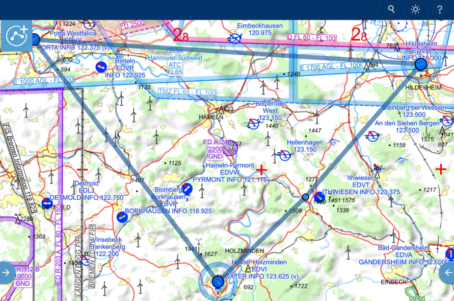
I’ve been following this thread for a while and as a ForeFlight user myself I wanted to share some experience. I agree that the aeronautical map at this point does not have enough details to be used for VFR. As a workaround I use the “Street Map” overlay, in theory it is only available while connected to the internet however the App caches already downloaded map tiles. This works surprisingly good. Since I pan through the route anyways before the flight it caches all the data and I never had problems with things not available in flight. In my opinion the street map shows terrain much nicer and you get the much needed detail for VFR flying (except heights of moutains). One downside I found is the town/city labels on the street map are always north up which is annoying when flying track up.
I would love a feature that would allow me to download all the map tiles for my route, e.g. when I pack the flight or allow to make whole regions available offline.
Jonas
PepperJo wrote:
As a workaround I use the “Street Map” overlay, in theory it is only available while connected to the internet however the App caches already downloaded map tiles.
I beg to differ. Yes, the “Street Map” shows much more detail. However, it is not displayed in a way that makes sense for VFR.
I do not need every single side street. Rather than that relevant details for navigation should be highlighted (overland streets, highways, obstacles, mountain passes, railroads) and elevation figures shown. Currently, in FF, even if, let’s say a street is displayed, it is very hard to see.
In that sense I think that Jeppesen MFD VFR has the best rendering. Even small towns are depicted in a non-distracting manner. Unfortunately it has other shortcomings :-/
In that sense I think that Jeppesen MFD VFR has the best rendering
It does have by far the best VFR maps, but at 3x the cost (roughly speaking; you do get the VFR terminal charts for Germany etc) it will never be a big success.
The main thing FF needs is altitude based map declutter. This is not trivial to do (as discussed further back this thread) because you have to make it dynamic, automatically exposing upper levels during a climb.
Peter wrote:
It does have by far the best VFR maps, but at 3x the cost (roughly speaking; you do get the VFR terminal charts for Germany etc) it will never be a big success.
Agreed. Additionally it is missing important features like fuel planning, hazard advisor etc. (at least it did two years ago, when I tested it).
The main thing FF needs is altitude based map declutter. This is not trivial to do (as discussed further back this thread) because you have to make it dynamic, automatically exposing upper levels during a climb.
From my point of view it doesn’t have to be dynamic, neccessarily. In Germany, airspace below FL100 is relatively simple. So just suppress everything above FL100 and all Echo and Golf type airspace.
Another approach: Sky Demon has the option to hide everything above/below a user defined threshold…
Supersonic wrote:
I beg to differ. Yes, the “Street Map” shows much more detail. However, it is not displayed in a way that makes sense for VFR.I do not need every single side street. Rather than that relevant details for navigation should be highlighted (overland streets, highways, obstacles, mountain passes, railroads) and elevation figures shown. Currently, in FF, even if, let’s say a street is displayed, it is very hard to see.
In that sense I think that Jeppesen MFD VFR has the best rendering. Even small towns are depicted in a non-distracting manner. Unfortunately it has other shortcomings :-/
I don’t disagree but as I said as a workaround for now it is better than the aeronautical map in my opinion. The Jeppesen map really does look nice.
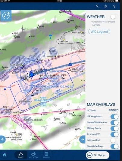
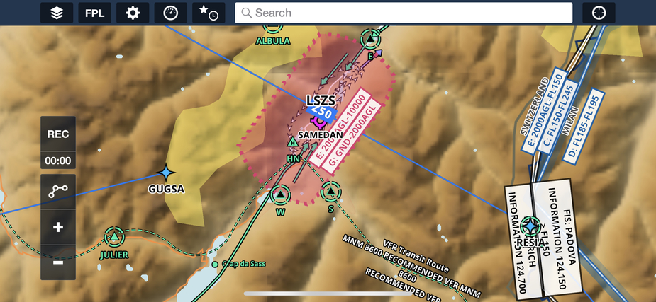
Have you tried the colored terrain setting instead of shaded? Looks much better.
Wolfgang_O wrote:
Have you tried the colored terrain setting instead of shaded? Looks much better.
It definitely does! However, still some information missing, like elevations, obstacles, passes, etc. E.g. what about the road to St. Bernina pass and lago bianco?
And what is the reason for the map being so pixelated?
Something I like over the other programs is that the VFR routes are shown incl. minimum altitude.
I guess, when those issues are taken care of, FF could have a unique selling proposition, being the only program suitable for VFR, IFR in the US and Europe. Plus the avionics integration with Garmin, Dynon and others…
Supersonic wrote:
It definitely does! However, still some information missing, like elevations, obstacles, passes, etc. E.g. what about the road to St. Bernina pass and lago bianco?And what is the reason for the map being so pixelated?
Something I like over the other programs is that the VFR routes are shown incl. minimum altitude.
I guess, when those issues are taken care of, FF could have a unique selling proposition, being the only program suitable for VFR, IFR in the US and Europe. Plus the avionics integration with Garmin, Dynon and others…
Hi Supersonic,
The map is pixelated because currently, it is a raster map rather than a vector version of the terrain map. I also wanted to mention that we have a project to improve the base map including the items you have mentioned. I will pass along the feedback to my colleagues as always :)
Josh
AFAIK topo maps are always raster, not vector.
It is a matter of what resolution they are made available in.
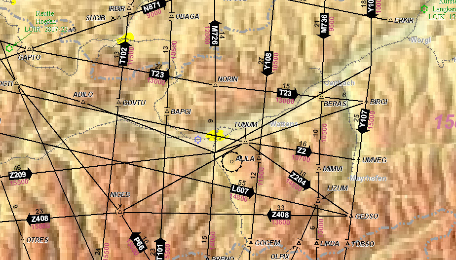
For example, the current PC Jeppesen package downloads some new “hi res” data which is about 6GB, of which I believe half is the terrain data. That may be worldwide. It looks like this – I would consider it pretty poor
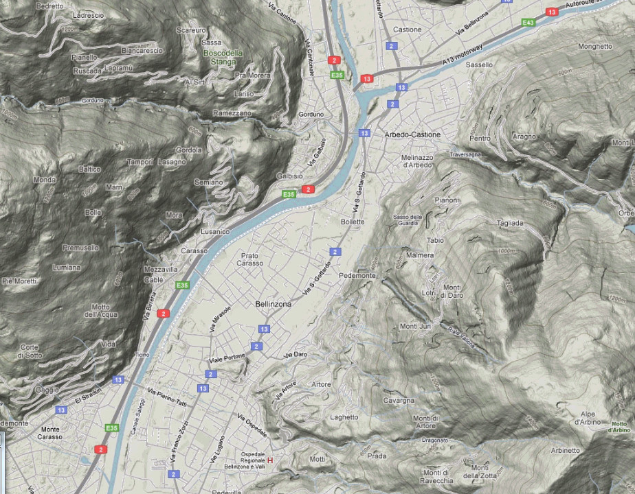
Another example: I have some hi-res topo data of the Alps and the Pyrenees, for overflying them above solid cloud (!) and that was 50GB downloaded from google terrain (I believe they now block bulk downloads from one IP) but it compressed to a few GB. This is what that looks like, in Oziexplorer
So that is the sort of order of magnitude one is looking at – a few GB sitting on the tablet, for Europe, if you want something between these two. The data itself is probably free, although I don’t know about commercial use.
On the specialised subject of colour coding, here is some history showing how one can screw up. One guy I knew in the US GA scene was convinced it was responsible for at least 2 fatal CFITs in the US (in its KMD550 incarnation). It is believed to have since been fixed. Admittedly only a muppet would use terrain colour coding for obstacle clearance but…
Peter wrote:
So that is the sort of order of magnitude one is looking at – a few GB sitting on the tablet, for Europe, if you want something between these two. The data itself is probably free, although I don’t know about commercial use.
Well, a few GB sounds good to me. Even if it would be a few dozen GB, that would be fine.
And – like you mentioned – it doesn’t have to be THAT high res. Just something in between…