
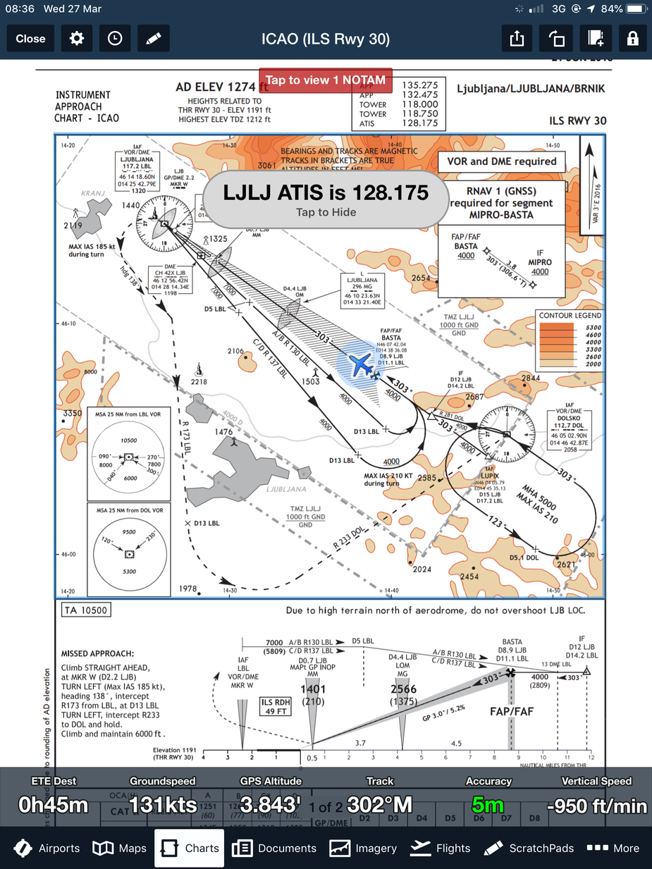
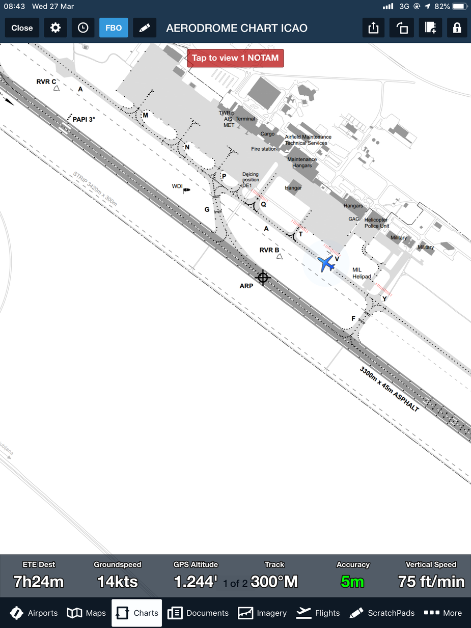
Two more screenshots from today’s approach/landing to Ljubljana LJLJ. Really good job FF with warnings on ATIS frequency, entering runway and other stuff besides geo-referenced plates.
Today I noticed that Slovenian arrivals, approaches, taxi and departures are georeferenced while in Croatian set only approaches and taxi plates are georeferenced. Can somebody from FF team answer why not all plates are georeferenced?
Emir wrote:
Croatia, Slovenia and Italy are supported with AIP charts. Great job!
So you have a Europe subscription plus Jepp charts? Did you have FF before they released the Europe sub? I have a Canada sub with Jepp Europe charts, and don’t at the moment see any advantage to adding a Europe sub. Any experience on the difference between the two variants?
Jacko wrote:
The FF deal-breakers for me were its incomplete and unreliable nav data
Would you have some examples of this?
So you have a Europe subscription plus Jepp charts?
I don’t have Jepp charts – these are AIP plates.
Did you have FF before they released the Europe sub?
No. I purchased subscription when Europe was added.
I obviously didn’t look closely enough.  The Slovenia plates have quite a Jepp look-and-feel vs France and the UK which are so very different, just to name a couple.
The FF Europe subscription is improving its coverage steadily and is a cost-effective alternative to Jepp especially for IFR if the CH/DE VAC charts aren’t needed.
ThreePoint wrote:
Jacko wrote:
The FF deal-breakers for me were its incomplete and unreliable nav data
Would you have some examples of this?
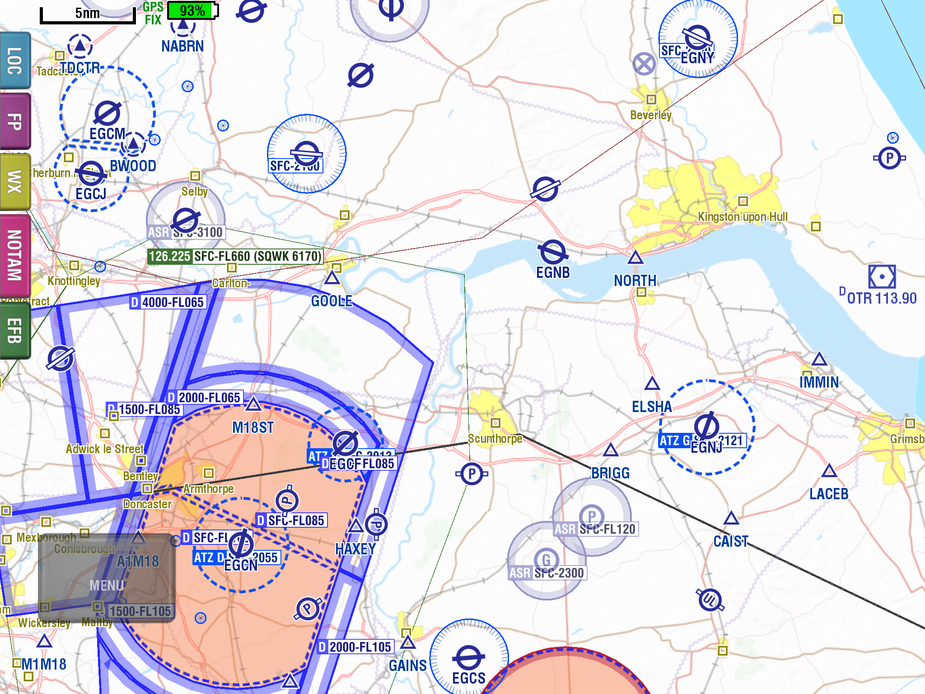
Sure. My FF trial has ended, but see how many of these private airfields, VRPs, parachute drop zones and glider launch sites you can find in FF.

@foreflight team
Would it be possible to add the option in the settings/layers of displaying a scale on the map to quickly estimate distances?
Hi all,
Josh here. Just getting back from a trip and I’m currently going through the list of questions and I’ll be back with you all shortly to answer your questions. Apologies on the delay.
Josh


