If you fly IFR in the Eurocontrol system, you don’t (in theory) need to know about terrain because the enroute MEAs, and the AIPs, take care of it. In Spain it is different  and anyway ATC could make a mistake, so one needs to be terrain-aware when in IMC, but I am sure most GA pilots aren’t.
If you are IFR outside the “controlled system” (whether you are legal or not; SERA is supposed to allow IFR in Class G, though maybe not non-radio like the UK does, no?) then you need the elevations. But you also need to know where controlled airspace lies because you have no clearance to go anywhere into it.
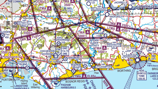
So e.g. the UK charts show the airspace clearly, and show the elevations clearly, because UK pilots can fly in IMC and if OCAS they don’t need a clearance (also a clearance is not deliverable in Class G anyway) but they don’t want to go into hills:
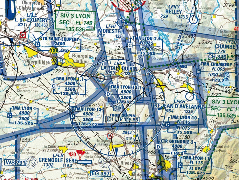
Whereas France has given up on showing airspace clearly – this is the supposedly “good for VFR” IGN chart:
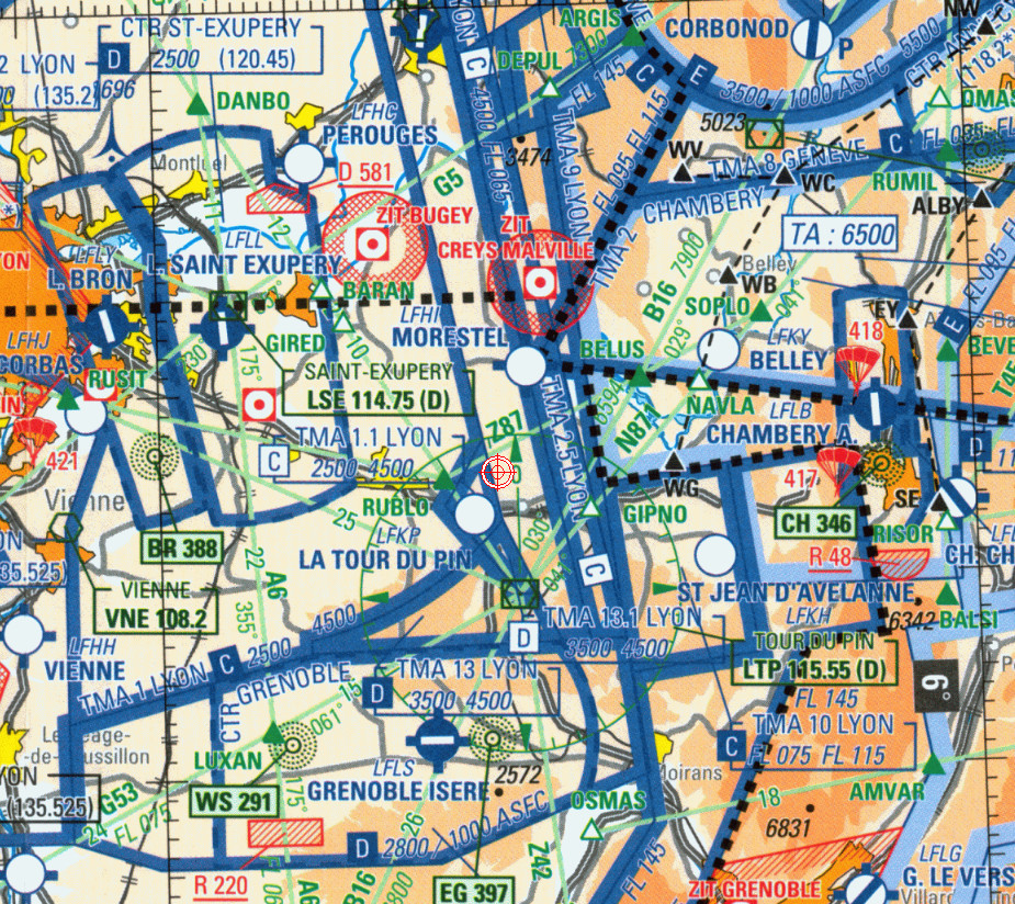
and has given up showing elevations also – this is the “official” SIA chart:
but seems to manage, due to these things:
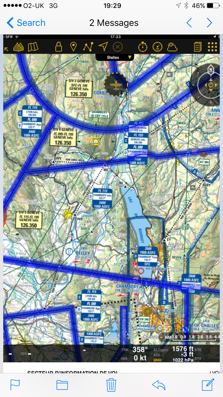
I am glad W-N made my point for me too about the “6500” label because to a casual chart user it looks awfully like a grid MSA etc and the pilot descended specifically to that figure.
What is “ADM”?
ADM = Airborne Decision Making
Agree with Jason and others here – the chart presentation becomes pretty irrelevant if proper pre-flight planning is carried out. If you fly into an airport surrounded by mountains w/o an instrument approach, then you at least have a look at some topo chart, no? Which will tell you that the cumulugranitus in that area extends to above 6500ft…. That said, both the UK and the French charts are, IMHO, crap. The only one I found useful when flying in Europe was the Jepp VFR chart. A real pity they don’t make them anymore! And to add a ‘ceterum censeo’: some form of SV would prob99 saved the day here.
The descent to 6500ft proves it wasn’t planned for obstacle clearance by reference to a correct topo chart but the other questions are still worth asking because this thread and the other one appear to make it clear that plenty of people don’t do strict MSA planning on VFR flights.
OTOH you can’t do MSA planning on a lot of mountain flying because you are doing it in the canyons… then you get the cloudbase (somehow) and work with a minimum value for that, versus the canyon bottom elevations.
But I doubt this flight was planned or intended for canyons because AFAIK Stefan had little canyon flying experience.
Peter wrote:
I am glad W-N made my point for me too about the “6500” label because to a casual chart user it looks awfully like a grid MSA etc and the pilot descended specifically to that figure.
It actually doesn’t to me because it is prefaced with TA. I may have wondered if it was really a transition altitude as I agree that is odd to have on the chart but wouldnt have taken it as a grid MSA.
I treat this the same as when climbing under the LTMA. On my track and nearby i like to have an altitude i know i can climb to without relying on hitting a certain step ie if i climb to 3000ft i know i am clear and have to time to get my clearance etc. I set that on the ground.
Descending into Vilshofen (VFR) I have preplanned an altitude I can go to while being certain to clear all relevant terrain and obstacles (some towers there). You can’t easily do that when already in the descent. If I don’t get visual I go to Straubing.
And it isn’t pure VFR as you are transitioning from IFR so need to make sure you are safe on that transition. It is also why once VFR you can’t just ad hoc go back into IMC as you prob aren’t prepared for it.
Peter wrote:
If you fly IFR in the Eurocontrol system, you don’t (in theory) need to know about terrain because the enroute MEAs, and the AIPs, take care of it.
I do not agree. You should be aware of terrain even flying IFR. When you start asking for headings for avoidance. When you need to descend to escape icing. MEA is not too useful for that. (Grid) MORA is more useful.
Peter wrote:
most of the French club-level GA flies only so very locally and at low level that they don’t really need charts
I don’t understand what beef you have with French aeroclubs. I am pretty sure the situation is exactly the same in the UK and Ireland, or anywhere else in Europe for that matter, so I don’t understand why you keep ranting about the poor state of things in France specifically. And in any event, if that is what they enjoy, or can afford, then let them. If they want to do aerobatics overhead their airfield, then let them do so. If they want to do a L2K burger run, it’s up to them. If they want to fly to China, same thing. Let’s not create a value scale with a local flight around the patch at one end and those that fly to China at the other.
The charts posted earlier are wrong – Chambery and Lyon TMA have changed (in November) and what was previously class E has now turned Class D (C for Lyon)in that area. Regardless, Stefan would have had to have been in touch with ATC.
Peter wrote:
most of the French club-level GA flies only so very locally and at low level that they don’t really need charts
To put it mildly – that is an assumption that deserves consideration. Having said that most of the clubs located near a small hill – like say Annemasse which is the biggest in France after Paris – don’t have the luxury of having planes so powerful that they can fly through and above mountains without a giving a thought to things like maximum ceiling. So in my actual experience maps with altitudes on them are actually a lot more prevalent in France than UK rumor would have it.
Finally – the pilot was expected by a flight instructor at arrival, and would have needed an endorsement to use LFKA. Again, out of actual experience I would think that endorsement requires knowing which map to use when planning the arrival.
But probably the blanket statement that “all foreign pilots use the SIA map because it says VFR on it” is closer to the truth.
Having just read the entire thread, it is impressive how much information has been collectively researched and put together.
The only knowledge I have of the pilot is through this thread but there are some human factors that stand out.
The following are my thoughts of what MAY have happened.
We know that the pilot was on a flight to go and meet his mountain instructor, to do some mountain flying.
The weather wasn’t ideal, as Peter has shown with the met chart and radar plot. It could be described as challenging but workable. He could have cancelled but often when we consider it might be a worthy challenge, we tend to go for it.
When he got closer to his destination the weather was worse than he thought. He makes the difficult decision to divert…in the mountains, a long way from his home base and with a lot of cloud around.
The workload doubles, triples..goes off the scale.
Unless you have a pre-programmed route planned and ready to execute you are now free navving around in poor weather.
You might end up heads down trying to get something into the FMC..who knows. You fly into cloud, so now you are flying IMC in terrain without a radar service. (This was backed up by Peter saying that the squawk was a French VFR one.)
As a commercial pilot you are drilled not to do this and you feel very uncomfortable. There is only one thing to do…climb above MSA.
Again Commercial pilots are drilled at knowing MSAs, adding various corrections, and being very careful about accepting clearances below it. Demonstrating terrain awareness is very important on route checks.
So, I think that the pilot thought he was safe as he thought that he was at or above MSA. This is backed up by the FR24 plot showing that a constant Flight Level or altitude was maintained, close to 6500 ft. (We can discount a incorrectly set altimeter as the met chart shows the QNH to be close to 1013.)
So why did he think the MSA was 6500ft?
As explained, the charting is awful. Maybe it was that? How many times have we all misread a chart? Particularly a complicated, unfamiliar one?
If he was working atc and it seems he was and stated he wanted a climb above msa what would they have given?
If he was working atc and it seems he was and stated he wanted a climb above msa what would they have given?
“Working ATC”? Do you mean being in contact with ATC? (Non native speakers like me sometimes have difficulties with this type of jargon…)
The Radar Minimum Altitude Chart as well as the sector altitudes for Annecy shows 8400ft in the direction of Albertville. I couldn’t plot the crash site on this chart so I don’t know what the minimum ATC approved altitude at this spot would have been. But certainly more than 6500ft.