
I could find several definitions:
COMMISSION REGULATION (EU) No 1089/2010
‘aerodrome reference point’ means the designated geographical location of an aerodrome, located near the initial or planned geometric centre of the aerodrome and normally remaining where originally established.
ICAO annex 14 vol 1 2.2
2.2 Aerodrome reference point
2.2.1 An aerodrome reference point shall be established for an aerodrome.
2.2.2 The aerodrome reference point shall be located near the initial or planned geometric centre of the aerodrome and shall normally remain where first established.
2.2.3 The position of the aerodrome reference point shall be measured and reported to the aeronautical information services authority in degrees, minutes and seconds.
Jeppesen do not take any risk, their definition is :
AIRPORT REFERENCE POINT (ARP) — A point on the airport designated as the official airport location.
According to https://www.faa.gov/documentLibrary/media/Advisory_Circular/150_5300_13.pdf, in the US the ARP is the midpoint of the runway if there is only one runway. Anyway you should always check where the ARP is before using the OBS function.
In the AIP you can find the actual coordinates of each threshold and so you can create a user waypoint if you do want to use the OBS function.
In France, aerodromes with two non-parallel runways will often have their crossing point as the ARP – Lille Lesquin is one example.
My bad. But then it falls into the same category as Malmø. The ARP is in the middle of the planned set of runways:
“The airport was initially planned to have six runways, but this number was reduced to five 4,500 m (14,800 ft) parallel runways in April 2009, with a large passenger complex in the middle.”
Just one for now,
Where actually is the definition of ARP? Somewhere with ICAO, I should think?
ICAO, too, is bound to state who decides on it. I expect it to be the aerodrome operator.
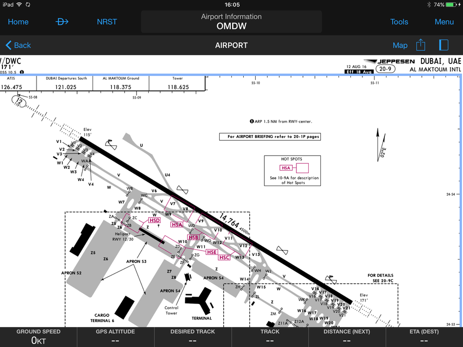
DWC, not DXB. DXB’s ARP is on the threshold of RW12R and has been for some time.
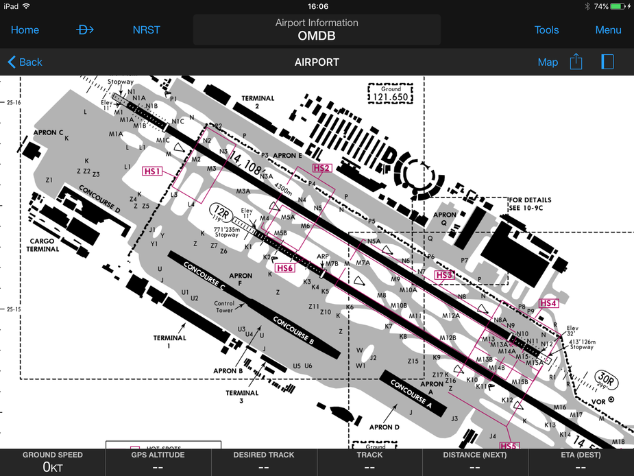
The ARP stays in place when runways are withdrawn. LFLX was a busy USAFE base, so presumably there may have been other runways, now long disused and redeveloped for other purposes. DXB has been extensively redeveloped too.
Peter wrote:
Fairly obviously it would be better to do a DCT
Depending on your database you can enter DCT runway XX which will guide you to the threshold with accurate distance reading (these waypoints will always be coded if there exists a GPS approach) or DCT to the identifier of the localiser, which would be “CX” for runway 21 in your example above. The distance readings will be relative to the position of the localiser antenna, but the lateral guidance will be spot on.
What waypoint would you use for the LOC?
(KLN94  )
)
Do that at Dubai World and you’ll never find the ILS! :) I tend to do DCT the localiser.
I do DCT [airport] when flying an ILS, just to get the magenta line as a rough reference for where the localiser lies, so I know when to expect the intercept.
Fairly obviously it would be better to do a DCT [some NDB or VOR close to the runway].


