Just wanted to tell about a new weather service that is now becoming available for all of GA (in Norway). It’s called HemsWX (Helicopter Emergency Medical Service Weather) and is developed by- and for ambulance helicopter pilots.
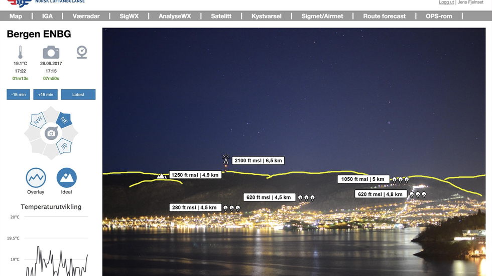
The system consists of 250 cameras sites, strategically placed all over Norway. Each site can have up to 3 cameras. They are all high definition cameras, taking pictures every 15 minutes. Each picture is overlaid with information, so it is possible to see ceiling and visibility.
The helicopter pilots have developed and used it for several years, and they think it will also be useful for light GA now. It will become operational (for GA) next week. It works on phones and pads as well as PC. The heli pilots also use night vision goggles as well as other fancy navigation equipment, but it’s still basically VFR from what I understand. I have no idea how it actually works yet, but will find out soon I hope 
I think this is just excellent, because it is only at larger airports we are able to find out the current weather in real time. With this system, we will can take the decision based on real up to date data, not only when planning, but also en-route, just about everywhere.
Thanks for sharing, LeSwing
Looks like you must have an account for it, but however, it still provides some nice WX even without the account.
I like the WX radar data !