Apologies, clearer versions:

Has anyone looked in a competing product, for example Air Nav Pro, or a Garmin product, to see what the airspace depiction looks like over there?
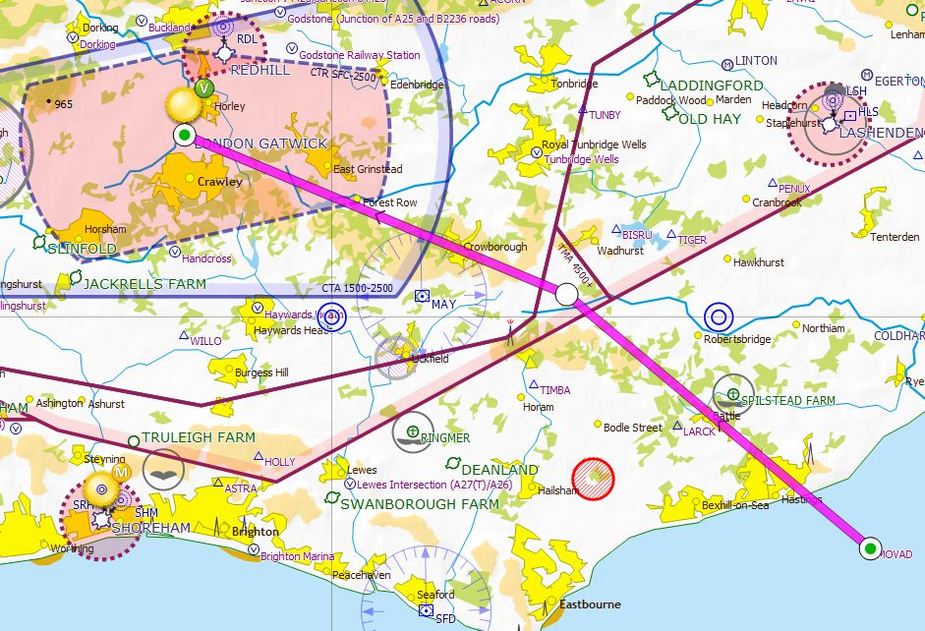
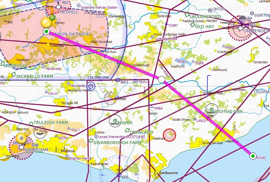
Navbox Pro, Jepp Flitestar, Jepp Raster Charts (1:500k "VFR/GPS" charts) all agree with the CAA 1:500k chart.
If that kink really existed (we didn't look at what the airspace within it was showing as, but I recall there was no label) at 5500ft Class A base, it would come interestingly close to LGW SIDs/STARs.
WB - I think you have exactly what we saw in your 3rd from bottom case. The same kink.
And SD disagrees with itself in the two pics below that, so it's not a change of airspace issue.
You should upload those images to e.g. imgur.com. Flickr is a site which objects to its images being used within other sites. Currently, it is witholding them.
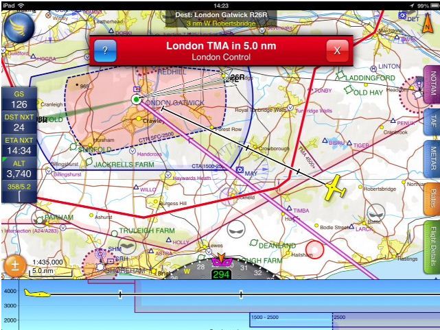
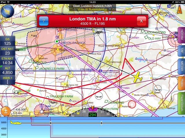
I stand to be correct here, but it is always good to learn... and I don't have a CAA chart in front of me, but if I am below 4500' QNH I can fly up to the line in the first picture. If I want to be above 4500' and stay below 5500' I can fly to the outer boundary line on the second picture. Above 5500' there are a whole lot of airways as well as the TMA. No? Now as to how or not that agrees with the chart and then the raw data and it's underlying source(s) is another question...
The current 500k CAA chart is what I posted in my original post.
That was a screenshot from Memory Map running the real thing, Edition 38.
The 4500ft airspace is indeed in that "kink" but it is not only in that "kink", which is why the thick line doesn't make sense (to me). The 4500ft bit is the whole airspace to the left of the kink, to the south of Gatwick etc.
In the previous year's map the 4500ft was 3500ft, incidentally.
You should upload those images to e.g. imgur.com. Flickr is a site which objects to its images being used within other sites. Currently, it is witholding them.
Yes, I see what you are describing now. I just ran an approach to that airspace in simulation mode to see what it displayed. Here are the results:
All images moved to imgur.com!
WB, if you do have some contacts with the SD team I would be interested if they would look at this thread and give an opinion. Unless I misunderstand it, or the CAA chart is now out of date / wrong, SD has joined two airspace boundaries at different heights together and formed them as one.
As I said before I love SD, but sometimes I think if you give people too many configurable options (in this case by setting what airspace you can see on screen at different heights (or altitudes) below and above your planned route), or in the air route - it can be more of a hinderance than a help.
However, on the other hand if you only evey fly at 2000ft, then it makes sense to hide anything a further 2000ft above you, for example, and not clutter the map. The problem with that is that if you decide to be 'adventurous' one day and fly to 5000ft, suddenly up pops some airspace you werent aware of when you were planning. Thats why I will always additionally use the NATS chart as a flight planning tool, and always take it with me and not fly only armed with an iPAD or a piece of software.
For reference, here is the same location in PocketFMS. All airspace shown...no altitude restrictions.

PA - Yes - I'm emailing their development team a link to thread now. From the simulation I just ran, the software would appear to function correctly, however as you rightly point out is using my specific settings at some random altitudes I selected to try and generate a warning. A different combination of settings and altitudes could generate wholly different results.
The NATS CAA VFR south chart amendments are shown here. Your text to link here...
I don't see any changes to this area listed.
dp
SkyDemon have had a look at the thread here and their thoughts are as follows:
"The kink exists, and only when you start including airspace that starts at 4500’ or above do you get the additional piece of TMA that “fills in” the kink. In SkyDemon it’s impossible to hide that airspace if you’re actually flying anywhere near that high, as the current altitude always overrides the “airspace clipping” feature with a significant (and configurable) safety margin.
In short, as far as I can tell, the SD depiction is perfectly correct according to the AIP. You can fly into that kink all you like as long as you’re below 4500’. SkyDemon’s default settings keep you safe and don’t lead you astray. We’re not responsible for the CAA chart, but it appears to be showing correct airspace too."
In summary, from their investigation and my simulation it appears the software is working as designed. As per Piper-Archer though, the 6 P's apply and Peter's friend might want to have a look at how they have the de-clutter configured. SkyDemon calls it 'clipping'.
In the 'Map Layers' menu scroll down to the very bottom and look at the setting 'Hide features higher than X000 ft above'. Depending on QNH versus the WGS84 height the GPS is giving, having this set too low could produce some surprises. Default is 1000 ft.