Once again I’m a happy user of that solution. Flight time 1:27 and about 1:15 in IMC at 4C. It’s great to know where the heavier rain is in order to not run into something nasty. The METARs and TAFs that get delivered also contribute to peace of mind.
Has anyone connected this to a Garmin 530 (so the flight plan downloads to the ADL120), if so could you give details of the pin connections Garmin-ADL120
Thanks
Hello Rob,
If you connect the ADL120 to a GNS530 (or GNS430/GTN650/GTN750) the pins on the Garmin side depend on the configuration of the GNS530 box.
1 Signal line
You will be looking at the P5001 connector of the Garmin 530. Pins 56, 58, 41, 54 are RSR232 outputs numbers 1,2,3,4 respectively. (There is a fifth RSR232 on the other connector). One of those has to be connected to Pin 3 of the ADL120 connector.
Then in the configuration of the RS232 this port has to be configured as “Aviation Data Output”.
If you have multiple devices requiring aviation data output only one port of the GNS530 can be configured to deliver it. In that case all devices will be connected to the same pin getting the same data. I have seen installations with many devices connected and this seems to work very well.
2 Groun
In addition to the single signal line you will need a proper ground connection between the ADL120 and the GNS530. On both sides you have a choice of pins for that. On the GNS530 pins 77,78 on the P5001 connector and more on other connectors. On the ADL120 side you can choose between 1, 23, 24 and 25 for ground.
If you have any further questions just write me.
Can I get the ADL output to overlay on SkyDemon or Garmin Pilot?
That overlay would certainly be very nice and avoid app switching
Update, Loop feature
I just used the ADL120 in real weather for the first time this morning and i must say it really works fantastic. I was not sure if I would get home to Munich (EDML, to be precise) from CZ this morning because of a cold fron coming in. In the end the flight was piece of cake due to very high ceilings in the rain and good visiblity, but it was a good test for the satellite link.
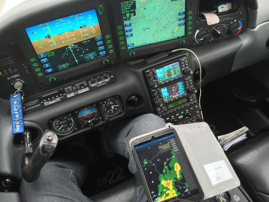
How to best use ADL weather radar images in flight
While we don’t have NEXRAD a € 2000 ADL120 gives you four radar images per hour on your iPad for a big part of Central Europe.
Based on that remark I would like to learn more about how others are using this service. I also have the device and so far my IMC flying was in benign conditions.
However, I did notice a few times that although the ownship symbol showed me in a yellow precipitation area in the actual situation (probably 20 minutes after the picture was taken and processed) there wasn’t any rain anymore.
So far my understanding is that one should watch the direction WX moves to and use the images to avoid bad WX by coming around behind it. But what isn’t entirely clear to me is what really depicts bad weather. For example, are yellow areas still ok to fly through?
What is your tactic, your way of using the service?
My tactic is that I do not even get close enough to the orange and red areas of the radar image or the strike symbols, so the 15 minute lag does not matter for me. I would not try to navigate between two thunderstorms with the help of the ADL. Maybe I’d do it if I was a professional pilot and with the help of onboard radar, I don’t know.
In IMC I try to stay out of the yellow areas, at least for now, and if I am not sure, then I rather fly a detour than risk anything.
While a massive simplification, I avoid red, try to avoid yellow and will fly through green. This is whether it is radar, nexrad or ADL. But the gain (essentially what the colour means) does vary. And sometimes it is better or worse than shown. However it is better to err on the side of safety.