
Are there any updates on this topic of SV on portable devices?
One should be able to achieve flight sim type imagery.
Yes I am very interested too. How does the Garmin Pilot work with the GDL39 or GDL 39 3D?
I believe there is a European version of Garmin Pilot. Does anybody have any feedback on the mapping etc
Peter wrote:
One should be able to achieve flight sim type imagery.
Flight Sim type imagery? I.e. “Looking nice is more important than any form of accuracy”? Don’t think there is a use case for that in actual flying… ;-)
Seriously:
I believe it is a conscious choice of the manufacturers to not try to achieve FS type imagery. You already have that by looking out of the window!
For a synthetic vision it is more important to show relevant features like power lines, ground structures, etc. much over-emphasized.
In addition it is a good design principle for safety relevant representations, that one should avoid creating “spurious* accuracy”: The representation of the synthetic vision should not be more accurate than the position/direction source used to calculate this synthetic image.
‘* Don’t know if this term is common in English – the German word “Scheingenauigkeit” seems to be an even better fit…
My Q remains: is there such a product?
I am not aware of evidence that flight sim scenery is inaccurate. The main challenge there seems to be achieving huge frame rates (50fps+) on huge screens, which needs a top-end PC with a huge video card. Plus a few hundred GB for storing the SRTM data. But none of this is an issue if running at say 25fps on a small screen. The panel mounted products which do SV have ancient processors; probably a 50MHz 486…
It would need a reasonably modern tablet to run. Most modern high-end phones would be OK; it is tablets which are currently lagging in R&D.
There is no commercially available solution.
If you carry around a notebook you can use the x-plane connect toolbox to link x-plane with some GPS-Source in your plane to get an x-Plane view from your actual position.
Peter wrote:
I am not aware of evidence that flight sim scenery is inaccurate.
There are bugs – even beyond the infamous sky towers in the latest FS. E.g.: https://forums.flightsimulator.com/t/lsmf-scenery-bug/303874
These Bugs do not matter for a flights but can be very irritating in a real flight SynVis.
And there is one systematic major challenge:
The best source of actual elevation data available is the NASA SRTM data that has resolutiony of 1-3 arc seconds depending on where you are on the globe. 1 Arc second at our latitude is about 25 meters. Therefore every feature that is smaller than 50m (Nyquist-Shannon !) will not be represented in the actual data but needs to be somehow interpolated. For FlightSim use this doesn’t matter – for actual flying use you would need an order of magnitude better resolution to show a photo realistic SV.
This is a standard feature with ForeFlight. SV can be viewed in split screen or full screen mode. It works best with an AHRS input from a portable or panel. The GDL39, GDL5x, Status, Sentry along with the FS210/510 and an OEM interface to provide the AHRS is available to other vendors such as the Stratux.
I believe EasyVFR has got this too, but you need to be actually flying to test it. Does FF have a “sim” mode?
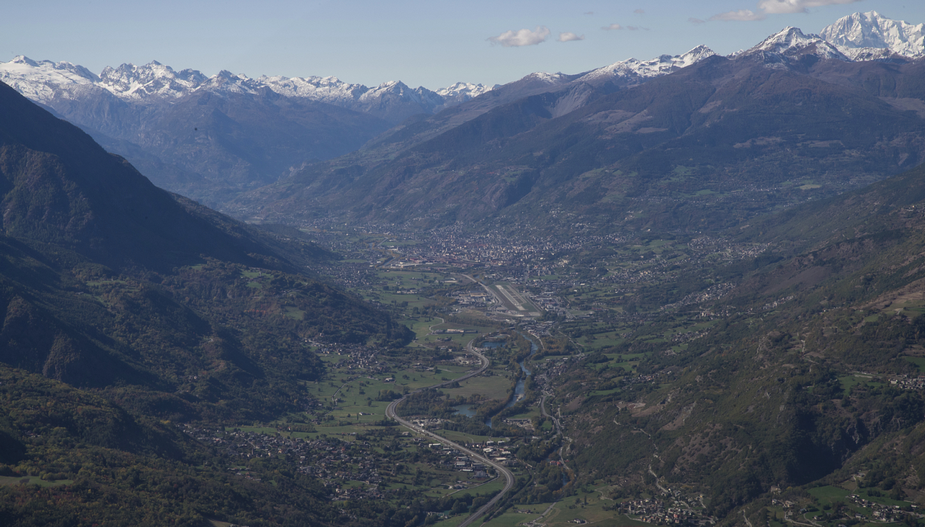
I’d like to see a pic from halfway down the IGS27 at LIMW  This is the real view
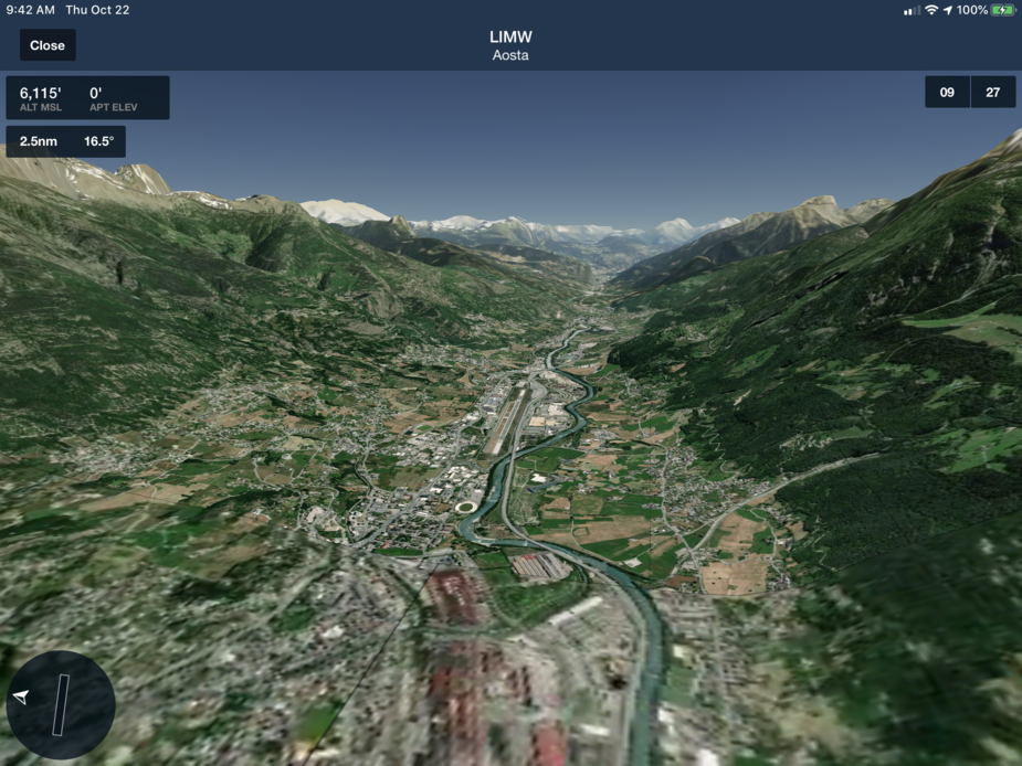
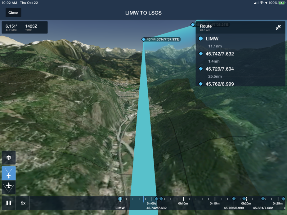
A 3D vision review is available on the Performance plus version that allows you to preview a flight following the route or replay a flight with the terrain or just preview an airport. The Pro Plus subscription level includes the SV, but not the 3D vision. You can also hook ForeFlight up to a flight simulator such as FS 2020 or others. Here are some screenshots from ForeFlight, the first is a preview of the airport, the second is based on a review replay of a prospective flight path.
What’s the difference between FF SV and 3D?
The above looks very good but that’s the $300 version.
I can run SV in Garmin Pilot on the Ipad, from conection to the Flightsteam which has AHRS.
Not sure its very high on detail though.
I should have run it through the Simplon pass to see how it displayed, but my eyes were on stalks and I didn’t look inside at all.

