
For those with interest Garmin pilot has now introduced a vertical profile view – much like that in SD. You can also now subscribe to the NATS VFR Charts for the UK. Flight plan filing is coming soon.
I use it all the time and like and it is now getting close to being a good solution for IFR and VFR in Europe.
Interestingly their new transponder the 345 allows ADS-B OUT and provides ADS-B in to Garmin Pilot. Not important for most yet but I love ADS-B in for filling in the enroute phase of flight.
Last thing I noticed is that Garmin just acquired DeLorme.
I’ve been using GP for a couple of years and although it was pretty ropey to start with, Garmin do keep improving and fixing. Connected by FlightStream to a GTN650, it works reasonably well as a poor farmer’s MFD.
Incidentally, I heard that a couple of years ago two products were hurting Garmin’s sales: iPad and Aspen. It looks as if they may be ready to attack the retro-fit PFD market soon…
Jacko wrote:
a poor farmer’s
You hear a lot about these but never meet one…. 
JasonC wrote:
Jacko wrote:
a poor farmer’s
You hear a lot about
Not in Europe at least…. Plenty back in Australia these days though!
You can also now subscribe to the NATS VFR Charts for the UK.
That is very good. I wonder if they will do other countries. France Germany and Switzerland do good VFR charts.
Flight plan filing is coming soon.
I wonder who they will use for that?
Here’s what’s available now:
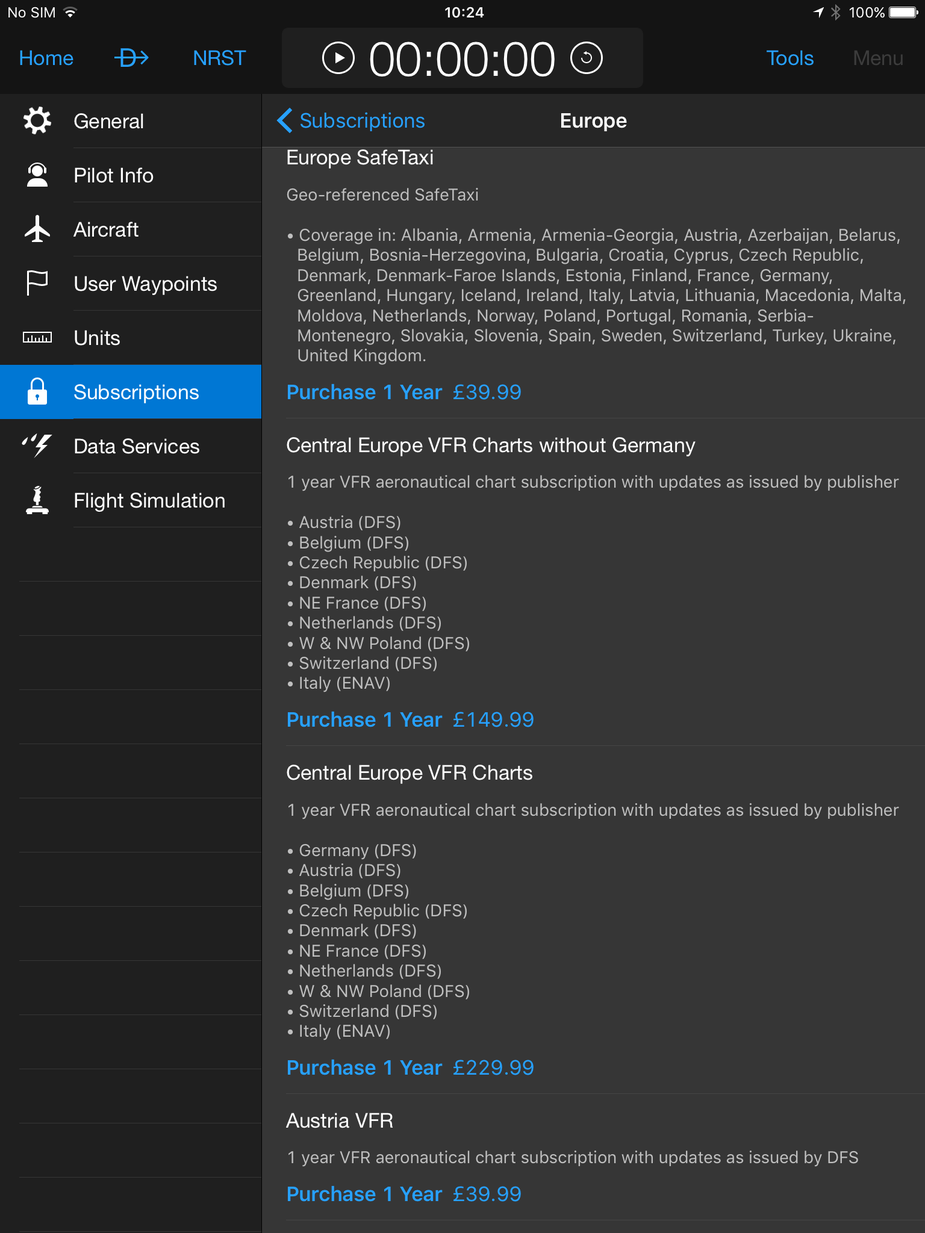
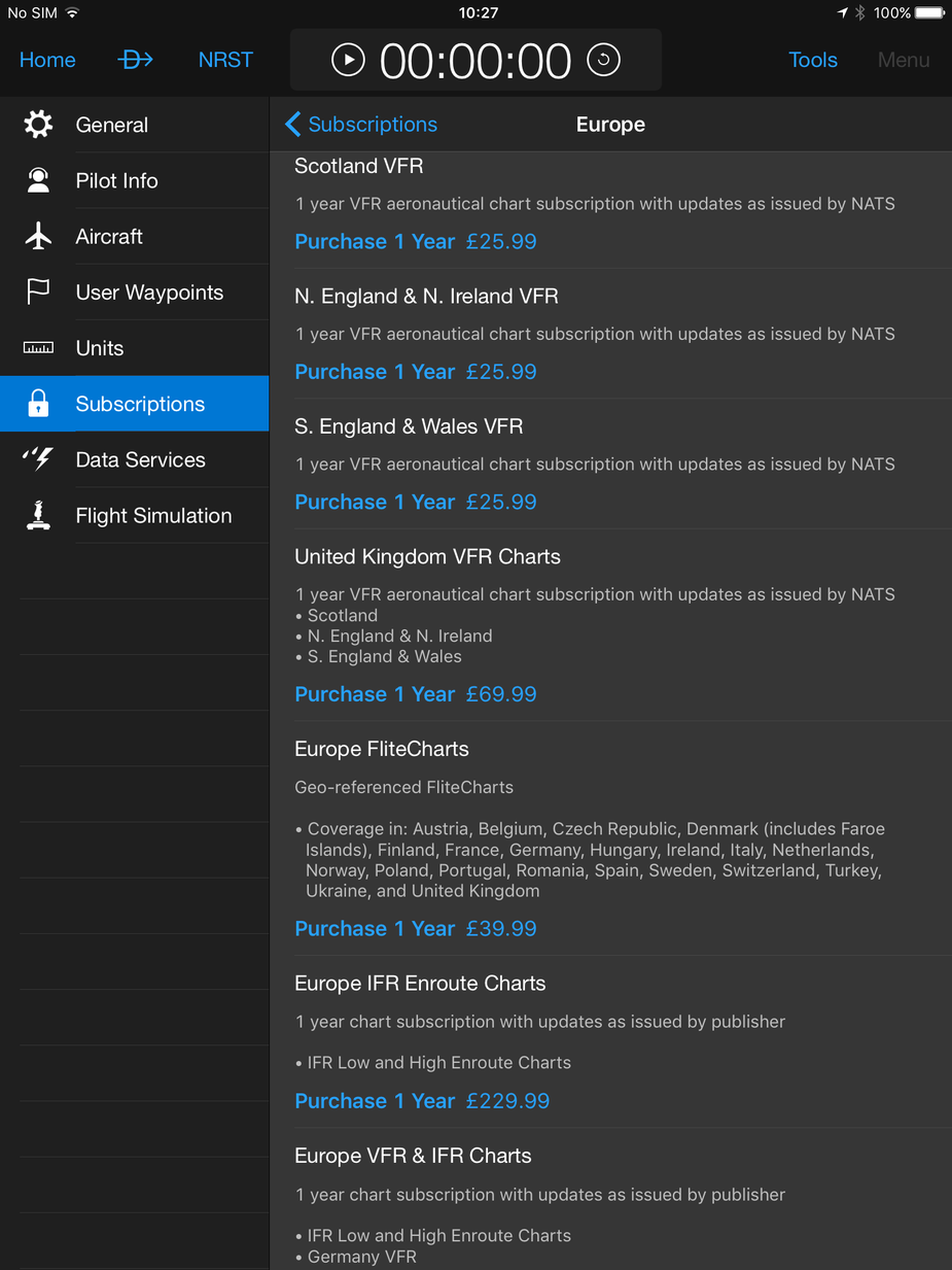
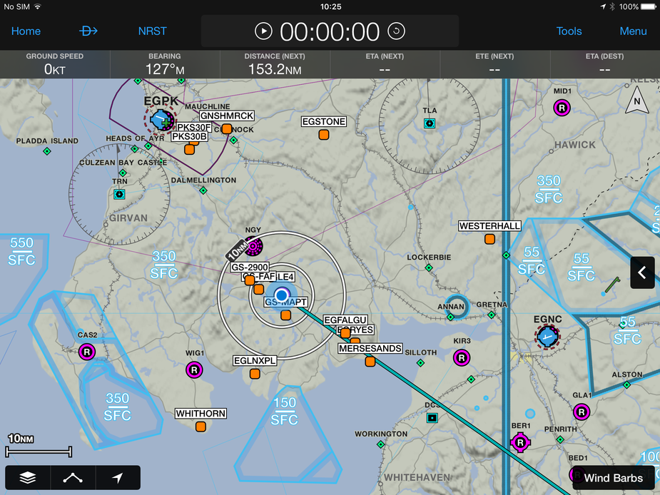
I haven’t tried the en-route charts because the base map is not bad. Safetaxi and the FliteCharts are just about worth 40 quid each for convenience.
Really interesting post – thank you Jacko.
Fun to see Germany charging even more for it’s VFR charts than the UK does Especially as the vast majority of UK pilots don’t buy all three UK charts.
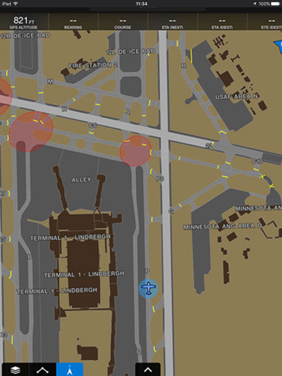
Am I right that Safetaxi are Jepp airport charts, georeferenced? Can anyone post an example?
Can anyone post an example of their Flitecharts (or did you post a piece above?), and the IFR Enroute charts?
I think IFR enroute are the least amount of work because the data is free from Eurocontrol and the rest is “just software” albeit nontrivial for rendering the labels correctly – as eg. here
Interesting their Flitecharts don’t cover Croatia.
Safetaxi looks like Jeppesen.
FliteCharts are just AIP downloads which you can put in somewhat convenient folders. *
FP filing is in beta at the moment, through Lockheed Martin. If I fly to Nurnberg as planned in a couple of weeks, I might try it…
* Correction, they are also geo-referenced, which seems a good deal for 40 quid by Garmin’s standard.
I think Safetaxi is much better than Jepp. I only have it on G1000 but it looks like this.
Flite charts are this (just the govt charts)

So even if looking only at enroute VFR charts: once you buy them all (and then you stil have covered only half of Europe), you spend north of 300 pounds / 400 Euros a year. A joke..


