What I find amazing is that Croatia isn’t capable to set Dubrovnik radar for years and years. Which leaves pretty big gap in radar coverage in large portion of south Dalmatia, Dubrovnik area, part of Adriatic sea and Monte Negro.
I really like the RainViewer App for weather wx radar information.
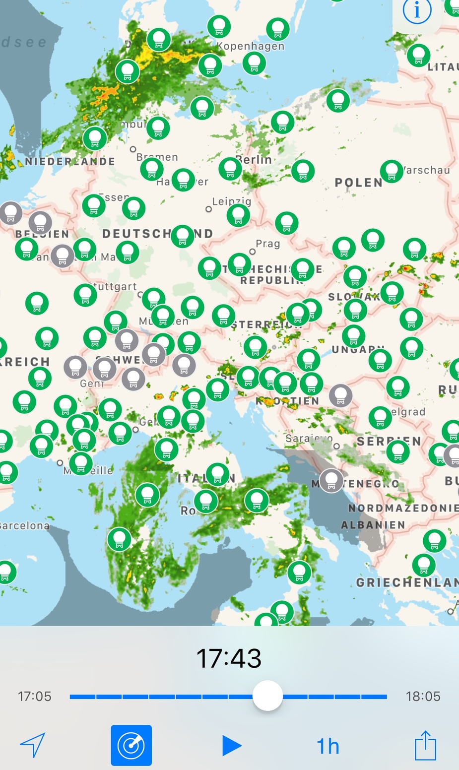
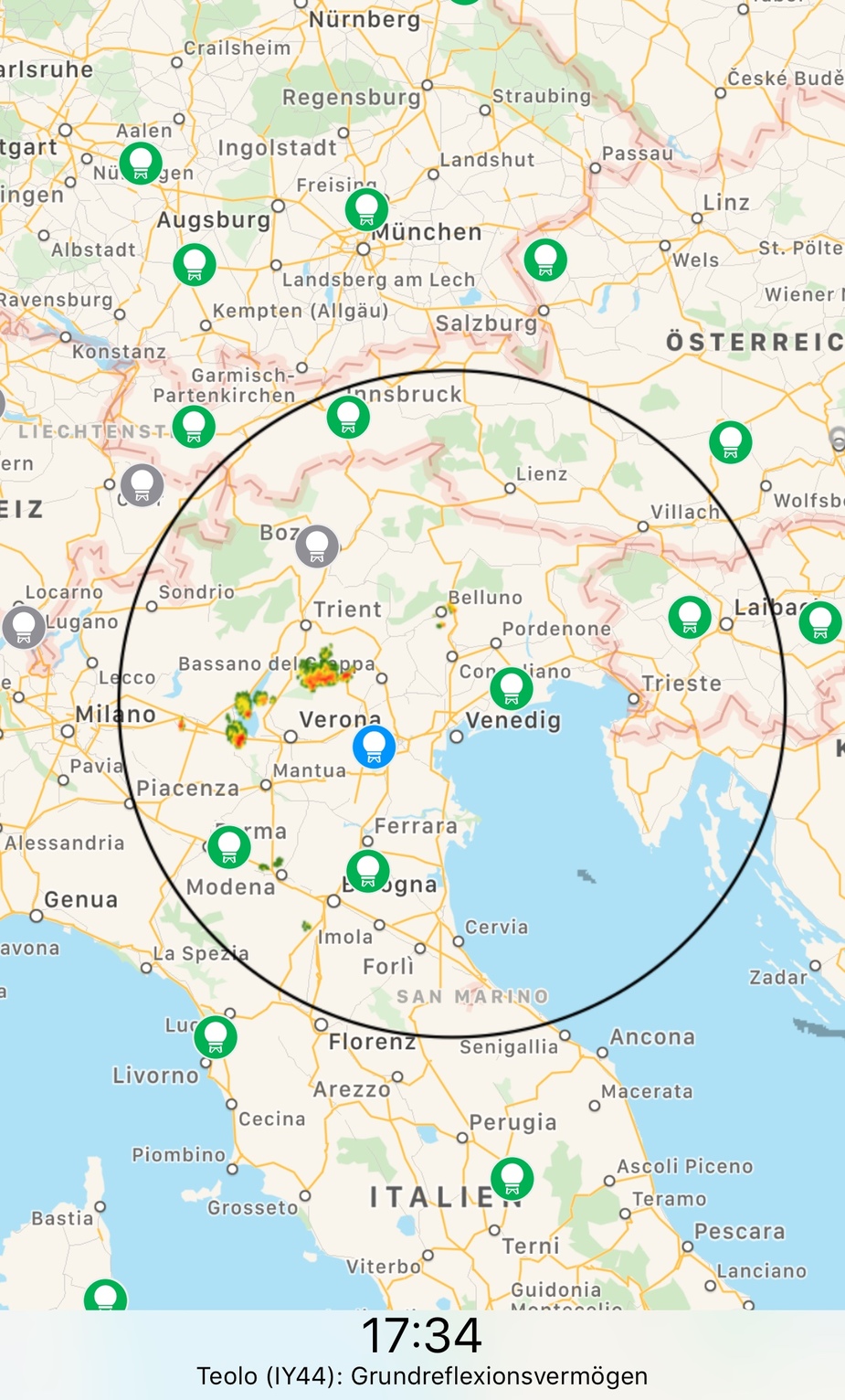
One can use „meta data“ or select individual radars and compare their echoes. I paid 3,49€ to get rid of ads. Recommended!
Peter wrote:
The official answer is that it takes time to process the data. Of course that is bull. The real answer is that they sell differently delayed data for different prices – same as happens with share prices, car satnav databases, you name it…
That makes a lot of sense. Presumably though the MetOffice data is not just limited to the UK? But they’ll have streams from Newfoundland to Moscow that will feed into MOGREPS? I know of one radar, over at Neatweather that has 1-2km high-resolution radar with updates every 5 minutes. Presumably that would be enough for the likes of an iPad with SkyDemon/ForeFlight.
There’s a fact sheet here local copy I just found.
Sebastian_G wrote:
Sure that could be improved especially by creating a full European composite in one step instead of the national intermediate products. But that would mean to reorganize the whole system and besides a few GA planes there is little demand for such a service.
Well almost everyone I see that flies in the US has this system. Would be so beneficial to have in-flight radar link, even if it is a couple of minutes off.
I always fail to understand why rainfall radar data is usually delayed?
Some radar stations do a so called volume scan of the atmosphere. This can take nearly 5 minutes alone as the antenna is rotated many times at different elevations etc. Some antennas just do one turn which is much faster but the quality will be less good. Other antennas will produce different weather products in a time share system.
Then comes the processing. The data is collected into composite images at different stages. Usually every nation produces their own national composite and they set a deadline until when all data has to be uploaded by the radar stations. Then this happens again at the international level with another deadline. Finally some more processing is done which takes a few seconds. In a worst case the deadlines of the different nations do not line up and a compromise for the final image will have to be made.
In the end for example the ADL in flight weather system has got a delay after the measurement timestamp of 4 minutes.
Sure that could be improved especially by creating a full European composite in one step instead of the national intermediate products. But that would mean to reorganize the whole system and besides a few GA planes there is little demand for such a service.
Does it take 5-10 mins for the radar head to rotate the required number of revolutions?
Incidentally, this is really dangeous
You are maybe 30 secs away from the “£400 hotel session”.
I have a DWD Flugwetter subscription and use the android app that comes with it all the time, mostly for non-aviation related stuff.
Don’t write that here as it breaches the license agreement ;-) Lufthansa and Ryanair subsidize our aviation weather with their enroute fees. If you want the exact same data for other purposes it will be more expensive than what DWD currently charges you.
Peter wrote:
The official answer is that it takes time to process the data. Of course that is bull.
Depends on the delay. Rapid Radars can do 5 Minute Imaging I believe, but normal is 10. So the delay of 10 minutes is usually caused by processing indeed, as normal Images are usually used for such sites, as they cover larger Areas. Some older installations can take longer and if their data is used in Composite Images, then the consequence is that the whole Image can only be produced once all data are in. That is why some Images only get updated every 15 or even 30 minutes.
I always fail to understand why rainfall radar data is usually delayed? Surely if you are sitting in Exeter, you’ll see the rain live? The benefits of linking that data via ADSB or Satellite to aircraft would be beautiful.
The official answer is that it takes time to process the data. Of course that is bull. The real answer is that they sell differently delayed data for different prices – same as happens with share prices, car satnav databases, you name it…
I have a DWD Flugwetter subscription and use the android app that comes with it all the time, mostly for non-aviation related stuff.
I always fail to understand why rainfall radar data is usually delayed? Surely if you are sitting in Exeter, you’ll see the rain live? The benefits of linking that data via ADSB or Satellite to aircraft would be beautiful.
After I landed from Southampton there was a risk of some embedded CBs, mostly a PROB30 north of the M4, but a PROB40 further South. I wanted to get back to London so as I was at the hold doing my power checks, I quickly checked the metoffice app (rainfall radar) and it showed a cell or two north of Shoreham on my departure route. Southampton was IFR and wouldn’t allow a VFR departure so I elected to fly Northbound IMC, then track north of London in between layers so I could see any potential cells. Thankfully it wasn’t convective.
Even if the data is 1 minute delayed due to bandwidth, it would be so ideal. I doubt a CB in the UK could grow rapidly in a minute or two, although I stand to be corrected.