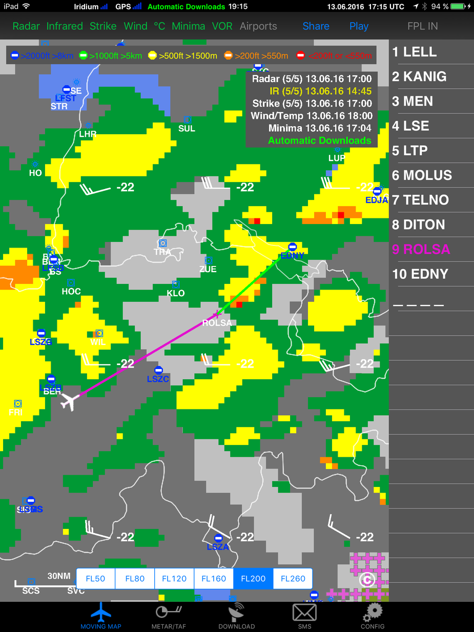
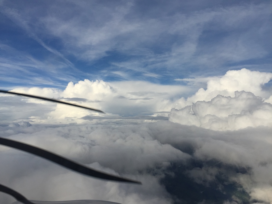
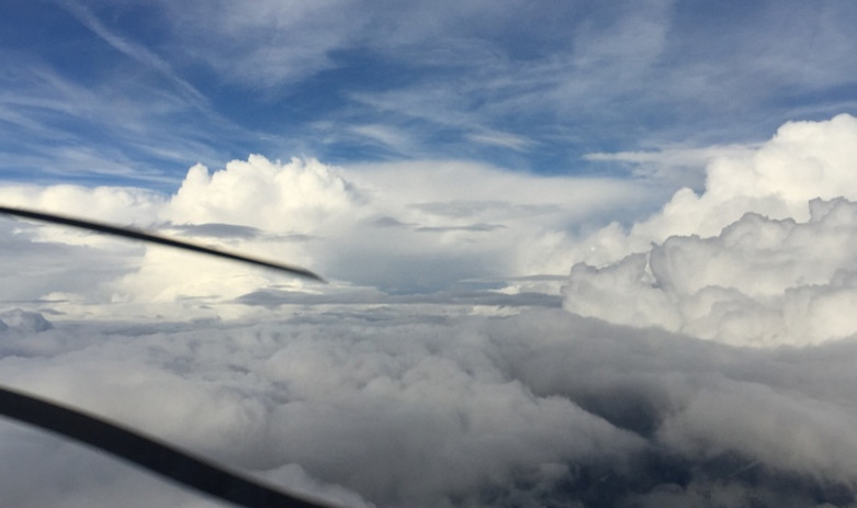
Yesterday I set out on a flight from Sabadell LELL to Friedrichshafen EDNY. I knew beforehand that there will be quite some convective activity but nothing like a line of thunderstorms blocking the way. The tops seemed to be within reach and it turned out to be mostly true. I found them at FL180 but later on at FL220 I was a bit short to be really out of it.
Some of the yellow spots did have a bit of turbulence and I also learned a lesson about the fact that the image is delayed. I skimmed the top of a yellow spot that had been blown by the wind into my path and there was quite a bit of static on radio for about 30 seconds. The autopilot had to work for the money as well.
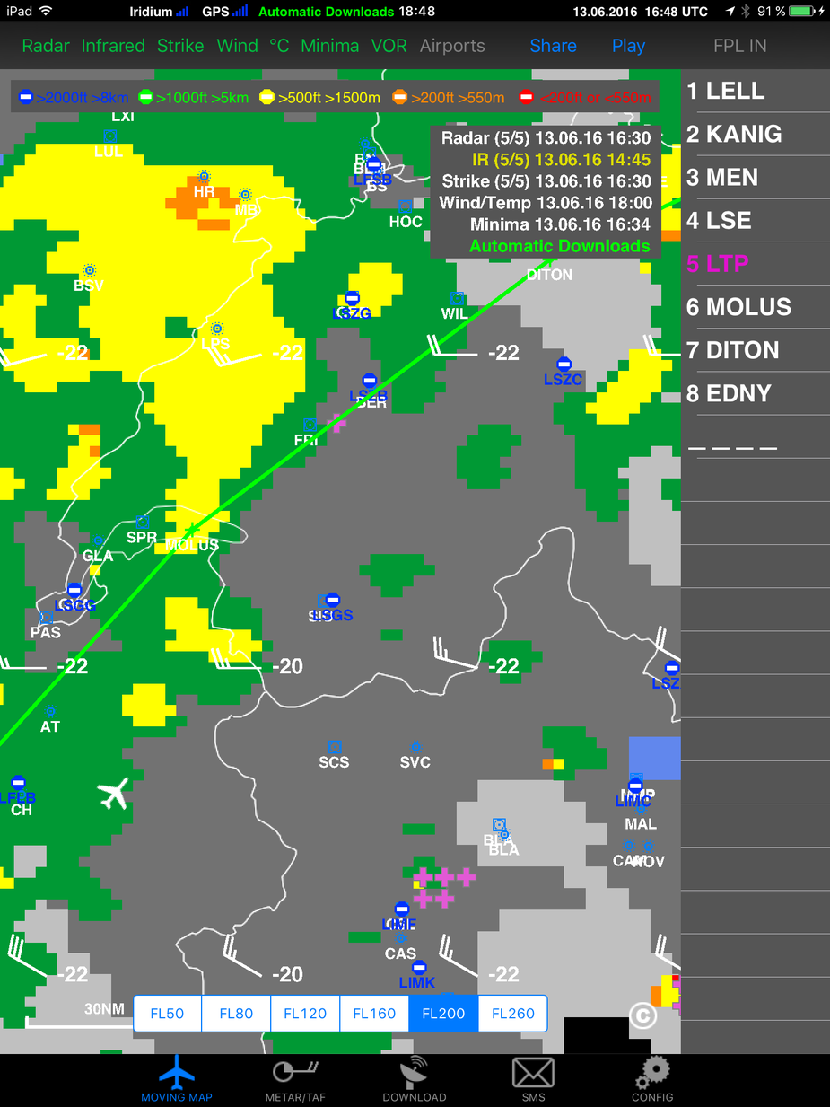
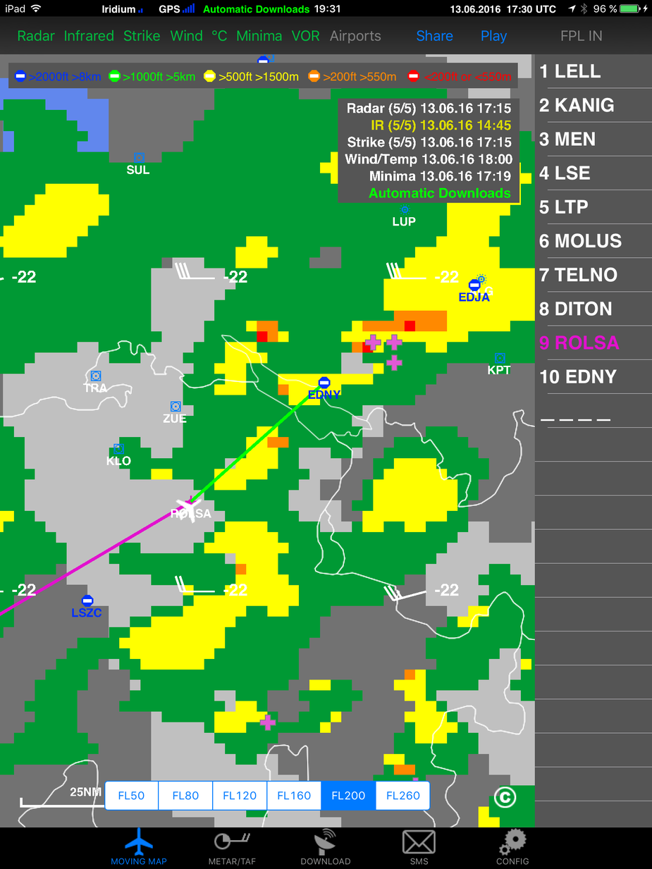
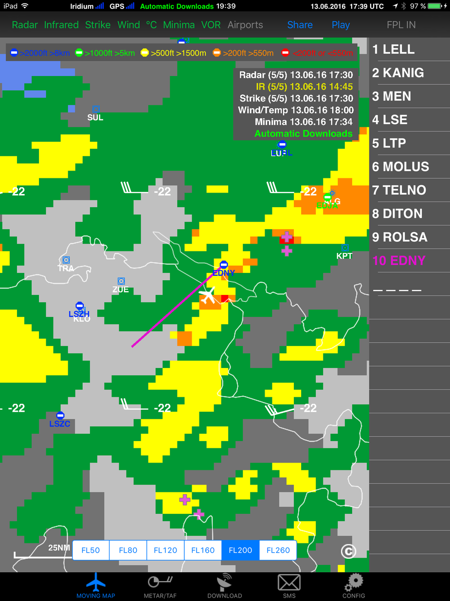
When I took the picture of the ADL screen I had developed a plan. I wasn’t going to turn into the stuff that was being flow into my path from the left. Instead I wanted to stay over the alps where the high mountains should create a blocking effect. So I rejected the requests from Swiss Radar to turn towards MOLUS.
The view to the right was ok. I was skimming along the edge of bad WX but was on top of the stuff to the right and thus could easily escape to there. It appeared that my idea of using the higher mountains to shield me a bit from the worst was working.
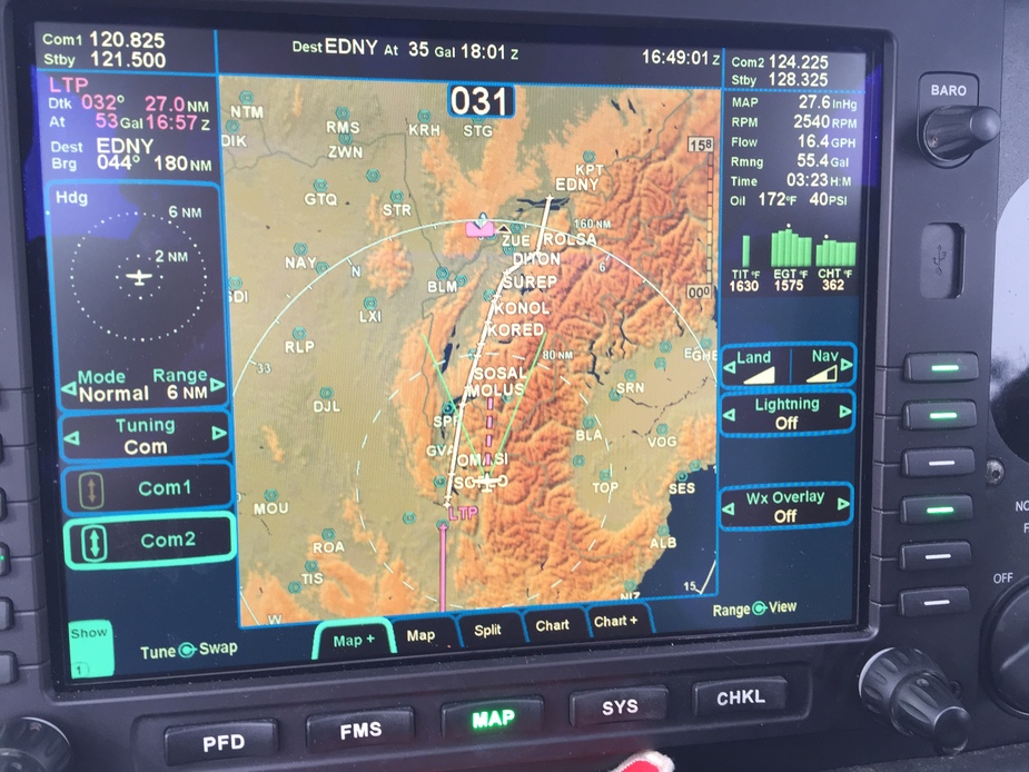
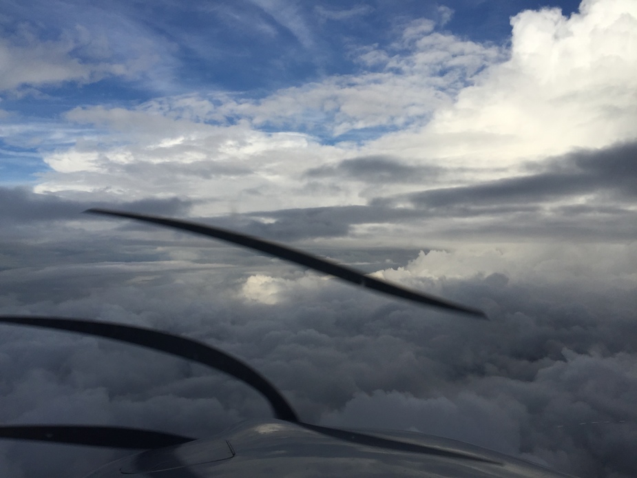
But then more trouble was ahead as I was getting closer to the STAR for Friedrichshafen ROLSA3P.
There was light ahead and I was hoping to be able to visually check out the upcoming situation.
The WX radar image 15 minutes later was a bit more promising. The red dot right after ROLSA had disappeared.
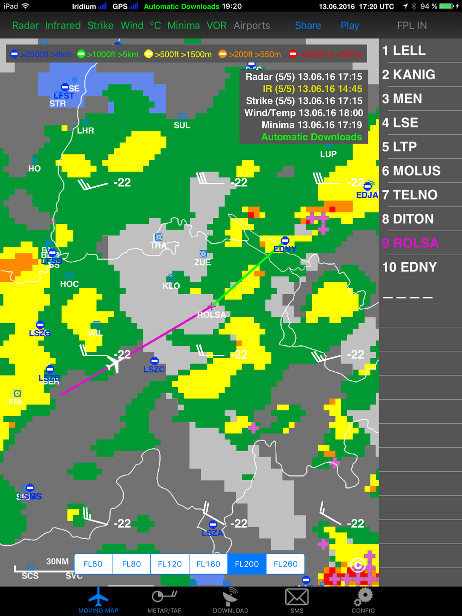
Just four minutes later I was able to see the reality and did look somewhat OK. At least it was now possible to visually understand and decide where to go. By the time I took the picture Zurich already had me in a descent down to FL130. I took the picture when I was passing FL170.
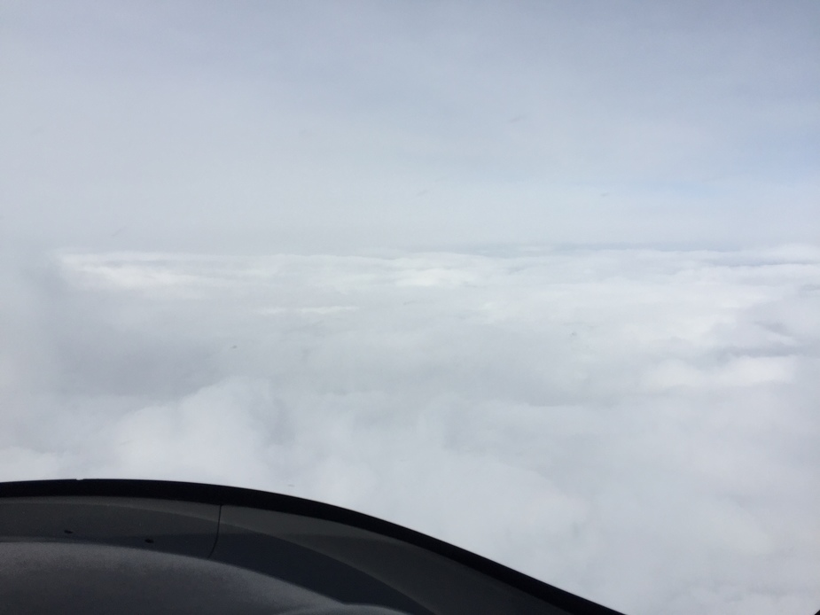
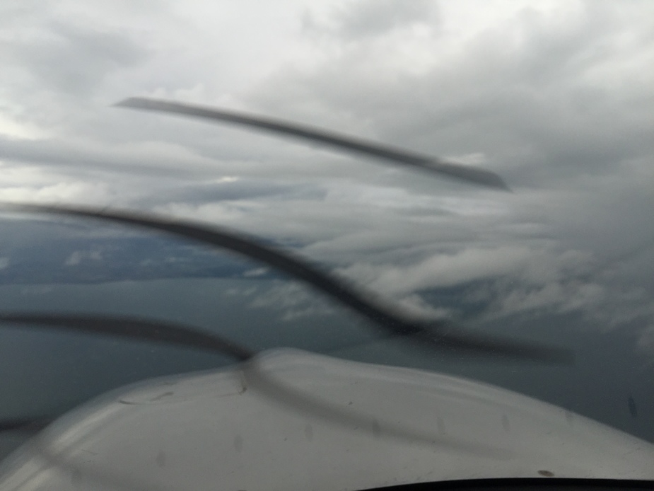
Down at FL150 the sight and the delay WX radar image continued to be ok and the WX radar image showed improvement for the area in front of me.
It does a bit ugly due to the color but it was smooth as the activity was more the right.
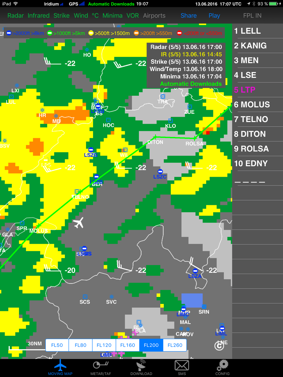
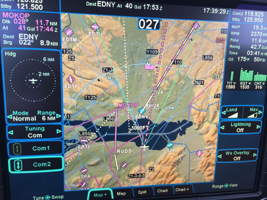
Zurich was vectoring me towards the ILS 24 at Friedrichshafen and as I was about to cross the lake ATC mentioned adverse weather ahead. I was already on a heading to not directly go for it. A few seconds later it started to rain.
So I went further to the left. On the ADL image one can clearly see the lightning crosses.
ATC queried my intentions and I let them know that I would be flying a visual approach as I had the field to my left in sight.
While I was passing the field at 6000’ I was cleared by Zurich for the visual approach RWY 24 and switched over to Friedrichshafen TWR. I overflew the localizer, turned around and landed smoothly on a wet runway on a very quite airport.
I am not sure if I should be envious of your ability to fly in such weather or be thankful I have neither the experience nor the aircraft to do so!
Good luck and thanks so much for sharing.
Brilliant report, thanks very much! Very interesting read.
I did keep in mind the fact that the radar images are at least 15 minutes old. In another thread a safety video was shared. In that video I pilot in the US apparently was using NexRAD as some sort of real time WX radar and a fatal accident was the result. That video was in my mind.
In the consequence I tried to stay as high as possible to be able to see things and know where the conditions were good. I also tried to incorporate the wind direction into my thinking. I had wind of 45 – 70 kts at altitude. My ride was completely smooth with the one exception where I had a bit of turbulence and some static on the radio for a few seconds. That was when I simply turned away (20 degrees to the right) and seconds later everything was smooth again. Turning away also brought me into VMC.
Do you have TKS, Stephen?
I ask because in this
anywhere around -5C would be loads of ice.
Obviously you know this  so I guess you are de-iced.
It’s an interesting report. The radar data doesn’t tell you what is at what altitude.
I was working with ATC to avoid those bigger buildups. Not so much for the icing (lots of warm air below and I was in 1500 fpm descent already) but because of the expected turbulence with the associated need to slow down.
The ADL does give you a rough idea about the tops. That what the others colors tell you. I have to admit I didn’t update my ADL yet but I did use the Internet download before the flight to get an idea. The tops will not change dramatically within 2 hours and the plan was to avoid visually anyway.
Do you have on board weather RADAR as well or just the ADL?
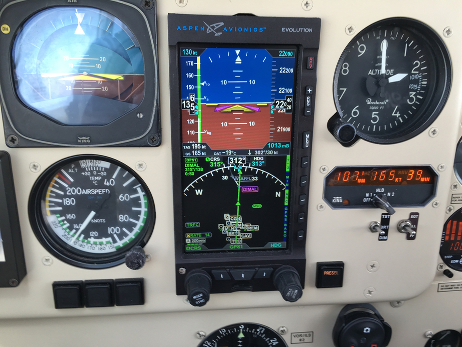
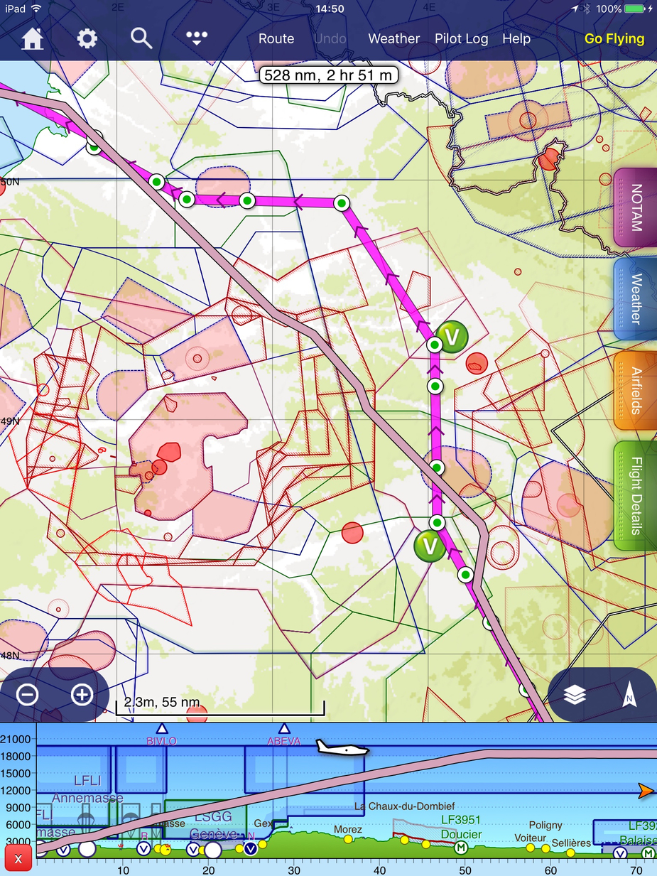
We came up from Annemasse LFLI (close to MOLUS) to Fairoaks EGTF yesterday. We broke out over the Jura at FL100 but the cloud steadily climbed underneath us. Eventually we were at FL220, occasionally in the tops, but with the temperature at -19C there was very little icing.
I don’t think we could have done this trip without the turbo.
Karen’s pulse-ox never got below 90% so she stayed on the cannula. Mine didn’t either, but I prefer to use a mask above FL200.
Another benefit of being so high is getting short cuts over Paris airspace:
On board WX radar is not available for the Cirrus SR.
Nice
I have that $400 MH mask too – built-in mike, for a proper Darth Vader emulation  I haven’t used it much, though I did use it for FL210.
You would indeed have not made FL220 without the turbo unless the temp was ISA-10 or colder. I was once at FL195 (not allowed higher by ATC) on a post maintenance flight test, ISA-15, and I was still doing +300fpm at FL195, so it would have gone to FL230. But those conditions are really unusual in the summer or anywhere near it.
Does the ADL display indicate tops? I didn’t think any ground based radar did that. The only way is to overlay sferics and where you see loads of strikes you can assume CBs and FL300+ tops.