I have a Stratus 2S that I bought ‘refurbished’ (probably new old stock) from Appareo for under $500, saving money over the then newly introduced 3. It has the advantage of working when velcroed to my glare shield and using its internal antenna, versus being precariously suction cup mounted to a side window as with some other options. Generally good quality of construction. My Stratus installation is never touched or moved, is ship powered and starts automatically when the master is turned on. The wi-fi connection to my iPad Mini & ForeFlight is immediate, provides GPS redundancy and is reliable. In the US it shows ADS-B traffic in seconds – at home base meaning before I release brakes and taxi from my hangar. AHRS and attitude indicator seems to work well enough but there’s a routine to teach the unit in its mounted attitude that the plane is straight and level. Apparently there are some issues in doing that on the ground with a tail wheel plane, seems to me you might have to lift the tail.
I use Stratux as well. Works well. I use the european firmware that gives FLARM in so I can see gliders.
Peter wrote:
What version of FF does this, and what is the cheapest/simplest external AHRS which can be used? I actually don’t need the two tapes, so perhaps an AHRS is not needed? After all, one can get the position and trajectory from GPS.
I have the performance plus super duper all in version. But I think the pro plus does it.
AHRS gives you bank and pitch. You get the tapes and SV regardless, from GPS, without any additional devices. But I would recommend one of the devices below or maybe an XGPS160 to at least have a reliable GPS receiver.
You can do AHRS with either of these:
Sentry (just got one, needs to be ordered from the US, very nice small package)
Stratus
Stratux (have built one, just as good as the Sentry but it is diy and lacks CO sensor)
XGPS190
The SV is available with the Pro plus version, the middle tier of subscription. The 3D is with the Performance Pus version, highest tier. Attitude indicator is not available without an AHRS, the tapes , the HSI and the SV will work with just a GPS input. These are the US prices for an ADS-B portable receiver that includes an AHRS:
Sentry – $499
Stratus 3 – $699
Garmin GDL50 – $699
There maybe others that have interfaced to ForeFlight thru OEM interface such as:
Stratux kit dual frequency Rcv, GPS, AHRS – $249
Panel devices which provide AHRS:
FS210 –
FS510 if connected to a GTN attached to a G500/600 and Txi or G1000 Nxi or GTX 345
GTX 345
Position yes, but you need a better update rate directly tied to attitude, like from the AHRS.
I think GP is the same sort of image
This terrain depiction
is good enough. What version of FF does this, and what is the cheapest/simplest external AHRS which can be used? I actually don’t need the two tapes, so perhaps an AHRS is not needed? After all, one can get the position and trajectory from GPS.
Don’t forget that ADS-B input is also displayed on synthetic vision with FF
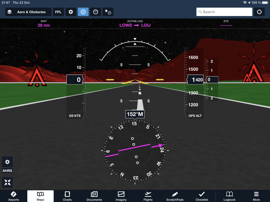
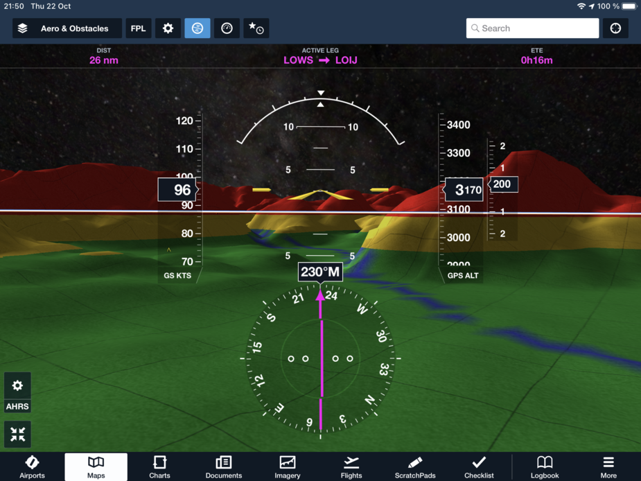
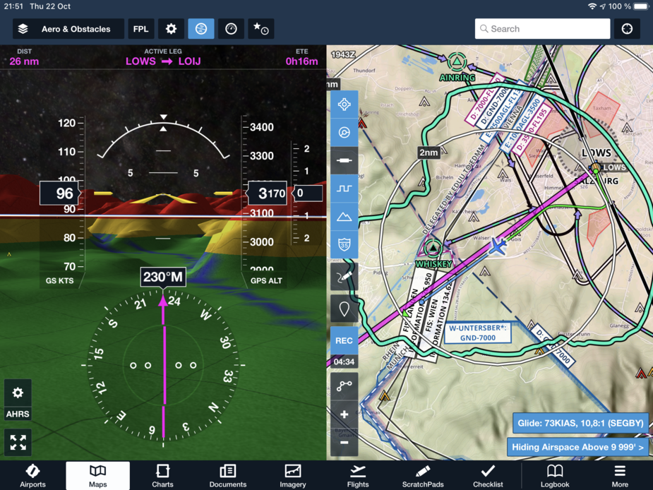
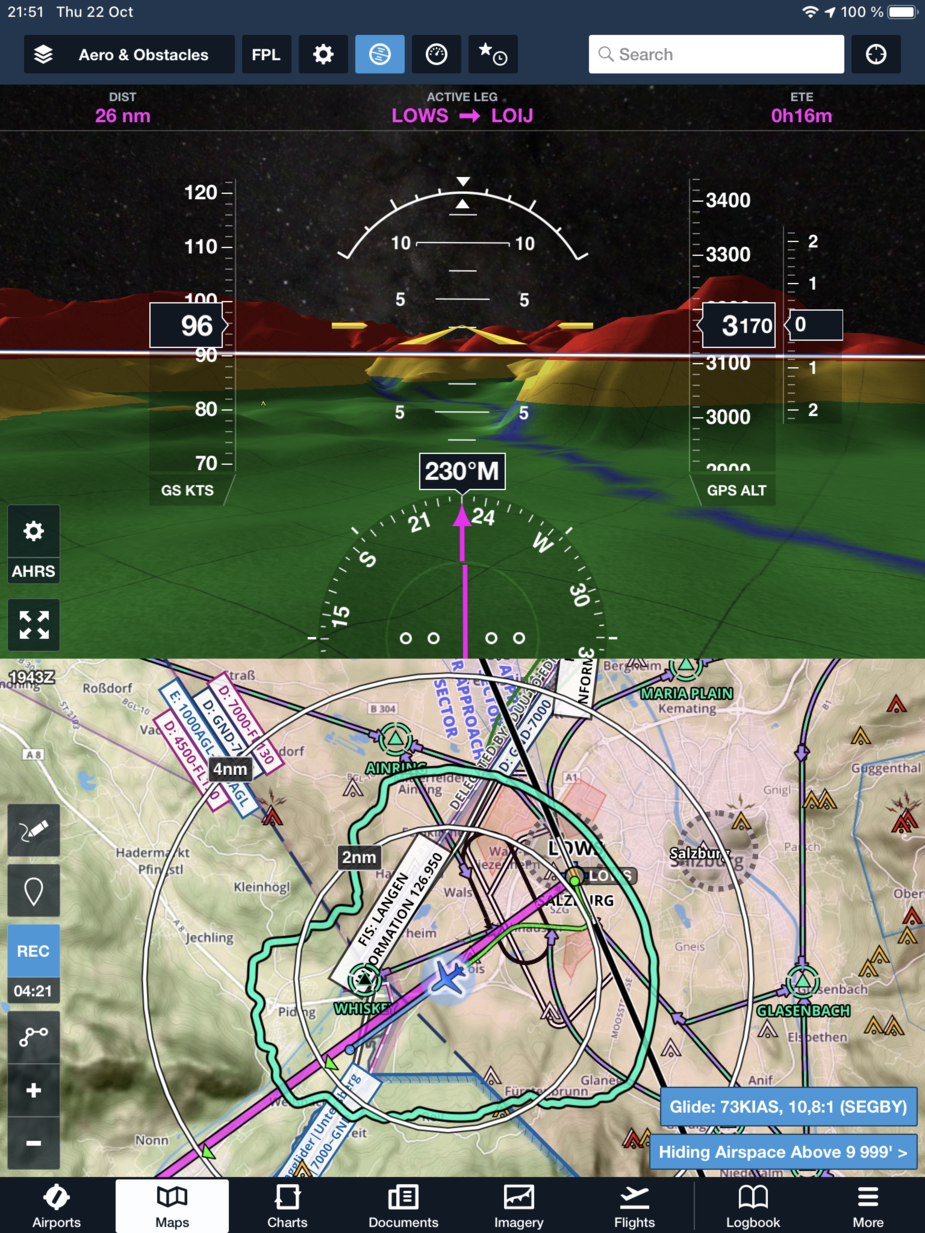
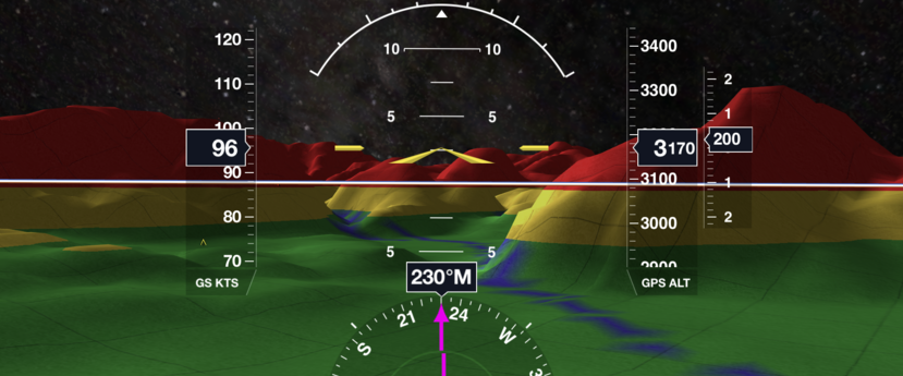
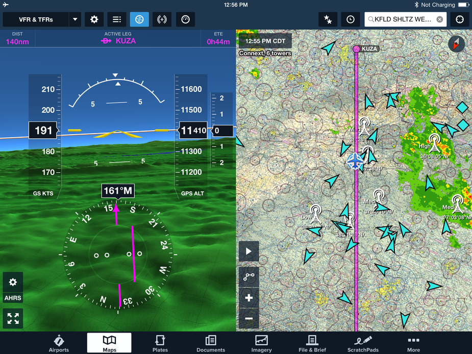
SV is a separate Synthetic Vision view and uses terrain, AHRS, and Traffic data for the view and may be used in an emergency for backup of an panel or power failure. 3D view is a preview or review capability from satellite enhanced graphical views using terrain data for vertical depiction. Here is a split screen view connected to a GDL39 in my office. The red indicates I am anywhere from +100 feet to below the terrain at my house. Not moving, so the 3 Kts is just the poor GPS position and the track is the same situation. The 630 is GPS elevation. If they exist, traffic would show as would terrain profiles in three colors, red, yellow, and green. Rivers and lakes would show in blue and airport locations would show with a banner.
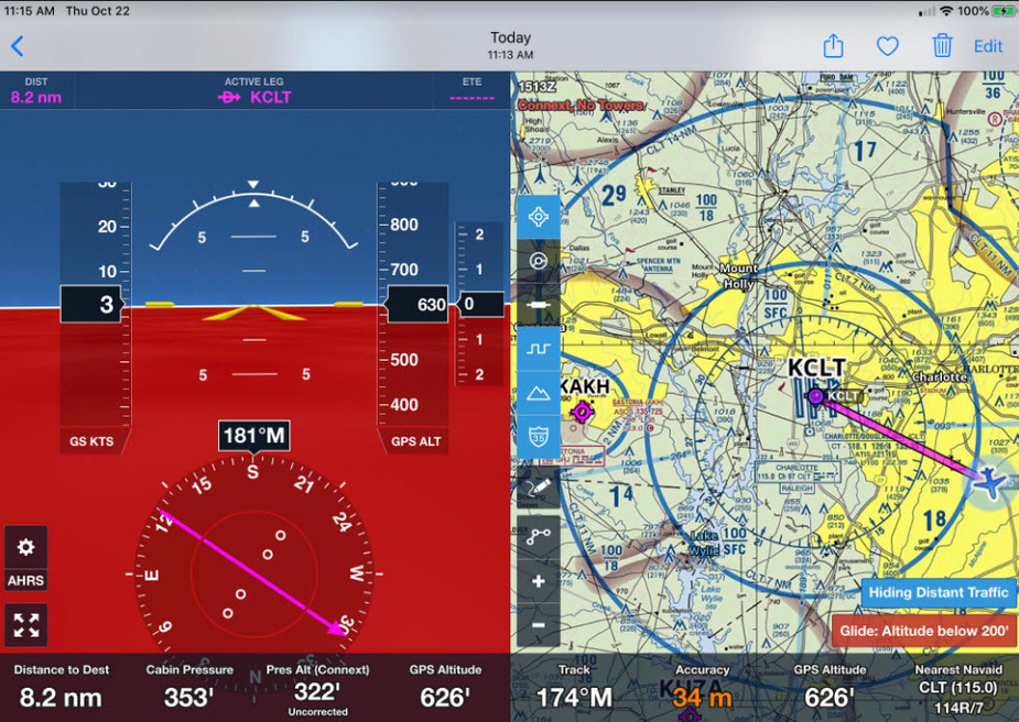
I don’t use SV much on ForeFlight with my G500Txi that has it on my PFD. I finally found a few pictures of SV while airborne.
I can run SV in Garmin Pilot on the Ipad, from conection to the Flightsteam which has AHRS.
Not sure its very high on detail though.
I should have run it through the Simplon pass to see how it displayed, but my eyes were on stalks and I didn’t look inside at all.