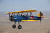
I had a weekend to myself and could take Friday off from work. The weather forecast had me torn between hiking and flying: no rain, no clouds, no wind. I figured I could have both if I flew to Zell am See and walked from the airport. On Friday morning I packed twice: a pilot’s bag with headphones, aircraft papers and the navigation tablet – and then a hiker’s backpack with sleeping bag, first aid kit and thermos filled with hot and sweet tea. What could go wrong…?
A high pressure system. No rain. No clouds. No wind. Autumn…


I took off anyway, thinking that landing in Innsbruck wouldn’t hurt my plans too much. They had CAVOK already there – and forecasted for the whole day. I also topped up the tanks so I could easily get back to my base if things got even worse.
Everyone was super helpful along the way. I wanted to be high, well above the low clouds. Krakow Informacja coordinated with Praha Radar, who were perfectly happy to welcome me into their controlled airspace at FL80. Halfway across the Czech Republic, I was handed over smoothly between Ostrava TMA and Brno TMA… and then was passed a message from Wien Radar that they did not want me that high and that I would have to descend before the Austrian border. Which I was reluctant to do, as more and more dense clouds appeared below me:

(… the photo is ruined by some “portrait background” effect I accidentally turned on, but you get the idea …)
I asked the Praha Radar controller if I could perhaps turn a little to the right to skip Wien TMA altogether. She hushed me standby and within a short while came back with some “direct” 5 letter code waaaaay into Austria. And of course maintain flight level 80.
Then followed some uncontrolled airspace until Linz. Who in turn cleared me straight through no questions asked. Half of their runway is visible just forward of the center of my leading edge; the other photo was taken two minutes later through the other window.


Next, Salzburg Radar mentioned the Reiter Alpe R-142 in Germany, which I had originally planned to fly around in a somewhat sluggish, square fashion. They suggested why don’t I fly direct my destination. The flight plan I had submitted in the morning followed UdoR’s advice pretty closely, with some valley flying to get me to Zell am See from the north. However since I was already at FL80 for other reasons, I thought actually why not take a shortcut… So I asked for 9000’ and actually ended up climbing to 10000’.
This is Untersberg – just in front of the wing. Lots of caves underneath. Big ones.

Hoher Göll. Also lots of caves.

Hagengebirge. More caves. The plateau looks like a flat surface, but in fact it’s a nightmare to hike on. Twenty meters up … thirty meters down … ten meters up … twelve meters down … one quickly gets exhausted!

Hochkönig. Probably has a lot of caves, but they won’t let us check. Long story.


Right after that I had to drop down like crazy. Would rather not do that with the family on board.

And here’s Zell am See runway! The maneuvers to reach it are indeed somewhat complex. It was sure challenging for me.


The whole trip involved a bet against the weather, which I won this time… but of course it was not obvious I would win! The Foreflight “screenshot” was taken half an hour before my landing! At that point I was pretty sure I would have to divert to Innsbruck or return to Salzburg.


But anyway, I got there and now it was time for some hiking.

I was in the mountains for a little over 24 hours. It was a great, off-peak experience! Try spotting the runway from a different side.


Many of the huts are already closed, but in the Austrian Alps you can count on a cozy self-service shelter located nearby. Of course I checked this out before my trip.


On Saturday I went higher. I chose a fairly challenging trail and was surprised by snow. In retrospect, I should have expected this… but I was very focused on the flight planning and maybe neglected the mountaineering planning a bit.


Kitzsteinhorn ski resort, seen from a distance. And the reservoirs in the valley beneath.


Here is where I gave up. I didn’t have crampons and thought this ridge was plain dangerous to cross without. Fun fact: at this point I was higher than my flight path had taken me the day before.

Backtracking my own steps. How many Trekking Poles do you see in this picture?


I passed the closed hut on the way back and walked all the way down to the airfield. Of course it was a long hike, but hey, that’s what I came for!
Soon, the day was to become – in a certain way – rapidly shorter. From the beginning I had planned to sleep in the town just prior to my departure on Sunday. My boots were toroughfuly wet and pretty smelly and I didn’t want to take them among people. So I left them at the airfield.


The restaurant at LOWZ has been warmly mentioned in EuroGA Airports Database. Indeed they maintain a good standard.


Sunday greeted me with a fog. This time I totally expected it. Also, things soon started to improve.


I did my preflight in the fog and then returned to the tower building to pay my fees and wait until the fog lifts.


The departure was much easier than arrival. This time I routed via November, just like I was advised here on EuroGA. Flying along the valleys was cool, but I imagine it must be truly “funny” in windy conditions…


Leoganger Steinberge. This one has a really HUGE cave, the deepest one in Austria!


From Salzburg on … you guessed it! – low clouds. Again I spent most of my flying day at 8000’


One piece of good news was that I had considerable tailwind all the way back. The ground speed reads 149 kt.

… and bad news was I had to descend into and then breathe in this haze. From above it looked quite toxic.

Approaching EPKM for landing on RWY 23:


And safely back home.

To sum up: two legs flown, EPKM to LOWZ (02:47 air time) and then LOWZ to EPKM (02:19), both around 330 NM. Thank you guys again for your advice and inspiration :)
Nice trip. I was using the railway from Brenner to Berlin on saturday and stared at the clouds from below all the while. They went down very low between the Austrian border and Munich.
Mateusz wrote:
How many Trekking Poles do you see in this picture?I will hazard a guess: None, just the shadow of one?
Beautiful trip and photos 
When I went to LOWZ it was always landing from the west, which is much easier. I think you needed a tight circle to land, plus having to worry about their crazy circuit requirements which some disregard anyway.
Boots not goretex?
I reckon 2 poles, held in one hand, camera in the other. My ski videos are like that.
Nice one!
Nice report Mateusz, good to see that even with that company that keeps you busy you take the time for such trips! And thanks for the tips how to dry hiking shoes. Also serves to keep animals out I suppose..
Love it, what a great weekend out, thanks for the story and photos!
Great report and great photos, thanks.
Excellent trip and report Mateusz.
A couple of hours at FL080 must have thoroughly dried and deodorised the 🥾. What knot did you use? 😀
Thinking about actually crossing the ridge, rather than just admiring the photo, it does look scary.
Thanks for the warm comments!
Boots not goretex?
I had to cross a few patches of calf deep, soft snow – and then goretex in boots is useless, as the snow simply enters from above. This thing works, but it makes your legs extra sweaty and of course it’s even more weight to carry on your back …

How many Trekking Poles do you see in this picture?
I will hazard a guess: None, just the shadow of one?
I reckon 2 poles, held in one hand, camera in the other. My ski videos are like that.
I think any integer between 0 and 3 can be defended. No prizes! :)
Thanks for the great write up!
I love flying somewhere to go hiking. Nice to see someone else doing the same thing.
Though crampons or not, I don’t think I’d be crossing that ridge!