Hello everybody,
I will fly my plane down to Africa in May and we plan to do some game drives in Kenya.
Which airport is suitable half way from Lokichoggio (HKLK) to Malindi (HKML) ?
We would prefer to do the safari in the Masai Mara National Parc.
Concrete runway with infrastructure would be good, a “well” maintained gravel strip would also work.
SD shows many places with Gravel in the vicinity, among others HKKE (Keerorak).
What about Olkurruk Mara Airfield?
Alternatively: how about Migori? Would have the advantage of being close to Lake Victoria. But it is quite far for a safari in the Masai Mara…
Which other places would you recommend for an Africa beginner?
For me flying plane to Africa looks quite adventurous. Can you share the details of your preparation?
Btw I’m traveling next month to Tanzania (just across the border to Kenya  ) by airliner and I’ll go to Serengeti and Victoria lake.
Great plan @TB_flyer:!
Nanyiki (HKNY) should have AVGAS, if you are looking for a place to refuel. You will need to check and get this confirmed (everywhere in Africa), so don’t count on AVGAS being available and end up without it when you arrive :-)
If you want a general e-book on flying in Africa, then read my Kindle ebook available on Amazon.com.
And if you can’t wait going on safari in the Masai Mara Triangle, you can go on virtual safari already. Go to SafariLive! on YouTube. They broadcast from the Masai Mara Triangle as well as from Django in the Greater Kruger Park area.
Hello AeroPlus,
I downloaded your ebook yesterday and have just been reading through the interesting chapter about sat communication in which you suggest the Iridium GO.
I am considering this one using it together with you apps.
Do you suggest HKNY also as the starting point for game drives or is another airfield (in the Masai Mara) more suitable?!
In general:
Anybody in the forum who’d like to share general information about flying in Kenya?
For i.e.: SD is showing 100 of airfields in Kenya and I wonder if one is allowed to conduct flights to them without notice, or do I need a permission for each (VFR) flight within Kenyan airspace etc.?!
Thx.
I would personally go for a Garmin Inreach device, which is an easy and cheaper device that allows for 2-way text communication. You can get the latest airport weather such as METAR, TAF and GFS data through the Garmin Inreach device by sending a message to our weather server [email protected] with stated in the body only the ICAO code of the Airport you want the weather from, such as EHAM. A reply will be sent to the Garmin Inreach device in several minutes with the weather. Just remember that for smaller airports, the TAF data is not very reliable as the forecasters are not all very well skilled in the art of forecasting. The ADL devices from Sebastian are also great devices. The weather radar will not work in Africa as they don’t have rain radar there, but you can still get the METAR and TAF data also in Africa through his devices. The Iridium GO needs to be installed with an external antenna ideally to work well and will allow you to make calls from the aircraft using e.g. a Bose A20 headset connected to your mobile phone via Bluetooth and via WIFI with the Iridium GO!, but I fly most of the time now with the Garmin Inreach device as you can see here.
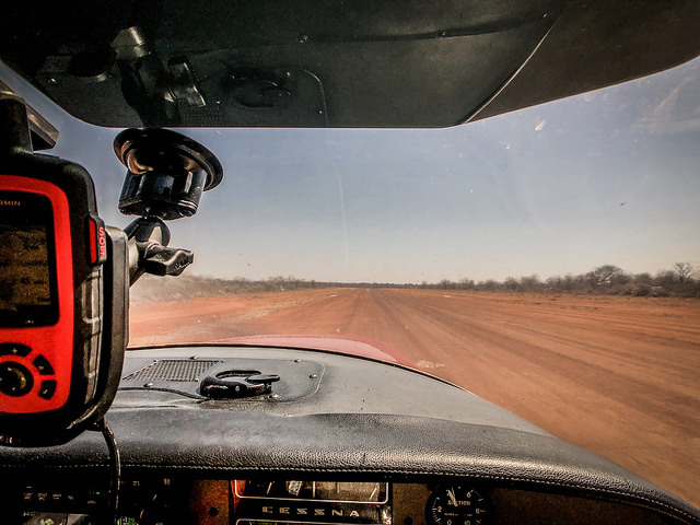
Garmin Inreach Device mounted in aircraft.
There are lots of flying opportunities in Kenya. Search for an airport that is close to the lodge or location you want to stay at, then call them and ask them for permission to land. You will probably need to sign an indemnity form before you show up there and before you get permission. Also, make sure that you have your clearances for flying in/through Kenia.
I did some flying in Kenya in 2014 (out and back from the UK) and 2016 (down to Cape Town on the western side of Africa and back up the eastern side) and visited two safari strips, Lewa and Loisaba where the surface is murram in my BE36. As Aeroplus says, PPR from the strip owner is essential and you need to ensure that you obtain prior approval for your entire route in advance from the Kenyan CAA as ad hoc approvals when you are there are difficult to get. Remember that much of inland Kenya is high altitude so with higher summer temperatures, aircraft performance becomes an issue. At safari strips, you need to take steps to safeguard your aircraft; some have permanent local guards while at others, you need to place thorn tree branches round your tires to prevent them from being eaten. For foreign aircraft flight plans also have to be filed, even for VFR flights, for which you have to pay a fee. This is problematic when flying from airstrip to airstrip and I arranged for a friendly handler at Nairobi Wilson to do this for me.
Bear in mind that the ITCZ is moving north into southern Sudan by May so dust storms can be an occasional problem.
You can file flight plans through the AFTN system, but not all the providers of flight plan software address the flight plans correctly, so best is to double check by calling them if they have received the flight plan.
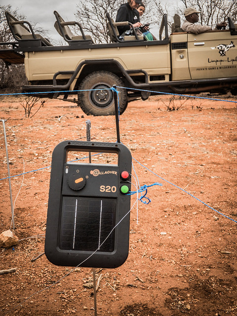
Hyenas love biting/eating tyres and soft plastic parts on the aircraft. Placing thorn tree branches around the “sweet” parts of the aircraft is not always enough to keep them away, and after my first encounter with hyenas eating the plane, I switched over to protecting the aircraft with an electric fence. It is a bit of a hassle, but you sleep better at night knowing that the aircraft is protected.
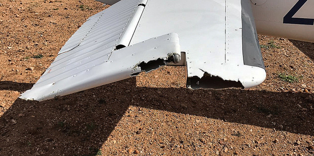
Duct tape was used to temporarily “fix” the aircraft.
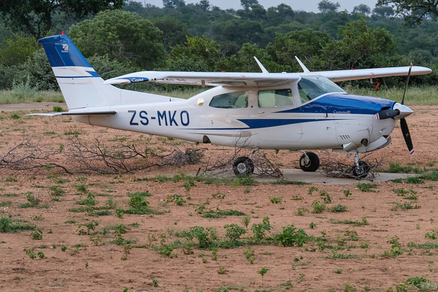
Here we protected the C210 with thorn branches, which is not always working, but better than nothing.
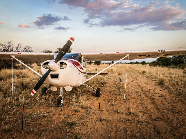
The wind can all of a sudden come from nowhere in the late afternoon or evening. Tying it down is a good precaution.
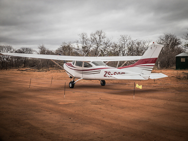
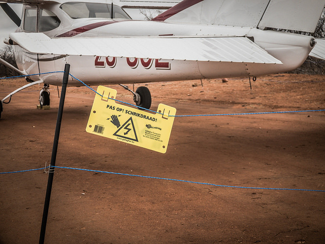
Sometimes I even warn for the electric wire. The sign is in Dutch, but seemingly the South African guys understand it well and the rest gets the idea of what that sign means.
Good morning,
thank you both very much for the interesting remarks. You address two essential points that I have on my list of points to be clarified.
AeroPlus: you recommend a Garmin Inreach. I’ve come across this one during my research, because it’s based on Iridium. However, I also need the possibility to make phone calls and send emails. Against the background: which device would you recommend?
Juliet: You’re addressing an important point on my list here: Weather in Africa. Can you recommend a good source or a book that deals specifically, perhaps even from a pilot’s point of view, with Africa’s weather pitfalls?
And last but not least: can you recommend a corresponding app for worldwide flight plan tasks? I plan to use autorouter as far as Egypt… and then?
A note: regarding permissions etc. I will work together with Ahmed and his great team. Without him…, I don’t even want to imagine…
Thank you for your help!
Don’t expect satellite calls to be very clear and crisp. There is always quite a bit of latency. If you have Ahmed standing by, send him an e-mail or message through the Inreach and let him make the call while you are flying. Also, people are not always that responsive to phone calls in Africa originating from strange numbers (like satellite phone numbers), so you might not have a lot of use for it. Sending long e-mails or images by e-mail using the Iridium Go! doesn’t work well. It might take up to 5 minutes or longer to send a 1 MB file over the slow Iridium satellite network. I just personally find that the Iridium Go! is nice, but needs to be wired with an external roof antenna to work properly and that the Inreach is easier to use in flight for messages, etc. but you can’t make calls with the device. On the ground, there is usually a good signal on airports and in and around cities and towns, except when far and remote on safari in nature parks.
As for the weather: it is all not rocket science. Check for the wet/dry seasons and summer/winter times when flying through Africa. See: https://www.expertafrica.com/kenya/weather-and-climate
Hello,
Weather is an exciting topic – I have admittedly quite a lot of respect for it in Africa.
I have taken from the archive the weather from last year at the end of May. The metars for HKEL (El Doret) look like this every day for this time:
How would you rate that, what kind of weather is to be expected? Individual CBs should be good to fly around once you have crossed the BKN layer? Or is there a danger when you try to climb through the BKN layer that one finds himself in the CB afterwards? How thick is the BKN Layer?
Which IFR/VFR strategy would you use (without Turbo)?