A new Flight/Trip planning tool for Greece
Aero webGIS 2
This browser based GIS tool has been hanging around since 2012, a personal work from @atmilatos a PPL, ATC in profession, with programming knowledge.
It was a web portal with map generated from data fed in the background.
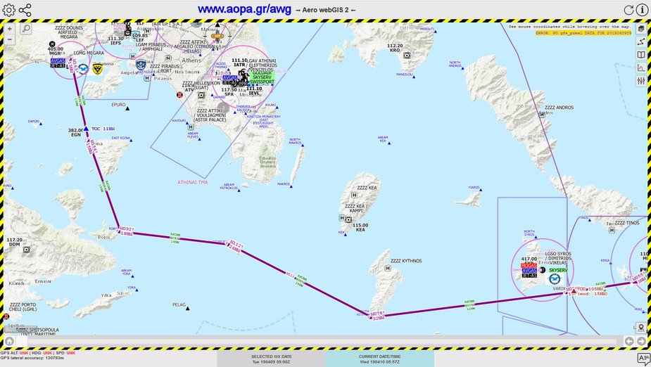
In 2018 an all new version came out in parallel with the ability to be used in georeferenced devices showing aircraft position on the map following the flight plan.
It still relies in web data to be downloaded (if it is to be used in flight i.e. 3G coverage).
AOPA Hellas got involved in 2019 when it was realized that practical native pilots’ input could be useful in unlocking some lesser known information properly displayed on a dynamic map. One of the reasons was that critical planning information was not combined anywhere except the informative page of AOPA at www.aopa.gr/Info
Its a long text and some times pilots won’t bother to read it to its entirety.
So AOPA got access to the database to enhance it with pilots feedback.
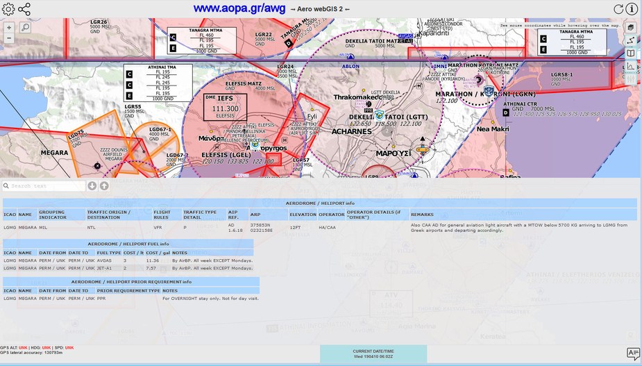
For example Greece AIP, for those who bother to login and browse the pages, still displays Chania LGSA or Thessaloniki LGTS as having AVGAS or has ambiguous information on various airports where planning information about PPRs or HANDLERs or MOGAS availability, or ZZZZ airstrips etc. is not clear.
The information you see on the map is a combination of the official AIP data with additions by native pilots’ input.
One of the ideas came from this post by @Snoopy
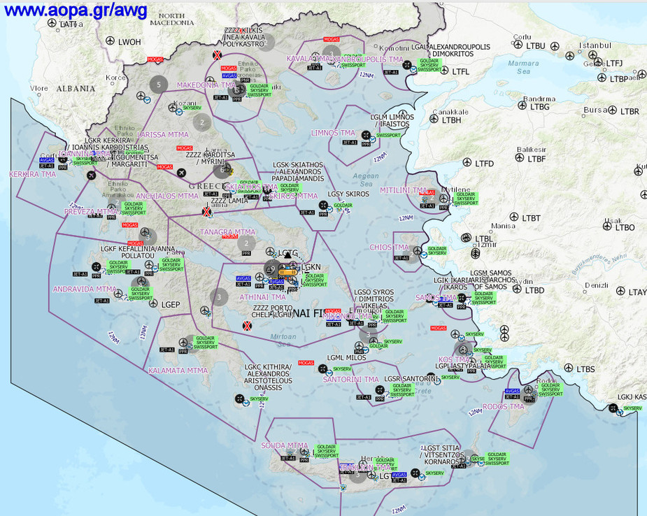
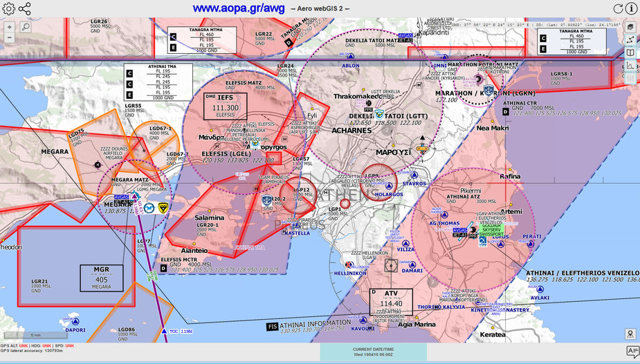
So Go to www.aopa.gr/awg and all the information is in there at the updated Aero webGIS 2.
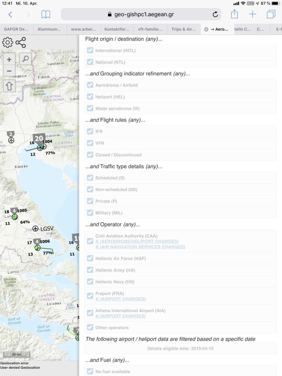
Use the filters buttons on the right to choose what to see and what to hide.
Use the Information page on the top right to see all the details about how to read and use it.
It is freely available as DONATIONWARE.
Instructions on donating are at the top right the information page link.
Key display features include:
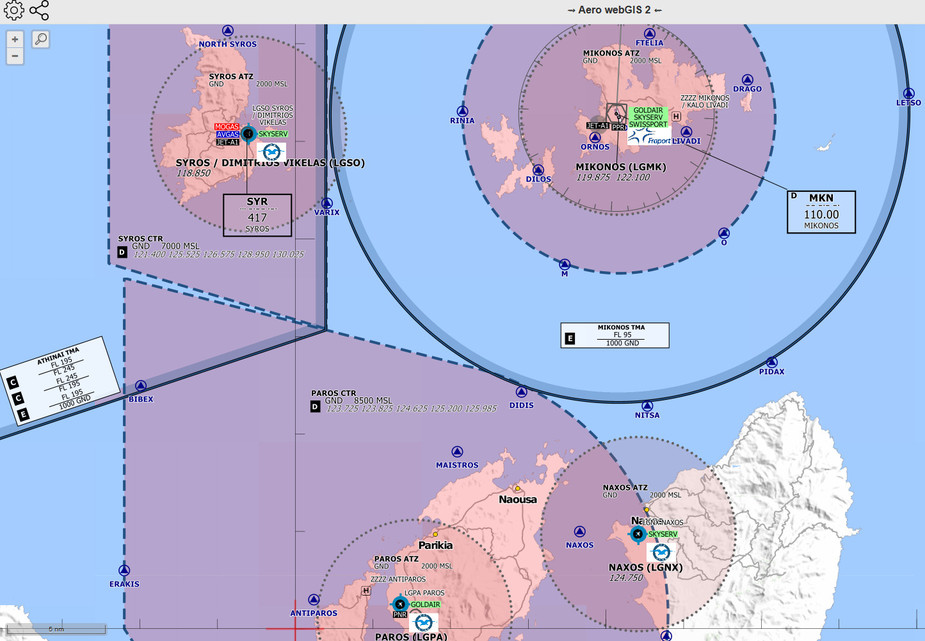
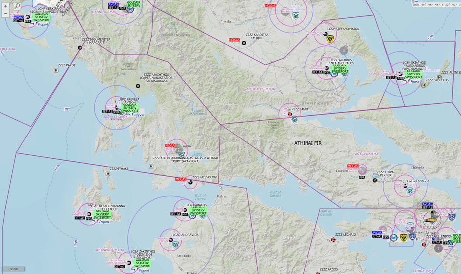
Airports, airfields, heliports, various map overlays, ability to generate a Flight Plan / Flight Log / Aircraft profile, Airport operator, HANDLING providers per airport, PPR/PNR requirements per airport, AVGAS/MOGAS/JET-A1 availability, VFR VRP’s, IFR fixes, Airspace, Heliports, ZZZZ airstrips, disused airfields and much more.
AOPA Hellas welcomes Pilots’ input for corrections on their part of the data at Email info[at]aopa.gr
The textual part of the data is always found at www.aopa.gr/Info
No, no, the Login is only for admin’s data entry.
The data gets updated instantly.
Any sees for free all the data. There is no user login.
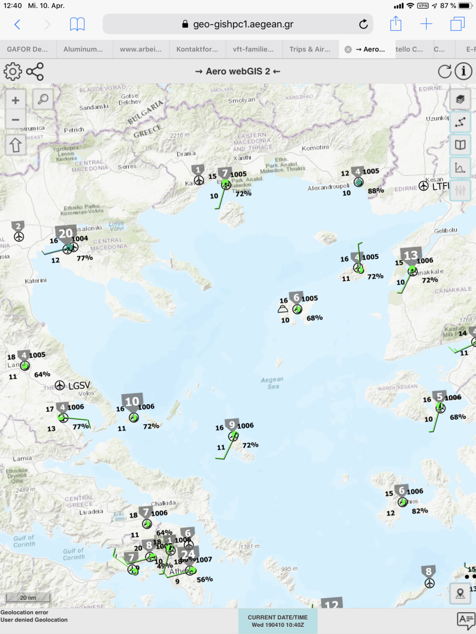
Some more screenshots from its usage:

@petekas Your pictures look good, but that’s what I get:
Not very useful. And while I can activate the checkboxes for .i.e. Metars and Notams, the interesting ones seem to be activated somewhere in the background but they are not visible on the chart.
These checkboxes are options of their layer, called “Aerodromes / Heliports”. Once you activate the layer you’ll see the data and you can control these options, thus filtering the results.
@atmilatos Sometimes it is to easy to see. Thank you.