Hoping to fly VFR from Sitia to Kithira via Naxos tomorrow (Saturday) and just seen a humongous Notam concerning major Greek military exercises pretty well everywhere. There’s a fantastically complex list of coordinates for a whole series of exercises which are almost impossible to visualise on a map and therefore see if there’s a potential issue for my flight.
Does anyone know if there’s a simpler graphical way to check where these exercises actually are (they run to Oct 12)? Or if you’re speaking to, say, Athens Info does it actually matter too much?
Dont bother much,especialy on weekends they go home.Nothing bad could happen within the huge Heraklion TMA.For the mini distance to Kythera,ask ATHINA INFO 130,92 or 119,75.What are you doing Naxos anyway? Milos is the crossroad.
I thought Skydemon plots all the polygon-specified notams… 
It usually does. Notams over the Aegean Sea are indeed spectacular for the newcomer.
Trust the local guy here :)
No SD plotting in this case.
Use this to plot the NOTAMs http://aopa.gr/awg
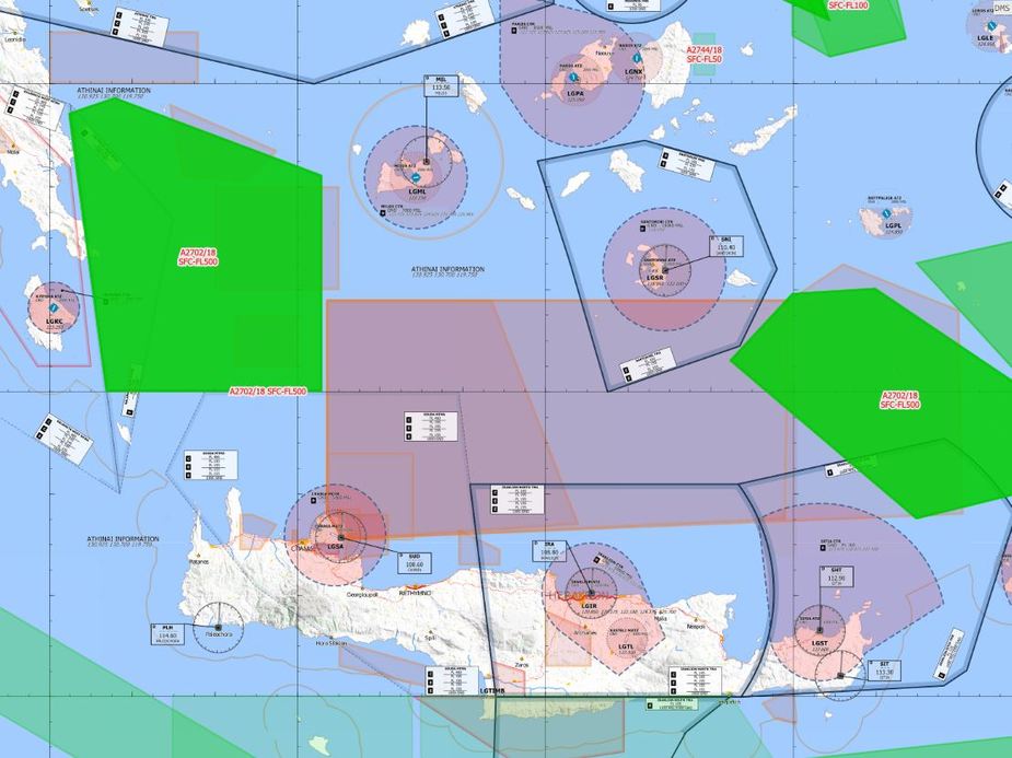
Thanks Dimme – tho can’t seem to get to that graphic via the link…
Click on the layers icon on the top right corner and enable the open flightmaps layer and the R/W/Q….NOTAM Polygons layer.