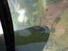
I use EasyVFR/PocketFMS as the iPad VFR map (with a bad elf), mainly as a European airport database. While it has the required VRPs I have’t figured out how to access VFR routes. I attach the wonderfully clear, not, Visual approach chart for Rome Urbe, as an example of the sort of information which would be useful.
It’s not clear to me exactly what your question is.
I’ll try again. Currently the aircraft has half a dozen old Jepp books with VFR airport plates, and I am looking for an electronic replacement. In part because I understand Jepp no longer produces a paper version. EasyVFR has most of the relevant details: runways, frequencies, contact details – but doesn’t have the VRP attached to the airport data (they are however on the map), or how the airport intends you to use the VRPs. Most airports are quite straightforward with a Sierra for a Southern reporting point, etc, but some airports have quite complicated VFR procedures, Urbe for example.
Rocket Route which we use for flight planning will have the relevant AIP entry and I guess this can be printed off before the flight.
The aircraft has chart view but only for IFR airports.
It may be that the set of VFR only airports with less than obvious procedures is quite small, but Urbe I think qualifies.
Robert – are you really looking for Jeppesen VFR plates (VACs etc)?
Not many airports have recommended VFR routes. They tend to exist at very low levels (say 1000ft or less) along the coast, as a means of transiting in/below the CAS of some coastal airport.
Robert,
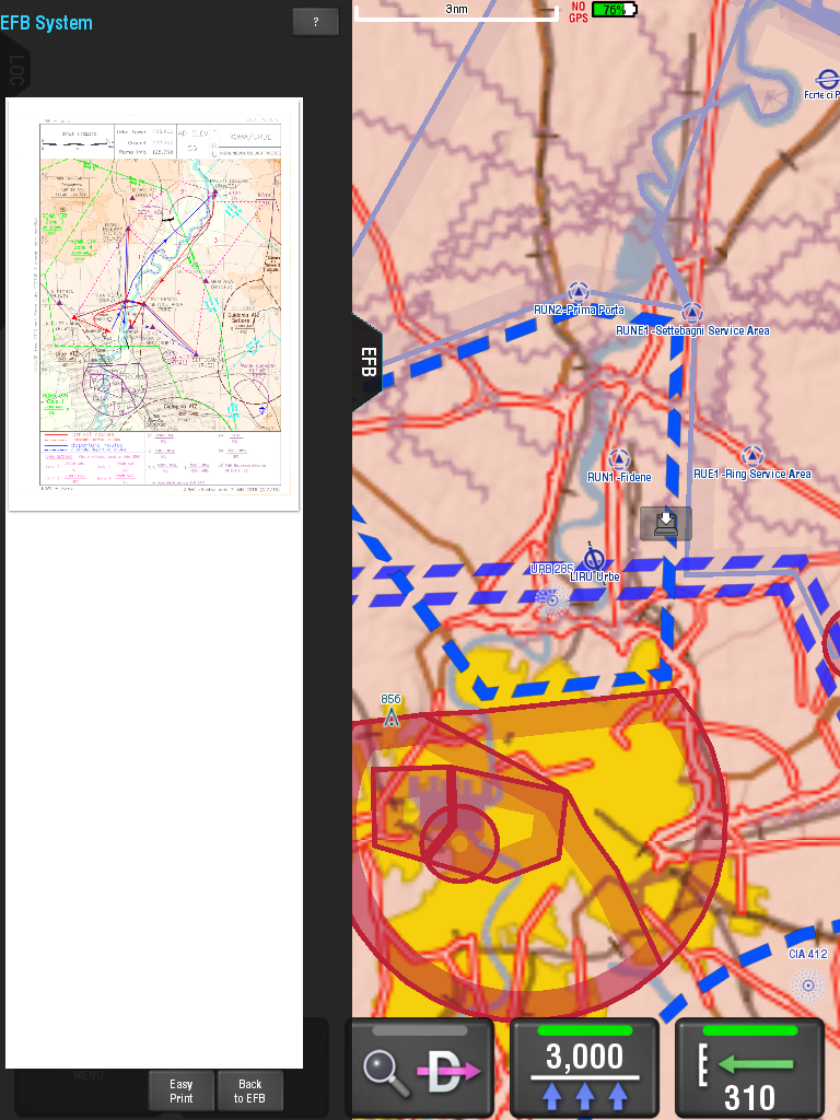
The VFR approach plates should be geo-referenced. I can see that it isn’t. I’ll find out why, and get the referenced.
They are available in the EFB in the un-georeferenced form, but they should also be overlaid on the map.
Colm
EasyVFR have them as georeferenced overlays
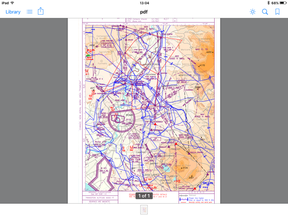
This map has the VFR routes geo-refeenced:
Anthony is that Skydemon or another app?
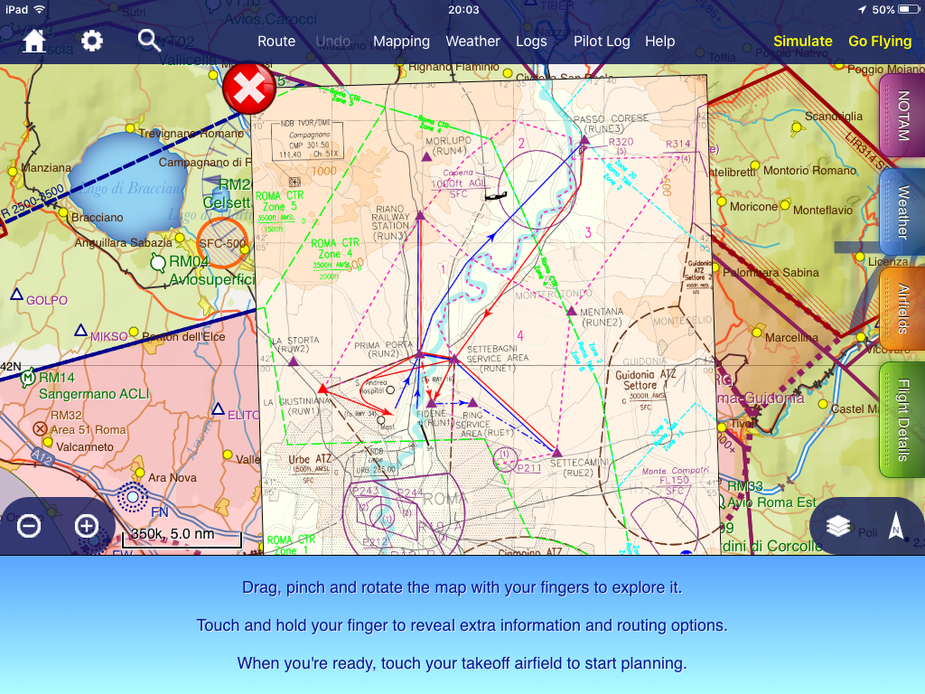
This is the closest I got via the EFB in EasyVFR. Couldn’t get a geo referenced overlay, although admittedly am not approaching LIRU but in North London.
RobertL 18C wrote:
Anthony is that Skydemon or another app?
Yes, Skydemon…. For Urbe the basic SD VFR chart shows the VFR routes as well but that screenshot was from selecting the VFR Routes chart from the airfields tab which overlays the AIP chart….