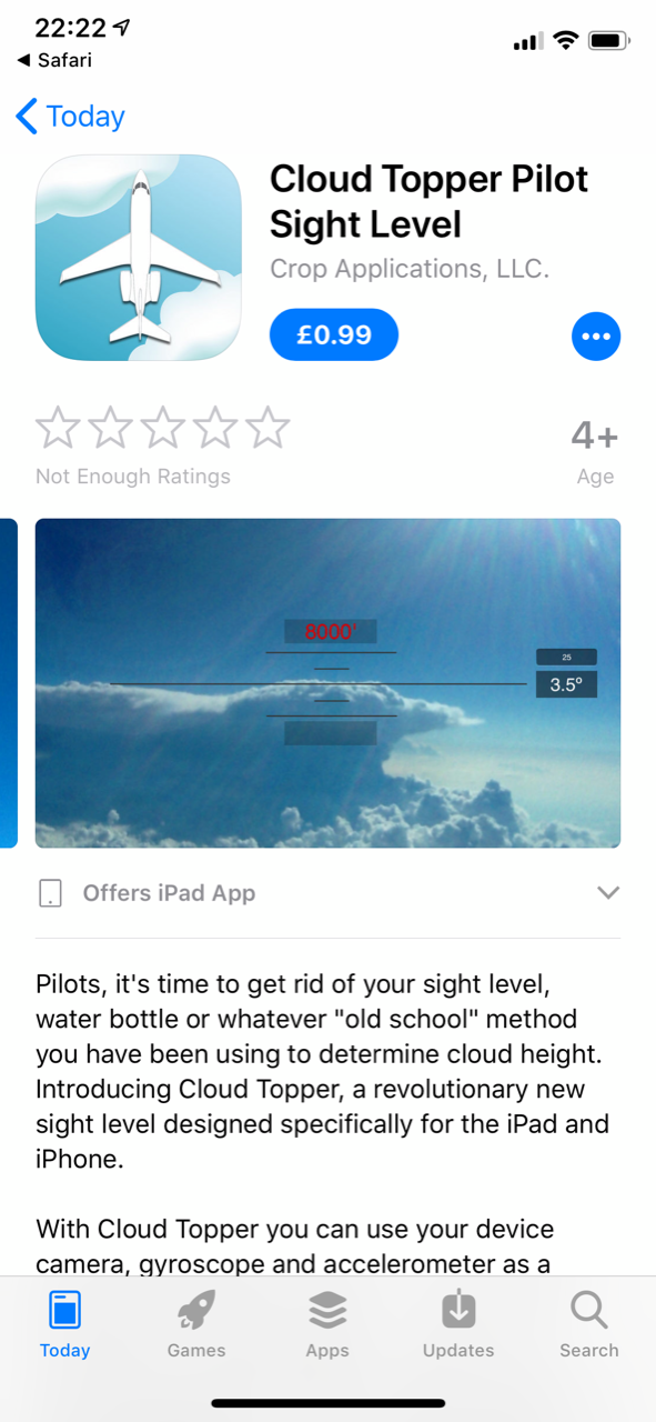
Randomly came across this application on the Apple AppStore today. Seems like a gimmick but wondering if anyone has ever used something like this? 
How does it work internally?
Gives you a number from cloud classification, weather data, angle and your own GPS height?
The angle should be more than enough for practical use in VFR flying but I wonder how it gets the distance?
It has been on board for now surely 2+ years, used quite often and is helpful.
You have to know the distance to cloud, don’t you? Can you really estimate that with sufficient accuracy? Since I got a Golze ADL device, I’ve frequently been surprised by how far away a buildup is compared to what it looks like.
Airborne_Again wrote:
I’ve frequently been surprised by how far away a buildup is compared to what it looks like.
If that factor distance perceived vs actual is the same every time, then problem solved
On iPhone app that measure the size of room objects just a camera + your moves and motion sensors are enough to induce angle parallax and get some accurate distance measurements, like me with two eyes and close object in a familiar environment
I doubt any of this will work to measure the hight of 5000ft cloud sitting 10nm far away while moving horizontally, but if you have an idea of cloud type and weather location you can get a decent number?
Did you try augmented reality based Measure.app? It works surprisingly well and CloudTopper is similar in function.
I use it in conjunction with onboard weather (the latter to calibrate how far the clouds are), it’s a gadget, but it’s 99c so hey…
You need to know the distance to the cloud that you almost never know (calculation is just Pythagoras). You could use it on the ground for training purposes but still you don’t know the distance accurately. Therefore, it’s an absolutely useless gadget.