No, and probably too late to get one now. I use the IR image, sferics, etc. And more recently windy.com and the ECMWF model there.
I always double-check with OGIMET. Today I had similar situation: all charts forecasted some isolated and embedded Cb on my path except GRAMET. OGIMET was so precise that Cb location was pinpointed  I know that forecasting buildups is not an easy job but obviously some do it better.
TRied multiple times today to get a report from OGIMET / GRAMET with no joy – just a “Sorry, No grib data available” message.
Anyone else experiencing problems w this service ?
I can’t get Ogimet at all at the moment
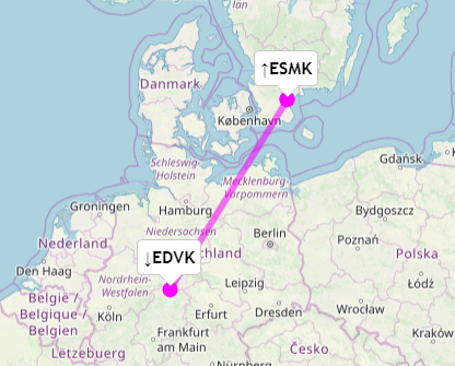
Now that I have an instrument rating, I have planned a fairly long trip this week end, but the weather en-route is not super great with a low-pressure on the way.
OGIMET and the autorouter GRAMET don’t really agree though, so I have a hard time making a decision:
How much do you trust the both GRAMETs these days?
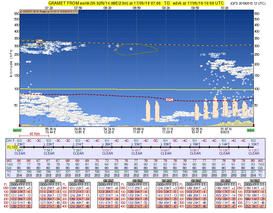
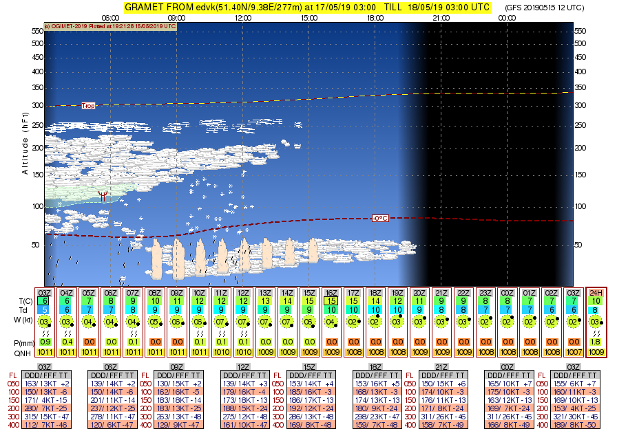
The natural middle stop for fuel is Kassel EDVK, but I don’t really like what I see (LYR BKN EMBD TCU) at the planned arrival time. The plane I will fly does not have a stormscope, an ADL or a weather radar, how can I trust ATS will keep me out of the convective cells? Can I at all?
What is your planned route?
Dep from ESMK on Friday 07:00Z, arrival EDVK 10:00Z. More or less a straight line.
Check Friday morning. You’re likely to get different graph than today.
I only use Ogimet. It’s great, but should be verified against other tools. On Windy you can switch between several models.
Are the vertical clouds on the images below what is worrying you?
Look at the Icon model on windy.com
The Autorouter gramet is probably not far off, but this situation is convective and unstable

Are the vertical clouds on the images below what is worrying you?
Yes. If you select FL040, it shows LYR BKN EMBD TCU. The intermediate segment to the ILS 09 is at 3500ft.