
The only real advantage of Jepp is coverage.
You seem to be talking IFR now. This thread is about VFR, where things are the other way round.
worldwide airport data would really worry Jepp.
The Navdata Garmin use is from Jeppesen..
This is digressing but I don’t believe anyone will take on Jepp’s terminal charts. The “professionals” all fly with Jepps and most don’t fly Garmin or ever will – in terms of the whole market Garmin own only the “low end” avionics market. Jepp’s penetration of the business is near-total and the vast majority of their 10k-20k customers (the number is known, from the number of (encrypted) customer subs in an easily readable .dbf file on their DVD) can easily pay the price. Finally, the very high pricing we pay in Europe is there only due to no competition; their US pricing is far lower.
glider12000 wrote:
The Navdata Garmin use is from Jeppesen..
Garmin does have their FliteCharts. But it’s far from worldwide. Even EU isn’t covered completely and it used to be US only.
Another thing I forgot when writinG down what I miss in
the app:
No way to share or sync flight plans with other devices/users.
We’re two pilots in the plane quite often and while I fly IFR most of the time and share my flight plan with the 2nd pilot with GoodReader (pdf) and JeppFD IFR there is no such way for the plans flying VFR.
Peter wrote:
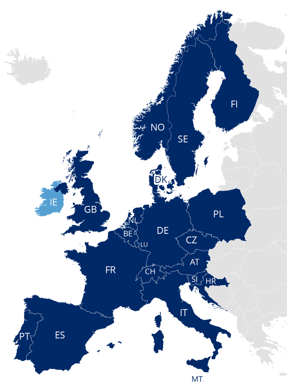
And the mapdata is a problem. Probably the neatest is the Jepp FD-VFR (I had one on trial for 6 months) but that is over €300/year to keep updated, and their coverage is still limited. The charts on that are synthetic but come closest to decent VFR charts.
Limited ? With the exception of Greece and the Baltic States it looks pretty good to me
Why would they take out Germany?
Some posts merged in from here to keep that thread on topic
Why would they take out Germany?
Because they are having to pay DFS money for data which DFS sell. My guess is that this increases the cost of the end product by anything up to €100. It does make its price increment over SD/PFMS more palatable but (a) not everyone needs German VFR airport charts and (b) lots of people have other sources for them.
I think MFDVFR is a neat product, nicely designed, with the best maps, not overflowing with functionality which most users cannot understand (which is IMHO true for SD, based on me seeing it in actual use), but in this price sensitive market I think they are overpriced.
Why should they be paying DFS ? They produce their own airport charts and do not use DFS charts.
Peter,
JMFDVFR still has a number of rather serious shortcomings. And, in most regards, there has been zero progress in the last 12 months. They are very inflexible, development-wise, because, while this product is mostly developed in Europe, the development group nevertheless depends on Denver…
These are:
-lack of coverage (Greece, Balitcs, Slovakia, Hungary, etc.)
-still no iphone support for backup purposes
-incomplete airport database; this is particulary relevant in the UK (most “farm strips” missing) and Italy (most Aviosuperfici and campi di volo missing). It’s effectively useless for the typical VFR flyer in these two countries
-no way of creating and storing user-waypoints
-most flightplanning features missing
That last one is actually not really a “shortcoming”, as they don’t actually intend to make it a full-blown flight-planning thing from the outset.
Plus, as you say, there is the price…
Terrain depiction sure is good in JMFDVFR… much better than SD or EVFR. GP’s terrain depiction is lousy.


