
This article describes an IFR (airways) trip from Shoreham (EGKA) to Sitia
(LGST) in Crete, via Losinj (LDLO) in Croatia, and back via a small airfield
in Greece, Kerkira/Corfu (LGKR) in Greece, and Zadar (LDZD) in Croatia.
All stops were chosen to be in places which we wanted to visit anyway i.e.
no stops purely for fuel.
We had planned to fly to Crete via Prague (Czech Republic) but this was dropped,
partly due to widespread marginal weather in N Europe, and partly due to the
distance from Prague to Crete being about 1000nm which, while technically fine,
is unwise due to the lack of alternates around Greece which have avgas. Possible
stops enroute from Prague to Crete which were checked out were Belgrade LYBE
in Serbia (feasible), Sofia LBSF in Bulgaria (very pricey), and Thessaloniki
LGTS in Greece (apparently no avgas).
Procedurally, the flight was very similar to other airways flights I have done,
but in flying to Crete from the UK with just one stop it demonstrates the long
range capabilities of the TB20 aircraft better than I have done before. Other
VFR and IFR trip reports can be found here.
I had flown to Sitia in Crete previously, in 2004
and that trip – being VFR – was much more challenging.
Here is a glossary for non-aviation readers.
Aircraft
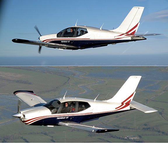
The aircraft is a 2002 Socata TB20GT which has a zero-fuel “book”
range of approximately 1100nm and an economical cruise speed of 155kt TAS at
10,000ft. Extra economical cruise power settings can extend the zero-fuel range
to 1300nm which, according to FAA rules, translates to approximately 1100nm
with IFR reserves. It has a ceiling of about 20,000ft and is equipped with oxygen.
It is not certified for flight into icing conditions but has a TKS de-iced propeller.
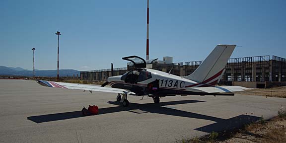
This is the actual aircraft
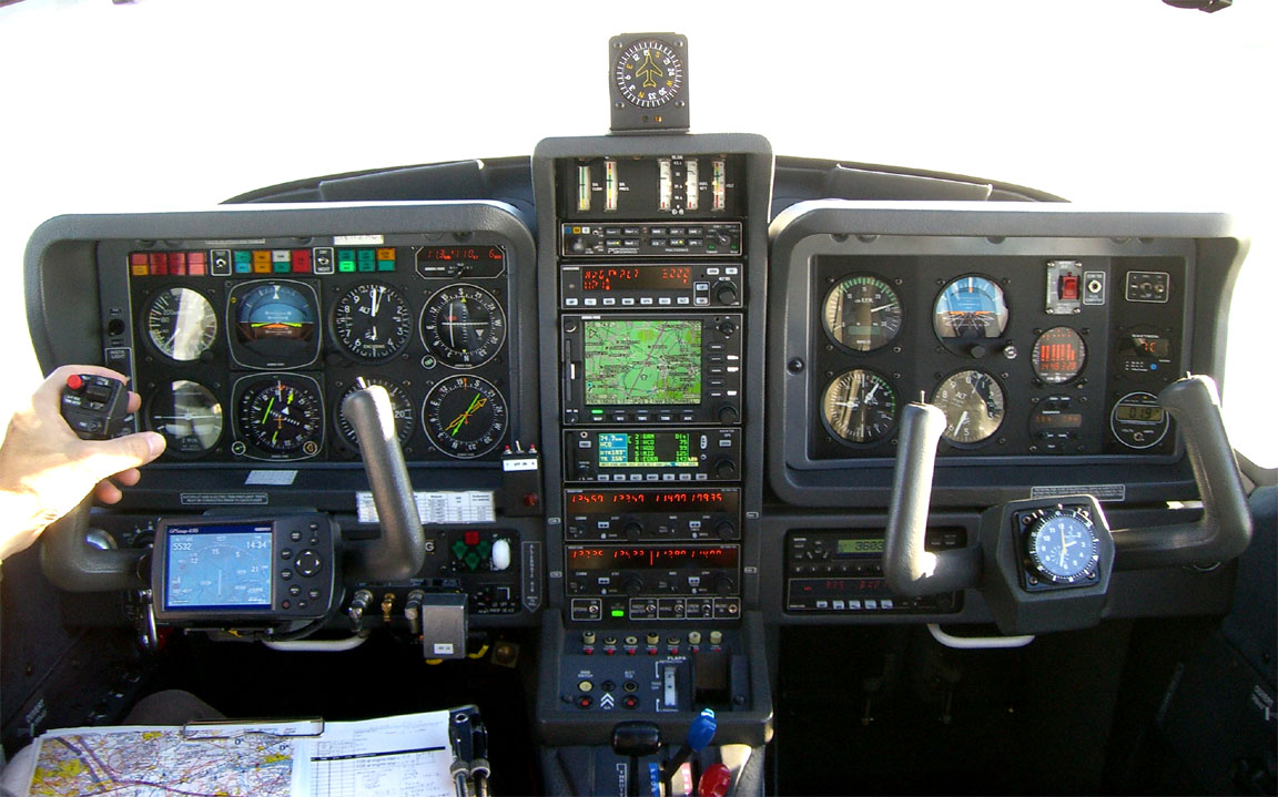
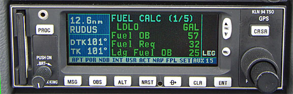
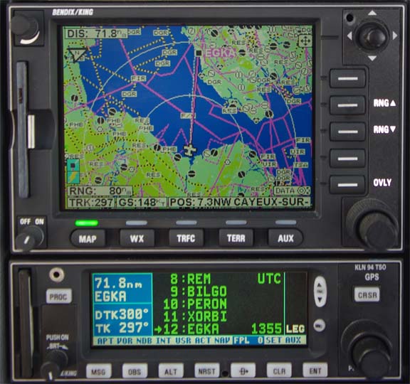
Navigation equipment includes a KLN94 IFR/BRNAV GPS and a KMD550 MFD and these
are used for primary navigation. IFR flight in Europe above FL095 (generally)
requires BRNAV certification which in the GA context is met only with a BRNAV
approved IFR GPS installation. The most common means of BRNAV compliance is
one of the Garmin 430/530 products but many other panel mounted GPSs have been
approved. BRNAV can also be met with the old KNS80 (with an antenna filter to
meet FM Immunity regs) but this product will not alone function in today’s “everything
is RNAV” environment where one is routinely sent to a VOR which is a great
distance away.
The aircraft has a KFC225 autopilot which can track VOR/GPS/LOC/ILS and fly
a preset altitude or a preset VS. There is an additional battery powered Garmin
496 GPS which also provides an audio terrain warning (TAWS) function with a
European terrain and obstacle database. The TAWS function projects the current
trajectory for 2 minutes and if there is a terrain conflict, one gets a “pull
up” type audio warning whose tone gradually becomes more urgent. A WX500
stormscope is also installed. One of the radios has 8.33kHz channel spacing
to legalise flight at 20,000ft although I have never been assigned such a frequency
Flight Planning
The routes were planned using Flight
Plan Pro (FPP) which was used to generate a Eurocontrol-accepted airways
route which was then pasted into Jeppesen FliteStar from which I printed out
enroute chart sections, plogs, etc. The workflow I use is illustrated in this
article. There are other ways one can do this; nowadays there is enough capability
in FPP alone to print out almost everything that’s needed. IFR route planning
is tightly constrained by the Eurocontrol system, and with flight itself being
a wholly point to point RNAV button-pushing exercise, it is an interesting observation
that one needs a lot less flight planning software functionality for IFR than
for VFR where good and current mapping data is needed – at least that’s true
for piston aircraft where one is not working with a severe altitude versus fuel
burn (i.e. range) tradeoff.
It always pays to do as much as possible back home, before departure, where
internet is free, printing is cheap and quick, and one would not depart in any
case if the weather is not suitable. For this trip, all routes
were preplanned and the ones actually intended to be flown were printed on a
colour laser printer. The pile of paper was about 20mm thick.
One thing which made some flights tricky was airport
opening times. In Greece in particular, some airports open for just a couple
of hours around a scheduled commercial flight. Croatia had a similar issue in places but has much improved.
Weather Planning
I try to use “technical” methods to make the go/no-go decision as
objective as possible. In the context of flying a non-deiced aircraft (I have
propeller-only TKS de-ice, which really does work very well but is no good for
spending hours in icing conditions) this means establishing whether the enroute
section of the flight can be done substantially in VMC, which given European
airway levels means VMC on top if there is any cloud about. One therefore needs
to establish where the cloud tops are likely to be. This is not trivial – some
notes are here and here.
Lately I have been heavily relying on satellite IR images to get a “cloud
tops METAR” just before a flight and this technique has been completely
successful on every flight where I have used it.
On the first flight of this trip, the weather was difficult. In the past, I
used to simply avoid frontal weather. On longer trips like this one, we would
normally set aside 2-3 days for the departure, and if it looked impossible all
the way through then we would get an airline flight (and probably go somewhere
else). Once one is well away from the UK weather system, e.g. south of the Alps,
things tend to be a lot easier. However, using such a simple policy, we would
have not got out of the UK for about a week after the planned date. The first
four MSLP charts 1 2
3 4 did not
look good so, together with my principle of always flying on the first technically
flyable day even if a following day “looks better”, we got our stuff
packed and looked at the actual conditions on each morning.
On the first day (10th June) the 0600
1200 1800
MSLP charts did not look promising for the first flight (EGKA-LDLO) and the
0600 1200
SigWx were of no more use, but the 0400
IR satellite image showed a lack of any clear frontal situation (suggesting
that much of the high level cloud showing was just high thin layers) and the
altitude-calibrated version looked
similar. The radar image showed some dense
cloud but the sferics image was clear. The
TAFs and METARs confirmed a likely dense
cloud but no high buildups. The Meteoblue
data – for a change – agreed. The 0500
IR image agreed with the sferics image and importantly on the location of
the very obvious thunderstorm around the border of France and Germany. Finally,
I looked at some ascents (weather baloon probe data) for 0000Z and appropriately
upwind of the planned route and these indicated a temperature-dewpoint spread
of about 5C which is certainly not solid IMC.
So we decided to go, with a plan to turn back if solid IMC with excessively
high cloud tops was encountered, either to Shoreham or, if the turnback decision
was made later, to somewhere in Germany, with Dortmund being one possibility.
Equipment
On any significant trip I carry a lightweight laptop (an old 12" Thinkpad
X60S-1704 with a 6 hour battery) with everything needed to do VFR and IFR route
planning, get weather, notams, file flight plans, and communicate via fax and
email. Not having this makes travelling by light aircraft far too much hassle.
The laptop has several different ways to get internet access; in descending
order of preference: wifi, a bluetooth connection to my Nokia E51 GPRS/3G phone,
a USB cable connection to the same phone, a built-in GPRS/3G radio (with a T-Mobile
SIM), and a USB cable connection to a Thuraya 7100 satellite phone. Fax (which
remains essential for airport communications, where a phone call is difficult
due to language issues) is done via email2fax and fax2email accounts; these
are not free but are very cheap. I used to use Winfax for sending faxes but
have not used it for a year or two; not least because it is very flakey with
GSM modems… On long trips I also carry a Canon IP90 A4 printer
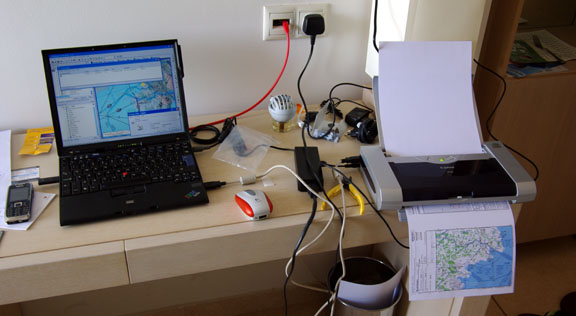
The printer can be battery powered but the battery pack makes it heavy, and
the mains power unit has to be carried anyway in case the battery goes flat.
The printer may seem “excessive” but is brilliant for printing out
enroute charts and approach plates when one has to substantially replan something.
The alternative is to print to a PDF, copy it to a USB stick, and look for an
internet cafe or a printing bureau which can print off the PDF …. hopefully
in colour. I find it suprising that nobody today makes a compact lightweight
A5 printer. There are some A6 printers but that is too small to read, for most
people over 45…
Given the nature of IFR planning, a loss or failure of the laptop would be
extremely inconvenient, so on long trips I also carry a cheap little
Asus EEE 901 laptop which has almost
the same software configuration as the main laptop. This backup laptop stays
permanently in the back of the aircraft. It is slow and its small keyboard is
hard to use, but it is a whole lot better than nothing. On short (overnight)
trips, on which everything has been pre-planned, pre-filed, and pre-printed
back home, and there is very little chance of anything going wrong, I tend to
carry this laptop as the only one because it is easy to chuck it into a backpack.
It is tempting to go fully “electronic” in the cockpit: print everything
off to PDFs, and transfer these to something like the Kindle DX e-book reader,
or the Apple Ipad. This would eliminate all printing. The Ipad, with an aftermarket
matt stick-on screen filter, makes a particularly competent PDF viewer providing there is no direct sunlight. The
data transfer method would depend on whether the document viewer is to hand
when planning, or remains in the aircraft. None of the options are particularly
robust. The Marketing Dept’s choice – emailing the data to oneself and then
downloading it on the reader using GPRS/3G – is the least attractive, given
the multi-megabyte data size and the vagaries of roaming GSM in some places.
The biggest issue is: what if it fails? Anything electronic can fail; even the
data transfer can break, but paper printouts can’t. One would need a 2nd (backup)
document reader. I currently run the competent if outdated LS800 tablet (see
further below – original cost over £2200, in 2005) whose broad WinXP functionality
cannot be replaced with any closed-architecture product such as the Ipad or
the Kindle. A more modern WinXP tablet is the Viliv
X70EX (around £600); I have tested this and it is OK but like all
“consumer” LCD products (including the Ipad) it falls down on sunlight
readability – more pics here. The Sumo
312 is a more serious product, at about £2200 with all the required
options. Going shopping for gadgets is fun but the reality is that paper is
easy to read, easy to organise into the expected order, costs almost nothing,
needs no backups, and just carries on working… I waste a significant amount
of my working day getting gadgets to do exactly what I need, and fixing them
when they have other ideas. The issue of totally unplanned in-flight diversions
remains, but this rare situation is addressed adequately with a single device
storing a wide choice of approach plates. In an emergency, once can fly a radar
vectored ILS knowing just the frequency and the runway heading.
I always fly with a liferaft, an emergency bag containing a 406MHz
EPIRB, a handheld radio and a lot of other stuff, a second 406MHz+GPS EPIRB,
and together with the large 48 cu. ft. carbon/kevlar oxygen cylinder these take
up the RH back seat. There is also a large toolbox with enough tools to do the
50-hr service plus potential emergency jobs like changing the vacuum pump. On
longer trips such as this I also carry a complete set of three spare servos
for the notoriously unreliable KFC225 autopilot, a second identical oxygen cylinder
and a spare 1st stage regulator, 1 refill for the 2-litre TKS propeller de-ice
system, and several 1-litre bottles of isopropyl alcohol (IPA) for use as fuel
anti-icing additive (there is no known case of a TB20 suffering fuel icing but
this is a very cheap precaution). Plus four 1qt bottles of engine oil. Plus
a lightweight reflective aircraft cover (from Bruce’s Custom Covers) which keeps
the cockpit cool when parked in hot climates and is a huge help in keeping the
interior in good condition. It is difficult to imagine doing such a trip in
one of the many 2-seater “homebuilt/sports” types. This leaves the
LH back seat free and Justine sometimes likes to sit there; the rear seat is
a lot thicker and softer than the front ones; in that case I run down the LH
fuel tank substantially, to keep the aircraft balanced.
The route illustrations in this article are screenshots from Jeppesen FliteStar
IFR. The terrain profiles shown at the bottom are not usable for safety altitude
planning; in fact the Jeppesen data contains systematic
errors. The vertical profile of an IFR flight is at a minimum level which
is decided by what is acceptable to the Eurocontrol computer. The minimum levels
which can be filed tend to be around FL070 but acceptable routings usually need
higher levels. Sensible routings start to appear around FL100 and the best ones
(below FL200) are obtained at FL140-FL160. Oxygen
is therefore highly desirable for European IFR.
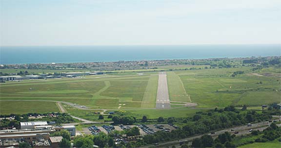
Flight Shoreham-Losinj
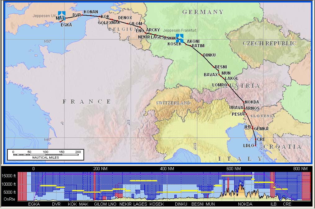
Route:
EGKA
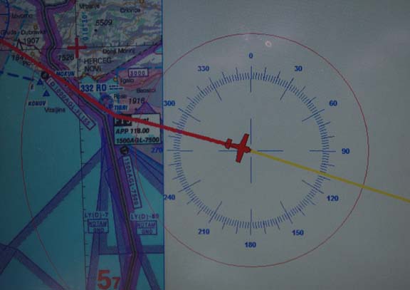
MAY M140 DVR L9 KONAN L607 RUDUS L984 ASKIK Z74 AKONI L603 OLETU Z106 BAVAX
M867 NOKDA Q100 ARNOS P125 URAVA L607 ILB P81 CRE
LDLO
FL150 Distance 700nm (GC) 779nm (airways)
The flight plan was filed about 1 hour before departure, using AFPEx. With
IFR flights – particularly ones to the east – there is a risk of a departure
slot being issued by Eurocontrol. For GA flights in the FL100-180 band, these
slots are apparently meaningless artefacts of their software and in any case
the resulting delay tends to shrink near the time due to the slot time being
modified, so one must still be ready for a departure at the originally filed
time. On this occassion, due to the Shoreham tower being unmanned 0800-0900
local time, and with AFPEx not supporting incoming message forwarding to SMS
(there is no practical way to run the AFPEx Java client application on a portable
device, though there are obscure “remote desktop” solutions) there
was no way to find out about a Eurocontrol slot. Homebriefing
does offer SMS notifications, but I stopped subscribing in 2009 because there
are now at least two other free ways to file
IFR flight plans and I don’t need to pay 40 euros/year for a third method.
So I phoned the ever helpful AFPEx helpdesk and checked… and there were no
slots.
If doing this type of “farm strip” departure, one contacts London
Information on 124.60 when airborne. They issued a squawk of 0027 with a “remain
outside controlled airspace” instruction. The base of controlled airspace
in the area is FL055. After a few minutes we were given a squawk of 0371 and
handed over to London Control on 120.175, who asked for a squawk ident and then
gave us a “direct DVR climb FL100”, and off we went as usual in IFR
flight.
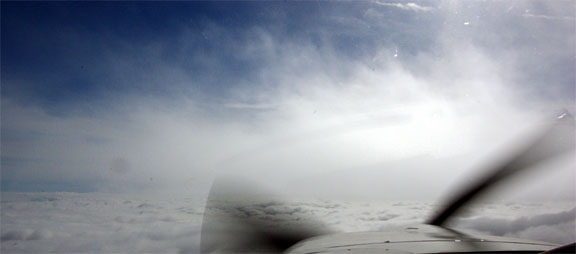
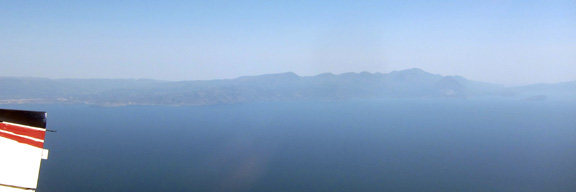
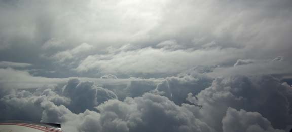
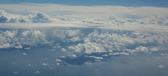
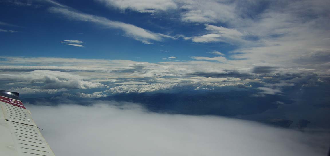
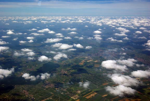
The cloudbase at Shoreham was about 800ft. Cloud tops were found around FL070,
with a mainly blue sky above
The surface temperature was around +14C, and the lowest temperature seen in
the cloud was +3C so icing was never an issue, but one would not be expecting
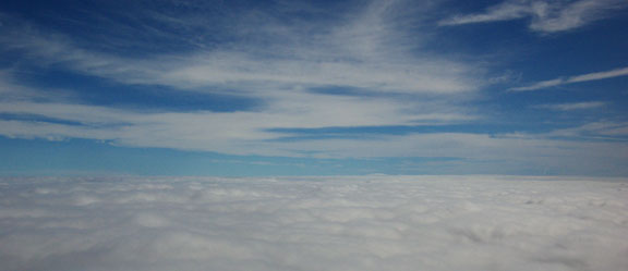
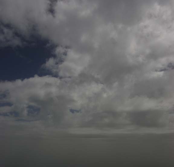
much ice in such smooth stratus. The haze improved as we climbed
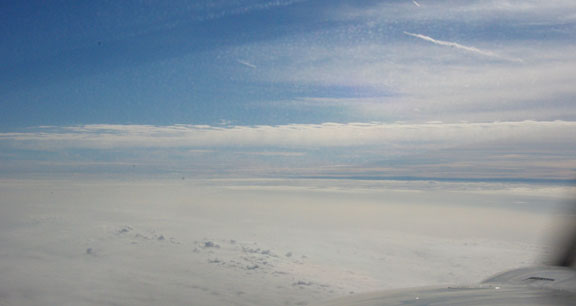
There was plenty of high but thin cloud around which no doubt featured prominently
in the IR satellite images. It was obvious – yet again – that the best data
for making the final go/no-go decision is the actual data: satellite IR images,
and weather probe ascents. The forecasts, SigWx included, were basically rubbish.
Due to the very good conditions and to conserve oxygen, I asked for a stop
climb at FL100. London Control offered FL090; apparently this level was requested
by the next sector. Upon a handover to Brussels we were cleared KOK LNO GELPA
which in one clearance took us right across Belgium and into Germany.
The cloud tops started to rise; I requested FL100. This is not on the official
semicircular levels (odd numbers if going east) but normally ATC do not care
about these. I don’t know if Belgium has changed its policy on this but they
offered FL110. Soon this was not enough and we climbed to FL130
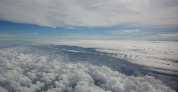
The clouds were in several layers and it might have been tempting to just fly
between these, but this can be a trap: if the layers merge together, the resulting
cloud above could turn out to be too thick to climb up through without a big
risk of icing. So the smart strategy is to always stay on top. Self evidently
very thin layers and haze can be ignored, and anyway there is little choice
if these are at FL300! As a result, we had climbed to FL150 before leaving Belgium,
and this was soon followed by climbs to FL170 and FL180
The temperature at FL180 was -8C which is substantially warmer than the standard
atmosphere, but the aircraft performance was still reasonable: 95kt IAS at 9.0GPH
(US), 2575RPM. The MP was 14.5" and without a turbo there isn’t much one
can do about that…
With enough “stuff” for a 2-week holiday, the back of the aircraft
was full
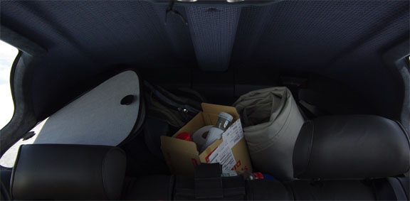
and even with two below average weight persons was about 6% below its 1400kg
MTOW.
Early on in the flight, the computed landing fuel on board (LFOB) figure stabilised
around 25USG and stayed that way till the destination
Munich requested a descent to FL170 which I accepted because the tops were
slightly lower by then. This was apparently due to jet traffic behind us at
FL180; we eventually spotted it, on a parallel track a good number of miles
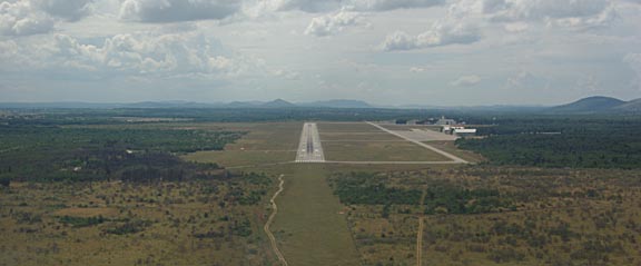
to our left. Here is the airport from FL170 or so:
There was a lot of haze which can be only partly removed with Photoshop, and
has to be done in several manual steps because the automatic colour correction
function is too primitive. In addition, during this flight the camera was accidentally
set to ISO400 so the pictures are not as good as they could be.
On all long flights I run the European VFR charts as a GPS moving map under
Oziexplorer, mainly for emergency use
but also for identifying interesting objects on the ground
Oziexplorer was originally developed for vehicle applications in the Australian
outback but it is really just a GPS moving map application which can run almost
any graphical image (that can be georeferenced) as a moving map. The LS800
tablet computer used here is an outdated product but remains one of the few
tablets which is truly sunlight readable. It has been modified with a solid
state hard drive; the original one used to crash around FL130. It is also used
to display weather data using an internet connection with a satellite phone
Each weather check like the one above costs about $1, using a Thuraya 7100
PAYG phone, connecting on a 1722 dial-up call at 9600 baud. The system is a
long way from being 100% reliable (I don’t think Thuraya care much for the reliability
of their data service) but usually works fine in the context of a flight lasting
several hours. One can supposedly get destination weather from ATC but many
ATCOs are too busy, and some evidently don’t like doing it anyway. It also appears
unprofessional when the vast majority of the players in the IFR airspace (airlines)
can get weather via their own comms systems (ACARS). I did some tests on using
satelline phones for aviation weather – here.
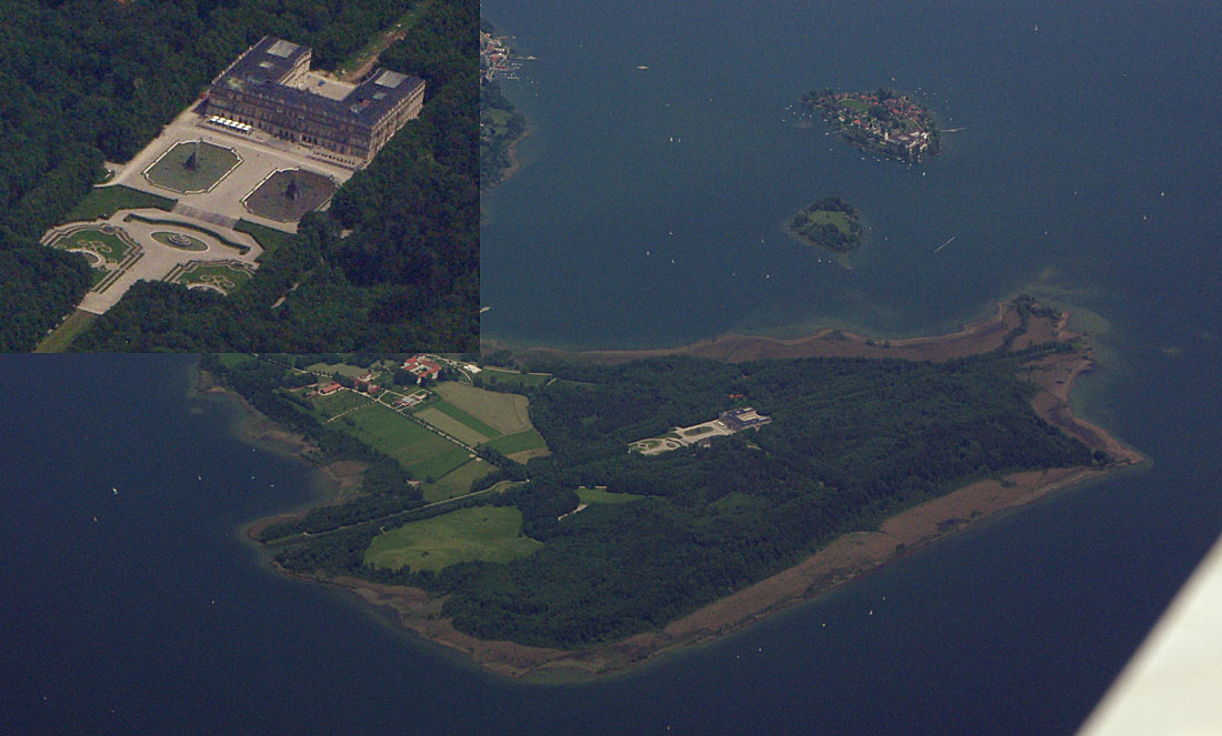
The route passes near the famous Schloss
Herrenchiemsee Castle, seen here from about FL170 and through a lot of haze
The winds aloft forecast bore no relation
to the headwind (5-15kt) which was present along the entire route.
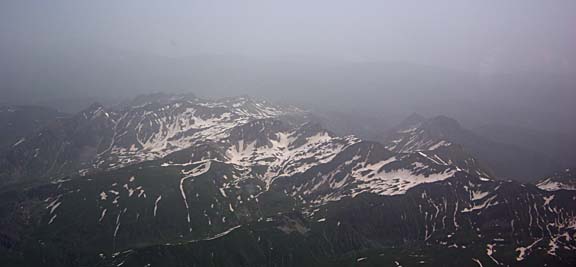
Around Munich, the Alps became visible in the haze
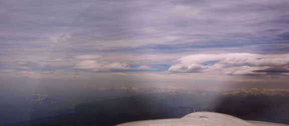
The wind was about 10kt and flowing across the Alps. A very rough rule is that
for every 10kt of wind flowing across mountain ridges, one should be at least
1000ft above the terrain in order to limit the up/downdraughts to 500fpm. In
this case, we were about 8000ft above most of the terrain, but there was a noticeable
level of turbulence for the first 50nm or so of the Alps crossing, which then
died down.
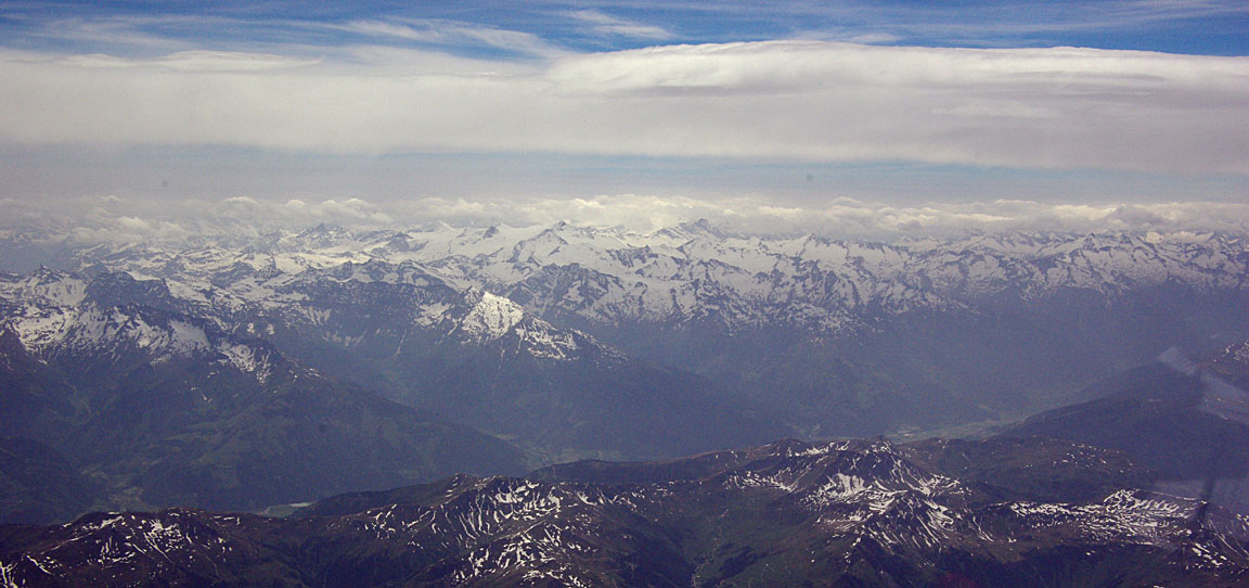
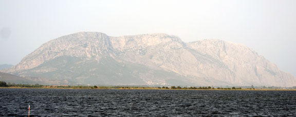
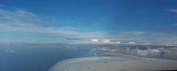
On clear days, the terrain is always spectacular

which was welcome since the last several flights I have done across the Alps
were mostly above a solid overcast. At FL180, the terrain is mostly about 10,000ft
below… it appears much closer!
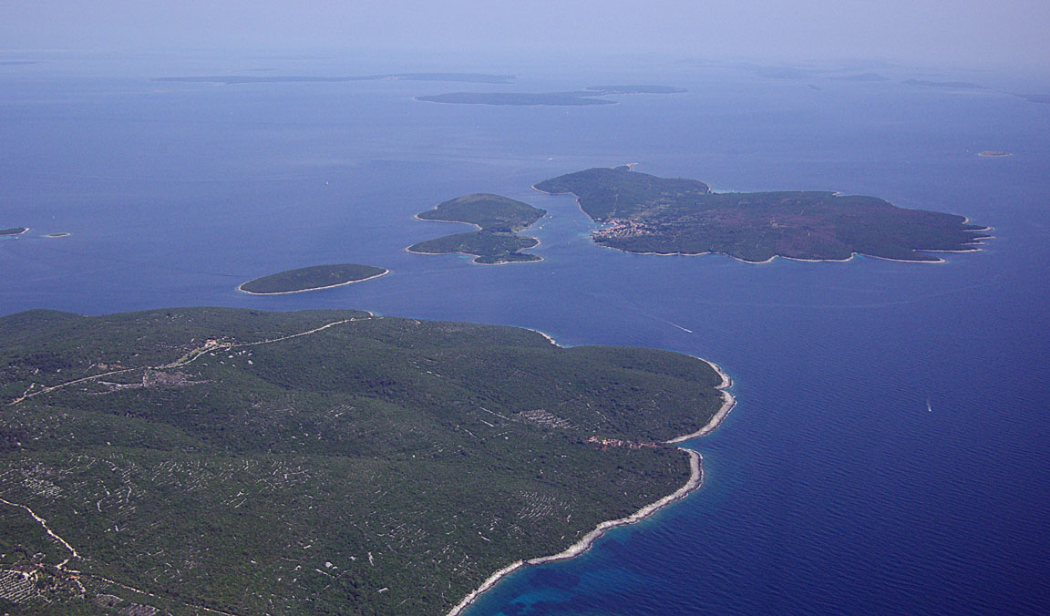
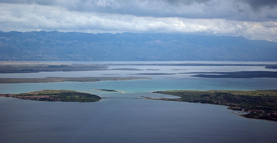
Immediately after the Alps comes Slovenia and then the Croatian islands appear
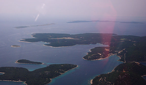
With about 100nm to run, and from FL170, I requested a descent to FL150; the
objective being a continuous descent all the way to Losinj. This worked out
fine, and Pula Radar issued further descents to 9000, 5000 and 3000ft.
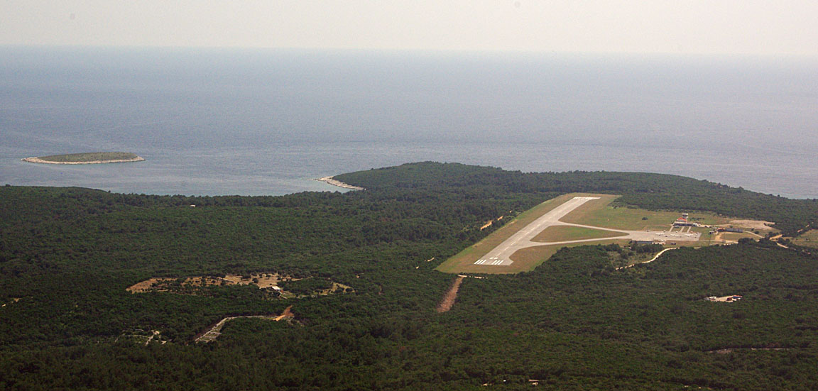
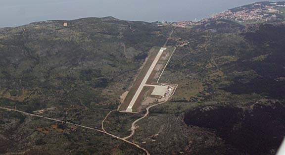
The filed route terminates at CRE (Cres Island) and this identifies the CRE2C
standard arrival. The full instrument procedure was requested and flown for
practice. CRE2C transitions to the NDB circling approach,
and runway 20 involves a right base turn to final. This pic was taken just before
establishing on the 303 inbound track

and this is from right base; it has been cropped and this suggests we were
much closer to the runway than in reality
This flight could not have been done VFR on the day, due to low cloudbases.
An IMC Rated pilot could have left the UK VFR, climbing VMC on top somewhere
past DVR, and then flown VMC on top to somewhere in southern Germany, where
he would have got into some issues with controlled airspace, trying to remain
above the cloud. Of course, a pilot who doesn’t mind flying “VFR”
in IMC would have been fine but could have faced some icing issues…
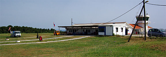
Losinj is a small but superbly organised place to which every European anally-retarded
empire-building airport manager should have a mandatory annual visit. The aircraft
is processed immediately. A single policeman makes it an “international
airport” with a Customs presence. No sign of the yellow jacket brigade!
The one thing one does need to watch out for are the opening hours, which can
be tight for a direct flight from the UK, but are a lot better than on my last
visit in 2007.
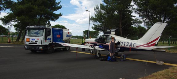
In line with the standard practice of always refilling immediately after arrival
(to avoid departure delays) we refuelled right away. In a warm place, this has
the drawback that one is likely to lose anything up to a gallon of fuel (approx
1% of the fuel tank content) to evaporation and fuel loss through the expansion
vents as the tanks warm up, but is still worth doing. And anyway one can always
top the tanks off before departure, if it appears this can be done without delays.
Evidently, Croatia has realised that it was selling avgas too cheap and the
price is now fully at EU levels, having increased by about 2x since 2007.
We landed about 1hr before the closing time, and a number of aircraft (mostly
German) departed shortly afterwards
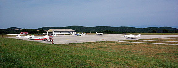
Each parking position has a couple of tie-down rings embedded in the concrete.
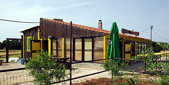
There is a super little cafe
and then it’s time to get a taxi into town; Mali Losinj is the biggest, with
a population of about 6500
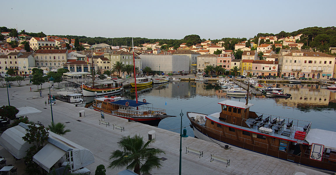
Losinj
We checked into Hotel Apoksiomen for 3 nights. The hotel was very nice (we
stayed there before in 2007) but the air conditioning turned out to be not working,
which made sleeping very difficult; this was reported 3 times before the next
morning but with no evident action. On the second day a different person revealed
that the whole hotel had this problem, and would not be fixed for several days.
It was pretty obvious that they knew this all along… Given the +35C outside
temperature and the need to get a decent sleep, we relocated into a really nice
small hotel; Mare Mare.
I would highly recommend it. Unfortunately for us they had a room for 1 night
only, so we spent the three nights in 3 different places.
Losinj is a truly lovely island; unspoilt by mass tourism. One can imagine
life here has not changed for decades. The locals are very friendly and the
food is excellent.
Justine’s Highlights
Step out of the plane and smell the wild herbs. Almost every plant on the
island seems to be aromatic (our guidebook says there are 250 types of herb
here).
Have a drink at the airport’s funky El Paso bar, the perfect place to get
your stuff organised, text the folks back home, break into your nice new 200
Kuna notes and call a taxi (if the driver doesn’t show up anyway – word travels
fast here).
The nicest place to stay in Mali Lošinj is the Mare Mare Suites, a
sort-of boutique B&B with a jacuzzi deck and very friendly staff. A little
way outside are the resort hotels of Cikat, which look worth a try if you want
to be close to the swimming spots. Book in advance if you can as there’s no
central agency and finding accommodation at short notice can be difficult and
time-consuming.
The bus trip to Cres is a great day out if you don’t mind a slightly deranged
driver and a vehicle with almost no suspension. We were literally bounced out
of our seats every time the road got bumpy.
Look out for sea urchins – the sea floor is very rocky and the spiny wretches
are everywhere. Bring or buy a pair of watershoes or you’ll be landlocked.
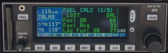
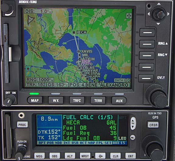
Flight Losinj-Sitia
Route:
LDLO
EBITA N606 ZDA L607 DBK R45 TAZ W47 POD L604 RETRA Y400 MAVAR N132 TALAS B1
ATV L617 XAVIS
LGST
FL150 Distance 776nm (GC) 820nm (airways)
In the morning, the TAFs and METARs
showed nothing of significance. The MSLP charts 0600
1200 were clean, though they
would probably not reveal the potential for thunderstorm formation – another
reason to do the flight early in the day. The sferics
image was clean. The satellite IR image
showed some high altitude cloud tops along the Croatian coast.
The relevant Sitia opening hours on the day were 1230-1430 UTC and a flight
time of approximately 5:30-6:00 was expected. So we planned to get airborne
0600 UTC.
On the day of departure, Losinj airport was quite busy, with a queue of tourists
waiting for a Dash-8 twin turboprop going to Innsbruck, and looking very envious
of the GA pilots who were departing on their own timetable. The police however
processed GA separately, and we were done in about 30 mins. A rare Extra 500
turboprop was seen
As expected, there was a certain amount of fuel loss due to the wing tanks
warming to the ambient over the three days and excess fuel spilling out through
the overflow vents. The loss was about 20mm below the “full” level
which is the brim of the filler hole. This seems to be the usual amount, and
measurements show it is worth about 4.5 litres (1USG), so I set the departure
FOB on the fuel totaliser to 85.0 instead of the usual 86.2USG.
On this occassion the flight was filed using EuroFPL.
This excellent new IFR flight plan filing site also provides a flight tracking
facility, which was useful as I was going to meet a few people at the destination.
Given the runway 20 and the first waypoint of the filed route of EBITA, the
expected departure was EBI2D and sure enough this
was it. The initial IFR clearance was direct LGST, FL130. The flight was completely
straightfoward. Curiously, the original squawk of 6546 was changed twice during
the flight; to 4017 by Zadar and later to 7033 by Athens. This perhaps explained
why the EuroFPL tracking facility did not pick up the aircraft progress until
about halfway. The 70xx squawk looked suspicious (70xx is VFR in much of Europe,
and you don’t ever want to get your IFR clearance accidentally terminated) but
Athens confirmed we were an IFR flight.
The departure passes alongside the town of Mali Losinj where we had stayed
The visibility was about 10nm which, at FL130, meant one could not see much
except when looking straight down
Here is Brac airport – another lovely island well worth a visit, with a superbly
organised airport with Customs and avgas. I have been there before 1
2.
Most of the cloud along Croatia turned out to be harmless thin stuff around
FL160 but there was one bit which went down to FL120, was darker, and had some
rain falling out of it. Since the OAT was just +1C and would be bound to fall
inside the cloud, we descended to FL110, and climbed back to FL130 afterwards
to remain well above the mountains of Albania where some turbulence might have
been expected.
There was a thin layer of cloud above but getting above it would have needed
about FL180 and there wasn’t any point
The end of the known universe becomes apparent when the coverage of the only
current aviation charts ends at the end of Croatia…
Fortunately not only are VFR charts not practically required for IFR (except
in special situations like Z or Y plans, or some emergency) but also there are
the old (1990s) U.S. ONC/TPC charts which are easily obtained for use as a GPS
moving map, and I have them for all relevant areas; these are out of date but
the terrain doesn’t change much…
Not much was seen of Albania
but there must have been a huge amount of snow on those mountains during the
winter, since we were flying in June at +2C and these peaks were about 6000ft
below us.
The LFOB figure had hovered around 25-28USG for the first part of the trip
Initially we had a headwind of about 5kt but this later changed to an increasing
tailwind, which eventually reached about 25kt. For fun, I replaced (in the GPS)
the destination of Sitia LGST with Cairo (HECA), to see how much fuel we would
have landed with assuming the ground speed had been maintained… 9USG!
Given the prevailing NW winds, a TB20 could quite often fly from Shoreham to
Crete nonstop, albeit with a reckless reserve. Shoreham to Corfu is completely
doable but all the alternates would not have avgas; getting a 200 litre drum
shipped to a Greek island would cost a small fortune.
There seems to be an increasing amount of co-operation between some countries
in this “politically difficult” region, because Skopje Radar gave
us a 142NM DCT right across FYR Macedonia, all the way to Thessaloniki.
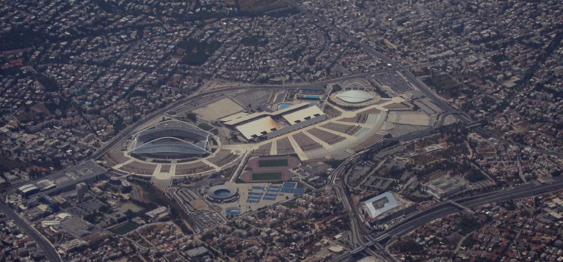
This is an Olympic stadium at Athens
On this day, Sitia was open for just 2 hours, and the departure time was originally
planned for an arrival 30 mins after it opens. Due to the tailwind, the continuously
re-computed ETA wound itself back until we were looking at arriving before the
opening time. I reduced the power by going further into the LOP region, too
keep the ETA within limits. The fuel flow was just 8.6GPH for a TAS of 133kt.
The Greek islands can have strong winds. For some reason, my satellite phone
did not work and Greek ATC would not obtain the Sitia weather despite my 2 requests
being met with “standby”. I eventually got it from a much more helpful
controller at Iraklion; it turned out to be a non-issue but was anyway too late
for an efficient diversion. The weather for Sitia (LGST) is not available via
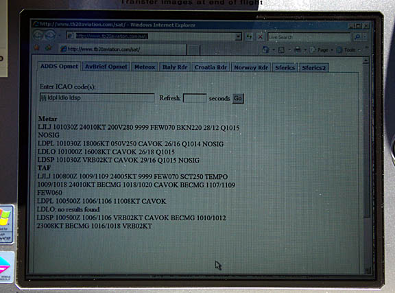
most popular weather websites; from NOAA you get nothing, from Avbrief you get
the TAF but no METAR, but this site
carries it.
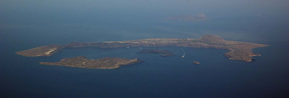
Here is Santorini from FL130 – another nice place to visit, which we did VFR
in 2005
We did not see Crete until quite late, due to the haze
I flew the full arrival and VOR approach procedures.
The DME arc took up another 5 minutes… Here is the final approach to the vast
runway
This flight could have been done VFR, at some suitable level below the clouds,
without any problem, though the route would most likely have been different
around the Montenegro/Albania airspaces; see my 2004
and 2005 trip writeups.
The tower is “Information” not ATC, so no landing clearance is issued;
you land at your discretion. Sitia airport is just as sleepy as it was on our
last visit in 2004, and with the same warm welcome in the tower by the same
Mr Dimitris
Due to the non-EU arrival (which required a 24hr PPR for Customs) we had to
fill in a GENDEC form which took all of a few minutes, and that was it… very
unlike every other Greek airport I have been to, where form filling can be extensive.
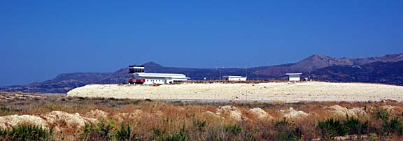
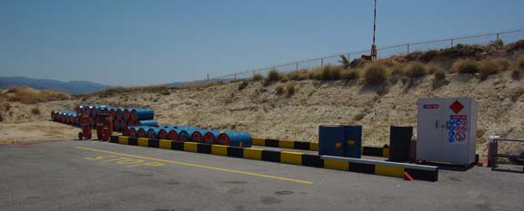
The fuel storage method has not changed since our last visit in 2004
and the cupboard on the right contains the pump
The landing FOB was 29.2USG and the refill was within 1% of the flowmeter-computed
figure.
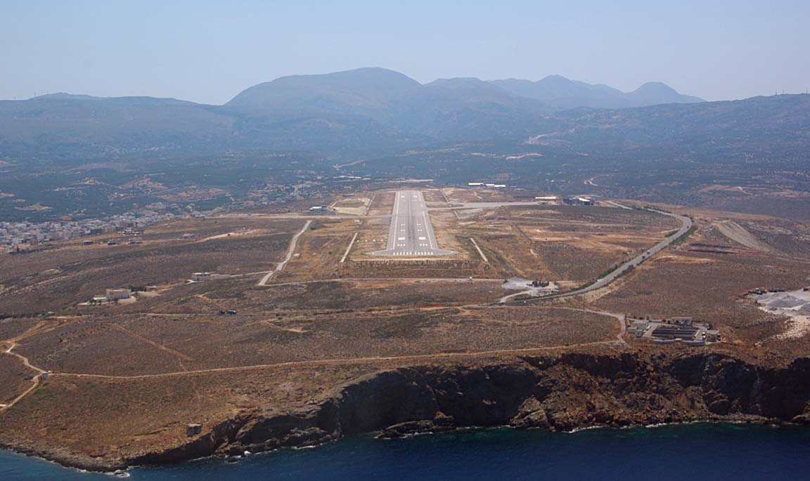
The fuel facility is near the tower but longer term GA parking in on a vast
apron on the north side of the runway
which was totally empty and where a huge passenger terminal – about 10x bigger
than required for any remotely conceivable level of passenger traffic for this
part of Crete – is under construction … apparently it has been under construction
for several years now, and I don’t really think there is a big hurry to finish
it, which is bound to be good news for GA. Sitia is a superb facility and quite
unlike the vast majority of airports in the area, most of which specialise in
job creation and paperwork generation. It is a Port of Entry which is very handy
for flights to e.g. Israel or Egypt, and needs 24hrs PPR for a non-EU arrival
or departure. An Aegean Airlines AVRO RJ100 (BAE146-lookalike) turned up while
we were waiting for the taxi to parking, which shows how GA can co-exist with
the big stuff perfectly.
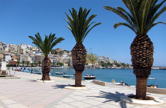
Sitia
As we found on our visit in 2004, Eastern Crete is much quieter than the other
parts. Sitia is a lovely town with a harbour, a sandy beach and lots of cafes
We stayed in the Sitia Beach Hotel which was excellent… apart from pricey
internet access in the rooms. Internet was free in the lobby downstairs when
it worked, which was not very often… back to GPRS/3G as usual.
Alongside stunning landscapes
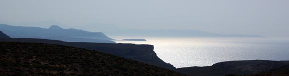
there is much to see in eastern Crete. It is a laid back part of the island;
much less hectic than the middle or western parts (Iraklion and Hania). The
lack of traffic is astonishing.
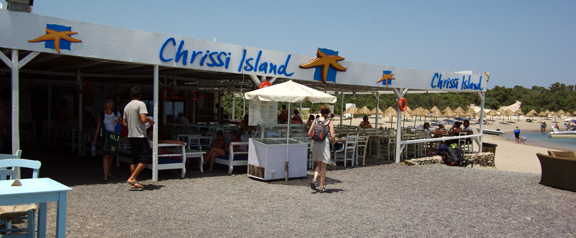
We did a 1hr boat trip to Chrissi Island (also known as Donkey Island) which
is nearly Europe’s most southerly point. Gavdhos Island is the most southerly
but is much less accessible. Chrissi is a lovely quiet place with one bar with
sandy beaches all round
and some people camp out among the sand dunes
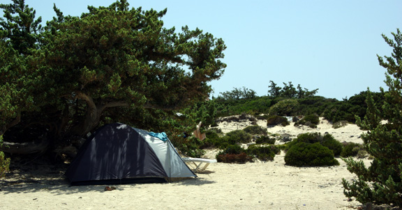
The island seems to have a few permanent residents
who are seen at the bar…
Property prices in Crete are more or less at UK levels and – unlike e.g. Spain
– development appears to have been reasonably well controlled. There are just
a few odd examples e.g. this huge self contained estate across the bay from
Sitia, with a guarded gate

which after years remains almost entirely empty, and this very old unfinished
hotel
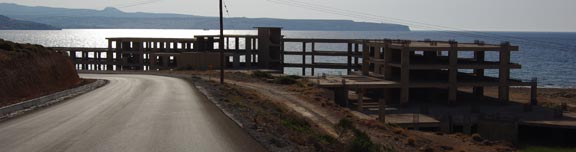
with, presumably, the workers’ tombs alongside….
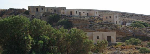
There are more unfinished developments on the southern coast though. I would
be astonished if the vast Sitia airport terminal was ever finished, too.
During our stay in Crete the daytime temperature was around +35C and getting
hotter… It was satisfying to notice the IR
image showing a totally unflyable band of frontal weather stretching from
Portugal to the Black Sea (MSLP)
but unfortunately this weather caused the massive flooding in France.
Justine’s Highlights
Top marks to local food, food and more food – tangy Cretan cheese, fish
caught the same day, aromatic little olives, succulent stuffed tomatoes, and
a real charcoal grill in every tiny taverna.
Toplou monastery is a short ride from town and definitely worth a visit if you
have transport. It has an astonishing collection of icons and early engravings,
and a well stocked shop where you can invest in a replica if you like that kind
of thing. The monastery wines are excellent too and you can buy them in any
supermarket.
East of Sitia see if you can spot the bizarre monstrosity that is Dionysis
Village – a tightly corralled high-density urban development transplanted onto
coastal countryside, now unsurprisingly unoccupied. How did they get permission
to build such an eyesore?
If you travel in June like us, you’ll see purple flowering thyme on every
hillside – the origin of famous Cretan thyme honey and no doubt also the fragrant
local lamb.
Visit the beach at Vai for golden sand with the added attraction of Europe’s
only native wild date palms. Park in the further car park (with the buses) to
avoid the EUR3.50 charge just down the road. Be prepared to pay top dollar for
everything else here though.
If you get to Ierápetra on the south coast do a day trip to Chrisi
Island (aka Galdouronisi) – the closest thing to an unspoiled desert island.
Sleeping here must be amazing – next time I am bringing a tent and spending
the night.
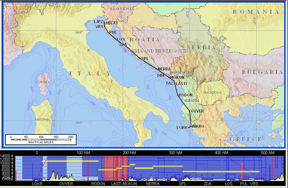
Flight Sitia-Mesolonghi-Corfu
Normally, it would be difficult to fly from Sitia to the UK in just two legs,
because one would expect a headwind on both of them. Picking very pleasant stops
with efficient airports, one would fly Sitia – Dubrovnik – Losinj – UK or something
like that. On this trip, however, we were meeting up with a group of Greek pilots
at an unmanned municipal airfield called Mesolonghi (under the MESSI intersection
on the map below). This in turn meant that a further stop would be required
to clear Customs (Greece has signed Schengen but disregards it if a vehicle
is involved) and the only option in the area with avgas is Kerkira (Corfu) LGKR.
There are other Customs-only options, e.g. Kefalonia but – having last fuelled
at Sitia – those would mean an early stop in Croatia, which would in turn mean
two more stops before the UK. And we had arranged to meet another friend
in Corfu…
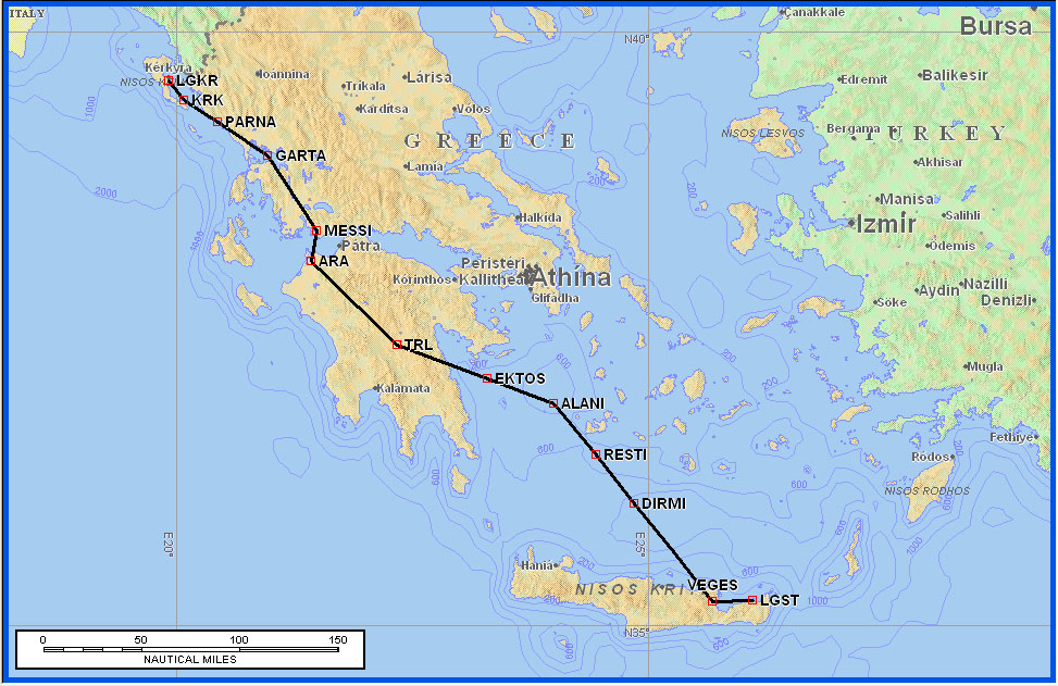
Route:
LGST
VEGES L613 ALANI A14 ARA VFR DCT MESSI (Y flight plan)
Mesolonghi
FL100 Distance 291nm (GC) 311nm (airways)
Mesolonghi
MESSI DCT GARTA/N0150F080 IFR (Z flight plan)
LGKR
FL100 Distance 104nm (GC) 106nm (airways)
This airfield has no ICAO code so the flight plan is filed as ZZZZ and a DEST/
or DEP/ MESSOLOGI is added to the Remarks section.
The weather for the flight from Sitia was clear
and with the IR and sferics
images also clear. The MSLP chart
showed a trough lying to the north of the destination. In reality, isolated
thunderstorms could be expected anywhere in the region, but clearly there was
no IMC around in which they could hide.
Kerkira LGKR can be problematic because of their 48-hour PPR by notam
which is strictly enforced to the point of refusing a landing unless an emergency
is declared. Occassionally they even notam a ban on LGKR being filed as an alternate.
All this is pointless because the place is not particularly busy and has a vast
amount of unused parking. Unfortunately the other western Greek airfields have
no avgas… The email address specified in the notam was invalid and bounced
back, but the fax number worked fine, during office hours. I had earlier tried
to get a permission for a range of dates but this was refused. I think that
if Kefalonia gets avgas but doesn’t implement this PPR policy, GA activity at
LGKR will dry up fast.
Given the initial waypoint of VEGES, the appropriate SID for Sitia is here
which goes out quite a bit over the sea to allow for obstacle clearance.
Sitia is a “paradise” among Greek airports, with a lack of formalities.
We already had fuel and the flight plan had been filed, so we went straight
through. A part of the vast apron was being used for training police motorcyclists
but they packed up just as we prepared to depart.
Curiously, the waypoint MESSI was not in the KLN94 GPS database, even though
it is in FliteStar, and both of these come from the same company: Jeppesen.
The initial departure clearance was to VEGES as expected but very soon we got
a series of vast shortcuts; initially from Iraklion and later from Athens Radar.
The longest one was DCT TRL of 172nm.
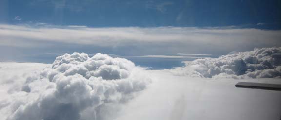
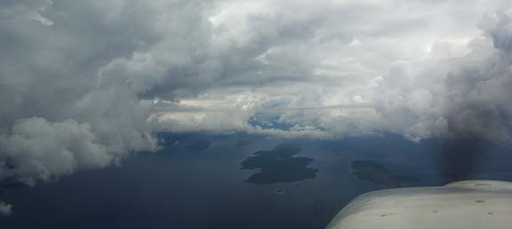
The weather started off just plain hazy but soon we saw some massive buildups
which looked about 50nm away but actually they were much further. We climbed
from the initial FL100 to FL160 to stay above the haze to maximise forward visibility.
Eventually we got close
and it became apparent that they were almost over our destination. This is
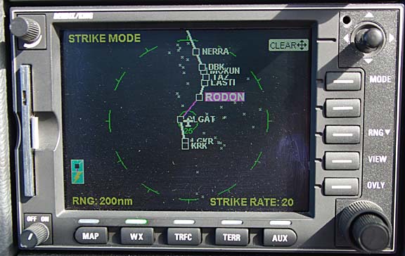
the stormscope display near the end of the flight
It was interesting to note that the stormscope was accurate in both azimuth
(which is normal) and the distance (which is unusual). However, it was obvious
that the buildups were all over the land and since Mesolonghi could be easily
approached from over the sea, this was not a problem.
Athens could not believe we were landing at Mesolonghi; they asked whether
we were a helicopter. I replied that there is an airfield there and has been
there for some years. Eventually they seemed to accept this and then they started
to press as to when I would be cancelling IFR. After a while they stated that
I cannot land at Mesolonghi unless I cancel IFR…. well, this was quite true
and in any case the flight plan was a Y plan i.e. IFR to VFR. So I cancelled
IFR while still descending through FL140. We spoke briefly to Araxos and Andravida
(both military airports) neither of which appeared to have radar available to
the civilian controllers, and were asking for position reports. The rest of
the flight was uneventful, except that it took a little while to find the airfield…
When flying the circuit, the Garmin-496-based GPWS system was emitting terrain
warnings – unsuprisingly given the lack of the airfield in the database, and
the surrounding terrain
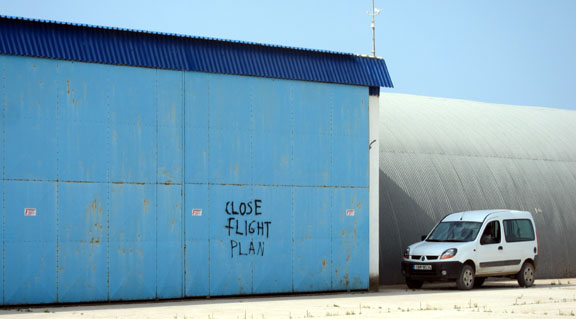
After landing, one needs to telephone the regional FIS unit to close the flight
plan
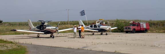
There was a Piper Lance parked
and two of my Greek pilot friends made it in a TB20 from Athens despite the
worsening weather
As a post-mortem on the CBs, this is the 1500Z
IR image which clearly shows the high cloud tops, and here
is a slightly later sferics image showing activity in the right place.
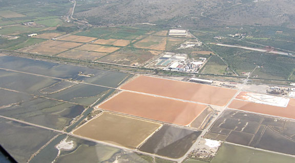
Mesolonghi produces most of the salt for Greece, in vast salt pans
Mesolonghi airfield is unmanned and is effectively open 24/7. In practice this
means daylight hours because there are no lights. The tafs
and metars looked OK, with a chance of stormy weather. The sferics
image showed a bit of this but past Corfu and the IR
image confirmed this. The MSLP
chart showed the end of a trough to the north.
The procedure at Mesolonghi is to call up Araxos when airborne to pick up the
IFR clearance but there was no response; same from Andravida. This was completely
unacceptable. Legally, one is outside controlled airspace and must remain thus
until a clearance to enter it is obtained. If one cannot be obtained, the only
safe way to fly to Corfu below controlled airspace would be to follow the coast
all the way. Greece does not publish VFR charts; some diagrams of the Athens
TMA can be found in its AIP (which is not online and must be purchased in paper
form from the HCAA) and Greek pilots fly with the most recent (1998) U.S. ONC
chart which does not show controlled airspace. According to FliteStar data,
the airfield in under the Andravida TMA whose base is 1000ft AGL and
there is always some “useful ambiguity” as to what “AGL”
means in practice when one is flying over varying-height terrain. I was ready
to try Athens, but eventually I got a response from Araxos which transferred
me to Aktio who finally dealt with it by issuing a DCT GARTA FL100. No squawk
was ever issued by anybody so the flight proceeded with 7000. I did say the
flight was filed India-Foxtrot-Romeo but they didn’t seem to understand. In
retrospect I am not sure that, in addition to the lack of response to the initial
radio calls, the flight plan was even visible to ATC.
I think there is a lesson here: given this is a VFR airfield, I should have
worked out a plan on what exactly to do if I cannot get any radio contact after
departure. In the UK, not being able to call up “somebody” is not
something one ever plans for. In this case, the only option would have been
to fly below 1000ft AGL all the way to Corfu, which given the poor visibility
due to haze means flying at 1000ft QNH along the coast. However, if this was
inland, with some terrain around, one’s only option would have been to turn
back and land. Another thing is that Z or Y flight plans need to be sent not
just to IFPS (the default) but to any airfields who will be called up on the
radio to facilitate the IFR clearance. IFR flight plans get delivered (by IFPS)
only to departure, destination, and the area control units.
We were transferred to Corfu (the airport and the city are called Kerkira)
early; with about 60nm to run, and they issued a descent to 2500ft. For an IFR
flight this would have been completely out of order, given terrain below and
ahead rising to 2x to 3x this altitude!! Such a clearance was obviously below
the controller’s MVA. It would have easily killed a pilot who was under the
impression of having an IFR clearance, a radar service, and – as is routine
in IFR – was not terrain-aware. Perhaps Kerkira had not connected up the flight
with the filed IFR flight plan, and thought we were VFR? I had made it clear
to earlier stations that this was a filed IFR flight, but I don’t think
the military controllers are connected into the IFR enroute system, or even
talk to each other much. I descended nice and slow, and later Kerkira amended
the clearance to be at 2500ft by KRK which was still some 35nm ahead, so this
was done as a continuous descent. Later were were asked to descend to 1000ft
as for a VFR flight, for a left hand circuit to runway 17

so presumably Kerkira ATC thought were were VFR all along, and maybe the IFR
flight plan got lost in the system…
Sitia to Mesologhi Picture Gallery
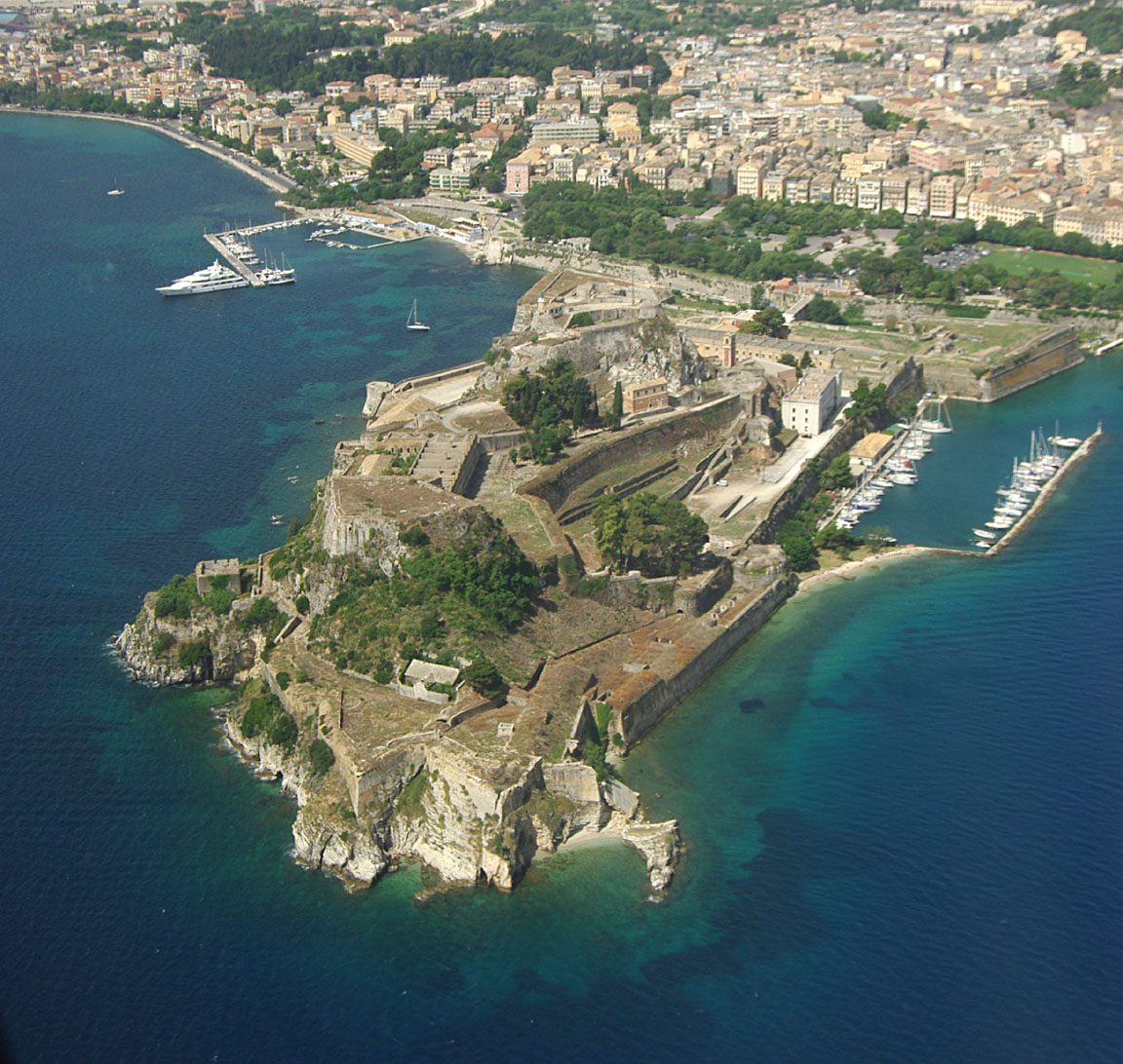
We were number two behind a 737 which was landing on a straight-in approach
and ATC said the runway would be clear in 3 minutes. As we were already downwind,
I offered to do a right orbit. A different controller replied with an affirmative.
Halfway through the orbit they cleared us to land so I turned back to do a left
base, getting a good pic of the castle
and here we go…
One gets a follow-me vehicle to the parking spot
The Olympic Handling van turned up within a minute; avgas was requested and
turned up a few minutes later. The Olympic Handling costs were 17 euros and
we paid those immediately inside the terminal. All in all, very efficient and
much quicker than on our past visits. However, as before, the CAA fees are paid
separately at an airside office to which one needs to be escorted and these
fees cannot be paid until the day of departure.
The landing FOB was 43.2USG and assuming a fill of 85USG at Sitia due to fuel
loss (max usable is 86.2) the 170 litre fill at Kerkira represents an error
within 1%. This was the first airport encountered in 2010 which accepted the
AIR BP card. I try to use the card when I can, in case I need it one day. I
got it around 2002; back then airport payment terms were sometimes weird (e.g.
cash or Mastercard but not Visa, and the cash machine was broken – Mikonos LGMK)
but nowadays they all seem to be better organised and accept Visa. The one known
exception in Europe is the French TOTAL fuel card which is the only means of
payment in the self service machines at some smaller French airfields; a French
bank account is needed to get that one but I have so far avoided this by landing
only at international airfields in France.
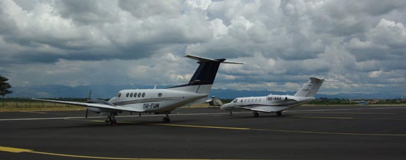
There was some upmarket hardware
but not enough to even start to fill up the vast apron.
Corfu was hot but not as hot as Crete or Mesolonghi. It is a very nice place
to stop, combining Greek culture with a more European weather.
We had flown to Corfu a number of times before, on my earlier trips where it
was always used as the Customs entry point for Greece. Given the lack of avgas
in western Greece, Corfu remains the only option unless one has enough range
to fly – from another Port of Entry which has avgas; e.g. Sitia – all the way
to e.g. Croatia.
Flight Corfu-Portoroz (diverted to Zadar)
From Corfu, one should make the longest reasonable distance back to the UK.
Unfortunately, the weather north of the Alps didn’t look good, but was improving,
so we decided to stop at Portoroz LJPZ in Slovenia.
There are obvious and easy alternates all the way along Croatia: Dubrovnik,
Brac, Split, Zadar, Losinj, Pula, and others. In Slovenia there is Ljubljana
– the only airport where the GA office gives you a customised flight/weather
briefing. Split is particularly handy if one is forced by weather to abandon
the aircraft; it can then be retrieved on the same day with an early morning
Easyjet flight from Gatwick.
Route:
LGKR
NIKRO M127 OVVER L611 RODON R45 DBK L607 ZDA N606 PUL P28 ABLAT
LJPZ
FL130 Distance 448nm (GC) 485nm (airways)
During our stay at Mesolonghi and Corfu it was obvious there were daily buildups
of CBs, and there was the usual PROB30 TEMPO in the TAFs. These usually became
a worse as the day progressed, so an early morning departure would be a good
idea. This IR satellite image sequence shows this clearly 1
2 3
4 5
6 7.
So we decided to depart 7am local time – 0400Z – and the flight plan was filed
accordingly. Kerkira is a 24hr airport so this was fine. Portoroz opens 0630Z.
As the flight would obviously take more than 2:30hrs this was OK.
We got up at 5am local time, and by the time daylight appeared around 6am the
sky was very dark indeed, and then it started to rain. Not just normal “UK
rain” but a massive downpour with near-constant lightning which went on
for about an hour. The 0600
and 1200 MSLP
charts showed nothing of relevance at the departure end, and a trough at the
other end. More relevant was the IR
image which showed reasonably widely scattered high cloud. A later IR
image looked a bit better in that it showed the thunderstorm to be mostly over
Albania, so if we could get a westerly departure from Kerkira, that should avoid
most of it; it also showed a clear flyable route up the Adriatic, well away
from land. The sferics images 1
2 agreed. The METARs
and TAFs contained the usual “everything including the kitchen sink”
stuff. The sferics images, the IR images, and the Croatia
and Italy radar images
agreed on the destination having bad weather but the TAFs forecast this to clear
well before we got there.
Clearly, this was a case of making sure the local weather is OK for a climb
to a high altitude, where one can have a good look around, and proceed while
avoiding the nasty stuff visually. The worst case scenario would be a return
to the departure airport, but the patchy IR image showed this to be extremely
unlikely.
Since it was obvious we would not be departing at 0400Z, I delayed the flight
plan by 1 hour, using the EuroFPL website function. We got soaked just getting
in and out of the taxi to the airport. I went to the CAA office where a further
12 euros were paid, making the total cost 29 euros – far less than I had paid
on previous visits to Kerkira. Of this, 12 euros is the cost of having a passenger;
this can be avoided if you designate the passenger as “crew” but Kerkira
(and I believe other large Greek airports) ask to see his/hers pilot license.
The Olympic agent also confirmed that parking is free… without a time limit!
The CAA official did not want to process the payment if there was any chance
of us not going that day; this was somewhat meaningless since doing the payment
means getting escorted halfway around the airport which is the last thing you
want to be doing once the weather is good enough to go. Assuming one refuelled
after landing (the standard and highly advisable procedure everywhere) I think
one should arrive 2 hours before EOBT.
While at the CAA office, I also delayed the flight plan by another hour, to
make better use of the improving weather, and queried whether they are able
to give me a departure to the west rather than the filed one to the east, to
avoid the worse weather over the mainland. For the answer, I was sent up to
the tower where the very helpful ATCO said it would be OK. They seem to have
tight coordination issues with Albania and Italy, but it is self evident that
there must be flexibility because heavy weather avoidance in this area is a
regular event by airliners.
In all of Europe, Greece has the greatest utility value for GA, with its widely
dispersed islands which cannot be accessed usefully in any other way; boat trips
can easily take all day. Unfortunately, it frustrates this with seemingly pointless
inflexibility and job creation schemes. However, there is hope on the horizon.
Greece has a very active AOPA (whose website contains accurate airport data for GA) and even during
the 6 years I have been visiting I have seen improvements. Santorini is soon
getting avgas (it already has Customs), and Thessaloniki should follow. The
airport charges seem to have dropped too; I used to pay around 100 euros at
Corfu.
The sky was clearing nicely to the west
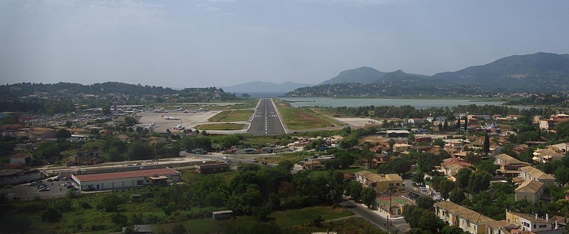
and we departed, on the OLGAT1D departure with
an initial clearance to FL080. The climb path worked out just right
but later some IMC in cumulus could not be avoided, with strong up- and down-draughts
and flying the aircraft manually to keep wings level while maintaining pitch.
VMC was reached around FL080 – more or less as expected given the patchy cloud
visible from the ground. In the warm temperatures there was no risk of icing.
The next few hundred miles were flown at FL140, in VMC, on headings “to
avoid weather”. The next station, Tirana, was completely on the ball in
perfect English and issued a clearance for any avoidance as required… every
airliner on the frequency was playing the same game. There were a fair few real
CBs around but they were visible from at least 100nm away
and produced good returns on the WX500 stormscope, on a generally accurate
azimuth if not range
The stormscope cannot accurately measure the range; it does it primarily using
the intensity of the return and this means that a particular CB will often generate
strikes which line up in azimuth but are well dispersed in range – as in the
above pic. A lot of spectacular weather was seen
and much of Croatia was clear, with apparent cloudbases over the land of about
5000ft
However, with about 100nm to run it was apparent that the weather near Protoroz
had not cleared and there was a solid wall of TCUs (and worse) stretching from
Italy to Slovenia, so the only way forward was to descend underneath it
The current unit – Zadar Radar – approved everything immediately, with a descent
to 3000ft. However this was not low enough and subsequent descent to 2000ft
required the cancellation of IFR. The earlier rain had cleared up the haze very
well
A few minutes later it became apparent that there was widespread heavy rain
down below, over a wide area, and with some 100nm to go I decided to not try
it, and requested a divertion to Zadar – the most northerly accessible airport
and one in obviously good weather, about 15nm away. The other option was somewhere
in Italy, but Croatia is far more attractive than Italy for flying, due to occassional
bizzare Italian ATC behaviour and avgas selling practices… In fact Croatia
is in a different league to most other places in Europe. The diversion was immediately
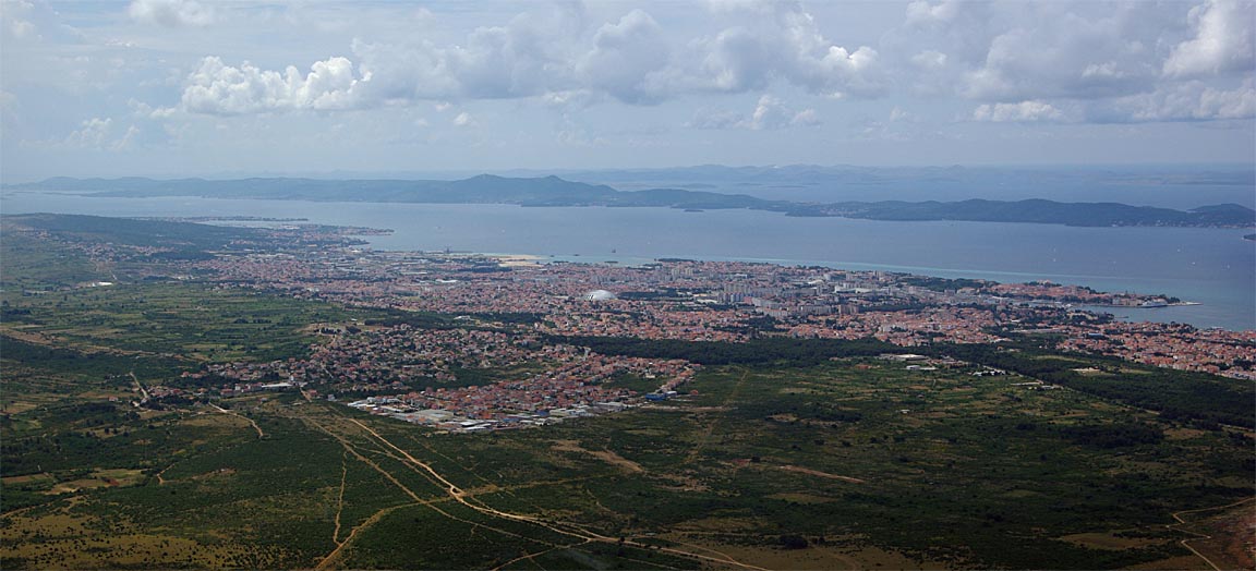
approved, with a vector to the airport. This is the city of Zadar
and a few minutes later we were on final
and another 10 minutes later refuelled and finished. One rarely sees anything
so efficient.
The landing FOB was 52.5USG and the fill was within 0.5% of the flowmeter-computed
figure.
There was the usual upmarket hardware
but otherwise the airport was very quiet. I get the impression that most GA
– in that I include jets – movements in Croatia are visiting pilots; not locals.
I hope the local scene grows because no country I have been to in southern Europe
is as supportive of GA, with usable airports and reasonable airport charges,
as well as the utility value of flying along such a long country, as Croatia.
We stayed at the very nice Hotel Bastion,
in the old city. It was not the cheapest but by this time we had enough of hotels
with duff air conditioning (2), all-night parties next door (1), rooms full
of mosquitoes (3) and other stuff which prevented getting a decent sleep. It
had a fast and free internet connection, using an ethernet cable.
I would highly recommended the old city for a visit

Zadar seems to reflect much of Croatia in the juxtaposition of the old communist
world, and new business and financial activity
Croatia is well organised, with excellent integrated transport. In many ways
it resembles Switzerland – at about 1/3 of the price!
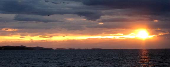
Zadar is renowned for spectacular sunsets over the islands… however, due
to the clouds, this was the best we could get
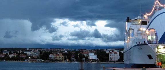
They get some “big weather” along the mountains
Justine’s Highlights
Stay in the traffic free old town if you can manage it – with its Roman
and medieval ruins, cafes and restaurants, museums and street entertainment,
far more interesting than the sprawling modern city outside. This is also the
ferry port and the centre for trips and excursions.
The archaeological museum (Kn 12) houses a wonderful display of finds dating
from prehistoric times with some very informative English explanations. The
incredible sophistication of early Adriatic culture and constant human migrations
will blow your mind.
Visit a Konzum supermarket for goodies to take home, unless you want specially
decorated bottles and so on in which case the tourist shops are better. We settled
for Bajadera nougat, dried sour cherries and Maraska liqueurs (made in Zadar
– you can see the factory just across the marina).
Sunset at the westernmost point of the old town is a must. The weather was
dramatically stormy the day we did it and the experience was spectacular even
so. Check out the unique ‘sea organ’ (musical pipes that descend into the water
and create mysterious melodies) and the ‘greeting to the sun’ solar powered
light show that comes alive as the sun disappears.
Get your bearings by taking an open-topped bus trip round the whole of Zadar
old and new. The young staff are charming, helpful, intelligent and seem genuinely
delighted to show off their fast-changing city.
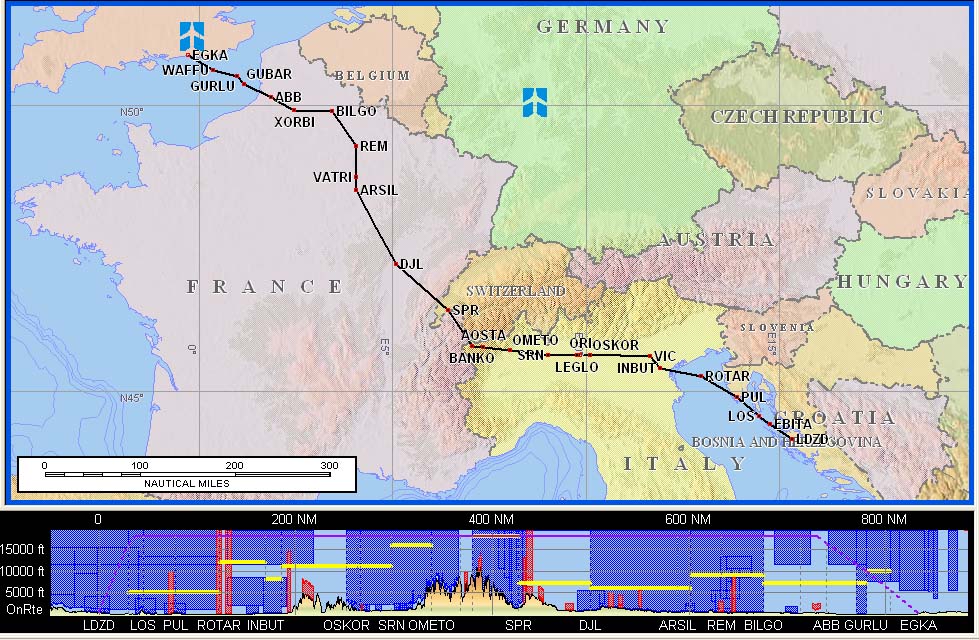
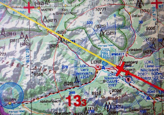
Flight Zadar-Shoreham
There are two routes which are within 10 miles of each other on the distance.
This one is more scenic, passing close to the French end of the Alps, and at
time of writing is the one which is automatically generated by Flight Plan Pro.
It has a section which must be flown at FL180 or higher
Route:
LDZD
EBITA N606 PUL P11 ROTAR L615 INBUT N503 VIC L615 OMETO/N0150F180 L615
AOSTA Z637 BANKO A1 DJL A6 ARSIL G40 VATRI B3 BILGO H20 XORBI H40 ABB T27 GURLU
Y8 WAFFU
EGKA
FL160 Distance 750nm (GC) 833nm (airways)
This one, obtained by specifying GIMIX as a fly-through waypoint in Flight
Plan Pro, would avoid the stronger forecast winds over the Alps, and the trough,
in the MSPL 0600 1200
charts.
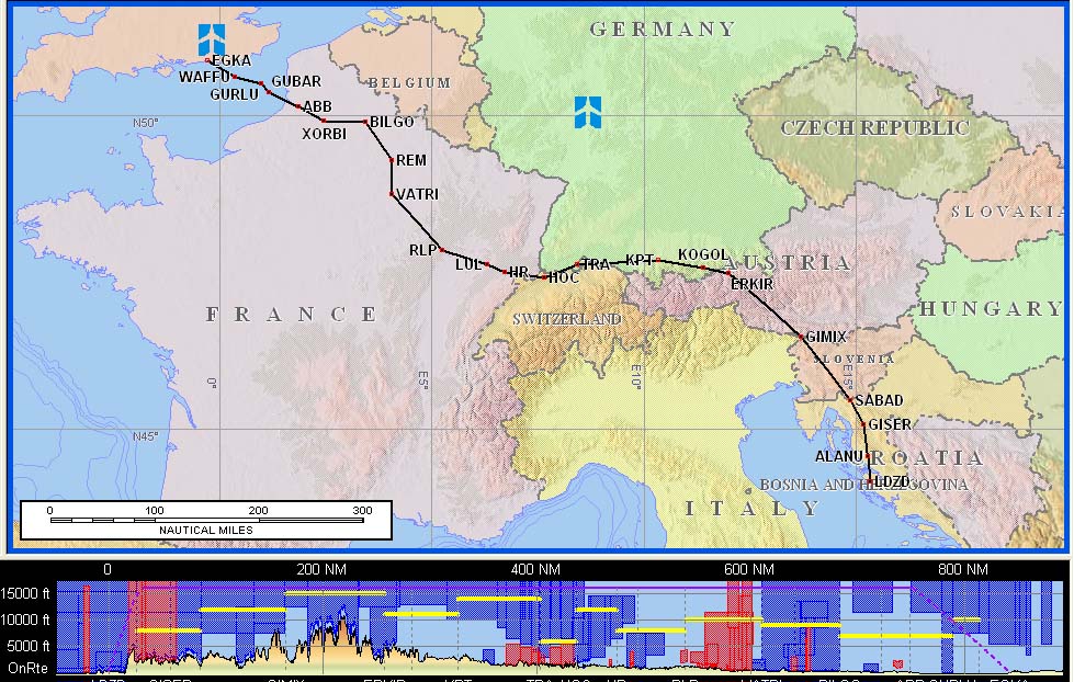
Route:
LDZD
ALANU L71 GISER L862 GIMIX L608 KPT L856 HOC G4 RLP B3 BILGO H20 XORBI H40 ABB
T27 GURLU Y8 WAFFU
EGKA
FL160 Distance 750nm (GC) 842nm (airways)
We filed the latter one. I had the former one preplanned and printed back home
(with a departure from Losinj LDLO, but Zadar is more or less on the same route)
so used the Canon printer to generate a new set of papers for the flight.
There was an unusual last-minute problem: the above route validated OK by Eurocontrol
(I normally use the EuroFPL
validation site because the Eurocontrol one is super-bloated) but the filing
of the flight plan produced a MAN (manual amendment) message. This normally
means the route will be manually amended (by a desk operator at Brussels) which
means two things: you have to wait for them to do it, and your existing documentation
(enroute printouts, plog, etc) for the route needs to be re-done. This is incidentally
why I never use the “reroute accepted” flight plan filing option.
I waited about 10 minutes and, not having got a reply, I cancelled the flight
plan and was about to re-file it when I got back the ACK message, with the original
route, except for a trivial change: they inserted the name of some SID at the
beginning, so the route became
ALANU1D ALANU L71 GISER L862 GIMIX L608 KPT L856 HOC G4 RLP B3 BILGO
H20 XORBI H40 ABB T27 GURLU Y8 WAFFU
So I filed that and it was accepted. There are some countries which require
SID/STAR names on a flight plan handed to a person at a tower, but I have not
previously seen Eurocontrol reject a flight plan without them. And I have never
seen a flight plan rejected which validates at the same time.
The forecast winds looked
fine. TAFs and METARs looked fine too, with rain forecast at Zadar later on,
so an early departure would be better. The IR
image was OK and improving. The sferics
image was clean. The Meteox
radar image (good only N of the Alps) looked clean. For what they are worth,
the 0600 and 1200
SigWx charts looked OK.
We paid for the landing and parking on the way out. The office is airside.
Security was tight, with everything checked, but this seems pointless because
at the end of the day they will still presumably let you out to your own aircraft!
I once had my toothpaste confiscated when outbound at Norwich airport in the
UK but I cannot see these people doing something so stupid. The whole process
took about 30 minutes which was pretty good. Having a fully airside office is
probably a good idea because it enables a “technical stop” (refuel
only) to be processed without having to be escorted halfway around the airport.
The issued departure was ALANU1F
(runway 32) but this was amended just before takeoff to a right turn to GISER.
There was obviously not much traffic; ATC suggested we line up on the runway
to do the engine checks. I hope Croatia never makes the UK mistake of privatising
everything; that will result in the instant closure of most of its airports,
and the exclusion of light aircraft from whatever would be left.
There was plenty of “weather” around after departure
but it was mostly avoided by flying a track about 20nm to the west of the DCT
GISER one, all the way to FL160. ATC were completely relaxed.
Climbing out of Zadar we encountered a lot of turbulence, all the way to about
FL100. This is mentioned on the departure plates, but I had not spotted it and
anyway the winds were no more than 10-20kt. Excursions in roll were up to 30
degrees. The KFC225 autopilot, for its reliability issues,
coped with this very well. Justine did not like it very much though.
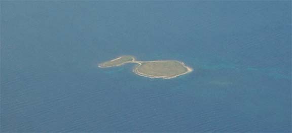
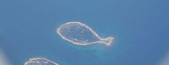
Croatia has many tiny islands and 2 or 3 of them are fish-shaped
Exercising very careful engine temperature management, the TB20 takes about
30 minutes to reach FL160, by which time we were in Slovenia. One can do it
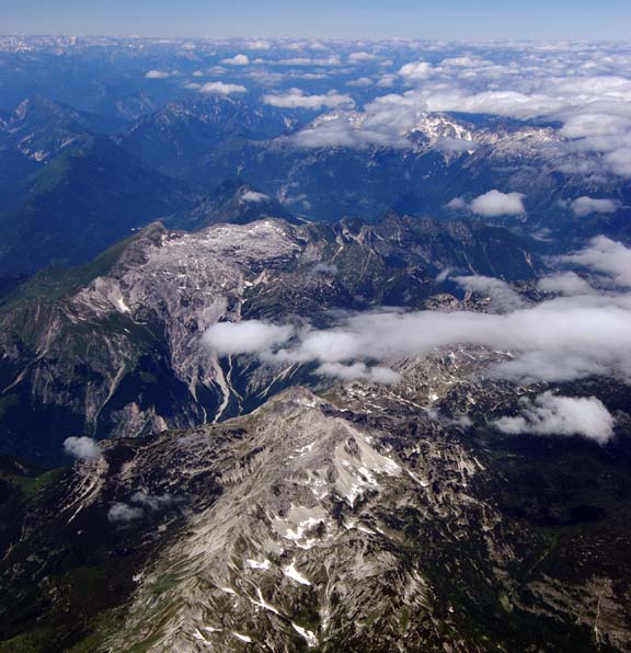
quicker but there is no point. Here are the Alps
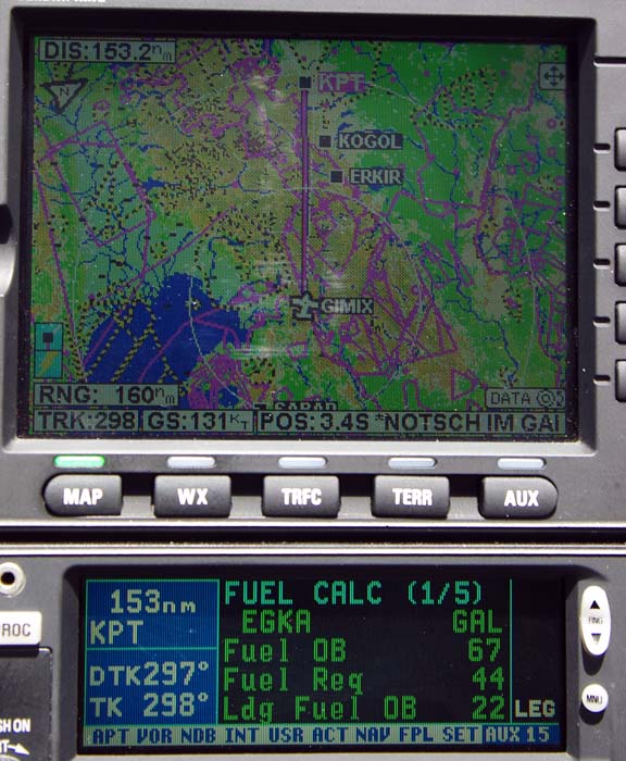
We got a series of long DCTs. Very early on, the LFOB stabilised around 22USG
which I regard as very reasonable in an area where there are plenty of diversions
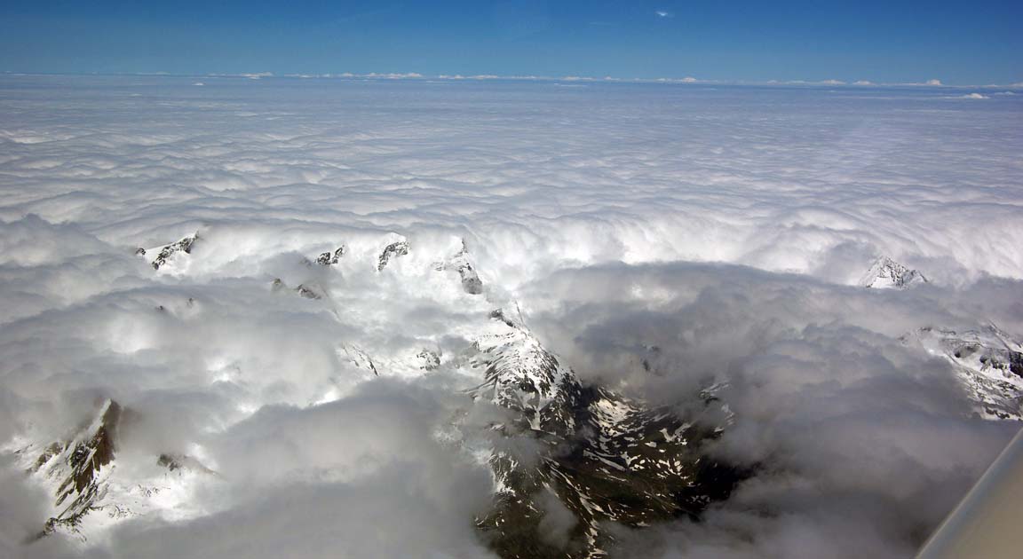
As has been the case on most of my flights in this area, the Alps were mostly
under cloud
This type of flying appears hazardous but in fact the Alps have flat-bottomed
canyons all over the place. How would one find one in the event of an engine
failure, above an overcast? A combination of plenty of altitude, and a GPS running
a map which shows the terrain:
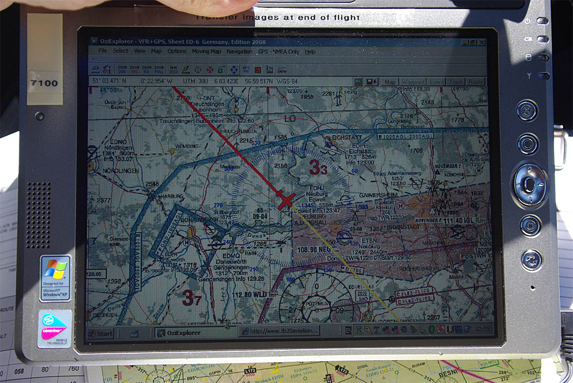
The above is a screen photo of my LS800 tablet computer running Oziexplorer
which is a generic GPS moving map application, available for standard windoze,
and for pocket/pc, and in this case runs various VFR and topo charts, which
for this kind of usage obviously do not need to be current. I consider an overflight
of the Pyrenees to be much more hazardous than an overflight of the Alps, due
to the shortage of canyons in the former.
The cloud tops were around FL100-120 so a certain amount of “rock”
did stick out
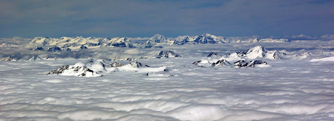
Here is the big stuff, photographed from at least 100nm away, with a long lens.
Enhancing the image in Photoshop was difficult due to the haze, so the colours
are slightly off…

The Matterhorn is visible in the above video, in the centre of the image, around
0:53.
There was no sign of the trough forecast in the MSLP charts, or any other variation
whatever in the weather over that area… a ex Met Office forecaster told me
once that if you put ten forecasters in a room, with the same data, they will
draw the troughs in different places – or nowhere at all.
After Switzerland we had the long expanse of northern France where one really
wishes one could fly at 500kt
With oxygen systems, it is mandatory (to the extent that anything can really
be “mandatory” on portable equipment) to carry a mask, in case somebody
gets a blocked nose. On this flight, for the first time ever, we had to get
the mask out for Justine, and for simplicity used it with a constant oxygen
flow. On the whole trip we had used up just 3/4 of one of my two large oxygen
cylinders so there was plenty of gas left. After Switzerland, I descended to
FL140 and then to FL120, to reduce the oxygen requirement and to get a better
speed – 150kt TAS at LOP at FL120.
To ensure a handover to London Control rather than London Information
(the latter results in a loss of one’s IFR clearance) I did not descent below
FL120 in France. FL120+ ensures being handled by Paris Control which
appears to have a letter of agreement with London Control. Due to some
parachute activity, Paris Control temporarily handed us over to Lille Radar.
Approaching the French coast we were transferred to London Control who gave
us a DCT Shoreham – right across the Channel
with a later descent to FL080, and then a descent out of controlled airspace.
The UK was having some very good weather
We landed with 22.3USG – amazingly close to the 22-23USG computed at the top
of climb from Zadar, despite the enroute winds varying from a 10-15kt headwind
most of the time to a 5kt tailwind in places.
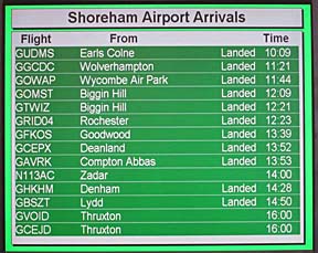
I think the Shoreham arrivals board – look at the aircraft registration countries
and their points of departure – was a pretty accurate and rather tragic picture
of the result of decades of European aviation regulation…….
As expected, the following day’s weather picture looked perfect,
but the original decision to go was still correct.
Zadar-Shoreham Flight Picture Gallery
General Notes
For pilots interested in getting an IR, it is worth comparing this trip with
the 2004 one which was done
under VFR. With IFR, one immediately notices the huge reduction in the route
planning workload. Obviously, as many traditionalists will say, “one can
go anywhere VFR, using a map and a stopwatch”, and I think I more or less
did (in Europe) back in 2004/05 albeit 100% on GPS, but the smoothness of IFR
procedures is in a different league. Even just the elimination of all controlled
airspace issues, and the whole-route IFR clearance which goes together with
that, takes a good 20 points off one’s blood pressure :) The ground hassles
which prevail in many airports do not change (and will probably get worse in
northern Europe where airports tend to be highly protected bastions of 1970s
British Leyland “management” practices) but once you get airborne,
“all” you are up against is the weather and, almost without exception,
ATC works with you to move things along. You need a suitable aircraft
and the appropriate technical knowledge. The actual flights are usually totally
uneventful and in good weather above the clouds; on this entire trip the total
instrument time logged was about 30 minutes.
When I think back to those long VFR trips I did in 2004/2005, it is apparent
that were were more lucky on the weather back then than has been the case on
the IFR trips in later years…
Only three other aircraft were seen on this entire trip at
anywhere near the same level – all 737-sized airliners, 10-20 miles away, and
two of those were seen near Paris on the return flight. So much for “crowded
European skies”. The reality is that, in the FL100-FL200 airspace used
by most GA, there is almost nothing there, and the Eurocontrol routings keep
GA traffic away from the busy terminal areas (see the long detour around Paris
on the last flight, for example).
Cloud Tops: this trip has really proven the use of IR
satellite imagery,
and to a lesser extent to use of sferics images, as a preflight
go/no-go decider.
One could achieve safe IFR flight using these alone, with TAFs and
METARs for
the terminal areas to check against approach minima in the usual way.
MSLP charts
still play a part in more general forward planning because they can be
obtained
5 days ahead and show obvious suspect weather. SigWx charts have
recently been dumbed-down by ICAO and no longer show fronts, or any
weather in areas where CBs are forecast, and are now almost useless
for this kind of non-deiced non-radar-equipped flying. On this trip
we had a lot of “big weather” which I would have never departed on the
basis of any forecasts; only the assurance of flyable high altitude actual conditions provided by the IR images made the flights possible.
Mobile Internet: Greece and Slovenia are in the EU but Croatia is not
(with the near-meltdown of the EU, they are probably not in a hurry right now).
With non-EU countries, there is the little gotcha of massive GSM roaming data
charges on internet access. The recent (2009) EU directive on limiting monthly
roaming data billing on GSM contract phones to 50 euros/month (unless a higher
figure is agreed with the customer) has been implemented disingenuously by most
mobile networks which have moved from a per-MB rate to a mandatory purchase
of a “data bundle”, and this is on a “per SIM card” basis
so if e.g. you pick up email with a GSM-connected laptop and a phone, you have
to buy two bundles (or use the phone as a bluetooth-connected modem for the
laptop…). At face value, these bundles can appear good value. For example,
T-Mobile sell 50MB/30-day ones for £10, which among the UK networks is
probably the best deal for holiday use, which is why I am with them myself;
the other reason is that they do not yet appear to have farmed out their customer
service to script monkeys on the other side of the world. (Beware: the 30 day
period shrinks to a near-useless 24 hours if the SIM card was purchased with
one of their “laptop” USB GPRS/3G products, and a number of other
networks play a similar trick). £10/50MB, at face value, is £0.20/MB
which, at face value, is great. But with a legal sleigh of hand the networks
wash their hands of this if the network you are connecting to is non-EU,
so in Croatia the cost jumps from £0.20/MB to £7.50/MB. Croatia
had excellent GSM connectivity, with fast 3G everywhere, but using this for
any significant data volume is expensive. In practice, everywhere, one can try
to mitigate the situation by using an email- and wifi-capable mobile phone,
and checking one’s email etc when an unsecured wifi access point is discovered.
We found enough usable wifi networks in Greece (mostly accidentally unsecured
private ones) but did not find a single one in Croatia.
PPR: This remains one of the biggest issues on long trips around Europe,
and is not getting any better. “PPR/PNR for Customs” is more common
still. A local-language speaker can bluff his way into most places, but a foreigner
is likely to be denied a landing clearance in some places, perhaps especially
if flying a US registered aircraft. On this trip, I found that concurrently
emailing and faxing an airport, with the body of the message containing
one’s email and fax number, worked quite well. I do this by emailing, and BCCing
the email to my email2fax account. More often than not, the email bounces back
(invalid) but the fax is delivered, and if I don’t get a reply within a day
I just re-send the fax. In an urgent situation one would try phoning the airport
and while this is fine in N Europe and some other places, I know of cases (Greece)
where a telephoned permission turned out to be worthless. Airport management
is only beginning to discover email so a receiving fax number is essential –
I use Inweb for a fax-to-email
service with a normal geographic (not 0870 etc) UK fax number. A reasonably
good source of airport fax numbers is the ACUKWIK
airport directory; another one is Navbox.
One would expect the AFPEx
tool (available only to pilots with a UK address) to work well, using its AFTN
free text message function, but I have found that most messages do not elicit
a reply. Interestingly, Sitia in Crete did reply to my AFTN message, but they
replied by email… you just never know your luck!
IFR route development: FlightPlanPro worked out every route perfectly.
It is great to see that one can finally fly IFR without having to read standard
route documents and all the associated stuff which, even if one understood it
perfectly, still doesn’t guarantee that a route will be accepted by the computer
in Brussels.
Flight Times (airborne):
EGKA-LDLO 6:00
LDLO-LGST 5:40
LGST-MESSI 2:50
MESSI-LGKR 0:45
LGKR-LDZD 2:45
LDZD-EGKA 5:55
Here is the track actually flown on
the entire trip, as recorded by Oziexplorer.
The aircraft performed perfectly. Some notes on Socata TB20 ownership and operation
are here. As on
every IFR flight I have done, the late-1990s avionics were 100% capable of everything
required. Total oil used was 2 litres.
I would like to give my thanks to my Greek friends, particularly Kyprianos
Biris and Giannis Georgantakis, for their invaluable assistance on this trip.
Photos: The pictures in this writeup were taken with
a Pentax K200D and a Canon S90.
The images within the text were cropped and adjusted in Photoshop, but
the images
in the galleries are mostly original. To get acceptable pictures from
an aircraft, the windows need to be clean and scratch-free and care
needs to be taken to minimise reflections from bright objects inside the
cockpit; these may need to be temporarily moved or re-orientated. For
example I usually have to turn my kneeboard upside down. The camera lens
should be held very close to the window – but do not actually touch the
window with any part of the camera otherwise vibration is transmitted
to the camera. Touching the window with one finger of the hand which is
holding the camera is an effective technique which also stabilises the
camera. Forward-looking pictures without a propeller blade showing are
almost impossible with a 3-blade propeller unless one either takes
dozens of them and gets lucky, or uses a slow shutter speed of 1/125 or
slower but that impacts sharpness.
Pilot: FAA CPL/IR, approx 1200 hours.
This page last edited 31st July 2010
Any feedback, reports of dead links, corrections or suggestions much appreciated: