
As part of my review of tablet software for in-flight use, I am going to compare map representations of various places; it’s one of the biggest differences between the different products.
As such, I am looking for suggestions as to the following. Some are quite obvious and I already have ideas, but am interested to hear from the wisdom of our users.
1) An area of the UK which has airspace which is particularly complex.
2) An area of the UK which has airspace/aviation features which are sometimes misrepresented, in your experience.
3) An area of France which has airspace which is particularly complex.
4) An area of Europe which is often poorly mapped.
For 2 and 4 I will need either a link to or a description of what it should be showing, so I know what I’m looking for.
Thanks.
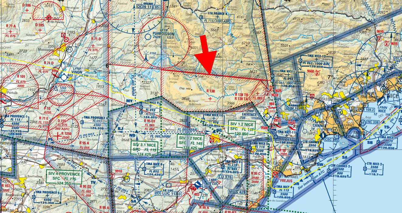
3) The area around Nice / Cannes.
An area of Europe which is often poorly mapped.
Portugal.
I cannot find updated paper charts anywhere… Anyway SD does a good job. Notice how the class C starts 1000AGL and how SD shows it in the virtual radar.
In practice nobody flies from A to B at 1000agl, everyone files a flight plan and flies higher.

practice nobody flies from A to B at 1000agl, everyone files a flight plan and flies higher.
Interesting. IME, people generally do all sorts of stuff in order to avoid having to file VFR flightplans…
Exactly what I was going to comment. Or even if they do have to, and know so, some just don’t. And they seem to get away with it, too. Perhaps some of us are all too obedient.
I don’t have a lot of experience flying around here (Portugal), only done 4 flights… Will write a report once I get some some free time. GA traffic is very sparse and everybody I heard on the radio was flying in the class C at a safe alt. In my view it would be madness to stay at 1000agl over this terrain (see SD screenshot above). You would have to keep on watching your GPS alt and constantly go up and down. There are cables and wind farms everywhere too. But perhaps “flying at 1000agl” should be another thread…
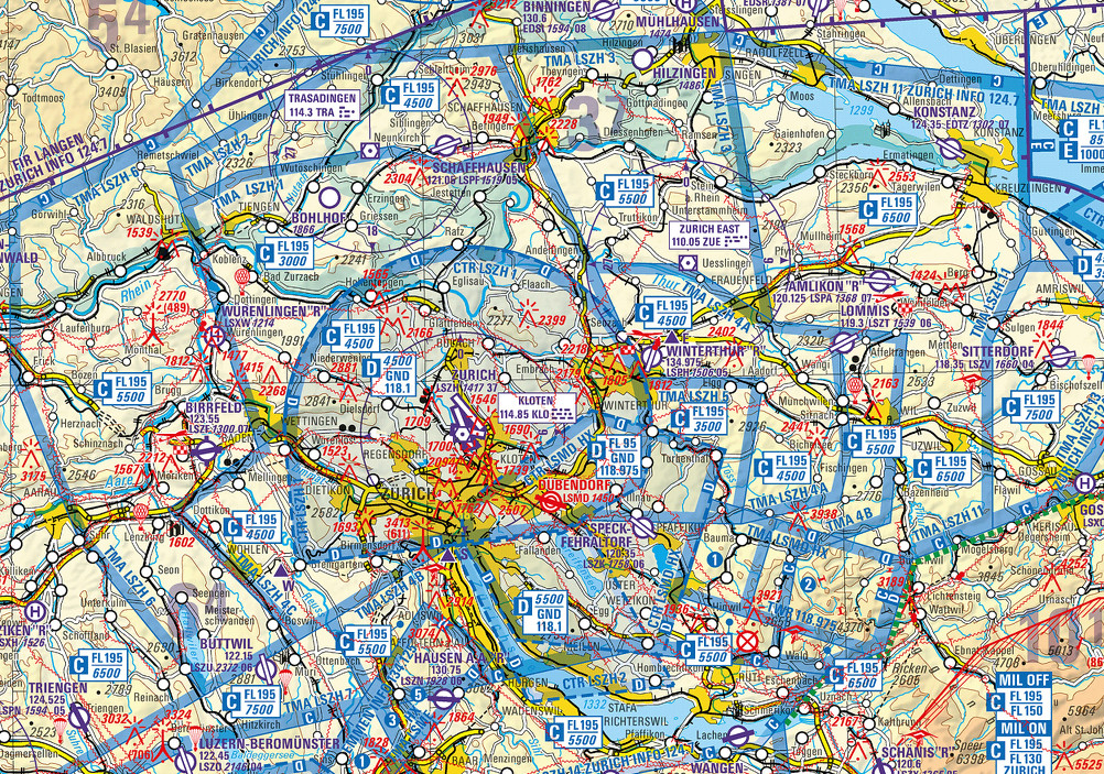
There are many areas in France and Switzerland where it is really hard to work out which bits of CAS overlay which other bits – example. Luckily the ATC (in France at least) tend to clear you through most of it. Swiss example here – maybe the locals can work it out.
In the UK the charts are unambiguous except the famous Belfast area.
Italy has no VFR charts; just unusable info in their AIP. I don’t know what Italian pilots use… the 2013 Jepps?
Interesting. IME, people generally do all sorts of stuff in order to avoid having to file VFR flightplans…
It’s about freedom. Flight plans are for Boeings and maglev trains 
I’d have proposed the area around Milan with class A going down to 1000 feet but if you wanted an area in France, I’d suggest the area to the east of Nancy with the masses of restricted / prohibited airspaces around (eg) LFQC, below is a screen shot from Flight Planner showing routing from EDDR (Saarbruecken) to LFQC (Luneville Croismare)

I have quite a few hours flying in Portugal and I and everyone else I met there just filed the flight plans, no big deal. It only is a big deal if you aren’t used to it.
A picture of the Belfast example in the UK which Peter referred to which I brought up before :

It can be done, but not easily and almost certainly not in the air.


