I have a panel mounted Flymap, works really well, but Jeppesen have stopped the maps. I liked the Jep maps because they were the same format throughout Europe.
Flymap are offering European coverage but with Intellimaps. Has anyone used these? And if so how did you find them?
Thanks.
Looking at their Apple shop page I am not even sure Intellimaps are “aviation” maps.
I have never heard of anybody doing VFR maps for Europe in general. It would be a major effort to do electronic-only VFR mapdata, given how fragmented the VFR market is.
DFS does maps for Germany and a few other places, France has several formats (IGN, SIA, Cartabossy), and there are others for most of Europe. Some of these exist in electronic form and I guess Flymap (which seems to be the only company that ever managed to license the Jepp VFR charts) will be working flat out to secure alternatives.
Pragmatically, I don’t see the 2013 Jepps going seriously out of date for quite a long time – especially if you take a bit of care to obtain recent mapdata (of any sort) for your route.
My Jepp maps are 2011 and I only fly VFR. Planning a short trip in Europe is ok – my problem is longer trips which could involve transiting unplanned countries.
In a good year I fly to 10 or more countries and Jepp maps have been great.
Although a bit of an overkill I share a JeppFD subscription for airfield plates.
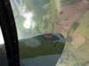
I have found these Intellimap pictures and it looks as if they don’t have any type or levels for airspace.
http://www.flymap.net/content/images/2011/Produkte/intelli4_gr_2012.jpg
http://www.flymap.net/content/images/2011/Produkte/intelli2_gr_2012.jpg
I wonder if those screenshots were taken from an app which has a layered database but the airspace labels were switched off? An aviation chart which shows unlabelled airspace is completely useless.
Anyway it is of a somewhat bizzare interest that there is somebody new out there who has composed aviation charts! I don’t know how much is nowadays available from Eurocontrol but in due course all this data should be available, under their B2B package. Not free but not anywhere near “Jeppesen license pricing”. OTOH you probably won’t ever get pretty VFR charts from Eurocontrol, showing forests, villages, etc.
I saw this today – only relevant to the UK:
VFR charts are produced and published by the air traffic control provider, NATS. The main changes… controlling authority’s CAS. Further information regarding the changes can be found in a NATS newsletter hosted on the NATS AIS website VFR Chart Changes
Hi Norman,
I personally would not fly with 2011 charts. I have no idea about the UK, but in Germany stuff like C airspace changes almost every year (I know that it did around Munich a couple of times)… and it’s not really a good idea to enter it without clearance.
I update the MFD in the plane every 28 days, buy new VFR charts every year and download the latest updates to SkyDemon on my ipad. And I update my 2 GPSs in the plane, of course. I could live ok without the latest database in the VFR if i flew VFR only – but I would ot fly without one set of the latest charts
I don’t know how much is nowadays available from Eurocontrol
The purpose of the Eurocontrol data I’ve seen is computer algorithms for IFR routing/flow management. It contains what is relevant for that use case. Eurocontrol seems to not care at all about VFR. For example, a lot of CTRs are missing from their airspace data. These are pretty irrelevant for IFR routing, but very relevant for VFR flying.
I personally would not fly with 2011 charts
I have two EFIS and a GNS430W which are updated every 28days. I used to run Jepp data on the EFIS’s, but tried PocketFMS and it’s much better. For a while, kept Jepp on the second EFIS but now run PocketFMS on both, it has proved so far to be good, the only problem is the EFIS’s interpretation could be better, which they say is coming. Jepp swapped my remaining subscription to the new VFR one. I also have SD, JeppFD and 2013 Jepp paper charts of most of Europe.
What I am trying to do is keep the panel mounted Flymap updated with usable European charts, otherwise I will replace it, but with what, GTN750, iPad mini?
Norman, since your aircraft is uncertified I think I would replace the Flymap with some generic device like ipad, nexus 7 etc. That way you are better placed to take advantage of any future developments relatively cheaply. EG: if traffic and weather become more easily available using one of the generic devices.