Peter is beaten !!
Just a video of a 7hrs flight our beloved admin excels at. Just a bit longer in terms of distance.
1186nm = 2196kms which is Shoreham (the center of the GA touring world  ) to the middle of Greece !!
And a direct clearance from the start amazing to imagine too.
I wonder which part of designing each IFR clearance is manual and which part is done by an algorithm.
Very impressive, he seems a lonely man tough (you lose all friends after 2h in the air)
Lot of IFR/FPLs with Eurocontrol routes will get algorithmic rejects if the legs are too much direct distance inside a FIR, or if the route crosses FIR boundaries on fishy points
I bet you will not get a similar clearance from Shoreham to Corfu, and with the UK peculiarity I am assuming lot of struggle to get a direct join from Shoreham to airways (Peter?) but this may work again in the middle of Australia, USA or Canada around NWT where one or two controllers run the show for 1000nm ;)
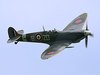
Nice video and his Bonanza seems perfectly equipped looking at the panel.
I wonder if going direct over for such a long time is disadvantageous to optimizing the routing for wind. Probably more applicable to higher levels and jetstreams but still. Is there any GA/consumer grade route planning program that compares routings with winds?
Let me rephrase:
Can any „consumer level“ flight planning program suggest a routing based on wind?
1000nm great circle = 10 kts tailwind
1200nm route = 50 kts tailwind
At work all planning is minimum time track and a 1000nm direct (frequently offered by Gander after coasting in) can „cost“ 15 minutes or more if it takes you straight into a hw jetstream.
@Snoopy: the modern routing engines take GFS wind forecast into their calculations. If you desire one stop including live validation by Eurocontrol, go Garmin Pilot or Foreflight or the free Autorouter.aero (enable GFS wind in autorouter under Advanced parameters, it is OFF by default).
Thank you.
I have Foreflight, does it really suggest routes (or only flightlevels) based on wind?
FF gives you the best altitudes in the altitude selection menu.
I think with their most expensive FF package, you get a route search engine that combines Eurocontrol validation, aircraft performance and wind forecasts. That’s what is advertised.
Peter is beaten !!
Easy to do… a Bonanza can carry a lot of fuel. @ChrisParker rarely posts these days but he has done some long legs.
you lose all friends after 2h in the air
Noooo; the ones you lose would not have been real friends anyway 
Can any „consumer level“ flight planning program suggest a routing based on wind?
Probably several; the Autorouter can do it although for the vast majority of cases the route appears to be exactly identical. I recall seeing only one case where it routed around an area of very strong headwind.
No chance of getting this kind of DCT in Europe (didn’t watch the video; I am on holiday right now). What you could do is a VFR flight which is as direct as you can hack up a route OCAS; then nobody can stop you flying it. The main drawback is the wx (you are likely to be doing illegal VFR, so need a de-iced plane) and most OCAS routes will be low down so not good for MPG. It may be possible to do something close to 8000ft though.
In practice, to do a stunt like this you would sit tight and wait for a good tailwind. I’ve had a long term plan to do UK to Greece, which would be done as Lydd to Corfu It is 1150nm on a typical Eurocontrol route, which a TB20 could do with 1hr left in the tanks in zero wind, at something approaching 8hrs airborne. One would not do it in zero wind though because 1hr is too tight considering the destination area.
Thank you.
I have Foreflight, does it really suggest routes (or only flightlevels) based on wind?
Not the very Basic version, but from Pro Plus on, yes. You can see it in the Altitude section of the FPL (‘based on winds aloft and aircraft performance’) if you entered an aircraft performance profile.