Long time readers of this forum, might well have noted my fondness for the island off the west coast of Scotland. I’ve been a regularly visitor since I started flying. Colonsay EGEY being my favourite of the islands. It’s small enough to be accessible by foot, but large enough to have somewhere to explore, one of the closer ones to me, and it has a great runway. With a population of just 135, (growing slowly) it has a really remote feel to it.
I last flew to Scotland in the summer of 2017. I brought a friend on mind and his son, and we explored the area of island that was south of the airport and wild camped overnight. Ever since, I’ve longed to go back and explore some of the island north of the airport. However life got in the way. My wife had an illness that kept me away from flying for about 2 years, and just as I got back, COVID put restrictions on movements, and our aircraft was down for extended periods getting new avionics (which took much longer than planned). But with all COVID travel restrictions in Ireland now gone, and our aircraft finally back and ready to fly, it was time to start making plans.
March 17, our national holiday is a public holiday. It fell on a Thursday this year. But this year our government has decided to make Friday 18 a national holiday too, in recognition of the dedication of our front line workers during the COVID pandemic. So a four day weekend. That would leave a good opportunity for a 2 day trip with some ability to move dates to find some nice weather. Flexibility being key to a VFR trip!
Originally I’d planned Thursday – Friday, but as it got closer, the weather on Thursday didn’t look great. So I changed to Friday to Saturday. (Thursday actually turned out ok, but I’d already changed my aircraft booking). The only downside to the weather was wind. It was forecast for 20-25kts fully crosswind, with gusts to 35kts. Sporting. It’s always windy up that direction! With just a 500 mtr runway you’ll have to make sure that cross wind technique is right.
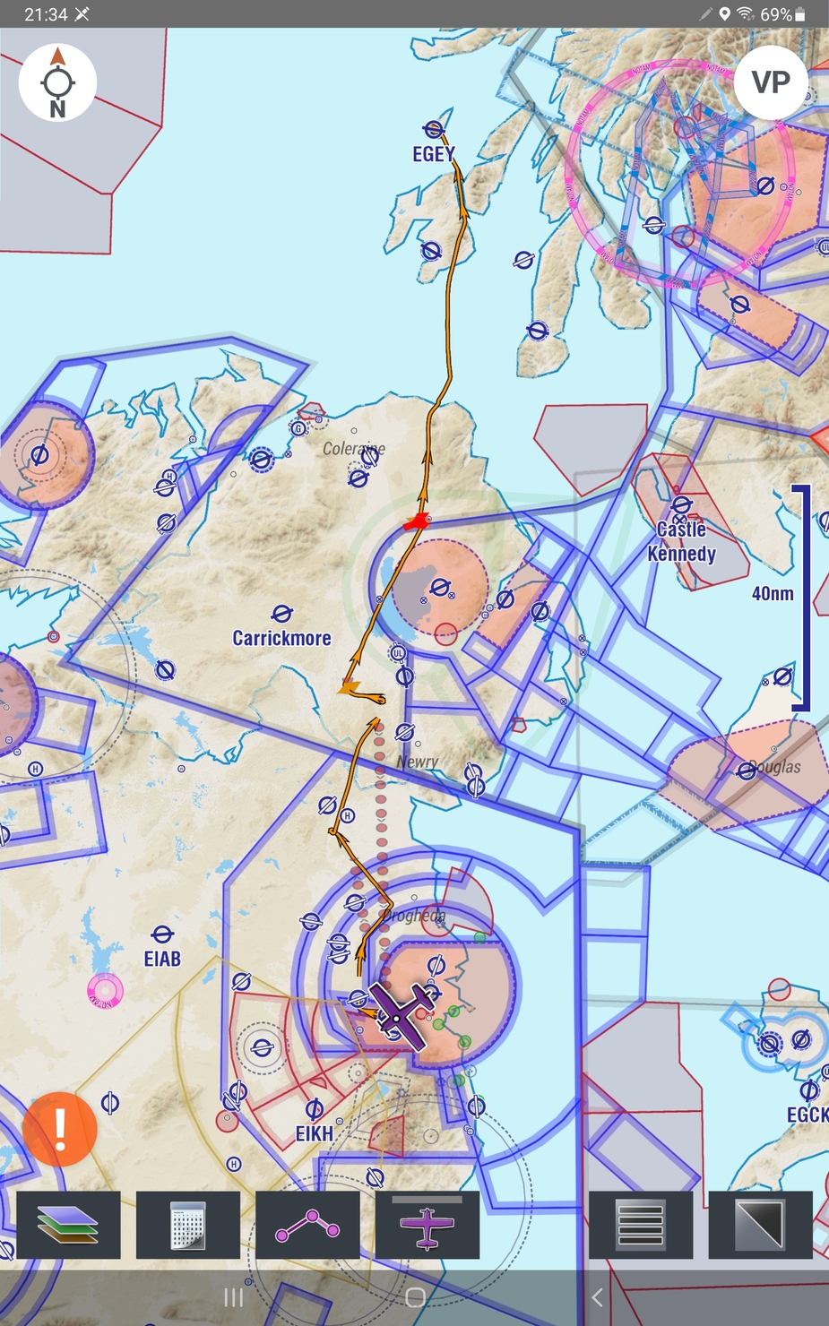
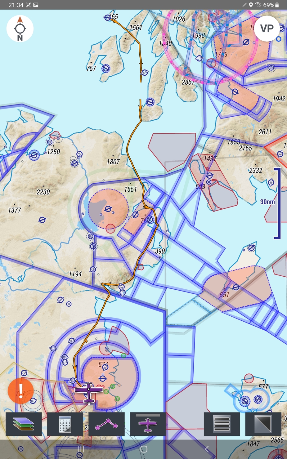
Our aircraft is based in Weston Airport (EIWT) near Dublin. It only opens at 9am, and I was ready to call for taxi at 9:10 and was airborne at 9:20. As I haven’t been this direction in a long time, I decided to take in as many landmarks as possible along the way.
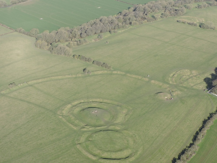
The first one was the Hill of Tara. I’ve recently posted a photo of this location on the photos thread. So a bit of repetition here.
The Hill of Tara is believed to be the inaugurtion site of the High Kings of Ireland. It’s an ancient burial/ceremonial site.
Hill of Tara on Wikipedia
====
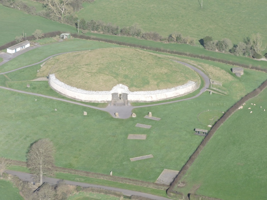
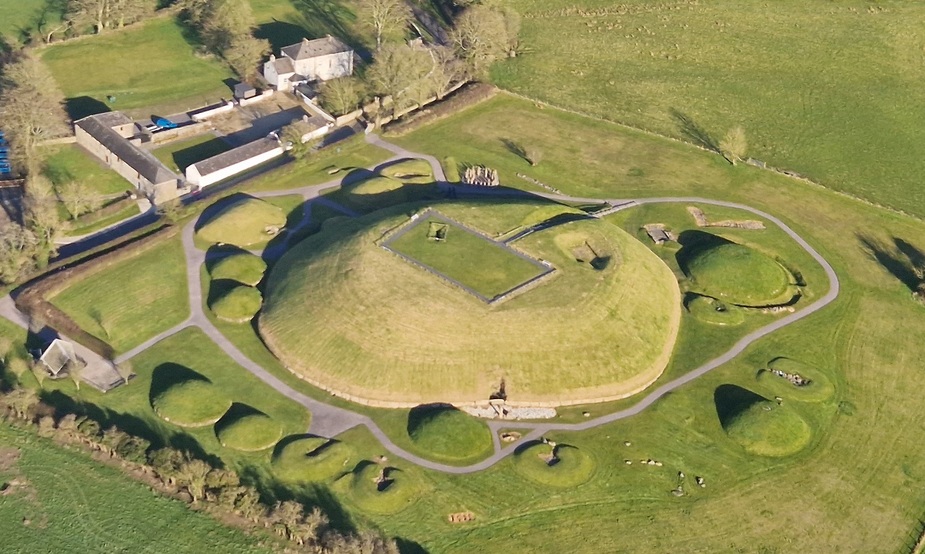
The next landmark was Newgrange. This is a passage tomb from around 3200BC (older than Stonehenge or the Pyramids). The rising sun shines through the opening down a long passage to light up the ceremonial chamber on the morning of the winter solstice. It’s quite an interesting tour if you are ever in the area.
Newgrange on Wikipedia
====
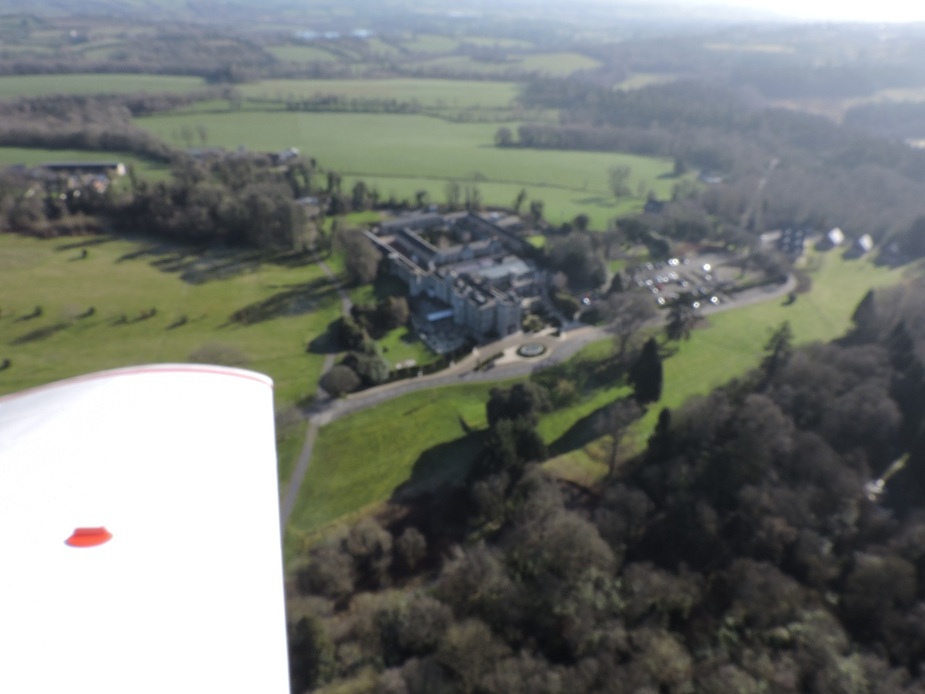
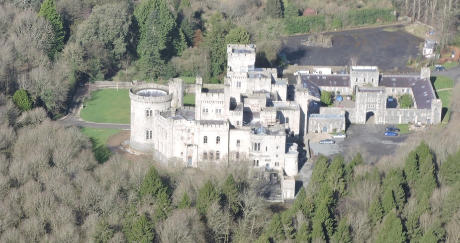
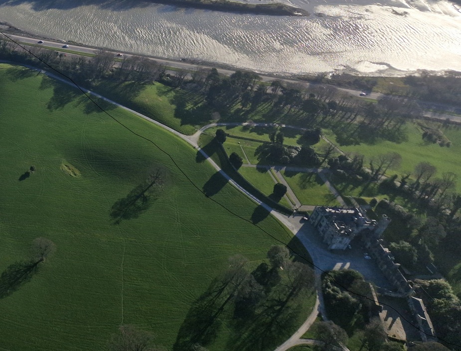
Next on my list was Cabra Castle, now used as a luxury hotel. It was built in the early 19th century. Unfortunately, despite taking 6 photos, not a single one came out in focus! Sorry. This is the best I can do with this one!
=====
After Cabra Castle, I crossed into Northern Ireland. My first sight in Northern Ireland was Gosford Castle.
Gosford on Wikipedia
The current castle was finished in 1859, though a castle has existed on this site since 1610.
=====
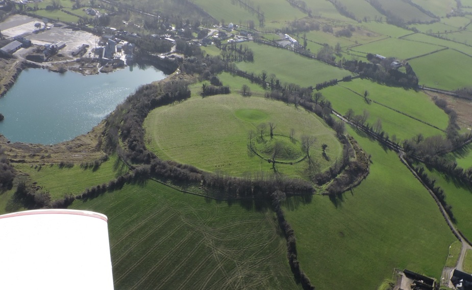
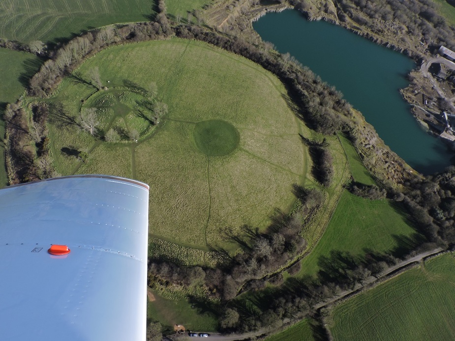
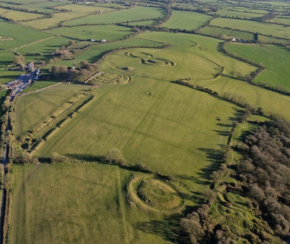
6 nm later it was Navan Fort. It’s an ancient fort or ceremonial mound, near Armagh. Not much can be seen now other than the mount and the outline. The earliest construction that can be dated goes back to the 8th century BC, but pottery and tools found on the site date back to between 4000 & 2500BC.
==
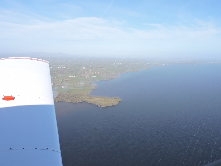
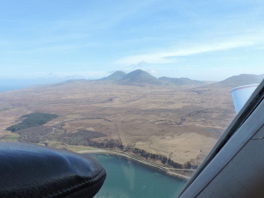
Now I pass over Lough Neagh, the largest lake on the island of Ireland and cut the corner of the Aldergrove CTR (No airspace awareness course for me….I had a clearance!)
Photo 9 Lough Neagh
==
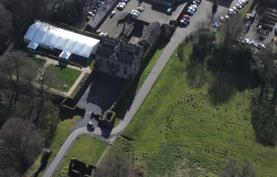
Then I fly over Galgorm Castle. With Navan Fort I had to keep things very tight to avoid flying too low over a built up area, and I again face a similar problem with Galgorm Castle. Galgorm is a 17th Century Castle.
Galgorm Castle
==
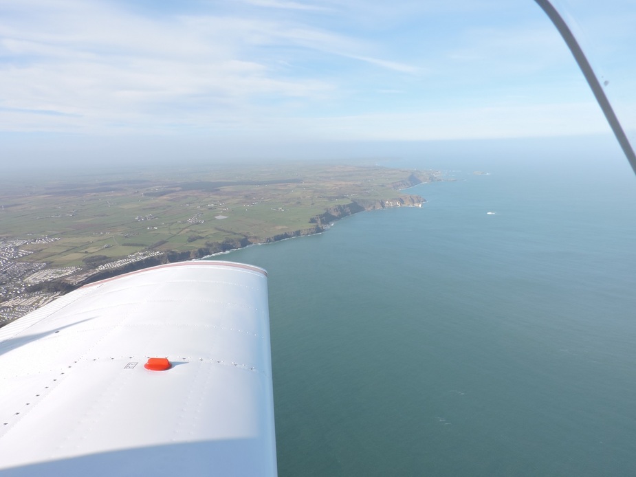
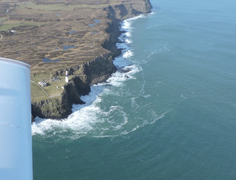
The cliffs of the Northern Ireland coastline as I coast out.
==
Rathlin Island, just 3nm off the coast of Northern Ireland.
==
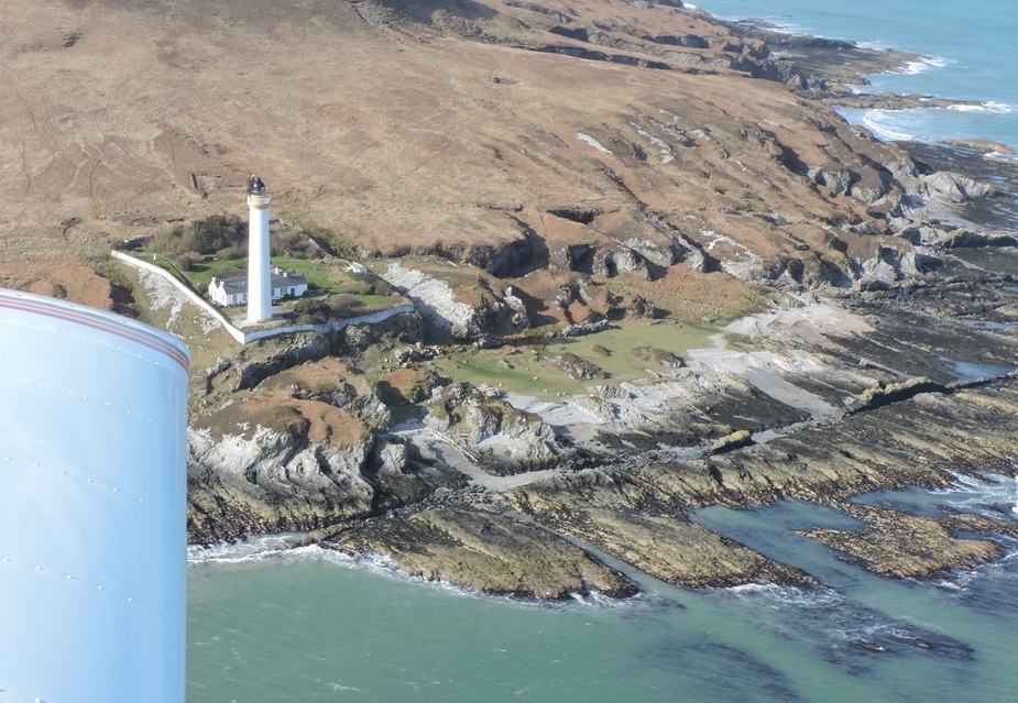
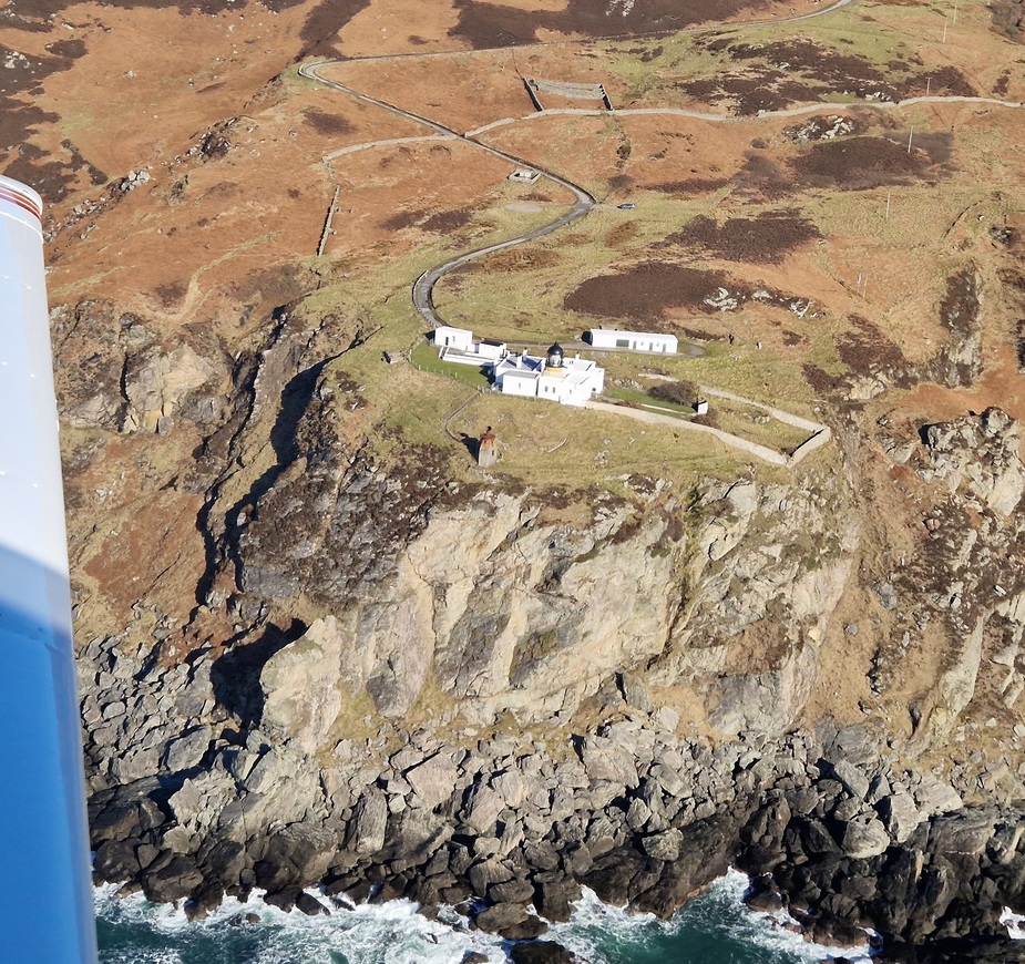
I as leave the island, I pass Rathlin East Lighthouse. It stands 27 mtrs tall and was built in 1849.
Rathlin East Lighthouse on Irish Lights
==
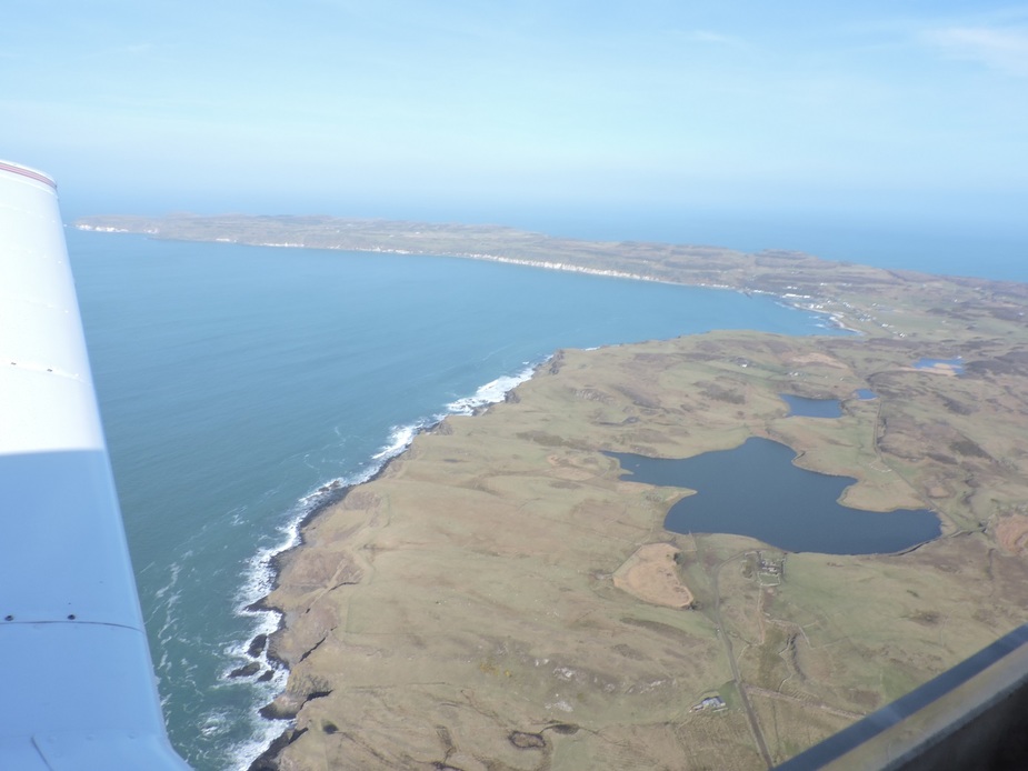
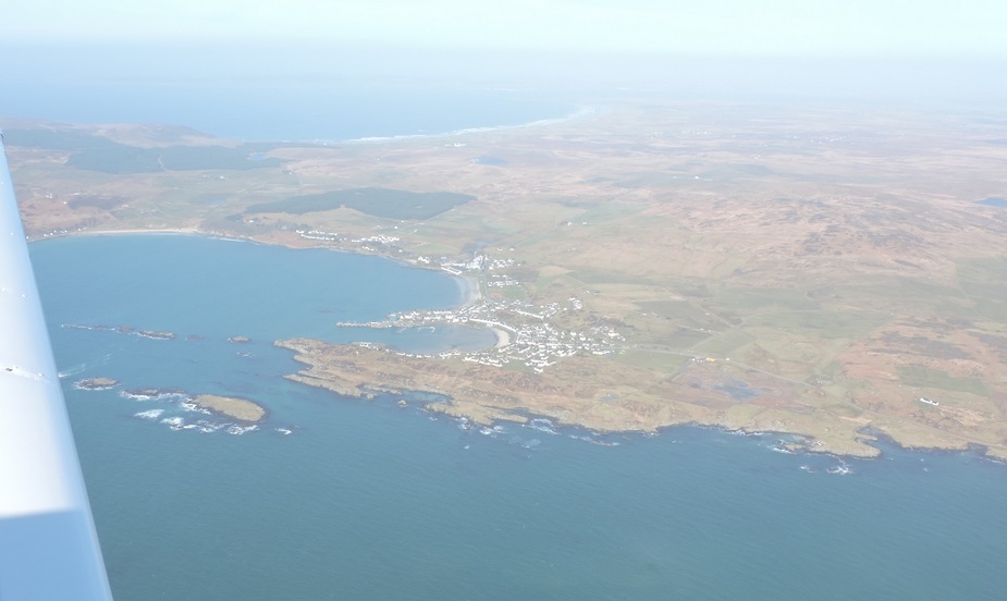
Port Ellen on Islay
===
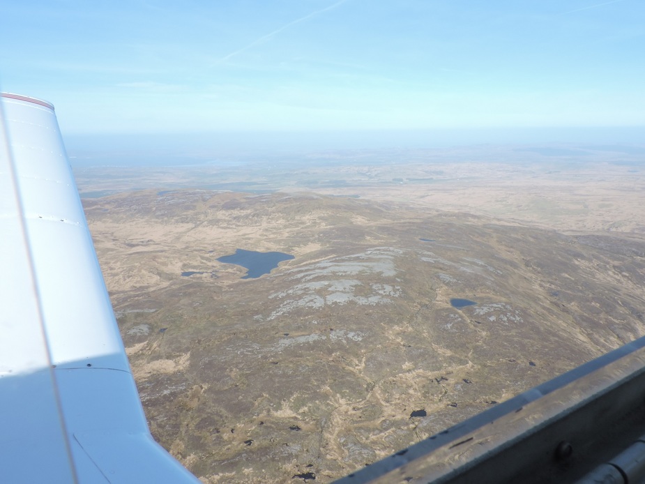
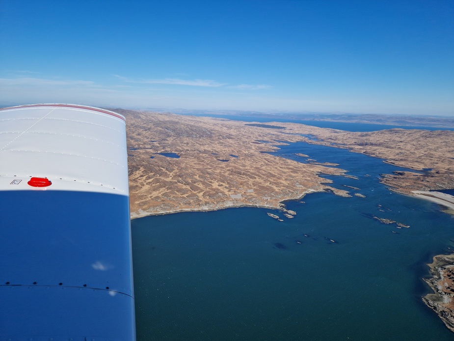
Islay interior
=====
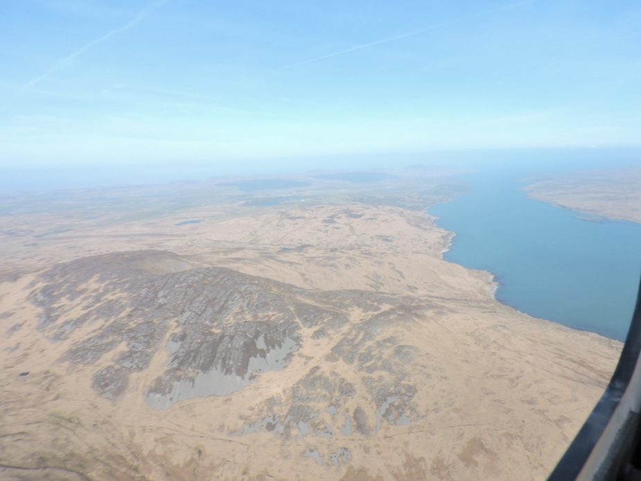
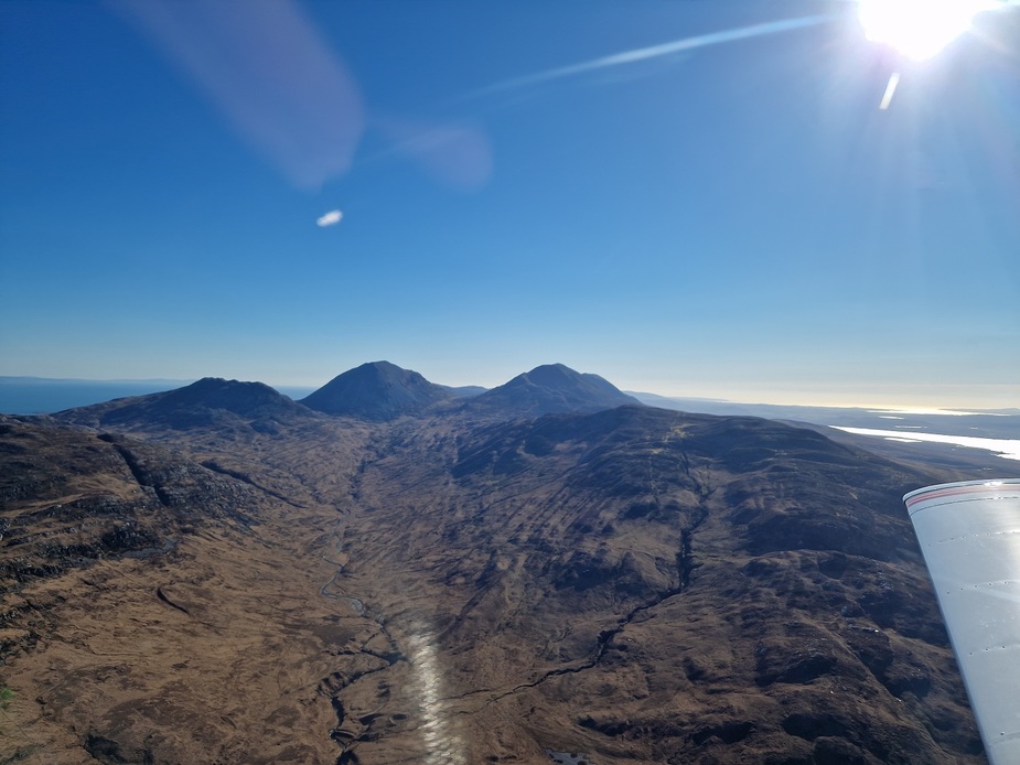
Islay to the left, Jura to the right
=====
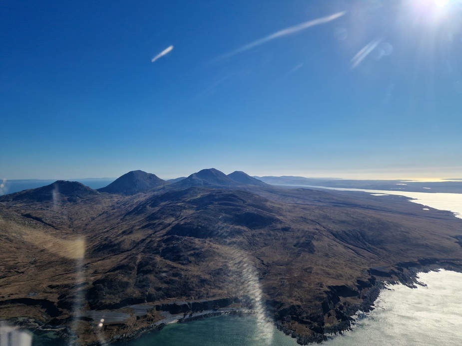
Jura
=====
Next is Ruvaal Lighthouse on the northern edge of Islay. It was completed in 1859 and stands 34 meters tall. Painted white, gold and black, I think it’s a fine sight.
Ruvaal Lighthouse on Wikipedia
==
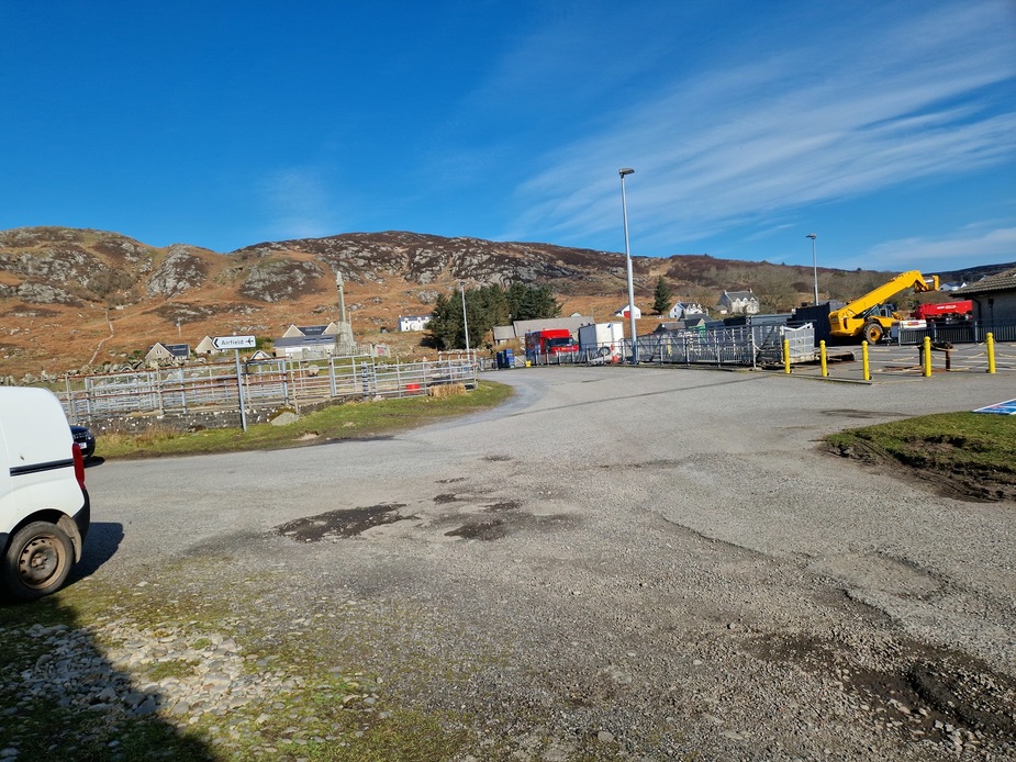
Now Colonsay, my destination, comes into view. It’s 40 sq km, measuring 13km long and 5km wide at the longest/widest points.
==
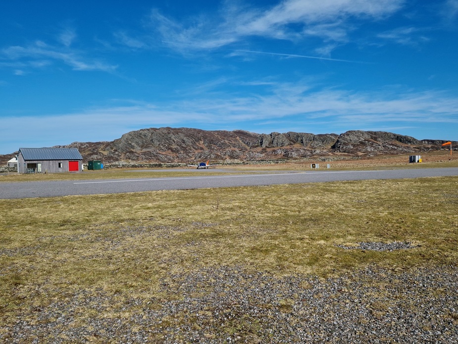
Colonsay Airport. You need an out of hours permit from Oban Airport in order to be able to fly here. It’s easily and freely available, but must be applied for in advance and you have to send a copy of your insurance before you get it. It’s valid for a year after that. You don’t need it if you arrive/depart during opening hours, but given that there are only 3 or 5 flights per week (covering 2 or 3 days) depending on winter or summer time tables and that they only open just before the flight lands and close as soon as it departs, you’re not likely to be able to make your visit during opening hours, making an out of hours permit a necessity.
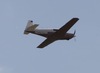
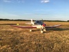
Wind at 2000ft was 35kts and on the ground was around 20kts (windsock almost horizontal). It was about 70 degrees across the runway with nasty gusts and turbulence.
=====
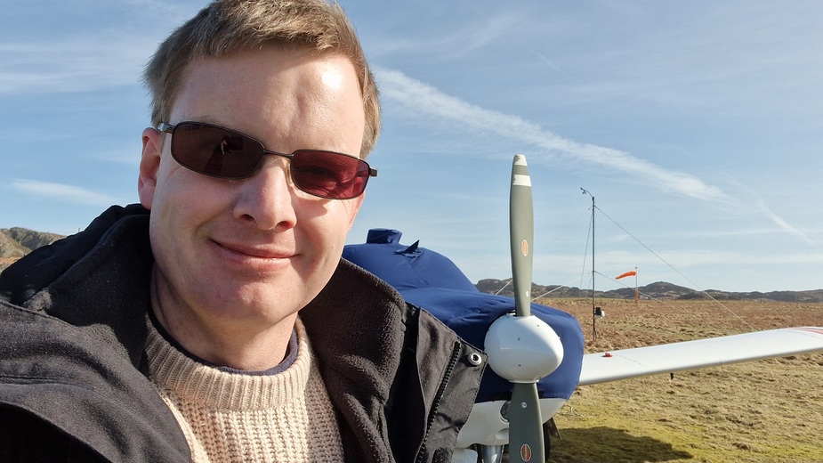
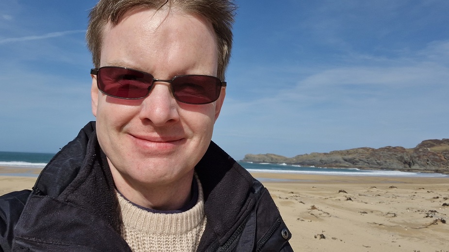
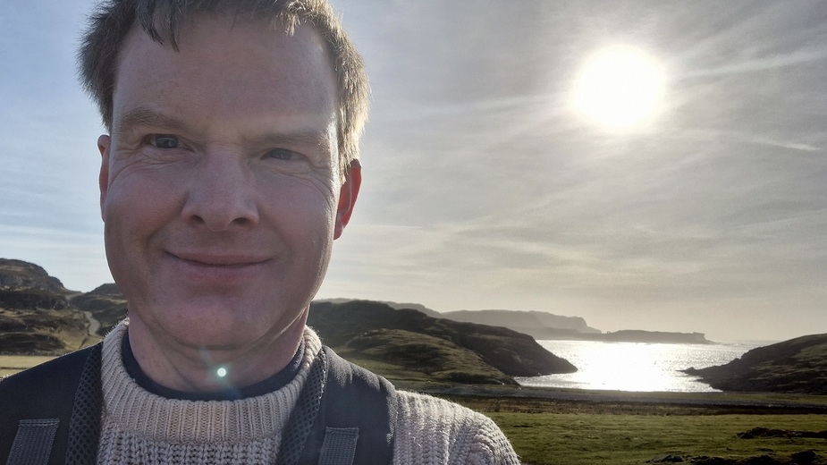
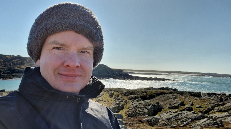
A pilot happy to be on Colonsay again.
==
Flight time was 1 hour & 25 minutes in the air. Given that I was here early in the day, and I was by myself (and not having to think about what I was putting anyone else through!), I figured I’d use the opportunity to explore as far north as I could. I wanted to get to the northern coast if I could, but needed to be back to the aircraft a bit before sunset. My camping gear was in the aircraft and I planned to camp close to the airfield.
So I put on my hiking boots and my day pack and headed off.
Colonsay golf course is just outside the entrance to the airport. Definitely a links course.

==
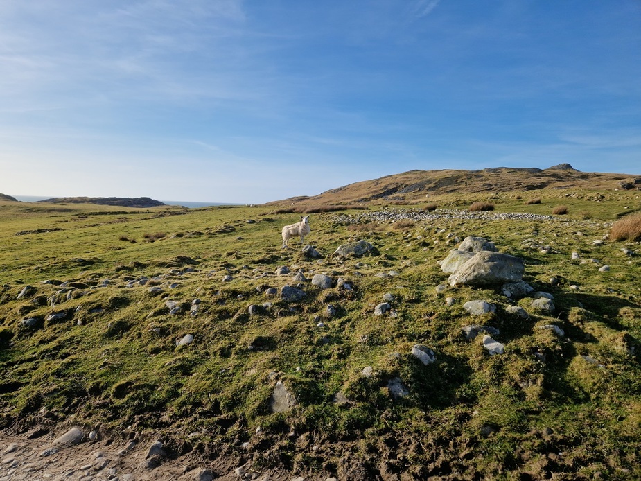
Some photos from the island
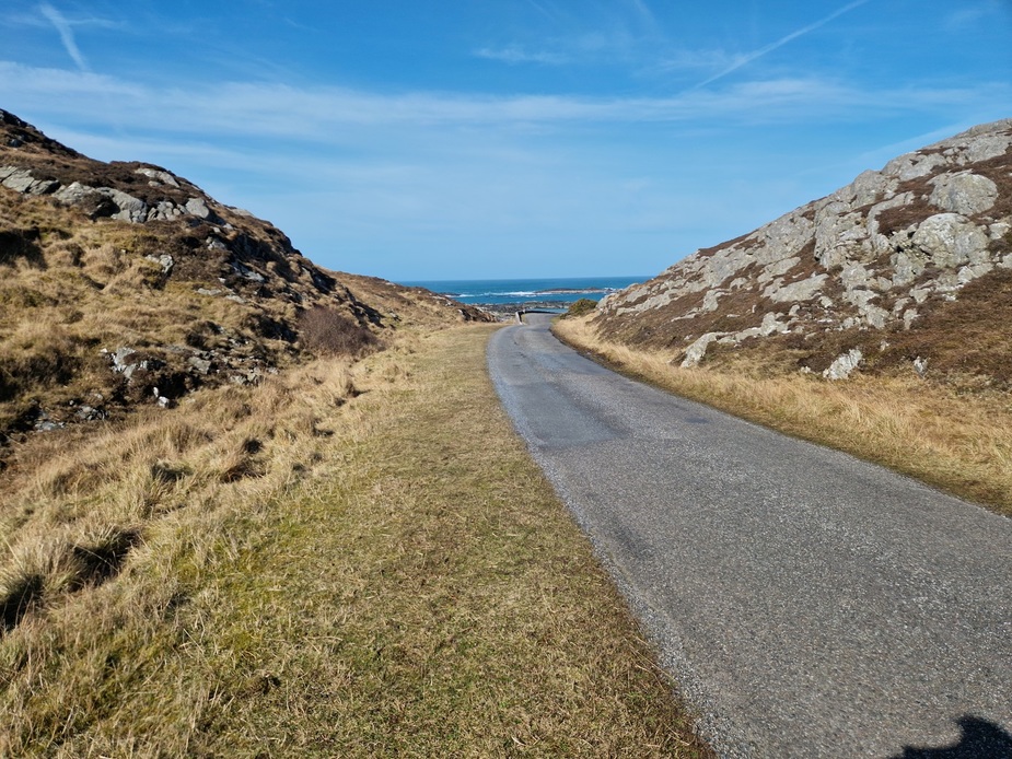
==
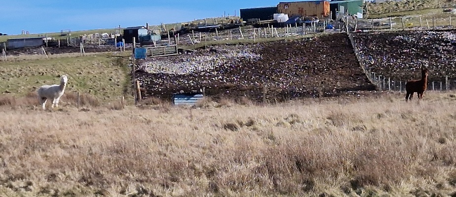
This isn’t a sheep! Someone farming Lamas
=====
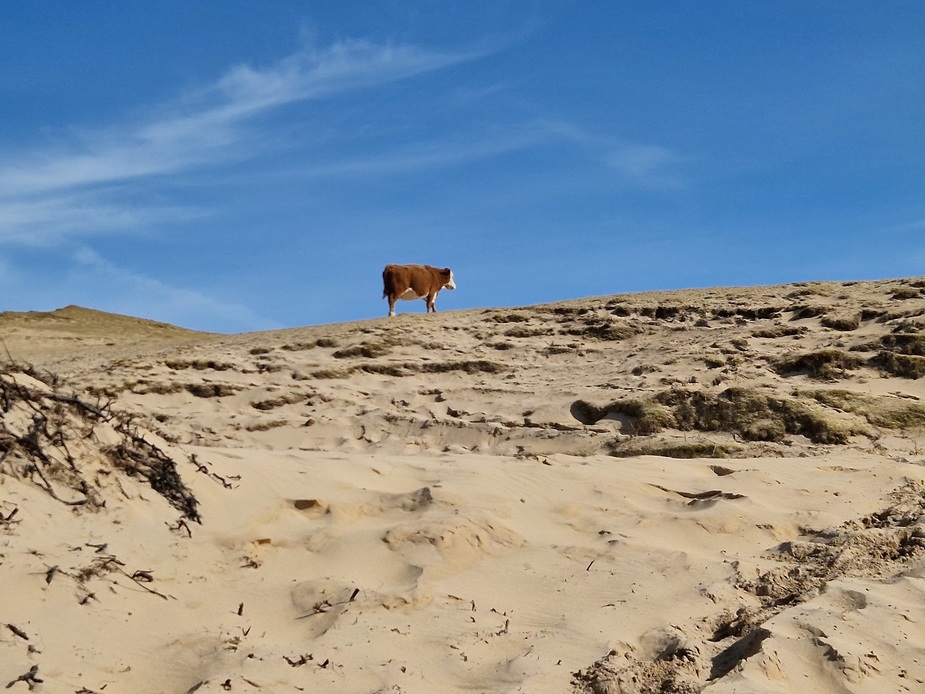
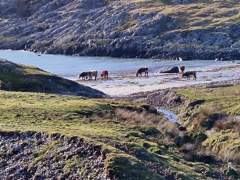
Beaches aren’t just for people! Here is a cow enjoying the beach
=====
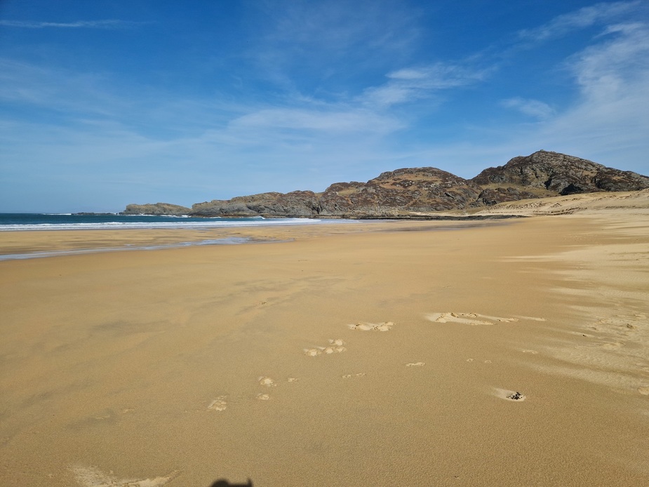
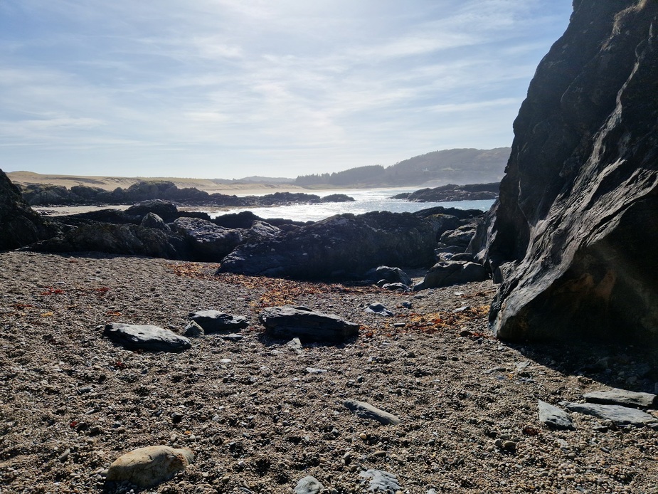
Kiloran beach. It’s a fine long sandy beach and gets all the publicity as far as beaches on Colonsay go. But there are lots of nice beaches on the island.
==
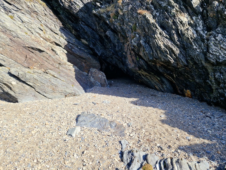
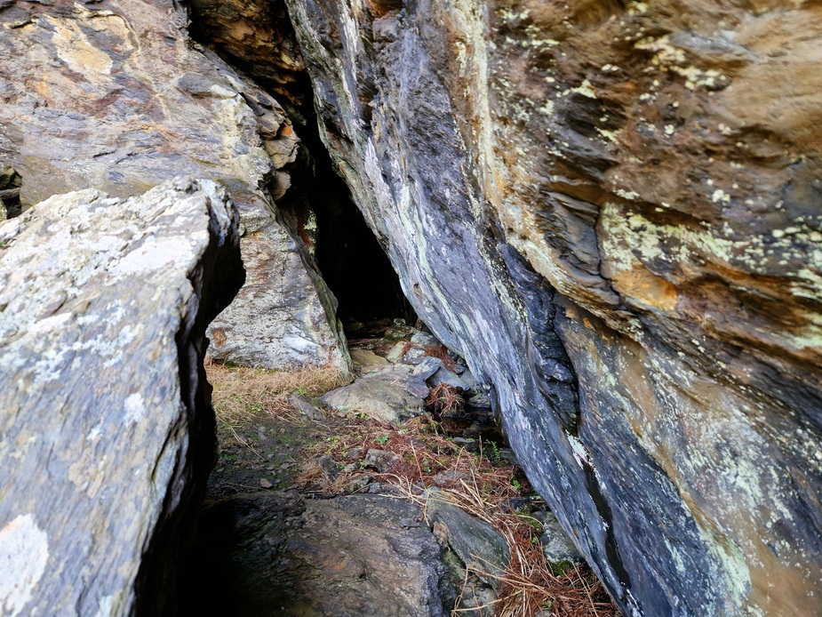
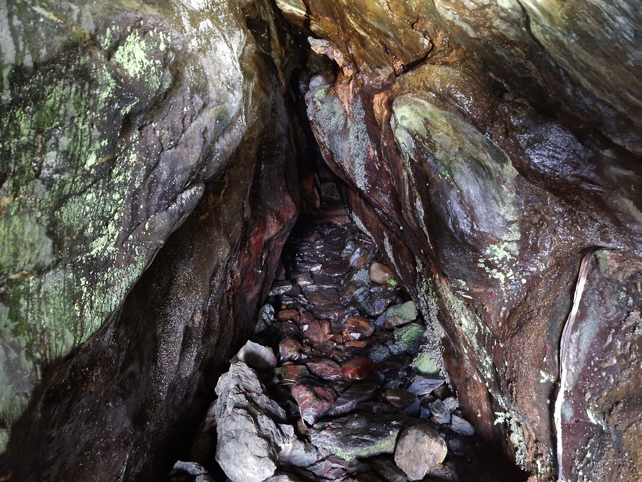
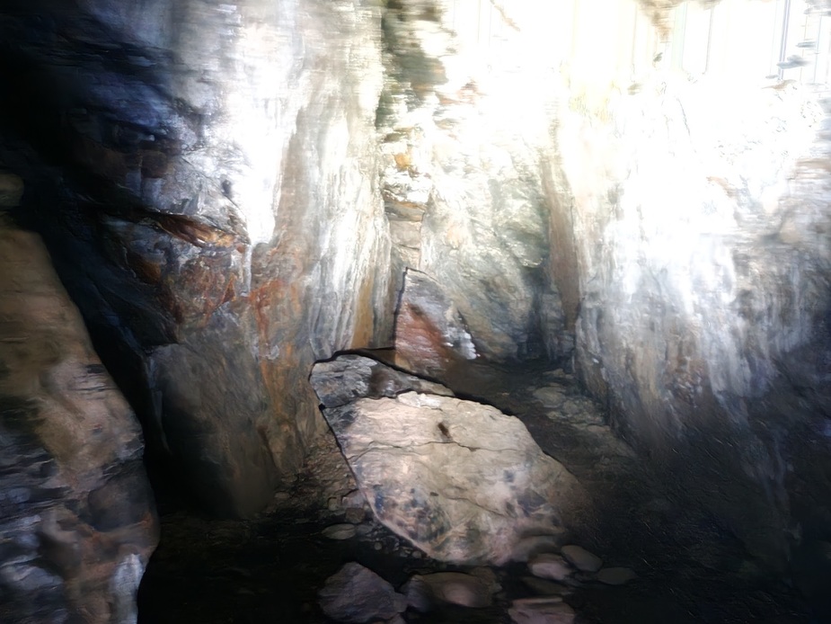
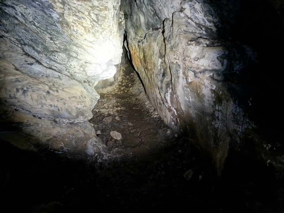
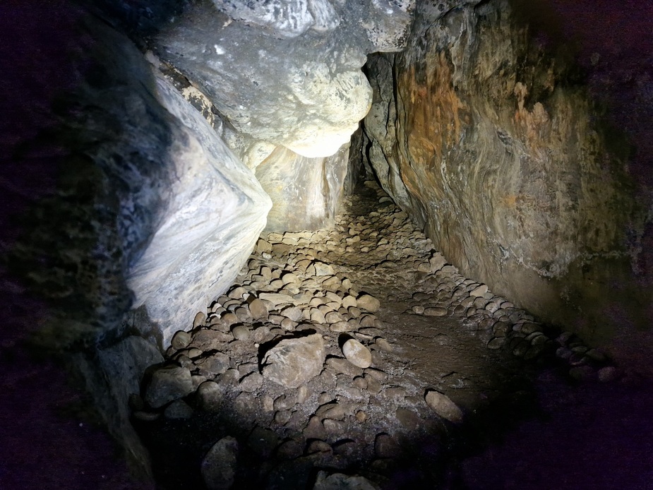
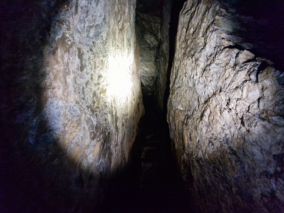
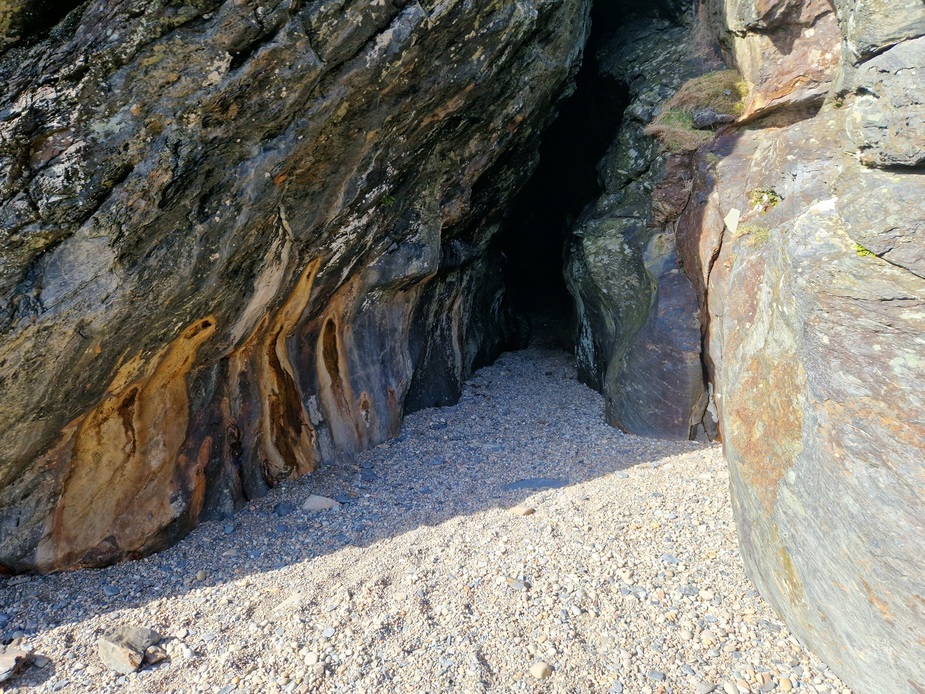
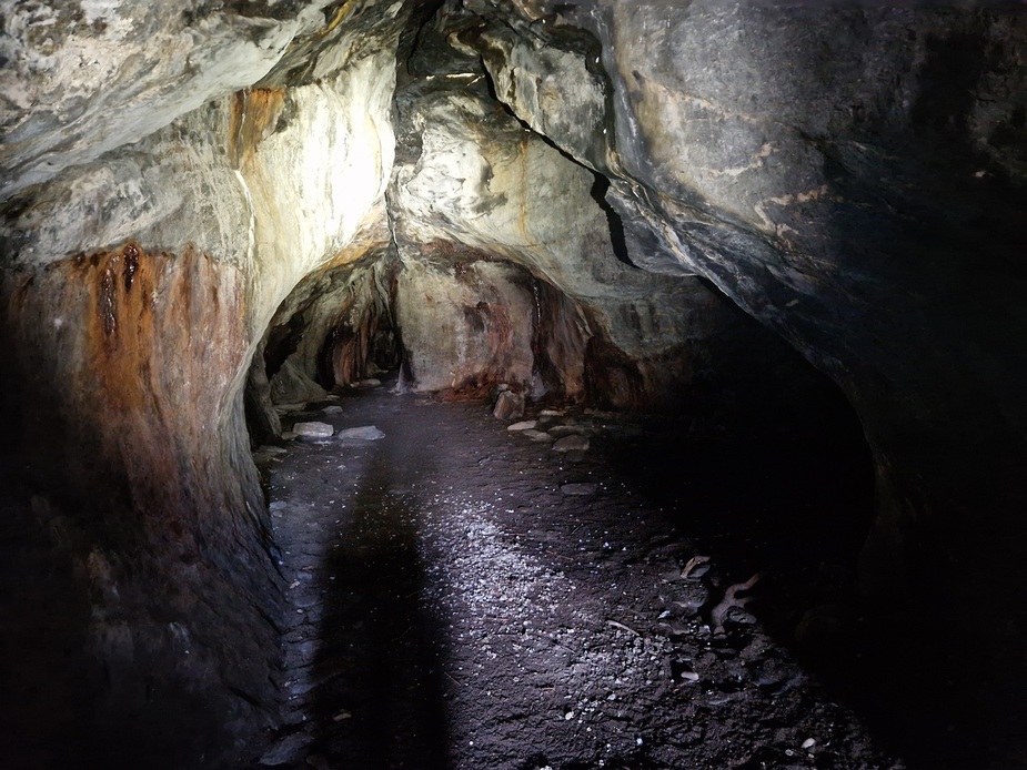
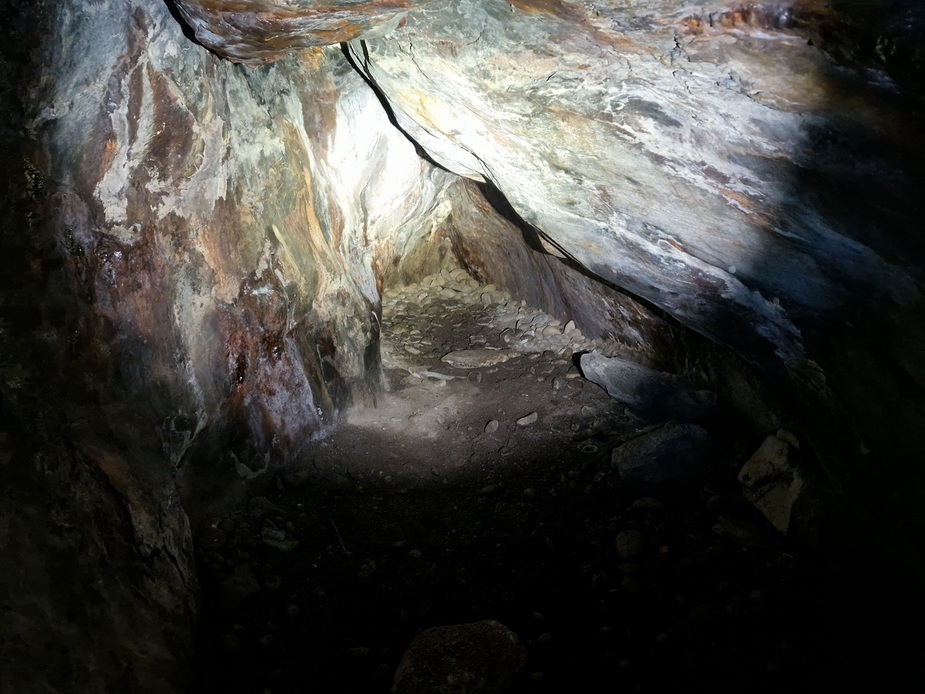
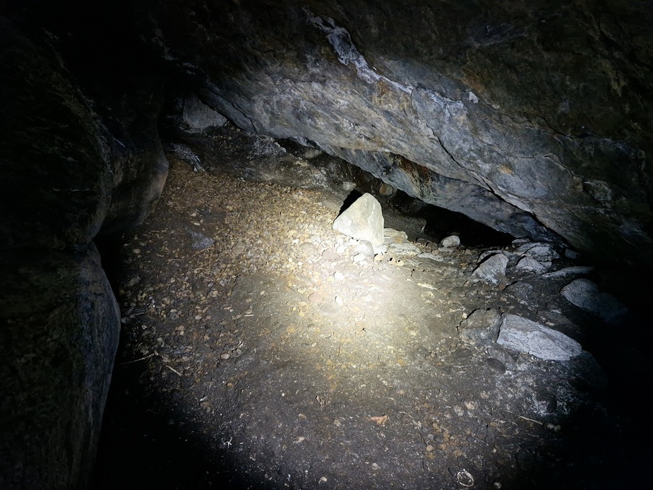
At the northern end of the beach are three caves. I found two of them. I assumed what looked like an entrance was the third one but didn’t go in as it was very narrow and awkward to get into it. After getting home, I did some reading and it turns out that wasn’t the entrance to the third one. It’s up above these two, so I missed it. The caves go back 80 mtrs into the rock.

==
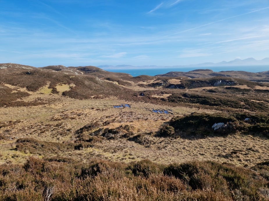
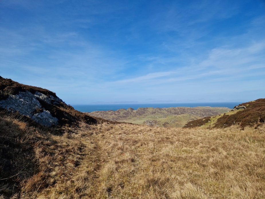
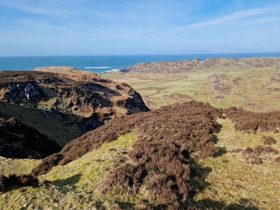
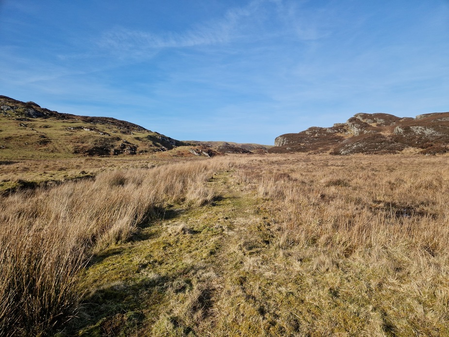
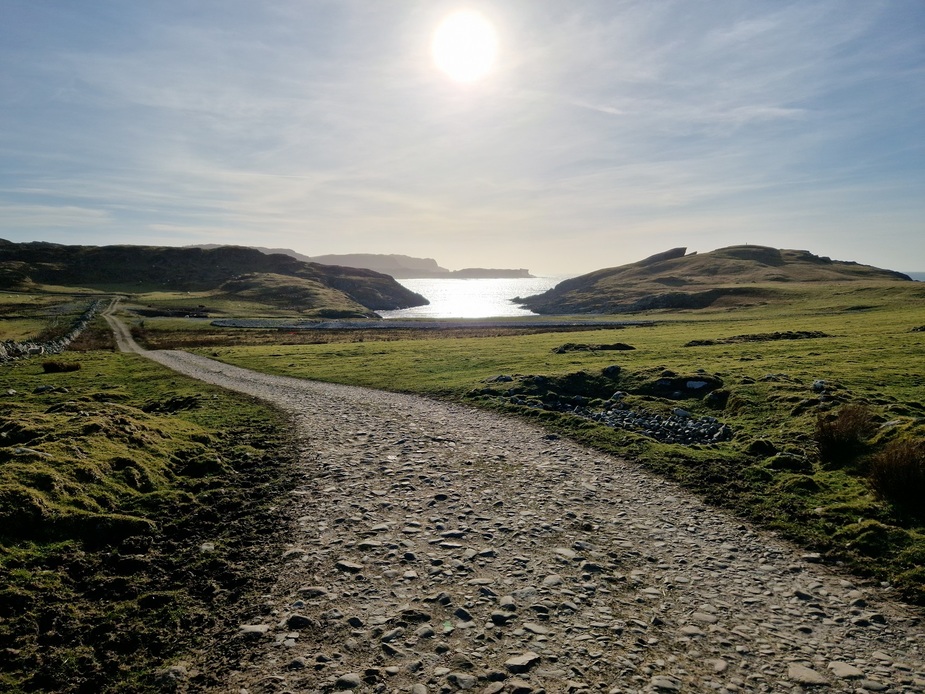
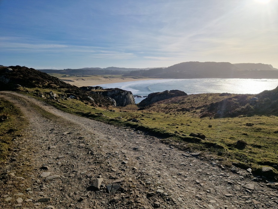
After the caves, I tried to pick up a trail shown on my hiking gps app. I’d no idea if the trail was a paved path, a cleared trail, or just a suggested path accross the ground. I crossed over a gravel road that appeared to come to a dead end as my GPS was telling me to continue a 100 mtrs further east. Turns out that that gravel road was the trail and it wasn’t a deadend! But I didn’t realise that until much later. That much later was when I was on a ridge line, looking down over the side of a cliff seeing the road below! So I unintentionally ended up hiking along the top so the hills moving north following sheep trails  But getting some very nice scenery and not seeing anyone.
==
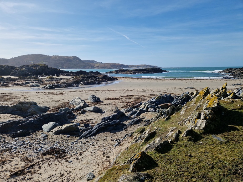
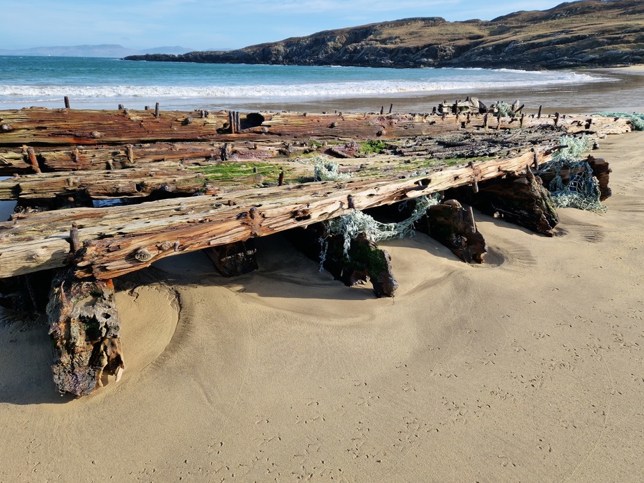
I eventually managed to join back up with road, (about 500mtrs from where it came to an end!). But time was getting late. I continued on to Balnahard Beach. In my mind it’s almost as nice as Kiloran Beach, but I suppose it doesn’t get the same publicity as it’s not so easy to get to (Certainly not the way that I got to it!).
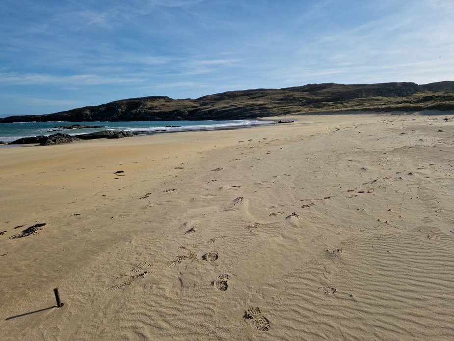
Can anyone tell me what this is? There are two of them buried in the sand at Balnahard Beach. They are flat timbers with massive nails/pins sticking out. At first I thought they were the rotting corpse of an old wooden ship, but then I saw some old fishing nets attached to one. Perhaps some structure dropped into the sea for farming or catching fish?
==
Well the sun waits for no man, so it was time to make my way back to set up camp before the sun set. I wasn’t sure that I was going to be back in time. I pushed the time a little in order to get to Balnahard beach and expected the return trip along the road would be faster than the way I came. I was only about 1 km from the most northerly tip of the island, but I didn’t have time to make it unless I was willing to put my tent up in the dark (which I wasn’t!).
So I set off back, joining up with the road that I missed first time.
This is the ridge line that I was moving along on the way north.
==
Some photos from the island
==
These cows seem to have a taste for seaweed!
==
Kiloran Beach from a higher vantage point
==
Lower Kilchattan Standing Stones
==
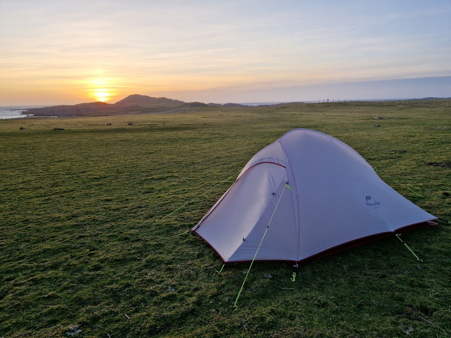
Time to set up camp for the night.
I set up camp close to a stone wall, as it sheltered me from the worst of the wind, but still left me a nice view of the sea, and I didn’t have to carry my gear too far from the aircraft.
My tent pitched just before sunset.
=====
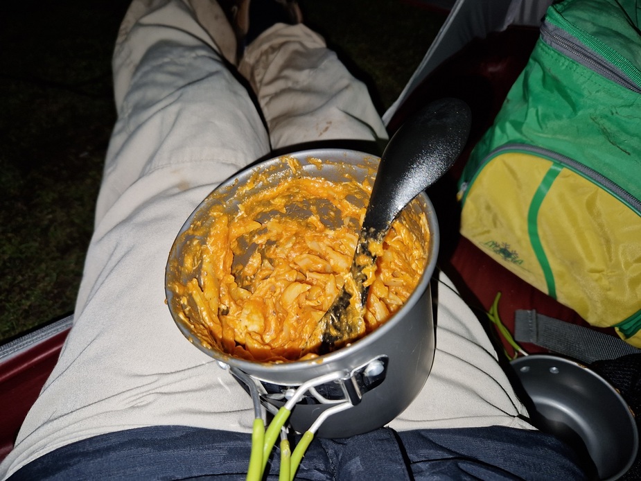
Chicken Arrabbiata for dinner. Yummie after a long day’s hiking!
=====
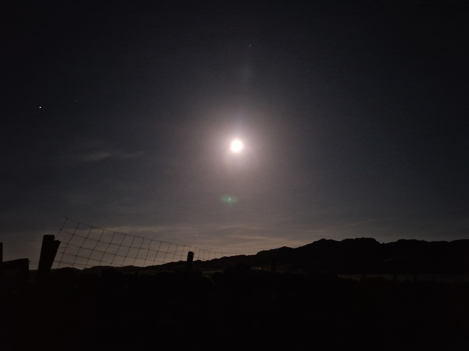
Colonsay has little in the way of light pollution. The locals seem to want to keep it that way to encourage tourism. (Coll an island a little further north has got recognised as a Dark Sky Community). While there were plenty of stars to see, and I also saw two satellites, and the sky was clear, unfortunately a really bright (almost full) moon ruined most of the viewing. The moon was casting very distinct shadows. Even inside my tent, I didn’t need a torch to find things, the moon was so bright.
==
Night time temperatures were 9C. I got fed up of being cold while camping, so bought a really warm sleeping bag (Rab Expedition 1400) and have never been cold again! At 9C I woke up during the night sweating and having to open some baffles to cool down.
The next morning an otter passed me my. It was no more than 2 meters from me and just walked on by! If it was scared of me, it didn’t show it. It just took a look at me while walking on continued on its way. It was almost gone before I got my phone out and camera app open (I had to do it slowly to avoid a sudden move which might frighten it!)

==
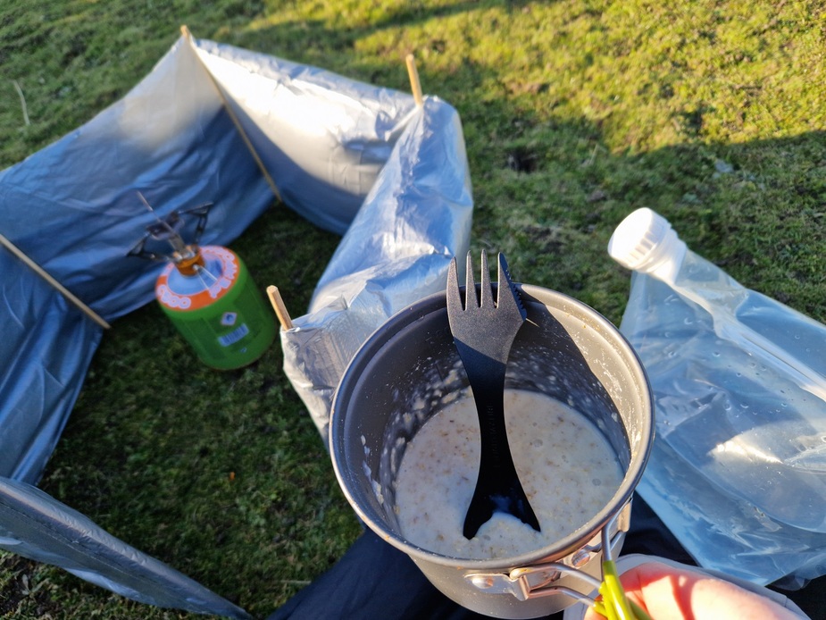
Porridge for breakfast
==
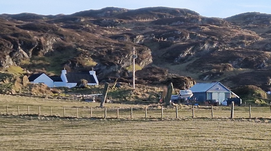
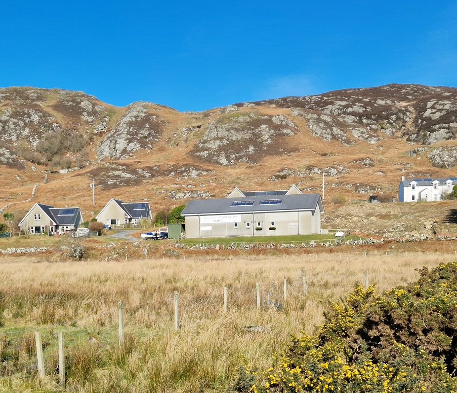
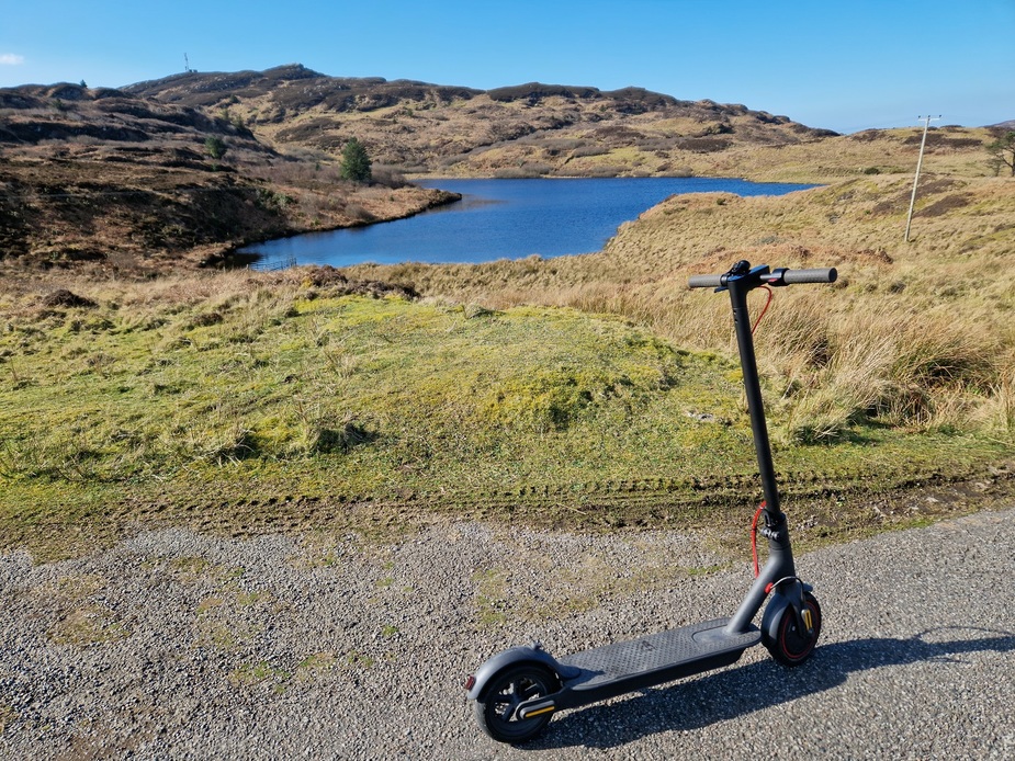
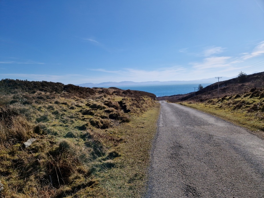
Having walked about 30km the day before, the soles of my feet were a bit sore. While the gravel road back was much faster than the hills, walking in hiking books along hard surfaces kills my feet. So I used my electric scooter to travel around a bit more on the second day. I packed up my tent and put it back in the aircraft and made my way to the main village on the island, Scalasaig.
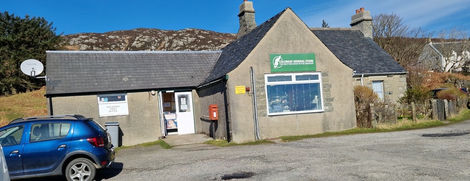
There isn’t much to the village.
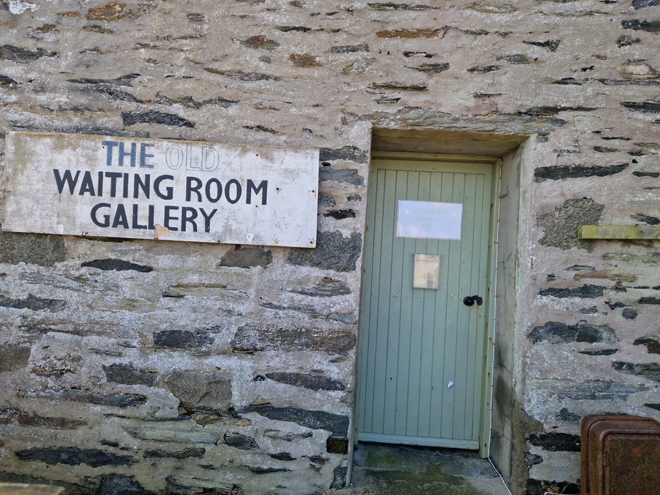
A bookshop/gallery/cafe (that I’ve never seen open). The sign says it should be open when I was there but it wasn’t. Maybe only open in summer?
The ferry terminal, a small shop and the local brewery. Apparently Colonsay is the smallest island in the world with its own brewery.
==
I explored a road up the eastern side that I’d not previously travelled, until it joined up with a road that I’d hiked along the previous day. The scooter making it much easier!
=====
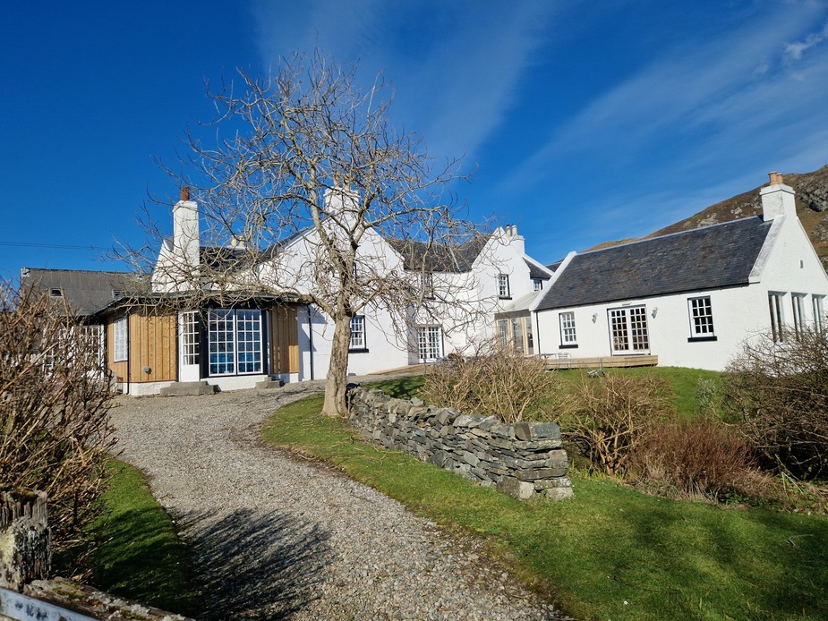
The Colonsay Hotel. I’ve never stayed here, but I have eaten here twice and the food was nice.
==
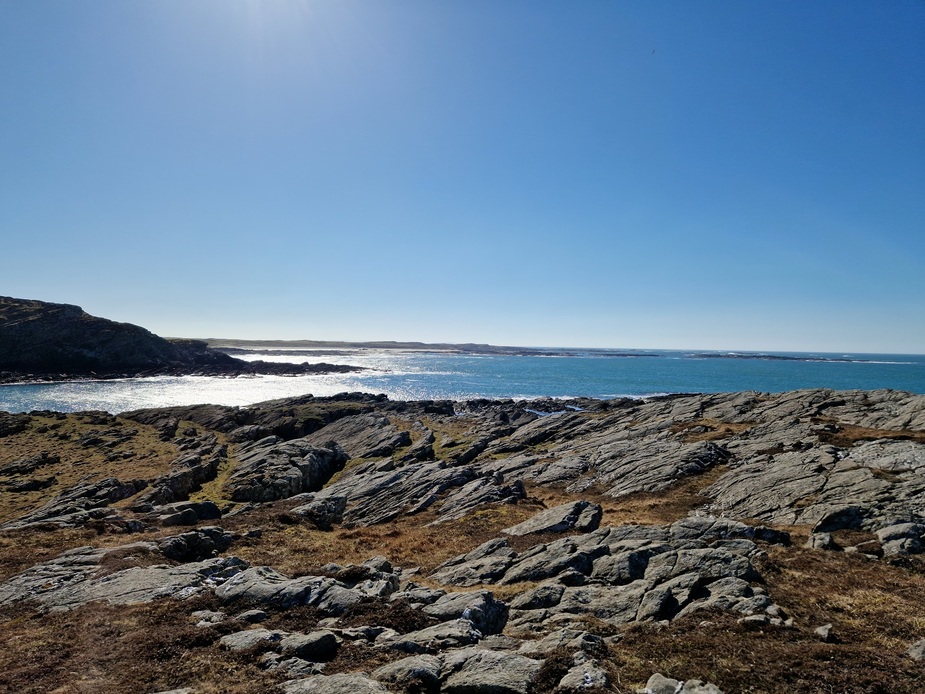
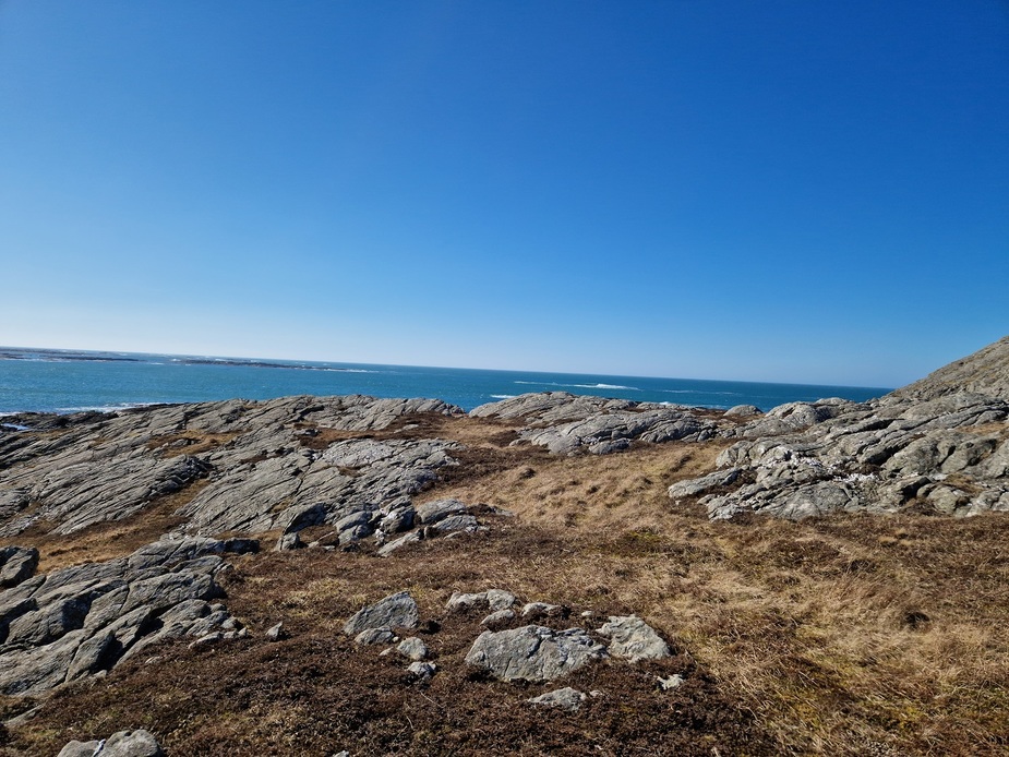
Some photos close to my camping spot before I prepare to head home.
==
Preparing to leave
==
It was time to leave now. And again I intended to take in as many sights as possible.
Winds for departure were just as strong as yesterday, but somewhat more aligned with the runway.
For my trip back, I was seeing winds aloft of between 30-50 kts. At one stage, it was 50kts straight on the nose! That made for slow progress. Occasionally when I got it just right, I was getting upward mountain wave which helped add a little to the TAS, but not anywhere near enough to cancel out the headwind!
These are a few shots of Jura Island.
==
This is Skervuile lighthouse. It was built in 1865 and has the same white, gold and black colour scheme as Ruvaal Lighthouse on Islay.
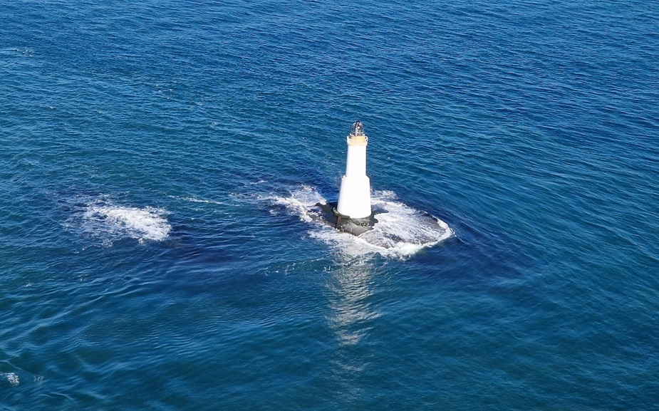
==
Gigha Island and runway.
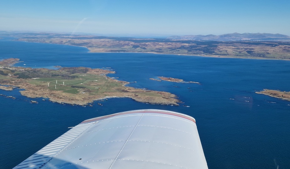
==
Campbeltown runway. Once a backup runway for the space shuttle
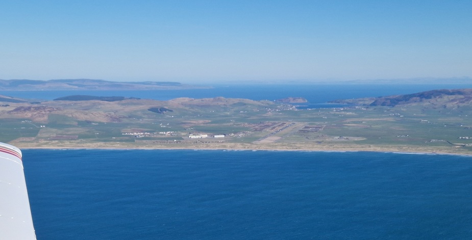
==
This is the Mull of Kintyre lighthouse. Originally built in 1788 and rebuilt in 1820. The former lighthouse keepers cottage is now a holiday cottage.
I hope you appreciate this photo. The light house is down low on some hills, so I had to drop below the peeks of the hills to get a decent shot. The wind at this point was 50kts coming straight over the hills. So I was very much in the washing machine to get this photo!
Mull of Kintyre lighthouse on wikipedia
==
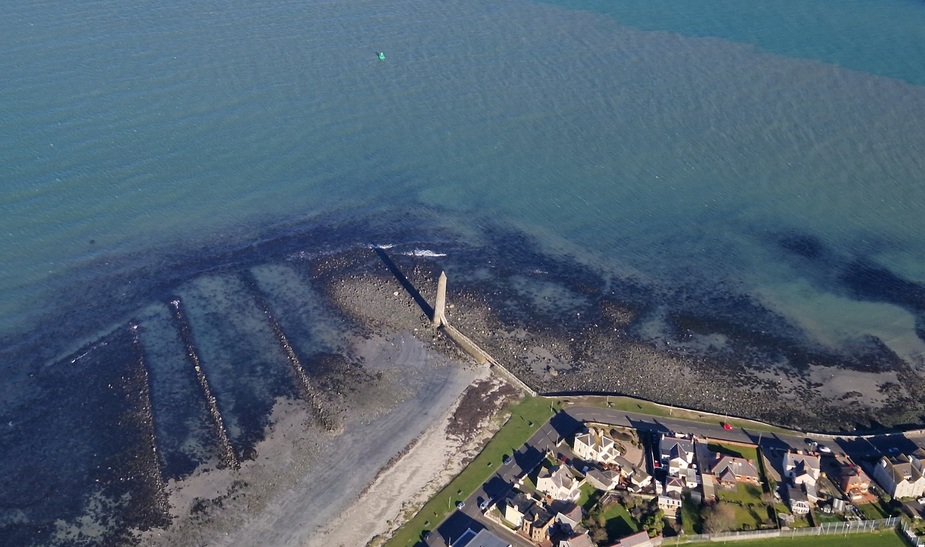
Chaine Tower. It’s a memorial to James Chaine MP and was built in 1888. It’s right beside Larne, so I couldn’t get low enough to get a great photo without infringing the low flying rules. I could have flown off the coast but then it would have been on the wrong ride of the aircraft for me, and I’d have to take the photo through the glass rather than the storm window.
==
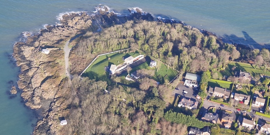
Grey Point Fort is military defence base built in 1904.
=====
Mount Stewart is a 19th century house owned by the national trust. Just as I was coming up to it, ATC wanted to confirm my intended track and advised of traffic. So I didn’t have much time take very many photos. Thankfully it came out ok!
==
My next point was intended to be Nendrum Monastery. However just as I was getting to it, ATC called again asking me to report some point and at first I couldn’t understand what they were saying and then didn’t know where it was, and they also wanted my estimate for the FIR boundary. Too much going on, and I missed the monastery. So this one will have to wait for another day!
The next one was Dundrum castle. This one I couldn’t find. I mixed it up with the following point, so was looking for the wrong thing! Oh well….another one for next time!
The next two were Narrow Water Castle and Narrow Water Keep. They are right beside one another. I didn’t see the castle, only the keep. But looking at my photos afterwards, I see that I caught the two in the same photo.
Narrow Water Castle was built in 1816, but a previous castle on the site dated back 1680. It’s now used as a hotel
Narrow Water Castle
===
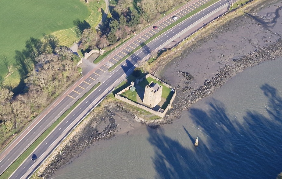
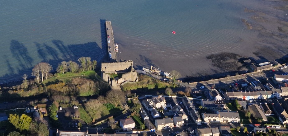
Next was King John’s Castle at Carlingford. I’ve walked around the grounds of this one before. It was built in the late 12th century.
King Johns Castle on Wikipedia
==
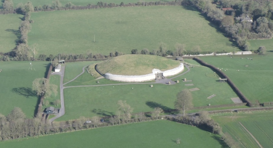
On my way back I passed Newgrange again. But this time I also spotted Knowth, another passage tomb which is also in the area. Its age is also estimated at 3200BC.
==
And another photo of Newgrange. And why not….it’s always worth a look

=====
And another of the Hill of Tara as I pass by on my way home.
====
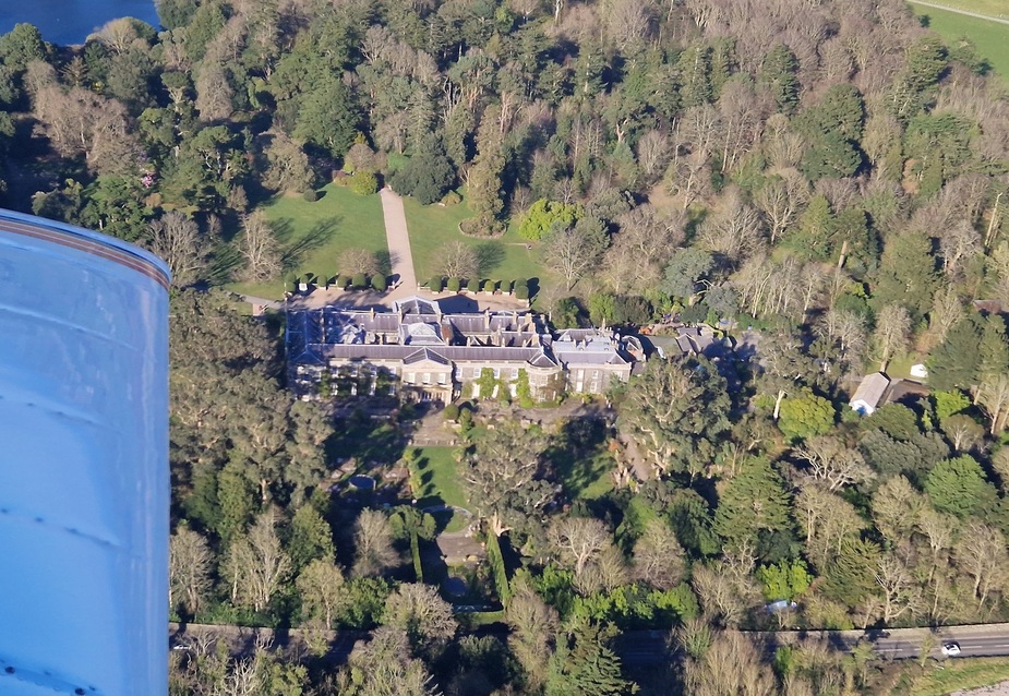
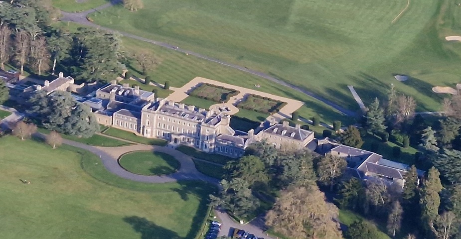
And the last one of my trip. Carton House. Normally I’m too busy at this point, as it’s quite close to Weston Airport. But Weston was quite today (almost nobody flying because of the wind!) so I got my calls and clearances in early and had time to take the photo.
Carton House is a 5 star luxury hotel. The first house on the site was from the early 17th century. The current house was commenced in 1739 and added to over the centuries. It’s attached to two highly rated golf courses.
==
I landed after 1 hour and 50 minutes in the air, after a really busy flight. It was a tiring but really rewarding trip. My feet still hurt and my head is still tired, but I really got to explore parts of Colonsay that I thought I might never get to, and I took in so many sights along the way to make it a really high value trip.
A trip to Colonsay comes highly recommended. It’s not for those seeking fancy shopping, collecting souvenirs or looking for 5* accommodation (though I believe that the hotel is nice), or Michelin star meals, or amazing night life. But if you would like a day or two with a slower pace and enough exploring by foot, it’s a great place to go.
EasyVFR’s logo is “Adventure made possible”. It certainly helped me to make this trip possible!
Great trip and stunning scenery. I simply have to visit Scotland and Ireland.
Thank you! Into the wild…
On the paperwork/PPR side: is it still:
How did you close the flightplan once there? They say there is very little phone signal at the airfield, but maybe that’s out of date?
How did you file the GAR? I guess it is 12 hours as Colonsay is not police designated?
Great trip report, have friends at Islay and nice photo of the Paps of Jura. That’s where George Orwell wrote 1984
Islay House has an aviation link, it was once owned by Idi Amin’s pilot
mmmh… been a few times to Scotland and the Shetlands, but missed this one. One more reason for a return 
Thanks for the report, had me travel along
Thanks for the report, enjoyed it very much!
Thank you very much for this report.
You seem to have a encyclopedic knowledge of Irish history
We like the same kind of holiday that you do.
Glad your wife recovered.
A super trip
I was going to come along but dropped out due to various things. This week is mega busy here, and I wasn’t sure if my camping gear would be up to it, but that is easy enough to fix. Will definitely do this another time.
I’ve often thought Dublinpilot is secretly funded by the Irish tourist board
Looks like an amazing destination, especially in the sunshine. I assume the landing was ok, even with the wind?
Are the caves under water at high tide? Some of them look quite damp.
boscomantico wrote:
On the paperwork/PPR side: is it still:contact Oban airport, hand in credit card details and insurance cert, then get the (free of charge) “holiday voucher”?
on the actual day, get PPR for the landing from Oban and landing fee will be charged to credit card?
How did you close the flightplan once there? They say there is very little phone signal at the airfield, but maybe that’s out of date?
How did you file the GAR? I guess it is 12 hours as Colonsay is not police designated?
I’ve never used the holiday voucher scheme. Instead I apply for an out of hours permit for the islands of Colonsay and Coll only. The advantage is that it’s free and lasts 1 year rather than costing £7 and lasting a week. The downside is that it’s not valid at Oban. But Oban’s opening hours never caused me an issue, so this works well for me. They usually turn the permit around within 48 hours (faster if you call them and need it urgently).
PPR has to be obtained before the flight. It doen’t matter if it’s just before take off or a week before.
Normally they ask for payment when requesting PPR. This time they didn’t (which suited me as I wasn’t sure I was going to make it) so I phoned them after returning home to pay the bill. £8.70 (about €10) for landing and no charge for overnight parking.
Sometimes in the past Scottish Information would close the flight plan for me when I was overhead the field. This time they told me that they couldn’t close it until I was on the ground. Once on the ground I couldn’t hear them anymore. Another pilot of frequency relayed the message that I’d landed safely for me. (Turns out Scottish could hear me, but I couldn’t here them). The UK doesn’t have the same concept about closing flight plans that exist elsewhere. So there isn’t an issue if you don’t close it (unless someone starts to get an uncomfortable feeling). But if you’re with Scottish Info until you’ve reached the island (as distinct to going off the radar while out to see), there is little chance of follow up action if you don’t close the plan. It doesn’t feel right to me not to close it, so I always try to, but it’s perfectly normal to British pilots.
There is virtually no phone signal at the airport. I briefly got a connection while camping, which disappeared as soon as I tried to use it! On other parts of the island you can get a signal, but nothing useful at the airport (and no wifi from the “terminal” either).
The GAR I filed using the HMRC online service
HMRC Submit a GAR service
As the flight was from/from Great Britain but within the common travel area, it requires 12 hours notice. I’ve an email from the GAR support telling me that it must also be emailed to the police force (because of the common travel area) but the guidance accompanying the form says that using this online service also serves as notice to the police! So I’m querying that with them for future reference. They are saying one thing while pointing to guidance which is saying the opposite!
Peter wrote:
I was going to come along but dropped out due to various things.
You missed out on a great trip
Capitaine wrote:
I’ve often thought Dublinpilot is secretly funded by the Irish tourist board
Maybe I shoudl try to mussle in on the Scottish Tourist Board too….hopefully they see this!
Capitaine wrote:
Looks like an amazing destination, especially in the sunshine. I assume the landing was ok, even with the wind?
Yes, it was no problem. I can’t do IMC, but crosswinds don’t cause me too much bother!
Capitaine wrote:
Are the caves under water at high tide? Some of them look quite damp.
No, they are above the waterline. But one of them had water actively comming down through the ceiling for the first few meters. So there must be some sort of stream above somewhere. Once past that, it was pretty dry. It’s amazing to find such impressive cave, with not so much as a sign to direct tourists towards them (never mind an entry fee!). But I suppose there aren’t enough people to bother. Apart from the odd car driving by (while I was initially on roads) I didn’t see anyone else while hiking around.