Here’s my summer trip report for 2015. The flight took place in late July and took me to the southwest of England and to the north of France. So much for now.
For me, this was the first trip in many years which was significantly affected by weather. It’s not because I am always lucky. It’s because I normally make my final choice of destination based on the general weather forecasts and usually change it (even last-minute) if the forecast looks entirely bad for the region originally planned for.
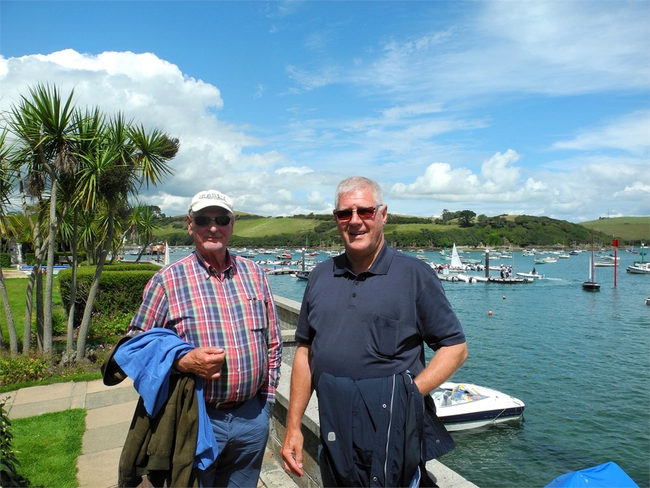
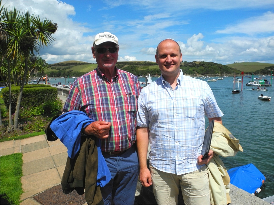
I still managed to take loads of very nice photos and will gladly share them. This report contains rather little weather discussion, weather charts etc. Let’s focus on the places and the scenery. We were three POB, one of them was my father.
Since I am rather short of time at the moment, and since I however have a big number of nice photos, I will divide this report into three parts.
Here’s part one: To the southwest of England.
A couple of days prior to our departure, the weather outlook for the south of Britain didn’t look all too bad actually. But it was clear right from the start that there was no such thing as big high pressure area around the corner. Not in Britain, not in Scandinavia and not in the Baltics – so we decided to stick with our plan A and fly to Britain – no way I am going to fly to the Mediterrenean in late July!
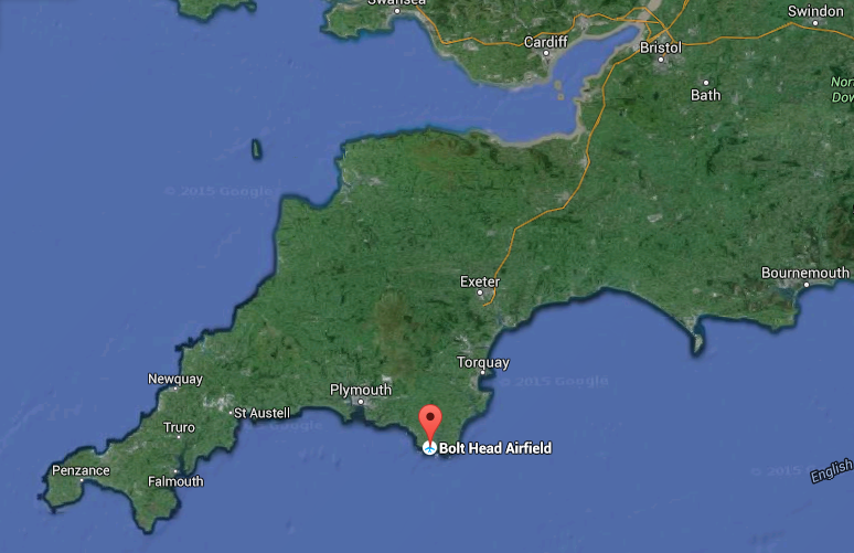
Our first main destination was Cornwall – the very southwestern tip of England. But as our first interim destination on the way there, we chose Bolt Head Airstrip, near Salcombe, in Devon. A nice, unlicensed grass strip perched on top of the cliffs and a place that I had always wanted to go to (and I sure don’t regret doing so). Here’s a map of the southwest of England to give those less familiar an idea where it is:
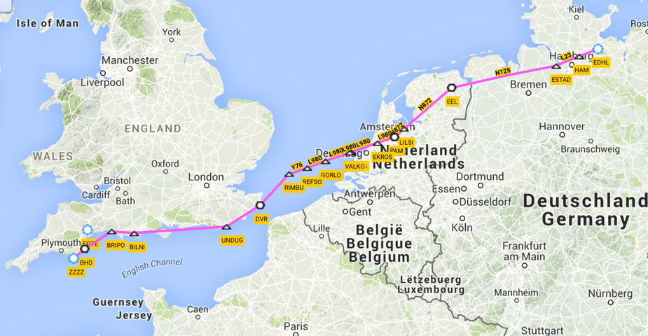
Departure was to be from Luebeck (EDHL). This first flight being a very long one, it was obviously planned as an IFR flight. Well, at least as far as the English Channel. After that, we would have to fly westbound along the coast of England for another 400 km, and it would have been a sin to fly this stretch on the airways, under IFR. So VFR it was for the second part.
Here’s the routing. By the way, this was the last time I used RocketRoute for planning my flights and filing my flight plans. My subscription has now expired a couple of days ago. Gone for good, I would say…
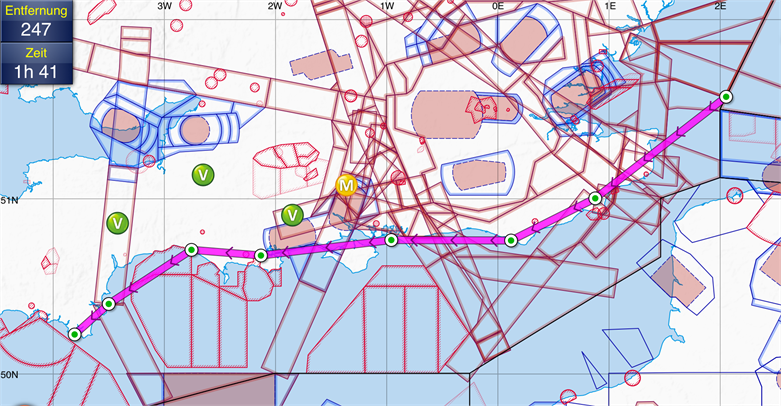
Here’s a shot from Skydemon showing the filed route for the VFR part in southern Britain:
Another important consideration was the wind: there is no Avgas at Bolt Head, so the plan was to continue on after Bolt Head, all the way to the very end of Britain, before refuelling. To make this work (800NM total) we wouldn’t be able to afford a lot of headwind. And everybody who has flown this (or a similar) route for a few times knows that the wind is out of the west on 90% of days. Just like that day – 250@40 for most of the route at FL100. A no-go. Then I checked the forecast for a bit lower down, and sure enough: up to about 5000 feet, the headwind would be much weaker (15-20 knots). Above that, the wind would quickly pick up in strength. That’s what the forecast said.
So we ended up filing the first part of the route (up do Dover) at 5000 feet – a rare circumstance on a long IFR segment. But we fully expected the lower headwind to outweigh the decrease in true airspeed we would have to accept.
Take-off at Luebeck was at 08:30 local time, in fair weather. As I called the radar controller during the departure, he suspisciouly asked me “confirm your requested final level is 5000 feet”? “Affirm!!” This exchange repeated itself at least three more times on that flight.
However, just 5 minutes after take-off, our low cruising altitude caused the first problem: normally, when climbing to FL100 or so out of Luebeck, the Bremen Radar controller lets us fly straight overhead the Hamburg (EDDH) airport (a nice direct route), as this does’t seem to cause any disruption to the arrivals and departures. Now, this time at 5000 feet, he instructed us to cirumnavigate Hamburg to the north. Immediately, our fuel plan was looking a little more dim – the destination FOB I was aiming for was 24 gallons at least (this way would allow us to continue to Cornwall and still arrive with a one-hour reserve), but it now briefly showed only 20-22. The wind was as expected at that altitude, about 240@15, so at a true airspeed of 160 knots, we averaged about 145 over the ground. After having left the Hamburg area, we were finally cleared more or less on route.
The first landmark on the route was Bremerhaven:
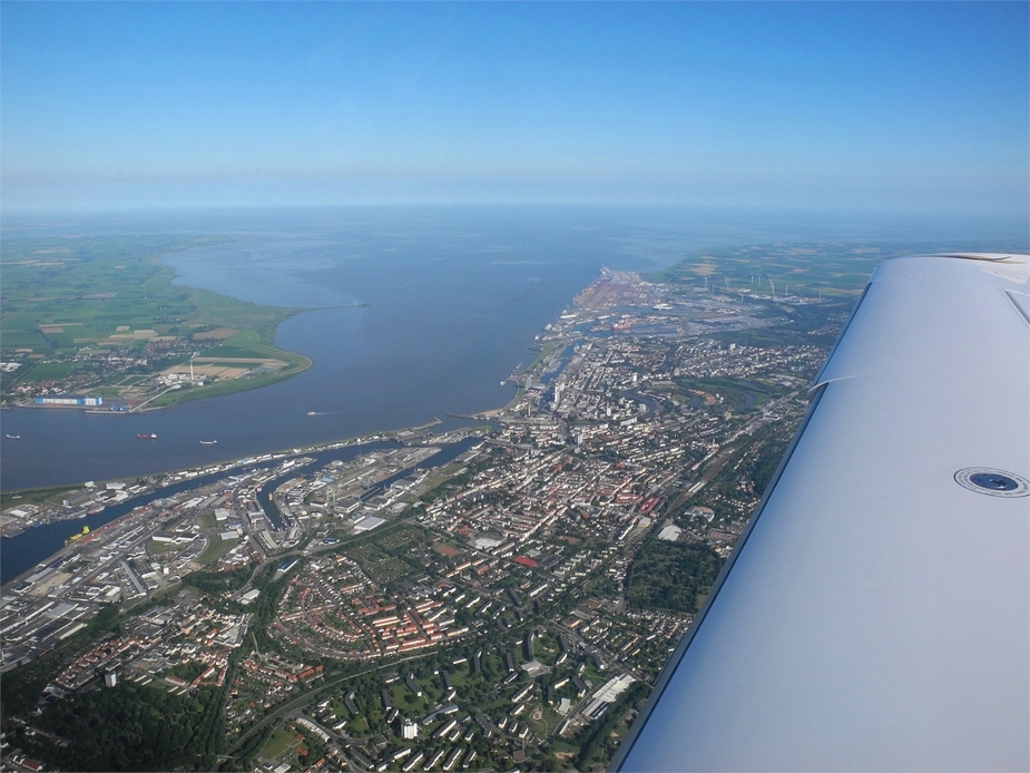
The second one was upon entering the Netherlands, just south of Emden.
Shortly after some clouds appeared…
… and eventually, we ended up just above this scattered cloud layer, still flying at 5000 feet (FL50 in NL).
Crossing a big highway bridge, southeast of Amsterdam:
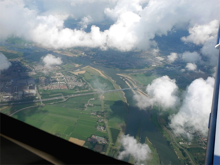
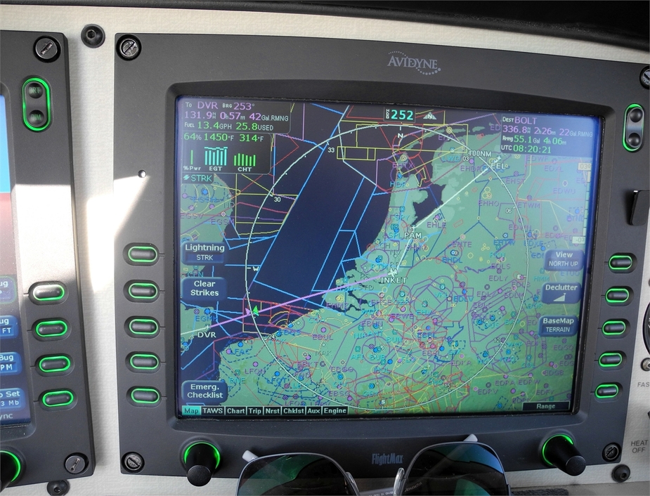
Shortly after, we received the next bit of bad news from Amsterdam. “N4ZY, at this altitude, I need you to circumnavigate the TMA via INKET” and we had no other chance than to comply, thereby further eating into our fuel reserves. Here’s a picture of the MFD, showing the detour via INKET (as opposed to our filed route, which was more direct). On the upper right of the screen, you can also see the destination FOB calculation – 24 gallons.
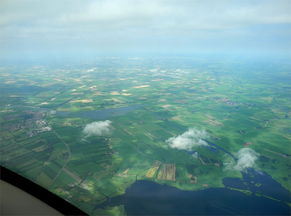
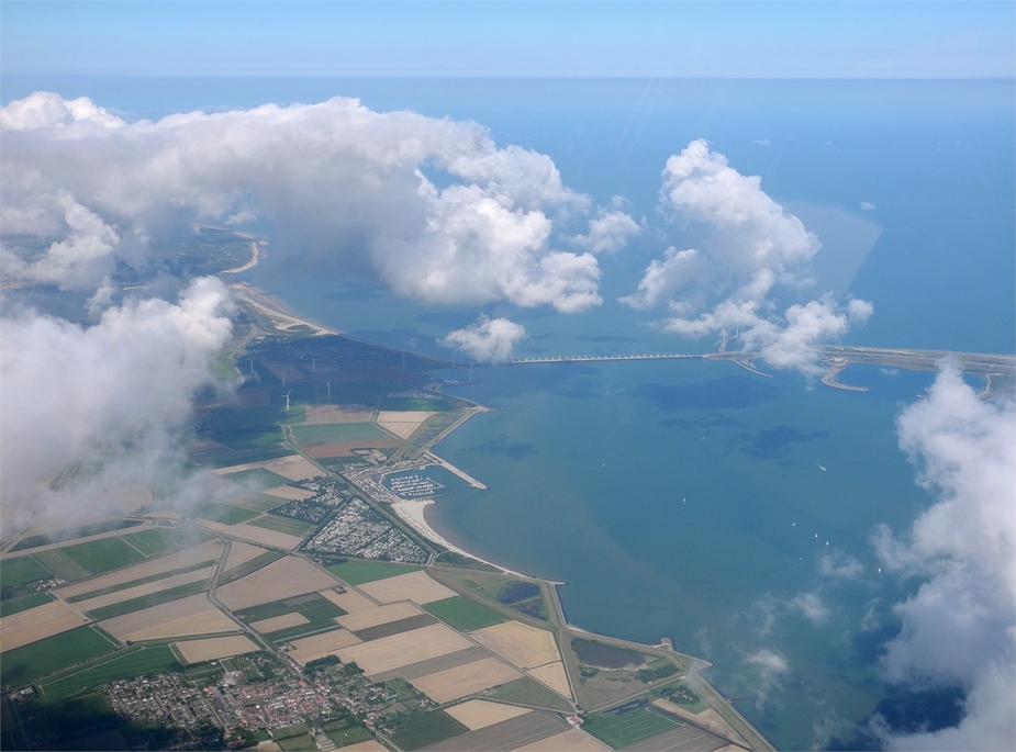
Here are a few pics of the coastlines of Zeeland:
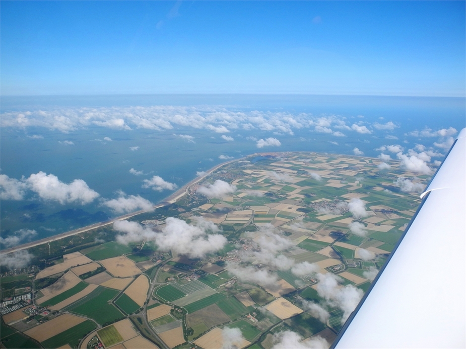
Just as we reached the Belgian coast, the cloud bases rose a little more, putting us right into those scattered cumulus clouds, so, given that the fuel situation was still OK-ish, we decided to climb to FL60 for comfort. And believe it or not, as soon as we reached FL60, the wind speed had increased dramatically – now 25-30 knots on our nose and the destination FOB dropped to below 20 gallons. We quickly asked for FL50 again – the clouds layer soon disappeared so this wasn’t a problem any more. What is astonishing is how precise the winds aloft forecast turned out to be!
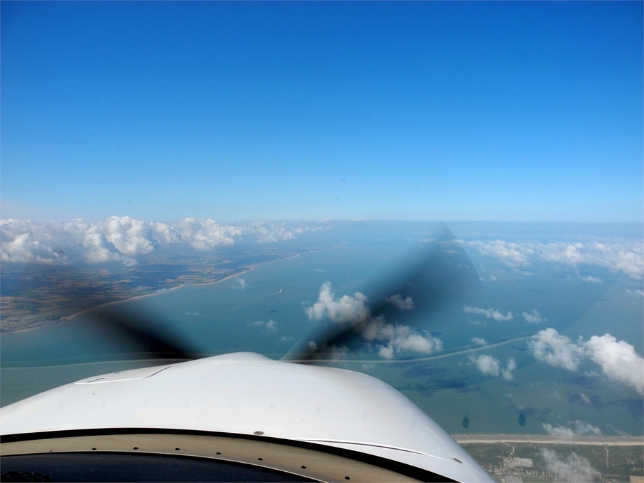
Just abeam Ostend:

At the same time, to the right, the cliffs of Dover were well in sight, which is always nice.
In the meantime, we started our decent to 2000 feet. We never cancelled IFR (not required outside the airways in the UK). Still we were now obviously flying VFR.
Here we are, coasting in near Lydd (EGMD). It was now a little more cloudy though:
Down there, the wind was weaker (about 10 knots on our nose), but so was obviously our true airspeed (150-ish). Still, the landing FOB stabilized a bit above 20 gallons – still good enough. As usual, it was impossible to get a traffic service from Farnborough, so the service ended up being very, well…, basic. Just west of Hastings here.
And, of course: Shoreham Spaceport.
Chichester Harbour:
Even without much sunshine, Hayling Island always offers some interesting colours and textures:
By the way, when flying along the south coast of England in summer, one doesn’t only have to look out for traffic – one also has to consider temporary flying restrictions. These are very frequently imposed due to events (including air shows, but not only). I diligently checked for these during the preflight action (AIC “Mauve” series) and found one right on track near Portsmouth (instated for the Americas Cup), but fortunately, it was only due to take effect one day later.
Portsmouth:
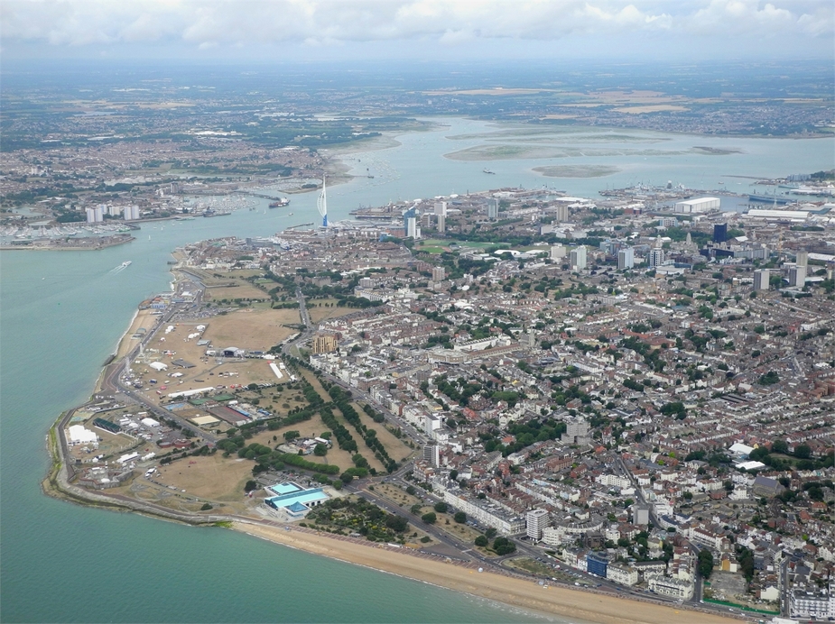
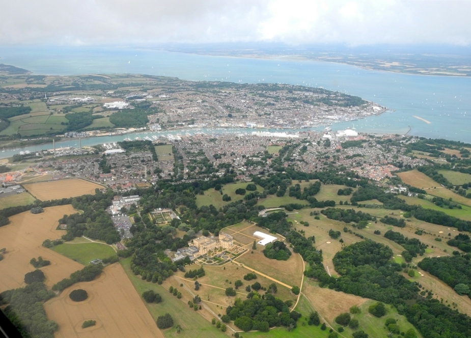
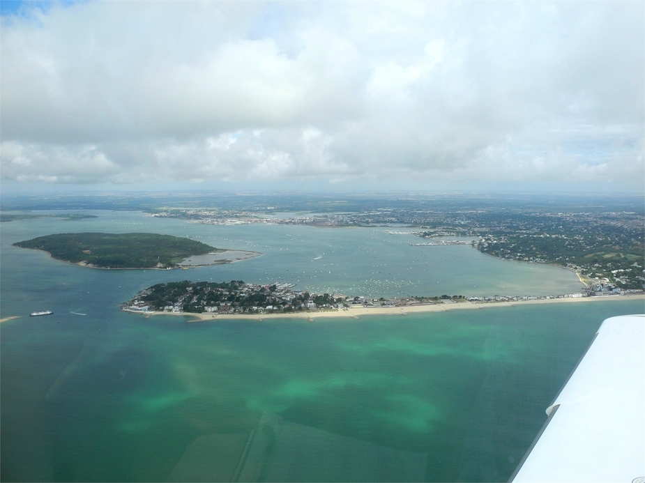
We then crossed parts of the Isle of Wight, just as the sun came back out again. Cowes in the background and Osbourne house in the foreground:
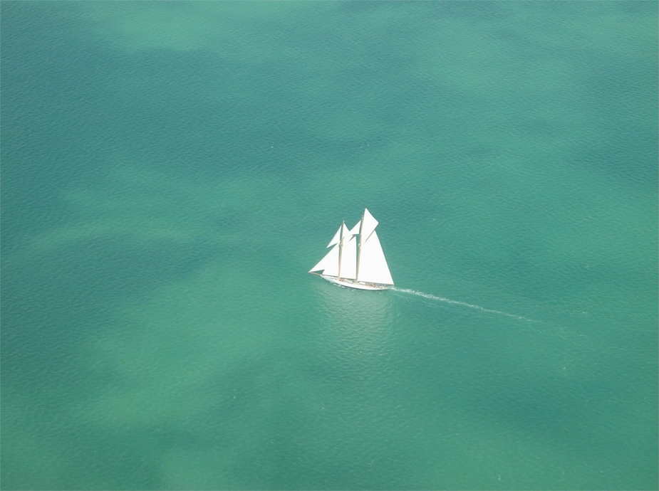
A nice sailing ship:
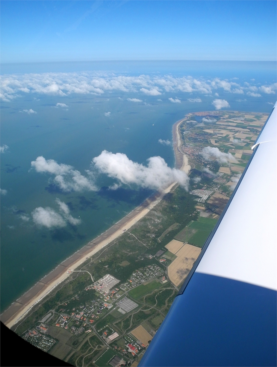
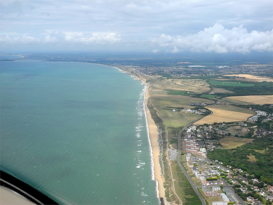
Back at the UK mainland, beaches near Milford-on-Sea:
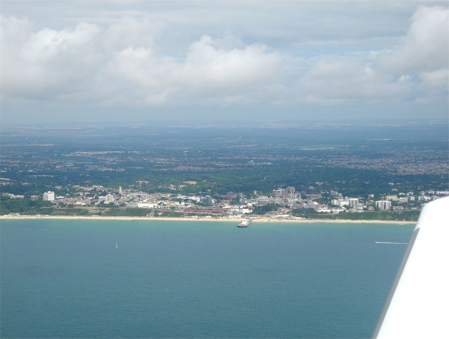
Abeam Bournemouth.
By the way, there was another flying restriction in that area. As I said, the UK coasts are full of these in summer. As this was the 22nd of July, we were still outside of the activation hours of this one though:

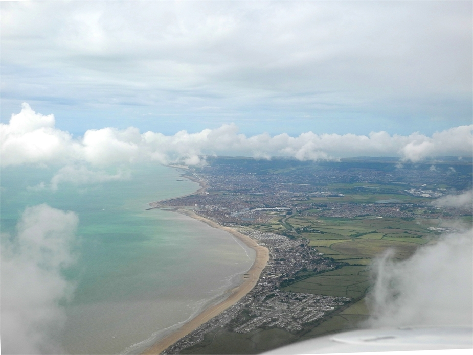
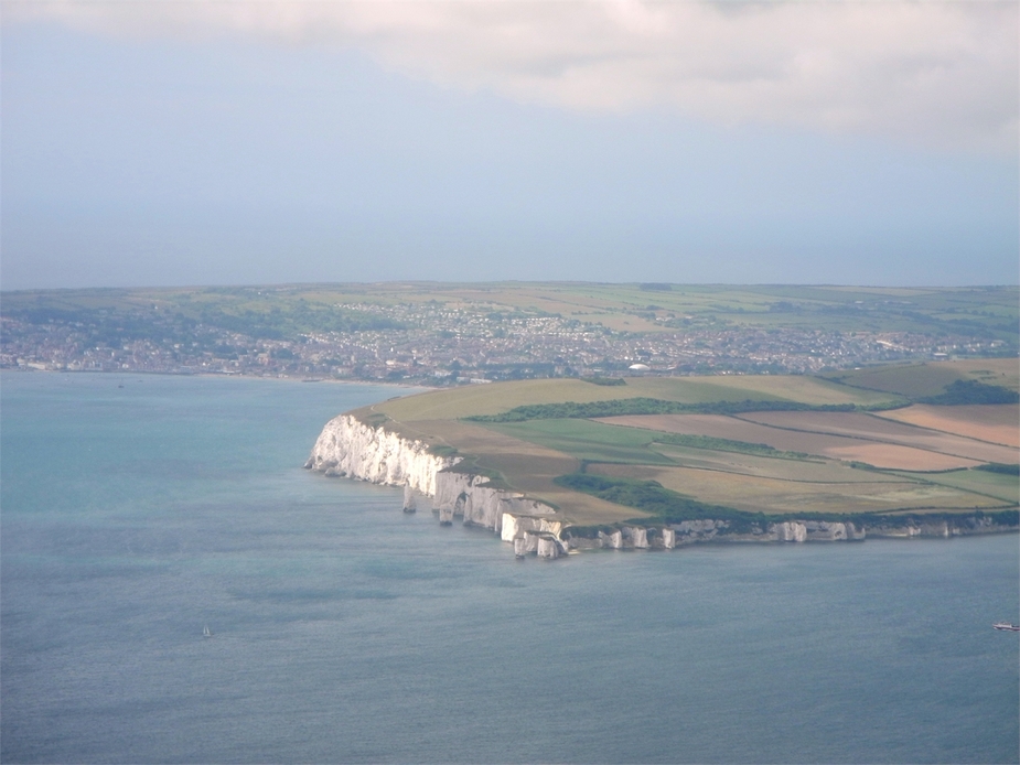
The Old Harry Rocks and Swanage in the distance. As a pupil, I once spent a few weeks at summer school in Swanage…
Just abeam Sandbanks and Poole.
This seems like a wonderful area and I would really like to spend some time on the ground there in one of the next summers. Unfortunately, there is no nice airfield in this area, only the “PPR/handling mandatory/steep fees/hi-vis” – type airport called Bournmouth (EGHH).
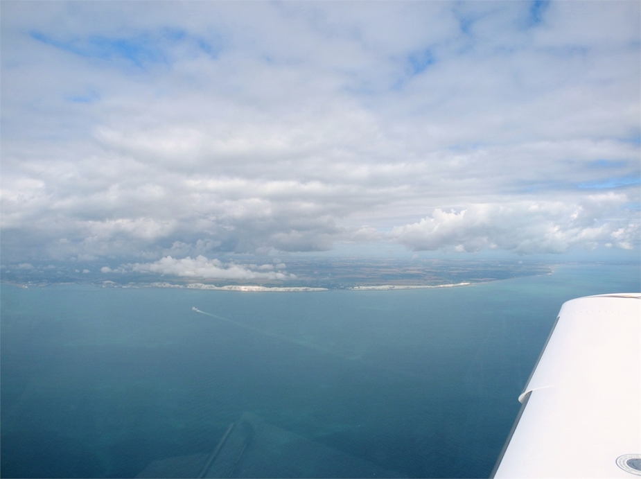
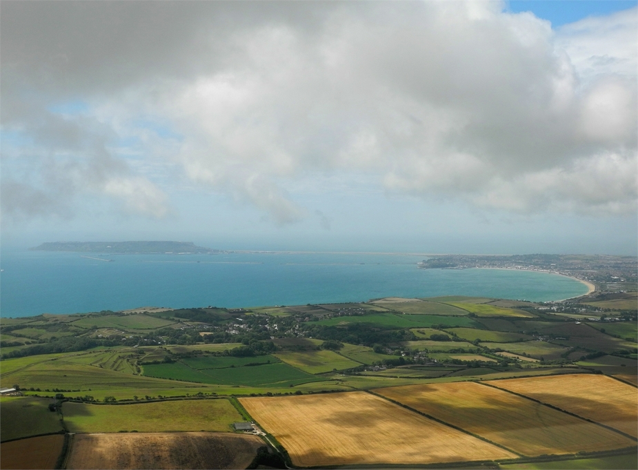
A little further west, Weymouth to the right and the Isle of Portland to the left.
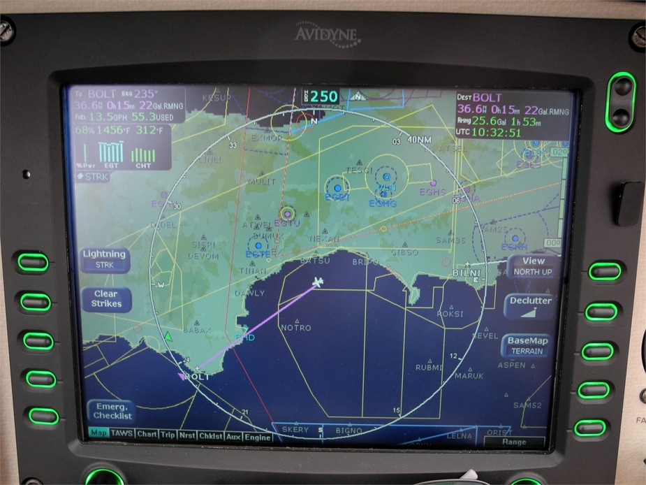
Weymouth Bay and Lyme Bay are clustered with Danger Areas. Since it is not generally allowed to cross Danger Areas without permission in the UK, I called up Plymouth Military to receive permission to transit one of them and fly more or less directly to Torquay. Here you can see the various Danger Areas on the MFD:
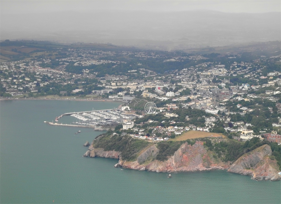
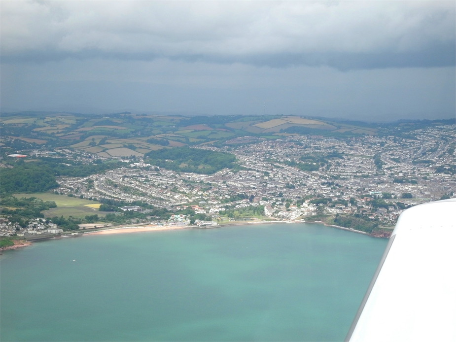
Coasting back in at Torquay and Paignton:
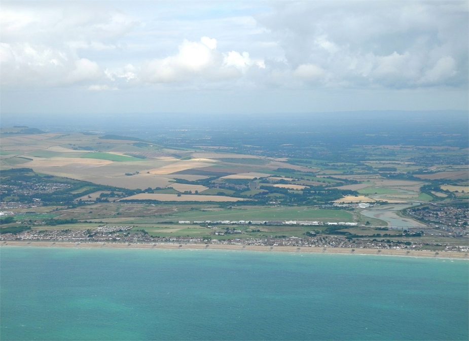
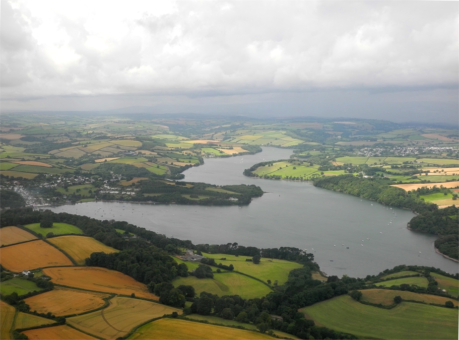
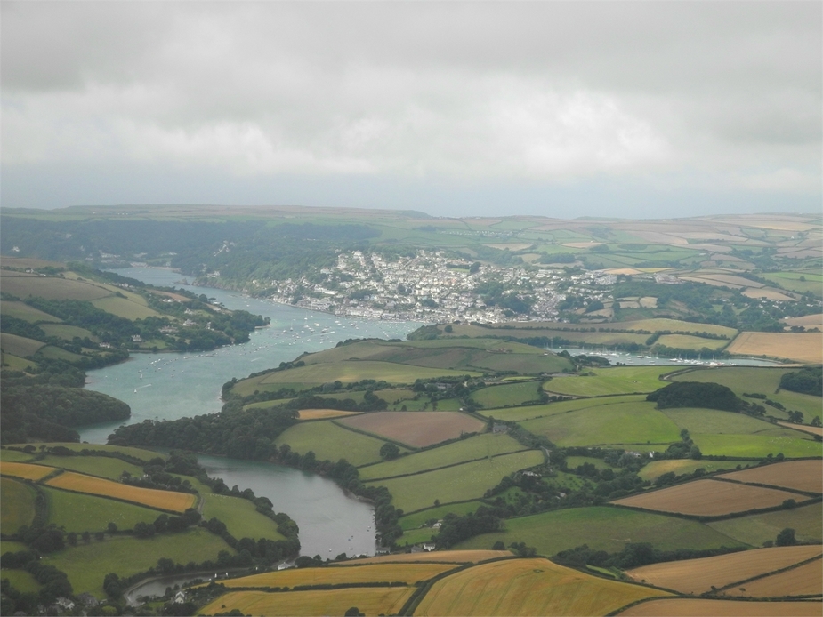
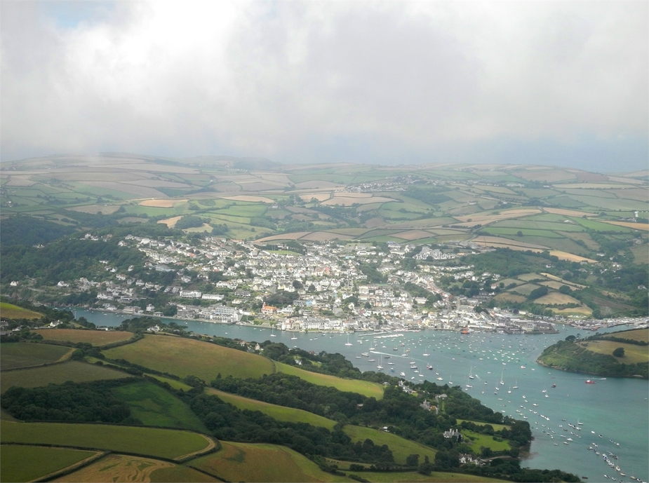
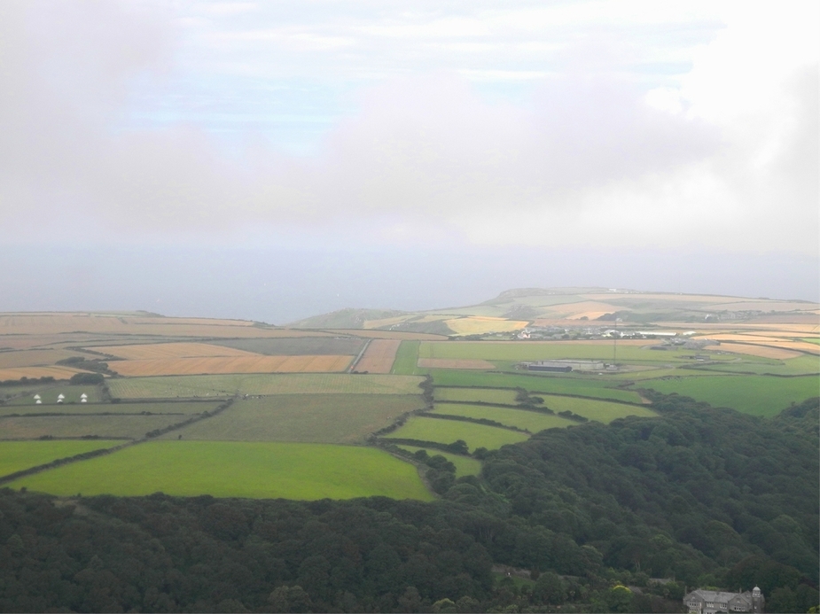
The very south of Dorset (southwest of Torquay) is quite scenic, with numerous fjord-like estuaries and picturesque villages:
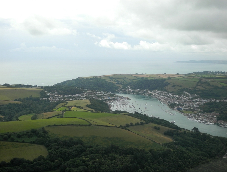
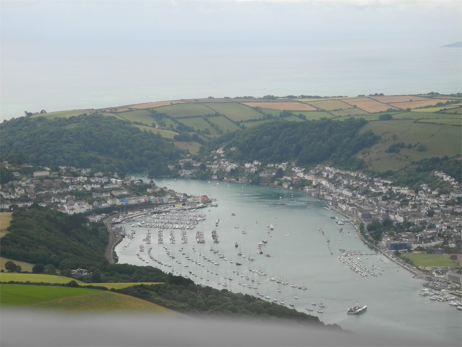

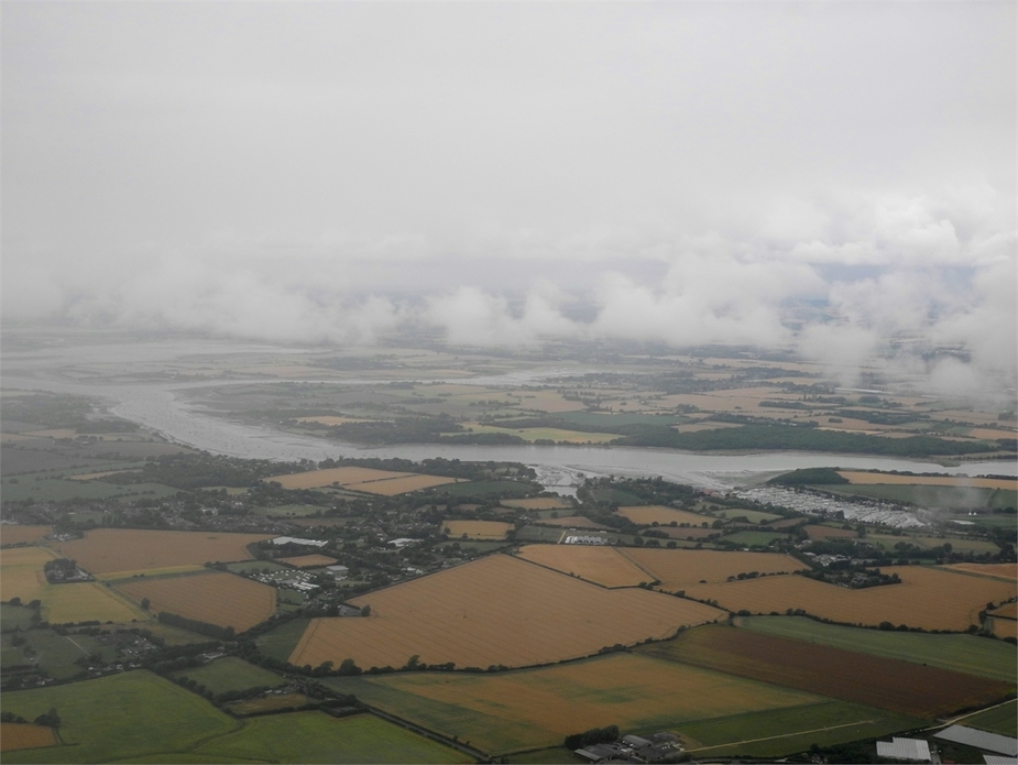
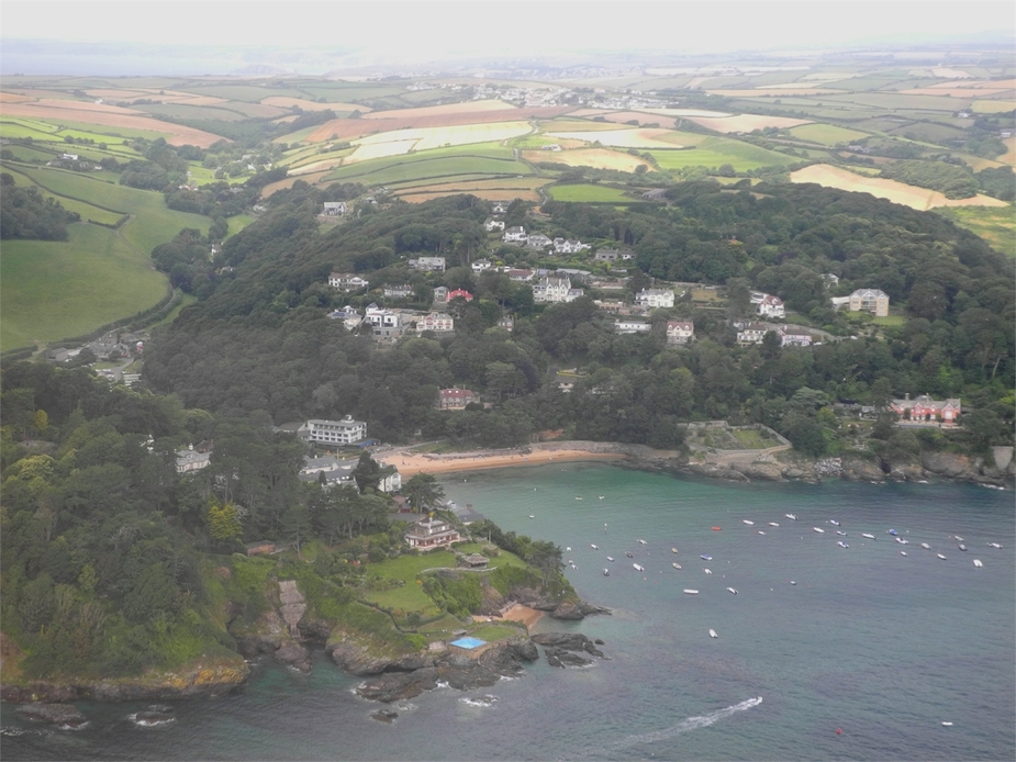
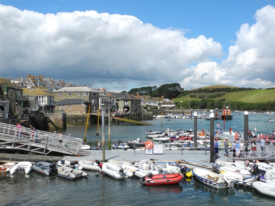
And here we are, approaching Salcombe, the place where we intended to stay at for lunch:
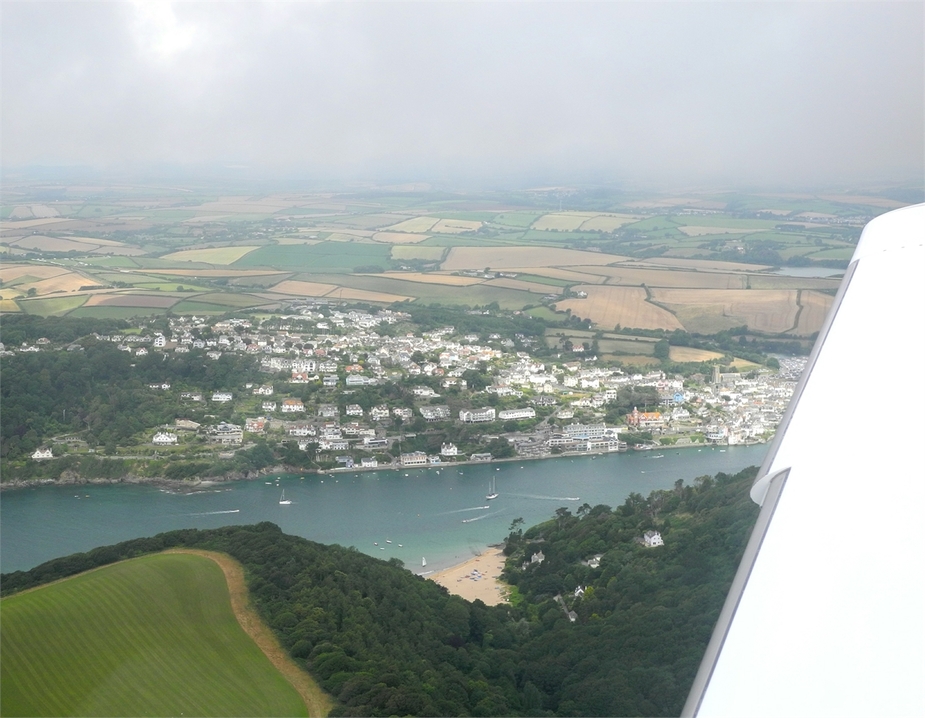
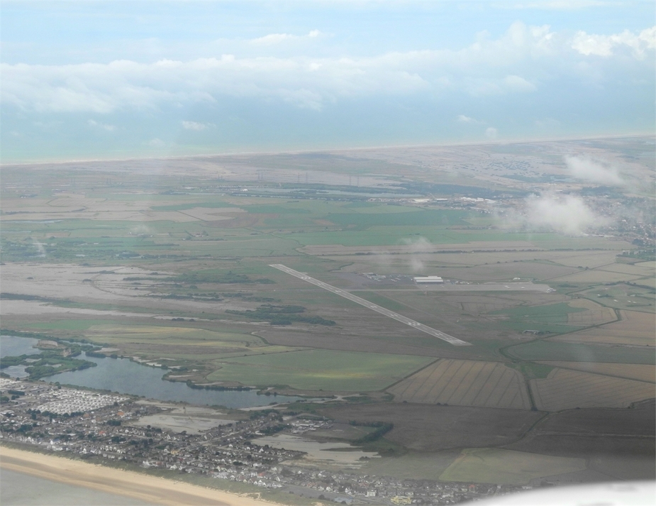
The Bolt Head airfield is just to the south of Salcombe, not far from the cliffs. We first made a low pass over the runway to make sure it was fine, followed by tight left circuit and an uneventful full stop landing.
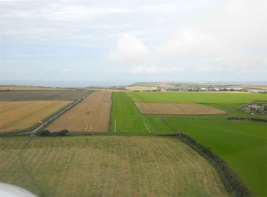


The strip turned out to be in great condition. Dry, even and well-cut.
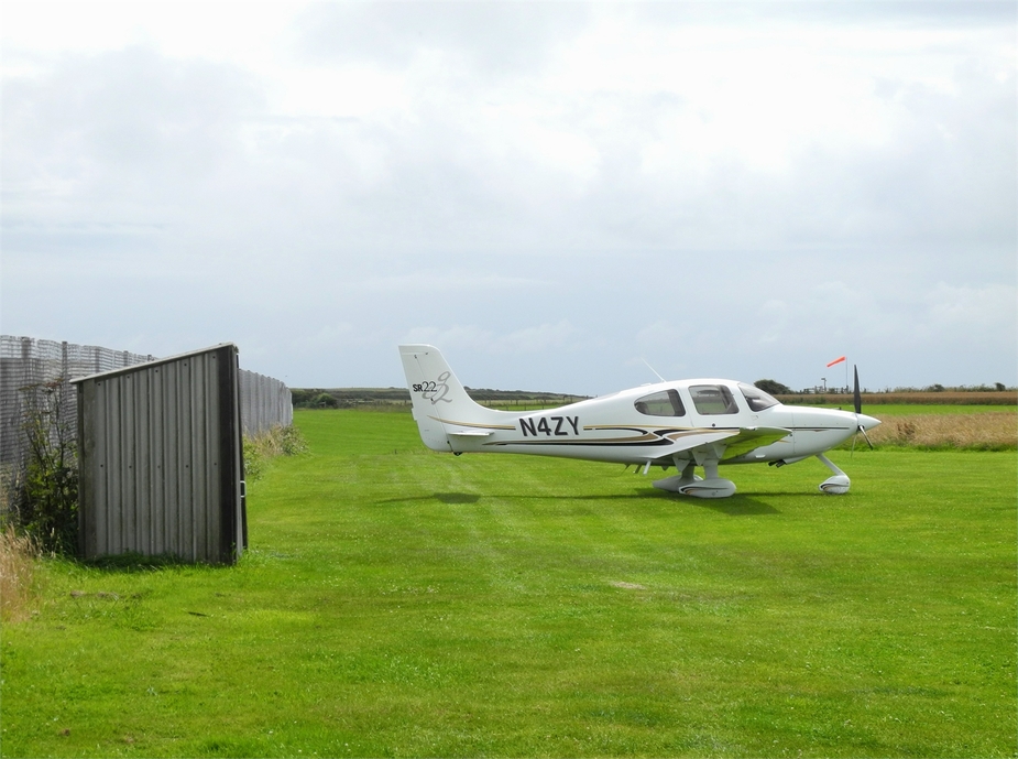
We parked near the “C” hut, just as the sun came out again. Needless to say, it was a superb flight. Even though it took us 4:15 hours from takeoff to landing, there was not a single moment of bordeom during the flight, thanks to the interesting scenery and the various navigational tasks. Landing FOB turned out to be 22 gallons – a little less than what I had hoped for, but still good enough to continue to Cornwall, where there would be plenty of small airfields with Avgas.
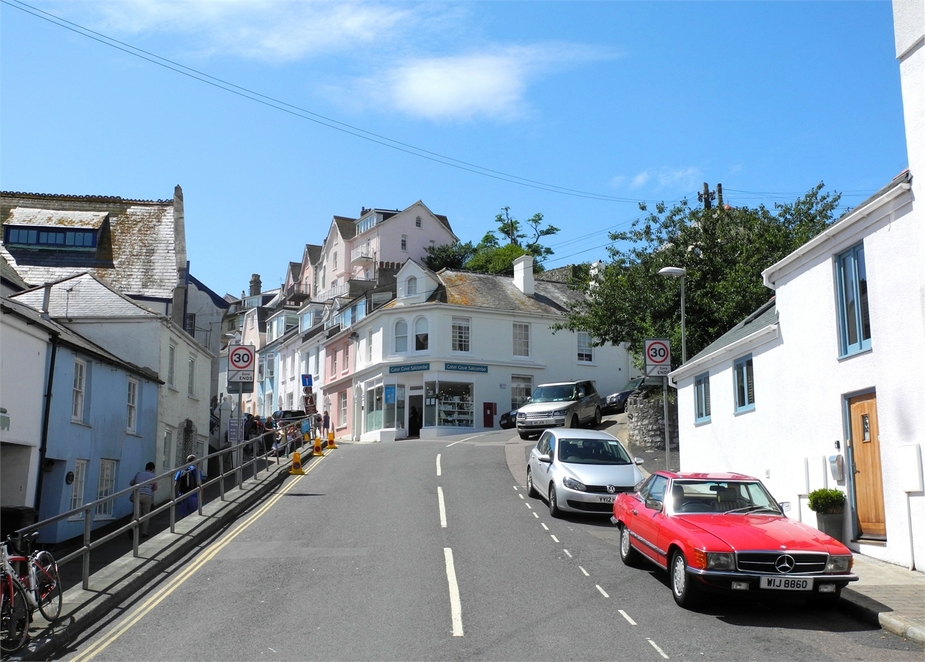
We called a taxi, which arrived after 10 minutes. While Salcombe is not far by direct distance (1.5 miles), it is almost impossible to walk there due to the undulating terrain. The taxi ride took another ten minutes. We asked the very friendly driver to take the “scenic route” to town.
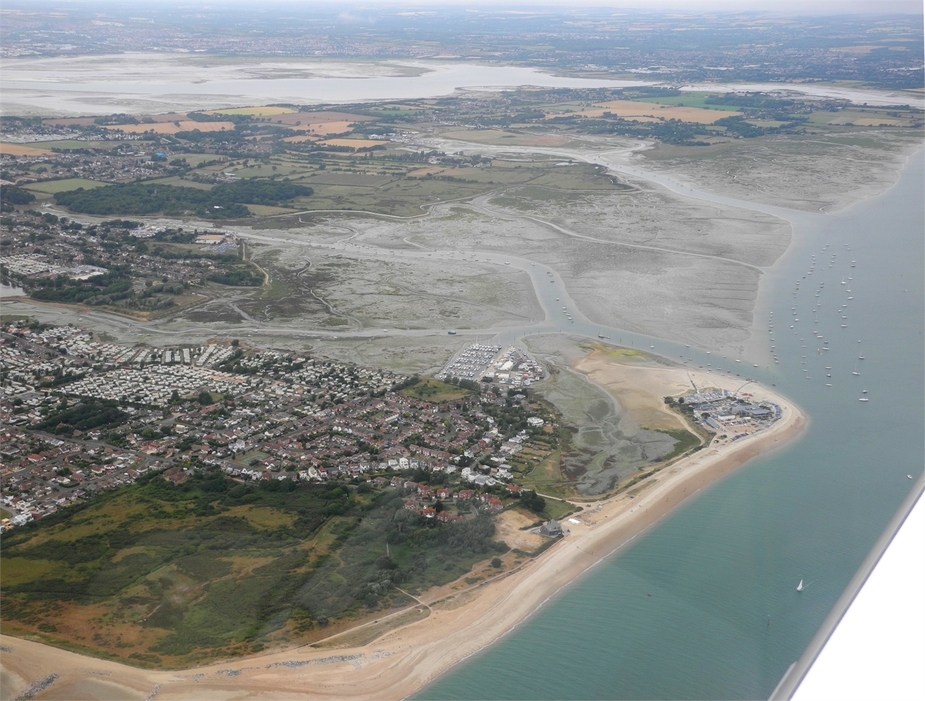
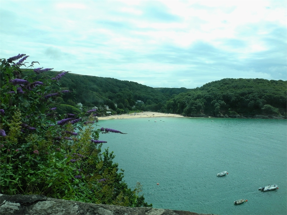
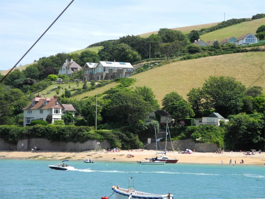
North Beach:

Mill Bay:
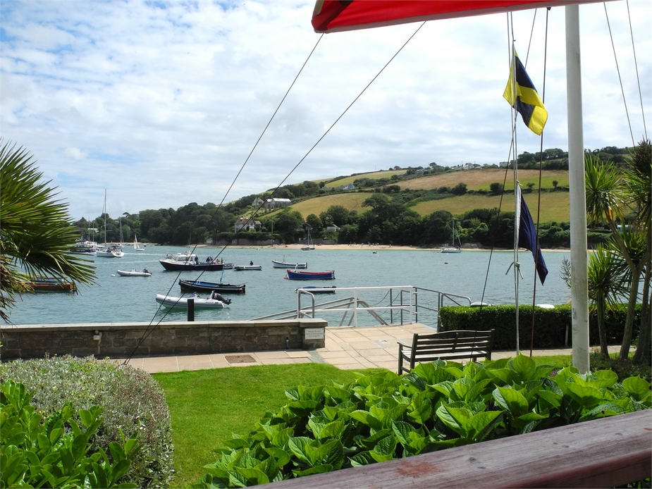
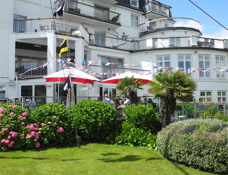
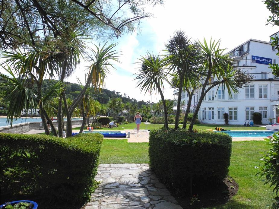
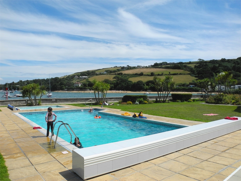
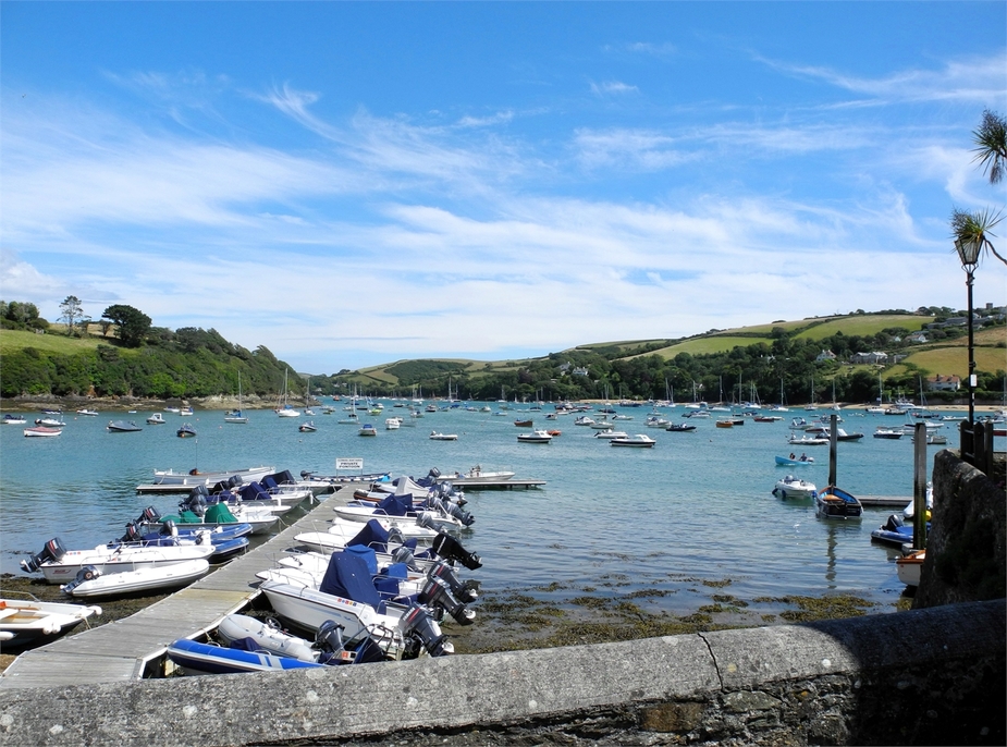
We decided to have lunch at “Dick and Wills” Restaurant, which was a great choice. The views from the terrace are fantastic:
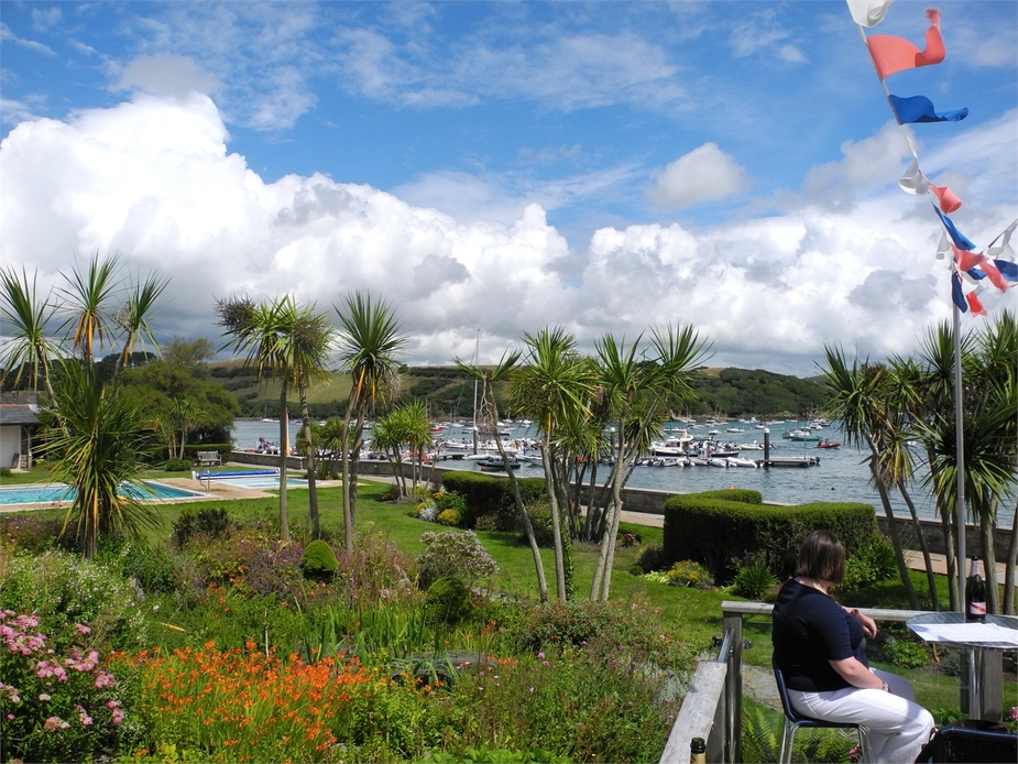
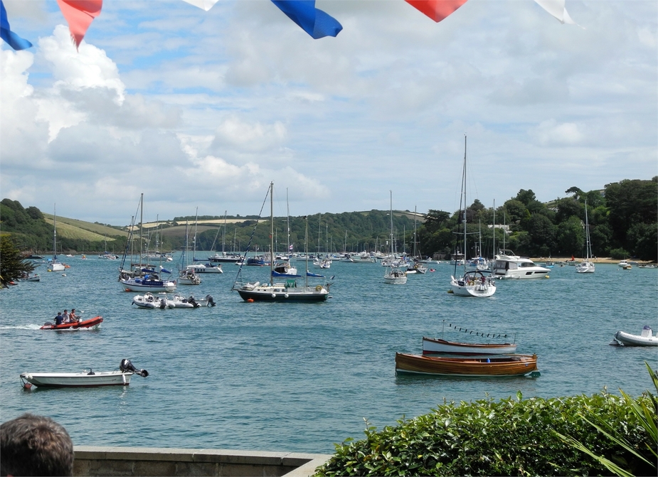
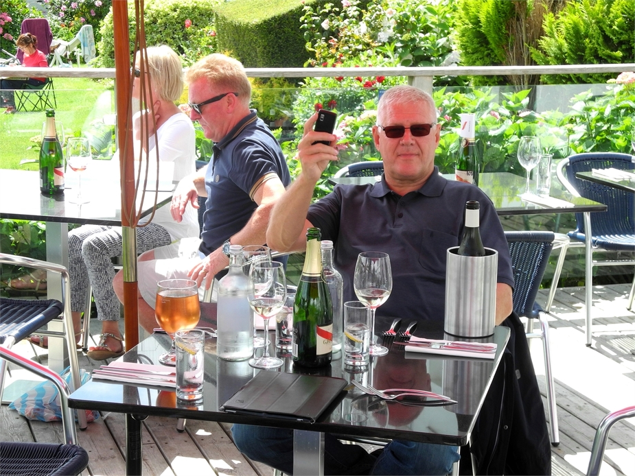
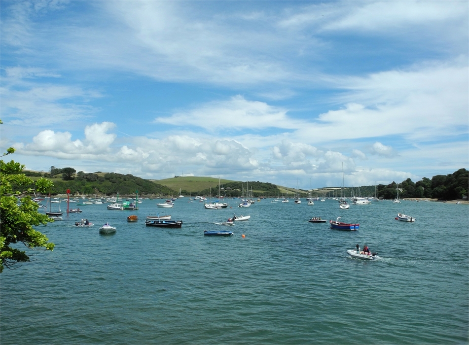
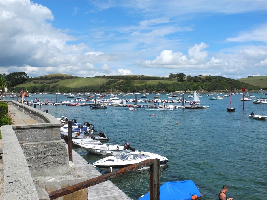
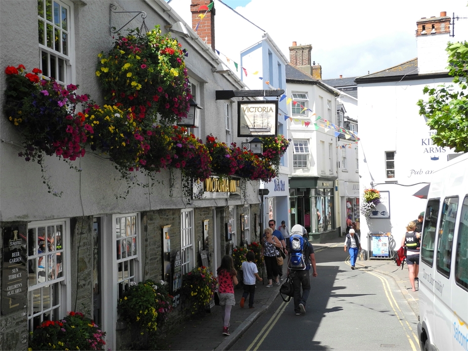
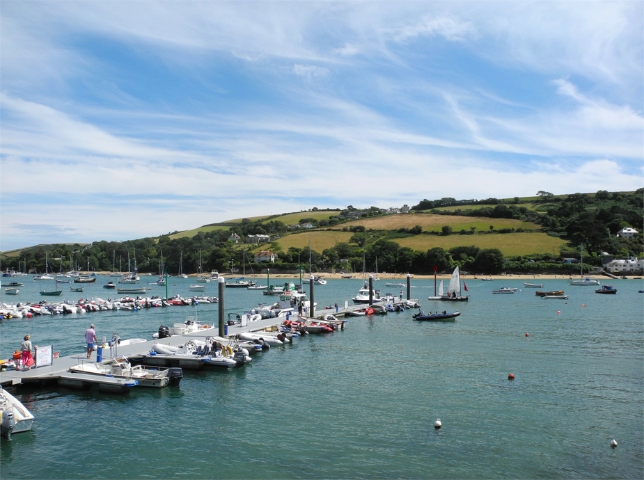
After lunch, we had some time to walk around some more, have an ice cream etc. Salcombe turned out to be a very nice place on a good summer day. The sheer number of boats buzzing around on the estuary is rivalled only by Venice. By the way, as the taxi driver told us, Salcombe supposedly is the most expensive place in Britain as far as property prices go.
Needless to say: a great first leg and a great first destination for this trip. Stay tuned for more as we flew further on to Cornwall later in the afternoon…
Wonderful! I grew up near Salcombe, it’s a great place to visit but horrendously expensive to live. I didn’t know about the strip there, will have to try it out.
Looking forward to the next installment…
Great, boscomantico-thanks for sharing! I hope, you went on also to Perranporth, where I bought my Europa :-)
If you wanted to land in the Solent region, why not choose Lee on Solent airfield, the old Daedalus base, then rent a car to go to Bournemouth? Having said that, Bourenmouth didn’t impress me and there is enough to see in Portsmouth – the Spinnacker Tower (are you man enough to walk along the glass bottomed floor? ;-)), HMS Victory or the Gunwharf Quays shopping complex, to name but a few…..
Steve,
sure, Portsmouth isn’t bad but the drive from Lee to Sandbanks or Swanage would be huge. Plus they don’t have cars on site.
No, in case I go I will probably bite the bullet and fly to Bournemouth, pay the ~100 quid and get the added comfort of the ILS and rental cars on site.
Rather, I might consider Old Sarum or even Yeovil and get a car in the nearby towns.
I will probably bite the bullet and fly to Bournemouth, pay the ~100 quid
I have just been invoiced GBP 37 by Bournemouth EGHH (1400kg TB20).
Yes, but I was referring to >1.5 tons (which is usually a big price step at UK airports) and figured in a few nights’ parking.
Rather, I might consider Old Sarum or even Yeovil and get a car in the nearby towns.
I tried getting permission from Westland to land at Yeovil, was a nightmare – even during the week there was practically no availability to land. In the end, I phoned RNAS Yeovilton and got permission to land there with a D registered 172, the best bit about it was that they took me to the Fleet Air Arm museum and recommended, if I had time, to get a taxi to the Haynes Motor Museum in Sparkford….
However that was a bit like teaching your Gran to suck eggs, seeing as how I grew up in that neck of the woods ;-)